
Empfohlen
Weitere ähnliche Inhalte
Was ist angesagt?
Was ist angesagt? (20)
Ähnlich wie Drone technology in agriculture
Ähnlich wie Drone technology in agriculture (20)
Kürzlich hochgeladen
Kürzlich hochgeladen (20)
Drone technology in agriculture
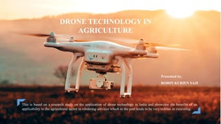
- 1. Presented by, ROHIN KURIEN SAJI DRONE TECHNOLOGY IN AGRICULTURE This is based on a research study on the application of drone technology in India and showcase the benefits of its applicability to the agricultural sector in rendering services which in the past tends to be very tedious in executing.
- 2. CONTENT Drone Technology In Agriculture 2 Introduction Sensors used in agricultural drones How drones are being used in Agriculture? Case Study Drone Laws in India Pros and Cons of Agricultural Drones Conclusion Reference
- 3. INTRODUCTION An agricultural drone is an unmanned aerial vehicle used to help optimize agriculture operations, increase crop production, and monitor crop growth. Sensors and digital imaging capabilities can give farmers a richer picture of their fields. Drone Technology In Agriculture 3
- 4. Sensors Used In Agricultural Drones Drone Technology In Agriculture 4 • Aerial mapping • Imaging • Plant counting • Surveying VISUA L MULTISPEC TRAL • Plant health measurement • Water quality assessment • Vegetation index • Plant counting • Heat signature detection • Livestock detection • Surveillance • Water source detection • Emergency response THERMAL LIDA R • Useful in 3D digital surface modelling • Surface variation detection • Flood mapping • Short range • Plant health measurement • Water quality assessment • Vegetation index calculation • Full spectral sensing • Spectral research and development HYPERSPECT RAL
- 5. HOW ARE DRONES BEING USED IN AGRICULTURE ? Monitoring Plant Health Drones equipped with special imaging equipment called Normalized Difference Vegetation Index (NDVI). Software analysis can be used to change values in order to reflect the specific crop type and even in which stage of life a specific crop is in. Drone Technology In Agriculture 5 Monitoring Field Condition Drones provide accurate field mapping. Having information on field elevation is useful in determining drainage patterns and wet/dry spots which allow for more efficient watering techniques.
- 6. Drone Technology In Agriculture 6 HOW ARE DRONES BEING USED IN AGRICULTURE ? Planting And Seeding Automated drone seeders are mostly being used in forestry industries. Planting with drones means very hard to reach areas can be replanted without endangering workers. Spray Application Crop spraying drones can carry large liquid storage reservoirs, can be operated more safely. It can be operated and maintained at a fraction of the cost compared to crop dusters.
- 7. Drone Technology In Agriculture 7 HOW ARE DRONES BEING USED IN AGRICULTURE ? Drones are used to monitor the far reaches of a farm and allows for more frequent monitoring of hard to reach areas. Monitoring remote areas, which used to take hours of walking can now be completed in a few minutes. Security Drone Pollination Researchers in the Netherlands and Japan are developing small drones that are capable of pollinating plants without damaging them. The next step is to create autonomous pollinating drones that will work and monitor crop health without constant instruction from operators.
- 8. Drone Technology In Agriculture 8 Multispectral Sensor Lidar Sensor Thermal Sensor Hyperspectral Sensor HOW ARE DRONES BEING USED IN AGRICULTURE ? Drone Irrigation Using microwave sensing, drones are able to capture very accurate soil health information. Water can be distributed in a field in the most efficient way in an effort to conserve resources.
- 9. CASE STUDY PROBLEM…? o Poor quality water management. o Limited cost recovery in the irrigation sector contributed to inefficient on-farm use of irrigation water and added to the fiscal burden of the state. o Fragmented and un-coordinated planning and management of water resources. A case study of use of Drone for mapping of command area of irrigation project in Pune region of Maharashtra State of India. Drone Technology In Agriculture 9
- 10. SOLUTION….. o Drones are used to measure area under irrigation. o Helps in analysing water consumption and determine crop types. o Helps in estimation of water charges. Drone Technology In Agriculture 10
- 11. OUTCOME… Sl No. Name Of Project Irrigation area as per project report(ha) No. of villages Area of villages as per Revenue Records(ha) Area of Assessment after drone survey is carried out(ha) Assessed area before drone survey(ha) Percentage increase in area 1 Dhom irrigation 32,925 179 78,101 34,728 10,805 221% 2 Kaner Irrigation 24,317 160 71,768 20,828 10,643 96% 3 Kolhapuri Type Weir on Wang/ Uttarmand/ Tarali Rivers 11,401 118 27,639 12,531 2,759 354% 4 Kolhapuri Type Weir on Urmodi River 907 26 12,548 2,617 1,083 142% 5 Kolhapuri Type Weir on Koyna River 9,570 78 29,600 7,516 4,853 55% Drone Technology In Agriculture 11
- 12. RESULT…. o Increase in area surveyed by minimum 55% and maximum 354%. o Total irrigated area is increased to about 13.88 lakh ha from previous year assessment of 10.71 lakh ha. o Total Increase in revenue of about ₹50 crores. o Increased transparency and reduction in dependency on manpower. Drone Technology In Agriculture 12
- 13. Agriculture Drones Bring Big Value to Potato Growers in North Dakota CASE STUDY : PROBLEM SOLUTION RESULT Improper planning and projection of crop yield. Incorrect calibration on planting of crops. Induction of drones to monitor the crops. Helps in proper estimation of crop loss due to heavy raining. Able to determine net loss of about $160,000. Accurate yield projection. Was able to save $16,000 on next growing season. Drone Technology In Agriculture 13
- 14. Fig 3: Horizontal red lines show areas where the planter malfunctioned and missed planting entire rows of potatoes Drone Technology In Agriculture 14 Fig 2: The southern section of the field sustained much more water damage than the northern section Fig 1: Of 150 acres: 27% is red (bad health), 58% is yellow (average health), 15% is green (good health)
- 15. Drone Laws In India Rules And Regulation All drones except those in the Nano category must be registered and issued a Unique Identification Number (UIN). A permit is required for commercial drone operations Drone pilots must maintain a direct visual line of sight at all times while flying. Drones cannot be flown more than 400 feet vertically. Drones cannot be flown in areas specified as “No Fly Zones”. Permission to fly in controlled airspace can be obtained by filing a flight plan and obtaining a unique Air Defense Clearance (ADC)/Flight Information Center (FIC) number. Drone Technology In Agriculture 15
- 16. PROS CONS Easy to Use Reduce Farm’s Operational Cost Makes Mapping easy Moisture Monitoring Prevents Invasion Assesses Crop Quality Legal Restriction Flight Routine Limitation Knowledge Limitation Personal Privacy Encroachment Fear Requires a License Expensive Safety Concerns Severe Weather Trends Pros and Cons of Agricultural Drones 16
- 17. CONCLUSION Drones have already vastly altered the agricultural industry and will continue to grow in the coming years. While drone use is becoming more useful to small farmers, there is still a ways to go before they become part of every farmer’s equipment roster, particularly in developing nations. Regulations around drone use need to be made and revised in many countries and more research needs to be done on their effectiveness at certain tasks. There are many ways drones can be useful to farmers but it is important to understand their limitations and functions before investing in expensive equipment. 17
- 18. REFERENCE https://en.wikipedia.org/wiki/Agricultural_drone https://www.researchgate.net/publication/331017387_Application_of_Drone_in_Agriculture/link/5c6aacb0458 5156b57036824/download https://www.croptracker.com/blog/drone-technology-in-agriculture.html https://uavcoach.com/drone-laws-in- india/#:~:text=All%20drones%20except%20those%20in,category%20flown%20below%20200%20feet). https://drones-pro.com/pros-and-cons-of-drones-in-agriculture/ https://www.newindianexpress.com/cities/kochi/2020/aug/22/drones-come-to-the-aid-of-ailing-farm-sector- 2186637.html https://medium.com/aerial-acuity/case-study-ce39c9f44e48 18