Weather and Climate
•Download as PPT, PDF•
20 likes•21,082 views

Weather & Climate, Synoptic Charts,Weather Maps
![Weather and Climate ,[object Object],[object Object],[object Object],[object Object]](data:image/gif;base64,R0lGODlhAQABAIAAAAAAAP///yH5BAEAAAAALAAAAAABAAEAAAIBRAA7)
Recommended
More Related Content
What's hot
What's hot (20)
Similar to Weather and Climate
Similar to Weather and Climate (20)
More from Rob Marchetto
More from Rob Marchetto (20)
Recently uploaded
Recently uploaded (20)
Weather and Climate
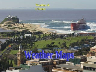
- 1. Weather Maps Weather & Climate
- 9. Atmospheric Pressure readings How do they get the land and sea readings? What do all these dots form when they are linked?
- 10. Isobars How do you work out which are high pressure cells and which are low pressure cells? An isobar is a line on a map joining places of equal atmospheric pressure
- 12. Synoptic Charts Synoptic Charts What is this feature? What does the shading refer to? What is the wind speed and direction? What is the air pressure?
- 18. Highs can bring rain from onshore warm waters
- 23. A cross section of a Tropical Cyclone
- 28. Note the closeness of the isobars Note the spaced isobars
- 29. Reading Wind Direction on a Weather Map Not where its going too x Sydney N Close up of a map Easterly √ (Remember that we name our wind direction on where the wind came from )
- 30. How to Read Wind Speed on a Weather map Legend- Wind Speed 5 km/hr 10 km/hr 20 km/hr To work out the wind speed of an area, all you need to do is match up the wind speed symbol found on the map with the symbol found in the key The wind speed at point A is 5 km/hr A 30 km/hr Calm
- 32. Wind direction Remember we always refer to where the wind is coming from ! Where has the wind come from? 1 2
- 34. Wind blows outwards in an anticlockwise direction in areas of high pressure. ANTI CYCLONE = ANTI CLOCKWISE WINDS.
- 36. Winds blow towards the centre of a low pressure system and in a clockwise direction LO W P. C. = CYC LO NE = C LO CKWISE WINDS.
- 39. How do you read wind direction without windsticks? The black arrows show the wind direction. High and low pressure regions do not stay in the same place. They move over the Earth's surface.
- 41. A warm front
- 42. Cold fronts are far more common in Australia and occur when cold air is pushed into a warm air mass . This forces the warm air to rise causing a number of changes: (a) Decrease in temperature : cold air replaces warm air. (b) Change in wind direction and sometimes speed. (c) Build up of cumulonimbus or rain bearing clouds . (d) Increase in humidity : corresponding to a build up of clouds. (e) Probability of rain . Make up an acronym to remember these changes.
- 43. A cold front
- 47. Types of rainfall: Convection http://www.youtube.com/watch?v=RkgThul2El8
- 48. Types of rainfall: Orographic http://www.youtube.com/watch?v=BVykQfRC_aI http://www.radioblogclub.com/open/51998/elevation_u2/U2_-_Elevation
- 49. Orographic Rainfall The dry air mass becomes warmer, with little chance of rain. Deserts are often found on the leeward side of large mountain ranges Warm moist air approaches a mountain barrier The air mass is forced to rise as it hits the mountain and condenses into clouds Orographic rainfall occurs on the windward side of the mountains The air mass, now drier, flows down the leeward side of the mountains
- 50. Types of rainfall: Frontal http://www.youtube.com/watch?v=D88dYNFyBq8 http://www.bbc.co.uk/schools/gcsebitesize/geography/weather/elementsofweatherrev6.shtml
- 53. Summer weather map Where are the different cells located?
- 54. Winter weather map Where are the different cells located?
- 55. Clear skies allow the sun’s rays to have maximum effect. Daytime temperatures are usually high. At night, clear skies allow heat to be lost causing temperatures to fall. In winter frosts are likely.
- 56. Why Do Climates Vary?
- 57. Factors Affecting The Climate What makes a certain place hot, cold, wet, dry, windy…?
- 59. World Pattern of Climate The climate of a particular place on the earth’s surface depends on 5 main factors. Latitude: Affects temperature radiation from the sun is stronger and more direct at the equator. Places at the equator are therefore generally hotter than the places near the poles. Also seasonal differences are more obvious away from the equator. Now copy fig 5.3e from p109 in your text
- 61. Differential Heating. At the Poles the sun’s rays covered a larger surface area, therefore heating is less efficient. At the Equator, the sun’s rays covered a smaller surface area, therefore heating is more efficient. At the Equator the sun’s rays also have to travel through less of the Earth’s atmosphere, therefore more heat energy reaches earth.
- 64. Why are the temperatures different? Relief Everest. The higher the relief (elevation), the lower the temperature, about 6degrees C for each 1000 metres.
- 69. Gulf Stream Then there are air masses... Also known as the North Atlantic Drift . A current of warm water that travels from the Gulf of Mexico . This, along with the prevailing South-Westerly wind , enables a relatively warmer climate compared to areas on the same latitude .
- 73. Continentality Sea heats up slowly and cools slowly. Land heats up quickly and cools quickly.
Editor's Notes
- 1. What is the difference between weather and climate?
- A line on a Synoptic Chart that joins places of equal barometric or atmospheric pressure is called? The unit of measurement of atmospheric pressure is termed? What is the abbreviation for this unit of atmospheric pressure?
- High Pressure occurs when the barometric reading is usually above 1010 hectopascals Low Pressure occurs when the barometric reading is usually below 1010 hectopascals.
- What are Synoptic Charts? Give six examples of the information shown by Synoptic Charts. List two groups of people you think that would benefit from using the information contained in Synoptic Charts.
- Identify the type of pressure system over Perth. What type of weather can Perth expect today? Why is Adelaide likely to have fine, settled weather? What is the wind speed and direction at Townsville? The shading on the map, in the Northern Territory, refers to what? Estimate the barometric pressure, north east of Hobart – where the pink arrow indicates.
- As you move your over the isobars between Alice Springs and Brisbane, what happens to the size of the numbers as you move to the centre of this pressure system? (move from 1006 hPa to 998 hPa) As you move your eyes over the isobars from north – west of Hobart to Perth, what happens to the air pressure readings? (998 hPa to 1012 hPa)
- List three features of weather associated with High Pressure systems. The term ‘diurnal means?
- Why does the air descend in high pressure systems? 2. True or false – air moves from high to low pressure?
- 1. What does the word ‘diurnal’ mean? 2. Why are the nights likely to be cool?
- True or False – atmospheric pressure decreases towards the centre in low pressure cells. True or False – Strong winds, cloudy skies and rain are associated with low pressure cells. True or False – an extension of low pressure is known as a trough.
- 1. Why are frosts unlikely with low pressure systems?
- What is the relationship between wind speed and the direction of the cyclone? What happens to wind speed after the cyclone has passed?
- If the isobars are closer together, what happens to wind speed? If the isobars are further apart, what happens to the speed of the wind?
- 1. What is the golden rule to remember with wind direction?
- With number 1, where is the wind coming from? In what direction is the wind coming from on this occasion?
- In what way do the winds in the southern hemisphere blow around high pressure systems? If winds blow anticlockwise in high pressure systems in the southern hemisphere, in what direction do winds blow in low pressure systems in the same hemisphere?
- In the southern hemisphere, in what direction do winds in a low pressure system blow?
- What is a front? Name the two types of fronts – look at the next slide to help you answer this question
- Identify the type of cloud that is bringing rain to the Earth’s surface. Name the highest cloud type shown on this slide.
- Would the following be a correct definition for Orographic Rain? The rain that results from air being forced to rise over a mountain barrier. If yes, explain why this definition is correct. Why is there relatively little rain after the air has been forced to rise over the mountain range?
- Over which part of Australia do low pressure systems occur during Summer? High Pressure systems occur over which part of Australia during Summer? Low pressure systems occur during which season over Southern Australia? What type of pressure system occurs during Winter over Northern Australia?
- 1. How can you prove that this synoptic chart is characteristic of a Summer Weather pattern?
- 1. Why is this synoptic chart characteristic of a southern hemisphere winter?
- Why are daytime temperatures usually high with high pressure systems? Why are temperatures at night likely to be colder?