
Empfohlen
Empfohlen
Weitere ähnliche Inhalte
Ähnlich wie User Experience Design for Mobile Cartography: Research Agenda Panel Discussion
Ähnlich wie User Experience Design for Mobile Cartography: Research Agenda Panel Discussion (20)
Mehr von reroth
Mehr von reroth (20)
Kürzlich hochgeladen
Kürzlich hochgeladen (20)
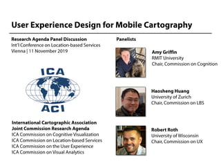
User Experience Design for Mobile Cartography: Research Agenda Panel Discussion
- 3. ICA Joint Commission Research Agendas: Some Examples
- 13. Cognitive Issues of Mobile Cartography: A Focus on Mobile Map Users Amy L. Griffin (RMIT) Tumasch Reichenbacher (UZH) Liao Hua (HNU) Wang Wangshu (TUW) Wang Shengkai (BNU) Cao Yinghui (QU) LBS 2019, TU Wien, 11 November 2019
- 14. Relevant context elements Griffin et al., 2017
- 15. Context Factors Users Spatial abilities Disability Affective and emotional responses Other individual differences Environment Physical environment Level of distraction Activity Task Time-of-use Individual/collaborative Map Characteristics of information used in the map Map display device Representation type Interface components employed Interaction mode
- 17. Challenge 1: • What additional cognitive challenges become important when mobile maps require or support interactions with other people, machines/sensors, spatial information, or places? • Opportunities?
- 18. Challenge 2 • How can we best synthesize the evidence provided by field and lab studies to provide valid information about mobile map use and users? • Opportunities?
- 19. Challenge 3 • Do people need a hybrid type of map that is neither reference nor thematic to help them better understand places for use cases like wayfinding, entertainment, disaster response, etc.? [deep mobile maps?] • Opportunities? Credit: Anton Thomas, North America: Portrait of a Continent
- 20. Map-based Mobile Services - Data Modeling and Processing Haosheng Huang, Yi Cheng, Weihua Dong, Georg Gartner, Jukka Krisp, Liqiu Meng LBS 2019, Vienna, 11 Nov 2019 Research Challenges and Opportunities
- 21. Data in map-based mobile services Data about mobile users and their context Data about the geo- social environment e.g., affordance of the environment, what can/do people do there, what is happening there, ... e.g., user tasks, user preferences, activity she is doing, past behaviors, mobile devices, … Adapted from Nivala, A.-M. and Sarjakoski, L.T. (2003)
- 22. Data processing pipeline in map-based mobile services Data about mobile users and their context Data about the geo- social environment Data Processing: reasoning, filtering and adapting Relevant information to be communicated to end users Mobile maps, AR, XR, … Overall question: How to derive relevant information that best fits a user’s cognition capacity for her task/activity and current context Guided by “Mobile Cognition” Map design Providing answers for “What are needed to be communicated to the user, in which form”
- 23. Mobile maps vs. GIS and web map applications • Distinct characteristics of map-based mobile services o Users and tasks: Users often have limited GIS expertise, and often employ mobile maps to support their daily activities in space o Dynamic and mobile: Often used in a dynamic and mobile environment, and via mobile portable devices o Context-awareness: Aware of the context their users are currently in, and can adapt the information and their presentation accordingly
- 24. How do these distinct characteristics matter? • Distinct characteristics of map-based mobile services o Users and tasks: Users often have limited GIS expertise, and often employ mobile maps to support their daily activities in space User profiling and task modeling “Naïve Geography”: quantitative & qualitative representation of geo-social environment Privacy-preserving and ethically-aware data modeling and processing o Dynamic and mobile: Often used in a dynamic and mobile environment, and via mobile portable devices Modeling the dynamics of geo-social environment and user context Modeling the cognition capacity of users for time-critical tasks Distributing of data and processing over mobile devices and the cloud o Context-awareness: Aware of the context their users are currently in, and can adapt the information and their presentation accordingly Context modeling and context-aware adaptation Ubiquitous positioning
- 25. Key issues
- 26. Challenge 1: How can the geo-social environment be modeled to effectively support map-based mobile services? Opportunities (potential key topics addressing the challenge) o Indoor/outdoor seamless spatial modeling (high definition) o Linked geodata and semantic web o Modeling urban semantics and mobility o Computational place modeling o Ambient spatial intelligence (Geospatial IoT) o “Naïve Geography”: quantitative & qualitative data modeling o Mapping geo-social environments for visually-impaired or mobility-impaired o … Physical layer Social layer • Both physical and social environment • Social layer: How people behave in, use, experience and perceive the environment
- 27. Challenge 2: How can context of a mobile user, as well as its dynamics be modeled? Opportunities (potential key topics addressing the challenge) o Ubiquitous positioning (e.g., indoor and outdoor) o “Contextualizing” location (towards semantic location) o User profiling and task modeling o Sensor fusion for context modeling and inference o Context reasoning (for deriving high-level context) o Activity recognition and prediction o Indoor behavior modeling o Interoperability of context data (among different apps) o … • There is more to context than location. Adapted from Nivala, A.-M. and Sarjakoski, L.T. (2003) Adapted from Kessler et al. (2009)
- 28. Challenge 3: How can relevant information be derived, matching the user’s tasks, and context? Opportunities (potential key topics addressing the challenge) o Theory: relevance modeling o Techniques of context-aware adaptation: similarity-based, collaborative filtering, machine learning o Time geography o Trajectory-aware adaptation o Uncertainty-aware reasoning o Level of automation in the adaptation process o Distributed computing: load balancing between mobile devices and cloud (“Where to process?”) o … Personalization and context- aware adaptation
- 29. Challenge 4: How can users’ (geo-)privacy be preserved during data modeling and processing? How can ethical issues be better addressed? Opportunities (potential key topics addressing the challenge) o Theory: (Geo-)privacy (e.g., Keßler & McKenzie 2018) o Modeling the trade-off between service quality and (geo-)privacy o GDPR compliant data processing (e.g., Atael, Degbelo & Kray 2018) o Privacy-preserving techniques o Ethically-aware data processing o Governance: methods to identify privacy violations, mechanism to validate privacy-preserving data processing o Guideline on consequence ethics (training) o …
- 30. Enable 4A (Anywhere, anytime, for anyone and anything) map services Thank you! Haosheng Huang (haosheng.huang@geo.uzh.ch)
- 35. • •
- 36. • • •
- 37. • • • •
- 38. •
- 39. • • • •