GeoMeetup overview of geospatial technologies
•Download as PPTX, PDF•
0 likes•641 views

This document summarizes concepts in geospatial technologies. It defines geospatial features as objects represented by attributes and spatial attributes like location. Features have geometries that can be represented in different coordinate systems. Common geospatial formats include shapefiles and databases that support geometries like PostGIS. The document demonstrates several open source geospatial tools and libraries, then asks attendees to select a live software demonstration.

Recommended
More Related Content
Similar to GeoMeetup overview of geospatial technologies
Similar to GeoMeetup overview of geospatial technologies (20)
Recently uploaded
Recently uploaded (20)
GeoMeetup overview of geospatial technologies
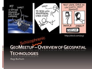
- 1. http://xkcd.com/713/ } Schizophrenic GeoMeetup – Overview of Geospatial Technologies Ragi Burhum
- 2. The structure of chaos 1) The “basics” of Geo2) Answer the #1 question asked in the survey for this GeoMeetup (from all 7 answers)3) Geo-Demos
- 3. Does this number mean anything to you? 404
- 4. How about this one? 4326
- 5. Let’s get the basics out of the way.
- 6. Summary of Geo-concepts Objects in the real world are represented by:1) A collection of “standard” attributes. For example: age (int), length(double), color (enum), name (string), etc.2) 1 or many “spatial” attributes. For example: location (point geometry), shape (polygon geometry), route traveled (line geometry), etcThe formal name for those objects in GIS is features.
- 8. Open Geospatial Consortium (OGC) Simple Features for SQL (SFSQL)
- 9. Summary of Geo-concepts The feature’s geometry can be represented in different coordinate systems – commonly referred to as Spatial Reference. In case you were wondering, 4326 is the spatial reference identifier (SRID) assigned to the WGS84 spatial reference system published by the European Petroleum Survey Group (EPSG). img: [1]
- 12. They all use various indexing mechanism
- 14. SELECTowner_phoneFROM parcelsWHEREST_DWithin(geom, ‘POINT()’, 1000 );
- 15. “How far did the bus travel last week?”
- 16. SELECTSum(ST_Length(geom))FROMvehicle_pathsWHERE (v_id = 12) AND (v_date > Now() - ‘7d’);
- 18. The structure of chaos 1) The “basics” of Geo2) Answer the #1 question asked in the survey for this GeoMeetup (from all 7 answers)3) Geo-Demos
- 19. #1 Q: What is available as Open Source?
- 20. projects Web Mapping Software
- 21. projects Web Mapping Software MapGuideOpen Source MapBuilder
- 23. projects Desktop Applications GRASS GIS OSSIM
- 25. projects GeoSpatial Libraries FDO
- 26. That is a tiny little fraction of what is available out there. Many companies in the Web 2.0 space (pardon me for lack of a better word that word) open source their geospatial technology and data.
- 27. “I am tired of listening to you talk. SHOW ME SOMETHING”
- 28. The structure of chaos 1) The “basics” of Geo2) Answer the #1 question asked in the survey for this GeoMeetup (from all 7 answers)3) Geo-Demos
- 29. Pick your GeoDemo poison 1) Showing *a lot* of data on a webmap – Google style.2) OpenStreetMap3) A tiny ESRI product sample4) Creating your own tiles and leveraging a spatial db5) Beyond Streetview – Merging augmented reality and enterprise GeoData.6) Machine Learning and automatic feature detection.
- 30. Thanks! Ragi Burhum ragi@burhumllc.com @rburhum linkedin.com/in/rburhum
Editor's Notes
- Hello, my name is Ragi Burhum and I am the organizer of the GeoMeetup. I want to thank you all for showing up to our very first meeting. Before we begin, I’d like to thank the sponsors. Without them, we wouldn’t be here.So who are they?CBS Interactive is providing the space. You have no idea how many places I went to or contacted to try to findSimpleGeo for providing so many pizzas, and xcubelabs for providing the beer, soda and paying or yearly meetup fees.Thank you guys!I’d like to say a few words – and only this time, because it is our very first geomeetup.So why are we here? There are various groups around the Bay Area that have presentations about geo. I attend many of them regularly. However, most of the time, they tend to cater to a non-developer audience – or if they do have developer content, it tends to not be *technical enough* in order to avoid alienating the rest of the audience. I want to change that.A little bit of history: Until last year, there was a small group of us that would meet and talk about Open Source GIS (Geographic Information Systems). We didn’t meet that often – but when we did, the conversations were interesting (at least to me). The usual format was to present something – and then go to a bar were we would exchange information about various GIS related projects in a relaxed environment.We stopped meeting for various reasons… and the other day some of us thought it would be good to resurrect that. Instead of continuing with the same group, we wanted to make it a little more broad – not just Open Source, but everything related to Geo… Mobile phones, geo services, proprietary geo technologies, everything geo.And so, here we are.The original idea was to have around 4 to 9 people… and somehow, we are around 90 sitting here.That’s not a bad thing - it just means the original plan isn’t going to scale. Normally, I would have gone around the group and ask everyone to introduce themselves – not with this many people. And that is a shame. Why? Because if you actually perused the list of people that signed up you will find that amongst you there are *experienced* people that are doing very interesting things in their own fields (whether it is for work or hobby). In this room there are people from the major search engines, the main social media websites/services, interesting startups in the geo space, experts in databases, hobbyist shooting things to the sky and taking amazing pictures, people doing custom geo hardware, mobile developers, people doing heavy analytics… smart people… and yet I think only three of you were smart enough to take the time to answer the meetup RSVP question! Come on!Please do it next time Whenever you have the chance, take the time to talk to the person next to you – there is the potential for good conversation.Now, I think I am ready to start with the presentation.--------------Name should have been schizophrenicAll over the place- 100 slides. Too much for the first meeting
- Reduced 100 slidesto 30 that I refusedtoremove.Presentationstructured in 3 sections
- Let’sstartwith a question.
- Now I know who has beendoingworkwithtraditional GIS datasets.
- And it is all there based on fully complying with standards written by the OGC. I don’t need to tell you why standards are good and how they prevent vendor lock in.
- Someprojections are good at preservingareas, other are greatfornavigation
- So what types of projects are part of OSGeo?Say that you need webmapping software so that you can bring your geospatial information to the web, well, there is an app for that! Wait, wrong presentation!There we go. Let me try again, Say that you need webmapping software to bring your geospatial information to the web. Well, we have some web controls, for zooming in and out as well as server and client side technology for rendering your geospatial information.
- There are some pretty popular projects here.Mapserver has been around since mid 1990s and it is an amazingly robust server side component. It provides a rendering engine, OGC web services, etc. OpenLayers is a javascript library that works as a front end for web mapping applications. Think of it like Google Maps API, but on steroids.
- What else is there? Well, say that you need heavy desktop applications to do image processing, analysis of vector, field of vision, editing, etc.
- Well there are projects for that. You may have heard of some of these. Notably, Grass… extremely powerful in terms of analysis… comparable (and better than most commercial GIS software out there). It has been around since dinosaurs roam this earth… and its GUI reflects that – it is super unintuitive! But powerful nevertheless. Some of the other projects are getting a lot more traction since they wrap GRASS functionality in a nicer, contemporary UI.
- Say that you are getting data from some customer. Those of you that have done this, will know that everyone uses different formats.In the geospatial world, formats are not our only headaches, since everyone also decides to use their own spatial references. Some people like meters as their units, others feet.So it may be the case that you are writing applications that need to deal with these type of problems.
- Well we have libraries with pretty liberal licenses that allow you to read from different formats, add buffering, intersections, projections to your tools.