

Recommended
More Related Content
Viewers also liked
Viewers also liked (20)
Similar to Don't Talk About It, Take Them There
Similar to Don't Talk About It, Take Them There (20)
Recently uploaded
Recently uploaded (20)
Don't Talk About It, Take Them There
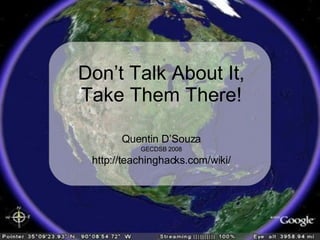
- 1. Quentin D’Souza GECDSB 2008 http://teachinghacks.com/wiki/ Don’t Talk About It, Take Them There!
- 2. How have we explored places in the past?
- 3. Web Mapping
- 5. Free
- 6. Google Earth vs. Google Maps Based on a Comparison By David Jakes Google Earth Google Maps Feature Installation Local Install Online Login Embed Media Limited Text, Image, Hyperlinks KML and KMZ file creation KML Only Export Community Lesson Plans
- 8. Based on an image from Popular Mechanics
- 9. What if it was our government?
- 12. Streetsview Streetsview is coming to Toronto this summer. - Bill Tighe, Business Manager, Google, Toronto If Toronto is next, can Amherstburg be far behind? - Doug Peterson
- 13. Victoria Falls The Galapagos Islands Mount Vesuvius Mila - Africa
- 17. PROS Cross-Curricular Visual Literacy Meaningful Differentiation CONS Bandwidth Computer Hardware
- 18. Why is Google Earth Significant? Leverage Data Visual Immediacy Create and Share Resources Learn through Discovery Visual Literacy Critical Literacy
- 19. Where Would You Go? Paris Rome London Home
- 20. Best Way to Find Places Not Always Successful Searching Based on Name Of Place Search by keyword or Exact name (using Quotation marks) Much More Accurate But Requires External Resources Find driving directions From one place to another Search Based On A Business Name Search Based on Latitude and Longitude Get Directions
- 21. What is a Placemark?
- 22. What is a Placemark? Title and Label Customize Icon Customize Placemark Add text, images, and embed media
- 24. Formatting A Placemark Add A Web Site Link: <a href=" http://www.TCDSB.org "> TCDSB Web Site </a> Adding An Image: <img src=" http://img68.imageshack.us/my.php?image=99501311up8.gif "> (Requires image to be already hosted online) Embed Media: Copy and paste the embed code from web sites into the placemark description
- 25. What is a Path and Polygon? Based on a Comparison By David Jakes Path Polygon Feature 2D and 3D Shapes Export Customize Description Text, Image, Hyperlinks Embed Media Organize Places Panel
- 27. What is a Model? Models can be brought into Google Earth and placed. Build models using free software. Adding a model is very similar to adding a polygon. Find models in the 3D Warehouse.
- 29. What is a Image Overlay? Add Web Mapping Service (WMS) overlays Your own images On the globe Set transparency and refresh rate. Embed media, text, And images in description View KMZ File
- 31. What is a Network Link? Fresh Data Many Sources Make Comparisons Arrange Data In New Ways
- 33. What is a Layer? Too many layers will Slow Down Google Earth Display Data Over Viewing Area You can turn on and off layers as you Need them. Add Points of Interest, Maps, Roads, Terrain, Buildings and much more.
- 35. Sharing in Google Earth
- 36. Ideas For The Classroom Apply Live Data Visit Almost Any Location In The World Measure Large Distances Create Virtual Tours Collect and Share Placemarks for Lessons Embed Media for Deeper Context Scout Out A Field Trip
- 37. http://bbs.keyhole.com/ Click NEXT to continue
- 40. http://www.googlelittrips.com/ Click NEXT to continue
- 41. http://gelessons.com/ Click NEXT to continue
- 42. http://www.gearthblog.com/ Click NEXT to continue
- 44. Explore The World! Finished Part 6