
Recommended
More Related Content
What's hot
What's hot (20)
Similar to Historical roman towns
Similar to Historical roman towns (20)
Recently uploaded
Recently uploaded (20)
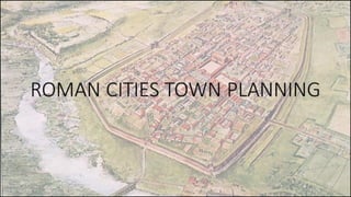
Historical roman towns
- 2. ▪ LOCATION: 1. Ancient Rome begin as a group of villages along the Tiber River in what is now Italy. 2. Around 750 B.C. these villages united to form the city of Rome. 3. For more than 200 years, kings ruled Rome. 4. In 509 B.C. Rome became a republic. 5. The Roman Senate was an assembly of elected representatives. 6. It was the single most powerful ruling body of the Roman Republic. 7. Rome was established near the Tiber river and Alban hills. 8. This site offered many benefits as the river was a natural border. 9. The hills gave a safe defensive position.
- 3. ▪ HISTORY: Ancient Roman town /settlement Planning ( 700B.C-500 AD) • Roman planning continued the legacy left by Greek architects and the established architectural orders, especially the Corinthian. • The Romans were also innovators and they combined new construction techniques and materials with creative design to produce a whole range of brand new architectural structures. • Many of the Roman planning innovations were a response to the changing practical needs of Roman society, and these projects were all backed by a state apparatus which funded, organized, and spread them around the Roman world, guaranteeing their permanence so that many of these great edifices survive to the present day. ▪ CLIMATE: • Warm, dry summers and mild, rainy winters. • A plentiful food supply was one key factor in Rome’s early growth.
- 4. ▪ EARLY ROMAN TOWNS: 1. In Italy, the earliest towns grew including Rome, were unplanned and without restriction. 2. The ground was uneven, their streets had no clear pattern and were often very narrow, lined by tall buildings. 3. Due to presence of river initially settlement started adjacent to river sides. 4. The foundation ceremony of new roman towns originated in Etruscan times. 5. Greek & Etruscan town plans were influential in evolution of roman town plans. PLAN OF THE ROMAN TOWN C. AD 75-150 PLAN OF THE ROMAN TOWN C. AD 150-400 8. A new forum was laid out to one side of the central axis of the town and its basilica was constructed on top of the remains of the legionary bath house. 9. The towns public baths were placed on the sloping ground. 10. On the surrounding insulae (islands of land) timber buildings grew up, some of which were evidently shops. 6. The development of roman town planning, which used a similar grid pattern of streets but had two major streets intersecting at right angles to provide a crossroads as a focal point in the town center. 7. Within this area stone buildings replaced the older timber ones.
- 6. ▪ CHARACTERSTICS FEATURES OF ROMAN TOWNS: • Roman colonial or camp plans were especially developed for the military engineers. • Such plans had necessarily to be simple to set out & the building blocks easy to measure. • In this case, the grid iron plan proved to be successful. • The Roman displayed crude symmetry & artistic rigidity in practice of levelling a hill to make the site confirm to the plan. • Roman planning was like the chess board system having the principal streets rounding across the length.
- 7. I. THE STREET: • Romans adopted the technology and planning skills of the Greeks. They were more advanced than the Greeks in terms of technological skills which they used to develop better infrastructural facilities and construction techniques. • It had two main axial roads called Cardus E-W Decumanus N-S. • "Secondary streets" complete the gridiron layout and form the building blocks known as "Insulae“ • Perimeter of the city was usually square/rectangular with bassions. • Cross streets occasionally stepped and bridged around the city due to topographical condition. • Generally rectangular walled city entered by several gates, showing complete town organization.
- 8. II. THE FORUM: • The focal point of the city was its forum, where political, economic, administrative, social and religious activity were centred. • "Forum area" usually located centre of the town formed by the intersection of the decamanus and cardo, similar to Greek “agoras”. • An open area bordered by colonnades with shops. • Functioned as the chief meeting place of the town. • It was two components long. • It was an open square in the middle of the city. • This place was full of statues, altars, arches and columns. • Forums were surrounded by temples and justice buildings.
- 9. Buildings around forum: 1. THE MARKET: • It was one component long. • They sold fruit, vegetables, meat and fish. 2. THE BATH: • It was one component long. • It was not only a place for washing, but also to meet friends or do business. 3. THE AMPHITHEATRE: • It was two components long and one-and-a-half wide. • In this place, prisoners and criminals were put to death. • Some of them were attacked by wild animals, others had to fight gladiators. • Construction was of stone, brick, wood & window glass. A roofed hall with a wide central area—the nave—flanked by side aisles, and it often had two or more storeys. 4. THE BASILICA
- 10. III. TOWN FORTIFICATION: • Colonies were provided with defenses, usually consisting of a wall with defendable four gateways. • Impressive masonry walls provided the colony with enhanced status, representing the power of Rome. • Walls varied in plan and construction from town to town but were usually built as free-standing masonry walls with a carefully finished facing of small blockwork. • Gateways were kept to a minimum (usually one per side if the town was planned as a rectangle), and were usually flanked by towers rising higher than the walls. • Gateways usually had single or double passageways for vehicles, flanked by narrower passageways for pedestrians. • There are 3 main walling systems used in the Roman period.
- 11. • The idea to which the romans referred when transporting water down to the city was similar to river flow, in fact they called the channel “rivus”. The general scheme as it was used in many cities of the roman empire. IV. WATER SUPPLY:
- 12. • The Romans constructed aqueducts throughout their Republic and later Empire, to bring water from outside sources into cities and towns. • Aqueduct water supplied public baths, latrines, fountains, and private households; it also supported mining operations, milling, farms, and gardens. • Aqueducts moved water through gravity alone, along a slight overall downward gradient within conduits of stone, brick, or concrete; the steeper the gradient, the faster the flow. V. AQUEDUCTS:
- 13. Types of aqueducts: 1.TWO TIER BRIDGE 2.SIPHON 3.TUNNEL VI. DRAINING CHANNEL: When water run in soil stratifications, it was made to permeate trough walls with holes and to flow inside a channel until reaching the basins. VII.SIPHON: Where a valley crossed was to deep or too big for a bridge, a siphon was built. To maintain the constant slope the “rivus” curved around hills and valleys, more than crossing them in a straight line, just as a river. however, when this was not possible, tunnels were excavated and the bottom of the valleys was crossed with siphons made with pressure lead or stone pipes. Draining channel and collection basin, Eiffel Aqueduct cologne, Germany (Habery, 1972) Channel crossing a valley: scheme of siphon arrangement (Hodge, 2002)
- 14. VIII.BASIN: During its course the channel reversed its waters to a so called “PISCINA LIMARIA”. A settling tank to avoid transport of particulate impurities downstream. The shape of the tank varied from the simple enlargement of the channel, to the more complex multi-storey arrangement of PISCINA of AQUA VIRGO. IX. DISTRIBUTION CHANNEL: Once approached the city the channel was flowing to a partitioning tank, the “CASTELLUM DIVISORIUM” were it was subdivided in different supply pipes going in separate parts of the city. This second part of the system, the urban distribution, was a pressure pipe distribution. Piscinae Limariae of Aqua Alessandrina, left and Aqua Virgo, right (Adapted from Piranesi and Cagnat) Castellum Divisorium in Pompeii: Plan, S-E Façade, View of the interior catwalks and partitioning masonry walls.
- 15. • A clear vision of the urban water supply system by means of water towers. • The CASTELLUM DIVISORIUM was connected with three mains to the water towers standing along sides of roads throughout the city. • The outline of the distribution of public fountains, water towers and deep wells. X. DISTRIBUTION FROM WATER TOWERS:
- 16. • Rome had a complex system of sewers • Waste flowed through a central channel into the main sewage system, then into a river . • The first sewers built between 800 and 735 BC • The sewers, covered with a vault of tightly fitted stones, have room in some places for hay wagons to drive through them. • Cloaca Maxima, (Greatest Sewer) is one of the world’s first sewage systems. • And the quantity of water brought into the city by aqueducts is so great that rivers, as it were, flow through the city and the sewers. • Almost every house has water tanks, and service pipes, and plentiful streams of water. • Not all homes were hooked up to sewers, most were not, so many still threw their waste into the streets. But Rome had pervasive street cleaning. • Dejecti Effusive Act: Protect citizens from being hit with waste thrown into street. X. SEWERS:
- 17. • Romans could get rid of waste by throwing it into the street or by using a public latrine. • The earliest public toilets date back to the 2nd century BC. • And became very popular. • Places of socialization • Offered little privacy, long benches, mostly stone, with keyhole slots. • No doors • Waste would go directly into the sewer system • Waste from baths and fountains helped clean out sewers • Aediles supervised the sanitary system in cities. • Many branches off the main sewer • Served public toilets, baths, public buildings • Constantly serviced. • Today, Cloaca Maxima drains rainwater and debris from center of Rome • Took sewage from city of Rome to Tiber River. • Built by Rome’s Etruscan kings • Began as an open drain, eventually built over and enclosed in 33 BC by Augustus, creating a tunnel XI. CLOACA MAXIMA: XII.TOILETS:
- 18. ▪ TECHNOLOGY ADVANCEMENT: They were more advanced than the Greeks in terms of technological skills which they used to develop better infrastructural facilities and construction techniques. • Lime and concrete was invented. • Applied mechanics for moving heavy masses developed. • Roads were paved with stones. • Advanced system of water supply (Aqueducts &water reservoirs), sewage system and drainage system through ducts and underground sewers in semi-circular vaulted form were used(like cloaca maxima). • All public latrines were connected to underground sewerage system. People normally used the public latrines leads to betterment in public health. •Methods of centralize heating
- 20. ▪ INTRODUCTION • The city of Pompeii was an ancient Roman town-city near modern Naples in the Italian region of Campania, in the territory of the commune of Pompeii (South Italy). • Pompeii was destroyed by the eruption of Mount Vesuvius (a volcano near the Bay of Naples) in 79 C.E. making the town one of the best-preserved examples of a Roman city, and tourists today marvel at the sensation of walking through a real ancient city. • While the volcano took thousands of lives and made the region uninhabitable for centuries, the layers of volcanic ash(4 to 6 meters)preserved Pompeii in a manner unparalleled at other ancient Roman sites.
- 21. ▪ GEOGRAPHY: • Built roughly five miles from Mount Vesuvius itself. • The region is humid and warm with refreshing breezes. • The area is also right over a Mediterranean fault line. • Tectonic activity has heavily shaped the geography around Pompeii and Herculaneum, resulting in hilly inlands and rocky beaches. • Pompeii was built on a spur formed by a prehistoric lava flow to the north of the mouth of the Sarnus (modern Sarno) River • The city of Pompeii was shaped irregularly because it was built on a prehistoric lava flow.
- 22. ▪ CHARACTERISTICS: • Pompeii was a commercial walled city with 7 gates. • It was full of artisans and craftspeople and handled much of the trade entering Italy through the Bay of Naples. • At its height, this walled city covered around three square kilometers and held about 10,000-12,000 people. Another 10,000 possibly lived in the farms, villas, and suburbs surrounding the actual city. • Pompeii's streets were relatively wide, paved in stone, and connected all of the most important city districts, including the public space called the forum, as well as the markets, temples and amphitheater. • At the east end of the town, nearly 1200 yds. from the western extremity, is the amphitheater.
- 23. ● Like most Roman towns, the overall pattern is built around a set of principle roads. ● The Via dell’ Abbondanza made up the central East- West axis that ran through the city, while the north- south axis was built around the Via Stabiana. ● Barriers at the entrance to certain streets prevented carts, reserving those roads for foot traffic only. ● The Romans also placed small white stones in major roads, theoretically to help people see the roads better at night time. ● The town-planning of Pompeii is in the main trapezoidal, not rectangular. ● Neither its oblongs, nor its squares, nor its street- crossings exhibit true right angles, though many of the rooms and peristyles in the private houses are regular enough. N
- 24. ▪ FORUM: ● The religious, political, and commercial center of any Roman city was its forum. ● The Forum was the site of various services and structures, and could be considered a sort of “downtown” for Pompeii. Later Roman development to the North and East left the forum in the original (irregularly planned) south west corner of the city. ● The forum was around 142X38 meters with the north side closed by the Temple of Jupiter. ● The forum was an open central area filled with statues,platforms and notice boards. The open piazza was paved with stone. ● The forum had most of the principle temples and public buildings around it. ● Macellum was a covered market. ● A kind of “entertainment district” in the south-central section of Pompeii included two theaters—one open-air, the other smaller and roofed. In these theaters, one could see plays, hear musical performances, and perhaps hold civic or social gatherings. These entertainments differ drastically from those enjoyed in the amphitheater at Pompeii.
- 26. ● Pompeii also had public establishments for bathing. ● At least five public baths (and scores of private ones within homes) provided not simply a place to get clean, but also opportunities for social interaction and exercise. ● Both the Stabian and the Forum Baths were initially constructed with public funds, indicating the extent to which such establishments were considered essential for Pompeii’s residents. ● Aqueducts fed both private and public baths, although many residents of Pompeii relied on rainwater or abundant wells in the city to supply their water. ● The high state preservation at Pompeii provides a view of the city’s water supply, from the aqueduct, through a distribution center at the high northern part of the town, through water towers and public fountains, and into private homes by way of terracotta and lead pipes.
- 27. ▪ WALLS: • Throughout it’s early history, Pompeii was surrounded by a series of defensive walls with 12 towers and 8 gateways leading into the town. • When Pompeii became a colony of Romans, defensive walls lost their importance and in parts of the city walls were pulled down to make way for housing. • The city gates were positioned at the end of the main throughfares. • The most impressive examples of gateways at Pompeii are the Marine Gate and the Herculaneum Gate. ▪ GATES:
- 29. ▪ INFERENCES: • The Roman Empire conquered many nations. It had a strict social set up so that the Empire didn’t fall to ruin. • It took ideas for new religion and art from these areas. As you might guess, the most powerful influence was from the Greek. • The Greek influenced the Religion, the Philosophy, and the Architecture of the Romans. • The Romans used a consolidated scheme for city planning, developed for civil convenience. • The basic plan consisted of a central forum with city services, surrounded by a compact, rectilinear grid of streets. • Hundreds of towns and cities were built by the Romans throughout their empire. • The design and structure of a city is as important as the people who dwell within her walls. • Eventually the Romans had fine tuned their design principals in such an advantageous way that they molded all of their city states similarly.
- 30. Submitted by: Mustafa Hasan Pankaj Dhakad Savy Soni Shivangi Shrivastva Vedant Chawla Yashasvi Agrawal