Route Analysis and Cut Fill Analysis using QGIS (open source GIS)
•
2 gefällt mir•3,528 views

Open source GIS has capacity to empower Architects and Urban designers towards sustainable development methodologies. This presentation is an example for one such initiative where CAD point data was converted to shape files and was then used for further analysis. Similar analysis can be conducted using ISRO satellite data that is available to public.

Empfohlen
Empfohlen
Weitere ähnliche Inhalte
Was ist angesagt?
Was ist angesagt? (20)
Andere mochten auch
Andere mochten auch (12)
Kürzlich hochgeladen
Kürzlich hochgeladen (20)
Route Analysis and Cut Fill Analysis using QGIS (open source GIS)
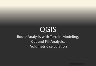
- 1. QGIS Route Analysis with Terrain Modeling, Cut and Fill Analysis, Volumetric calculation 1 Pallavi Prakash Jha
- 2. 2 SITE Projection : EPSG:32643 - WGS 84 / UTM
- 3. DATA- CONTOUR POINTS 3 Projection : EPSG:32643 - WGS 84 / UTM
- 4. CATEGORISED POINTS 4 Projection : EPSG:32643 - WGS 84 / UTM
- 5. DEM - MODEL 5 Projection : EPSG:32643 - WGS 84 / UTM
- 6. CATEGORISED - DEM 6 Projection : EPSG:32643 - WGS 84 / UTM
- 7. SLOPE IN DEGREES 7 Projection : EPSG:32643 - WGS 84 / UTM
- 8. RELIEF MAP 8 Projection : EPSG:32643 - WGS 84 / UTM
- 9. STREAMS 9 Projection : EPSG:32643 - WGS 84 / UTM
- 10. COST - MAP 10 Projection : EPSG:32643 - WGS 84 / UTM
- 11. ROUTE GENERATED 11 Projection : EPSG:32643 - WGS 84 / UTM
- 12. PATH OVERLAID ON DEM/STREAMS 12 Projection : EPSG:32643 - WGS 84 / UTM
- 13. PATH-VECTOR 13 Projection : EPSG:32643 - WGS 84 / UTM
- 14. BUFFER 3 METER 14 Projection : EPSG:32643 - WGS 84 / UTM
- 15. EXISTING DEM PATH 15 Projection : EPSG:32643 - WGS 84 / UTM
- 16. CUT AND FILL PORTIONS OF PATH 16 Projection : EPSG:32643 - WGS 84 / UTM
- 17. VOLUME 17