Alappuzha
•Als PPTX, PDF herunterladen•
10 gefällt mir•6,341 views

evolution of settlement in alappuzha

Empfohlen
Weitere ähnliche Inhalte
Was ist angesagt?
Was ist angesagt? (20)
Andere mochten auch
Andere mochten auch (20)
Ähnlich wie Alappuzha
Ähnlich wie Alappuzha (20)
Kürzlich hochgeladen
Kürzlich hochgeladen (20)
Alappuzha
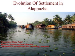
- 1. Evolution Of Settlement in Alappuzha Prepared by Nipun Patel Master in urban & regional planning, Department of Architecture, M.S. University, Vadodara
- 2. LOCATION • Alappuzha is a landmark between the broad Arabian sea and a web of rivers flowing into it. • Situated from 58 km away from Cochin(Ernakulam) and 230 km away from Calicut in south direction
- 3. HISTORY • Since landing in Calicut in 1498, the Portuguese started playing an influential role in this area (Alappuzha). They began by spreading Catholicism and converting already existing Syrian Christians into Catholics. • In the 17th century, as the Portuguese power declined, the Dutch gained a predominant position in the principalities of this district. They built many factories and warehouses for storing pepper and ginger, relying on several treaties signed between the Dutch and the Rajas of Purakkad, Kayamkulam and Karappuram.
- 4. EVOLUTION OF ALAPPUZHA TOWN • As the prominence of this place increased day by day, in 1762, the Dewan of Travancore, Raja Kesavadas established a town called Alappuzha to encourage trading and commercial activities. There were two canals through the strip of sand between the Arabian Sea and Vembanad Lake. • Both banks of the canals were dotted with several commercial establishments, shops and factories. This attracted merchants from other parts of India to the region.
- 5. Settlement Morphology of Alappuzha Town PORT AREA GUJRATI CLUSTER AGRAHARAM CLUSTER INDUSTRIAL CLUSTERGODOWN CLUSTER
- 6. DESIGN OF CANAL • The width of main canals is 30-35m while the width of sub canals is 8- 10m • While the depth of main canal is about 10m and sub canal is 3m Leiden – a paradise of interwoven canals and built fabric Schematic section through Alappuzha canal stretch
- 7. MAIN CANAL SUB CANAL
- 8. • Also the alternative channels were constructed for the river water to reach the sea, the original down river (stream) water section served as an outer harbor and the up-river section acted as an inner harbor (Amsterdam). Damming at Alleppey
- 10. ALAPPUZHA – ESSENTIALLY A DUTCH TOWN •DIKE TOWN - Rivers / backwaters were diked •Canals provides a valuable central space and a setting for public buildings across on both sides. Alappuzha canal stretch Leiden canal stretch
- 11. Alappuzha Leiden
- 12. DUTCH TOWN PLANNING PRINCIPLES OF ALAPPUZHA Larger buildings at prominent places is the symbol of secular authority Landmarks – Church Towers Leiden
- 13. • Alignment of building blocks parallel to the canal and placement of a landmark to terminate the vista. • Important crossings are accentuated by citing a religious building along the canal front.
- 14. • Limiting the width of water way by techniques in stone and timber construction
- 15. Higher degree of homogeneity in building style and street architecture Alappuzha Leiden
- 16. Streetscape - Leiden Streetscape - Alappuzha PRIMARY STREET SECONDARY STREET TERTIARY STREET CONNECTORS Streetscape - Leiden
- 17. • Back in 1859 a 302 meter long sea bridge and light house which can spread its light up to 20 Km was commissioned . canals and roads are created to facilitate inland transportation and to bring goods from the shipyard to the industrial areas. • Thus the town became one of the busiest trade centres, which had a port along the Malabar Coast. Traders travelling to the destination from across the world came in search for souvenirs and black gold.
- 18. • In the early first decade of the 20th Century the Viceroy of the Indian Empire, Lord Curzon made a visit in the State to Alleppey, now Alappuzha. • Fascinated by the Scenic beauty of the place, in joy and amazement, he exclaimed, “Alappuzha, the Venice of the East”. Thus the sobriquet found its place in the world Tourism Map. • The development of Cochin as a natural harbor in 1928 diminished the importance of Alleppey town as a business hub. After the formation of Kerala state after independence of India increased the popularity of Cochin town as a harbor. Because the industries in Alleppy are centered around Allppey port, it was diminished as the Cochin port became a popular destination for ships.
- 19. FORMATION OF ALAPPUZHA DISTRICT • On 17th of August 1957, the Alappuzha district was formed by carving out some regions of Kottayam and Kollam district. • It is assumed that the name of Alappuzha was derived by the geographical position and physical features of the place which means ”the land between the sea and the network of rivers flowing into it”. • As the time passes, commercial activities decreases in Alappuzha and slowly this place is transferred the to tourist place. • Alappuzha is famous for house boats and back waters. • Current population of Alappuzha is 174,164 which is sixth largest district in Kerala.
- 22. SOURCES • http://www.alappuzha.com/kuttanad.htm • http://alappuzhatown.com/history/ • http://www.indianetzone.com/8/history_alappu zha-district.htm • http://www.ayurvedapackages.org/?destination s=alappuzha • http://en.wikipedia.org/wiki/Alappuzha
Hinweis der Redaktion
- DIKE TOWN - Rivers / backwater were diked and canals were protected on either sides by dikes and town was established Inland waterways taken from the sea or river into the interiors Straight alignment of built fabric along the dikes and a landmark such as a tower, a church or a windmill, built to terminate the vista Dykes and canals provided a valuable central space and a setting for public buildings