SlideShare a Scribd company logo
1 of 32
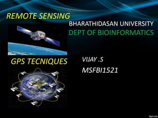
REMOTE SENSING
GPS TECNIQUES VIJAY .S
MSFBI1521
BHARATHIDASAN UNIVERSITY
DEPT OF BIOINFORMATICS
Global Positioning System
HISTORY
In 1956 the American physicalist
Friedwardt winterberg proposed a test of
general relativity which was used in the
design of GPS.
The US began the project of GPS in 1973
to overcome the limitations of previous
navigation system.
In 1978 the first experimental BLOCK-1
GPS satellite was launched.
What is GPS ?
A very precise positioning system
• Developed and maintained by the US
Department of Defense (DOD)
• Satellite Based
* 24 satellites
* 20,200 km high orbit
BUT!
Although it is a very precise
geographic positioning system
•It is very easy to get youself into trouble
•Why?
•Because you (probably) don’t understand
how it works
•And that leads to garbage
Characteristics of GPS
• Free
• Precise
• Reliable
• Anytime & anywhere
• All weather
• Unlimited user capacity
How GPS Works ………
Uses measurements from 4+ satellites
Distance = travel time x speed of light
GPS Receivers
Methods of data collection
Three methods of positioning
• Autonomous
10-20 meters
• Differential
2-5 meters
• Phase Differential
centimeter
2-5m10-20 m
cm
How accurate is GPS?
Depends on some variables
• Design of receiver
• Relative positions of satellites, often
known as DOP (Dilution of Precision)
• Postprocessing
• Time spent on measurement
REMOTE SIENSING
What is remote sensing used for?
Remote sensing is a method for getting information
about of different objects on the planet, without any
physical contacts with it.
Image Source: cimss.ssec.wisc.edu
Elements of Remote Sensing
Source:staff.aub.edu.lb
Satellite pictures
Satellite imagery consists of
photographs from which
collected by satellites.
Image Source: www.wonderwhizkids.com
Image Source: www.loneotaku.net
Japan Satellite View
Satellites offer a Global View
What does satellite image give you?
-Information on land cover, land use, habitats and
infrastructure
-multiple engagements by time series
-Mapping and monitoring changes and predict future
Application of Remote Sensing
Urbanization & Transportation
• Urban planning
• Roads network and transportation
planning
• City expansion
• City boundaries by time
• Wetland delineation
Image source: www.ldeo.columbia.edu
Image source: www.geospectra.net
Satellite image of deforestation
 Wageningen UR 2002
Types of Satellites
Geostationary
Satellites
A geostationary satellite is one
of the satellites which is getting
remote sense data and
located satellite at an altitude of
approximately 36000 kilometres
and directly over the equator.
Image Source: cimss.ssec.wisc.edu
Polar-Orbiting
Satellites
A polar orbit is a satellite
which is located near to
above of poles. This
satellite mostly uses for
earth observation by time.
Types of Satellites
Image Source: globalmicrowave.org
Some Image Processing Software
• ERDAS Imagine
• ENVI
• ILWIS
• ArcGIS
31
Remote sensing and gps

More Related Content

What's hot

Gis powerpoint
Gis powerpointGis powerpoint
Gis powerpointkaushdave
 
Digitization in ArcGIS
Digitization in ArcGISDigitization in ArcGIS
Digitization in ArcGISKU Leuven
 
Introduction to GPS
Introduction to GPSIntroduction to GPS
Introduction to GPSDaniel Kim
 
Movement of EMR in the Atmosphere and Atmospheric window
Movement of EMR in the Atmosphere and Atmospheric windowMovement of EMR in the Atmosphere and Atmospheric window
Movement of EMR in the Atmosphere and Atmospheric windowSumo Ranjan Mandal
 
Remote sensing and image interpretation
Remote sensing and image interpretationRemote sensing and image interpretation
Remote sensing and image interpretationMd. Nazir Hossain
 
GIS presentation
GIS presentationGIS presentation
GIS presentationarniontech
 
Basic of gis concept and theories
Basic of gis concept and theoriesBasic of gis concept and theories
Basic of gis concept and theoriesMohsin Siddique
 
Introduction and Application of GIS
Introduction and Application of GISIntroduction and Application of GIS
Introduction and Application of GISSatish Taji
 
introduction to gis technology and its applications
  introduction to gis technology and its applications  introduction to gis technology and its applications
introduction to gis technology and its applicationsGhassan Hadi
 
Data acquisition Platforms
Data acquisition PlatformsData acquisition Platforms
Data acquisition PlatformsSumant Diwakar
 
Remote sensing & Gis
Remote sensing & GisRemote sensing & Gis
Remote sensing & Gisgopichand's
 

What's hot (20)

Gis powerpoint
Gis powerpointGis powerpoint
Gis powerpoint
 
Geo referencing
Geo referencingGeo referencing
Geo referencing
 
Digitization in ArcGIS
Digitization in ArcGISDigitization in ArcGIS
Digitization in ArcGIS
 
Introduction to GPS
Introduction to GPSIntroduction to GPS
Introduction to GPS
 
Introduction to Remote Sensing
Introduction to Remote SensingIntroduction to Remote Sensing
Introduction to Remote Sensing
 
Movement of EMR in the Atmosphere and Atmospheric window
Movement of EMR in the Atmosphere and Atmospheric windowMovement of EMR in the Atmosphere and Atmospheric window
Movement of EMR in the Atmosphere and Atmospheric window
 
Remote sensing and image interpretation
Remote sensing and image interpretationRemote sensing and image interpretation
Remote sensing and image interpretation
 
Satellite Image
Satellite Image Satellite Image
Satellite Image
 
Gps and its application
Gps and its applicationGps and its application
Gps and its application
 
GIS presentation
GIS presentationGIS presentation
GIS presentation
 
Basic of gis concept and theories
Basic of gis concept and theoriesBasic of gis concept and theories
Basic of gis concept and theories
 
Introduction and Application of GIS
Introduction and Application of GISIntroduction and Application of GIS
Introduction and Application of GIS
 
Remote sensing & gis
Remote sensing & gisRemote sensing & gis
Remote sensing & gis
 
introduction to gis technology and its applications
  introduction to gis technology and its applications  introduction to gis technology and its applications
introduction to gis technology and its applications
 
GPS & GIS
GPS & GISGPS & GIS
GPS & GIS
 
Data acquisition Platforms
Data acquisition PlatformsData acquisition Platforms
Data acquisition Platforms
 
Remote sensing & Gis
Remote sensing & GisRemote sensing & Gis
Remote sensing & Gis
 
Remote Sensing ppt
Remote Sensing pptRemote Sensing ppt
Remote Sensing ppt
 
Remote sensing
Remote sensing   Remote sensing
Remote sensing
 
Remote Sensing ppt
Remote Sensing pptRemote Sensing ppt
Remote Sensing ppt
 

Similar to Remote sensing and gps

Presentation A.K Nigam sir (2) (1).pptx
Presentation A.K Nigam sir (2)  (1).pptxPresentation A.K Nigam sir (2)  (1).pptx
Presentation A.K Nigam sir (2) (1).pptxspeedcomcyber25
 
Global Positioning System (GPS)
Global Positioning System (GPS) Global Positioning System (GPS)
Global Positioning System (GPS) ManjuChauhan16
 
Advances in Agricultural remote sensings
Advances in Agricultural remote sensingsAdvances in Agricultural remote sensings
Advances in Agricultural remote sensingsAyanDas644783
 
Remote sensing and its applications, DIP, GIS, GPS
Remote sensing and its applications, DIP, GIS, GPSRemote sensing and its applications, DIP, GIS, GPS
Remote sensing and its applications, DIP, GIS, GPSUniversity of Jammu
 
Global positioning system (gps)
Global positioning system (gps)Global positioning system (gps)
Global positioning system (gps)Gokul Saud
 
Chapter 1 (Introduction to remote sensing)
Chapter 1 (Introduction to remote sensing)Chapter 1 (Introduction to remote sensing)
Chapter 1 (Introduction to remote sensing)Shankar Gangaju
 
Global positioning system
Global positioning systemGlobal positioning system
Global positioning systemdivyapunna
 
Global Positioning system GPS - Dr. S. Balamurugan
Global Positioning system GPS - Dr. S. BalamuruganGlobal Positioning system GPS - Dr. S. Balamurugan
Global Positioning system GPS - Dr. S. BalamuruganPrakash Kumar Sekar
 
GPSS ,DEFENITION,TYPE,WORKING,PRINCIPLES
GPSS ,DEFENITION,TYPE,WORKING,PRINCIPLESGPSS ,DEFENITION,TYPE,WORKING,PRINCIPLES
GPSS ,DEFENITION,TYPE,WORKING,PRINCIPLESSALIAALIAS
 
Global positioning system
Global positioning systemGlobal positioning system
Global positioning systemDivya Lattoo
 
IT in Space Technology.pdf
IT in Space Technology.pdfIT in Space Technology.pdf
IT in Space Technology.pdfSreeshSirash
 

Similar to Remote sensing and gps (20)

Rs
RsRs
Rs
 
2014_Remote Sensing.pptx
2014_Remote Sensing.pptx2014_Remote Sensing.pptx
2014_Remote Sensing.pptx
 
Remot sensing
Remot sensingRemot sensing
Remot sensing
 
Remote Sensing
Remote SensingRemote Sensing
Remote Sensing
 
Presentation A.K Nigam sir (2) (1).pptx
Presentation A.K Nigam sir (2)  (1).pptxPresentation A.K Nigam sir (2)  (1).pptx
Presentation A.K Nigam sir (2) (1).pptx
 
Concept of remote sensing
Concept of remote sensingConcept of remote sensing
Concept of remote sensing
 
Global Positioning System (GPS)
Global Positioning System (GPS) Global Positioning System (GPS)
Global Positioning System (GPS)
 
Advances in Agricultural remote sensings
Advances in Agricultural remote sensingsAdvances in Agricultural remote sensings
Advances in Agricultural remote sensings
 
Remote sensing and its applications, DIP, GIS, GPS
Remote sensing and its applications, DIP, GIS, GPSRemote sensing and its applications, DIP, GIS, GPS
Remote sensing and its applications, DIP, GIS, GPS
 
Global positioning system (gps)
Global positioning system (gps)Global positioning system (gps)
Global positioning system (gps)
 
Chapter 1 (Introduction to remote sensing)
Chapter 1 (Introduction to remote sensing)Chapter 1 (Introduction to remote sensing)
Chapter 1 (Introduction to remote sensing)
 
Global positioning system
Global positioning systemGlobal positioning system
Global positioning system
 
Global Positioning system GPS - Dr. S. Balamurugan
Global Positioning system GPS - Dr. S. BalamuruganGlobal Positioning system GPS - Dr. S. Balamurugan
Global Positioning system GPS - Dr. S. Balamurugan
 
GIS FINAL REPORT.pdf
GIS FINAL REPORT.pdfGIS FINAL REPORT.pdf
GIS FINAL REPORT.pdf
 
Seminar
SeminarSeminar
Seminar
 
Global positioning system
Global positioning systemGlobal positioning system
Global positioning system
 
GPSS ,DEFENITION,TYPE,WORKING,PRINCIPLES
GPSS ,DEFENITION,TYPE,WORKING,PRINCIPLESGPSS ,DEFENITION,TYPE,WORKING,PRINCIPLES
GPSS ,DEFENITION,TYPE,WORKING,PRINCIPLES
 
Global positioning system
Global positioning systemGlobal positioning system
Global positioning system
 
IT in Space Technology.pdf
IT in Space Technology.pdfIT in Space Technology.pdf
IT in Space Technology.pdf
 
Solomon Zerihun seminar presentation
Solomon Zerihun seminar presentationSolomon Zerihun seminar presentation
Solomon Zerihun seminar presentation
 

Recently uploaded

Science 7 - LAND and SEA BREEZE and its Characteristics
Science 7 - LAND and SEA BREEZE and its CharacteristicsScience 7 - LAND and SEA BREEZE and its Characteristics
Science 7 - LAND and SEA BREEZE and its CharacteristicsKarinaGenton
 
Hybridoma Technology ( Production , Purification , and Application )
Hybridoma Technology  ( Production , Purification , and Application  ) Hybridoma Technology  ( Production , Purification , and Application  )
Hybridoma Technology ( Production , Purification , and Application ) Sakshi Ghasle
 
Introduction to ArtificiaI Intelligence in Higher Education
Introduction to ArtificiaI Intelligence in Higher EducationIntroduction to ArtificiaI Intelligence in Higher Education
Introduction to ArtificiaI Intelligence in Higher Educationpboyjonauth
 
Introduction to AI in Higher Education_draft.pptx
Introduction to AI in Higher Education_draft.pptxIntroduction to AI in Higher Education_draft.pptx
Introduction to AI in Higher Education_draft.pptxpboyjonauth
 
Crayon Activity Handout For the Crayon A
Crayon Activity Handout For the Crayon ACrayon Activity Handout For the Crayon A
Crayon Activity Handout For the Crayon AUnboundStockton
 
Kisan Call Centre - To harness potential of ICT in Agriculture by answer farm...
Kisan Call Centre - To harness potential of ICT in Agriculture by answer farm...Kisan Call Centre - To harness potential of ICT in Agriculture by answer farm...
Kisan Call Centre - To harness potential of ICT in Agriculture by answer farm...Krashi Coaching
 
ECONOMIC CONTEXT - LONG FORM TV DRAMA - PPT
ECONOMIC CONTEXT - LONG FORM TV DRAMA - PPTECONOMIC CONTEXT - LONG FORM TV DRAMA - PPT
ECONOMIC CONTEXT - LONG FORM TV DRAMA - PPTiammrhaywood
 
Organic Name Reactions for the students and aspirants of Chemistry12th.pptx
Organic Name Reactions  for the students and aspirants of Chemistry12th.pptxOrganic Name Reactions  for the students and aspirants of Chemistry12th.pptx
Organic Name Reactions for the students and aspirants of Chemistry12th.pptxVS Mahajan Coaching Centre
 
Pharmacognosy Flower 3. Compositae 2023.pdf
Pharmacognosy Flower 3. Compositae 2023.pdfPharmacognosy Flower 3. Compositae 2023.pdf
Pharmacognosy Flower 3. Compositae 2023.pdfMahmoud M. Sallam
 
Class 11 Legal Studies Ch-1 Concept of State .pdf
Class 11 Legal Studies Ch-1 Concept of State .pdfClass 11 Legal Studies Ch-1 Concept of State .pdf
Class 11 Legal Studies Ch-1 Concept of State .pdfakmcokerachita
 
EPANDING THE CONTENT OF AN OUTLINE using notes.pptx
EPANDING THE CONTENT OF AN OUTLINE using notes.pptxEPANDING THE CONTENT OF AN OUTLINE using notes.pptx
EPANDING THE CONTENT OF AN OUTLINE using notes.pptxRaymartEstabillo3
 
SOCIAL AND HISTORICAL CONTEXT - LFTVD.pptx
SOCIAL AND HISTORICAL CONTEXT - LFTVD.pptxSOCIAL AND HISTORICAL CONTEXT - LFTVD.pptx
SOCIAL AND HISTORICAL CONTEXT - LFTVD.pptxiammrhaywood
 
POINT- BIOCHEMISTRY SEM 2 ENZYMES UNIT 5.pptx
POINT- BIOCHEMISTRY SEM 2 ENZYMES UNIT 5.pptxPOINT- BIOCHEMISTRY SEM 2 ENZYMES UNIT 5.pptx
POINT- BIOCHEMISTRY SEM 2 ENZYMES UNIT 5.pptxSayali Powar
 
History Class XII Ch. 3 Kinship, Caste and Class (1).pptx
History Class XII Ch. 3 Kinship, Caste and Class (1).pptxHistory Class XII Ch. 3 Kinship, Caste and Class (1).pptx
History Class XII Ch. 3 Kinship, Caste and Class (1).pptxsocialsciencegdgrohi
 
_Math 4-Q4 Week 5.pptx Steps in Collecting Data
_Math 4-Q4 Week 5.pptx Steps in Collecting Data_Math 4-Q4 Week 5.pptx Steps in Collecting Data
_Math 4-Q4 Week 5.pptx Steps in Collecting DataJhengPantaleon
 
internship ppt on smartinternz platform as salesforce developer
internship ppt on smartinternz platform as salesforce developerinternship ppt on smartinternz platform as salesforce developer
internship ppt on smartinternz platform as salesforce developerunnathinaik
 

Recently uploaded (20)

Science 7 - LAND and SEA BREEZE and its Characteristics
Science 7 - LAND and SEA BREEZE and its CharacteristicsScience 7 - LAND and SEA BREEZE and its Characteristics
Science 7 - LAND and SEA BREEZE and its Characteristics
 
Hybridoma Technology ( Production , Purification , and Application )
Hybridoma Technology  ( Production , Purification , and Application  ) Hybridoma Technology  ( Production , Purification , and Application  )
Hybridoma Technology ( Production , Purification , and Application )
 
9953330565 Low Rate Call Girls In Rohini Delhi NCR
9953330565 Low Rate Call Girls In Rohini  Delhi NCR9953330565 Low Rate Call Girls In Rohini  Delhi NCR
9953330565 Low Rate Call Girls In Rohini Delhi NCR
 
Introduction to ArtificiaI Intelligence in Higher Education
Introduction to ArtificiaI Intelligence in Higher EducationIntroduction to ArtificiaI Intelligence in Higher Education
Introduction to ArtificiaI Intelligence in Higher Education
 
Introduction to AI in Higher Education_draft.pptx
Introduction to AI in Higher Education_draft.pptxIntroduction to AI in Higher Education_draft.pptx
Introduction to AI in Higher Education_draft.pptx
 
Crayon Activity Handout For the Crayon A
Crayon Activity Handout For the Crayon ACrayon Activity Handout For the Crayon A
Crayon Activity Handout For the Crayon A
 
Kisan Call Centre - To harness potential of ICT in Agriculture by answer farm...
Kisan Call Centre - To harness potential of ICT in Agriculture by answer farm...Kisan Call Centre - To harness potential of ICT in Agriculture by answer farm...
Kisan Call Centre - To harness potential of ICT in Agriculture by answer farm...
 
ECONOMIC CONTEXT - LONG FORM TV DRAMA - PPT
ECONOMIC CONTEXT - LONG FORM TV DRAMA - PPTECONOMIC CONTEXT - LONG FORM TV DRAMA - PPT
ECONOMIC CONTEXT - LONG FORM TV DRAMA - PPT
 
Organic Name Reactions for the students and aspirants of Chemistry12th.pptx
Organic Name Reactions  for the students and aspirants of Chemistry12th.pptxOrganic Name Reactions  for the students and aspirants of Chemistry12th.pptx
Organic Name Reactions for the students and aspirants of Chemistry12th.pptx
 
Model Call Girl in Tilak Nagar Delhi reach out to us at 🔝9953056974🔝
Model Call Girl in Tilak Nagar Delhi reach out to us at 🔝9953056974🔝Model Call Girl in Tilak Nagar Delhi reach out to us at 🔝9953056974🔝
Model Call Girl in Tilak Nagar Delhi reach out to us at 🔝9953056974🔝
 
Staff of Color (SOC) Retention Efforts DDSD
Staff of Color (SOC) Retention Efforts DDSDStaff of Color (SOC) Retention Efforts DDSD
Staff of Color (SOC) Retention Efforts DDSD
 
Pharmacognosy Flower 3. Compositae 2023.pdf
Pharmacognosy Flower 3. Compositae 2023.pdfPharmacognosy Flower 3. Compositae 2023.pdf
Pharmacognosy Flower 3. Compositae 2023.pdf
 
Class 11 Legal Studies Ch-1 Concept of State .pdf
Class 11 Legal Studies Ch-1 Concept of State .pdfClass 11 Legal Studies Ch-1 Concept of State .pdf
Class 11 Legal Studies Ch-1 Concept of State .pdf
 
EPANDING THE CONTENT OF AN OUTLINE using notes.pptx
EPANDING THE CONTENT OF AN OUTLINE using notes.pptxEPANDING THE CONTENT OF AN OUTLINE using notes.pptx
EPANDING THE CONTENT OF AN OUTLINE using notes.pptx
 
SOCIAL AND HISTORICAL CONTEXT - LFTVD.pptx
SOCIAL AND HISTORICAL CONTEXT - LFTVD.pptxSOCIAL AND HISTORICAL CONTEXT - LFTVD.pptx
SOCIAL AND HISTORICAL CONTEXT - LFTVD.pptx
 
POINT- BIOCHEMISTRY SEM 2 ENZYMES UNIT 5.pptx
POINT- BIOCHEMISTRY SEM 2 ENZYMES UNIT 5.pptxPOINT- BIOCHEMISTRY SEM 2 ENZYMES UNIT 5.pptx
POINT- BIOCHEMISTRY SEM 2 ENZYMES UNIT 5.pptx
 
History Class XII Ch. 3 Kinship, Caste and Class (1).pptx
History Class XII Ch. 3 Kinship, Caste and Class (1).pptxHistory Class XII Ch. 3 Kinship, Caste and Class (1).pptx
History Class XII Ch. 3 Kinship, Caste and Class (1).pptx
 
_Math 4-Q4 Week 5.pptx Steps in Collecting Data
_Math 4-Q4 Week 5.pptx Steps in Collecting Data_Math 4-Q4 Week 5.pptx Steps in Collecting Data
_Math 4-Q4 Week 5.pptx Steps in Collecting Data
 
TataKelola dan KamSiber Kecerdasan Buatan v022.pdf
TataKelola dan KamSiber Kecerdasan Buatan v022.pdfTataKelola dan KamSiber Kecerdasan Buatan v022.pdf
TataKelola dan KamSiber Kecerdasan Buatan v022.pdf
 
internship ppt on smartinternz platform as salesforce developer
internship ppt on smartinternz platform as salesforce developerinternship ppt on smartinternz platform as salesforce developer
internship ppt on smartinternz platform as salesforce developer
 

Remote sensing and gps

  • 1. REMOTE SENSING GPS TECNIQUES VIJAY .S MSFBI1521 BHARATHIDASAN UNIVERSITY DEPT OF BIOINFORMATICS
  • 3. HISTORY In 1956 the American physicalist Friedwardt winterberg proposed a test of general relativity which was used in the design of GPS. The US began the project of GPS in 1973 to overcome the limitations of previous navigation system. In 1978 the first experimental BLOCK-1 GPS satellite was launched.
  • 4.
  • 5. What is GPS ? A very precise positioning system • Developed and maintained by the US Department of Defense (DOD) • Satellite Based * 24 satellites * 20,200 km high orbit
  • 6. BUT! Although it is a very precise geographic positioning system •It is very easy to get youself into trouble •Why? •Because you (probably) don’t understand how it works •And that leads to garbage
  • 7. Characteristics of GPS • Free • Precise • Reliable • Anytime & anywhere • All weather • Unlimited user capacity
  • 8.
  • 9.
  • 10.
  • 11.
  • 12.
  • 13. How GPS Works ……… Uses measurements from 4+ satellites Distance = travel time x speed of light
  • 15. Methods of data collection Three methods of positioning • Autonomous 10-20 meters • Differential 2-5 meters • Phase Differential centimeter 2-5m10-20 m cm
  • 16. How accurate is GPS? Depends on some variables • Design of receiver • Relative positions of satellites, often known as DOP (Dilution of Precision) • Postprocessing • Time spent on measurement
  • 17.
  • 19. What is remote sensing used for? Remote sensing is a method for getting information about of different objects on the planet, without any physical contacts with it. Image Source: cimss.ssec.wisc.edu
  • 20.
  • 21.
  • 22. Elements of Remote Sensing Source:staff.aub.edu.lb
  • 23.
  • 24.
  • 25. Satellite pictures Satellite imagery consists of photographs from which collected by satellites. Image Source: www.wonderwhizkids.com Image Source: www.loneotaku.net Japan Satellite View
  • 26. Satellites offer a Global View What does satellite image give you? -Information on land cover, land use, habitats and infrastructure -multiple engagements by time series -Mapping and monitoring changes and predict future
  • 27. Application of Remote Sensing Urbanization & Transportation • Urban planning • Roads network and transportation planning • City expansion • City boundaries by time • Wetland delineation Image source: www.ldeo.columbia.edu Image source: www.geospectra.net
  • 28. Satellite image of deforestation  Wageningen UR 2002
  • 29. Types of Satellites Geostationary Satellites A geostationary satellite is one of the satellites which is getting remote sense data and located satellite at an altitude of approximately 36000 kilometres and directly over the equator. Image Source: cimss.ssec.wisc.edu
  • 30. Polar-Orbiting Satellites A polar orbit is a satellite which is located near to above of poles. This satellite mostly uses for earth observation by time. Types of Satellites Image Source: globalmicrowave.org
  • 31. Some Image Processing Software • ERDAS Imagine • ENVI • ILWIS • ArcGIS 31