
Recommended
More Related Content
What's hot
What's hot (19)
Similar to Mormon rocks etiwanda preserve power point
Similar to Mormon rocks etiwanda preserve power point (20)
More from lschmidt1170
More from lschmidt1170 (20)
Recently uploaded
Recently uploaded (20)
Mormon rocks etiwanda preserve power point
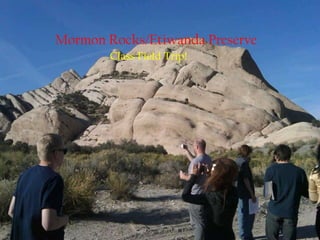
- 1. Mormon Rocks/Etiwanda Preserve Class Field Trip!
- 2. Mormon Rocks!!! The Mormon Rocks were created by the movements of the San Andreas Fault And they received their name after the Mormon Settlers' who came through on the Mormon trail and were settling throughout the valley out towards Los Angeles.
- 3. The San Andreas Rift Zone The San Andreas Fault starts in the Gulf of California, and travels north through Baja, past the Salton Sea, all the way up to San Francisco and exit’s the bay where it continues to run along the coast until it ends near Eureka, CA. The San Andreas Fault is a strike slip fault. And parts of it’s branch are oblique-slip faults. All of which create the mountain ranges we see up and down California.
- 4. The Granular Structure The Mormon Rocks are made up of underlying sedimentary rocks that have been pushed through the eroded soil from the San Gabriel Mountains.
- 5. Natural Holes: Mormon Rocks The holes that form in the Mormon rocks are due to the expanding and contracting of the rocks. Add in the wind and water and ice that use to occupy the valley many many years ago…and you have yourself some holes!
- 6. Natural Vegetation Oak Tree Shrub Grass
- 7. Welcome to the Etiwanda Preserve!! The Etiwanda Preserve was created as a habitat preservation area for impacts related to construction of the 210 Freeway. The initial 762 acres acquired for the Preserve consisted primarily of a unique Riversidean Alluvial Fan Sage Scrub plant community and was purchased by SANBAG to be preserved as a natural habitat for impacts to the Costal California Gnatcatcher and similar habitat consumed by the development of the freeway. Right now there is ongoing conservation efforts that have been enabled for the expansion of the Preserve to over 1200 acres!! That’s a lot of land!
- 8. Etiwanda Water Tank There are certain flood control elements surrounding Etiwanda, but there isn’t a flood control modification that has been constructed within the Preserve itself. Which leaves the fluvial activity which rejuvenates alluvial scrub vegetation along the upper portion of East Etiwanda Creek remaining intact. There is flood control modifications however, including a debris basin, that has been constructed about two miles downstream of where Etiwanda Creek exits the San Gabriel Mountains.
- 9. Etiwanda Vegetation The Alluvial Sage Scrub Habitat houses scrubland types such as sage scrubs that are dominated by soft-leaved drought deciduous species, chaparrals dominated by woody species. There are an estimated 427.6 acres of alluvial scrub on the Preserve. The community is found on the coastal base of the Transverse Range and on a few isolated alluvial fans on the cismontane base of the Peninsular Range. There are two communities on the site that are dominated by herbaceous plant species: freshwater Cienega and non-native grassland. The Preserve supports a variety of sensitive wildlife species and plant species. Several of them can be found on Federal and State lists for threatened or endangered life. Some include; California gnatcather, shouthwestern willow flycatcher, the San Bernardino Merriam’s kangaroo rat, Los Angeles pocket mouse, San Diego homed lizard, mountain yellow-legged frog, and Parry’s spinefloweralong with many more! The list just goes on….
- 10. Effects of the Grand Prix Fire The GrandPrixfire was discovered the afternoon of Oct. 21 in a brushy, flat stretch of land known as Coyote Canyon, parallel to a new housing development in Fontana just west of Interstate 15. It scorched a total of nearly 60,000 acres and destroying 136 homes! The blaze raged west across the foothills of the San Gabriel Mountains for the next week, closing freeways, forcing evacuations, threatening thousands of homes and destroying structures ranging from rustic cabins above Rancho Cucamonga to million-dollar estates in San Antonio Heights and Claremont.
- 11. No Guns?What? Really just thought this was a funny photo
- 12. End Reason for taking it? The picture speaks for itself….reminds me of….Freedom….