Presentation-on-Rivers-of-WesternGhats-IIC-NewDelhi
•Als PPT, PDF herunterladen•
1 gefällt mir•1,515 views

The document discusses the unique characteristics of rivers in Kerala, India that originate from the Western Ghats mountain range. It notes that the rivers have short lengths but support a high population density and biodiversity. Six major threats to the rivers are identified: catchment deforestation, dams and diversions, sand mining, incorrect land use, pollution, and encroachments. Three rivers are highlighted as either on the brink of dying (Chalakudy River) or already dying/dead (Periyar and Bharathapuzha Rivers) due to these threats and flow modifications from dams. The document calls for plans to restore rivers to more "living" states through ecological restoration, improved dam management, and strengthened

Empfohlen
Empfohlen
Weitere ähnliche Inhalte
Was ist angesagt?
Was ist angesagt? (20)
Andere mochten auch
Andere mochten auch (15)
Ähnlich wie Presentation-on-Rivers-of-WesternGhats-IIC-NewDelhi
Ähnlich wie Presentation-on-Rivers-of-WesternGhats-IIC-NewDelhi (20)
Kürzlich hochgeladen
Kürzlich hochgeladen (20)
Presentation-on-Rivers-of-WesternGhats-IIC-NewDelhi
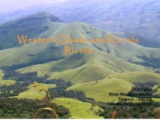
- 1. Western Ghats and Kerala Rivers Dr.A.Latha River Research Centre Thrissur – 680306 rrckerala@gmail.com
- 2. What could have been a living river in the Western Ghats ? • • • • • • Good forested catchment Habitat continuity Flowing from source to sea Carrying freshwater upto the coast Intact river banks with continuous riparian stretch Fertile flood plains and deltas enabling agriculture to thrive • Rich biodiversity • River dependent communities and livelihoods with a sense of belongingness and ownership to their river • River culture and aesthetics moulded by landscape, people and livelihoods
- 3. Home for hornbills and the fishing eagle
- 5. Aesthetics
- 8. What is unique about Kerala Rivers ? • • • • • • • All the rivers originate from the Western Ghats – ‘Hotspot’ among 34 Global Biodiversity Hotspots The most biodiversity rich region in the entire 1600 km Western Ghats supporting 30 + million population Short torrential monsoon fed rivers with steep gradient from east to west Very high fish diversity ( 260 – 312 sp ) and very high endemism ( 109 – 129 sp ) Supports very high population for such small rivers Connect diverse ecosystems – forests to sea The well being of the rivers – inextricably linked to the well being of the Western Ghats
- 10. Kerala Western Ghats rivers at a glance • 44 river basins – 41 west flowing and 3 east flowing • No major rivers – four medium and rest are streams • East flowing Kabini, Pambar and Bhavani – tributaries of Kavery • Total catchment just 43,000 sq.km - less than half of Kavery • Mainstay of more than 30 million people living in 38,000 + sq.km small strip of land • Just 11 rivers more than 100 km in length • 10 rivers are interstate • Total annual utilisable yield – 49000 + MCM
- 11. Important rivers Name Leng Catch th ment (km) (sq.km) Annual utilisable Yield ( MCM) Origin in the Western Ghats Periyar 244 5398 8230 Sivagiri Bharatha puzha 209 6186 4146 Anamalais Pamba 176 2235 3164 Pulachimalai Chaliyar 169 2923 3160 Ilambalari Chalakudy 144 1704 2033 Anamalais
- 12. Six major interventions contributing to dying rivers • Catchment deforestation and habitat fragmentation in the Western Ghats • Dams and Diversions • Sand Mining • Incorrect land use • Pollution • Encroachments into rivers
- 16. Korava swamps in Kabini basin
- 20. Believe me or not - this is a stream
- 21. Most rivers hover between Living and Dying ! • No untouched pristine river in Kerala • Three rivers • Chalakudy – on the brink • Periyar – Dying • Bharathapuzha – A dead river
- 23. Direct modifiers of flow • Daily and Seasonal changes in flows – time, duration, frequency – Chalakudy river • Modify river channel and flood plain habitats • Disconnect rivers from flood plains Bharathapuzha • Sediment flow changes impact downstream aquatic life - Bharathapuzha • Life cycles and flow adaptations change • Flood recession agriculture – Kole and Kuttanad • Diversions kill the flows and river life – Mullperiyar
- 24. Flow fragmentation – Chalakudy basin Sl.no Name of the Project River Stretch below dam with no river flow 1 Parambikulam dam 5 km 2 Peruvaripallam dam 2 km 3 Thunakadavu dam 3 km 4 T N Sholayar 4 km 5 Kerala Sholayar 12 km 6 Poringalkuthu 3 km TOTAL 28 km
- 27. Flow Fluctuations – CRB With 6 dams upstream 1: 4 Proposal for seventh dam Future flow fluctuation 1 : 17
- 32. Disconnected flows – Periyar • 17 dams • Mullaperiyar to Idukki – river stretch dries up during summer • Below Idukki group of dams for 25 km river dries up – 1440 MCM water annually diverted to Muvattupuzha river after power generation • Nirar tributary diverted to Tamil Nadu through Parambikulam dams part of PAP treaty • IWMI study – High score for sensitivity along with high scores for ecological condition indicate that ecological aspects of river are important and high environmental flows are required
- 33. Where is the river ?
- 34. Disconnected flows : Bharathapuzha basin • 11 dams out of which three are part of the Parambikulam Aliyar interstate water sharing Treaty. • All the irrigation projects divert river through canals for irrigation – river flow lost for considerable distance
- 35. Chalakudy river basin – on the brink + Maximum catchment under jurisdiction of Forest Department + Athirappilly waterfalls – the gift of nature + Very few industries and large townships + High fish diversity and endemism – 104 fish sp and 54 % endemism + Flowing through four altitudinal niches – enabling rich habitats and biodiversity + Supports 10 lakh population in three districts + Major irrigation project serving 15 Local self governments
- 36. What a fall !
- 37. Periyar – life line of Kerala - Dying + Main single source of drinking water to maximum populace in Kerala – 30 lakh + Kochi Metro survives on Periyar + Main contributor to electricity production – Idukki HEP + Supports the maximum area under tea in South India + Supports the largest industrial area in Kerala – 250 odd industries
- 39. Bharathapuzha - The dead river + The most revered, romanticised and written river in Kerala – in literature and movies + Main source of drinking water for three districts – 175 panchayaths – 8 lakhs population + Supports the rice bowl of Kerala – Palakkad + Maximum cultural and religious places along this river + Present flow in the downstream owing to Kunti catchment saved from the Silent Valley HEP
- 41. Time to plan for Living Rivers
- 42. The river also has a right to flow ! • Ecological values of rivers need to be recognized and respected by planners, policy makers and implementing agencies and integrated into the planning process • Plan for development of river basin within ecological limits and not hydrological potential
- 43. Can we have Indicators of river health ? Extent of intact Catchment Aquatic diversity Protected Areas in the River Basin Degree of flow regulation and fragmentation Extent of Sand Mining Human dependence – Use and misuse Water quality Extent of saline ingress
- 44. From Dying to Living………… • Eco – restoration of catchments – protection of sources • Reservoir Operations Management Strategies for dammed and regulated rivers for improving flows – Chalakudy river • Sand audit based regulation and Sand Mining ‘holidays’ to be declared in heavily mined stretches • River Bank Protection – Vegetative • Decentralised water management options in place of river dependent centralised options Mullaperiyar
- 45. A stream starts here
- 47. ………. Long Way ahead • Ensure minimum and acceptable water quality • Policy changes integrating ecosystem needs and services into planning – eg. land use planning for an LSG in a river basin • Policy support and enforcement to ensure flow regime is worked out, water is released for the ecosystem needs/ abstraction is limited to meet ecosystem needs in heavily utilised rivers – e flows implementation • Dam decommissioning as a means to improve the flows – Mullaperiyar dam
- 48. For our rivers to flow