![Outline ,[object Object]](data:image/gif;base64,R0lGODlhAQABAIAAAAAAAP///yH5BAEAAAAALAAAAAABAAEAAAIBRAA7)
Recommended
More Related Content
Similar to What is geography
Similar to What is geography (20)
Recently uploaded
Recently uploaded (20)
What is geography
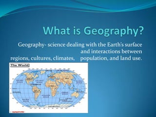
- 1. What is Geography? Geography- science dealing with the Earth’s surface and interactions between regions, cultures, climates, population, and land use.
- 3. People in natural environment
- 4. How people use the Earth
- 6. Earth is home to 5 billion people Geography groups people according to the environment they live in. Regions- parts of the world that have the same characteristics.
- 7. Latitude & Longitude Coordinates used to tell where a place is located Latitude - horizontal Longitude- vertical Bovee UC 43◦ N, 84◦ W
- 8. Temperature Regions Regions are divided into temperatures regions because the Sun dose not heat the Earth equally. Polar regions Between 60◦N/North Pole and 60◦S/South Pole Cold weather year round Temperate regions Between 30◦ N/60◦ N and 30◦ S/60◦ S Summers- warm/hot Winters- cool/cold Tropical regions Between 30◦ N and 30◦ S Warm year round
- 9. Culture Regions People who live in a region with similar cultures. Language, religion, and traditions may be same Can spread across boundaries of countries, nations, and continents example) Hispanic Culture
- 10. Population Cartogram- The size show how big the country’s population is. Population Density- the number of people living in an area.
- 11. People and Natural Environments
- 12. Physical Features and Climate Physical Features create both opportunities and difficulties for people Physical Features: rivers, valleys, mountains, plains, and plateaus Climate affects all aspects of life like your home, job, food, clothes, and where you live. There are 4 different Climates: Tropical, Temperate, Polar, and Dry.
- 13. Climate Tropical Temperate Warm-hot year round Lots of rainfall Dense forests Erosion problems Asia, Africa, and South America Cool-Cold Winters Warm-Hot Summers Summers long enough to grow crops Precipitation varies
- 14. Climate Polar Dry Very cold and dry Snow and ice covered People who live in Polar climates adapted to the weather. Fish/hunt for food Wear protective clothes Found at many latitudes Deserts in Africa & Middle East. Cooler temperatures in U.S. and Asia. Vegetation: grass, shrubs, or cactuses To grow crops farmers need to bring water in (irrigation system).
- 15. How People Use the Land
- 17. Homes, buildings, clear-cutting forests
- 18. Agriculture
- 19. Growing crops, raising animals
- 20. Resources
- 21. Coal, wood, water, air, iron, petroleum
- 24. Cities and Suburbs Cities- a town with a large population. Has apartment, commercial, government building Can have many different culture in on area: Chinatown and Greektown in Chicago Suburbs- The outskirts of a city where residential homes are.
- 25. Building Materials Northern Europe- wood house Hot dry climate- mud or clay Wet tropical regions- walls made from wood, roofs made from leaves Other common materials: stone, brick, straw, and ice You can tell a lot about a region by what the house is made out of.
- 26. Barriers Mountain Ocean Today there are still people who live up in the mountains and are cut off from civilization. They live off the mountain in small communities. Before there was navigation systems people would use the ocean currents to cross the ocean. Andes Mountains
- 27. Thank You!
- 28. References The world map http://www.georgehernandez.com/h/xMartialArts/Geography.asp Geography definition http://dictionary.reference.com/browse/geography Picture of world population http://home.comcast.net/~DiazStudents/whistory_units1.htm Picture of world regions http://home.comcast.net/~DiazStudents/whistory_units1.htm Picture of Bovee http://itouchmap.com/latlong.html Picture of Hispanic culture http://en.wikipedia.org/wiki/File:Hispanic_Culture-World_Map.png World cartogram picture from The World And Its People book Climate map http://mappery.com/map-of/World-Climate-Map Physical features picture form Microsoft Clip Art Climate pictures from Microsoft Clip Art How do people use the land picture http://www.waterencyclopedia.com/La-Mi/Land-Use-Planning .html Land Uses pictures from Microsoft Clip Art
- 29. References Picture of Chinatown http://www.chicagochinatown.org/cccorg/article.jsp?pageReq=p1214322194157& articleID=a1214545920334 Picture of Greektown http://www.google.com/imgres?q=greektown+chicago&um=1&hl=en&safe=off&r lz=1C1CHFX_ enUS391US391&biw=1440&bih=775&tbm=isch&tbnid=6zCKW-wgc_P_uM:&imgrefurl=http:// m.wikitravel.org/en /Chicago/Near_ West_ Side&docid=6vUP6TdihQxWcM&w=2048&h=1365& ei=ECeTTrTKOtKDsgKXtP29 AQ&zoom=1&iact=rc&dur=315& page=1&tbnh=122&tbnw= 176&start=0&ndsp=30&ved=1t:429,r:25,s:0&tx=99&ty=49 Picture of suburbs http://citiesetc.blogspot.com/2011/03/suburbs.html Picture of wood house http://www.superstock.co.uk/stock-photos-images/1848-269027 Picture of mud house http://blog.travelpod.com/travel-blog-entries/beebowen/1/1272287231/tpod.html#_ Picture of rainforest hut http://www.travelsinparadise.com/travelarticle/ecuador-rainforest.html Picture of Andes Mountains http://www.google.com/imgres?q=villages+in+the+andes&um=1&hl=en&safe=off&rlz=1C1CHFX_enUS391US391&biw=1440&bih=775&tbm=isch&tbnid=pefLp6bUYPKpZM:&imgrefurl=http://www.aynishamanichealing.eu/pictures.php&docid=Si8N5G7iGTgxEM&w=600&h=450&ei=c0mTTuG2M-iNsAKPgd2bAQ&zoom=1&iact=rc&dur=299&page=4&tbnh=125&tbnw=176&start=86&ndsp=29&ved=1t:429,r:24,s:86&tx=108&ty=90 Picture of ocean currents http://destinationofmarvel.blogspot.com/2011/01/ocean-currents-and-salinity.html Information from Garcia, Juan R., Daniel J. Gelo, Linda L. Greennow, James B. Kracht, Deborah Gray White, and Becky Manfredini. The World And Its People. Sliver Burdett Ginn, 1997. Print.