Reaching for the Sky: Open Satellite Data and Global Climate Change
•Als PPTX, PDF herunterladen•
1 gefällt mir•562 views

The document discusses open satellite data and geospatial information systems (GIS). It notes that satellites gather high-fidelity, real-time data about locations and conditions on Earth, oceans, atmosphere and socioeconomic factors. Examples are given of how such data has been used for applications like analyzing global climate change, earthquake activity, earth and ocean science, helping with disasters through early warnings, and creating a multi-billion dollar weather and GPS industry. The document advocates for open data and citizen science, including crowdsourcing to solve food security challenges and correcting data. It asks what GIS data is needed in Uganda and suggests ways to utilize and explore such open data.

Empfohlen
Weitere ähnliche Inhalte
Was ist angesagt?
Was ist angesagt? (12)
Ähnlich wie Reaching for the Sky: Open Satellite Data and Global Climate Change
Ähnlich wie Reaching for the Sky: Open Satellite Data and Global Climate Change (6)
Mehr von Jeanne Holm
Mehr von Jeanne Holm (20)
Kürzlich hochgeladen
Kürzlich hochgeladen (20)
Reaching for the Sky: Open Satellite Data and Global Climate Change
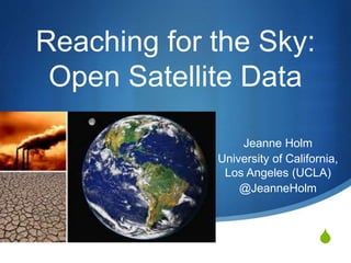
- 1. S Reaching for the Sky: Open Satellite Data Jeanne Holm University of California, Los Angeles (UCLA) @JeanneHolm
- 2. Uganda Geospatial Data S Satellites gather data to monitor the Earth => GIS (geospatial information system) S Such data is high-fidelity, real-time views of locations or conditions from the ground through the upper layers of the atmosphere S Atmospheric data S Earth data S Ocean data S Socioeconomic data February 26, 2015 2
- 3. February 26, 2015 3
- 4. Global Climate Change February 26, 2015 4
- 5. Analyzing Data February 26, 2015 5
- 6. Analyzing Data February 26, 2015 6
- 7. February 26, 2015 7
- 8. Earthquake Activity February 26, 2015 8
- 9. Earth and Ocean Science February 26, 2015 9
- 10. 10 100,000+ collections 349 citizen apps 500,000 data resources 175 agencies 410 APIs February 26, 2015
- 11. 11 Helping others through a disaster February 26, 2015
- 12. 12 700,000 downloads of a transportation app using data from Data.gov Early warnings save lives February 26, 2015 Hurricanes and Emergencies
- 13. Deep Water Horizon Disaster Lower images are the oil slick as seen from space by NASA's Terra satellite on 24 MayFebruary 26, 2015 13
- 14. 14 Creating a multi- billion dollar industry February 26, 2015
- 15. Weather Data + GPS = $100B Industry February 26, 2015 15
- 17. USAID Food Security Challenge S USAID wanted to develop apps to increase food security S “Crowdsourcing the questions and crowdsourcing the solutions” S Three Ideation Jams Code-a- thon and a Data Palooza S 10,000 data entries corrected with 145 volunteers in 16 hours with 85% accuracy S http://idea.usaid.gov/g8 17February 26, 2015
- 21. February 26, 2015 21
- 22. What GIS Data Do You Need? S Working with the Government of Uganda to understand open data needs S Collecting needs, ideas, and requests S @JeanneHolm S jholm@ucla.edu February 26, 2015 22
- 23. What Will You Do? S Explore geospatial data in Uganda S Identify an issue within and between regions S Create a map S Create an app S Join Africa Open Data MeetUp S International Open Data = Ebola Data February 26, 2015 23
Hinweis der Redaktion
- Provides instant access to ~400,000 datasets in easy to use formats Contributions from 172 agencies, UN, and World Bank Encourage development of innovative applications Drive innovation and knowledge use across the globe
- Kat Townsend Develop apps to increase food security “The best way for people to have impact if for people to learn from their peers” “Crowdsourcing the questions and crowdsourcing the solutions” Three Ideation Jams leading to a Code-a-thon and a Data Palooza http://idea.usaid.gov/g8
- This is just the beginning. Host ideation jams to do more with the data Not just a one-off. The map will be updated. Excited to see how lives are improved from the data release
- Raise your hand if you’ve ever saved a life? Congratulations! Raise your hand if you’ve ever written a line of code? You are a potential lifesaver.
- John Celenza Severe weather warnings allow people to react appropriately to threats Internationalization: MeteoAlarm (EUMetNet) Need shared models and standards http://www.wunderground.com/