SlideShare a Scribd company logo
1 of 47
Download to read offline
Digital Mapping in Kenya, a case study of Map
                                                       Kibera
                                                                                 YETAM workshop, July 21, 2010
                                                                                        GroundTruth Initiative
                                                                                              OpenStreetMap


photo: http://gallery.me.com/dbullington#100816&view=null&bgcolor=black&sel=12
Overview
• Geography terminology
• History/background of Map
  Kibera
• Voice of Kibera platform
• Questions, comments and
  discussion
What is geography?
• The study of patterns and
  process that take place on the
  earth‟s surface
• Everybody experiences their own
  geography each and every day!

           …citizen geography!
 (also known as neogeography)
History of new geography tools
 (new media) in 60 seconds…
GIS, GPS, Mapping…
• Geographic Information Systems
  (GIS) (information management for
  geography)– ArcGIS $$$
• Global Positioning System (GPS)
• Digitize and Geo-reference
• The expansion of:
  – The internet
  – Cheap GPS devices
  – Software that is less technically
    demanding (on the user and data
    processing)
Internet mapping
• Google (or Yahoo! or Microsoft)
  proprietary software

• Open Street Map (free software)
Internet mapping cont.
• Open Street Map
Free and Open Source
• Data and/or Software itself is
  free
• Anyone can use it and customize
  it
• What else do you need to think
  about?
 – Human resources, skills, time,
   training, etc
 – Technical customizations (vs out-
   of-the-box)
Kibera 500,000 people(?), 2.5 km2
was a blank spot on the map
Existing Data
    satellite imagery
Partners and Allies
NGOs/CBOs: Social Development Network (Infonet), Carolina for Kibera, Kibera
Community Development Agenda (KCODA)

Broadcast and Community Media: Pamoja FM, Kibera Journal, Kibera
WorldWide

Tech Community: Ushahidi, OpenStreetMap

Funding partner: Jumpstart, International – American NGO
*Recruited Mappers
 Recruited Mappers
*The Mappers
 The Mappers
Map Kibera
• Uses Open Street Map (free and
  open source)
• GPS devices (more on this
  later…)
• Phase I and Phase II
• Walking Paper
• Digitizing and georeferencing
Mappers took to GPS Surveying naturally
* open data ... all Open Data
     Potential of about potential
         Can be a little abstract in Kibera
How does Map Kibera benefit or
     impact the people in Kibera?


•   Develop Entities and Skills
•   Kibera Mappers
•   Kibera News Network
•   Citizen journalism
•   Voice of Kibera
•   SMS Reporting
Phase II
• Health
• Education (informal)
• Security (focus on girl‟s
  security
• Water and Sanitation
Voice of Kibera
• Uses the Ushahidi
  platform to
  aggregate data and
  maps the info on
  the Map Kibera map
• Ushahidi does not
  run the website;
  VoK
  Advisory/Editorial
  Board runs the
  site
• http://ushahidi.co
  m
Out-of-the-box
Customized
Customized - Voice of
       Kibera
What is Voice of Kibera?
•   Non-profit and independent community information
    sharing platform by, for and about Kibera

•   It uses a. articles, photos, videos and SMS b. a
    unique information mapping tool and c. moderation
    of content to ensure accurate reporting

•   A unifying and catalytic agent to contribute to
    positive change in Kibera and Kenya

•   A citizen journalist website sharing the real
    story of what Kibera is

•   Aims to fill current information gaps in terms of
    emergency and accurate information adding location
    data when relevant
Reports
One website, lots of
           media!
• Media on the site
  • Video: creating videos and posting
    on the site
    • Examples: Kibera News Network & Kibera TV
  • Photos: featuring work by local
    photographers
  • Reports: sending SMS to 3002 or
    submitting online
  • Twitter: see „tweets‟ about Kibera
• Local Media
  • Report may be featured in other
    media
    • Creating awareness through radio and
      print
Sending in Reports
There are two ways you can
 submit reports:
 1. Sending an SMS to 3002
   •   Make sure SMS includes the word
       “Kibera” and as much detail as
       possible, including location.
 2. Clicking SUBMIT A REPORT
 on the website.
SMS Reporting
• Send message to short code, 3002,
  including “Kibera” in the text [cost:
  5 KSH]
• SMS Reporters
• Possibilities of things to submit:
  • Things happening right now in the
    community whether good or bad (e.g. a
    fire, street festival)
  • Info about local organisations (e.g.
    events)
  • Opinions on local businesses or services
    (e.g. experience at a clinic)
  • Other news and events
SMS Demo
• Submitting a report
  using SMS
  • Include “Kibera” and as
    much detail as possible,
    including location in
    message
  • Send the message to 3002
• Check the site to see
  your report!
Kibera News Network (KNN)
www.youtube.com/KiberaNewsNetwork
(in partnership with KCODA)
Future plans…
Expansion – to other locations in Kenya
Challenges
• Engaging with youth – resources
  (paid vs volunteer)?
• The map is not enough
 – The digital divide is both
   infrastructral and social
 – Otherwise, you're simply
   contributing to status quo of
   inequality
• large agencies (UN, govt) are
  very interested
• how to support them without
  simply allowing them to co-opt
  the work the citizens are doing
• without extra effort, open
  source and open data really
  just means, open to the elites
  which is not actually open at
  all.
Regynnah’s story
Other tools
• Budget tracking tool
Constituency Development Funds (CDF)
Budget Tracking Tool (SODNET) http://www.opengovernance.info
SMS 3002 with constiuency#issue (eg: matuga#education)
Other tools cont.
• Huduma
Recap
• Open Street Map (open source
  data)
• Ushahidi (open source software,
  but remember other inputs needed)
• FrontlineSMS
• Budget tracking tool (3002 plus
  constituency #issue 3002: kwale
  #water)
• Huduma
• Flip cameras (YouTube)

More Related Content

What's hot

GroundTruth Initiative presentation in Cairo, September 2012
GroundTruth Initiative presentation in Cairo, September 2012GroundTruth Initiative presentation in Cairo, September 2012
GroundTruth Initiative presentation in Cairo, September 2012
ericahagen
 
2012 11-25 infromation-innovation_buildingcommunities_box
2012 11-25 infromation-innovation_buildingcommunities_box2012 11-25 infromation-innovation_buildingcommunities_box
2012 11-25 infromation-innovation_buildingcommunities_box
sirf13
 
3 g germangeoconsultantsgroup_geospatialbriefing
3 g germangeoconsultantsgroup_geospatialbriefing3 g germangeoconsultantsgroup_geospatialbriefing
3 g germangeoconsultantsgroup_geospatialbriefing
soelden
 
Towards a Socio-Economical Evaluation Framework of VGI
Towards a Socio-Economical Evaluation Framework of VGITowards a Socio-Economical Evaluation Framework of VGI
Towards a Socio-Economical Evaluation Framework of VGI
ACSG Section Montréal
 
GIS enabled eGovernance
GIS enabled eGovernanceGIS enabled eGovernance
GIS enabled eGovernance
Esri India
 

What's hot (18)

CIPPIC 2012 Summer Lecture Series
CIPPIC 2012 Summer Lecture SeriesCIPPIC 2012 Summer Lecture Series
CIPPIC 2012 Summer Lecture Series
 
Deamicis etal
Deamicis etalDeamicis etal
Deamicis etal
 
An update on national orthoimagery programs
An update on national orthoimagery programsAn update on national orthoimagery programs
An update on national orthoimagery programs
 
197
197197
197
 
Ph lightning sotm2011
Ph lightning sotm2011Ph lightning sotm2011
Ph lightning sotm2011
 
GroundTruth Initiative presentation in Cairo, September 2012
GroundTruth Initiative presentation in Cairo, September 2012GroundTruth Initiative presentation in Cairo, September 2012
GroundTruth Initiative presentation in Cairo, September 2012
 
Map and GIS Data for 21st Century Research
Map and GIS Data for 21st Century ResearchMap and GIS Data for 21st Century Research
Map and GIS Data for 21st Century Research
 
2012 11-25 infromation-innovation_buildingcommunities_box
2012 11-25 infromation-innovation_buildingcommunities_box2012 11-25 infromation-innovation_buildingcommunities_box
2012 11-25 infromation-innovation_buildingcommunities_box
 
3 g germangeoconsultantsgroup_geospatialbriefing
3 g germangeoconsultantsgroup_geospatialbriefing3 g germangeoconsultantsgroup_geospatialbriefing
3 g germangeoconsultantsgroup_geospatialbriefing
 
The role of geospatial information in a hyper connected society
The role of geospatial information in a hyper connected societyThe role of geospatial information in a hyper connected society
The role of geospatial information in a hyper connected society
 
Remote sensing GIS and public policy
Remote sensing GIS and public policyRemote sensing GIS and public policy
Remote sensing GIS and public policy
 
Gis Day Presentation 2010 - ACCC - Expanded Version
Gis Day Presentation 2010 - ACCC - Expanded VersionGis Day Presentation 2010 - ACCC - Expanded Version
Gis Day Presentation 2010 - ACCC - Expanded Version
 
Towards a Socio-Economical Evaluation Framework of VGI
Towards a Socio-Economical Evaluation Framework of VGITowards a Socio-Economical Evaluation Framework of VGI
Towards a Socio-Economical Evaluation Framework of VGI
 
GIS in property management
GIS in property management GIS in property management
GIS in property management
 
OER World Map presentation at OpenEd14
OER World Map presentation at OpenEd14OER World Map presentation at OpenEd14
OER World Map presentation at OpenEd14
 
Multi Layer GIS Platform in Digital India - Mr. Vishnu Chandra
Multi Layer GIS Platform in Digital India - Mr. Vishnu ChandraMulti Layer GIS Platform in Digital India - Mr. Vishnu Chandra
Multi Layer GIS Platform in Digital India - Mr. Vishnu Chandra
 
GIS enabled eGovernance
GIS enabled eGovernanceGIS enabled eGovernance
GIS enabled eGovernance
 
Salerno2009 Synthesis
Salerno2009 SynthesisSalerno2009 Synthesis
Salerno2009 Synthesis
 

Similar to Map Kibera at YETAM training

Map Kibera Presentation, May 2010
Map Kibera Presentation, May 2010Map Kibera Presentation, May 2010
Map Kibera Presentation, May 2010
Map Kibera
 
Ground truth.mapkibera.ford
Ground truth.mapkibera.fordGround truth.mapkibera.ford
Ground truth.mapkibera.ford
Map Kibera
 
Map Kibera at Where 2.0
Map Kibera at Where 2.0Map Kibera at Where 2.0
Map Kibera at Where 2.0
mikel_maron
 
Map Kibera at the UN
Map Kibera at the UNMap Kibera at the UN
Map Kibera at the UN
mikel_maron
 
Kano GIS Day 2014 - Opening remarks
Kano GIS Day 2014 - Opening remarksKano GIS Day 2014 - Opening remarks
Kano GIS Day 2014 - Opening remarks
eHealth Africa
 
Voice of Kibera Focus Group Presentation
Voice of Kibera Focus Group PresentationVoice of Kibera Focus Group Presentation
Voice of Kibera Focus Group Presentation
Map Kibera
 

Similar to Map Kibera at YETAM training (20)

Map kibera presentation plan management meeting
Map kibera presentation plan management meetingMap kibera presentation plan management meeting
Map kibera presentation plan management meeting
 
Map Kibera Presentation, May 2010
Map Kibera Presentation, May 2010Map Kibera Presentation, May 2010
Map Kibera Presentation, May 2010
 
GroundTruth Map Kibera East Coast Tour
GroundTruth Map Kibera East Coast TourGroundTruth Map Kibera East Coast Tour
GroundTruth Map Kibera East Coast Tour
 
Map kibera presentation plan management meeting
Map kibera presentation   plan management meetingMap kibera presentation   plan management meeting
Map kibera presentation plan management meeting
 
Map Kibera - University of Sussex IDS
Map Kibera - University of Sussex IDSMap Kibera - University of Sussex IDS
Map Kibera - University of Sussex IDS
 
Map Kibera: Methods for Citizen Engagement in Mapping and Reporting
Map Kibera: Methods for Citizen Engagement in Mapping and ReportingMap Kibera: Methods for Citizen Engagement in Mapping and Reporting
Map Kibera: Methods for Citizen Engagement in Mapping and Reporting
 
Map Kibera
Map KiberaMap Kibera
Map Kibera
 
Ground truth.mapkibera.ford
Ground truth.mapkibera.fordGround truth.mapkibera.ford
Ground truth.mapkibera.ford
 
Map Kibera at Where 2.0
Map Kibera at Where 2.0Map Kibera at Where 2.0
Map Kibera at Where 2.0
 
What can be done with Open Data?
What can be done with Open Data?What can be done with Open Data?
What can be done with Open Data?
 
Map Kibera
Map KiberaMap Kibera
Map Kibera
 
ODC BarCamp 2013 - Introduction to Data Journalism
ODC BarCamp 2013 - Introduction to Data JournalismODC BarCamp 2013 - Introduction to Data Journalism
ODC BarCamp 2013 - Introduction to Data Journalism
 
OpenGovHub GroundTruth presentation
OpenGovHub GroundTruth presentationOpenGovHub GroundTruth presentation
OpenGovHub GroundTruth presentation
 
Analytic Journalism: Digital Evolution in the Datasphere
Analytic Journalism: Digital Evolution in the DatasphereAnalytic Journalism: Digital Evolution in the Datasphere
Analytic Journalism: Digital Evolution in the Datasphere
 
Map Kibera at the UN
Map Kibera at the UNMap Kibera at the UN
Map Kibera at the UN
 
[EN] Maps and Digital Tools For Activists [RO] Hărți și instrumente digitale ...
[EN] Maps and Digital Tools For Activists [RO] Hărți și instrumente digitale ...[EN] Maps and Digital Tools For Activists [RO] Hărți și instrumente digitale ...
[EN] Maps and Digital Tools For Activists [RO] Hărți și instrumente digitale ...
 
Mapping Map Kibera. What is behind the map?
Mapping Map Kibera. What is behind the map?Mapping Map Kibera. What is behind the map?
Mapping Map Kibera. What is behind the map?
 
Kano GIS Day 2014 - Opening remarks
Kano GIS Day 2014 - Opening remarksKano GIS Day 2014 - Opening remarks
Kano GIS Day 2014 - Opening remarks
 
Voice of Kibera Focus Group Presentation
Voice of Kibera Focus Group PresentationVoice of Kibera Focus Group Presentation
Voice of Kibera Focus Group Presentation
 
Gis update2010 som-legibility
Gis update2010 som-legibilityGis update2010 som-legibility
Gis update2010 som-legibility
 

Recently uploaded

Recently uploaded (20)

1111 ChatGPT Prompts PDF Free Download - Prompts for ChatGPT
1111 ChatGPT Prompts PDF Free Download - Prompts for ChatGPT1111 ChatGPT Prompts PDF Free Download - Prompts for ChatGPT
1111 ChatGPT Prompts PDF Free Download - Prompts for ChatGPT
 
Oauth 2.0 Introduction and Flows with MuleSoft
Oauth 2.0 Introduction and Flows with MuleSoftOauth 2.0 Introduction and Flows with MuleSoft
Oauth 2.0 Introduction and Flows with MuleSoft
 
TopCryptoSupers 12thReport OrionX May2024
TopCryptoSupers 12thReport OrionX May2024TopCryptoSupers 12thReport OrionX May2024
TopCryptoSupers 12thReport OrionX May2024
 
Integrating Telephony Systems with Salesforce: Insights and Considerations, B...
Integrating Telephony Systems with Salesforce: Insights and Considerations, B...Integrating Telephony Systems with Salesforce: Insights and Considerations, B...
Integrating Telephony Systems with Salesforce: Insights and Considerations, B...
 
State of the Smart Building Startup Landscape 2024!
State of the Smart Building Startup Landscape 2024!State of the Smart Building Startup Landscape 2024!
State of the Smart Building Startup Landscape 2024!
 
TEST BANK For, Information Technology Project Management 9th Edition Kathy Sc...
TEST BANK For, Information Technology Project Management 9th Edition Kathy Sc...TEST BANK For, Information Technology Project Management 9th Edition Kathy Sc...
TEST BANK For, Information Technology Project Management 9th Edition Kathy Sc...
 
ECS 2024 Teams Premium - Pretty Secure
ECS 2024   Teams Premium - Pretty SecureECS 2024   Teams Premium - Pretty Secure
ECS 2024 Teams Premium - Pretty Secure
 
WebAssembly is Key to Better LLM Performance
WebAssembly is Key to Better LLM PerformanceWebAssembly is Key to Better LLM Performance
WebAssembly is Key to Better LLM Performance
 
Intro in Product Management - Коротко про професію продакт менеджера
Intro in Product Management - Коротко про професію продакт менеджераIntro in Product Management - Коротко про професію продакт менеджера
Intro in Product Management - Коротко про професію продакт менеджера
 
How we scaled to 80K users by doing nothing!.pdf
How we scaled to 80K users by doing nothing!.pdfHow we scaled to 80K users by doing nothing!.pdf
How we scaled to 80K users by doing nothing!.pdf
 
WSO2CONMay2024OpenSourceConferenceDebrief.pptx
WSO2CONMay2024OpenSourceConferenceDebrief.pptxWSO2CONMay2024OpenSourceConferenceDebrief.pptx
WSO2CONMay2024OpenSourceConferenceDebrief.pptx
 
Enterprise Knowledge Graphs - Data Summit 2024
Enterprise Knowledge Graphs - Data Summit 2024Enterprise Knowledge Graphs - Data Summit 2024
Enterprise Knowledge Graphs - Data Summit 2024
 
How Red Hat Uses FDO in Device Lifecycle _ Costin and Vitaliy at Red Hat.pdf
How Red Hat Uses FDO in Device Lifecycle _ Costin and Vitaliy at Red Hat.pdfHow Red Hat Uses FDO in Device Lifecycle _ Costin and Vitaliy at Red Hat.pdf
How Red Hat Uses FDO in Device Lifecycle _ Costin and Vitaliy at Red Hat.pdf
 
Where to Learn More About FDO _ Richard at FIDO Alliance.pdf
Where to Learn More About FDO _ Richard at FIDO Alliance.pdfWhere to Learn More About FDO _ Richard at FIDO Alliance.pdf
Where to Learn More About FDO _ Richard at FIDO Alliance.pdf
 
ERP Contender Series: Acumatica vs. Sage Intacct
ERP Contender Series: Acumatica vs. Sage IntacctERP Contender Series: Acumatica vs. Sage Intacct
ERP Contender Series: Acumatica vs. Sage Intacct
 
ASRock Industrial FDO Solutions in Action for Industrial Edge AI _ Kenny at A...
ASRock Industrial FDO Solutions in Action for Industrial Edge AI _ Kenny at A...ASRock Industrial FDO Solutions in Action for Industrial Edge AI _ Kenny at A...
ASRock Industrial FDO Solutions in Action for Industrial Edge AI _ Kenny at A...
 
Your enemies use GenAI too - staying ahead of fraud with Neo4j
Your enemies use GenAI too - staying ahead of fraud with Neo4jYour enemies use GenAI too - staying ahead of fraud with Neo4j
Your enemies use GenAI too - staying ahead of fraud with Neo4j
 
Using IESVE for Room Loads Analysis - UK & Ireland
Using IESVE for Room Loads Analysis - UK & IrelandUsing IESVE for Room Loads Analysis - UK & Ireland
Using IESVE for Room Loads Analysis - UK & Ireland
 
Continuing Bonds Through AI: A Hermeneutic Reflection on Thanabots
Continuing Bonds Through AI: A Hermeneutic Reflection on ThanabotsContinuing Bonds Through AI: A Hermeneutic Reflection on Thanabots
Continuing Bonds Through AI: A Hermeneutic Reflection on Thanabots
 
PLAI - Acceleration Program for Generative A.I. Startups
PLAI - Acceleration Program for Generative A.I. StartupsPLAI - Acceleration Program for Generative A.I. Startups
PLAI - Acceleration Program for Generative A.I. Startups
 

Map Kibera at YETAM training

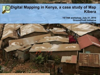
  • 1. Digital Mapping in Kenya, a case study of Map Kibera YETAM workshop, July 21, 2010 GroundTruth Initiative OpenStreetMap photo: http://gallery.me.com/dbullington#100816&view=null&bgcolor=black&sel=12
  • 2. Overview • Geography terminology • History/background of Map Kibera • Voice of Kibera platform • Questions, comments and discussion
  • 3. What is geography? • The study of patterns and process that take place on the earth‟s surface • Everybody experiences their own geography each and every day! …citizen geography! (also known as neogeography)
  • 4. History of new geography tools (new media) in 60 seconds…
  • 5. GIS, GPS, Mapping… • Geographic Information Systems (GIS) (information management for geography)– ArcGIS $$$ • Global Positioning System (GPS) • Digitize and Geo-reference • The expansion of: – The internet – Cheap GPS devices – Software that is less technically demanding (on the user and data processing)
  • 6. Internet mapping • Google (or Yahoo! or Microsoft) proprietary software • Open Street Map (free software)
  • 7. Internet mapping cont. • Open Street Map
  • 8. Free and Open Source • Data and/or Software itself is free • Anyone can use it and customize it • What else do you need to think about? – Human resources, skills, time, training, etc – Technical customizations (vs out- of-the-box)
  • 9. Kibera 500,000 people(?), 2.5 km2 was a blank spot on the map
  • 10. Existing Data satellite imagery
  • 11. Partners and Allies NGOs/CBOs: Social Development Network (Infonet), Carolina for Kibera, Kibera Community Development Agenda (KCODA) Broadcast and Community Media: Pamoja FM, Kibera Journal, Kibera WorldWide Tech Community: Ushahidi, OpenStreetMap Funding partner: Jumpstart, International – American NGO
  • 13. *The Mappers The Mappers
  • 14. Map Kibera • Uses Open Street Map (free and open source) • GPS devices (more on this later…) • Phase I and Phase II • Walking Paper • Digitizing and georeferencing
  • 15. Mappers took to GPS Surveying naturally
  • 16.
  • 17.
  • 18.
  • 19.
  • 20. * open data ... all Open Data Potential of about potential Can be a little abstract in Kibera
  • 21. How does Map Kibera benefit or impact the people in Kibera? • Develop Entities and Skills • Kibera Mappers • Kibera News Network • Citizen journalism • Voice of Kibera • SMS Reporting
  • 22. Phase II • Health • Education (informal) • Security (focus on girl‟s security • Water and Sanitation
  • 23.
  • 24.
  • 25.
  • 26.
  • 27. Voice of Kibera • Uses the Ushahidi platform to aggregate data and maps the info on the Map Kibera map • Ushahidi does not run the website; VoK Advisory/Editorial Board runs the site • http://ushahidi.co m
  • 30. Customized - Voice of Kibera
  • 31. What is Voice of Kibera? • Non-profit and independent community information sharing platform by, for and about Kibera • It uses a. articles, photos, videos and SMS b. a unique information mapping tool and c. moderation of content to ensure accurate reporting • A unifying and catalytic agent to contribute to positive change in Kibera and Kenya • A citizen journalist website sharing the real story of what Kibera is • Aims to fill current information gaps in terms of emergency and accurate information adding location data when relevant
  • 33. One website, lots of media! • Media on the site • Video: creating videos and posting on the site • Examples: Kibera News Network & Kibera TV • Photos: featuring work by local photographers • Reports: sending SMS to 3002 or submitting online • Twitter: see „tweets‟ about Kibera • Local Media • Report may be featured in other media • Creating awareness through radio and print
  • 34. Sending in Reports There are two ways you can submit reports: 1. Sending an SMS to 3002 • Make sure SMS includes the word “Kibera” and as much detail as possible, including location. 2. Clicking SUBMIT A REPORT on the website.
  • 35. SMS Reporting • Send message to short code, 3002, including “Kibera” in the text [cost: 5 KSH] • SMS Reporters • Possibilities of things to submit: • Things happening right now in the community whether good or bad (e.g. a fire, street festival) • Info about local organisations (e.g. events) • Opinions on local businesses or services (e.g. experience at a clinic) • Other news and events
  • 36. SMS Demo • Submitting a report using SMS • Include “Kibera” and as much detail as possible, including location in message • Send the message to 3002 • Check the site to see your report!
  • 37. Kibera News Network (KNN) www.youtube.com/KiberaNewsNetwork (in partnership with KCODA)
  • 39. Expansion – to other locations in Kenya
  • 40. Challenges • Engaging with youth – resources (paid vs volunteer)? • The map is not enough – The digital divide is both infrastructral and social – Otherwise, you're simply contributing to status quo of inequality
  • 41. • large agencies (UN, govt) are very interested • how to support them without simply allowing them to co-opt the work the citizens are doing
  • 42. • without extra effort, open source and open data really just means, open to the elites which is not actually open at all.
  • 44. Other tools • Budget tracking tool
  • 45. Constituency Development Funds (CDF) Budget Tracking Tool (SODNET) http://www.opengovernance.info SMS 3002 with constiuency#issue (eg: matuga#education)
  • 47. Recap • Open Street Map (open source data) • Ushahidi (open source software, but remember other inputs needed) • FrontlineSMS • Budget tracking tool (3002 plus constituency #issue 3002: kwale #water) • Huduma • Flip cameras (YouTube)