SlideShare a Scribd company logo
1 of 20
• What are indicators?
• Indicators are data or a combination of data
collected and processed for a clearly defined
analytical or policy purpose.
That purpose should be explicitly specified
and taken into account when interpreting
the value of an indicator.
• Indicators generally simplify complex phenomena so
that communication of information to policy-makers
and other stakeholders is enabled or enhanced.
• They are powerful tools that provide feedback and
early warning signals about emerging issues.
A framework for Indicators of Sustainable Development
• There is no doubt that there is a need for an indicator-policy
cycle that includes monitoring of biodiversity, socio-
economic, and governance indicators, within an analytical
decision framework applied to local and regional scales and
for multiple resources
• In order to succeed, some steps in the indicator-policy cycle
need to be considered:
– Defined broad policy goals: Clear goals need to be defined
for the indicators.
– Identified the sources of data: Are there enough data to
evaluate de indicators? Without good data, based on
monitoring, it is not possible to develop indicators
• Select the indicators: Indicators need to be tested to
determine their use and validity. Can they detect trend?
Key players in the development of indicators for the management of
the coastal system/or coastal zone
Information
Knowledge
Data
Information Managers (Policy- Makers)Stakeholders Scientists
INDICATORS
Process indicators
Stress reduction indicators
Environmental status indicators
Decision support and policy
impact and evaluation
Information in a format that
is relevant and useful to
policymakers.
Inter-disciplinary scientists in
collaboration with subject
specialists.
Collaboration between
policy-makers,
stakeholders and
scientists
Information flux and role of indicators.
• The development and election of the indicators for this report
was based on the types of indicators defined by Duda (2002)
as:
• Process Indicators: Traditionally, process indicators have
been a measure of progress in project activities involving
procurement and production (inputs and outputs) of goods,
physical structures and services.
• Stress Reduction Indicators: Stress reduction indicators
relate to the specific, on-the-ground measures implemented by
the collaborating countries. They provide evidence that action
occurred on the ground.
• Environmental Status Indicators: Environmental status
indicators provide measures of actual performance or success
in restoring and protecting the targeted ecosystem or
community
• Process Indicators.
1 – Existence and/or adoption of various instruments (policies,
management plans, programs) and their application.
• The capacity to manage fisheries depends on available human and
financial resources as well as on the existence of competent
institutions.
2 – Global, regional and local efforts to promote sustainable coastal
and marine development.
• States should co-operate on bilateral, regional and multilateral
levels to establish, reinforce and implement effective means and
mechanisms to ensure sustainable coastal and marine
development. The management system is consistent with relevant
international conventions and agreements.
3 – Global warming and climate change.
• To recognize the threat of climate change to coastal habitats and to
ensure appropriate and ecologically responsible response
• Stress Reduction Indicators
4 – Water quality.
• Healthy waterways are necessary to maintain the variety of
aquatic habitats, and the economic, social and environmental
systems that rely on them. Degree of turbidity and changes in
turbidity levels in coastal and estuarine waters are an indicator for
the conditions of the marine resources.
5 – Levels of toxic substances in the marine environment (organic
and inorganic contamination).
• Monitoring major groups of contaminants (e.g., persistent organic
pollutants, hydrocarbons, heavy metals) dispersed/dissolved in the
water column and/or accumulated on surface sediments provides
a good indication of anthropogenic pollution pressure on the
marine resources.
6– Level of restoration/recuperation of ecosystems and species.
• Habitat measurements help identify and quantify habitat types
(number and percent coverage) and spatial patterns of key
habitats (diversity at the ecosystem-level). Such measurements are
helpful to review the current status of coastal habitats in terms of
natural versus impacted habitats.
• Environmental Status Indicators
7 – Changes in the spatial coverage of marine ecosystems.
• Changes in the area of habitat can indicate changing conditions in the
environment that could be caused by natural disturbances or by
anthropogenic factors, such as habitat use and fishing. Geospatial
information improves our understanding of our environment, allows for
more comprehensive and transparent planning, and can help increase
stakeholder participation in environmental management.
8 – Landings/catches from the populations of exploited fishing resources.
• Fish abundance, age and size composition, and length and weight
relationships are the primary parameters scientists require to describe the
status of a fish population. In addition to static parameters (i.e., those at a
single point in time), dynamic parameters that quantify rates of
population processes, such as survival, growth, reproduction and
mortality, provide greater insight into a fish population’s ecological state.
9 – Levels of fishing effort.
•Effective fishing effort” is a measure of fishing mortality. Landings (in terms
of volume or value) and fishing efforts (e.g., number of vessels, types and
number of nets, gear, etc.) may be a useful proxy to assess the quantity of
resources harvested and it may be an indication, although indirect, of the
status of local fisheries and fish stocks.
• The development of indicators and their use in evaluating progress
is dependent on a data and information management and reporting
system being put in place by government, non-governmental
organizations (NGOs), civil society, and the private sector. Within
the CLME region there a several national, regional and international
programs targeting the collection of environmental indicators.
These include: CARICOM’s Caribbean Coastal Marine Productivity
Programme, Organization of Eastern Caribbean States (OECS),
UNEP under different programs (such as Caribbean Environmental
Program and Environmental Data Explorer GEO), United Nations
(UNSD Environmental Indicators), World Resource Institute
(Ecosystem Service Indicators database), Worldwide Governance
Indicators, Latin American and Caribbean Initiative for Sustainable
Development (ILAC), The World Bank, and The Nature Conservancy,
among others.
• The process of establishing a set of indicators for the CLME in
coastal and marine zones is not easy.
• Significant scientific, technical and administrative effort, as well as,
consensus with stakeholder groups must be achievement before the
definition of indicators and targets are established.
• It also implies agreement between governments (local and regional)
on the intensity of monitoring, the goals and the resources required.
• It is recommended to develop indicator factsheets based on the
existing data. This fact sheets should be regional or country specific
depending of the data available.
• Communication is the key for success of an indicator policy.
• A common framework is needed in the CLME region.
Recommendations on Indicator Information
• Indicators must be established under baseline conditions. Indicators are
most effectively assessed when baseline information on the governance,
ecological and socioeconomic conditions of the management area is
available.
• Indicators should relate to the specific management issues, such as
multiple user conflicts, ecological degradation, community interest, or a
commitment to improve the management of a local marine area.
• It is strongly recommended that stakeholders are consulted as early as
possible in the indicator development process in order to determine the
purpose of the indicator and its audience.
• Transparency in the decision making process promotes credibility and
provides opportunities for stakeholders to introduce new information.
• The indicators selected for use should be based on the best scientific
understanding currently available and have been developed in
consultation with international and country experts, other agencies and
stakeholder groups.
• The more an indicator meets a real decision-making need and it is
effectively communicated, the greater the likelihood that a national or
regional statistic agency will recognized the value of the indicator.
• The calculation of an indicator must be accompanied by documentation of
the methods used and data sources. This ensures that the calculation is
transparent and open to scrutiny and can be repeated in the future for
consistent production of the indicator.
• The agreement on the indicator set and the standardization of
methodology and formats for compilation and presentation of results
ensures the comparability, correct assessment and aggregation of the
results obtained in different countries and at different scales around the
CLME. Furthermore, the identification of data gaps or limitations will
allow prioritization of effort on the monitoring of required datasets.
INSTITUTION NAME
CZMU
ICRI
NEPA
TNC
NOAA-Habitat
INSTITUTION NAME
FAO
OSPESCA
FishBase
SeaAround Us
SocMon
Issue
Poll
ution
Ha
bitat
Degr
adati
on
Type of Fisheries
Coastal
Shelf
Fisheries
Reef Fisheries
Pelagic Fisheries
Coastal
Shelf
Fisheries
Reef Fisheries
Pelagic Fisheries
Coastal
Shelf
Fisheries
Reef Fisheries
Pelagic Fisheries
Coastal
Shelf
Fisheries
Reef Fisheries
Pelagic Fisheries
INSTITUTION NAME
CARICOMP
University of the West Indies (UWI)
UNEP-SPAW
UNEP-GAP
WEBSITE
http://www.unesco.org/csi/act/caricomp /ecosystem.htm
http://www.mona.uwi.edu/cms/ccdc /ccdc.html
http://www.gpa.unep.org/
http://www.cep.unep.org/
http://www.unesco.org/csi/act/caricomp /ecosystem.htm
WEBSITE
http://www.coastal.gov.bb/
http://earw.icriforum.org/
http://www.nepa.gov.jm/index.asp
http://www.nature.org/
http://www.habitat.noaa.gov/ protection/efh/
newInv/index.html.
WEBSITE
http://www.fao.org/index_en.htm
http://www.sica.int/ospesca/
http://www.fishbase.org/home.htm
http://www.seaaroundus.org/
http://www.socmon.org/default.aspx
IMS
INDICATOR BOXWORD DOCUMENT
(Description of the Indicators)
EXCEL FILE
(Includes the
database)
INSTITUTION NAME
Caribbean Climate Centre (CCCC)
Caribbean Policy Centre
(CPACC)
Caribbean Action Plan (CAP)
WEBSITE
http://www.caribbeanclimate.bz/
http://caribbeanresearchandpolicycenter.org/
http://www.cep.unep.org/
DESCRIPTION
Indicators:
Water quality
Amount of
sedimentation.
Frequency of algal blooms
Sources and quantity/velocity of runoff
Levels of toxic substances in the marine
environment (organic and inorganic
contamination).
Origin of sediments
Land use changes.
Indicators:
 Level of restoration/ recuperation
of ecosystems and species.
Area mapped
Spatial and temporal resolution
 Existence of legislation on coastal
and marine resources
 Management plans (guidelines and
regulations)
 Changes in the spatial coverage of marine
Geographical units
Zoning plan
Mapping Essential Fish Habitat
Demographic information
Indicators:
 Landings/catch from populations
of exploited fishing resources.
Changes in the population structure
of exploited species.
Levels of fishing effort.
Existence of regulations or
management plans and their
application.
Indicators:
Global warming and Climate change
Acidification
Sea level rise,
Hurricane incidence.
Sources of uncertainty and
potential failure
Examples Solutions Problem
solvers
1) Assumptions in the
evaluation process
Poor problem definition resulting in unclear
goals, badly defined or ambiguous targets
A clear understanding of the problem at
hand, clear goals, and a way of
translating goals into specific and
realistic targets.
Collaboration
between
policy-
makers,
stakeholders
and scientists
Uncertainty in models: underestimating or
not accounting for key processes (e.g.,
ecological responses, the indirect effects of
policy (e.g. redistribution of fishing effort, or
the impacts of other external drivers (e.g.
economic forces or climate change
Strong conceptual frameworks and
inter-disciplinary models, with
sensitivity analyses to understand the
impacts of uncertainties.
Inter-
disciplinary
scientists in
collaboration
with subject
specialists.
2) Link between
evaluation and selection
of actions: most
appropriate course of
action might not be taken
because decision-makers
have other priorities or
the action is unpalatable
Fisheries management: scientific
advice on actions such as total
allowable catch is often not
implemented.
Ensure the set of actions is realistic and
can be implemented through
stakeholder participation and
consultation, and improve
understanding of the public and
decision-makers.
Collaboration
between
policy-
makers,
stakeholders
and scientists
Potential sources of uncertainty and failure identified by Nicholson et al (2012)
3) Link between action
selection and
implementation
Actions may fail to be implemented
effectively due to under-resourcing,
poor governance or lack of
compliance with rules at the local
level. e.g. ineffective protected areas
.
Improved understanding of human
decision making, information on
governance and corruption,
participatory selection of a set of
possible actions to ensure support at
implementation.
Social
scientists,
managers
and
interdisciplin
ary scientists
4) Impact of the action
differing from the
anticipated impact, due
to other drivers, indirect
effects and externalities
The effects of other drivers
obscuring any impact of policy. For
example, poor understanding of the
interactions between harvesting and
fish spwaning aggregations.
Acknowledgement and understanding
of types and sources of uncertainty
during the evaluation process, leading
to better and broader models and
improved information
Inter-
disciplinary
scientists in
collaboration
with
fishermen.
5) Link between
biodiversity change and
indicator change
Poor indicator design renders the
indicator a poor proxy for
biodiversity, e.g. protected area
coverage provides little indication of
the effectiveness of protected areas
in conserving biodiversity
More extensive modelling of the
behavior of indicators as the system
changes; e.g. extensive testing of
indicators in fisheries science;
improved suite of indicators to ensure
a more structured coverage of aspects
of biodiversity change.
Scientists
Data quality makes trends difficult
to detect or interpret due to
taxonomic, spatial and temporal
gaps and biases
More, and more targeted, data, more
systematic sampling of taxonomic
groups, revise indicators to require
less data
6) Link between indicator
change and target
assessment: assessing
indicators against poorly
defined targets, rendering
assessment meaningless
Targets are qualitative or ambiguous. Define targets more clearly and in a
meaningful way, e.g. SMART targets
(specific, measureable, ambitious, realistic and
time-bound).
Scientists and
policy-makers
Targets are not meaningful biologically (e.g.
to avoid tipping points)
Improve understanding of underlying
processes
Scientists
Targets are not compatible, requiring trade-
offs between targets. e.g. different groups of
species provide different ecosystem services
(e.g. climate regulation versus food
production versus biodiversity conservation)
and may have different management needs
Identify potential impacts of alternative
policies and achievability of targets through
modelling; identify and acknowledge trade-
offs, conflicts and synergies between targets
and policies
Scientists and
policy-makers
7) Mismatches in temporal
and spatial scales throughout
the cycle
Policies decided at a range of scales from
global to local; Transboundary effects of
national policies on issues such as fisheries
management; implementation and data
collection occur at the national to local scale.
Identify where spatial mismatches may occur
throughout the cycle; Better negotiation and
cooperation across borders.
Collaboration
between policy-
makers,
stakeholders
and scientists.
Ecological processes at a wide range of
scales from daily to centuries, including
ecological time lags: e.g. extinction debt,
time for stock recovery after reduction of
fisheries pressure
Explicitly consider processes at different
spatial and temporal scales.
Scientists and
policy-makers
Indicators for Small Scale Fisheries
Type of Indicator Indicator Explanation
Added value of the artisanal
fisheries at the national level.
Indicates the economic contribution of
fisheries to local incomes
Process
Contribution of fisheries to
national economic development
Including fisheries and associated
economic activities (transport, boats,
marketing)
Resource users involved in small
scale fishing (number and
demographics)
Important for understanding resource
users involved in small scale fisheries
(eg. gender, age)
Stress Reduction
Number of communities
involved in small scale fishing
(including indigenous groups)
Information to guide the development
of training programs
Revenue generated by small
scale fisheries
Allows an assessment of the amount of
fishing effort
Percentage of time spent on this
activity
Amount of time that is dedicated to
these activities compared with other
activities.
Environmental Status
Change in levels of poverty Indicates the condition or well-being
of the population
• An indicator approach provides a useful tool
for appraising sustainability and for assessing
policies – in particular for assessing measures
and actions taken or proposed in relation to
marine resources.
• Indicators can help to inform citizens, policy-
makers, scientists and other stakeholders
about the status of marine resources, human
impacts on the marine ecosystem, mitigating
actions and the roles and responsibilities of
stakeholders.
A framework for Indicators of Sustainable
Development
• Specify targets that are measurable using
indicators.
• Define actions that can be implemented or
achieve; use models to make predictions
about the potential impacts.
• Indicators must therefore be able to take into
account different locations, people, cultures
and institutions
• All this information can be used to improve
monitoring and collection of better indicator
datasets.
Database questions
• The development of an effective indicator framework requires data and
information, as well as appropriate data, information management and
mechanisms to calculate, review and revise the indicators on a continuous
basis. However, there are fundamental gaps in data collection and
monitoring for sustainable development in coastal areas of the CLME. As
mentioned by Heileman and Walling (2008), a number of initiatives have
been undertaken in the region to improve environmental statistics. Some
of the main problems are summarized below:
• The coastal zone is not well represented as a distinct reporting unit or as a
specific area in most GIS information sources or databases.
• There is a lack of coherence in data gathering programs in terms of
geographic and temporal coverage, and in the definition of measurements.
This can be due to the absence of guiding policies, deficient benchmark
information or inadequate analysis.
• Indicators calculated by research centers, government, public
administrations or agencies may be limited in scope (methodology,
definitions, coverage), which restricts their usefulness at a wider regional
level.
• Differences in statistical data between countries may result in a bias in
calculations and in comparison of 'the coastal zone' between CLME
countries, in particular for population and socio-economic data.
• Differences in the composition of sampling units for different reporting purposes
may cause inconsistencies at the moment of reporting indicators between
countries and over time.
• Frequency and interval of sampling may not coincide between countries. For
instance, frequency and period of sampling for two related indicators or indicators
(e.g. number of overnight fishing trips and numbers of fishing boats) may not
coincide, generating an unknown bias in the results.
• Changes in methodology over time, within the data gathering program, may create
an interruption and/or a breach in time series. This can be due to changes in
measuring instruments, modifications in the location of measuring stations,
changes in weighting factors in the analysis of data from surveys, etc.
• Geo-referenced data is limited. Data needs to be geo-referenced in order to allow
comparisons and representation of socio-economic and environmental
information.
• Consistent data and data flow should provide a more realistic picture of the
processes taking place and support decision-making at different levels (from local
to national to CLME level). The best way to ensure comparability data or indicators
at all levels is a bottom-up approach in data collecting and information systems:
starting from reliable and sound data at the local level and aggregating it at higher
levels in common databases.

More Related Content

What's hot

Strategic Environmental Assessment
Strategic Environmental Assessment Strategic Environmental Assessment
Strategic Environmental Assessment Kinza Irshad
 
NAP Process in the Philippines: Enhancing the National Climate Change Action ...
NAP Process in the Philippines: Enhancing the National Climate Change Action ...NAP Process in the Philippines: Enhancing the National Climate Change Action ...
NAP Process in the Philippines: Enhancing the National Climate Change Action ...NAP Global Network
 
The NAP Agriculture Programme
The NAP Agriculture ProgrammeThe NAP Agriculture Programme
The NAP Agriculture ProgrammeFAO
 
Overview of public expenditure for climate change in Viet Nam
Overview of public expenditure for climate change in Viet NamOverview of public expenditure for climate change in Viet Nam
Overview of public expenditure for climate change in Viet NamUNDP Climate
 
FAO’s Work on Climate Change
FAO’s Work on Climate ChangeFAO’s Work on Climate Change
FAO’s Work on Climate ChangeFAO
 
Iwrm planning ppp draft 2
Iwrm planning ppp draft 2Iwrm planning ppp draft 2
Iwrm planning ppp draft 2SITWA-ANBO-RAOB
 
Comprehensive Risk Management
Comprehensive Risk ManagementComprehensive Risk Management
Comprehensive Risk ManagementUNDP Climate
 
Paris Agreement and the NAP process Global Capacity Development
Paris Agreement and the NAP process Global Capacity Development Paris Agreement and the NAP process Global Capacity Development
Paris Agreement and the NAP process Global Capacity Development ExternalEvents
 
NAP Agriculture Technical Guidelines: Approach, Opportunities and Challenges
NAP Agriculture Technical Guidelines: Approach, Opportunities and ChallengesNAP Agriculture Technical Guidelines: Approach, Opportunities and Challenges
NAP Agriculture Technical Guidelines: Approach, Opportunities and ChallengesFAO
 
From climate information to climate impacts on agriculture and food security
From climate information to climate impacts on agriculture and food securityFrom climate information to climate impacts on agriculture and food security
From climate information to climate impacts on agriculture and food securityFAO
 
9.2.2 Regional TEM-A Part III
9.2.2 Regional TEM-A Part III9.2.2 Regional TEM-A Part III
9.2.2 Regional TEM-A Part IIINAP Events
 
Nand Kishor Agrawal, Coordinator, Himalayan Climate Adaptation Programme (HIC...
Nand Kishor Agrawal, Coordinator, Himalayan Climate Adaptation Programme (HIC...Nand Kishor Agrawal, Coordinator, Himalayan Climate Adaptation Programme (HIC...
Nand Kishor Agrawal, Coordinator, Himalayan Climate Adaptation Programme (HIC...NAPExpo 2014
 
Andrew Takawira, GWP Africa, Integrated approaches to planning and implementa...
Andrew Takawira, GWP Africa, Integrated approaches to planning and implementa...Andrew Takawira, GWP Africa, Integrated approaches to planning and implementa...
Andrew Takawira, GWP Africa, Integrated approaches to planning and implementa...NAPExpo 2014
 
FAO, Climate Change Adatation, and NAPs
FAO, Climate Change Adatation, and NAPsFAO, Climate Change Adatation, and NAPs
FAO, Climate Change Adatation, and NAPsFAO
 
Supranational policy imperatives Tarek Merabtene
Supranational policy imperatives Tarek MerabteneSupranational policy imperatives Tarek Merabtene
Supranational policy imperatives Tarek MerabteneWANA forum
 

What's hot (20)

Strategic Environmental Assessment
Strategic Environmental Assessment Strategic Environmental Assessment
Strategic Environmental Assessment
 
INDC Adaptation component for Swaziland by Deepa Pullanikkatil
INDC Adaptation component for Swaziland by Deepa PullanikkatilINDC Adaptation component for Swaziland by Deepa Pullanikkatil
INDC Adaptation component for Swaziland by Deepa Pullanikkatil
 
IV Seminario Regional de Agricultura y Cambio Climático - Francisco Meza
IV Seminario Regional de Agricultura y Cambio Climático - Francisco Meza IV Seminario Regional de Agricultura y Cambio Climático - Francisco Meza
IV Seminario Regional de Agricultura y Cambio Climático - Francisco Meza
 
24. Strategic Environmental Assessment & Appropriate Assessment
24. Strategic Environmental Assessment & Appropriate Assessment24. Strategic Environmental Assessment & Appropriate Assessment
24. Strategic Environmental Assessment & Appropriate Assessment
 
NAP Process in the Philippines: Enhancing the National Climate Change Action ...
NAP Process in the Philippines: Enhancing the National Climate Change Action ...NAP Process in the Philippines: Enhancing the National Climate Change Action ...
NAP Process in the Philippines: Enhancing the National Climate Change Action ...
 
The NAP Agriculture Programme
The NAP Agriculture ProgrammeThe NAP Agriculture Programme
The NAP Agriculture Programme
 
Overview of public expenditure for climate change in Viet Nam
Overview of public expenditure for climate change in Viet NamOverview of public expenditure for climate change in Viet Nam
Overview of public expenditure for climate change in Viet Nam
 
FAO’s Work on Climate Change
FAO’s Work on Climate ChangeFAO’s Work on Climate Change
FAO’s Work on Climate Change
 
Iwrm planning ppp draft 2
Iwrm planning ppp draft 2Iwrm planning ppp draft 2
Iwrm planning ppp draft 2
 
Comprehensive Risk Management
Comprehensive Risk ManagementComprehensive Risk Management
Comprehensive Risk Management
 
Paris Agreement and the NAP process Global Capacity Development
Paris Agreement and the NAP process Global Capacity Development Paris Agreement and the NAP process Global Capacity Development
Paris Agreement and the NAP process Global Capacity Development
 
NAP-GSP Cambodia Stocktaking Mission Debriefing
NAP-GSP Cambodia Stocktaking Mission DebriefingNAP-GSP Cambodia Stocktaking Mission Debriefing
NAP-GSP Cambodia Stocktaking Mission Debriefing
 
NAP Agriculture Technical Guidelines: Approach, Opportunities and Challenges
NAP Agriculture Technical Guidelines: Approach, Opportunities and ChallengesNAP Agriculture Technical Guidelines: Approach, Opportunities and Challenges
NAP Agriculture Technical Guidelines: Approach, Opportunities and Challenges
 
National Climate Change Adaptation Plan for Sri Lanka
National Climate Change Adaptation Plan for Sri Lanka�National Climate Change Adaptation Plan for Sri Lanka�
National Climate Change Adaptation Plan for Sri Lanka
 
From climate information to climate impacts on agriculture and food security
From climate information to climate impacts on agriculture and food securityFrom climate information to climate impacts on agriculture and food security
From climate information to climate impacts on agriculture and food security
 
9.2.2 Regional TEM-A Part III
9.2.2 Regional TEM-A Part III9.2.2 Regional TEM-A Part III
9.2.2 Regional TEM-A Part III
 
Nand Kishor Agrawal, Coordinator, Himalayan Climate Adaptation Programme (HIC...
Nand Kishor Agrawal, Coordinator, Himalayan Climate Adaptation Programme (HIC...Nand Kishor Agrawal, Coordinator, Himalayan Climate Adaptation Programme (HIC...
Nand Kishor Agrawal, Coordinator, Himalayan Climate Adaptation Programme (HIC...
 
Andrew Takawira, GWP Africa, Integrated approaches to planning and implementa...
Andrew Takawira, GWP Africa, Integrated approaches to planning and implementa...Andrew Takawira, GWP Africa, Integrated approaches to planning and implementa...
Andrew Takawira, GWP Africa, Integrated approaches to planning and implementa...
 
FAO, Climate Change Adatation, and NAPs
FAO, Climate Change Adatation, and NAPsFAO, Climate Change Adatation, and NAPs
FAO, Climate Change Adatation, and NAPs
 
Supranational policy imperatives Tarek Merabtene
Supranational policy imperatives Tarek MerabteneSupranational policy imperatives Tarek Merabtene
Supranational policy imperatives Tarek Merabtene
 

Similar to Acosta Presentation on Indicators

Case study:The Mekong Wetlands Biodiversity Programme (Meynell, Peter-John)
Case study:The Mekong Wetlands Biodiversity Programme (Meynell, Peter-John)Case study:The Mekong Wetlands Biodiversity Programme (Meynell, Peter-John)
Case study:The Mekong Wetlands Biodiversity Programme (Meynell, Peter-John)Iwl Pcu
 
Watershed Management_Social,ecology,economic
Watershed Management_Social,ecology,economicWatershed Management_Social,ecology,economic
Watershed Management_Social,ecology,economicshrutik57
 
Way forward on criteria and indicators towards permanent restoration of Indon...
Way forward on criteria and indicators towards permanent restoration of Indon...Way forward on criteria and indicators towards permanent restoration of Indon...
Way forward on criteria and indicators towards permanent restoration of Indon...CIFOR-ICRAF
 
IUKWC Workshop Nov16: Developing Hydro-climatic Services for Water Security –...
IUKWC Workshop Nov16: Developing Hydro-climatic Services for Water Security –...IUKWC Workshop Nov16: Developing Hydro-climatic Services for Water Security –...
IUKWC Workshop Nov16: Developing Hydro-climatic Services for Water Security –...India UK Water Centre (IUKWC)
 
SWaRMA_IRBM_Module1_#5, Experiences of IWRM implementation from Australia, An...
SWaRMA_IRBM_Module1_#5, Experiences of IWRM implementation from Australia, An...SWaRMA_IRBM_Module1_#5, Experiences of IWRM implementation from Australia, An...
SWaRMA_IRBM_Module1_#5, Experiences of IWRM implementation from Australia, An...ICIMOD
 
SWaRMA_IRBM_Module2_#7, Basin planning experience from Australia, Andrew Joh...
SWaRMA_IRBM_Module2_#7,  Basin planning experience from Australia, Andrew Joh...SWaRMA_IRBM_Module2_#7,  Basin planning experience from Australia, Andrew Joh...
SWaRMA_IRBM_Module2_#7, Basin planning experience from Australia, Andrew Joh...ICIMOD
 
Halpern et al 2012 an index to assess the health and benefits of the global o...
Halpern et al 2012 an index to assess the health and benefits of the global o...Halpern et al 2012 an index to assess the health and benefits of the global o...
Halpern et al 2012 an index to assess the health and benefits of the global o...Loretta Roberson
 
Sharing, networking, capacity building
Sharing, networking, capacity buildingSharing, networking, capacity building
Sharing, networking, capacity buildinggroundwatercop
 
The Evolution of Sea Grant as a National Program
The Evolution of Sea Grant as a National ProgramThe Evolution of Sea Grant as a National Program
The Evolution of Sea Grant as a National ProgramOregon Sea Grant
 
CEE-401-Economics-of-Environment-Module-5-AB-Das.pdf
CEE-401-Economics-of-Environment-Module-5-AB-Das.pdfCEE-401-Economics-of-Environment-Module-5-AB-Das.pdf
CEE-401-Economics-of-Environment-Module-5-AB-Das.pdfdeepakanand4567
 
Practical Application of the Water Governance Indicator Framework
Practical Application of the Water Governance Indicator FrameworkPractical Application of the Water Governance Indicator Framework
Practical Application of the Water Governance Indicator FrameworkOECDregions
 
State action plans on climate change_Preeti Soni, UNDP_15 October 2014
State action plans on climate change_Preeti Soni, UNDP_15 October 2014State action plans on climate change_Preeti Soni, UNDP_15 October 2014
State action plans on climate change_Preeti Soni, UNDP_15 October 2014India Water Portal
 
Large Marine Ecosystems Track 2
Large Marine Ecosystems Track 2Large Marine Ecosystems Track 2
Large Marine Ecosystems Track 2Iwl Pcu
 
Building national systems for adaptation Monitoring, Evaulation and Learning ...
Building national systems for adaptation Monitoring, Evaulation and Learning ...Building national systems for adaptation Monitoring, Evaulation and Learning ...
Building national systems for adaptation Monitoring, Evaulation and Learning ...NAP Global Network
 
Natural Capital Accounting in the Caribbean eftec January 2021
Natural Capital Accounting in the Caribbean eftec January 2021Natural Capital Accounting in the Caribbean eftec January 2021
Natural Capital Accounting in the Caribbean eftec January 2021iweco-project
 

Similar to Acosta Presentation on Indicators (20)

Framework for wqm
Framework for wqmFramework for wqm
Framework for wqm
 
Case study:The Mekong Wetlands Biodiversity Programme (Meynell, Peter-John)
Case study:The Mekong Wetlands Biodiversity Programme (Meynell, Peter-John)Case study:The Mekong Wetlands Biodiversity Programme (Meynell, Peter-John)
Case study:The Mekong Wetlands Biodiversity Programme (Meynell, Peter-John)
 
Case study:The Mekong Wetlands Biodiversity Programme (Meynell, Peter-John)
Case study:The Mekong Wetlands Biodiversity Programme (Meynell, Peter-John)Case study:The Mekong Wetlands Biodiversity Programme (Meynell, Peter-John)
Case study:The Mekong Wetlands Biodiversity Programme (Meynell, Peter-John)
 
Watershed Management_Social,ecology,economic
Watershed Management_Social,ecology,economicWatershed Management_Social,ecology,economic
Watershed Management_Social,ecology,economic
 
Way forward on criteria and indicators towards permanent restoration of Indon...
Way forward on criteria and indicators towards permanent restoration of Indon...Way forward on criteria and indicators towards permanent restoration of Indon...
Way forward on criteria and indicators towards permanent restoration of Indon...
 
IUKWC Workshop Nov16: Developing Hydro-climatic Services for Water Security –...
IUKWC Workshop Nov16: Developing Hydro-climatic Services for Water Security –...IUKWC Workshop Nov16: Developing Hydro-climatic Services for Water Security –...
IUKWC Workshop Nov16: Developing Hydro-climatic Services for Water Security –...
 
SWaRMA_IRBM_Module1_#5, Experiences of IWRM implementation from Australia, An...
SWaRMA_IRBM_Module1_#5, Experiences of IWRM implementation from Australia, An...SWaRMA_IRBM_Module1_#5, Experiences of IWRM implementation from Australia, An...
SWaRMA_IRBM_Module1_#5, Experiences of IWRM implementation from Australia, An...
 
SWaRMA_IRBM_Module2_#7, Basin planning experience from Australia, Andrew Joh...
SWaRMA_IRBM_Module2_#7,  Basin planning experience from Australia, Andrew Joh...SWaRMA_IRBM_Module2_#7,  Basin planning experience from Australia, Andrew Joh...
SWaRMA_IRBM_Module2_#7, Basin planning experience from Australia, Andrew Joh...
 
Halpern et al 2012 an index to assess the health and benefits of the global o...
Halpern et al 2012 an index to assess the health and benefits of the global o...Halpern et al 2012 an index to assess the health and benefits of the global o...
Halpern et al 2012 an index to assess the health and benefits of the global o...
 
Sharing, networking, capacity building
Sharing, networking, capacity buildingSharing, networking, capacity building
Sharing, networking, capacity building
 
The Evolution of Sea Grant as a National Program
The Evolution of Sea Grant as a National ProgramThe Evolution of Sea Grant as a National Program
The Evolution of Sea Grant as a National Program
 
2. Integrated Catchment Management - Vision
2. Integrated Catchment Management - Vision2. Integrated Catchment Management - Vision
2. Integrated Catchment Management - Vision
 
CEE-401-Economics-of-Environment-Module-5-AB-Das.pdf
CEE-401-Economics-of-Environment-Module-5-AB-Das.pdfCEE-401-Economics-of-Environment-Module-5-AB-Das.pdf
CEE-401-Economics-of-Environment-Module-5-AB-Das.pdf
 
Practical Application of the Water Governance Indicator Framework
Practical Application of the Water Governance Indicator FrameworkPractical Application of the Water Governance Indicator Framework
Practical Application of the Water Governance Indicator Framework
 
State action plans on climate change_Preeti Soni, UNDP_15 October 2014
State action plans on climate change_Preeti Soni, UNDP_15 October 2014State action plans on climate change_Preeti Soni, UNDP_15 October 2014
State action plans on climate change_Preeti Soni, UNDP_15 October 2014
 
Cac 2
Cac 2Cac 2
Cac 2
 
Large Marine Ecosystems Track 2
Large Marine Ecosystems Track 2Large Marine Ecosystems Track 2
Large Marine Ecosystems Track 2
 
Building national systems for adaptation Monitoring, Evaulation and Learning ...
Building national systems for adaptation Monitoring, Evaulation and Learning ...Building national systems for adaptation Monitoring, Evaulation and Learning ...
Building national systems for adaptation Monitoring, Evaulation and Learning ...
 
OECD work on biodiversity, development and development co-operation
OECD work on biodiversity, development and development co-operationOECD work on biodiversity, development and development co-operation
OECD work on biodiversity, development and development co-operation
 
Natural Capital Accounting in the Caribbean eftec January 2021
Natural Capital Accounting in the Caribbean eftec January 2021Natural Capital Accounting in the Caribbean eftec January 2021
Natural Capital Accounting in the Caribbean eftec January 2021
 

More from Iwl Pcu

Flood and Drought Management Tools (IWC8)
Flood and Drought Management Tools (IWC8)Flood and Drought Management Tools (IWC8)
Flood and Drought Management Tools (IWC8)Iwl Pcu
 
Caribbean Wastewater - Innovative Solutions (IWC8)
Caribbean Wastewater - Innovative Solutions (IWC8)Caribbean Wastewater - Innovative Solutions (IWC8)
Caribbean Wastewater - Innovative Solutions (IWC8)Iwl Pcu
 
Large Marine Ecosystems: Megaregional Best Practices for LME Assessment and M...
Large Marine Ecosystems: Megaregional Best Practices for LME Assessment and M...Large Marine Ecosystems: Megaregional Best Practices for LME Assessment and M...
Large Marine Ecosystems: Megaregional Best Practices for LME Assessment and M...Iwl Pcu
 
Understanding the audience (IWC8)
Understanding the audience (IWC8)Understanding the audience (IWC8)
Understanding the audience (IWC8)Iwl Pcu
 
Effective slide designing
Effective slide designingEffective slide designing
Effective slide designingIwl Pcu
 
How to communicate science effectively (IWC8 Presentation)
How to communicate science effectively (IWC8 Presentation)How to communicate science effectively (IWC8 Presentation)
How to communicate science effectively (IWC8 Presentation)Iwl Pcu
 
Presentation vs Publication
Presentation vs PublicationPresentation vs Publication
Presentation vs PublicationIwl Pcu
 
Introduction to Nutrient Roundtable (IWC8)
Introduction to Nutrient Roundtable (IWC8)Introduction to Nutrient Roundtable (IWC8)
Introduction to Nutrient Roundtable (IWC8)Iwl Pcu
 
GEF Oceanic Fisheries Management Project – Towards Transformation Change (IWC...
GEF Oceanic Fisheries Management Project – Towards Transformation Change (IWC...GEF Oceanic Fisheries Management Project – Towards Transformation Change (IWC...
GEF Oceanic Fisheries Management Project – Towards Transformation Change (IWC...Iwl Pcu
 
TDA/SAP Methodology Training Course Module 2 Section 1
TDA/SAP Methodology Training Course Module 2 Section 1TDA/SAP Methodology Training Course Module 2 Section 1
TDA/SAP Methodology Training Course Module 2 Section 1Iwl Pcu
 
TDA/SAP Methodology Training Course Module 2 Section 10
TDA/SAP Methodology Training Course Module 2 Section 10TDA/SAP Methodology Training Course Module 2 Section 10
TDA/SAP Methodology Training Course Module 2 Section 10Iwl Pcu
 
TDA/SAP Methodology Training Course Module 2 Section 10
TDA/SAP Methodology Training Course Module 2 Section 10TDA/SAP Methodology Training Course Module 2 Section 10
TDA/SAP Methodology Training Course Module 2 Section 10Iwl Pcu
 
TDA/SAP Methodology Training Course Module 2 Section 9
TDA/SAP Methodology Training Course Module 2 Section 9TDA/SAP Methodology Training Course Module 2 Section 9
TDA/SAP Methodology Training Course Module 2 Section 9Iwl Pcu
 
TDA/SAP Methodology Training Course Module 2 Section 5
TDA/SAP Methodology Training Course Module 2 Section 5TDA/SAP Methodology Training Course Module 2 Section 5
TDA/SAP Methodology Training Course Module 2 Section 5Iwl Pcu
 
TDA/SAP Methodology Training Course Module 2 Section 5
TDA/SAP Methodology Training Course Module 2 Section 5TDA/SAP Methodology Training Course Module 2 Section 5
TDA/SAP Methodology Training Course Module 2 Section 5Iwl Pcu
 
TDA/SAP Methodology Training Course Module 2 Section 5
TDA/SAP Methodology Training Course Module 2 Section 5TDA/SAP Methodology Training Course Module 2 Section 5
TDA/SAP Methodology Training Course Module 2 Section 5Iwl Pcu
 
TDA/SAP Methodology Training Course Module 2 Section 7
TDA/SAP Methodology Training Course Module 2 Section 7TDA/SAP Methodology Training Course Module 2 Section 7
TDA/SAP Methodology Training Course Module 2 Section 7Iwl Pcu
 
TDA/SAP Methodology Training Course Module 2 Section 5
TDA/SAP Methodology Training Course Module 2 Section 5TDA/SAP Methodology Training Course Module 2 Section 5
TDA/SAP Methodology Training Course Module 2 Section 5Iwl Pcu
 
TDA/SAP Methodology Training Course Module 2 Section 6
TDA/SAP Methodology Training Course Module 2 Section 6TDA/SAP Methodology Training Course Module 2 Section 6
TDA/SAP Methodology Training Course Module 2 Section 6Iwl Pcu
 
TDA/SAP Methodology Training Course Module 2 Section 5
TDA/SAP Methodology Training Course Module 2 Section 5TDA/SAP Methodology Training Course Module 2 Section 5
TDA/SAP Methodology Training Course Module 2 Section 5Iwl Pcu
 

More from Iwl Pcu (20)

Flood and Drought Management Tools (IWC8)
Flood and Drought Management Tools (IWC8)Flood and Drought Management Tools (IWC8)
Flood and Drought Management Tools (IWC8)
 
Caribbean Wastewater - Innovative Solutions (IWC8)
Caribbean Wastewater - Innovative Solutions (IWC8)Caribbean Wastewater - Innovative Solutions (IWC8)
Caribbean Wastewater - Innovative Solutions (IWC8)
 
Large Marine Ecosystems: Megaregional Best Practices for LME Assessment and M...
Large Marine Ecosystems: Megaregional Best Practices for LME Assessment and M...Large Marine Ecosystems: Megaregional Best Practices for LME Assessment and M...
Large Marine Ecosystems: Megaregional Best Practices for LME Assessment and M...
 
Understanding the audience (IWC8)
Understanding the audience (IWC8)Understanding the audience (IWC8)
Understanding the audience (IWC8)
 
Effective slide designing
Effective slide designingEffective slide designing
Effective slide designing
 
How to communicate science effectively (IWC8 Presentation)
How to communicate science effectively (IWC8 Presentation)How to communicate science effectively (IWC8 Presentation)
How to communicate science effectively (IWC8 Presentation)
 
Presentation vs Publication
Presentation vs PublicationPresentation vs Publication
Presentation vs Publication
 
Introduction to Nutrient Roundtable (IWC8)
Introduction to Nutrient Roundtable (IWC8)Introduction to Nutrient Roundtable (IWC8)
Introduction to Nutrient Roundtable (IWC8)
 
GEF Oceanic Fisheries Management Project – Towards Transformation Change (IWC...
GEF Oceanic Fisheries Management Project – Towards Transformation Change (IWC...GEF Oceanic Fisheries Management Project – Towards Transformation Change (IWC...
GEF Oceanic Fisheries Management Project – Towards Transformation Change (IWC...
 
TDA/SAP Methodology Training Course Module 2 Section 1
TDA/SAP Methodology Training Course Module 2 Section 1TDA/SAP Methodology Training Course Module 2 Section 1
TDA/SAP Methodology Training Course Module 2 Section 1
 
TDA/SAP Methodology Training Course Module 2 Section 10
TDA/SAP Methodology Training Course Module 2 Section 10TDA/SAP Methodology Training Course Module 2 Section 10
TDA/SAP Methodology Training Course Module 2 Section 10
 
TDA/SAP Methodology Training Course Module 2 Section 10
TDA/SAP Methodology Training Course Module 2 Section 10TDA/SAP Methodology Training Course Module 2 Section 10
TDA/SAP Methodology Training Course Module 2 Section 10
 
TDA/SAP Methodology Training Course Module 2 Section 9
TDA/SAP Methodology Training Course Module 2 Section 9TDA/SAP Methodology Training Course Module 2 Section 9
TDA/SAP Methodology Training Course Module 2 Section 9
 
TDA/SAP Methodology Training Course Module 2 Section 5
TDA/SAP Methodology Training Course Module 2 Section 5TDA/SAP Methodology Training Course Module 2 Section 5
TDA/SAP Methodology Training Course Module 2 Section 5
 
TDA/SAP Methodology Training Course Module 2 Section 5
TDA/SAP Methodology Training Course Module 2 Section 5TDA/SAP Methodology Training Course Module 2 Section 5
TDA/SAP Methodology Training Course Module 2 Section 5
 
TDA/SAP Methodology Training Course Module 2 Section 5
TDA/SAP Methodology Training Course Module 2 Section 5TDA/SAP Methodology Training Course Module 2 Section 5
TDA/SAP Methodology Training Course Module 2 Section 5
 
TDA/SAP Methodology Training Course Module 2 Section 7
TDA/SAP Methodology Training Course Module 2 Section 7TDA/SAP Methodology Training Course Module 2 Section 7
TDA/SAP Methodology Training Course Module 2 Section 7
 
TDA/SAP Methodology Training Course Module 2 Section 5
TDA/SAP Methodology Training Course Module 2 Section 5TDA/SAP Methodology Training Course Module 2 Section 5
TDA/SAP Methodology Training Course Module 2 Section 5
 
TDA/SAP Methodology Training Course Module 2 Section 6
TDA/SAP Methodology Training Course Module 2 Section 6TDA/SAP Methodology Training Course Module 2 Section 6
TDA/SAP Methodology Training Course Module 2 Section 6
 
TDA/SAP Methodology Training Course Module 2 Section 5
TDA/SAP Methodology Training Course Module 2 Section 5TDA/SAP Methodology Training Course Module 2 Section 5
TDA/SAP Methodology Training Course Module 2 Section 5
 

Acosta Presentation on Indicators

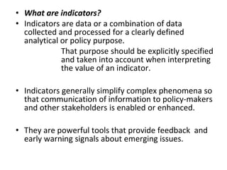
  • 1. • What are indicators? • Indicators are data or a combination of data collected and processed for a clearly defined analytical or policy purpose. That purpose should be explicitly specified and taken into account when interpreting the value of an indicator. • Indicators generally simplify complex phenomena so that communication of information to policy-makers and other stakeholders is enabled or enhanced. • They are powerful tools that provide feedback and early warning signals about emerging issues.
  • 2. A framework for Indicators of Sustainable Development • There is no doubt that there is a need for an indicator-policy cycle that includes monitoring of biodiversity, socio- economic, and governance indicators, within an analytical decision framework applied to local and regional scales and for multiple resources • In order to succeed, some steps in the indicator-policy cycle need to be considered: – Defined broad policy goals: Clear goals need to be defined for the indicators. – Identified the sources of data: Are there enough data to evaluate de indicators? Without good data, based on monitoring, it is not possible to develop indicators • Select the indicators: Indicators need to be tested to determine their use and validity. Can they detect trend?
  • 3. Key players in the development of indicators for the management of the coastal system/or coastal zone Information Knowledge Data Information Managers (Policy- Makers)Stakeholders Scientists INDICATORS Process indicators Stress reduction indicators Environmental status indicators Decision support and policy impact and evaluation Information in a format that is relevant and useful to policymakers. Inter-disciplinary scientists in collaboration with subject specialists. Collaboration between policy-makers, stakeholders and scientists Information flux and role of indicators.
  • 4. • The development and election of the indicators for this report was based on the types of indicators defined by Duda (2002) as: • Process Indicators: Traditionally, process indicators have been a measure of progress in project activities involving procurement and production (inputs and outputs) of goods, physical structures and services. • Stress Reduction Indicators: Stress reduction indicators relate to the specific, on-the-ground measures implemented by the collaborating countries. They provide evidence that action occurred on the ground. • Environmental Status Indicators: Environmental status indicators provide measures of actual performance or success in restoring and protecting the targeted ecosystem or community
  • 5. • Process Indicators. 1 – Existence and/or adoption of various instruments (policies, management plans, programs) and their application. • The capacity to manage fisheries depends on available human and financial resources as well as on the existence of competent institutions. 2 – Global, regional and local efforts to promote sustainable coastal and marine development. • States should co-operate on bilateral, regional and multilateral levels to establish, reinforce and implement effective means and mechanisms to ensure sustainable coastal and marine development. The management system is consistent with relevant international conventions and agreements. 3 – Global warming and climate change. • To recognize the threat of climate change to coastal habitats and to ensure appropriate and ecologically responsible response
  • 6. • Stress Reduction Indicators 4 – Water quality. • Healthy waterways are necessary to maintain the variety of aquatic habitats, and the economic, social and environmental systems that rely on them. Degree of turbidity and changes in turbidity levels in coastal and estuarine waters are an indicator for the conditions of the marine resources. 5 – Levels of toxic substances in the marine environment (organic and inorganic contamination). • Monitoring major groups of contaminants (e.g., persistent organic pollutants, hydrocarbons, heavy metals) dispersed/dissolved in the water column and/or accumulated on surface sediments provides a good indication of anthropogenic pollution pressure on the marine resources. 6– Level of restoration/recuperation of ecosystems and species. • Habitat measurements help identify and quantify habitat types (number and percent coverage) and spatial patterns of key habitats (diversity at the ecosystem-level). Such measurements are helpful to review the current status of coastal habitats in terms of natural versus impacted habitats.
  • 7. • Environmental Status Indicators 7 – Changes in the spatial coverage of marine ecosystems. • Changes in the area of habitat can indicate changing conditions in the environment that could be caused by natural disturbances or by anthropogenic factors, such as habitat use and fishing. Geospatial information improves our understanding of our environment, allows for more comprehensive and transparent planning, and can help increase stakeholder participation in environmental management. 8 – Landings/catches from the populations of exploited fishing resources. • Fish abundance, age and size composition, and length and weight relationships are the primary parameters scientists require to describe the status of a fish population. In addition to static parameters (i.e., those at a single point in time), dynamic parameters that quantify rates of population processes, such as survival, growth, reproduction and mortality, provide greater insight into a fish population’s ecological state. 9 – Levels of fishing effort. •Effective fishing effort” is a measure of fishing mortality. Landings (in terms of volume or value) and fishing efforts (e.g., number of vessels, types and number of nets, gear, etc.) may be a useful proxy to assess the quantity of resources harvested and it may be an indication, although indirect, of the status of local fisheries and fish stocks.
  • 8. • The development of indicators and their use in evaluating progress is dependent on a data and information management and reporting system being put in place by government, non-governmental organizations (NGOs), civil society, and the private sector. Within the CLME region there a several national, regional and international programs targeting the collection of environmental indicators. These include: CARICOM’s Caribbean Coastal Marine Productivity Programme, Organization of Eastern Caribbean States (OECS), UNEP under different programs (such as Caribbean Environmental Program and Environmental Data Explorer GEO), United Nations (UNSD Environmental Indicators), World Resource Institute (Ecosystem Service Indicators database), Worldwide Governance Indicators, Latin American and Caribbean Initiative for Sustainable Development (ILAC), The World Bank, and The Nature Conservancy, among others.
  • 9. • The process of establishing a set of indicators for the CLME in coastal and marine zones is not easy. • Significant scientific, technical and administrative effort, as well as, consensus with stakeholder groups must be achievement before the definition of indicators and targets are established. • It also implies agreement between governments (local and regional) on the intensity of monitoring, the goals and the resources required. • It is recommended to develop indicator factsheets based on the existing data. This fact sheets should be regional or country specific depending of the data available. • Communication is the key for success of an indicator policy. • A common framework is needed in the CLME region. Recommendations on Indicator Information
  • 10. • Indicators must be established under baseline conditions. Indicators are most effectively assessed when baseline information on the governance, ecological and socioeconomic conditions of the management area is available. • Indicators should relate to the specific management issues, such as multiple user conflicts, ecological degradation, community interest, or a commitment to improve the management of a local marine area. • It is strongly recommended that stakeholders are consulted as early as possible in the indicator development process in order to determine the purpose of the indicator and its audience. • Transparency in the decision making process promotes credibility and provides opportunities for stakeholders to introduce new information.
  • 11. • The indicators selected for use should be based on the best scientific understanding currently available and have been developed in consultation with international and country experts, other agencies and stakeholder groups. • The more an indicator meets a real decision-making need and it is effectively communicated, the greater the likelihood that a national or regional statistic agency will recognized the value of the indicator. • The calculation of an indicator must be accompanied by documentation of the methods used and data sources. This ensures that the calculation is transparent and open to scrutiny and can be repeated in the future for consistent production of the indicator. • The agreement on the indicator set and the standardization of methodology and formats for compilation and presentation of results ensures the comparability, correct assessment and aggregation of the results obtained in different countries and at different scales around the CLME. Furthermore, the identification of data gaps or limitations will allow prioritization of effort on the monitoring of required datasets.
  • 12. INSTITUTION NAME CZMU ICRI NEPA TNC NOAA-Habitat INSTITUTION NAME FAO OSPESCA FishBase SeaAround Us SocMon Issue Poll ution Ha bitat Degr adati on Type of Fisheries Coastal Shelf Fisheries Reef Fisheries Pelagic Fisheries Coastal Shelf Fisheries Reef Fisheries Pelagic Fisheries Coastal Shelf Fisheries Reef Fisheries Pelagic Fisheries Coastal Shelf Fisheries Reef Fisheries Pelagic Fisheries INSTITUTION NAME CARICOMP University of the West Indies (UWI) UNEP-SPAW UNEP-GAP WEBSITE http://www.unesco.org/csi/act/caricomp /ecosystem.htm http://www.mona.uwi.edu/cms/ccdc /ccdc.html http://www.gpa.unep.org/ http://www.cep.unep.org/ http://www.unesco.org/csi/act/caricomp /ecosystem.htm WEBSITE http://www.coastal.gov.bb/ http://earw.icriforum.org/ http://www.nepa.gov.jm/index.asp http://www.nature.org/ http://www.habitat.noaa.gov/ protection/efh/ newInv/index.html. WEBSITE http://www.fao.org/index_en.htm http://www.sica.int/ospesca/ http://www.fishbase.org/home.htm http://www.seaaroundus.org/ http://www.socmon.org/default.aspx IMS INDICATOR BOXWORD DOCUMENT (Description of the Indicators) EXCEL FILE (Includes the database) INSTITUTION NAME Caribbean Climate Centre (CCCC) Caribbean Policy Centre (CPACC) Caribbean Action Plan (CAP) WEBSITE http://www.caribbeanclimate.bz/ http://caribbeanresearchandpolicycenter.org/ http://www.cep.unep.org/ DESCRIPTION Indicators: Water quality Amount of sedimentation. Frequency of algal blooms Sources and quantity/velocity of runoff Levels of toxic substances in the marine environment (organic and inorganic contamination). Origin of sediments Land use changes. Indicators:  Level of restoration/ recuperation of ecosystems and species. Area mapped Spatial and temporal resolution  Existence of legislation on coastal and marine resources  Management plans (guidelines and regulations)  Changes in the spatial coverage of marine Geographical units Zoning plan Mapping Essential Fish Habitat Demographic information Indicators:  Landings/catch from populations of exploited fishing resources. Changes in the population structure of exploited species. Levels of fishing effort. Existence of regulations or management plans and their application. Indicators: Global warming and Climate change Acidification Sea level rise, Hurricane incidence.
  • 13. Sources of uncertainty and potential failure Examples Solutions Problem solvers 1) Assumptions in the evaluation process Poor problem definition resulting in unclear goals, badly defined or ambiguous targets A clear understanding of the problem at hand, clear goals, and a way of translating goals into specific and realistic targets. Collaboration between policy- makers, stakeholders and scientists Uncertainty in models: underestimating or not accounting for key processes (e.g., ecological responses, the indirect effects of policy (e.g. redistribution of fishing effort, or the impacts of other external drivers (e.g. economic forces or climate change Strong conceptual frameworks and inter-disciplinary models, with sensitivity analyses to understand the impacts of uncertainties. Inter- disciplinary scientists in collaboration with subject specialists. 2) Link between evaluation and selection of actions: most appropriate course of action might not be taken because decision-makers have other priorities or the action is unpalatable Fisheries management: scientific advice on actions such as total allowable catch is often not implemented. Ensure the set of actions is realistic and can be implemented through stakeholder participation and consultation, and improve understanding of the public and decision-makers. Collaboration between policy- makers, stakeholders and scientists Potential sources of uncertainty and failure identified by Nicholson et al (2012)
  • 14. 3) Link between action selection and implementation Actions may fail to be implemented effectively due to under-resourcing, poor governance or lack of compliance with rules at the local level. e.g. ineffective protected areas . Improved understanding of human decision making, information on governance and corruption, participatory selection of a set of possible actions to ensure support at implementation. Social scientists, managers and interdisciplin ary scientists 4) Impact of the action differing from the anticipated impact, due to other drivers, indirect effects and externalities The effects of other drivers obscuring any impact of policy. For example, poor understanding of the interactions between harvesting and fish spwaning aggregations. Acknowledgement and understanding of types and sources of uncertainty during the evaluation process, leading to better and broader models and improved information Inter- disciplinary scientists in collaboration with fishermen. 5) Link between biodiversity change and indicator change Poor indicator design renders the indicator a poor proxy for biodiversity, e.g. protected area coverage provides little indication of the effectiveness of protected areas in conserving biodiversity More extensive modelling of the behavior of indicators as the system changes; e.g. extensive testing of indicators in fisheries science; improved suite of indicators to ensure a more structured coverage of aspects of biodiversity change. Scientists Data quality makes trends difficult to detect or interpret due to taxonomic, spatial and temporal gaps and biases More, and more targeted, data, more systematic sampling of taxonomic groups, revise indicators to require less data
  • 15. 6) Link between indicator change and target assessment: assessing indicators against poorly defined targets, rendering assessment meaningless Targets are qualitative or ambiguous. Define targets more clearly and in a meaningful way, e.g. SMART targets (specific, measureable, ambitious, realistic and time-bound). Scientists and policy-makers Targets are not meaningful biologically (e.g. to avoid tipping points) Improve understanding of underlying processes Scientists Targets are not compatible, requiring trade- offs between targets. e.g. different groups of species provide different ecosystem services (e.g. climate regulation versus food production versus biodiversity conservation) and may have different management needs Identify potential impacts of alternative policies and achievability of targets through modelling; identify and acknowledge trade- offs, conflicts and synergies between targets and policies Scientists and policy-makers 7) Mismatches in temporal and spatial scales throughout the cycle Policies decided at a range of scales from global to local; Transboundary effects of national policies on issues such as fisheries management; implementation and data collection occur at the national to local scale. Identify where spatial mismatches may occur throughout the cycle; Better negotiation and cooperation across borders. Collaboration between policy- makers, stakeholders and scientists. Ecological processes at a wide range of scales from daily to centuries, including ecological time lags: e.g. extinction debt, time for stock recovery after reduction of fisheries pressure Explicitly consider processes at different spatial and temporal scales. Scientists and policy-makers
  • 16. Indicators for Small Scale Fisheries Type of Indicator Indicator Explanation Added value of the artisanal fisheries at the national level. Indicates the economic contribution of fisheries to local incomes Process Contribution of fisheries to national economic development Including fisheries and associated economic activities (transport, boats, marketing) Resource users involved in small scale fishing (number and demographics) Important for understanding resource users involved in small scale fisheries (eg. gender, age) Stress Reduction Number of communities involved in small scale fishing (including indigenous groups) Information to guide the development of training programs Revenue generated by small scale fisheries Allows an assessment of the amount of fishing effort Percentage of time spent on this activity Amount of time that is dedicated to these activities compared with other activities. Environmental Status Change in levels of poverty Indicates the condition or well-being of the population
  • 17. • An indicator approach provides a useful tool for appraising sustainability and for assessing policies – in particular for assessing measures and actions taken or proposed in relation to marine resources. • Indicators can help to inform citizens, policy- makers, scientists and other stakeholders about the status of marine resources, human impacts on the marine ecosystem, mitigating actions and the roles and responsibilities of stakeholders.
  • 18. A framework for Indicators of Sustainable Development • Specify targets that are measurable using indicators. • Define actions that can be implemented or achieve; use models to make predictions about the potential impacts. • Indicators must therefore be able to take into account different locations, people, cultures and institutions • All this information can be used to improve monitoring and collection of better indicator datasets.
  • 19. Database questions • The development of an effective indicator framework requires data and information, as well as appropriate data, information management and mechanisms to calculate, review and revise the indicators on a continuous basis. However, there are fundamental gaps in data collection and monitoring for sustainable development in coastal areas of the CLME. As mentioned by Heileman and Walling (2008), a number of initiatives have been undertaken in the region to improve environmental statistics. Some of the main problems are summarized below: • The coastal zone is not well represented as a distinct reporting unit or as a specific area in most GIS information sources or databases. • There is a lack of coherence in data gathering programs in terms of geographic and temporal coverage, and in the definition of measurements. This can be due to the absence of guiding policies, deficient benchmark information or inadequate analysis. • Indicators calculated by research centers, government, public administrations or agencies may be limited in scope (methodology, definitions, coverage), which restricts their usefulness at a wider regional level. • Differences in statistical data between countries may result in a bias in calculations and in comparison of 'the coastal zone' between CLME countries, in particular for population and socio-economic data.
  • 20. • Differences in the composition of sampling units for different reporting purposes may cause inconsistencies at the moment of reporting indicators between countries and over time. • Frequency and interval of sampling may not coincide between countries. For instance, frequency and period of sampling for two related indicators or indicators (e.g. number of overnight fishing trips and numbers of fishing boats) may not coincide, generating an unknown bias in the results. • Changes in methodology over time, within the data gathering program, may create an interruption and/or a breach in time series. This can be due to changes in measuring instruments, modifications in the location of measuring stations, changes in weighting factors in the analysis of data from surveys, etc. • Geo-referenced data is limited. Data needs to be geo-referenced in order to allow comparisons and representation of socio-economic and environmental information. • Consistent data and data flow should provide a more realistic picture of the processes taking place and support decision-making at different levels (from local to national to CLME level). The best way to ensure comparability data or indicators at all levels is a bottom-up approach in data collecting and information systems: starting from reliable and sound data at the local level and aggregating it at higher levels in common databases.