GIS in Mining and Exploration 2011 Brochure
•
1 like•1,314 views

Uncovering Technologies and Strategies for Exploration and Mine Advancement Using Geographic Information Systems Optimising the use of GIS on mine sites and in mineral exploration Following its great success in Perth, Mining IQ's GIS in Mining and Exploration 2011 is coming to Queensland! GIS in Mining and Exploration 2011 QLD is about advancing the knowledge base of all those who interact with GIS. This event has been developed specifically with your challenges in mind, providing you with the critical updates you need in a dynamic and demanding field. For more information about the event, please visit http://www.gisinmining.com.au or call us on 61 2 9229 1000

Recommended
Recommended
More Related Content
What's hot
Viewers also liked
Viewers also liked (20)
Similar to GIS in Mining and Exploration 2011 Brochure
Similar to GIS in Mining and Exploration 2011 Brochure (20)
More from IQPC Australia
More from IQPC Australia (20)
Recently uploaded
Recently uploaded (20)
GIS in Mining and Exploration 2011 Brochure
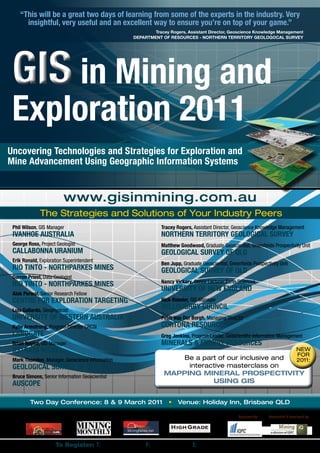
- 1. “This will be a great two days of learning from some of the experts in the industry. Very insightful, very useful and an excellent way to ensure you’re on top of your game.” Tracey Rogers, Assistant Director, Geoscience Knowledge Management DEPARTMENT OF RESOURCES - NORTHERN TERRITORY GEOLOGOCAL SURVEY GIS in Mining and Exploration 2011 Uncovering Technologies and Strategies for Exploration and Mine Advancement Using Geographic Information Systems www.gisinmining.com.au The Strategies and Solutions of Your Industry Peers Phil Wilson, GIS Manager Tracey Rogers, Assistant Director, Geoscience Knowledge Management IVANHOE AUSTRALIA NORTHERN TERRITORY GEOLOGICAL SURVEY George Ross, Project Geologist Matthew Goodwood, Graduate Geoscientist, Greenfields Prospectivity Unit CALLABONNA URANIUM GEOLOGICAL SURVEY OF QLD Erik Ronald, Exploration Superintendent Ben Jupp, Graduate Geoscientist, Greenfields Prospectivity Unit RIO TINTO - NORTHPARKES MINES GEOLOGICAL SURVEY OF QLD Darren Priest, Data Geologist Nancy Vickery, Senior Lecturer Earth Sciences RIO TINTO - NORTHPARKES MINES UNIVERSITY OF NEW ENGLAND Alok Porwal, Senior Research Fellow CENTRE FOR EXPLORATION TARGETING Nick Roesler, GIS Manager Luis Gallardo, Geophysicist WILLOUGHBY COUNCIL UNIVERSITY OF WESTERN AUSTRALIA Peter Van Der Borgh, Managing Director Kylie Armstrong, Program Director CRCSI CORTONA RESOURCES LANDGATE Greg Jenkins, Program Leader, Geoscientific Information Management Brian Naylor, GIS Manager MINERALS & ENERGY RESOURCES XSTRATA NICKEL NEW FOR Mark Thornton, Manager, Geoscience Information Be a part of our inclusive and 2011: GEOLOGICAL SURVEY OF QLD interactive masterclass on Bruce Simons, Senior Information Geoscientist MAPPING MINERAL PROSPECTIVITY AUSCOPE USING GIS Two Day Conference: 8 & 9 March 2011 • Venue: Holiday Inn, Brisbane QLD Media Partners: Organised by: Researched & Developed by: To Register: T: (02) 9229 1000 F: (02) 9223 2622 E: registration@iqpc.com.au
- 2. “As Rio Tinto – Northparkes Mines ramps up exploration efforts, we’ve turned to 3D-GIS applications for our fundamental data visualisation and interpretation platform. GIS in Mining and Exploration 2011 looks to be well timed for us to share our experiences and increase our knowledge of industry best practice. I’m very much looking forward to this event.” GIS in Mining and Exploration 2010 Erik Ronald, Exploration Superintendent, RIO TINTO - NORTHPARKES MINES DAY ONE: Tuesday 8 March 2011 8.30 Registration and Refreshments GEOLOGICAL SURVEY OF QLD 12.20 Lunch and Networking 9.00 Opening Address from the Chair Brian Naylor, GIS Manager 1.20 Innovations in Information Delivery by the XSTRATA NICKEL Northern Territory Geological Survey (NTGS) 9.10 Utilising and Combining GIMS (Geoscientific • Reviewing recent improvements in data quality and Information Management Systems) and GIS to accuracy manage Geoscientific Data and Workflow • Incorporating the data into your GIS Processes • Identifying current and future data needs and A case study detailing the use of the aQuire GIMS and appropriate sources GIS to handle the data, information layers and workflow Tracey Rogers, Assistant Director, Geoscience processes of your resource assets. Knowledge Management • Integrating the systems and existing databases NORTHERN TERRITORY GEOLOGICAL SURVEY • Ensuring effective data management by 2.00 Taking Advantage of Increased Mobile implementing commercial solutions Capabilities in Data Acquisition and Distribution Phil Wilson, GIS Manager • Making the case for mobile networks and GIS IVANHOE AUSTRALIA provision 9.50 Implementing GIS Solutions for Junior Explorers • Avoiding security and integrity issues with adequate • Matching your current and future operations with controls and procedures your GIS capability • Establishing infrastructure for quick data transfer to • Examining the increasing number of licensed and mobile devices open source options • Establishing user base and providing further • Using GIS in daily operations education • Overcoming common early issues Nick Roesler, GIS Manager • Upskilling staff in order to maximise the efficiency of WILLOUGHBY COUNCIL the GIS solution implemented 2.40 Afternoon Tea and Networking George Ross, Project Geologist CALLABONNA URANIUM 3.10 Utilising GIS for Exploration Targeting 10.30 Morning Tea and Networking • Maximising opportunities in data acquisition, mapping and modelling solutions in the marketplace 11.00 3D GIS applications for exploration at the • Converting geological models into workable Northparkes Cu-Au Mine, NSW exploration and prospectivity models Northparkes is a copper and gold mine located 27 • Establishing targeting criteria kilometres north west of Parkes in the Central West Alok Porwal, Senior Research Fellow of New South Wales, Australia. Northparkes is a joint CENTRE FOR EXPLORATION TARGETING venture between Rio Tinto (80%) and the Sumitomo 3.50 Access to Real Data: Is it Beyond GIS? Group (20%). • Standards based services – why delivering real world • Integration of surface and subsurface data data matters • Use of Gocad for exploration targeting. • The Spatial Information Services Stack – tools to • UG & surface design of drill programmes using establish the services Gocad • The AuScope web portal – a means to discover and Erik Ronald, Exploration Superintendent access these services RIO TINTO - NORTHPARKES MINES • The status of ‘out of the box’ GIS tools to consume Darren Priest, Data Geologist and use these services RIO TINTO - NORTHPARKES MINES • Other mechanisms available for accessing live data 11.40 Using 3D Common Earth Models and 3D GIS in over the web Conducting Regional Exploration Targeting Bruce Simons, Senior Information Scientist 3D modelling and potential field inversion of AUSCOPE geoscientific data can be used to aid regional 4.30 Closing Remarks from the Chair exploration targeting within a 3D environment. This presentation will discuss new workflows utilised by the 4.35 End of Day 1 GSQ including: • 3D modelling and potential field inversion of geophysical data • Statistical selection of exploration criteria and construction of a common earth model • Using a weights of evidence approach to create a 3D mineral potential model of region Matthew Goodwood, Graduate Geoscientist, Greenfields Prospectivity Unit Ben Jupp, Graduate Geoscientist, Greenfields Prospectivity Unit To Register | T: (02) 9229 1000 | F: (02) 9223 2622 | E: registration@iqpc.com.au | W: www.gisinmining.com.au
- 3. “GIS in Mining and Exploration is a worthwhile programme of experienced speakers and relevant topics. I’m looking forward to a very valuable and insightful industry event.” Bruce Simons, Senior Information Geoscientist, AUSCOPE GIS in Mining and Exploration 2010 DAY TWO: Wednesday 9 March 2011 8.30 Registration and Refreshments government, business, academia and the broader community 9.00 Opening Remarks from the Chair Kylie Armstrong, Program Director CRCSI Mark Thornton, Manager, Geoscience Information LANDGATE GEOLOGICAL SURVEY OF QLD 12.20 Lunch and Networking 9.10 GIS for Exploration Targeting: A Study of Cortona 1.20 Improving Accuracy and Information Depth of Resources’ Mineral Potential GIS • Analysing Cortona’s active exploration programs • Reviewing recent improvements in data quality and including regional geological mapping initiatives accuracy • Implementing data sets for effective company mineral • Incorporating the data into your GIS and energy exploration reporting • Identifying current and future data needs and • Understanding how GIS can be integrated into the appropriate sources mine design and management process and the value Luis Gallardo, Geophysicist it can add to the business UNIVERSITY OF WESTERN AUSTRALIA • Cortona’s NSW projects: providing examples of data accuracy, improvement and uses 2.00 INCLUSIVE MASTERCLASS Peter Van Der Borgh, Managing Director Facilitated by: CORTONA RESOURCES Alok Porwal, Senior Research Fellow CENTRE FOR EXPLORATION TARGETING 9.50 Maximising Mineral Exploration Opportunities Part 1 Mapping Mineral Prospectivity Using GIS within South Australia This inclusive masterclass will provide an overview • Promoting mineral exploration opportunities within of mineral prospectivity analysis and mapping in South Australia and facilitating access to its wealth of a GIS environment. It will comprise a balance of geoscientific data presentations, demonstrations and hands-on exercises • Undertaking major airborne geophysical surveys in on various procedures involved in GIS-based mineral key areas of the State as part of the South Australian prospectivity mapping including: Exploration Initiative (SAEI), Broken Hill Exploration • Selection of targeting criteria: mineral systems Initiative (BHEI) and the Targeted Exploration Initiative approach, scale-dependence of targeting criteria South Australia (TEiSA) and, most recently, the Plan • Transformation of targeting criteria into spatial (GIS) for Accelerating Exploration (PACE) Initiative layers using GIS tools Greg Jenkins, Program Leader, Geoscientific Information Management 2.40 Afternoon Tea and Networking MINERALS & ENERGY RESOURCES 3.10 Part 2 Mapping Mineral Prospectivity Using GIS 10.30 Morning Tea and Networking • Mineral prospectivity modelling: approaches and implementation; practical implementations of 11.00 Enhancing GIS Functionality for Environmental concept-driven (fuzzy) and data-driven Management (weights-of-evidence and neural network) models; Environmental management departments require GIS demonstration of advanced models (neuro-fuzzy and to actively monitor the ongoing environmental impacts genetic programming) caused by mining activities. This session will give • Validation and evaluation of output prospectivity examples of GIS practice when providing services to maps engineers and geologists in the department 4.00 Closing Remarks from the Chair • Providing temporal as well as spatial data • Data management techniques for keeping on top of 4.10 End of Conference automatic data collection Nancy Vickery, Senior Lecturer Earth Sciences UNIVERSITY OF NEW ENGLAND BENEFITS OF SPONSORING & EXHIBITING 11.40 Accelerating the Potential for Spatial Information 4 key reasons: in the Mining Sector • Providing updates in the spatial infrastructure 1. Direct access to your target market program of the corporate research centre 2. Building your company brand and position for spatial Information • Enabling an Australian/New Zealand spatial market 3. Increasing your competitive selling advantage place that is interoperable and will move from just 4. Achieving a high profile association with key decision delivering data products to a range of spatial makers products • Overseeing critical information delivery in an existing FOR MORE INFORMATION, PLEASE and emerging spatial infrastructure environment CONTACT MIKE ADAMS ON +61 2 9229 1083 or mike.adams@iqpc.com.au • Increasing access to spatial information by To Register | T: (02) 9229 1000 | F: (02) 9223 2622 | E: registration@iqpc.com.au | W: www.gisinmining.com.au
- 4. GIS in Mining and Exploration Two Day Conference: 8 & 9 March 2011 Venue: Holiday Inn, Brisbane QLD To speed registration, please provide the priority code located on the mailing label or in the box below. Venue: Holiday Inn Brisbane ENQEH 159 Roma St, Brisbane QLD 4000 Phone (07) 3238 2222 Fax (07) 3238 2266 Web www.holidayinnbrisbane.com.au Accommodation The Lido Group is the official booking agent for the GIS in Mining and Exploration conference. They have negotiated event rates at a range of hotels including the conference venue. To take advantage of these rates & book direct on the website please go to www.gisinmining. com.au and click on the Venue & Accommodation page. Benefits of Sponsoring & Exhibiting: 1. Direct access to your target market. 2. Enhancing your company or brand position. HOW TO REGISTER: 3. Increasing your competitive selling advantage. (02) 9229 1000 4. Achieving a high profile association with key decision makers. (02) 9223 2622 For more information, please contact Mike Adams on registration@iqpc.com.au +61 (0) 2 9229 1083 or mike.adams@iqpc.com.au IQPC, Level 6, 25 Bligh Street, SYDNEY NSW 2000 14246.003 About IQPC Each year IQPC offers approximately 2,000 conferences, seminars and related learning programs worldwide attracting a dedicated group of top www.gisinmining.com.au decision makers. IQPC leverages a global research base of best practices to produce an unrivalled portfolio of problem-solving conferences, in doing so provide the fastest and most enjoyable way to find out what is going on in your professional community and the best way to meet the suppliers that can help you accomplish your goals. IQPC now has offices in major INDUSTRY UPDATES: cities across six continents including: Berlin, Dubai, London, New York, Sao Paulo, Singapore, Stockholm, Sydney and Toronto. From finance events in Keep up to date on all the important issues in the lead up to the conference: New York, Rail conferences in Brussels, Marketing summits in Singapore and Mining events in Australia, IQPC transfers expertise around the world, • podcasts • debates • interviews • articles • industry news keeping delegates competitive, profitable and delivering maximum ROI. Join our speakers online at: www.iqpc.com.au. www.gisinmining.com.au Privacy - Your Choice Any information provided by you in registering for this conference is being collected by IQPC and will be held in the strictest confidence. It will be added to our database and will be used primarily to provide you with further information about IQPC events and services. From time to time IQPC may share information from our database with other Standard Package Early Bird Discount – Standard Pricing professional organisations (including our event sponsors) to promote similar products *Register and pay before 18/01/2011 and services. By supplying your email address and mobile telephone number you are SAVE $400* agreeing to IQPC contacting you by these means to provide you further information about IQPC products and services. Please tick the box below if you do NOT want us to o Conference Only $2999 + GST = $3298.90 $3399 + GST = $3738.90 pass on your details. To amend your current details, advise of duplicates or to opt out of further mailings, please contact our Database Integrity Maintenance Department, Vendor Pricing - $3699 + GST = $4068.90 Level 6, 25 Bligh Street, SYDNEY NSW 2000. Alternatively, email database@iqpc.com. * Payment received by IQPC prior to 5pm AEST on the cut-off date. au, call 02 9229 1028 or fax 02 9223 2622. # Registrations received without payment will incur a processing fee of $99 + GST = $108.90 per registration o I do not wish to have my details made available to other organisations IQPC Cancellation And Postponement Policy Team Discounts For details of IQPC’s Cancellation and Postponement policy please visit www.iqpc. IQPC recognises the value of learning in teams. Take advantage of one of these special rates: com.au. $ Groups of 3 or more booking on the conference at the same time from the same company receive a $500 discount © 2011 IQPC ABN 92 071 142 446 All RIGHTS RESERVED. The format, design, from the total registration fee content and arrangement of this brochure constitute a copyright of IQPC. Unauthorised reproduction will be actionable by law. $ Register a team of 4 to the conference at the same time from the same company and receive a free pass for a 5th delegate $ Ask about multi-event discounts. Ring (02) 9229 1000 for more details Please note: Only one discount applies o Please send me ___ set(s) of AUDIO COMPACT DISCS and PRESENTATION CD at $878.90 ($799 plus GST) o Please keep me informed via email about this and other related events Delegate 1: Position: Email: Delegate 2: Position: Email: Delegate 3: Position: Email: Organisation: Address: Postcode Telephone: ( ) Fax: ( ) Approving Manager: Position: Email: o Cheque enclosed for $___________ (Please make cheques payable to: IQPC) Please charge o American Express o Visa o MasterCard o Diners Club Credit Card Number Amex 4 Digit Code: Expiry Date: _____/_____ Name of Cardholder:(please Print) NOTE: PAYMENT IS DUE WITHIN 7 DAYS FROM REGISTRATION TO SECURE YOUR PLACE. Registrations received without payment or a Government PO will incur a processing fee of $99+GST = $108.90 per registration. Payment prior to the conference is mandatory for attendance. Payment includes lunches, refreshments, a copy of conference presentations via FTP website or workbook and all meeting materials. If payment has not been received two weeks before the conference, a credit card hold will be taken and processed. This card will be refunded once alternate payment has been received.