Sediment Yield Studies For Selected Catchments in Visakhapatnam District, Andhra Pradesh

Sediment yield studies determine the amount of sediment that leaves a basin for an event or over a period of time. The sediment yield provides the necessary input to determine sedimentation impacts on a reservoir. Each reservoir project requires a sediment yield analysis to determine the storage depletion resulting from the deposition of sediment during the life of the project. The main object of the present study is to identify the particular suitable theoretical method to predict the sediment rate for selected catchments by comparing with the hydrographic survey results.Literature review has enabled the identification of three methods for determining the rate of sediment yield. These methods are (a) Grade’s method (b) Khosla’s method (c) Joglekar’smethod.Rate of sediment yield obtained from Khosla’s method is close to the rate computed form the hydrographic survey data for Thandava and KonamReservoirs. For the reservoir on Raiwada Reservoir, Joglekar’s method is found to give sediment rate closer to the value arrived from hydrographic survey data

Empfohlen
Empfohlen
Weitere ähnliche Inhalte
Was ist angesagt?
Was ist angesagt? (18)
Andere mochten auch
Andere mochten auch (19)
Ähnlich wie Sediment Yield Studies For Selected Catchments in Visakhapatnam District, Andhra Pradesh
Ähnlich wie Sediment Yield Studies For Selected Catchments in Visakhapatnam District, Andhra Pradesh (20)
Kürzlich hochgeladen
Kürzlich hochgeladen (20)
Sediment Yield Studies For Selected Catchments in Visakhapatnam District, Andhra Pradesh
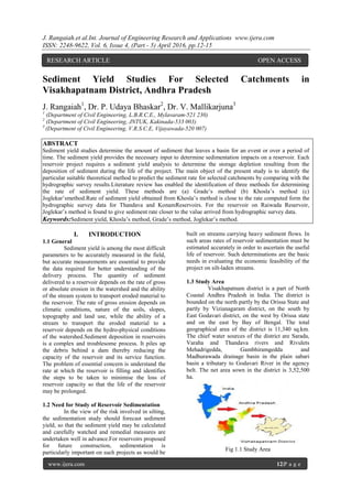
- 1. J. Rangaiah.et al.Int. Journal of Engineering Research and Applications www.ijera.com ISSN: 2248-9622, Vol. 6, Issue 4, (Part - 5) April 2016, pp.12-15 www.ijera.com 12|P a g e Sediment Yield Studies For Selected Catchments in Visakhapatnam District, Andhra Pradesh J. Rangaiah1 , Dr. P. Udaya Bhaskar2 , Dr. V. Mallikarjuna3 1 (Department of Civil Engineering, L.B.R.C.E., Mylavaram-521 230) 2 (Department of Civil Engineering, JNTUK, Kakinada-533 003) 3 (Department of Civil Engineering, V.R.S.C.E, Vijayawada-520 007) ABSTRACT Sediment yield studies determine the amount of sediment that leaves a basin for an event or over a period of time. The sediment yield provides the necessary input to determine sedimentation impacts on a reservoir. Each reservoir project requires a sediment yield analysis to determine the storage depletion resulting from the deposition of sediment during the life of the project. The main object of the present study is to identify the particular suitable theoretical method to predict the sediment rate for selected catchments by comparing with the hydrographic survey results.Literature review has enabled the identification of three methods for determining the rate of sediment yield. These methods are (a) Grade’s method (b) Khosla’s method (c) Joglekar’smethod.Rate of sediment yield obtained from Khosla’s method is close to the rate computed form the hydrographic survey data for Thandava and KonamReservoirs. For the reservoir on Raiwada Reservoir, Joglekar’s method is found to give sediment rate closer to the value arrived from hydrographic survey data. Keywords:Sediment yield, Khosla’s method, Grade’s method, Joglekar’s method. I. INTRODUCTION 1.1 General Sediment yield is among the most difficult parameters to be accurately measured in the field, but accurate measurements are essential to provide the data required for better understanding of the delivery process. The quantity of sediment delivered to a reservoir depends on the rate of gross or absolute erosion in the watershed and the ability of the stream system to transport eroded material to the reservoir. The rate of gross erosion depends on climatic conditions, nature of the soils, slopes, topography and land use, while the ability of a stream to transport the eroded material to a reservoir depends on the hydro-physical conditions of the watershed.Sediment deposition in reservoirs is a complex and troublesome process. It piles up the debris behind a dam thereby reducing the capacity of the reservoir and its service function. The problem of essential concern is understand the rate at which the reservoir is filling and identifies the steps to be taken to minimise the loss of reservoir capacity so that the life of the reservoir may be prolonged. 1.2 Need for Study of Reservoir Sedimentation In the view of the risk involved in silting, the sedimentation study should forecast sediment yield, so that the sediment yield may be calculated and carefully watched and remedial measures are undertaken well in advance.For reservoirs proposed for future construction, sedimentation is particularly important on such projects as would be built on streams carrying heavy sediment flows. In such areas rates of reservoir sedimentation must be estimated accurately in order to ascertain the useful life of reservoir. Such determinations are the basic needs in evaluating the economic feasibility of the project on silt-laden streams. 1.3 Study Area Visakhapatnam district is a part of North Coastal Andhra Pradesh in India. The district is bounded on the north partly by the Orissa State and partly by Vizianagaram district, on the south by East Godavari district, on the west by Orissa state and on the east by Bay of Bengal. The total geographical area of the district is 11,340 sq.km. The chief water sources of the district are Sarada, Varaha and Thandava rivers and Rivulets Mehadrigedda, Gambhiramgedda and Madhurawada drainage basin in the plain sabari basin a tributary to Godavari River in the agency belt. The net area sown in the district is 3,52,500 ha. Fig 1.1 Study Area RESEARCH ARTICLE OPEN ACCESS
- 2. J. Rangaiah.et al.Int. Journal of Engineering Research and Applications www.ijera.com ISSN: 2248-9622, Vol. 6, Issue 4, (Part - 5) April 2016, pp.12-15 www.ijera.com 13|P a g e The Thandava Reservoir project was constructed across river Thandava near GantavaniKothagudem village in Kotauratlamandal of Visakhapatnam district. The construction of the project was commenced in the year 1965 and completed in the year 1974 to create a storage capacity of 140.428 M.cum at FRL. An earth dam for a length of 201.17m was constructed in the main gorge portion of the river and the surplus has been arranged through a regulator constructed in another valley about 3km away from earth dam. The global co-ordinates are, east longitude 820 -17’- 20” and north latitude 170 -17’-50” respectively. The Konam reservoir project was constructed across the river Bodderu, a tributary to SharadaRiver at Konam village, in Cheedikadamandal of Visakhapatnam district. The Konam reservoir was constructed in the year 1979 to create a storage capacity of 24.0833 M.cum at FRL. The length of the earth dam is 300 m. The global co-ordinates are, east longitude of 820 -51’- 50” and north latitude 170 -58’-30” respectively. The Raiwada Reservoir project was constructed across the river Sharada near Raiwadavillage in Devarapallimandal of Vishakapatnam district. The Raiwada reservoir was constructed in the year 1983 to create a storage capacity of 101.93 M.cum at FRL. The length of the earth dam is 5.75km. The global co-ordinates are east longitude 820 -59’-00” and north latitude 180 -00’-30” respectively. II. METHODOLOGY AND DATA 2.1 General Sediment is defined geologically as any fragmental material transported by, suspended in, or deposited by water or air. The amount of sediment, which is collected at the outlet of the watershed, is termed as sediment yield. Several empirical models have been developed to estimate the sediment yield from a catchment. Most of these models are statistically established based on observed data, which are usually easier to use and computationally efficient. Some of these models were used in the present study after taking into consideration their applicability and data availability. 2.2 Grade’s Method Grade et al (1983) proposed the following equation, which considers various hydrologic factors, like annual rainfall, annual runoff, catchment area, slope, drainage density and vegetative cover factor. Vs = 1.067 x 10⁻⁶ x A1.29 x P1.38 x Dd 0.4 x S0.13 x Fc 2.51 Eq-2.1 Where, Vs = Sediment yield in Mm3 / Year, A = Catchment Area in sq.km, P = Average Annual Precipitation in cm, Dd = Drainage Density in km-1 S = Average Slope of the Area = It is the ratio of the difference between the levels of end points of main streams to the length of the stream. Dd = It is the ratio of total length of all streams of the catchment to total area of the catchment. Fc = Vegetation cover Factor = It has been arrived by regrouping the land use / land cover classification into F1, F2, F3, F4& F5 and is estimate using the following formula. Fc = (0.2xF1+0.2xF2+0.6xF3+0.8xF4+F5) / (F1+F2+F3+F4+F5) Eq-2.2 In which, F1 = Area under reserve and protected forest = (Deciduous forest (Dense + Open) + forest plantations) F2 = Unclassified forest area, F3 = Cultivated area, = (Khariff unirrigated + Khariff irrigated + Agricultural Plantations + double crop land) F4 = Grass and pasture land and F5 = Waste land.(Land with scrub + Land without scrub + Degraded / Scrub Forest + Rocky barren land) 2.3 Khosla’s Method Khosla (1953) considered catchment area to be the only major parameter affecting the sediment. The equation for the estimation of sediment yield developed Khosla is given as Vs = 0.00323 x A0.72 Eq-2.3 Where,Vs = Annual sediment yield in M.cum A = Catchment area in sq.km 2.4 Joglekar’s Method Joglekar (1960) considered catchment area to be the only major parameter affecting the sediment. Based on data from reservoirs from India and abroad, Joglekar expressed the annual sediment yield rate as Vs = 0.00597 x A0.72 Eq-2.4 Where, Vs = Annual sediment yield in M.cum A = Catchment area in sq.km The sediment rates obtained from these three methods (Grade’s, Khosla’s, and Joglekar’s method)are compared with the hydrographic survey results of APERL, Hyderabad. 2.5 Data The data required for theoretical computations are presented here. The various parameters involved in the computation of sediment yield are listed in following table and the source of this data is also indicated in this table.
- 3. J. Rangaiah.et al.Int. Journal of Engineering Research and Applications www.ijera.com ISSN: 2248-9622, Vol. 6, Issue 4, (Part - 5) April 2016, pp.12-15 www.ijera.com 14|P a g e Table 2.1 Parameters involved in the sediment yield computation formulas The hydrographic survey results are obtained from the records of APERL, Hyderabad is presented here. Table 2.2 Hydrographic Survey Results for Three Reservoirs III. DISCUSSION OF RESULTS 3.1 General The sediment yield computations for the selected reservoirs are presented in the following section. Theoretical computations of sediment yield rates are carried out in the present investigation using Grade’s method, Khosla’s method and Joglekar’s method. The theoretical results obtained for each of the three reservoirs are compared with the rate of sediment yield computed using the data of hydrographic survey conducted by APERL, Hyderabad for these reservoirs during different periods. 3.2 Sediment Yield for Thandava Reservoir The following table indicate the sediment yield rates obtained for the Thandava reservoir using Grade’s method, Khosla’s method and Joglekar’s method. These results are compared with the sediment yield obtained with the help of hydrographic survey data (Actual data). It is seen from this table that the sediment yield rate obtained using Khosla’s method is close to the rate observed through hydrographic survey. Table 3.1 Comparison of Actual and Estimated Sediment Yields for Thandava Reservoir 3.3 Sediment Yield for Konam Reservoir The following table contain the theoretical results of sediment yield for Konam Reservoir and compared with the results obtained from the hydrographic survey (Actual results). It is seen from this table that the sediment yield rate obtained using Khosla’s method is close to the rate observed through hydrographic survey. Table 3.2 Comparison of Actual and Estimated Sediment Yields for Konam Reservoir 3.4 Sediment Yield for Raiwada Reservoir The following table contain the theoretical results of sediment yield for Raiwada Reservoir and compared with the results obtained from the hydrographic survey (Actual results). It is seen from this table that the sediment yield rate obtained using Joglekar’s method is close to the rate observed through hydrographic survey.
- 4. J. Rangaiah.et al.Int. Journal of Engineering Research and Applications www.ijera.com ISSN: 2248-9622, Vol. 6, Issue 4, (Part - 5) April 2016, pp.12-15 www.ijera.com 15|P a g e Table 3.3 Comparison of Actual and Estimated Sediment Yields for Raiwada Reservoir The annual sediment yield estimate from Grade’s method is lower than the result obtained through hydrographic survey data and the percentage deviation obtained from Grade’s method for Thandava, Konam and Raiwada reservoirs are -32.26%, -61.09% and -66.35% respectively. The annual sediment yield estimate from Joglekar’smethodare+137.51% and +121.88 % higher than the result obtained through hydrographic survey data for Thandava and Konam reservoirs but the annual sediment yield estimate from Joglekar’s method is closer to the result obtained through hydrographic survey data for Raiwada reservoir and the percentage deviation obtained from Joglekar’s method is +1.78 %. The annual sediment yield estimate from Khosla’s method is close to the result obtained through hydrographic survey data and the percentage deviation obtained from Khosla’s method is consistently low at +0.61% and -2.24% for Thandava and Konam reservoirs. The percentage deviation in case of Raiwada reservoir is higher at - 56.79%. Fig. 3.1 Comparison of Actual and Estimated Sediment Yields for selected reservoirs IV. CONCLUSIONS Rate of sediment yield obtained from Khosla’s method is closed to the rate computed from the hydrographic survey data for Thandava&Konam Reservoirs. For the reservoir on Raiwada, Joglekar’s method is found to give sediment rate closer to the value arrived from hydrographic survey data. V. SCOPE FOR FURTHER STUDY The following scope has been identified and the same is suggested further study. (1) The relevant parameters involved in the sediment yield equations can be arrived using the remote sensing imageries instead of S.O.I top sheets. (2) Suitable sediment controlling techniques may be identified for increasing the life of the reservoirs. (3) Only 3 methods are chosen here to compute the rate of sediment yield into the reservoir. Other methods can also be considered. REFERENCE [1]. Gottschalk L.C.,(1952) “Measurement of sedimentation in small Reservoirs”, with discussions A.S.C.E. Transactions, Vol.117. [2]. Grade.R.J. and Kothyari, D.C., Sediment Yield Estimations, J1. of Irrigation and Power, CBIP, India, Vol.44, No.3,1987. [3]. Grade.R.J.,andRangaraju, K.G., Mechanics of Sediment Transportation and Alluvial Stream Problems,2nd Ed. Wiley Eastern Ltd., New Delhi, 1977. [4]. Joglekar D.V.,(1960) “Silting of Reservoirs”, Journal of the Institution of Engineers (India), Voll.40.8, PartI. [5]. Khosla A.N., (1953) “Silting of Reservoirs”, Central Board of Irrigation and power, Publication No.51. [6]. Murthy B.N., (1980) “Life of reservoir”, publication 89, central board of irrigation and power, New Delhi. [7]. “Records of Irrigation Department” (2004) Irrigation Circle, Visakhapatnam. [8]. “Report on the hydrographic surveys of Thandava reservoir”, (1991) A.P.Engineering Research Laboratories. Hyderabad. [9]. “Report on the hydrographic surveys of Konam reservoir”, (1992) A.P. Engineering Research Laboratories. Hyderabad. [10]. “Report on the hydrographic surveys of Raiwada reservoir”, (1993) A.P. Engineering Research Laboratories. Hyderabad.