SlideShare a Scribd company logo
1 of 10
Download to read offline
Participatory 3-Dimensional Mapping:
Reclaiming Ancestral Domains
I
ndigenous peoples (IPs) in the Philippines
continue to count among the poorest of the
poor, having been deprived for the longest time
of legal recognition of their territories. Yet, there
is a legal framework in place that recognizes the
rights of IPs.
Passed in 1997, Republic Act 8371 or the
Indigenous Peoples Rights Act (IPRA) addresses
four substantive rights of indigenous people/
communities: (i) the right to ancestral domains
and lands, (ii) the right to self-governance and
empowerment, (iii) the right to cultural integrity,
and (iv) social justice and human rights. The law
defines ancestral domains to cover “forests,
pastures, residential and agricultural lands,
hunting grounds, worship and burial areas,
including lands no longer occupied exclusively by
indigenous cultural communities, but to which
they had traditional access.”
Under the principle of self-determination,
IPRA provides for indigenous communities to
document and delineate their own ancestral
domain claims and to formulate their own
ancestral domain sustainable development and
management plans (ADSDPPs) based on their
indigenous knowledge systems and practices.
At the time the Philippine Association for
Intercultural Development (PAFID) NGO-ECP
project started in 2003, many indigenous
communities in the Caraga region were in the
process of filing claims and negotiating for legal
recognition of their ancestral domains. Yet,
Moving Up Innovations to Scale84
use of global positioning system/geographic
information system (GPS/GIS) technology. A
3-D map is a physical model of a place. It uses
an appropriate scale that shows the rivers,
mountains, and valleys, as well as the location of
residential and cultivated areas, and the resources
from which communities derive their livelihoods.
It also records indigenous knowledge, beliefs, and
practices—i.e., the sacred areas, burial sites, and
all those features that have social, cultural, and
spiritual significance to the local people are shown.
The mapping process heavily banks on the
the boundaries of their domains had not been
properly identified and mapped, causing extreme
frustration within the communities whose claims
were often questioned as to their legitimacy.
Moreover, in the absence of perimeter maps and
community plans, adverse claimants (including
mining, logging, and plantation companies)
continued to encroach into IPs’ lands.
The innovation: marrying
traditional knowledge
and technical processes
The use of participatory three-dimensional
mapping (P3DM) as a tool for community
development was pioneered in Thailand in
the late 80s and was used extensively by the
Royal Forestry Department. It was introduced
in the Philippines in 1993 by the Environmental
Science for Social Change in their work with
the Indigenous Alangan Mangyan in the island
of Mindoro. In 1995, PAFID adopted the
methodology and customized its use to respond
to issues related to IPs’ land rights and to
facilitate ancestral domain management planning
(ADMP).
With P3DM, local communities construct a relief
model of their ancestral domain by combining
collective and specific local knowledge and the
The Philippine Association for Intercultural
Development, Inc. (PAFID) is a social
development organization that, for 47 years, has
assisted indigenous communities in regaining
their ancestral domains.
PAFID’s project with IFAD, Mapping Ancestral
Domains in Northern Mindanao, was
implemented for 3 years (2003 – 2006). Its overall
goal was to bring about full recognition of the
rights of indigenous communities over their
ancestral domains. The project provided support
to the indigenous peoples’ communities that had
initiated negotiations with the government for
the legal recognition of their ancestral domains
in the Caraga region of northern Mindanao. The
project focused on achieving its aims using (i)
participatory community mapping, (ii) ancestral
domain management planning, and (iii) capacity-
building.
MappingAncestral Domainsin
NorthernMindanao, Philippines
Mapping by “experts” Community mapping
P Very expensive and laborious;
P Expert-driven;
P Leaves little room for participation;
P Technically accurate, but usually omits critical
data;
P Access to and control of information are
removed from the community.
P Cost-effective;
P Community-driven;
P High community participation;
P Acceptable & within the technical standards of state
mapping while ensuring community perspective;
P Guarantees access to critical data & information.
Table 1. Conventional vs community mapping.
Participatory 3-Dimensional Mapping: Reclaiming Ancestral Domains 85
claims. People recall and write the names of
mountains, rivers, sacred areas, and old villages
in their indigenous language and provide
historical accounts of these. They identify
important landmarks such as burial caves,
community boundaries, communal forests, and
others. These sketch maps provide the basis
for preparing enlarged topographic and base
maps that would be used to construct 3-D relief
models of their domains.
participation of indigenous communities in
delineating their own domains based on physical
and cultural markers. This establishes the basis
for their filing of ancestral domain claims.
Furthermore, because the P3-D map is
constructed from the combination of local
knowledge and state-of-the-art mapping
technologies, it contains accurate and easily
understandable spatial information such as area,
location, distance and land uses, thus providing
critical technical inputs for the local community
in formulating its ancestral domain management
plans.
The process: empowering
communities for claim
making and domain
planning
The process of P3DM and domain planning
involves several related activities:
1. Discussion of IP community situations
Forums and community meetings are first
organized to discuss the general situation
of IPs and the salient features of the IPRA
law—e.g., socioeconomic and tenurial rights
of IP communities; community rights and
obligations to protect, utilize, and develop
their ancestral domains. Some larger forums
may be attended by both tribal leaders and
local government officials and may convene
up to 300 people.
2. Community orientation and capacity building
for mapping activities
In community workshops, PAFID technical
staff facilitate sketch-mapping activities to
enable communities to identify and determine
the coverage of their ancestral domain
Discussion of IP
community situations
Community orientation
and capacity building for
mapping activities
Documentation of
historical evidence for
making land claims
On-ground survey of the
IP territory
Production of ancestral
domain maps
Visioning and
community planning
Distribution of ADMP to
support groups
Filing of land claim
Actual 3-D mapping
Moving Up Innovations to Scale86
Experience has shown the many difficulties
usually encountered during field research.
Official statistics regarding tribal communities
are neither available nor credible. Often,
key informants such as the elders are not
available or may have relocated elsewhere.
Local customs may require baylans or spiritual
masters to conduct certain rituals before
they are able to mention names of persons
and sacred places or to divulge indigenous
systems and practices. Some communities
face internal difficulties because of boundary
disputes or leadership conflicts. Moreover,
in areas such as eastern Mindanao, there
are peace and order problems due to the
presence of rebel groups and military
operations in indigenous community areas.
4. Community on-ground survey of the territory
Assisted by a PAFID technical team, GPS-
trained members of the community conduct
an on-ground perimeter survey to delineate
the ancestral domain. They take a perimeter-
walk to mark off the natural boundary lines
and cultural markers of the domain. They also
take point positions of important geographical
features inside the domain. These include the
location of barangays, sitios, schools, health
centers, markets, bridges, concrete and rough
roads, and rivers and streams.
In preparation for the conduct of on-ground
perimeter surveys, the PAFID technical
staff also conduct a series of community
trainings on the use of GPS instruments and
other survey equipment. Resource persons
often include tribal leaders from other
communities who have been previously
trained on GPS and have already done
perimeter surveys of their own ancestral
domains.
Capacity building is also ingrained in actual
3-D mapping and community planning.
3. Documentation of historical evidence
for making land claims
Throughout the mapping process, the PAFID
staff work closely with the community in
gathering evidence to support their ancestral
domain claims. These include extensive
gathering of documentary and physical
evidence, recording of historical and oral
accounts, writing affidavits and testimonies
of elders, and genealogical profiling. These
are compiled into “claim-books,” the set
of documents submitted to the National
Commission on Indigenous Peoples (NCIP)
containing the mandatory requirements
needed for IPs to support their claims to
their land.
Participatory 3-Dimensional Mapping: Reclaiming Ancestral Domains 87
All the data gathered are overlaid on a
topographic map. This is then used as the
base map for determining the extent of the
domain.
5. Actual 3-D mapping
Using the base map, community members
then construct a relief or 3-D map model at
the appropriate scale. The youth, women,
elders, and leaders are actively engaged in
the construction, identification of landmarks,
and recollection of historical accounts of
old villages, sacred mountains, and rivers.
Sketch maps that were previously drawn at
the start of the process are used as additional
reference for spatial information.
Physical materials used for the actual
construction of the 3-D map may vary—from
resin to rolls of rubber sheets. The physical
work involves preparing the base frame;
numbering contour lines on the base map;
tracing, cutting, and layering rubber sheets;
and coating the model with epoxy and
painting it white. Once dried, the community
then traces and locates geographical markers
and land uses on the map (including sacred
sites, forests, indigenous settlements,
transient settlers, mountains and rivers,
traditional farms, etc.).
Through this process, the 3-D map is able to
combine accurate spatial information with
community-relevant data. Once finished, it is
treated as an accomplishment by the whole
local community.
The 3-D map serves as a user-friendly
technical tool in the effort of indigenous
communities to identify the exact extent of
their domains and to help resolve boundary
disputes and other long-standing land
problems. Communities also use these maps
to dialogue with government and corporations
and discuss issues related to the entry or
continued operation of mining, logging, and
plantation companies within their domains.
6. Production of ancestral domain maps
Other maps are then produced through data
generated from the 3-D map to represent
the various land uses and other technical
information on hydrology, slope incidence,
and tenurial patterns or to show settlement
areas and road networks. Hazard and risk
maps, particularly those showing flood- and
landslide-prone areas, may also be produced
as part of the map series that will be used
during the formulation of the ADMP.
7. Visioning and community planning
The participatory way in which mapping
activities are conducted enables the people
to see, understand, and better appreciate the
land-use situation in their domain. This sets
the stage for the community to formulate its
domain management plans and priorities,
as well as community rules and regulations,
based on indigenous resource management
systems and practices. The 3-D map serves
as the community’s guide in formulating its
own ADMP.
8. Distribution of ADMP to support groups
The community may choose to provide a copy
of the ADMP to NCIP and LGUs for adoption
and integration into municipal development
plans and comprehensive land use plans. The
community may also opt to look for other
sources of funds to implement their ADMP.
9. Filing of land claims
PAFID assists the community in packaging
the documents and maps into a claim folder.
The community then submits this claim folder
together with their official letter to NCIP in
their application for ancestral domain claims.
Moving Up Innovations to Scale88
Implementation
of the project
The PAFID project (NGO/ECP 214) was funded by
IFAD and co-financed by MISEREOR-Germany.
Spanning a period of 3 years (2003-2006), it
involved nine IP communities from the Manobo
and Mamanwa tribes in all four provinces of
the Caraga region—Agusan del Sur, Agusan del
Norte, Surigao del Sur, and Surigao del Norte.
The nine IP communities covered an estimated
12,000 individuals from about 1,600 families.
With PAFID’s assistance, seven 3-D models,
including one for the municipality of Jabonga,
Agusan del Norte and two 2-D maps were
completed. Perimeter maps of all nine IP
communities, along with thematic maps,
were produced. Two of the nine communities
completed their ADSDPPS during the project
period. Two other communities completed their
CADT claim books and had their ancestral domain
titles approved and awarded by NCIP, covering
13,657 hectares in five municipalities. More than
a hundred members of partner IP communities
learned basic skills on participatory community
mapping, use of GPS instruments in surveys, and
3-D modeling. Hundreds more acquired basic
knowledge about their rights under the IPRA.
Lessons learned
Participatory mapping with the use of 3-D
relief models has shown enormous potential
for assisting indigenous communities in their
struggle for land rights and self-governance. The
maps make information tangible and visual for all.
The participatory process of constructing the
3-D models helps the local people to identify
the extent of their domains, the conflict areas,
the land utilization and resource-use patterns, as
well as the overall situation of the community.
The spatial and cultural data that are generated
become critical inputs for the community in
defining future land use, with emphasis on their
priorities for development and conservation. All of
these create a clearer understanding that supports
decision making and consensus building.
The participatory manner in which the 3-D map
is constructed enables all community members
—youth, women, elders, and leaders—to share
information about their domain. Naming the
places in the people’s own language gives
the community a sense of ownership and
accomplishment.
In the conduct of perimeter surveys of ancestral
domains, the model can be used to guide
the technical staff of support groups in the
formulation of a realistic or smart survey plan.
Locations of corners or markers can be initially
identified in the 3-D model and all the survey
team has to do is to locate these and take GPS
positions. Interactive mapping can take on
different forms—from crude hand-drawn sketches
to state-of-the-art mapping technology such as
GPS and computer software such as GIS.
Resource management and development
planning activities will also be much more
comprehensive and facilitative with the thematic
data generated through the relief maps. Land-
use maps showing primary and secondary forest
areas, cogonal and idle lands, agricultural zones,
and sacred grounds are crucial in the formulation
of the ADMP. That these are clearly understood
by the people makes any planning activity more
productive.
It is important that support to IP communities
must respect and appreciate the community’s
Participatory 3-Dimensional Mapping: Reclaiming Ancestral Domains 89
own development plans, however crudely they
may be written. Often, due to pressing project
targets and time frames, the importance of
integration and rapport building as a crucial
element in community-based projects is
deliberately overlooked. Oftentimes, the end
result is a top-down approach where projects are
identified and prioritized by outsiders and time
frames are dictated, in complete disregard of the
community’s traditional processes and calendar
of activities.
While IPs should have an active part in resource
use planning, this should occur within the
framework of their having secure access and
jurisdiction over their traditional territories.
Scaling up and moving
forward
PAFID’s P3DM process has been scaled up many
times and in different ways.
P3DM has been replicated in many indigenous
communities throughout the Philippines. From
1995 to 2014, an estimated 790,000 hectares
covering more than 100 ancestral domain claims
in the country have been mapped using it. Data
were culled out from the PAFID database.
The P3DM process has also been introduced
to other countries through its partnership with
international organizations such as IFAD. These
areas include Tura and Sasatgre, Meghalaya, India
(2003); the Godavari Watershed, Pulchoki, Nepal
(2003); Song Da, Vietnam (1999); and the Upper
Nan Watershed, Nan Province, Thailand (1997-
2003).
P3DM has also been adopted for other
purposes. Several barangay and municipal LGUs
in Mindanao had also requested for PAFID
In May 2003, IFAD engaged the services of
PAFID thru the North Eastern Region Community
Resource Management Project (NERCORMP) to
conduct a training on Participatory Community
Mapping and Land Use Planning through
3-D-modeling for project staff and Sasatgre
villagers to address livelihood concerns without
overexploitation of the natural resources.
As a result of the training, project staff and
Sasatgre villagers acquired technologies and
skills necessary for P3DM and land use planning.
An output of the training provided by PAFID was
the 3-D map of the Akhing Land of the Sasatgre.
The 3-D map has brought to these communities
“a deeper understanding and appreciation of
their village geography and natural resources,
improved village communication and planning
capacity, and improved land use management,
particularly with respect to selection of areas for
shifting cultivation.” (Bajracharya et al. 2008)
NERCORMP further replicated the P3DM
approach resulting in a total of 24 3-D maps in its
sites of operation in India.
AdoptionoftheP3DMProcessinIndia
ThroughNERCORMP-IFAD
assistance in building P3DM to enhance their
land-use planning processes. This includes
barangay LGUs of Pinalpalan and Datu Danwata
of Malita, Davao del Sur (through the Upland
Development Program) and the Watershed
Management Council of Davao City (through
its partnership with Interface Development
Interventions, Inc. and Foundation for the
Philippine Environment). Other NGOs such as the
EcoWEB, has also adopted the P3DM process
in CADT applications and community resource
management planning. The ADMP as well as
the data/information generated from 3-D maps
have also been adopted by the Protected Area
Management Board of Mt. Kalatungan Range
Natural Park in Bukidnon and some LGUs,
specifically those in Jabonga and Kitcharao,
Agusan del Norte.
Moving Up Innovations to Scale90
Moreover, P3DM in some IP communities have
also expanded their use from claim making and
ADMP to resolving conflicts as was the case in
Tubo and Boliney, Abra; coalition building among
Higa-unons in Impasug-ong, Bukidnon; and
tapping payment to environmental services (PES)
to support the community development plan
of the Talaandig-Kalatunganon tribe in Talakag,
Bukidnon. In the Subanen communities in Bayog
and Kumalarang, Zamboanga del Sur, community
participation in the whole process has gone a
step further by enabling them to generate their
own thematic maps with GIS technology, which
was previously delegated to the PAFID GIS
specialist only due to its high level of technicality.
Vision and potential scope
As of December 2012, NCIP reported that 158
CADTs had been issued nationwide, covering
about 4.2 million hectares and benefiting
918,000 rights claim holders. It is projected
that more than 2 million hectares still need to
be processed; hence, a total of 6 to 7 million
hectares is expected to be eventually covered
under ancestral domain titles and claims (NCIP
database).
Participatory mapping and 3-D modeling is an
appropriate and proven methodology for the
purpose of self-delineation of ancestral domains.
The 3-D model also provides a good tool for
negotiation and conflict resolution between
tribes because it provides a complete view of
boundaries, traditional territories, and tenurial
arrangements.
However, beyond its purpose to achieving
legal recognition of ancestral domain rights
through a CADT, it can also be used for land
use planning, conservation planning, natural
resource management, and boundary and conflict
resolutions. This enables the IP communities
to penetrate into decision-making processes
relevant to their ancestral domain in the local,
national, and international levels.
Drivers and champions
The champions of this upscaling are IP
communities that had already undergone the
process. In another sense, they could also be
drivers, just like the IP communities that have
not yet delineated their territories and have not
yet formulated their ancestral domain plans
due to encroachment into IP lands by mining
and logging companies and other destructive
projects. This forces IP communities to actively
defend their people and ancestral domain.
Environment groups can also act as drivers
for the shared goal of conserving nature,
biodiversity, and cultural landscapes. Areas that
had experienced devastating calamities (such
as Cagayan de Oro City) have now become
drivers for scaling up of P3DM in search of
means to manage and reduce disaster risks.
Spaces and opportunities
In many applications for CADT, IP communities
encounter bottlenecks due to the following:
D tedious and bureaucratic requirements
for the processing of claims (institutional/
capacity space);
D limited financial and technical resources of
both the government agency and the CADT
applicant (fiscal/financial space); and
D overlapping, sometimes contradicting, laws
and policies relevant to land and resource
use, management, and ownership (policy
space).
Participatory 3-Dimensional Mapping: Reclaiming Ancestral Domains 91
Nevertheless, the products of P3DM are useful
for community conservation and natural resource
management planning, which are also key
components of the ICCA approach.
Although the value of IPs in resource governance
(sustainable use, protection, and conservation)
is still not fully recognized by the Philippine
government, there is increasing recognition of
indigenous and community conserved areas
(ICCAs) at the international level. (ICCAs are
defined by the International Union for the
Conservation of Nature (IUCN) as natural and/
or modified ecosystems containing significant
biodiversity values, ecological services and
cultural values, voluntarily conserved by IPs
and local communities, both sedentary and
mobile, through customary laws or other
effective means.) This is based on a finding that
a considerable part of the earth’s biodiversity
survives on territories under the stewardship,
control, or management of IPs. Philippine maps
produced by PAFID shows a high degree of
overlap between forest areas, biodiversity hot
spots, and ancestral domains of IPs.
The Convention on Biodiversity, World Parks
Congress, and the IUCN have recognized ICCAs
as effective means of nature and biodiversity
conservation.
PAFID’s 3-D model approach can be potentially
used to facilitate local community conservation
planning processes and to identify boundaries
and extents of ICCAs. It could also provide
immediate protection at the international level
through registration into the United Nations
Environment Programme World Conservation
Monitoring Center (UNEP-WCMC), ICCA Registry,
and the World Database of Protected Areas.
Pathways to greater scale
Policy support. As of today, an ICCA bill has been
drafted and strategies for its passing into law is
being developed through the combined efforts
of DENR-BMB, PAFID, UP-NCPAG, Bukluran ng
mga Katutubo na Nangangalaga ng Kalikasan sa
Pilipinas or the Philippine ICCA Consortium, and
other NGOs. In essence, the draft bill calls for
national and legal recognition of and appropriate
support to sustain ICCA communities in the
Philippines.
Building and linking communities of practice.
Participatory 3-D modeling is not just a method
but an empowerment tool developed through
years of practice in support of tenure rights for
IPs. It requires skilled community facilitation by
practitioners driven with a sense of mission.
A key pathway to scaling up is to build
“communities of practice” and links among IP
communities and their supporters.
Bibliography
Bajracharya, Siddhartha B., and Ngamindra Dahal,
eds. 2008. Shifting paradigms in protected
area management. National Trust for Nature
Conservation. 98 p.
Choudhury, D. 2011. Making a difference in Asia and
the Pacific: India’s innovations and best practices.
Issue 1. March 2011.
International Union for the Conservation of Nature
(IUCN). 2014. Indigenous and community
conserved areas: a bold new frontier for
conservation.
http://iucn.org/about/union/commissions/ceesp/
topics/governance/icca/
Moving Up Innovations to Scale92
New Conservation Areas in the Philippines Project
(NewCAPP). 2014. Payment for ecosystem
services: frequently asked questions. http://
newcapp.files.wordpress.com/2013/11/pes-
kalatungan4.pdf. September 2014.
Philippine Association for Intercultural Development
(PAFID). 2006. Mapping the ancestral domains
of the Indigenous Peoples in Mindanao. Project
completion report submitted to IFAD.
Philippine Association for Intercultural Development
(PAFID). 2002. NGO-ECP status domains of the
indigenous peoples in northern Mindanao: NGO-
ECP grant proposal. December 2001.
Rambaldi, G. 2010. Participatory 3D-modeling: Guiding
principles and applications. ACP-EU Technical
Centre for Agricultural and Rural Cooperation. 21 p.
Sibona. 2005. Second supervision mission to the NGO/
ECP. Grant no.214/PAFID. Mapping the ancestral
domains of the indigenous peoples in northern
Mindanao.
Authors
Glaiza Tabanao (gltabanao@gmail.com) and
Dave De Vera, (devera.dave@gmail.com), PAFID; and
Tony Quizon (tonyquizon@yahoo.com)
Acknowledgments
The authors thank the following for their inputs: PAFID
staff and volunteers, and the Mamanwa and Manobo
peoples in Caraga.

More Related Content

Similar to Participatory 3D Mapping for Ancestral Domain Claims

Mldrin19.02.2009
Mldrin19.02.2009Mldrin19.02.2009
Mldrin19.02.2009pdalby
 
Spatial technology in community forestry resource mapping
Spatial technology  in community forestry resource mappingSpatial technology  in community forestry resource mapping
Spatial technology in community forestry resource mappingswapneswar dehury
 
Revitalizing indigenous leadership
Revitalizing indigenous leadershipRevitalizing indigenous leadership
Revitalizing indigenous leadershipifadseahub
 
Land Use Conflict in the Resources Industry
Land Use Conflict in the Resources IndustryLand Use Conflict in the Resources Industry
Land Use Conflict in the Resources IndustryFernando Penarroyo
 
The IPRAW LAW the report.pptx
The IPRAW LAW the report.pptxThe IPRAW LAW the report.pptx
The IPRAW LAW the report.pptxbrigette15
 
Indigenous people in the philippines
Indigenous people in the philippinesIndigenous people in the philippines
Indigenous people in the philippinesDr Lendy Spires
 
duff-2012-managing-weeds-native-title-lands
duff-2012-managing-weeds-native-title-landsduff-2012-managing-weeds-native-title-lands
duff-2012-managing-weeds-native-title-landsBruce Gorring
 
VGGT for the protection of customary rights
VGGT for the protection of customary rightsVGGT for the protection of customary rights
VGGT for the protection of customary rightsmrlgregion
 
Combating Land Grabbing and Empowering Local Communities through Participator...
Combating Land Grabbing and Empowering Local Communities through Participator...Combating Land Grabbing and Empowering Local Communities through Participator...
Combating Land Grabbing and Empowering Local Communities through Participator...Dr. Juscar Ndjounguep
 
Overview of the NAB Subsistence Mapping Project
Overview of the NAB Subsistence Mapping ProjectOverview of the NAB Subsistence Mapping Project
Overview of the NAB Subsistence Mapping ProjectZach Stevenson
 
Delimiting Community Land Rights in Mozambique
Delimiting Community Land Rights in MozambiqueDelimiting Community Land Rights in Mozambique
Delimiting Community Land Rights in Mozambiquerightsandclimate
 
Society for the Protection of Prespa
Society for the Protection of PrespaSociety for the Protection of Prespa
Society for the Protection of PrespaFutureleadersGR
 
IP Rights-BHRC-LDSPO-august 10^J 2022 [Autosaved].pptx
IP Rights-BHRC-LDSPO-august 10^J 2022 [Autosaved].pptxIP Rights-BHRC-LDSPO-august 10^J 2022 [Autosaved].pptx
IP Rights-BHRC-LDSPO-august 10^J 2022 [Autosaved].pptxArchieUBuaya
 
Indigenous land management in urban and peri-urban landscapes
Indigenous land management in urban and peri-urban landscapesIndigenous land management in urban and peri-urban landscapes
Indigenous land management in urban and peri-urban landscapesRachele Wilson
 
Traditional knowledge in the philippines
Traditional knowledge in the philippinesTraditional knowledge in the philippines
Traditional knowledge in the philippinesErnesto Empig
 
Land information and gltn
Land information and gltnLand information and gltn
Land information and gltnUN-HABITAT
 

Similar to Participatory 3D Mapping for Ancestral Domain Claims (20)

Mldrin19.02.2009
Mldrin19.02.2009Mldrin19.02.2009
Mldrin19.02.2009
 
Spatial technology in community forestry resource mapping
Spatial technology  in community forestry resource mappingSpatial technology  in community forestry resource mapping
Spatial technology in community forestry resource mapping
 
Revitalizing indigenous leadership
Revitalizing indigenous leadershipRevitalizing indigenous leadership
Revitalizing indigenous leadership
 
Land Use Conflict in the Resources Industry
Land Use Conflict in the Resources IndustryLand Use Conflict in the Resources Industry
Land Use Conflict in the Resources Industry
 
The IPRAW LAW the report.pptx
The IPRAW LAW the report.pptxThe IPRAW LAW the report.pptx
The IPRAW LAW the report.pptx
 
Indigenous people in the philippines
Indigenous people in the philippinesIndigenous people in the philippines
Indigenous people in the philippines
 
duff-2012-managing-weeds-native-title-lands
duff-2012-managing-weeds-native-title-landsduff-2012-managing-weeds-native-title-lands
duff-2012-managing-weeds-native-title-lands
 
VGGT for the protection of customary rights
VGGT for the protection of customary rightsVGGT for the protection of customary rights
VGGT for the protection of customary rights
 
Combating Land Grabbing and Empowering Local Communities through Participator...
Combating Land Grabbing and Empowering Local Communities through Participator...Combating Land Grabbing and Empowering Local Communities through Participator...
Combating Land Grabbing and Empowering Local Communities through Participator...
 
Overview of the NAB Subsistence Mapping Project
Overview of the NAB Subsistence Mapping ProjectOverview of the NAB Subsistence Mapping Project
Overview of the NAB Subsistence Mapping Project
 
National park presentation 2011 2012
National park presentation 2011 2012National park presentation 2011 2012
National park presentation 2011 2012
 
RDP Chapter 7
RDP Chapter 7RDP Chapter 7
RDP Chapter 7
 
0599 lapsset report
0599 lapsset report0599 lapsset report
0599 lapsset report
 
FINAL PDF Rural Heritage Initiative
FINAL PDF Rural Heritage InitiativeFINAL PDF Rural Heritage Initiative
FINAL PDF Rural Heritage Initiative
 
Delimiting Community Land Rights in Mozambique
Delimiting Community Land Rights in MozambiqueDelimiting Community Land Rights in Mozambique
Delimiting Community Land Rights in Mozambique
 
Society for the Protection of Prespa
Society for the Protection of PrespaSociety for the Protection of Prespa
Society for the Protection of Prespa
 
IP Rights-BHRC-LDSPO-august 10^J 2022 [Autosaved].pptx
IP Rights-BHRC-LDSPO-august 10^J 2022 [Autosaved].pptxIP Rights-BHRC-LDSPO-august 10^J 2022 [Autosaved].pptx
IP Rights-BHRC-LDSPO-august 10^J 2022 [Autosaved].pptx
 
Indigenous land management in urban and peri-urban landscapes
Indigenous land management in urban and peri-urban landscapesIndigenous land management in urban and peri-urban landscapes
Indigenous land management in urban and peri-urban landscapes
 
Traditional knowledge in the philippines
Traditional knowledge in the philippinesTraditional knowledge in the philippines
Traditional knowledge in the philippines
 
Land information and gltn
Land information and gltnLand information and gltn
Land information and gltn
 

More from ifadseahub

Snrmpep presentation to mission april 2016
Snrmpep presentation to mission april 2016Snrmpep presentation to mission april 2016
Snrmpep presentation to mission april 2016ifadseahub
 
Lao pdr ssfsnp presentation 19 apr. 16
Lao pdr ssfsnp presentation 19 apr. 16Lao pdr ssfsnp presentation 19 apr. 16
Lao pdr ssfsnp presentation 19 apr. 16ifadseahub
 
FNML Presentation for COSOP 2016_Progress Report
FNML Presentation for COSOP 2016_Progress ReportFNML Presentation for COSOP 2016_Progress Report
FNML Presentation for COSOP 2016_Progress Reportifadseahub
 
SWG-ARD Secretariat 2016 Laos
SWG-ARD Secretariat 2016 LaosSWG-ARD Secretariat 2016 Laos
SWG-ARD Secretariat 2016 Laosifadseahub
 
Main drinking water supply scheme
Main drinking water supply schemeMain drinking water supply scheme
Main drinking water supply schemeifadseahub
 
Tentative program 35th years of Laos-IFAD partnership
Tentative program 35th years of Laos-IFAD partnershipTentative program 35th years of Laos-IFAD partnership
Tentative program 35th years of Laos-IFAD partnershipifadseahub
 
RB-COSOP workshop laos 270416-revised with participants comments
RB-COSOP workshop laos 270416-revised with participants commentsRB-COSOP workshop laos 270416-revised with participants comments
RB-COSOP workshop laos 270416-revised with participants commentsifadseahub
 
Laos program presentation April 2016
Laos program presentation April 2016Laos program presentation April 2016
Laos program presentation April 2016ifadseahub
 
Lao Gafsp Press Release
Lao Gafsp Press ReleaseLao Gafsp Press Release
Lao Gafsp Press Releaseifadseahub
 
17. COSOP Looking Forward
17. COSOP Looking Forward17. COSOP Looking Forward
17. COSOP Looking Forwardifadseahub
 
16. MIS for Project Monitoring and Evaluation
16. MIS for Project Monitoring and Evaluation 16. MIS for Project Monitoring and Evaluation
16. MIS for Project Monitoring and Evaluation ifadseahub
 
15. COSOP 2013-18 Recommendations
15. COSOP 2013-18 Recommendations15. COSOP 2013-18 Recommendations
15. COSOP 2013-18 Recommendationsifadseahub
 
13. COSOP 2013-18 Implemenation Progress
13. COSOP 2013-18 Implemenation Progress13. COSOP 2013-18 Implemenation Progress
13. COSOP 2013-18 Implemenation Progressifadseahub
 
12. Building adaptive capacity through the scaling-up of renewable energy tec...
12. Building adaptive capacity through the scaling-up of renewable energy tec...12. Building adaptive capacity through the scaling-up of renewable energy tec...
12. Building adaptive capacity through the scaling-up of renewable energy tec...ifadseahub
 
6. Overview of the Cambodia country portfolio
6. Overview of the Cambodia country portfolio 6. Overview of the Cambodia country portfolio
6. Overview of the Cambodia country portfolio ifadseahub
 
5. Panel briefing notes
5. Panel briefing notes5. Panel briefing notes
5. Panel briefing notesifadseahub
 
4. COSOP workshop agenda 2016
4. COSOP workshop agenda 20164. COSOP workshop agenda 2016
4. COSOP workshop agenda 2016ifadseahub
 
3. Concept Note
3. Concept Note3. Concept Note
3. Concept Noteifadseahub
 
2. COSOP results review mtr 2016
2. COSOP results review mtr 20162. COSOP results review mtr 2016
2. COSOP results review mtr 2016ifadseahub
 

More from ifadseahub (20)

Snrmpep presentation to mission april 2016
Snrmpep presentation to mission april 2016Snrmpep presentation to mission april 2016
Snrmpep presentation to mission april 2016
 
Lao pdr ssfsnp presentation 19 apr. 16
Lao pdr ssfsnp presentation 19 apr. 16Lao pdr ssfsnp presentation 19 apr. 16
Lao pdr ssfsnp presentation 19 apr. 16
 
FNML Presentation for COSOP 2016_Progress Report
FNML Presentation for COSOP 2016_Progress ReportFNML Presentation for COSOP 2016_Progress Report
FNML Presentation for COSOP 2016_Progress Report
 
SWG-ARD Secretariat 2016 Laos
SWG-ARD Secretariat 2016 LaosSWG-ARD Secretariat 2016 Laos
SWG-ARD Secretariat 2016 Laos
 
Main drinking water supply scheme
Main drinking water supply schemeMain drinking water supply scheme
Main drinking water supply scheme
 
Tentative program 35th years of Laos-IFAD partnership
Tentative program 35th years of Laos-IFAD partnershipTentative program 35th years of Laos-IFAD partnership
Tentative program 35th years of Laos-IFAD partnership
 
RB-COSOP workshop laos 270416-revised with participants comments
RB-COSOP workshop laos 270416-revised with participants commentsRB-COSOP workshop laos 270416-revised with participants comments
RB-COSOP workshop laos 270416-revised with participants comments
 
Laos program presentation April 2016
Laos program presentation April 2016Laos program presentation April 2016
Laos program presentation April 2016
 
Lao Gafsp Press Release
Lao Gafsp Press ReleaseLao Gafsp Press Release
Lao Gafsp Press Release
 
17. COSOP Looking Forward
17. COSOP Looking Forward17. COSOP Looking Forward
17. COSOP Looking Forward
 
16. MIS for Project Monitoring and Evaluation
16. MIS for Project Monitoring and Evaluation 16. MIS for Project Monitoring and Evaluation
16. MIS for Project Monitoring and Evaluation
 
15. COSOP 2013-18 Recommendations
15. COSOP 2013-18 Recommendations15. COSOP 2013-18 Recommendations
15. COSOP 2013-18 Recommendations
 
13. COSOP 2013-18 Implemenation Progress
13. COSOP 2013-18 Implemenation Progress13. COSOP 2013-18 Implemenation Progress
13. COSOP 2013-18 Implemenation Progress
 
12. Building adaptive capacity through the scaling-up of renewable energy tec...
12. Building adaptive capacity through the scaling-up of renewable energy tec...12. Building adaptive capacity through the scaling-up of renewable energy tec...
12. Building adaptive capacity through the scaling-up of renewable energy tec...
 
11. AIMS
11. AIMS11. AIMS
11. AIMS
 
6. Overview of the Cambodia country portfolio
6. Overview of the Cambodia country portfolio 6. Overview of the Cambodia country portfolio
6. Overview of the Cambodia country portfolio
 
5. Panel briefing notes
5. Panel briefing notes5. Panel briefing notes
5. Panel briefing notes
 
4. COSOP workshop agenda 2016
4. COSOP workshop agenda 20164. COSOP workshop agenda 2016
4. COSOP workshop agenda 2016
 
3. Concept Note
3. Concept Note3. Concept Note
3. Concept Note
 
2. COSOP results review mtr 2016
2. COSOP results review mtr 20162. COSOP results review mtr 2016
2. COSOP results review mtr 2016
 

Recently uploaded

Akurdi ( Call Girls ) Pune 6297143586 Hot Model With Sexy Bhabi Ready For S...
Akurdi ( Call Girls ) Pune  6297143586  Hot Model With Sexy Bhabi Ready For S...Akurdi ( Call Girls ) Pune  6297143586  Hot Model With Sexy Bhabi Ready For S...
Akurdi ( Call Girls ) Pune 6297143586 Hot Model With Sexy Bhabi Ready For S...tanu pandey
 
↑VVIP celebrity ( Pune ) Serampore Call Girls 8250192130 unlimited shot and a...
↑VVIP celebrity ( Pune ) Serampore Call Girls 8250192130 unlimited shot and a...↑VVIP celebrity ( Pune ) Serampore Call Girls 8250192130 unlimited shot and a...
↑VVIP celebrity ( Pune ) Serampore Call Girls 8250192130 unlimited shot and a...ranjana rawat
 
Get Premium Balaji Nagar Call Girls (8005736733) 24x7 Rate 15999 with A/c Roo...
Get Premium Balaji Nagar Call Girls (8005736733) 24x7 Rate 15999 with A/c Roo...Get Premium Balaji Nagar Call Girls (8005736733) 24x7 Rate 15999 with A/c Roo...
Get Premium Balaji Nagar Call Girls (8005736733) 24x7 Rate 15999 with A/c Roo...MOHANI PANDEY
 
CBO’s Recent Appeals for New Research on Health-Related Topics
CBO’s Recent Appeals for New Research on Health-Related TopicsCBO’s Recent Appeals for New Research on Health-Related Topics
CBO’s Recent Appeals for New Research on Health-Related TopicsCongressional Budget Office
 
Call Girls Chakan Call Me 7737669865 Budget Friendly No Advance Booking
Call Girls Chakan Call Me 7737669865 Budget Friendly No Advance BookingCall Girls Chakan Call Me 7737669865 Budget Friendly No Advance Booking
Call Girls Chakan Call Me 7737669865 Budget Friendly No Advance Bookingroncy bisnoi
 
Lucknow 💋 Russian Call Girls Lucknow ₹7.5k Pick Up & Drop With Cash Payment 8...
Lucknow 💋 Russian Call Girls Lucknow ₹7.5k Pick Up & Drop With Cash Payment 8...Lucknow 💋 Russian Call Girls Lucknow ₹7.5k Pick Up & Drop With Cash Payment 8...
Lucknow 💋 Russian Call Girls Lucknow ₹7.5k Pick Up & Drop With Cash Payment 8...anilsa9823
 
Night 7k to 12k Call Girls Service In Navi Mumbai 👉 BOOK NOW 9833363713 👈 ♀️...
Night 7k to 12k  Call Girls Service In Navi Mumbai 👉 BOOK NOW 9833363713 👈 ♀️...Night 7k to 12k  Call Girls Service In Navi Mumbai 👉 BOOK NOW 9833363713 👈 ♀️...
Night 7k to 12k Call Girls Service In Navi Mumbai 👉 BOOK NOW 9833363713 👈 ♀️...aartirawatdelhi
 
Top Rated Pune Call Girls Hadapsar ⟟ 6297143586 ⟟ Call Me For Genuine Sex Se...
Top Rated  Pune Call Girls Hadapsar ⟟ 6297143586 ⟟ Call Me For Genuine Sex Se...Top Rated  Pune Call Girls Hadapsar ⟟ 6297143586 ⟟ Call Me For Genuine Sex Se...
Top Rated Pune Call Girls Hadapsar ⟟ 6297143586 ⟟ Call Me For Genuine Sex Se...Call Girls in Nagpur High Profile
 
VIP Call Girl Service Ludhiana 7001035870 Enjoy Call Girls With Our Escorts
VIP Call Girl Service Ludhiana 7001035870 Enjoy Call Girls With Our EscortsVIP Call Girl Service Ludhiana 7001035870 Enjoy Call Girls With Our Escorts
VIP Call Girl Service Ludhiana 7001035870 Enjoy Call Girls With Our Escortssonatiwari757
 
VIP Model Call Girls Kiwale ( Pune ) Call ON 8005736733 Starting From 5K to 2...
VIP Model Call Girls Kiwale ( Pune ) Call ON 8005736733 Starting From 5K to 2...VIP Model Call Girls Kiwale ( Pune ) Call ON 8005736733 Starting From 5K to 2...
VIP Model Call Girls Kiwale ( Pune ) Call ON 8005736733 Starting From 5K to 2...SUHANI PANDEY
 
Incident Command System xxxxxxxxxxxxxxxxxxxxxxxxx
Incident Command System xxxxxxxxxxxxxxxxxxxxxxxxxIncident Command System xxxxxxxxxxxxxxxxxxxxxxxxx
Incident Command System xxxxxxxxxxxxxxxxxxxxxxxxxPeter Miles
 
2024: The FAR, Federal Acquisition Regulations - Part 29
2024: The FAR, Federal Acquisition Regulations - Part 292024: The FAR, Federal Acquisition Regulations - Part 29
2024: The FAR, Federal Acquisition Regulations - Part 29JSchaus & Associates
 
Regional Snapshot Atlanta Aging Trends 2024
Regional Snapshot Atlanta Aging Trends 2024Regional Snapshot Atlanta Aging Trends 2024
Regional Snapshot Atlanta Aging Trends 2024ARCResearch
 
Postal Ballots-For home voting step by step process 2024.pptx
Postal Ballots-For home voting step by step process 2024.pptxPostal Ballots-For home voting step by step process 2024.pptx
Postal Ballots-For home voting step by step process 2024.pptxSwastiRanjanNayak
 
Call On 6297143586 Viman Nagar Call Girls In All Pune 24/7 Provide Call With...
Call On 6297143586  Viman Nagar Call Girls In All Pune 24/7 Provide Call With...Call On 6297143586  Viman Nagar Call Girls In All Pune 24/7 Provide Call With...
Call On 6297143586 Viman Nagar Call Girls In All Pune 24/7 Provide Call With...tanu pandey
 
Item # 4 - 231 Encino Ave (Significance Only).pdf
Item # 4 - 231 Encino Ave (Significance Only).pdfItem # 4 - 231 Encino Ave (Significance Only).pdf
Item # 4 - 231 Encino Ave (Significance Only).pdfahcitycouncil
 
2024 Zoom Reinstein Legacy Asbestos Webinar
2024 Zoom Reinstein Legacy Asbestos Webinar2024 Zoom Reinstein Legacy Asbestos Webinar
2024 Zoom Reinstein Legacy Asbestos WebinarLinda Reinstein
 
PPT Item # 4 - 231 Encino Ave (Significance Only)
PPT Item # 4 - 231 Encino Ave (Significance Only)PPT Item # 4 - 231 Encino Ave (Significance Only)
PPT Item # 4 - 231 Encino Ave (Significance Only)ahcitycouncil
 

Recently uploaded (20)

Akurdi ( Call Girls ) Pune 6297143586 Hot Model With Sexy Bhabi Ready For S...
Akurdi ( Call Girls ) Pune  6297143586  Hot Model With Sexy Bhabi Ready For S...Akurdi ( Call Girls ) Pune  6297143586  Hot Model With Sexy Bhabi Ready For S...
Akurdi ( Call Girls ) Pune 6297143586 Hot Model With Sexy Bhabi Ready For S...
 
↑VVIP celebrity ( Pune ) Serampore Call Girls 8250192130 unlimited shot and a...
↑VVIP celebrity ( Pune ) Serampore Call Girls 8250192130 unlimited shot and a...↑VVIP celebrity ( Pune ) Serampore Call Girls 8250192130 unlimited shot and a...
↑VVIP celebrity ( Pune ) Serampore Call Girls 8250192130 unlimited shot and a...
 
Get Premium Balaji Nagar Call Girls (8005736733) 24x7 Rate 15999 with A/c Roo...
Get Premium Balaji Nagar Call Girls (8005736733) 24x7 Rate 15999 with A/c Roo...Get Premium Balaji Nagar Call Girls (8005736733) 24x7 Rate 15999 with A/c Roo...
Get Premium Balaji Nagar Call Girls (8005736733) 24x7 Rate 15999 with A/c Roo...
 
CBO’s Recent Appeals for New Research on Health-Related Topics
CBO’s Recent Appeals for New Research on Health-Related TopicsCBO’s Recent Appeals for New Research on Health-Related Topics
CBO’s Recent Appeals for New Research on Health-Related Topics
 
Call Girls Chakan Call Me 7737669865 Budget Friendly No Advance Booking
Call Girls Chakan Call Me 7737669865 Budget Friendly No Advance BookingCall Girls Chakan Call Me 7737669865 Budget Friendly No Advance Booking
Call Girls Chakan Call Me 7737669865 Budget Friendly No Advance Booking
 
Lucknow 💋 Russian Call Girls Lucknow ₹7.5k Pick Up & Drop With Cash Payment 8...
Lucknow 💋 Russian Call Girls Lucknow ₹7.5k Pick Up & Drop With Cash Payment 8...Lucknow 💋 Russian Call Girls Lucknow ₹7.5k Pick Up & Drop With Cash Payment 8...
Lucknow 💋 Russian Call Girls Lucknow ₹7.5k Pick Up & Drop With Cash Payment 8...
 
Night 7k to 12k Call Girls Service In Navi Mumbai 👉 BOOK NOW 9833363713 👈 ♀️...
Night 7k to 12k  Call Girls Service In Navi Mumbai 👉 BOOK NOW 9833363713 👈 ♀️...Night 7k to 12k  Call Girls Service In Navi Mumbai 👉 BOOK NOW 9833363713 👈 ♀️...
Night 7k to 12k Call Girls Service In Navi Mumbai 👉 BOOK NOW 9833363713 👈 ♀️...
 
Top Rated Pune Call Girls Hadapsar ⟟ 6297143586 ⟟ Call Me For Genuine Sex Se...
Top Rated  Pune Call Girls Hadapsar ⟟ 6297143586 ⟟ Call Me For Genuine Sex Se...Top Rated  Pune Call Girls Hadapsar ⟟ 6297143586 ⟟ Call Me For Genuine Sex Se...
Top Rated Pune Call Girls Hadapsar ⟟ 6297143586 ⟟ Call Me For Genuine Sex Se...
 
VIP Call Girl Service Ludhiana 7001035870 Enjoy Call Girls With Our Escorts
VIP Call Girl Service Ludhiana 7001035870 Enjoy Call Girls With Our EscortsVIP Call Girl Service Ludhiana 7001035870 Enjoy Call Girls With Our Escorts
VIP Call Girl Service Ludhiana 7001035870 Enjoy Call Girls With Our Escorts
 
VIP Model Call Girls Kiwale ( Pune ) Call ON 8005736733 Starting From 5K to 2...
VIP Model Call Girls Kiwale ( Pune ) Call ON 8005736733 Starting From 5K to 2...VIP Model Call Girls Kiwale ( Pune ) Call ON 8005736733 Starting From 5K to 2...
VIP Model Call Girls Kiwale ( Pune ) Call ON 8005736733 Starting From 5K to 2...
 
Incident Command System xxxxxxxxxxxxxxxxxxxxxxxxx
Incident Command System xxxxxxxxxxxxxxxxxxxxxxxxxIncident Command System xxxxxxxxxxxxxxxxxxxxxxxxx
Incident Command System xxxxxxxxxxxxxxxxxxxxxxxxx
 
(NEHA) Call Girls Nagpur Call Now 8250077686 Nagpur Escorts 24x7
(NEHA) Call Girls Nagpur Call Now 8250077686 Nagpur Escorts 24x7(NEHA) Call Girls Nagpur Call Now 8250077686 Nagpur Escorts 24x7
(NEHA) Call Girls Nagpur Call Now 8250077686 Nagpur Escorts 24x7
 
2024: The FAR, Federal Acquisition Regulations - Part 29
2024: The FAR, Federal Acquisition Regulations - Part 292024: The FAR, Federal Acquisition Regulations - Part 29
2024: The FAR, Federal Acquisition Regulations - Part 29
 
Regional Snapshot Atlanta Aging Trends 2024
Regional Snapshot Atlanta Aging Trends 2024Regional Snapshot Atlanta Aging Trends 2024
Regional Snapshot Atlanta Aging Trends 2024
 
Postal Ballots-For home voting step by step process 2024.pptx
Postal Ballots-For home voting step by step process 2024.pptxPostal Ballots-For home voting step by step process 2024.pptx
Postal Ballots-For home voting step by step process 2024.pptx
 
Call On 6297143586 Viman Nagar Call Girls In All Pune 24/7 Provide Call With...
Call On 6297143586  Viman Nagar Call Girls In All Pune 24/7 Provide Call With...Call On 6297143586  Viman Nagar Call Girls In All Pune 24/7 Provide Call With...
Call On 6297143586 Viman Nagar Call Girls In All Pune 24/7 Provide Call With...
 
Item # 4 - 231 Encino Ave (Significance Only).pdf
Item # 4 - 231 Encino Ave (Significance Only).pdfItem # 4 - 231 Encino Ave (Significance Only).pdf
Item # 4 - 231 Encino Ave (Significance Only).pdf
 
Call Girls Service Connaught Place @9999965857 Delhi 🫦 No Advance VVIP 🍎 SER...
Call Girls Service Connaught Place @9999965857 Delhi 🫦 No Advance  VVIP 🍎 SER...Call Girls Service Connaught Place @9999965857 Delhi 🫦 No Advance  VVIP 🍎 SER...
Call Girls Service Connaught Place @9999965857 Delhi 🫦 No Advance VVIP 🍎 SER...
 
2024 Zoom Reinstein Legacy Asbestos Webinar
2024 Zoom Reinstein Legacy Asbestos Webinar2024 Zoom Reinstein Legacy Asbestos Webinar
2024 Zoom Reinstein Legacy Asbestos Webinar
 
PPT Item # 4 - 231 Encino Ave (Significance Only)
PPT Item # 4 - 231 Encino Ave (Significance Only)PPT Item # 4 - 231 Encino Ave (Significance Only)
PPT Item # 4 - 231 Encino Ave (Significance Only)
 

Participatory 3D Mapping for Ancestral Domain Claims

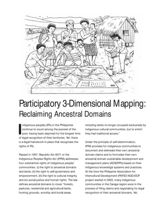
  • 1. Participatory 3-Dimensional Mapping: Reclaiming Ancestral Domains I ndigenous peoples (IPs) in the Philippines continue to count among the poorest of the poor, having been deprived for the longest time of legal recognition of their territories. Yet, there is a legal framework in place that recognizes the rights of IPs. Passed in 1997, Republic Act 8371 or the Indigenous Peoples Rights Act (IPRA) addresses four substantive rights of indigenous people/ communities: (i) the right to ancestral domains and lands, (ii) the right to self-governance and empowerment, (iii) the right to cultural integrity, and (iv) social justice and human rights. The law defines ancestral domains to cover “forests, pastures, residential and agricultural lands, hunting grounds, worship and burial areas, including lands no longer occupied exclusively by indigenous cultural communities, but to which they had traditional access.” Under the principle of self-determination, IPRA provides for indigenous communities to document and delineate their own ancestral domain claims and to formulate their own ancestral domain sustainable development and management plans (ADSDPPs) based on their indigenous knowledge systems and practices. At the time the Philippine Association for Intercultural Development (PAFID) NGO-ECP project started in 2003, many indigenous communities in the Caraga region were in the process of filing claims and negotiating for legal recognition of their ancestral domains. Yet,
  • 2. Moving Up Innovations to Scale84 use of global positioning system/geographic information system (GPS/GIS) technology. A 3-D map is a physical model of a place. It uses an appropriate scale that shows the rivers, mountains, and valleys, as well as the location of residential and cultivated areas, and the resources from which communities derive their livelihoods. It also records indigenous knowledge, beliefs, and practices—i.e., the sacred areas, burial sites, and all those features that have social, cultural, and spiritual significance to the local people are shown. The mapping process heavily banks on the the boundaries of their domains had not been properly identified and mapped, causing extreme frustration within the communities whose claims were often questioned as to their legitimacy. Moreover, in the absence of perimeter maps and community plans, adverse claimants (including mining, logging, and plantation companies) continued to encroach into IPs’ lands. The innovation: marrying traditional knowledge and technical processes The use of participatory three-dimensional mapping (P3DM) as a tool for community development was pioneered in Thailand in the late 80s and was used extensively by the Royal Forestry Department. It was introduced in the Philippines in 1993 by the Environmental Science for Social Change in their work with the Indigenous Alangan Mangyan in the island of Mindoro. In 1995, PAFID adopted the methodology and customized its use to respond to issues related to IPs’ land rights and to facilitate ancestral domain management planning (ADMP). With P3DM, local communities construct a relief model of their ancestral domain by combining collective and specific local knowledge and the The Philippine Association for Intercultural Development, Inc. (PAFID) is a social development organization that, for 47 years, has assisted indigenous communities in regaining their ancestral domains. PAFID’s project with IFAD, Mapping Ancestral Domains in Northern Mindanao, was implemented for 3 years (2003 – 2006). Its overall goal was to bring about full recognition of the rights of indigenous communities over their ancestral domains. The project provided support to the indigenous peoples’ communities that had initiated negotiations with the government for the legal recognition of their ancestral domains in the Caraga region of northern Mindanao. The project focused on achieving its aims using (i) participatory community mapping, (ii) ancestral domain management planning, and (iii) capacity- building. MappingAncestral Domainsin NorthernMindanao, Philippines Mapping by “experts” Community mapping P Very expensive and laborious; P Expert-driven; P Leaves little room for participation; P Technically accurate, but usually omits critical data; P Access to and control of information are removed from the community. P Cost-effective; P Community-driven; P High community participation; P Acceptable & within the technical standards of state mapping while ensuring community perspective; P Guarantees access to critical data & information. Table 1. Conventional vs community mapping.
  • 3. Participatory 3-Dimensional Mapping: Reclaiming Ancestral Domains 85 claims. People recall and write the names of mountains, rivers, sacred areas, and old villages in their indigenous language and provide historical accounts of these. They identify important landmarks such as burial caves, community boundaries, communal forests, and others. These sketch maps provide the basis for preparing enlarged topographic and base maps that would be used to construct 3-D relief models of their domains. participation of indigenous communities in delineating their own domains based on physical and cultural markers. This establishes the basis for their filing of ancestral domain claims. Furthermore, because the P3-D map is constructed from the combination of local knowledge and state-of-the-art mapping technologies, it contains accurate and easily understandable spatial information such as area, location, distance and land uses, thus providing critical technical inputs for the local community in formulating its ancestral domain management plans. The process: empowering communities for claim making and domain planning The process of P3DM and domain planning involves several related activities: 1. Discussion of IP community situations Forums and community meetings are first organized to discuss the general situation of IPs and the salient features of the IPRA law—e.g., socioeconomic and tenurial rights of IP communities; community rights and obligations to protect, utilize, and develop their ancestral domains. Some larger forums may be attended by both tribal leaders and local government officials and may convene up to 300 people. 2. Community orientation and capacity building for mapping activities In community workshops, PAFID technical staff facilitate sketch-mapping activities to enable communities to identify and determine the coverage of their ancestral domain Discussion of IP community situations Community orientation and capacity building for mapping activities Documentation of historical evidence for making land claims On-ground survey of the IP territory Production of ancestral domain maps Visioning and community planning Distribution of ADMP to support groups Filing of land claim Actual 3-D mapping
  • 4. Moving Up Innovations to Scale86 Experience has shown the many difficulties usually encountered during field research. Official statistics regarding tribal communities are neither available nor credible. Often, key informants such as the elders are not available or may have relocated elsewhere. Local customs may require baylans or spiritual masters to conduct certain rituals before they are able to mention names of persons and sacred places or to divulge indigenous systems and practices. Some communities face internal difficulties because of boundary disputes or leadership conflicts. Moreover, in areas such as eastern Mindanao, there are peace and order problems due to the presence of rebel groups and military operations in indigenous community areas. 4. Community on-ground survey of the territory Assisted by a PAFID technical team, GPS- trained members of the community conduct an on-ground perimeter survey to delineate the ancestral domain. They take a perimeter- walk to mark off the natural boundary lines and cultural markers of the domain. They also take point positions of important geographical features inside the domain. These include the location of barangays, sitios, schools, health centers, markets, bridges, concrete and rough roads, and rivers and streams. In preparation for the conduct of on-ground perimeter surveys, the PAFID technical staff also conduct a series of community trainings on the use of GPS instruments and other survey equipment. Resource persons often include tribal leaders from other communities who have been previously trained on GPS and have already done perimeter surveys of their own ancestral domains. Capacity building is also ingrained in actual 3-D mapping and community planning. 3. Documentation of historical evidence for making land claims Throughout the mapping process, the PAFID staff work closely with the community in gathering evidence to support their ancestral domain claims. These include extensive gathering of documentary and physical evidence, recording of historical and oral accounts, writing affidavits and testimonies of elders, and genealogical profiling. These are compiled into “claim-books,” the set of documents submitted to the National Commission on Indigenous Peoples (NCIP) containing the mandatory requirements needed for IPs to support their claims to their land.
  • 5. Participatory 3-Dimensional Mapping: Reclaiming Ancestral Domains 87 All the data gathered are overlaid on a topographic map. This is then used as the base map for determining the extent of the domain. 5. Actual 3-D mapping Using the base map, community members then construct a relief or 3-D map model at the appropriate scale. The youth, women, elders, and leaders are actively engaged in the construction, identification of landmarks, and recollection of historical accounts of old villages, sacred mountains, and rivers. Sketch maps that were previously drawn at the start of the process are used as additional reference for spatial information. Physical materials used for the actual construction of the 3-D map may vary—from resin to rolls of rubber sheets. The physical work involves preparing the base frame; numbering contour lines on the base map; tracing, cutting, and layering rubber sheets; and coating the model with epoxy and painting it white. Once dried, the community then traces and locates geographical markers and land uses on the map (including sacred sites, forests, indigenous settlements, transient settlers, mountains and rivers, traditional farms, etc.). Through this process, the 3-D map is able to combine accurate spatial information with community-relevant data. Once finished, it is treated as an accomplishment by the whole local community. The 3-D map serves as a user-friendly technical tool in the effort of indigenous communities to identify the exact extent of their domains and to help resolve boundary disputes and other long-standing land problems. Communities also use these maps to dialogue with government and corporations and discuss issues related to the entry or continued operation of mining, logging, and plantation companies within their domains. 6. Production of ancestral domain maps Other maps are then produced through data generated from the 3-D map to represent the various land uses and other technical information on hydrology, slope incidence, and tenurial patterns or to show settlement areas and road networks. Hazard and risk maps, particularly those showing flood- and landslide-prone areas, may also be produced as part of the map series that will be used during the formulation of the ADMP. 7. Visioning and community planning The participatory way in which mapping activities are conducted enables the people to see, understand, and better appreciate the land-use situation in their domain. This sets the stage for the community to formulate its domain management plans and priorities, as well as community rules and regulations, based on indigenous resource management systems and practices. The 3-D map serves as the community’s guide in formulating its own ADMP. 8. Distribution of ADMP to support groups The community may choose to provide a copy of the ADMP to NCIP and LGUs for adoption and integration into municipal development plans and comprehensive land use plans. The community may also opt to look for other sources of funds to implement their ADMP. 9. Filing of land claims PAFID assists the community in packaging the documents and maps into a claim folder. The community then submits this claim folder together with their official letter to NCIP in their application for ancestral domain claims.
  • 6. Moving Up Innovations to Scale88 Implementation of the project The PAFID project (NGO/ECP 214) was funded by IFAD and co-financed by MISEREOR-Germany. Spanning a period of 3 years (2003-2006), it involved nine IP communities from the Manobo and Mamanwa tribes in all four provinces of the Caraga region—Agusan del Sur, Agusan del Norte, Surigao del Sur, and Surigao del Norte. The nine IP communities covered an estimated 12,000 individuals from about 1,600 families. With PAFID’s assistance, seven 3-D models, including one for the municipality of Jabonga, Agusan del Norte and two 2-D maps were completed. Perimeter maps of all nine IP communities, along with thematic maps, were produced. Two of the nine communities completed their ADSDPPS during the project period. Two other communities completed their CADT claim books and had their ancestral domain titles approved and awarded by NCIP, covering 13,657 hectares in five municipalities. More than a hundred members of partner IP communities learned basic skills on participatory community mapping, use of GPS instruments in surveys, and 3-D modeling. Hundreds more acquired basic knowledge about their rights under the IPRA. Lessons learned Participatory mapping with the use of 3-D relief models has shown enormous potential for assisting indigenous communities in their struggle for land rights and self-governance. The maps make information tangible and visual for all. The participatory process of constructing the 3-D models helps the local people to identify the extent of their domains, the conflict areas, the land utilization and resource-use patterns, as well as the overall situation of the community. The spatial and cultural data that are generated become critical inputs for the community in defining future land use, with emphasis on their priorities for development and conservation. All of these create a clearer understanding that supports decision making and consensus building. The participatory manner in which the 3-D map is constructed enables all community members —youth, women, elders, and leaders—to share information about their domain. Naming the places in the people’s own language gives the community a sense of ownership and accomplishment. In the conduct of perimeter surveys of ancestral domains, the model can be used to guide the technical staff of support groups in the formulation of a realistic or smart survey plan. Locations of corners or markers can be initially identified in the 3-D model and all the survey team has to do is to locate these and take GPS positions. Interactive mapping can take on different forms—from crude hand-drawn sketches to state-of-the-art mapping technology such as GPS and computer software such as GIS. Resource management and development planning activities will also be much more comprehensive and facilitative with the thematic data generated through the relief maps. Land- use maps showing primary and secondary forest areas, cogonal and idle lands, agricultural zones, and sacred grounds are crucial in the formulation of the ADMP. That these are clearly understood by the people makes any planning activity more productive. It is important that support to IP communities must respect and appreciate the community’s
  • 7. Participatory 3-Dimensional Mapping: Reclaiming Ancestral Domains 89 own development plans, however crudely they may be written. Often, due to pressing project targets and time frames, the importance of integration and rapport building as a crucial element in community-based projects is deliberately overlooked. Oftentimes, the end result is a top-down approach where projects are identified and prioritized by outsiders and time frames are dictated, in complete disregard of the community’s traditional processes and calendar of activities. While IPs should have an active part in resource use planning, this should occur within the framework of their having secure access and jurisdiction over their traditional territories. Scaling up and moving forward PAFID’s P3DM process has been scaled up many times and in different ways. P3DM has been replicated in many indigenous communities throughout the Philippines. From 1995 to 2014, an estimated 790,000 hectares covering more than 100 ancestral domain claims in the country have been mapped using it. Data were culled out from the PAFID database. The P3DM process has also been introduced to other countries through its partnership with international organizations such as IFAD. These areas include Tura and Sasatgre, Meghalaya, India (2003); the Godavari Watershed, Pulchoki, Nepal (2003); Song Da, Vietnam (1999); and the Upper Nan Watershed, Nan Province, Thailand (1997- 2003). P3DM has also been adopted for other purposes. Several barangay and municipal LGUs in Mindanao had also requested for PAFID In May 2003, IFAD engaged the services of PAFID thru the North Eastern Region Community Resource Management Project (NERCORMP) to conduct a training on Participatory Community Mapping and Land Use Planning through 3-D-modeling for project staff and Sasatgre villagers to address livelihood concerns without overexploitation of the natural resources. As a result of the training, project staff and Sasatgre villagers acquired technologies and skills necessary for P3DM and land use planning. An output of the training provided by PAFID was the 3-D map of the Akhing Land of the Sasatgre. The 3-D map has brought to these communities “a deeper understanding and appreciation of their village geography and natural resources, improved village communication and planning capacity, and improved land use management, particularly with respect to selection of areas for shifting cultivation.” (Bajracharya et al. 2008) NERCORMP further replicated the P3DM approach resulting in a total of 24 3-D maps in its sites of operation in India. AdoptionoftheP3DMProcessinIndia ThroughNERCORMP-IFAD assistance in building P3DM to enhance their land-use planning processes. This includes barangay LGUs of Pinalpalan and Datu Danwata of Malita, Davao del Sur (through the Upland Development Program) and the Watershed Management Council of Davao City (through its partnership with Interface Development Interventions, Inc. and Foundation for the Philippine Environment). Other NGOs such as the EcoWEB, has also adopted the P3DM process in CADT applications and community resource management planning. The ADMP as well as the data/information generated from 3-D maps have also been adopted by the Protected Area Management Board of Mt. Kalatungan Range Natural Park in Bukidnon and some LGUs, specifically those in Jabonga and Kitcharao, Agusan del Norte.
  • 8. Moving Up Innovations to Scale90 Moreover, P3DM in some IP communities have also expanded their use from claim making and ADMP to resolving conflicts as was the case in Tubo and Boliney, Abra; coalition building among Higa-unons in Impasug-ong, Bukidnon; and tapping payment to environmental services (PES) to support the community development plan of the Talaandig-Kalatunganon tribe in Talakag, Bukidnon. In the Subanen communities in Bayog and Kumalarang, Zamboanga del Sur, community participation in the whole process has gone a step further by enabling them to generate their own thematic maps with GIS technology, which was previously delegated to the PAFID GIS specialist only due to its high level of technicality. Vision and potential scope As of December 2012, NCIP reported that 158 CADTs had been issued nationwide, covering about 4.2 million hectares and benefiting 918,000 rights claim holders. It is projected that more than 2 million hectares still need to be processed; hence, a total of 6 to 7 million hectares is expected to be eventually covered under ancestral domain titles and claims (NCIP database). Participatory mapping and 3-D modeling is an appropriate and proven methodology for the purpose of self-delineation of ancestral domains. The 3-D model also provides a good tool for negotiation and conflict resolution between tribes because it provides a complete view of boundaries, traditional territories, and tenurial arrangements. However, beyond its purpose to achieving legal recognition of ancestral domain rights through a CADT, it can also be used for land use planning, conservation planning, natural resource management, and boundary and conflict resolutions. This enables the IP communities to penetrate into decision-making processes relevant to their ancestral domain in the local, national, and international levels. Drivers and champions The champions of this upscaling are IP communities that had already undergone the process. In another sense, they could also be drivers, just like the IP communities that have not yet delineated their territories and have not yet formulated their ancestral domain plans due to encroachment into IP lands by mining and logging companies and other destructive projects. This forces IP communities to actively defend their people and ancestral domain. Environment groups can also act as drivers for the shared goal of conserving nature, biodiversity, and cultural landscapes. Areas that had experienced devastating calamities (such as Cagayan de Oro City) have now become drivers for scaling up of P3DM in search of means to manage and reduce disaster risks. Spaces and opportunities In many applications for CADT, IP communities encounter bottlenecks due to the following: D tedious and bureaucratic requirements for the processing of claims (institutional/ capacity space); D limited financial and technical resources of both the government agency and the CADT applicant (fiscal/financial space); and D overlapping, sometimes contradicting, laws and policies relevant to land and resource use, management, and ownership (policy space).
  • 9. Participatory 3-Dimensional Mapping: Reclaiming Ancestral Domains 91 Nevertheless, the products of P3DM are useful for community conservation and natural resource management planning, which are also key components of the ICCA approach. Although the value of IPs in resource governance (sustainable use, protection, and conservation) is still not fully recognized by the Philippine government, there is increasing recognition of indigenous and community conserved areas (ICCAs) at the international level. (ICCAs are defined by the International Union for the Conservation of Nature (IUCN) as natural and/ or modified ecosystems containing significant biodiversity values, ecological services and cultural values, voluntarily conserved by IPs and local communities, both sedentary and mobile, through customary laws or other effective means.) This is based on a finding that a considerable part of the earth’s biodiversity survives on territories under the stewardship, control, or management of IPs. Philippine maps produced by PAFID shows a high degree of overlap between forest areas, biodiversity hot spots, and ancestral domains of IPs. The Convention on Biodiversity, World Parks Congress, and the IUCN have recognized ICCAs as effective means of nature and biodiversity conservation. PAFID’s 3-D model approach can be potentially used to facilitate local community conservation planning processes and to identify boundaries and extents of ICCAs. It could also provide immediate protection at the international level through registration into the United Nations Environment Programme World Conservation Monitoring Center (UNEP-WCMC), ICCA Registry, and the World Database of Protected Areas. Pathways to greater scale Policy support. As of today, an ICCA bill has been drafted and strategies for its passing into law is being developed through the combined efforts of DENR-BMB, PAFID, UP-NCPAG, Bukluran ng mga Katutubo na Nangangalaga ng Kalikasan sa Pilipinas or the Philippine ICCA Consortium, and other NGOs. In essence, the draft bill calls for national and legal recognition of and appropriate support to sustain ICCA communities in the Philippines. Building and linking communities of practice. Participatory 3-D modeling is not just a method but an empowerment tool developed through years of practice in support of tenure rights for IPs. It requires skilled community facilitation by practitioners driven with a sense of mission. A key pathway to scaling up is to build “communities of practice” and links among IP communities and their supporters. Bibliography Bajracharya, Siddhartha B., and Ngamindra Dahal, eds. 2008. Shifting paradigms in protected area management. National Trust for Nature Conservation. 98 p. Choudhury, D. 2011. Making a difference in Asia and the Pacific: India’s innovations and best practices. Issue 1. March 2011. International Union for the Conservation of Nature (IUCN). 2014. Indigenous and community conserved areas: a bold new frontier for conservation. http://iucn.org/about/union/commissions/ceesp/ topics/governance/icca/
  • 10. Moving Up Innovations to Scale92 New Conservation Areas in the Philippines Project (NewCAPP). 2014. Payment for ecosystem services: frequently asked questions. http:// newcapp.files.wordpress.com/2013/11/pes- kalatungan4.pdf. September 2014. Philippine Association for Intercultural Development (PAFID). 2006. Mapping the ancestral domains of the Indigenous Peoples in Mindanao. Project completion report submitted to IFAD. Philippine Association for Intercultural Development (PAFID). 2002. NGO-ECP status domains of the indigenous peoples in northern Mindanao: NGO- ECP grant proposal. December 2001. Rambaldi, G. 2010. Participatory 3D-modeling: Guiding principles and applications. ACP-EU Technical Centre for Agricultural and Rural Cooperation. 21 p. Sibona. 2005. Second supervision mission to the NGO/ ECP. Grant no.214/PAFID. Mapping the ancestral domains of the indigenous peoples in northern Mindanao. Authors Glaiza Tabanao (gltabanao@gmail.com) and Dave De Vera, (devera.dave@gmail.com), PAFID; and Tony Quizon (tonyquizon@yahoo.com) Acknowledgments The authors thank the following for their inputs: PAFID staff and volunteers, and the Mamanwa and Manobo peoples in Caraga.