
Recommended
More Related Content
What's hot
What's hot (20)
Viewers also liked
Viewers also liked (20)
Similar to Single Family House
Similar to Single Family House (20)
Single Family House
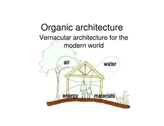
- 1. Organic architecture Vernacular architecture for the modern world
- 2. Vernacular architecture of the Picts “Vernacular architecture is a term used to categorise methods of construction which use locally available resources and traditions to address local needs. Vernacular architecture tends to evolve over time to reflect the environmental, cultural and historical context in which it exists. It has often been dismissed as crude and unrefined, but also has proponents who highlight its importance in current design.” - Wikipedia Who are the Picts? The Caledonians or Caledonian Confederacy, is a name given by historians to a group of the Indigenous peoples of Scotland during the Iron Age that the Romans initially included as Britons, but later distinguished as the Picts.
- 3. Where did they live? The indigenous Picts lived to the north of the Forth and Clyde rivers, in what was later to become eastern and northern Scotland Pictland, also known as Pictavia, was gradually absorbed by the Gaelic kingdom of Dal Riata to form the Kingdom of Alba. By the 11th century the Picts lost their independent identity.
- 4. How did they live? Buildings surviving from the Pictish period include brochs (round stone towers), souterrains (possibly underground storage passages once attached to surface dwellings), hillforts, crannogs and houses of several different kinds. The dwellings had to be made of stone because at the time there weren’t many trees around. These days the Eastern Highlands are one of the most important forested areas in the UK. The majority of planting has taken place since the 1920’s, primarily fast growing conifers. A Broch was designed to impress and defend. Because they are perched on hills and headlands, the brochs seem to have been built by resident lords to protect their settlements from sea-borne raiders. Brochs are built with two concentric walls of stone, with a stairway or gallery within the walls to the upper floors. There’s only a few remaining souterrains (often referred to as Picts' Hooses) in which the roof sections - the large slabs of stone forming the roof - remain intact. Such passageways are believed to have been used as food stores (traces of grain have been found at some sites). Other suggestions have included some sort of ceremonial use, and that they were used as hideouts. Broch Souterrain Located on a position which provides commanding views over all the surrounding countryside it is easy to see why the hillforts became such important strategic sites. Here in the wooded heartland of Scotland, the prehistoric crannogs were originally timber-built roundhouses supported on piles driven into the lochbed. Hillfort Crannog
- 5. The Picts at home Brochs usually had a single entrance, aligned according to cosmological principles. The majority were oriented towards the east for equinoctial sunrise or the south-east for midwinter sunrise. Their homes would have always had a fire as a centre welcoming point. It was mainly used as a source of heat for the entire house but also doubled as a stove. A clay vase built into the middle of the floor would have served as a fire and would have stopped accidents and ashes being spread about. The fire would have been kept burning 24 hours a day. To be caught without a fire would have been a social disgrace. Meat and fish were hung up in the roof of the house where it would preserve and gain flavour amongst the warmth and smoke.
- 6. What is the area like? Flat or steep The Scottish Highlands • Predominately mountainous • It is the most rugged region on the island of Great Britain • Contains some of the island’s highest peaks
- 7. What is the area like? Soil types
- 8. What is the area like? History of Geology
- 9. What is the area like? Land and sub-surface geology Atlantic Highland plate collided with the Scandinavian Shield to form the Scottish Highlands running from the North-East to the South-West
- 10. What is the area like? Rural or urban Rural – Countryside some small villages The most sparsely inhabited section of Scotland - in some areas density is as low as 8 people per sq km (21 per sq mi)
- 11. What is the area like? Surface water North Sea & the North Atlantic Ocean are the largest bodies of water that border the North of Scotland Scotland has an abundance of rivers, streams and lakes
- 12. What is the area like? Sun cycles - orientation Scotland lies between latitudes of 55 degres and 61 degrees North, and while the summer days are long, the sun is never high in the sky. In winter the sun rises only a little way above the horizon and sinks again within a few hours. This low sun angle, which causes the rays of light to pass through a considerable thickness of the atmosphere, is responsible for many of the optical effects and colours of the sky and clouds which artists and visitors find so attractive.
- 13. What is the area like? Sun cycles – Overhang design Inverness, Admin HQ Highland Council: Latitude: 57°28' 0 N, Longitude: 4°13' 60 W March Equinox (3/21): Altitude: 32degree above horizon Azimuth: 7 degrees east of south June Solstice (6/21): Altitude: 53 degree above horizon Azimuth: 31 degrees east of south September Equinox (9/21): Altitude: 31 degree above horizon Azimuth: 21 degrees east of south December Solstice (12/21): Altitude: 9 degree above horizon Azimuth: 3 degrees east of south
- 14. What is the area like? Orientation of site-access & views The Highlands are noted for their unspoilt, wild beauty and scenic grandeur. Precipitous cliffs, moor land plateaux, mountain lakes, sea lochs, swift-flowing streams, and dense thickets are common to the Highlands
- 15. What is the area like? Wind patterns Each wind brings its own characteristic weather, according to the season. The Atlantic Ocean is always relatively warm, so moist westerly winds bring most of Scotland's rain, which falls principally on the western margins of the country. The north winds of summer cross a chilly Arctic Ocean and bring noticeably colder weather, often with light rain or showers. In winter, when parts of the northern seas are frozen, the air can be extremely cold and dry, giving remarkable visibility. Winds from the east and south, having travelled over land, can be warm and dry in summer, cold and dry in winter, although winds passing over the North Sea can pickup enough moisture to drop considerable amounts of rain or snow on Scotland's eastern counties.
- 16. What is the area like? Climate analysis The most of the sunshine is for Ayrshire, Lothians, Angus and Fife, the least for the mountains in the Highland region. The average sunshine hours are at their maximum in May and June and the least in December and January. Because of the high latitude the winterdays are very short but are compensated with long summerdays with only 5 hours of “almost darkness”. Rainfall is another key element of Scottish weather although it is not as bad as sometimes told. Some areas receive about 3,000 mm per year (the western Highlands) and other areas only 800 mm per year (the east coast). Measurable rainfall occurs on over 250 days in the Highlands to 175 days per year in other parts. Rainfall Sunshine
- 17. What is the area like? Impact and use of vegetation The most common species of trees indigenous to Scotland are rowan, oak and especially conifers – chiefly fir, pine and larch. Except in the wooded areas, vegetation in the upland regions consists largely of heather, ferns, mosses, and grasses. Saxifrage, mountain willow, and other types of alpine and arctic flora occur on elevations above 600m (2000 feet).
- 18. The Design ‘Vernacular traditions experimented with, consolidated and refined over centuries, are among the most valuable and reliable sources of information on the techniques appropriate to the soils of an area, and a guide to the structural and climatic benefits of the systems employed’ - J. Norton, 1997 The aim of this project is to learn and utilise what we can from the indigenous architecture of the north-eastern Highlands and use it in a modern context with modern means of energy sourcing and preservation
- 19. Layout Rainwater catchment and Treatment system Roof extent WC Utility Room Bed 1 Master Kitchen Bed Sun Room Dining Earth cover Living Terrace Raised terrace to keep structure away from standing water
- 20. Construction Cavity wall construction: 1. Waterproof membrane around construction parts covered with earth (back of the building) 2. Exterior wall: ‘Clay and bool’ similar to mud wall, often created by shuttering, where evenly sized ‘bools’ (rocks) were placed against the shuttering faces, and the spaces between filled with a relatively fine aggregate earth mix. 3. Waterproof insulation 4. Earthbricks 5. Interior finish – Earthplaster The walls will be raised on a waterproof plinth out of reach from ground water, standing water and splashing A far overhanging roof will provide protection from rain as well as solar shading from the summer sun Additives and stabilizers are also used to improve wearing qualities Earth brick Waterproof membrane Insulation Earth plaster Clay & Bool
- 21. Benefits of Earth construction • It can facilitate good indoor air quality by regulating relative humidity • Dense forms of earth construction are load-bearing and have high thermal mass • Excellent sustainable characteristics: Low carbon emissions Efficient use of finite resources Minimizing pollution Minimizing waste Use of benign materials Local sourcing • Can be produced in situ – no transporting • Can be self-built • Very durable • Good fire resistance Simplified graph showing Earth Material’s Properties Local industry ‘Mudmason’ used to be an occupation and a thriving industry in Scotland. Much of the existing manufacturing infrastructure can be re-adapted to allow for earth products to be produced parallel to conventional products. This could create jobs in local communities and product availability will encourage use, reduce costs and ease the environmental impact of buildings in Scotland
- 22. Electricity Grid supplied electricity Personal windmills are available in various heights (determined by the site’s characteristics). These slim yet high- performance wind generator can produce 400 kilowatt hours of energy per month, up to 90% of an average household’s energy consumption. Most of them work efficiently with local utility grids switching back to grid power when wind speeds drop below 8 miles per hour. Scotland’s many fast flowing rivers and its lochs are an important energy resource and a considerable amount of the country’s electricity is generated by hydroelectric power facilities. Northern Scotland contains most of the UK’s largest hydroelectric generating stations. There is also increasing use being made of wind farms, with a number being opened in 2000-2001
- 23. Water Rainwater harvesting and recycling Surface water can easily be utilized in this design to reduce the domestic water consumption expenses. Being earth-sheltered, the water tank is protected from extremely low or high temperatures. The earth falls around the tank are profiled in such a way as to funnel the rainwater into the tank
- 24. Heat Summer sun Passive solar Winter sun Geothermal Heating system to heat water which is used for the radiant flooring system Earthfloor throughout the house
- 25. Water & Heat
- 26. Lighting Sun tubes will help provide light in the back rooms where the earth shelter does not permit for windows - these sun tubes intensify the light as they reflect it back into the space and therefore remain efficient even on overcast days Large southfacing windows allow for direct sunlight during the day Electric lighting for evenings and winter time when there is limited sun light
- 27. Features Sun trap to help maintain indoor temperature – Because this sunspace temperature is higher than the surrounding outside air, the sunspace acts as a thermal buffer zone, reducing the amount of heat lost from the living space at night and during prolonged overcast periods. The earthshelter and living roof provide external thermal mass, reduce heat loss, and help to easily maintain a steady indoor air temperature; as well as softening the structure’s visible impact on the landscape
- 28. Images 06/21 12:00 12/21 12:00 12/21 16:40
- 29. The End