Jaipur's Historic Pink City Grid Layout
•Download as PPTX, PDF•
4 likes•3,381 views

Jaipur was founded in 1727 by Maharaja Sawai Jai Singh II as the new capital of Amber due to safety concerns with Amber's location and increasing population. Jaipur was planned with a grid-like layout on flat land south of Amber to allow for expansion. The city was designed for defense, with natural barriers of hills to the north and east. Water supply was ensured through dams and channels. Over time, the city expanded beyond its original walled boundaries under later rulers in the 18th-19th centuries, adopting modern infrastructure like railways. Jaipur became an important religious and commercial center.

Recommended
More Related Content
What's hot
What's hot (20)
Viewers also liked
Similar to Jaipur's Historic Pink City Grid Layout
Similar to Jaipur's Historic Pink City Grid Layout (20)
More from Hamzah Meraj, Faculty of Architecture, Jamia Millia Islamia, New delhi
More from Hamzah Meraj, Faculty of Architecture, Jamia Millia Islamia, New delhi (20)
Recently uploaded
Recently uploaded (20)
Jaipur's Historic Pink City Grid Layout
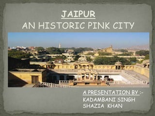
- 1. JAIPUR AN HISTORIC PINK CITY A PRESENTATION BY :KADAMBANI SINGH SHAZIA KHAN
- 2. INTRODUCTION Jaipur is one of the most important cities in India from the point of tourism. Situated in Rajasthan the city was founded by Maharaja Sawai Jai Singh II on 18 November 1727. Jaipur is a land of natural beauty and great history. It has a flourishing tourism industry. Also called pink City, it is the capital of Rajasthan. It is well connected to the other parts of the world, through its vast network of airways, railways and roads.
- 3. HISTORY •Jaipur was founded on 18th November 1727 by Maharaja Sawai Jai Singh II, a Kachawaha Rajput, who ruled from 1699-1744. Initially his capital was Amber (now pronounced as Amer), lies at a distance of 11 km from Jaipur. Maharaja Sawai Jai Singh II felt the need of shifting his capital city because of safety reasons as it was likely to be attacked by a Mughal King Bahadur Shah after the death of Aurangzeb, as well as ever-increasing population and growing scarcity of water also pushed him to set up a well planned city.
- 4. Jaipur lies at a distance of about 200 miles from Delhi, 150 miles from Agra and 84 miles from Ajmer. Capital city of Rajasthan is located amidst the Aravali hill ranges at an altitude of about 430 m above sea level. •Latitude – 26 55’ •Longitude – 75 50’ Reasons for Maharaja Sawai Jai Singh to change his capital from Amber to Jaipur: Military Reasons Defence was an important consideration. A site at the South of Amber ensured greater distance from Delhi and also prevented the expansion of the city in that direction. It was clear that the out skirting hill ranges (Nahargarh hills) shaped as a horseshoe would allow the new city to expand only in the South. So this flat site with a basin like shape was chosen. It was an open plain bounded on the north-west and east by hills. Earlier rajput capitals were established in the hills, and so moving capital to the plains was an ex of Sawan Jai Singh's boldness. SITE
- 5. Geographical Reasons The rocky terrain of Amber restricted expansion. Jaipur had the potentialities of developing into a city with adequate drinking water due to the presence of a perennial stream nearby and good drainage system. Its rugged hills also ensured a constant supply of building material, which might be required in the times to come Two significant facts responsible for the origin of the city and its subsequent layout: The need of a new capital for 18th century Dhoondhar as the earlier one of Amber built on a hill was getting congested. Sawai Raja Jai Singh’s vision of the new capital as a strong political statement at par with Mughal cities and as a thriving trade and commerce hub for the region. The site with the natural east west ridge and the surrounding forts as defense feature The site with the natural east west ridge and the surrounding forts as defense
- 6. The site selected for establishing the new capital of Jaipur was a valley located south of Amber and the plains beyond, a terrain that was the bed of a dried lake. There used to be dense forest cover to the north and the east of the city. The physical constraints that informed the building of Jaipur city included the hills on the north that housed the fort of Jaigarh and the Amber palace beyond, and the hills on the east, which contained the sacred spot of Galtaji. To facilitate water supply to the new city, the Darbhavati river in the north was dammed to create the Jai Sagar and Man Sagar (that later housed the Jal Mahal) lakes. Later the Jhotwara River in the north west was diverted through the Amani Shah Nallah and a number of canals were channelised through Brahmapuri and Jai Niwas to supply water to the city.
- 7. CITY AND ITS EVOLUTION Interpretation of the 18th century map from Kapad-dwara collection, Jaipur, with the gridiron pattern evident in the layout Interpretation of the 18th century map from Kapaddwara collection, Jaipur, with the gridiron pattern evident in the layout • The foundation of the city of Jaipur was established by Sawai Jai Singh II (1700-1743) in 1727. The city was designed by Sawai Jai Singh II himself and further developed and monitored by hisrenowned counsellorVidyadhar. • The city planned in the gridiron pattern was built with extraordinary foresight and futuristic planning and is probably the only 18th century walled city in India that can still cater to the present day pressures of vehicular traffic on roads. • It included innovative concepts in traditional planning guidelines along with an appropriate adaptation of the terrain itself. The direct application of the mandala in the plan of Jaipur seems improbable, though parallels can be found between the Jaipur planning principles and traditional texts on spatial organization such as Rajvallabha, the regional 15th century text written by the sutradhar Mandan. • Two significant facts responsible for the origin of the city and its subsequent layout were: a) The need of a new capital for 18th century Dhoondhar as the earlier one of Amber built on a hill was getting congested;
- 8. Amber Town with the Fort on top of the hill and the walled town down the slopes • The medieval towns of Rajasthan were of military, agrarian, mercantile or religious nature. The presence of a deity marked the reference point for the ruler’s abode and the rest of the city. The name of the town was usually associated with the political or religious centre (with the Ambikeshwar temple in the case of Amber and with Sawai Jai Singh in the case of Jaipur). • Unlike Dausa and Amber, the two previous capital cities of the Dhoondhar region established on hill-top, whose planning was guided by topographical structure of the areas, Jaipur city was revolutionary both in terms of its grid-iron pattern planning and its location at the base of the hills. • There was also a significant economic shift from an agricultural base in Dausa and Amber to trading in the capital of Jaipur.
- 9. I9th and 20th century additions Later in the 18th and 19th centuries, there were additions in the built fabric of the city and the palace such as the Hawa Mahal and a number of temples added by Sawai Pratap Singh under whom the Jaipur architectural vocabulary reached its peak in terms of stylization. • Two major contributors to the city development and establishment of modern infrastructure were Sawai Ram Singh II (1835 – 1879) and Sawai Man Singh II (1922 – 1969). • In the 19th century, with the accession of Sawai Ram Singh II, the city extended beyond the old city walls, adapted newer modes of transport such as the railways with a railway station located on the western outskirts, started using gaslights on the streets and adopted modernized drainage and piped water supply system. • There were interesting additions in the urban fabric within the walled city with new buildings constructed in the Indo Saracenic vocabulary such as the Mubarak Mahal within the Palace Complex, the Naya Mahal or Vidhan Sabha and the Maharaja’s College in 1873 (now Rajasthan School of Arts); and the Ramniwas Bagh that was later enhanced with the visual focus of the monumental Albert Hall Museum to the south of the walled city. • The 20th century observed further modernization and urban renovations within the walled city, including the restoration work of the city walls and gates and, converting the inner temporary houses in the sectors into more permanent structures; pioneered by the famous Mirza Ismail who was appointed as the Prime Minister of Jaipur in the early 20th century. A number of new colonies such as the Bani Park came outside the walled city. • In 1947, the four largest Rajput
- 10. Jaipur and Amber, the earlier of capital of Dhoondhar capital are renowned for their numerous historic temples. While Amber has excellent stone carved temples with shikharas (spires) built from 11th century onwards, Jaipur became the precursor in building haveli temples of the 18th century. The Jain and Hindu temples form a significant part of the built fabric. • The planning of Jaipur is rooted in the centric Indian philosophy with the temple of Govind Dev defining the centre that led to the genesis of the city plan. The Govind Dev Temple, established in a pavilion called Suraj Mahal, standing in between the Badal Mahal and Chandra Mahal in the Jai Niwas Garden, continues to be the most active temple even today. • Although there is no definite data, locals state that around 400 temples were built in Jaipur during its planning. There are more than 1000 temples of various sizes in Jaipur with 606 within the walled city as registered temples with the Devasthan department in 1973. All the important temple sites, specifically on the main commercial streets had been marked in the Jaipur plan during the reign of Sawai Jai Singh. • Even today, the important temples with shikharas can be observed at four most important locations in the city along the cardinal axes i.e. the Laxmi Narayan Temple at Badi Chaupar, the Rama temple at Chhoti Chaupar, the Murli Manohar temple at Ramganj Chaupar and the Kalka temple opposite to the main Sireh Deodhi entrance to the Palace. It is interesting that in all these temples the idol is facing towards Govind Dev, the main deity of Jaipur.
- 11. Amber Town with the Fort on top of the hill and the walled town down the slopes PLANNING OF THE CITY The generic plan of a medieval Rajasthani hill town- as in Dausa and Amber The hill town of Dausa with an organic layout guided by the topography
- 12. •The medieval towns of Rajasthan were of military, agrarian, mercantile or religious nature. The presence of a deity marked the reference point for the ruler’s abode and the rest of the city. The name of the town was usually associated with the political or religious centre (with the Ambikeshwar temple in the case of Amber and with Sawai Jai Singh in the case of Jaipur). •Unlike Dausa and Amber, the two previous capital cities of the Dhoondhar region established on hill-top, whose planning was guided by topographical structure of the areas, Jaipur city was revolutionary both in terms of its grid-iron pattern planning and its location at the base of the hills. •There was also a significant economic shift from an agricultural base in Dausa and Amber to trading in the capital of Jaipur. Amber Town with the Fort on top of the hill and the walled town down the slopes