

Empfohlen
Weitere ähnliche Inhalte
Was ist angesagt?
Was ist angesagt? (20)
Ähnlich wie The Mighty Brahmaputra
Ähnlich wie The Mighty Brahmaputra (20)
Mehr von Geeta Bhandari
Mehr von Geeta Bhandari (20)
Kürzlich hochgeladen
Kürzlich hochgeladen (20)
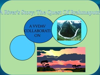
The Mighty Brahmaputra
- 2. FACTS ABOUT BRAHMAPUTRA 1. In the Tibbet and Himalayan region, Brahmaputra flows at an average height of 400 eters for 13000 kms. This highest for any major river in the world. 2. The mighty Brahmaputra is supposed to be on of the most powerful river in the world. Based upon the flow rate, Brahmaputra is the fifth strongest river in the world. 3. The Brahmaputra is one of those vwey few major rivers in the world which exhibit 'tidal bore'. It means incoming tides form waves that travel up the river against the direction of the current. This is what called a true 'tidal wave' in geography. This is one of the reason behind Brahmaputra's enormous strength. 4. 'Majuli', the largest island created by a river also resides in the Brahmaputra. This river island is situated in Assam and around 100 km in length.
- 3. 5. The Brahmaputra along with Ganges create the largest delta in the world, Sundarban in Bangladesh. 6. The average width of Brahmaputra is close to 10 km in plains which is on the widest in the world. 7. Where Brahmaputra enters India is till date on the most remote and adventurous part of the world. The river flows rapidly down to the plains from a height of 4000 meters in this region. This unknown region had trapped imagination of British for many decades in 19th century until it was discovered. 8. The rivers are considered to be female in India. But the Brahmaputra is the only male river in India
- 4. 'The Quest for the Brahmaputra' is a journey along the course of Brahmaputra, the largest river in India. Originating from Tibet as river TsangPo, Brahmaputra travels through the hills and plateaus of Tibet, entering the plains of Assam and finally merges with the Bay of Bengal through Bangladesh. Changing its name six times throughout its journey, the Brahmaputra is equivalent to Navarasa, the nine emotions; sometimes calm and silent, as if in a meditative mood, sometimes destructive like a monster. The presentation portrays the culture and livelihoods that have flourished along the river. Over half a million people are dependent on the river, which also has religious importance in their lives 'The Quest for the Brahmaputra' is a quest that ends with the silent answer from a fisherman, when asked about their dependence even though the river is so destructive.
- 5. Source: Chemayungdung From its origin in south-western Tibet Glacier, Himalayas, Tibet Length :2,900 km as the Yarlung Basin: 651,334 km2 (Imperial blood) River, Tributaries : - left Dibang the Brahmaputra flows across , Lohit Dhansiri southern Tibet - right Kameng, Raida where it is known as Dihang Jaldhaka, Teesta River to break through the Himalayas in Countries :Bangladesh, India, China great gorges. It flows southwest through the Assam Mouth : Bay of Bengal location Ganges Valley Delta, Bangladesh and south through Bangladesh as the Jamuna.
- 6. THE JOUNERY OF RIVER In order to cover all statistics of the river including important information, we divide the river according to it’s various stages: Journey in Tibet (Youth) Journey in India (Adult) Journey in Bangladesh (Old)
- 8. 6% 6% 0% 4% 0% 6% 42% State Arunachal Pradesh Assam 36% West Bengal Meghalaya Nagaland Sikkim
- 9. The biggest and the smallest river islands in the world, Majuli and Umandana, are in this river. It originates as the Yarlung Zangbo River in southwestern Tibet and is also known as the Tsangpo there Trivia The Brahmaputra is at its narrowest (1 km) at Guwahati near the ancient pilgrimage center of Hajo. The Brahmaputra is less polluted than most other rivers in India.
- 10. The Manas River is a major tributary of the Brahmaputra River
- 11. Physiography Brahmaputra sub-basin extends over an area of 580,000 sq. km lying in Tibet (China), Bhutan, India and Bangladesh. The drainage area lying in India is 194413 sq. km which is nearly 5.9% of the total geographical area of the country. It is bounded on the north by the Himalays, on the east by the Patkari range of hills running along the Assam-Burma border, on the south by the Assam range of hills and on the west by the Himalayas and the ridge separating it from Ganga sub-basin. The Sub-basin lies in the States of Arunachal Pradesh, Assam, Nagaland, Meghalaya, West Bengal and Sikkim.
- 12. The Gorge of the Tsangpo River at Namcha Barva. Where the river enters India with a ‘U’ turn
- 13. Brahmaputa river originates from Kailash ranges of Himalayas a an elevation of about 5150 m and flows for abut 2900 km through Tibet (China), India and Bangladesh and joins the Ganga. The river Brahmaputra receives a number of tributaries at its north and south banks, in the catchment area in India. The major tributaries are as follow (A) SIANG RIVER The Siang is the principal constituent river of the Brahmaputra known as Yarlung Zangbo in China. It originates from the glacier mass of the Kailash Range of the Himalayas at an elevation of about 5300 m and flows through China. The river flows eastwards for about 1600 km through the Tibetan Plateau
- 14. (B)TISTA RIVER DHANSIRI (S) RIVER The Tista is the largest river of North Bengal. It rises in the Himalayas in North Sikkim. Running through narrow gorges for nearly 138 km, it debouches into the plains of the Jalpaiguri district at sevoke. It flows in a steady course upto Jalpaiguri town beyond which it records frequent changes. It joins the Brahmaputra near Rangpur town in Bangladesh after The Dhansiri (S) rises in the south west corner of Nagaland below the laishiang peak. From its source upto Dimapur, the Dhansiri forms the boundary between the districts of Cachar, Nagaon and Nagaland. Beyond Dimapur, the river enters and flows through the KarbiAlong and Golaghat districts of Assam. The river is nearly 354 km long.
- 16. During the year, four distinct seasons occur in the Indian portion of the basin. These are (i) winter, (ii) summer, (iii) monsoon and (iv) autum or postmonsoon. The winter season begins in December and continues to the end of February. Light north-easterly winds blow down the Brahmaputra valley in Assam and light northerly to north westerly winds in West Bengal. The weather is occasionally changed by the passage of western disturbances across the region, light rainfall occurs in January and February along the hills, increasing towards North-east Assam. Thunder storms are rare in December and January and occur only on one or two days in February, these may occasionally be accompanied by a dust or hail storm
- 17. During the post-winter months, the north-east monsoon finds its way into the Brahmaputra valley through a saddle in the high Himalayas, at their eastern end. The Assam range of hills gradually rise in height eastward from 300 m in the Garo hills to about 3,000 m in the Naga hills. The rainfall in the Tista valley varies from 1,635 mm in West Dinajpur district to 3,945 mm in Jalpaiguri district. During the monsoon months of May to October, about 85% of the precipitation in the basin occurs. About 12% of the annual rainfall occurs in March and April.
- 18. During the winter season in January, the mean temperature over the catchment varies from 15.0°C to 17.5°C. The higher elevations in the Himalayan ranges experience lower temperatures. During the summer season in April, the mean temperature in the lower part of the catchment varies from 25.0°C to 27.5°C. The temperatures are below 25°C in the upper parts of the basin notably in Arunachal. In the rainy season, in the month of July, the mean temperature varies from 27.5°C to 30.0°C. Towards the end of th monsoon season, in the month of October, the mean temperature ove the basin varies from 25.0°C to 27.5°C. The Arunachal region experiences temperatures lower than 25.0°C.
- 19. Plant life Along the upper reaches of the Brahmaputra (Tsangpo) on the high Plateau of Tibet, the vegetation is mainly drought-resistant shrubs and grasses. As the river descends from Tibet, increased precipitation supports the growth of forests. Forests of sal, a valuable timber tree that yields resin, are found in Assam. At even lower elevations, tall reed jungles grow in the swamps and depressed waterfilled areas (jheels) of the immense floodplains. Around towns and villages in the Assam Valley, the many fruit trees yield plantains, papayas, mangoes, and jackfruit. Bamboo thickets abound throughout Assam and Bangladesh
- 22. The Brahmaputra sub-basin has abundant hydropower potential. As per the latest assessment the hydropower potential of the sub-basin is 31012 MW at 60% load factor. This is almost 37% of the country’s total installed capacity of 196 MW are in operation and another 7 schemes with a total installed capacity of 1043 MW are under construction. These 14 schemes together amount for only 2.2% of the assessed potential. Therefore, a large chunk of the hydropower potential of the sub-basin remains to be tapped.
- 23. . Guwahati, Shillong and Siliguri are the important urban centres. The sub-basin is rich in petroleum and coal. Digboi in Assam was the only source of petroleum in Sales India until about 1953-54. Petroleum products, jute, drugs and pharmaceuticals are other industries in the subbasin. 1st Qtr Brahmaputra Board was established by the Govt. of India in 1980 with the object of preparing a master plan for controlling the flood and bank erosion and improving the drainage of the Brahmaputra valley, simultaneously tapping the immense water potential for hydropower generation and 2nd Qtr 3rd Qtr 4th Qtr
- 24. To draw up standards and specifications for construction, operation and maintenance of such dams and other projects. To construct with the approval of the Central Government, multipurpose dams and works connected therewith as proposed in the Master Plan approved by the Central Govt. and maintain and operate such dams and works. To prepare in consultation with State Govt. concerned, a phased programme for construction by the State Government of all dams and other projects proposed in the Master Plan as approved by the Central Government other than those referred in above. The Board may maintain and operate any dam or project for so long as it deems necessary to do so. To perform such other functions as are supplemental, incidental or consequential to the functions specified above.