

Empfohlen
Weitere ähnliche Inhalte
Andere mochten auch
Andere mochten auch (10)
Ähnlich wie Cieo india
Ähnlich wie Cieo india (20)
Cieo india
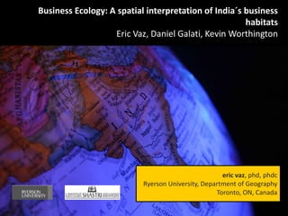
- 1. Business Ecology: A spatial interpretation of India´s business habitats Eric Vaz, Daniel Galati, Kevin Worthington eric vaz, phd, phdc Ryerson University, Department of Geography Toronto, ON, Canada
- 2. A Business as a living organism parented by Mankind hab·i·tat /ˈhabiˈtat / Noun The natural home or environment of an animal, plant, or other organism. A particular type of environment regarded as a home for organisms. Synonyms: residence - home – dwelling A business is an organism; a contiguous living system capable of response to stimulus, reproduction, growth and development, and maintenance of homeostasis as a stable whole. The business organism, as any other organism, depends on its ecosystem surroundings, which are reflected by its geographical surroundings
- 3. India – A country of challenges and opportunities >> The opportunities India is the fourth largest economy in the world in terms of GDP after purchasing power parity, after US, China and Japan Economic reforms are recent albeit all this significant growth (1991) Very attractive destination given the huge manpower (1.2 billion people), and availability of resources Goldman Sachs predicts India as the second largest economy in the world (followed by China) Consistent economic growth of 8-9% in almost a decade
- 4. India – A country of challenges and opportunities >> The challenges Education and population increase must be fostered by policies responding to 1.2 billion people According to 2010 data from the United Nations Development Programme, an estimated 37.2% of Indians live below the country's national poverty line A huge asymetry exists between rich and poor, urban areas and peripheral regions India´s urban growth is leading to excessive pressure on fragile wetlands, ecosystems and is affecting directly biodiversity Transportation and communication systems are very poor at national level
- 5. The GIS dimension “GIS are becoming places to think, act, and respond“ Eric Vaz, ERSA 2012, Timisoara, Romania
- 6. Computer Assisted Drawing Databases Geographic Information Systems
- 7. Crossdisciplinar: Synergies of knowledge Digital Mapping Surveying Photogrammetry CAD Remote Databases Sensing Geographic Information Systems
- 8. All our work was developed with open soure technologies at hand Advantages: 1. Existence of a panel of programming and IT experts useful for Geographers 10. Works on Windows, Linux and Mac 2. Support by a large and growing development community 11. Thousands of available specialized tools for every field of research or 3. Bugs and fixes available for any users application 4. Free learning materials available 12. Larger capabilities of importing GIS data (shapefiles are obviously included) 5. Low implementation and startup costs 13. Absolutely for free, save money on 6. Continuous optimization and software, and give someone a job improvement of software
- 9. The Geocoding Challenge 6675 Company entries including 20+ attribute variables Addresses are provided but format is not consistent across all entries. Specific: Broad: Problem: How could one acquire an accurate spatial reference for all corresponding companies in a time efficient manner?
- 10. The Geocoding Challenge Solution: Python Scripting using Google Geocoding API Combining Python and Google allows the programmer to completely automate the acquisition of spatial references based on provided address data. Google Geocoding API accepts addresses in specific or broad formats. Google Geocoding API uses its wide library of spatial information to provide the most accurate spatial reference possible.
- 11. The Geocoding Challenge Result: Fully automated spatial reference acquisition of all 6625 company addresses. 99% acquisition success rate. Poorly formatted or invalid addresses are left blank.
- 12. Patenting the results: A new application was born 1. A Business API of automatic geocoding based on an Excel spreadseet 2. Integration of geocoded materials as shapefiles (points) in an ArcGIS environment 3. Automatic projection of shapefiles onto Google Earth for local visualization
- 13. Always look on The GIS dimension the bright side of life Opportunities Spatial Analysis Increase Create a investors WebGIS Challenges Support Understand planning environmental change Monitor growth
- 14. The WebGIS landscape: Indian dimension “Information is about having, knowledge is about sharing“, Geocoding Eric Vaz, European Space Agency, Krakow, 2011 6675 Company entries including 20+ attribute variables Addresses are provided but format is not consistent across all entries. Specific: Broad: Problem: How could one acquire an accurate spatial reference for all corresponding companies in a time efficient manner? Solution: Python Scripting using Google Geocoding API Combining Python and Google allows the programmer to completely automate the acquisition of spatial references based on provided address data. Google Geocoding API accepts addresses in specific or broad formats. Google Geocoding API uses its wide library of spatial information to provide the most accurate spatial reference possible.
- 16. What the WebGIS brings 1. A geocoded system of location of over 6000 registered Indian businesses buy business activity 2. Spatial analysis of business clusters from an investor perspective. 3. Temporal analysis of location of businesses since 1850 with geovisualization capabilities- 4. A spatio-temporal understanding of India‘s business morphology 5. Understanding India‘s business dimension as an independent ecosystem from a general user perspective 6. Defining the intricate relations of the business organisms.
- 17. The Spatial analysis landscape: Indian dimension “Information is about having, knowledge is about sharing“, Geocoding Eric Vaz, European Space Agency, Krakow, 2011
- 18. The Spatial analysis landscape: Indian dimension “Information is about having, knowledge is about sharing“, Geocoding Eric Vaz, European Space Agency, Krakow, 2011
- 19. The Spatial analysis landscape: Indian dimension “Information is about having, knowledge is about sharing“, Geocoding Eric Vaz, European Space Agency, Krakow, 2011
- 20. What the Spatial Analysis brought 1. Understanding of two very independent and autonomous business clusters in India 2. Evolution of India‘s business landscape has developed from West to East, resulting from the influence of original business locations in the 19th century 3. The indian business landscape may jeopardize fragile ecosystems such as Mumbai`s (former Bombay) wetland system. 4. Business location is intrinsically linked to urban infrastructures – buy managing urban and regional spatial interactions, we have found that the business organism interacts in space and time
- 21. The Research Team Principal Investigator: Eric Vaz is Assistant Professor at Ryerson University. With over fifty publications in the field of Geosciences, Eric’s interest is linked in understanding the changes in the spatial morphology of business landscapes, and the interactions of urban and rural environments. Research Scientist: Daniel Galati is fourth year Geographic Analysis student at Ryerson University. Pursuing his Masters of Spatial Analysis in 2013/2014, Daniel is primarily interested in developing new manipulation tools to address the growing popularity of raster images in Geographic Information Systems (GIS). Research Scientist: Kevin Worthington is Ryerson University Graduate with a degree in Information Technology Management, where he majored in Application Development. His passion for presenting media using web-based map technology has driven the development of multiple webGIS applications. Co-Investigator: Shailendra Rai is Assistant Professor at the Management and Development Institute in Delhi and interested in the integration of Management in a context of Indian business.
- 22. obrigado