HỌC TỐT TIẾNG ANH 11 THEO CHƯƠNG TRÌNH GLOBAL SUCCESS ĐÁP ÁN CHI TIẾT - CẢ NĂ...
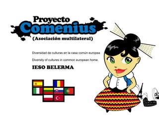
Trabajo De GeografíA E Historia
1.
2. SUBVENCIONADO POR EL PARLAMENTO EUROPEO Y LA COMISIÓN EUROPEA Convocatoria nacional 2008 de propuestas de las acciones descentralizadas de los programas COMENIUS , Leonardo Da Vinci, Erasmus, Grundtvig y Transversal, en el marco del PROGRAMA DE APRENDIZAJE PEMANENTE. La convocatoria 2008 de propuestas se basa en la “Decisión” por la que se establece un programa de acción en el ámbito del aprendizaje permanente, adoptada por el Parlamento Europeo y el Consejo el 15 de noviembre de 2006 (Decisión nº 1720/2006/CE).
3. OBJETIVO DE LOS PROGRAMAS DE APRENDIZAJE PERMANENTE “ Contribuir, mediante el aprendizaje permanente, al desarrollo de la Comunidad como sociedad del conocimiento avanzada, con un crecimiento económico sostenible, más y mejores puestos de trabajo y una mayor cohesión social, garantizando al mismo tiempo una buena protección del medio ambiente en beneficio de las generaciones futuras. En particular, pretende estimular el intercambio, la cooperación y la movilidad entre los sistemas de educación y formación dentro de la Comunidad, de modo que se conviertan en una referencia de calidad mundial.”
4. ORGANISMO AUTÓNOMO DE LOS PROGRAMAS EDUCATIVOS EUROPEOS La Agencia nacional española (OAPEE) se ocupa de difundir la convocatoria del programa, suministrar asistencia técnica y asesoramiento a los posibles beneficiarios de las acciones, hacer el seguimiento adecuado para que las acciones previstas consigan sus resultados y gestionar de forma eficiente y transparente los fondos europeos. El Organismo Autónomo “Programas Educativos Europeos” tiene como misión gestionar la participación española en el Programa de Aprendizaje Permanente (PAP) de la Unión Europea.
7. POLITICAL MAP OF SPAIN Spain has got seventeen regions: SHIELD AND FLAG OF SPAIN NATIONAL ANTHEM
8. POLITICAL MAP OF SPAIN Shields and flags of the different regions
9. POLITICAL MAP OF SPAIN Map with geographical limits. You can see Regions and provinces of Spain. The most important cities of each region are marked with a red point
10. POLITICAL MAP OF SPAIN Spain has got seventeen regions. Each region has got these provinces:
12. PHYSICAL MAP OF SPAIN CATCHMENT AREAS OF SPANISH RIVERS Cachment area of Atlantic Slope Cachment area of CantabricSlope Cachment area of Mediterranean Slope
13. RIVERS OF SPAIN PHYSICAL MAP OF SPAIN The most important rivers of Spain are: -Tajo -Ebro -Duero -Guadalquivir -Guadiana -Júcar -Miño
14. PHYSICAL MAP OF SPAIN It drains an area of 80,100 km² (the second largest in the Iberian peninsula after the Douro). It follows a very constricted course for much of its length, but after Almourol it enters a vast alluvial valley prone to flooding. Today the Alcantara Dam regulates much of the river's flow. The source of the Tagus is the Fuente García, in the Albarracín mountains. The main cities it passes through are Aranjuez, Toledo, and Talareva de la Reina in Spain, and Abrantes, Santarém and Almada and Lisbon in Portugal. The Tagus is the longest river on the Iberian Peninsula. It measures 1,038 kilometers in length, 716 km of which are in Spain, 47 km as border between Portugal and Spain and the remaining 275 km in Portugal, where it empties into the Atlantic at Lisbon. THE RIVER TAGUS (Sp: RÍO TAJO)
15. PHYSICAL MAP OF SPAIN THE RIVER EBRO (Sp: RÍO EBRO) The Ebro is Spain's most voluminous river. Its source is in Fontibre (Cantabria). It flows through cities such as Miranda de Ebro, Logroño, Zaragoza, Flix, Tortosa, and Amposta before discharging in a delta on the Mediterranean Sea in the province of Tarragona. It measures 910 kilometers in length.
16. PHYSICAL MAP OF SPAIN The most important mountains ranges of Spain are: -Pyrennees -Cantabric Mountain range -Central Mountain range -Moraine Mountains -Iberic Sistem -Betics Sistems -Teide
17. PHYSICAL MAP OF SPAIN HIGHEST MOUNTAINS IN SPAIN: TEIDE Mount Teide or, in Spanish, El Teide , is an active though dormant volcano which last erupted in 1909. It is located on Tenerife, Canary Islands. The volcano and its surrounds comprise the Teide National Park ( Parque Nacional del Teide in Spanish). The park has an area of 18900 ha and was named a World Heritage Site by UNESCO on June 29, 2007. At 3718 m above sea level, and approximately 7500 m above the floor of the Atlantic Ocean, Teide is the highest mountain in Spain and the highest point in the Atlantic Ocean. The island of Tenerife itself is the third largest volcanic ocean island on Earth by volume. Teide is also the third highest volcano on a volcanic ocean island. It is also unstable and possibly in a more advanced stage of deformation and failure than the much publicised Cumbre Vieja.The United Nations Committee for Disaster Mitigation have designated Teide as a Decade Volcano. It is considered to be the 13th most dangerous volcano in the world due to its proximity to several major towns and the nearby city of Puerto de la Cruz. Teide together with its neighbour Pico Viejo and Montaña Blanca forms the Central Volcanic Complex.
18. PHYSICAL MAP OF SPAIN Mulhacén is the highest mountain in continental Spain and in the Iberian Peninsula. It is part of the Sierra Nevada range in the Cordillera Penibética. At 3478 m above sea level. While not of exceptional height by European standards, Mulhacén is the highest peak in Europe outside the Caucasus Mountains and the Alps. It is also the third most topographically prominent peak in Western Europe, after Mont Blanc and Mount Etna, and is ranked 64 th in the world by prominence. The north face of the mountain, however, is much steeper, and offers several routes involving moderately steep climbing on snow and ice in the winter. HIGHEST MOUNTAINS IN SPAIN: MULHACEN
19. PHYSICAL MAP OF SPAIN Aneto is the highest mountain in the Pyrenees and in Aragon, and Spain's third highest mountain- reaching a height of 3,404 m (11,168 ft). It lies in the Spanish province of Huesca, the northernmost of all three Aragonese provinces. It forms the southernmost part of the Maladeta massif. It was also known as Pic de Néthou in French, though this is little-used as the mountain lies entirely within Spain. Aneto holds the largest glacier in Spain, covering 79.6 ha in 2005; it is shrinking rapidly due to warming summer temperatures and decreasing winter precipitation over the twentieth century- it covered 106.7 ha in 1981, and over 200 ha in the XIX century . HIGHEST MOUNTAINS IN SPAIN: ANETO
32. GEOGRAPHY OF CASTILLA LA MANCHA PROVINCES: ALBACETE Albacete is a city and municipality in southeastern Spain, 173 miles southeast of Madrid, the capital of the province of Albacete in the autonomous community of Castilla-La Mancha. The municipality had a population of 152,115 in 2002. The settlement was named Al-Basit, "the plain," by the Moors. The city has been known as a center for the manufacture of fine daggers, penknife, scissors, and knives. Albacete is not known as a tourist destination, but its sights include the new Cathedral and the Museum de Albacete. During the Spanish Civil War, it was the headquarters and training camp of the International Brigades. Its fair has been declared of International Interest to Tourist. Albacete is home to the football team Albacete Balompié.
37. GEOGRAPHY OF CASTILLA LA MANCHA PROVINCES: CIUDAD REAL Ciudad Real (Spanish for: Royal City) is a city in Castile-La Mancha, Spain. It is the capital of the province of Ciudad Real. The city was founded by King Alfonso X in the 13th century to fight against the Military Order of Calatrava. Its population is 65,048 (as of 2002), about an eighth of the population of the province. It has a stop on the AVE high-speed rail line and has begun to grow as a long-distance commuter suburb of Madrid.
42. GEOGRAPHY OF CASTILLA LA MANCHA PROVINCES CUENCA Cuenca is a city (2004 pop. 47,862) in the autonomous community of Castilla-La Mancha in central Spain. It is the capital of the province of Cuenca (see map). Its name may derive from Latin conca meaning "river basin" and referring to the gorge of the rivers Júcar and Huécar. It may also be derived from the now-ruined Arab castle, Kunka. Its medieval town can still be explored. Other alternative original names are contemplated, including "Anitorgis", "Sucro" or "Concava".[citation needed] The city of Cuenca is also known as the 'Eagle's Nest' because of its position on the hill. A beautiful and ancient city, it was declared a UNESCO World Heritage Site. It is famous for its casas colgadas (hanging houses) on the edge of the gorge of the river Huécar. While its collection of historical buildings is not as impressive as Toledo or Salamanca, it offers a unique mixture of nature and human constructions. Its landscapes are particularly wonderful in autumn, due to the mix of green, yellow and red colours in the gorges of the two rivers. The city is a popular day or weekend trip from Madrid, to which it is connected by rail (RENFE), and is home to numerous museums, including the Museum of Spanish Abstract Art.
46. GEOGRAPHY OF CASTILLA LA MANCHA PROVINCES: GUADALAJARA Guadalajara is a city and municipality in the autonomous community of Castile-La Mancha, Spain. It is the capital of the province of Guadalajara. It is located roughly 60 km northeast of Madrid on the Henares River, and has a population of 66,200 (2000). Founded by the Iberians, it was in the hands of the Carpetani and named Arriaca when encounted by the Romans. The city, as Caracca or Caraca was incorporated into the Roman province of Hispania Tarraconensis. The city was on the high road from Emerita (modern Mérida) to Caesaraugusta (modern Zaragoza), 22 M. P. northeast of Complutum (modern Alcalá de Henares). Under Moorish rule, the city was called Wādī al-Ḥaǧārah (Arabic وادي الحجارة ), or "valley of stones". Sights The bridge across the Henares river is built on Roman foundations. It has several historic buildings such as the Palacio del Infantado, as well as many churches.
50. GEOGRAPHY OF CASTILLA LA MANCHA TOLEDO Toledo is a city and municipality located in central Spain, about 70 kilometers south of Madrid. It is the capital of the province of Toledo and of the autonomous community of Castile-La Mancha. As of 2005, Toledo, Spain has a population of 75,578. As encountered by the Romans, the city – called Toletum– was the capital of the Carpetani. It was incorporated into the Roman province of Hispania Tarraconensis. It sat at a strategic location along the Tagus River and on the road from Emerita (modern Mérida) to Caesaraugusta (modern Zaragoza), and connected also by another road with Laminium. It was a very strong town, though only of moderate size, and famed for its manufacture of arms and steel-ware. (According to an old Spanish tradition, Toledo was founded in the year 540 BCE by Jewish colonists, who named it Toledoch, that is, mother of people, whence one might perhaps infer a Phoenician settlement. Toledo later served as the capital city of Visigothic Spain, beginning with Liuvigild (Leovigild), and was the capital until the Moors conquered Iberia in the 8th century. Under the Caliphate of Cordoba, Toledo enjoyed a golden age. This extensive period is known as La Convivencia, i.e. the Co-existence of Jews, Christians, and Muslims. Under Arab rule, Toledo was called Tulaytulah (Arabic طليطلة , academically transliterated Ṭulayṭulah). On May 25, 1085 Alfonso VI of Castile took Toledo and established direct personal control over the Moorish city from which he had been exacting tribute. This was the first concrete step taken by the combined kingdom of Leon-Castile in the Reconquista by Christian forces. Toledo was famed for its production of steel and especially of swords and the city is still a center for the manufacture of knives and other steel implements. When Philip II moved the royal court from Toledo to Madrid in 1561, the old city went into a slow decline from which it never recovered. Toledo's Alcázar became renowned in the 19th and 20th centuries as a military academy. At the outbreak of the Spanish Civil War in 1936 its garrison was famously besieged by Republican forces. In 1986 the UNESCO declared Toledo a World Heritage Site. PROVINCES
54. PHYSICAL MAP OF C ASTILLA LA MANCHA The most important rivers of Castilla-La Mancha are: Tagus, Guadiana, Júcar and Segura. Its mountains more importants are Mountain of Toledo, Range of Cuenca and Mountain Range of Alcaraz.
55. GEOGRAPHY OF CASTILLA LA MANCHA THE RIVERS OF CASTILLA LA MANCHA THE MOUNTAINS OF CASTILLA LA MANCHA
56. PHYSICAL MAP OF CASTILLA LA MANCHA THE RIVER GUADIANA River Guadiana is the fourth longest river in Spain. It goes from east to west through Castilla- La Mancha and Extremadura. It is born in Lagunas de Ruidera (Albacete). It flows into the Atlantic Ocean. River Guadiana covers an overall distance of 818Km, of which 578Km corresponds to Spain and 140Km corresponds to Portugal.This river crosses the provinces of Albacete, Ciudad Real, Badajoz and Huelva. Guadiana crosses Portugal in its final stretch and it flows into the Gulf of Cádiz.
57. PHYSICAL MAP OF CASTILLA LA MANCHA The Júcar is a river on the Iberian Peninsula of Spain. The river runs for approximately 509 km from the Universales Mountains to Cullera, where it discharges into the Mediterranean sea at the Gulf of Valencia. It passes through the towns of Cuenca, Alcalá del Júcar, Cofrentes, Alcira, Sueca and Cullera, near its mouth into the Mediterranean Sea. The Cabriel is its most important affluent. In 1982 the river Júcar broke Tous's reservoir, provoking the biggest flood in Spanish history with an avalanche of 16,000 cubic meters per second, killing more than 30 people. The flood was called "La pantanada de Tous" THE RIVER JÚCAR
58. PHYSICAL MAP OF CASTILLA LA MANCHA MOUNTAINS OF CASTILLA-LA MANCHA. THE HIGHEST MOUNTAINS OF EACH PROVINCE: PICO DE LAS CABRAS-2084 m (Albacete) RISCOS DEL AMOR- 1344 m (Ciudad Real) PICO DEL LOBO- 2273 m (Guadalajara) COROCHO DE ROCIGALGO- 1447 m (Toledo) LA MOGORRITA- 1866 m (Cuenca)
60. HISTORY OF OSSA DE MONTIEL Ossa de Montiel, a small town in the province of Albacete. It is in the heart of La Mancha, inside the historic Campo de Montiel and in the middle of the route of Don Quixote. It’s located in the west of the province of Albacete, at 901 meters of altitude and 24,000 hectares of which more than 15,000 hectares are occupied by junipers, oaks, rosemary and juniper. These attract many hunters due to the abundance of rabbits and hares. The cereals, wines and its tourism infrastructure are its main economic resources. Historical frame. Its origins date back, according to archaeological finding in a wide variety of items on its territory, from the Paleolithic to the present day, passing by peoples such as the Iberian, Roman, Visigoth and Muslim. One particular note is the period of the Bronze Age (1600 to 1100 BC), when the use of the metal spread and an amount of little settlements appeared. They are called “Morra” or “Catellones” when they are at the height and “Motilla” when in the catchment of rivers or marshy depressions. Founded by the Romans in the valley of San Pedro with the name Caput Fluminis Ane. Other settlements are deduced in the same village and on the slopes of Cerro del Almendral. Later the Visigoths left traces of their passage to the old chapel of St. Peter, and the Berber tribe of "Masmuda" seized this land and in the twelfth century they erected on nearby hill the romance and historic "Castle Rochafrida." Conquered the Castle, called in the Middle Ages as San Felices by Alfonso VII, it was conquered again by the Almohads until its final reconquest by Alfonso VIII. Henry I of Castile in the 26th of april 1216, entrusted it to Don Sueroz Tellez Meneses with the lands and pastures. A few years later, it was controled by the Santiago´s order until the nineteenth century, when it was fallen into obscurity in the Isabel and Ferdinand´s reign. Ossa de Montiel was elevated to the rank of town with other people in the Campo de Montiel and confirmed his "Letter Puebla" by the Infante Don Enrique, King Ferdinand of Aragon´s son, in 1410.
61. HISTORY OF OSSA DE MONTIEL OSSA DE MONTIEL CHURCH OF SANTA MARÍA MAGDALENA This is a church from the Gothic period maybe at the beginning of s. XVI Sculpture of Quixote in Cave of Montesinos Cave of Montesinos Quixote near of Cave of Montesinos Rollo o Picota. Old monument of jurisdiction
63. GEOGRAPHY OF OSSA DE MONTIEL Ossa de Montiel is a municipality in Albacete, Castilla-La Mancha, Spain. It has a population of 2,836. It is our small town!
64. PHYSICAL MAP OF OSSA DE MONTIEL THE NEAREST MOUNTAINS OF OSSA DE MONTIEL: MOUNTAIN RANGE OF ALCARAZ OSSA DE MONTIEL IS LOCATED IN THE HEART OF THE CASTILIAN PLAIN
65. VICINITIES OF OSSA DE MONTIEL PHYSICAL MAP OF OSSA DE MONTIEL THE NEAREST MOUNTAINS OF OSSA DE MONTIEL: MOUNTAIN RANGE OF ALCARAZ
67. VICINITIES OF OSSA DE MONTIEL RIVER MUNDO SOURCE PHYSICAL MAP O F OSSA DE MONTIEL
68. GEOGRAPHY OF OSSA DE MONTIEL RIVERS In Ossa de Montiel there are two rivers, Alarconcillo and Guadiana. River Alarconcillo, which only takes water in periods of rain, is an affluent of River Guadiana whose source is located in Ossa de Montiel (Lagunas de Ruidera). RIVER GUADIANA Guadiana is one of the major rivers of Spain and Portugal. It forms part of the border between the two countries, separating Extremadura and Andalucia (Spain) from Alentejo and Algarve (Portugal). It is 742 kilometers long and drains an area of about 67,000 square kilometers. It is born in Lagunas de Ruidera (Ossa de Montiel). It flows into the Gulf of Cadiz, part of the Atlantic Ocean, between Vila Real de Santo Antonio (Portugal) and Ayamonte (Spain). In Spain, the river flows east to west, then flows south, in Spain and Portugal.
69. GEOGRAPHY OF OSSA DE MONTIEL Lagunas de Ruidera (Lakes of Ruidera) is a natural park in Spain, containing 15 lagoons that are located among of the La Mancha plain. Its area is more than 38 km². The lagoons are connected by falls, small rivers as well as subterranean flow and the area is considered as the source of Guadiana River . Once nicknamed "The Mirrors of La Mancha", the 16 interconnected lakes which make up the Parque Natural de las Lagunas de Ruidera stretch for 20 km through a valley. At the reservoir of “Peñarroya” the plain turns into hills and you find yourself in another, friendlier, habitat accompanied by an incessant clamour of birds, for whom this humid area of La Mancha is an oasis in the desert. The reeds and bullrushes along its shore provide perfect cover for many kinds of duck. Not far from the sleepy village of Ruidera are the two largest lakes, the Laguna del Rey and La Colgada... The road from Ruidera winds along their banks and gradually ascends from one lake to the next, for each is just a step higher than its neighbour. Just after several small lakes — Batana, Santo Morcillo, Salvadora, La lengua, La Tinaja, La Tomilla—, the Laguna Conceja, with its marshy shore-line and wooded surrounding hills. The laguna Conceja has a higher degree of natural protection in respect of the rest of the lagoons. The name Ruidera is said to derive from the noise (ruido) made by the water running from lake to lake, which stretches along a total of 25 kilometres (16 miles), with a difference of 128 metres (420 feet) in height between the southernmost pool, La Blanca, and Cenagosa at the northern end. Geologists have demonstrated that while some of the water runs from one lake to the other along surface streams and cascades, it also flows underground, through layers of clay and gypsum or sandstone. (more)
70. GEOGRAPHY OF OSSA DE MONTIEL The protected area of the Parque Natural de Ruidera includes not only the lakes but also the tributary valley of San Pedro, with the ruins of Rochafrida castle and the cave of Montesinos, which plays such an important role in the second part of Don Quixote . These are literary landmarks. Rochafrida is mentioned in Spanish medieval romances, although it was already in ruins when Cervantes roamed this district as a tithe proctor for the Knights of St. John at Argamasilla. Hence Don Quixote must go underground to meet the heroes of his ever-romantic imagination: Montesinos, Belerma, Durandarte. Here he learns that the inhabitants of the cave, Guadiana and Ruidera, together with their seven daughters and two nieces, have been transformed into a river and several lakes by Merlin the magician. The great subterranean reservoir, through which the river supposedly flowed westward, has been tapped by the pumps of the wine-growers of Tomelloso, and the wetlands of the Tablas de Daimiel have ceased to be the great national park they once were. But the Lagunas de Ruidera are upstream from the pumps, and thus more precious than ever. DATE WHEN LAKES BECAME A NATURAL PARK:13 th of july 1979 AREA:3772 hectare PROVINCE: Albacete and Ciudad Real PROMOTIONAL VIDEO OF LAGUNAS DE RUIDERA
72. LAGOON OF KING SOME LAKES IN THE NATURAL PARK OF “LAS LAGUNAS DE RUIDERA”: LAGOONS AT NIGHTFALL LA BATANA GEOGRAPHY OF OSSA DE MONTIEL
73. LAGUNAS DE RUIDERA LAGUNAS DE RUIDERA ARE 15 SMALL LAKES GEOGRAPHY OF OSSA DE MONTIEL ALL-IN-ONE SUMMARY (VIDEO)
74. Los organismos Europeos y nacionales que crean, posibilitan y subvencionan este tipo de proyectos: Parlamento Europeo Programa Comenius Agencia Nacional( OAPEE )
75. A las profesoras de Geografía e Historia, Manoli y Estela , por su colaboración, trabajo propuesto y desarrollado tanto en sus clases como fuera de ellas, para el desarrollo de este proyecto. A Mireia , profesora de EPV, por su colaboración y tiempo dedicado, así como por las actividades propuestas para el proyecto. A Jorge , profesor de Inglés, por todo el tiempo, paciencia y apoyo a los alumnos/as en la traducción de estos textos y por las actividades desde el departamento de inglés. A todos los alumnos y alumnas del proyecto por el buen trabajo desarrollado en grupo.
76. El responsable único de la información aquí publicada es el Proyecto de Asociación Comenius del IESO “Belerma”. La Comisión Europea no es responsable del uso fraudulento que pudiera hacerse de dicha información.