SlideShare a Scribd company logo
1 of 25
The Study on City Master Plan and Urban Development Program of Ulaanbaatar City (UBMPS)
        Intensive Learning Session on Urban Planning under Market Economy


          Land Use Plan and
           Land Management


                              Hiroaki Ohashi
                               JICA Study Team


                                                                                          1
Today’s Agenda


• National Land Use Plan (National,
  Prefectural, & Municipal-Level Plans) in
  Japan
• General Land Use Plan (Prefectural Level)
  in Japan

• Land Use Planning and Regulations in City
  Planning Area (Municipal Level) in Japan

• Introduction of Preparation Procedure of
  Land Use Planning (Municipal Level) in
  Japan


                                              2
Characteristics of National Land in Japan

                                                                306          174
                                                           26
 Total Land Area                                     123                               504
                                                    133
 37,780,000 ha

 Total Population (as of March, 2005)
 Approx. 126,870,00 (persons)
                                                                                                    Bui
                                    306   174
                               26
                                                                                                    Ag
Administrative Structure (as of Oct., 2006)
                       123                504                                                       For
                         133                                                                        Wa
                                                                                                    Roa
     Central Government                                                                             I so
                                                                                                    Ot h
                                                                      2512         Unit: 0,000 ha
        47 Prefectures
                                                            Building Land
                                                            A gr icult ur al Land
     1,817 Municipalities                                   For est Land
                                                            Wat er Sur f ace, Riv er s, et c.
          • 779 Cities (15 Special Stated Cities)           Roads
          • 842 Towns                                       I solat ed Wilder ness
          • 196 Villages                                    Ot her s
                                     2512
                                                                                                     3
National Land Use Plans
                  & General Land Use Plan

                                                                 Five Separate
       National Land Use Planning Law (NLUPL)
                                                                     Laws


                                                                City Planning Area
National Land Use Plan                                           City Planning Area


   National-level Plan
                                                                Agricultural Area
                                                                 Agricultural Area

                               General Land Use Plan
                                By Each Prefecture
                               (1) General Land Use Plan           Forest Area
                                    Map                             Forest Area
  Prefectural-level Plan
                                     (Five Categorized Areas)
                               (2) Planning Document

                                                                Natural Park Area
                                                                 Natural Park Area

                               Land Transaction Regulation
  Municipal-level Plan          (1) Permission Standard

                                (2) Recommendation Standard          Natural
                                                                      Natural
                                                                Conservation Area
                                                                 Conservation Area


                                                                                      4
Pictures for Five Categorized Areas

City Planning Area
 City Planning Area


                                     Forest Area
                                      Forest Area

Agricultural Area
 Agricultural Area


                                                    5
Pictures for Five Categorized Areas


Natural Park Area
 Natural Park Area


                                 Natural Conservation Area
                                  Natural Conservation Area


                                                              6
Example of General Land Use Plan Map
              (Fukuoka Prefecture, Japan)


Legends
           City Planning Area   Agricultural Area           Forest Area

           Natural Park Area    Natural Conservation Area
                                                                          7
Structure of General Land Use Plan
                                           & Five Basic Laws
                                     Categories               Plans                      Basic Laws

                                                                                       City Planning Law
                                                                                        City Planning Law
                                                        City Planning Area    (administered by Ministry of Land,
                                 City Planning Area      City Planning Area    (administered by Ministry of Land,
                                  City Planning Area        Master Plan          Infrastructure and Transport
                                                             Master Plan          Infrastructure and Transport
                                                                                             (MLIT))
                                                                                              (MLIT))
(Prepared by Each Prefecture)


                                                                              Agricultural Promotion Areas Law
                                                                               Agricultural Promotion Areas Law
                                                           Agricultural         (administered by Ministry of
    General Land Use Plan


                                  Agricultural Area         Agricultural          (administered by Ministry of
                                   Agricultural Area    Improvement Plan      Agriculture, Forests and Fishing
                                                         Improvement Plan      Agriculture, Forests and Fishing
                                                                                           (MAFF))
                                                                                            (MAFF))

                                                                                          Forest Law
                                                                                           Forest Law
                                                                                 (administered by Ministry of
                                    Forest Area            Forest Plan            (administered by Ministry of
                                     Forest Area            Forest Plan        Agriculture, Forests and Fishing
                                                                                Agriculture, Forests and Fishing
                                                                                            (MAFF)
                                                                                             (MAFF)


                                                                                      National Park Law
                                                                                       National Park Law
                                 Natural Park Area          Park Plan            (administered by Ministry of
                                  Natural Park Area          Park Plan            (administered by Ministry of
                                                                                     Environment (MoE))
                                                                                      Environment (MoE))


                                                                                  National Conservation Law
                                Natural Conservation                               National Conservation Law
                                 Natural Conservation   Conservation Plan        (administered by Ministry of
                                        Area             Conservation Plan        (administered by Ministry of
                                         Area                                        Environment (MoE))
                                                                                      Environment (MoE))
                                                                                                                    8
Examples of Development Control Measures
                 within Categorized Areas
  Categorized    Areas which can be        Available Development Control Measures
     Areas           Designated
City Planning   • City Planning Area   • Respective Development Permission System in
Area            • Urban Promotion        Urban Promotion Area and Urban Control Area
                  Area (within CPA)    • Land Use Regulations
                • Urban Control Area   • Building Code
                  (within CPA)
Agricultural    • Agricultural         • Restriction on Conversion of Agricultural Land
Area              Promotion Area         in Agricultural Use District
                • Agricultural Use     • Development Permission System in Agricultural
                  District (within       Use District
                  Agricultural         • Recommendation System and Public
                  Promotion Area)        Disclosure System for Development Activities
                                         within Agricultural Promotion Area except
                                         Agricultural Use District
Forest Area     • Forest Reserve       • Development Permission System of Tree
                  Area                   Cutting and Land Development in Forest
                • Target Area of         Reserve Area
                  Regional Forest      • Development Permission System (for Land
                  Plan (prepared by      Development more than 1 ha) in Private Forest
                  Each Prefecture)       located in the Target Area of Regional Forest
                                         Plan                                             9
Roles of General Land Use Plan
               (Prefecture Level)


   Comprehensively Coordinating Five Subordinate Plans
   Comprehensively Coordinating Five Subordinate Plans
             based on Five Separate Laws
              based on Five Separate Laws

     • Controlling Development Activities indirectly through Five
       Subordinate Plans


Regulating Land Transaction for Preventing Land Speculation

      •Designating “Controlled Area”, “Supervised Area”, etc.


     Requiring Review of Land Transaction Price and Objective of
     Land Transaction in Designated Areas at Prefectural Level


             Determining Measures for Idle Land
             Determining Measures for Idle Land
                                                                    10
Land Taxation System
Categories            Tax Types             Targets to be Assessed & Assessment Criteria
Tax on Land   Registration License Tax      Registration fee of land and/or building based
Acquisition   (National Tax)                on assessed value of fixed assets
              Real Estate Acquisition       Acquired real estate by buying land and/or
              Tax ( Prefectural Tax)        building and constructing building based on
                                            assessed value of fixed assets
              Special Landholding Tax       Acquired land based on land acquisition cost
              related to Land Acquisition   (under suspension)
              (Municipal Tax)
              Land Inheritance Tax        All properties including land based on
              (National Tax)              assessed value of inherited properties (approx.
                                          80 % of posted land price)
Tax on        Fixed Asset Tax (Municipal Land, building, and depreciable property based
Landholding   Tax)                        on assessed value of fixed assets (approx.
                                          70 % of posted land price)
              City Planning Tax           Land and/or building located in Urban
              (Municipal Tax)             Promotion Area based on assessed value of
                                          fixed assets (approx. 70 % of posted land
                                          price)
              Special Landholding Tax     Land which is hold for less than ten years
              related to Landholding      based on land acquisition cost (under
              (Municipal Tax)             suspension)
              Land Price Tax (National    Land, etc. based on assessed value of
              Tax)                        inherited properties (approx. 80 % of posted
                                          land price) (under suspension)
Tax on Land   Levied through Personal Income Tax and Inhabitant Tax (in case of
                                                                                             11
Municipal Master Plan &
   National Land Use Plan (Municipal-level Plan)

                        National Land Use Plan
                         (National-Level Plan)


                        National Land Use Plan
                        (Prefectural-Level Plan)
                                                      Designation of City Planning Area

                                                      Master Plan for City Planning Area
                                                      (by the Prefectural Government)


Municipal               National Land Use Plan
Basic                   (Municipal-Level Plan)
Principles                                            Municipal Master Plan (by the
                                                      Municipality)


Land Use Regulations                    Urban Facilities   Urban Development Projects
• Area Division (Senbiki System)
• Zoning (Zones and Districts)
• District Plan, etc.

                                                                                           12
Area Division (Senbiki System)
                    for Urban Growth Management

Designating Line between Town and Country in City Planning Areas

           City Planning Area
            City Planning Area                Urban Promotion Area (UPA)
                                               Urban Promotion Area (UPA)
    (Delineated by Each Prefecture)
     (Delineated by Each Prefecture)            (Delineated by Each City)
                                                 (Delineated by Each City)

            Agricultural Area
             Agricultural Area              Areas which already built-up areas,
                Forest Area                 or
                 Forest Area
                                            Areas which should be priority area
            Nature Park Area
             Nature Park Area               for development in a planed manner
                                            within approximately ten years
       Nature Conservation Area
        Nature Conservation Area


City Planning                                  Urban Control Area (UCA)
     Area              Urban Control Area       Urban Control Area (UCA)
                                               (Delineated by Each City)
                                                (Delineated by Each City)
                             (UCA)

                                            Area where urbanization should be
                                            restricted
                   Urban Promotion Area
                          (UPA)


                                                                                  13
Urban Promotion Area (UPA)
& Urban Control Area (UCA)

                       Urban Promotion Area
                       Urban Control Area
                     Boundary of City Planning Area


                                                      14
Development & Land Use Control
        in relation to Area Division (Senbiki System)

              Item                   Urbanization Promotion Area            Urbanization Control Area
Land Use Control                   Land use is controlled in               Land use is regulated by
                                   accordance with Land Use                plans from the agricultural
                                   Zoning, etc. for orderly use of         side. Land Use Zoning is
                                   urban lands.                            not designated.
Public Investment                  Public facilities such as roads,        Public investment for the
                                   park, sewerage, etc. are                promotion of agriculture
                                   approved and public Investment          will be actively carried out.
                                   will be actively carried out.
Urban Development Project          Will be actively done.                  Will not be done.
Land Development                   For development of more than            The urban development
Permission                         1000m 2 , approval by the               activities are strictly
                                   prefectural governor is                 controlled.
                                   necessary. Technical standards
                                   need to be me t .
Conversion of Farmland             Conversion must be reported to          Official Approval from the
                                   local government.                       prefectural governor is
                                                                           required.
City Planning Tax                  City Planning Taxes may be              Cannot be levied.
                                   collected to generate revenue
                                   to find City Planning Projects.
Source: “Urban Planning System in Japan 2 nd edition” JICA in corporation with MLIT, March 2007
                                                                                                           15
Zoning Map

             Category 1 Low-height Exclusive Residential
             Zone
             Category 2 Low-height Exclusive Residential
             Zone
             Category 1 Mid-height Exclusive Residential
             Zone
             Category 2 Mid-height Exclusive Residential
             Zone
             Category 1 Residential Zone
             Category 2 Residential Zone
             Semi-Residential Zone
             Neighborhood Commercial Zone
             Commercial Zone
             Semi-Industrial Zone
             Industrial Zone


                                                      16
Background of Preparation of
Land Use Plan Map(Fuzinomiya City, Shizuoka Prefecture)
 and
  Background of Fuzinomiya City
    • • Geological proximity to Tokyo Metropolitan
         Geological proximity to Tokyo Metropolitan
        Region
         Region
    • • Enriched natural and tourism resource
         Enriched natural and tourism resource


    Increase of residential, industrial and resort
     Increase of residential, industrial and resort
    development during high-growth period since 1965
     development during high-growth period since 1965


    Necessity of land use plan based on appropriate
     Necessity of land use plan based on appropriate
    land use planning methodology
     land use planning methodology

  Preparation History of Land Use-related
       Plans
   1986 Fuzinomiya-City Comprehensive Development
          Plan (2 nd Comprehensive Plan)
   1989   Fuzinomiya-City National Land Use Plan (1 st )


   2002 Fuzinomiya-City Urban Planning Master Plan
   2005 Fuzinomiya-City National Land Use Plan (3 rd )
                                                           17
Preparation Procedure of Land Use Planning
based on Land Resource Diagnosis (Municipal Level)

   Land Resource Diagnosis (Evaluation) for Land Use Planning


    • Geology
    • Soil
    • Vegetation
    • Flora & Fauna                  •   Urbanization Land
    • Water                          •   Agricultural Land
    • Cultural Heritages,            •   Forest Land
      etc                            •   Disaster Prevention
    • Legislative                    •   Water Resource
      Regulations                    •   Natural Resource
    • Past Records of                •   Environmental Green
      Public Investment,
      etc.
    • Others


                                                                18
Example of Preparation Procedure of
Land Use Plan Map (Fuzinomiya City, Shizuoka Prefecture
 and

         Land Classification Map
                                         Overlapping
    Urbanization Land Suitability Map
    Urbanization Land Suitability Map      Criteria

    Agricultural Land Suitability Map
     Agricultural Land Suitability Map
                                              Comprehensive Land
                                              Comprehensive Land
       Forest Land Suitability Map             Use Suitability Map
                                               Use Suitability Map
        Forest Land Suitability Map

       Preservation Land Map for
        Preservation Land Map for
          Disaster Prevention
           Disaster Prevention
                                                           Consideration
       Preservation Land Map for
        Preservation Land Map for                         of Policy Factor
            Water Resource
             Water Resource

       Preservation Land Map for
        Preservation Land Map for
           Natural Resource
            Natural Resource
                                               Land Use Plan Map
                                                Land Use Plan Map
          Environmental Green
           Environmental Green
                Land Map
                 Land Map
                                                                         19
Urbanization Land Suitability Map
Urbanization Land Suitability Map   Agricultural Land Suitability Map
                                     Agricultural Land Suitability Map


                                                                         20
Forest Land Suitability Map    Preservation Land Map for
                                Preservation Land Map for
 Forest Land Suitability Map
                                  Disaster Prevention
                                   Disaster Prevention


                                                            21
Preservation Land Map
 Preservation Land Map   Preservation Land Map
                          Preservation Land Map
  for Water Resource
   for Water Resource     for Natural Resource
                           for Natural Resource


                                                  22
Environmental Green Land
 Environmental Green Land   Legislative Regulation
                             Legislative Regulation
          Map
           Map                        Map
                                       Map


                                                      23
Comprehensive Land Use
Comprehensive Land Use   Land Use Plan Map
                          Land Use Plan Map
    Suitability Map
     Suitability Map


                                              24
Summary


• Establishment of Hierarchical System of Land
  Use Planning

• Establishment of Development Control in
  Divided Areas based on the above
  Hierarchical System

• Importance of Land Use Planning based on
  Analysis of Land Resource


Placing Right Use in Right Place !!
Placing Right Use in Right Place
                                                 25

More Related Content

What's hot

Land adjustment Land value capture
Land adjustment Land value captureLand adjustment Land value capture
Land adjustment Land value capture
Kartikeya Pandey
 

What's hot (20)

URDPFI - 2016
URDPFI - 2016URDPFI - 2016
URDPFI - 2016
 
Land adjustment Land value capture
Land adjustment Land value captureLand adjustment Land value capture
Land adjustment Land value capture
 
Udpfistandards
UdpfistandardsUdpfistandards
Udpfistandards
 
Planning NCR
Planning NCRPlanning NCR
Planning NCR
 
Master Plan
Master PlanMaster Plan
Master Plan
 
Advocacy and pluralism
Advocacy and pluralismAdvocacy and pluralism
Advocacy and pluralism
 
National capital region
National capital regionNational capital region
National capital region
 
Jnnurm uig overview
Jnnurm uig overviewJnnurm uig overview
Jnnurm uig overview
 
REGIONAL PLANNING
REGIONAL PLANNINGREGIONAL PLANNING
REGIONAL PLANNING
 
Structural plan for bangalore
Structural plan for bangaloreStructural plan for bangalore
Structural plan for bangalore
 
Regional planning ppt
Regional planning pptRegional planning ppt
Regional planning ppt
 
Urban & Regional Planning - Issues & Challenges
Urban & Regional Planning - Issues & ChallengesUrban & Regional Planning - Issues & Challenges
Urban & Regional Planning - Issues & Challenges
 
Spatial planning india
Spatial planning indiaSpatial planning india
Spatial planning india
 
Growth foci concept
Growth foci conceptGrowth foci concept
Growth foci concept
 
History & Theory of Planning: Introduction to Planning
History & Theory of Planning: Introduction to PlanningHistory & Theory of Planning: Introduction to Planning
History & Theory of Planning: Introduction to Planning
 
Region and Urban-Periphery
Region and Urban-PeripheryRegion and Urban-Periphery
Region and Urban-Periphery
 
St. Helens, Oregon Waterfront Project
St. Helens, Oregon Waterfront ProjectSt. Helens, Oregon Waterfront Project
St. Helens, Oregon Waterfront Project
 
indore city
indore cityindore city
indore city
 
Comprehensive planning atty. dagnalan, en.p.
Comprehensive planning atty. dagnalan, en.p.Comprehensive planning atty. dagnalan, en.p.
Comprehensive planning atty. dagnalan, en.p.
 
Urban planning 01 the scope for urban planning in society
Urban planning 01   the scope for urban planning in societyUrban planning 01   the scope for urban planning in society
Urban planning 01 the scope for urban planning in society
 

Viewers also liked

презентаци 10162013
презентаци 10162013презентаци 10162013
презентаци 10162013
Bayar Tsend
 
Intensive learning session hosomi
Intensive learning session hosomiIntensive learning session hosomi
Intensive learning session hosomi
Bayar Tsend
 
Traffic managementforpolice
Traffic managementforpoliceTraffic managementforpolice
Traffic managementforpolice
Bayar Tsend
 
Taniltsuulga mongol 26 feb 2013.new era of public transportation.
Taniltsuulga mongol 26 feb 2013.new era of public transportation.Taniltsuulga mongol 26 feb 2013.new era of public transportation.
Taniltsuulga mongol 26 feb 2013.new era of public transportation.
Bayar Tsend
 
Social considerations eng
Social considerations engSocial considerations eng
Social considerations eng
Bayar Tsend
 
KB greenbook-3-ind-06
KB greenbook-3-ind-06KB greenbook-3-ind-06
KB greenbook-3-ind-06
PUPUK
 
Assessing Renewable Energy Potential Using the Geospatial Toolkit (GsT): Appl...
Assessing Renewable Energy Potential Using the Geospatial Toolkit (GsT): Appl...Assessing Renewable Energy Potential Using the Geospatial Toolkit (GsT): Appl...
Assessing Renewable Energy Potential Using the Geospatial Toolkit (GsT): Appl...
Worldwatch Institute
 
KB ZOPP charts-r1
KB ZOPP charts-r1KB ZOPP charts-r1
KB ZOPP charts-r1
PUPUK
 
Ubmps(jica strada) okamura.
Ubmps(jica strada) okamura.Ubmps(jica strada) okamura.
Ubmps(jica strada) okamura.
Bayar Tsend
 
Ubmps learning session_abe_en
Ubmps learning session_abe_enUbmps learning session_abe_en
Ubmps learning session_abe_en
Bayar Tsend
 
1[1].land readjustment mongolia
1[1].land readjustment mongolia1[1].land readjustment mongolia
1[1].land readjustment mongolia
Bayar Tsend
 
Intro to urban planning eng
Intro to urban planning engIntro to urban planning eng
Intro to urban planning eng
Bayar Tsend
 
Adb 28.06.13 mongol
Adb 28.06.13 mongolAdb 28.06.13 mongol
Adb 28.06.13 mongol
Bayar Tsend
 

Viewers also liked (20)

Preparation of master plan
Preparation of master planPreparation of master plan
Preparation of master plan
 
Master plan and land use
Master plan and land useMaster plan and land use
Master plan and land use
 
презентаци 10162013
презентаци 10162013презентаци 10162013
презентаци 10162013
 
Intensive learning session hosomi
Intensive learning session hosomiIntensive learning session hosomi
Intensive learning session hosomi
 
Traffic managementforpolice
Traffic managementforpoliceTraffic managementforpolice
Traffic managementforpolice
 
Taniltsuulga mongol 26 feb 2013.new era of public transportation.
Taniltsuulga mongol 26 feb 2013.new era of public transportation.Taniltsuulga mongol 26 feb 2013.new era of public transportation.
Taniltsuulga mongol 26 feb 2013.new era of public transportation.
 
Social considerations eng
Social considerations engSocial considerations eng
Social considerations eng
 
KB greenbook-3-ind-06
KB greenbook-3-ind-06KB greenbook-3-ind-06
KB greenbook-3-ind-06
 
Assessing Renewable Energy Potential Using the Geospatial Toolkit (GsT): Appl...
Assessing Renewable Energy Potential Using the Geospatial Toolkit (GsT): Appl...Assessing Renewable Energy Potential Using the Geospatial Toolkit (GsT): Appl...
Assessing Renewable Energy Potential Using the Geospatial Toolkit (GsT): Appl...
 
KB ZOPP charts-r1
KB ZOPP charts-r1KB ZOPP charts-r1
KB ZOPP charts-r1
 
Environment eng
Environment engEnvironment eng
Environment eng
 
Ubmps(jica strada) okamura.
Ubmps(jica strada) okamura.Ubmps(jica strada) okamura.
Ubmps(jica strada) okamura.
 
Low Emission Vehicles : Tesla Motors
Low Emission Vehicles : Tesla MotorsLow Emission Vehicles : Tesla Motors
Low Emission Vehicles : Tesla Motors
 
Ubmps learning session_abe_en
Ubmps learning session_abe_enUbmps learning session_abe_en
Ubmps learning session_abe_en
 
Land Use Strategic Master Plans
Land Use Strategic Master Plans Land Use Strategic Master Plans
Land Use Strategic Master Plans
 
1[1].land readjustment mongolia
1[1].land readjustment mongolia1[1].land readjustment mongolia
1[1].land readjustment mongolia
 
Intro to urban planning eng
Intro to urban planning engIntro to urban planning eng
Intro to urban planning eng
 
Adb 28.06.13 mongol
Adb 28.06.13 mongolAdb 28.06.13 mongol
Adb 28.06.13 mongol
 
Logical framework
Logical frameworkLogical framework
Logical framework
 
Controlling global warming through land use planning
Controlling global warming through land use planningControlling global warming through land use planning
Controlling global warming through land use planning
 

More from Bayar Tsend

матрын ордны ерөнхий шинж
матрын ордны ерөнхий шинжматрын ордны ерөнхий шинж
матрын ордны ерөнхий шинж
Bayar Tsend
 
УЛААНБААТАР ХОТ ТӨЛӨВЛӨЛТТЭЙ ХОЛБООТОЙ ХИЙСЭН СУРГАЛТУУД
УЛААНБААТАР ХОТ ТӨЛӨВЛӨЛТТЭЙ ХОЛБООТОЙ ХИЙСЭН СУРГАЛТУУД УЛААНБААТАР ХОТ ТӨЛӨВЛӨЛТТЭЙ ХОЛБООТОЙ ХИЙСЭН СУРГАЛТУУД
УЛААНБААТАР ХОТ ТӨЛӨВЛӨЛТТЭЙ ХОЛБООТОЙ ХИЙСЭН СУРГАЛТУУД
Bayar Tsend
 
ТУСГАЙ ЗАМЫН АВТОБУС 20150904
ТУСГАЙ ЗАМЫН АВТОБУС 20150904 ТУСГАЙ ЗАМЫН АВТОБУС 20150904
ТУСГАЙ ЗАМЫН АВТОБУС 20150904
Bayar Tsend
 
АЗИЙН ХӨГЖЛИЙН БАНКТАЙ ХАМТРАН ХЭРЭГЖҮҮЛЖ БУЙ ТӨСӨЛ
АЗИЙН ХӨГЖЛИЙН БАНКТАЙ ХАМТРАН ХЭРЭГЖҮҮЛЖ БУЙ ТӨСӨЛАЗИЙН ХӨГЖЛИЙН БАНКТАЙ ХАМТРАН ХЭРЭГЖҮҮЛЖ БУЙ ТӨСӨЛ
АЗИЙН ХӨГЖЛИЙН БАНКТАЙ ХАМТРАН ХЭРЭГЖҮҮЛЖ БУЙ ТӨСӨЛ
Bayar Tsend
 
БАЯНХОШУУ СЭЛБЭ ДЭД ТӨВИЙГ ХӨГЖҮҮЛЭХ ТӨСӨЛ
БАЯНХОШУУ СЭЛБЭ ДЭД ТӨВИЙГ ХӨГЖҮҮЛЭХ ТӨСӨЛБАЯНХОШУУ СЭЛБЭ ДЭД ТӨВИЙГ ХӨГЖҮҮЛЭХ ТӨСӨЛ
БАЯНХОШУУ СЭЛБЭ ДЭД ТӨВИЙГ ХӨГЖҮҮЛЭХ ТӨСӨЛ
Bayar Tsend
 
Asphalt Binders Used in Mongolia in the view of Superpave Specification,jul...
Asphalt Binders Used  in Mongolia in the view of  Superpave Specification,jul...Asphalt Binders Used  in Mongolia in the view of  Superpave Specification,jul...
Asphalt Binders Used in Mongolia in the view of Superpave Specification,jul...
Bayar Tsend
 
УЛААНБААТАР ХОТЫН ГЭР ХОРООЛЛЫГ ХӨГЖҮҮЛЭХ, ХӨРӨНГӨ ОРУУЛАЛТЫГ ДЭМЖИХ ХӨТӨЛБӨР...
УЛААНБААТАР ХОТЫН ГЭР ХОРООЛЛЫГ ХӨГЖҮҮЛЭХ, ХӨРӨНГӨ ОРУУЛАЛТЫГ ДЭМЖИХ ХӨТӨЛБӨР...УЛААНБААТАР ХОТЫН ГЭР ХОРООЛЛЫГ ХӨГЖҮҮЛЭХ, ХӨРӨНГӨ ОРУУЛАЛТЫГ ДЭМЖИХ ХӨТӨЛБӨР...
УЛААНБААТАР ХОТЫН ГЭР ХОРООЛЛЫГ ХӨГЖҮҮЛЭХ, ХӨРӨНГӨ ОРУУЛАЛТЫГ ДЭМЖИХ ХӨТӨЛБӨР...
Bayar Tsend
 
газар чөлөөлөлт ба нүүлгэн суурьшуулалтын танилцуулга
газар чөлөөлөлт ба нүүлгэн суурьшуулалтын танилцуулгагазар чөлөөлөлт ба нүүлгэн суурьшуулалтын танилцуулга
газар чөлөөлөлт ба нүүлгэн суурьшуулалтын танилцуулга
Bayar Tsend
 
ХҮЙТЭН ЦАГ АГААРЫН НӨХЦӨЛД ЦЕМЕНТ БЕТОН АВТО ЗАМ БАРИХ Орчуулсан Ц.Баярсайхан...
ХҮЙТЭН ЦАГ АГААРЫН НӨХЦӨЛД ЦЕМЕНТ БЕТОН АВТО ЗАМ БАРИХ Орчуулсан Ц.Баярсайхан...ХҮЙТЭН ЦАГ АГААРЫН НӨХЦӨЛД ЦЕМЕНТ БЕТОН АВТО ЗАМ БАРИХ Орчуулсан Ц.Баярсайхан...
ХҮЙТЭН ЦАГ АГААРЫН НӨХЦӨЛД ЦЕМЕНТ БЕТОН АВТО ЗАМ БАРИХ Орчуулсан Ц.Баярсайхан...
Bayar Tsend
 

More from Bayar Tsend (20)

матрын ордны ерөнхий шинж
матрын ордны ерөнхий шинжматрын ордны ерөнхий шинж
матрын ордны ерөнхий шинж
 
2015 хагас жилийн тайлан
2015 хагас жилийн тайлан2015 хагас жилийн тайлан
2015 хагас жилийн тайлан
 
УЛААНБААТАР ХОТ ТӨЛӨВЛӨЛТТЭЙ ХОЛБООТОЙ ХИЙСЭН СУРГАЛТУУД
УЛААНБААТАР ХОТ ТӨЛӨВЛӨЛТТЭЙ ХОЛБООТОЙ ХИЙСЭН СУРГАЛТУУД УЛААНБААТАР ХОТ ТӨЛӨВЛӨЛТТЭЙ ХОЛБООТОЙ ХИЙСЭН СУРГАЛТУУД
УЛААНБААТАР ХОТ ТӨЛӨВЛӨЛТТЭЙ ХОЛБООТОЙ ХИЙСЭН СУРГАЛТУУД
 
ТУСГАЙ ЗАМЫН АВТОБУС 20150904
ТУСГАЙ ЗАМЫН АВТОБУС 20150904 ТУСГАЙ ЗАМЫН АВТОБУС 20150904
ТУСГАЙ ЗАМЫН АВТОБУС 20150904
 
Гэр хорооллын дахин төлөвлөлтийн хувилбарууд
Гэр хорооллын дахин төлөвлөлтийн хувилбаруудГэр хорооллын дахин төлөвлөлтийн хувилбарууд
Гэр хорооллын дахин төлөвлөлтийн хувилбарууд
 
битумын контейнер
битумын контейнер битумын контейнер
битумын контейнер
 
Сайжруулсан асфальтыг авто замд ашиглах боломжууд
Сайжруулсан асфальтыг авто замд ашиглах боломжуудСайжруулсан асфальтыг авто замд ашиглах боломжууд
Сайжруулсан асфальтыг авто замд ашиглах боломжууд
 
Битумын контейнер/ Bitumen container
Битумын контейнер/ Bitumen containerБитумын контейнер/ Bitumen container
Битумын контейнер/ Bitumen container
 
АЗИЙН ХӨГЖЛИЙН БАНКТАЙ ХАМТРАН ХЭРЭГЖҮҮЛЖ БУЙ ТӨСӨЛ 01
АЗИЙН ХӨГЖЛИЙН БАНКТАЙ ХАМТРАН ХЭРЭГЖҮҮЛЖ БУЙ ТӨСӨЛ 01АЗИЙН ХӨГЖЛИЙН БАНКТАЙ ХАМТРАН ХЭРЭГЖҮҮЛЖ БУЙ ТӨСӨЛ 01
АЗИЙН ХӨГЖЛИЙН БАНКТАЙ ХАМТРАН ХЭРЭГЖҮҮЛЖ БУЙ ТӨСӨЛ 01
 
АЗИЙН ХӨГЖЛИЙН БАНКТАЙ ХАМТРАН ХЭРЭГЖҮҮЛЖ БУЙ ТӨСӨЛ
АЗИЙН ХӨГЖЛИЙН БАНКТАЙ ХАМТРАН ХЭРЭГЖҮҮЛЖ БУЙ ТӨСӨЛАЗИЙН ХӨГЖЛИЙН БАНКТАЙ ХАМТРАН ХЭРЭГЖҮҮЛЖ БУЙ ТӨСӨЛ
АЗИЙН ХӨГЖЛИЙН БАНКТАЙ ХАМТРАН ХЭРЭГЖҮҮЛЖ БУЙ ТӨСӨЛ
 
БАЯНХОШУУ БА СЭЛБЭ ДЭД ТӨВИЙГ ХӨГЖҮҮЛЭХ ТӨСӨЛ ТАНИЛЦУУЛГА
БАЯНХОШУУ БА СЭЛБЭ ДЭД ТӨВИЙГ ХӨГЖҮҮЛЭХ ТӨСӨЛ ТАНИЛЦУУЛГАБАЯНХОШУУ БА СЭЛБЭ ДЭД ТӨВИЙГ ХӨГЖҮҮЛЭХ ТӨСӨЛ ТАНИЛЦУУЛГА
БАЯНХОШУУ БА СЭЛБЭ ДЭД ТӨВИЙГ ХӨГЖҮҮЛЭХ ТӨСӨЛ ТАНИЛЦУУЛГА
 
БАЯНХОШУУ СЭЛБЭ ДЭД ТӨВИЙГ ХӨГЖҮҮЛЭХ ТӨСӨЛ
БАЯНХОШУУ СЭЛБЭ ДЭД ТӨВИЙГ ХӨГЖҮҮЛЭХ ТӨСӨЛБАЯНХОШУУ СЭЛБЭ ДЭД ТӨВИЙГ ХӨГЖҮҮЛЭХ ТӨСӨЛ
БАЯНХОШУУ СЭЛБЭ ДЭД ТӨВИЙГ ХӨГЖҮҮЛЭХ ТӨСӨЛ
 
УЛААНБААТАР НИЙТИЙН ТЭЭВЭР 2014
УЛААНБААТАР НИЙТИЙН ТЭЭВЭР 2014 УЛААНБААТАР НИЙТИЙН ТЭЭВЭР 2014
УЛААНБААТАР НИЙТИЙН ТЭЭВЭР 2014
 
Asphalt Binders Used in Mongolia in the view of Superpave Specification,jul...
Asphalt Binders Used  in Mongolia in the view of  Superpave Specification,jul...Asphalt Binders Used  in Mongolia in the view of  Superpave Specification,jul...
Asphalt Binders Used in Mongolia in the view of Superpave Specification,jul...
 
УЛААНБААТАР ХОТЫН ГЭР ХОРООЛЛЫГ ХӨГЖҮҮЛЭХ, ХӨРӨНГӨ ОРУУЛАЛТЫГ ДЭМЖИХ ХӨТӨЛБӨР...
УЛААНБААТАР ХОТЫН ГЭР ХОРООЛЛЫГ ХӨГЖҮҮЛЭХ, ХӨРӨНГӨ ОРУУЛАЛТЫГ ДЭМЖИХ ХӨТӨЛБӨР...УЛААНБААТАР ХОТЫН ГЭР ХОРООЛЛЫГ ХӨГЖҮҮЛЭХ, ХӨРӨНГӨ ОРУУЛАЛТЫГ ДЭМЖИХ ХӨТӨЛБӨР...
УЛААНБААТАР ХОТЫН ГЭР ХОРООЛЛЫГ ХӨГЖҮҮЛЭХ, ХӨРӨНГӨ ОРУУЛАЛТЫГ ДЭМЖИХ ХӨТӨЛБӨР...
 
газар чөлөөлөлт ба нүүлгэн суурьшуулалтын танилцуулга
газар чөлөөлөлт ба нүүлгэн суурьшуулалтын танилцуулгагазар чөлөөлөлт ба нүүлгэн суурьшуулалтын танилцуулга
газар чөлөөлөлт ба нүүлгэн суурьшуулалтын танилцуулга
 
АВТО ЗАМЫН ЗАСВАР АРЧЛАЛТЫН СТРАТЕГИ Орчуулсан Ц.Баярсайхан 88115842
АВТО ЗАМЫН ЗАСВАР АРЧЛАЛТЫН СТРАТЕГИ Орчуулсан Ц.Баярсайхан 88115842АВТО ЗАМЫН ЗАСВАР АРЧЛАЛТЫН СТРАТЕГИ Орчуулсан Ц.Баярсайхан 88115842
АВТО ЗАМЫН ЗАСВАР АРЧЛАЛТЫН СТРАТЕГИ Орчуулсан Ц.Баярсайхан 88115842
 
ХҮЙТЭН ЦАГ АГААРЫН НӨХЦӨЛД ЦЕМЕНТ БЕТОН АВТО ЗАМ БАРИХ Орчуулсан Ц.Баярсайхан...
ХҮЙТЭН ЦАГ АГААРЫН НӨХЦӨЛД ЦЕМЕНТ БЕТОН АВТО ЗАМ БАРИХ Орчуулсан Ц.Баярсайхан...ХҮЙТЭН ЦАГ АГААРЫН НӨХЦӨЛД ЦЕМЕНТ БЕТОН АВТО ЗАМ БАРИХ Орчуулсан Ц.Баярсайхан...
ХҮЙТЭН ЦАГ АГААРЫН НӨХЦӨЛД ЦЕМЕНТ БЕТОН АВТО ЗАМ БАРИХ Орчуулсан Ц.Баярсайхан...
 
Accountability mechanism 06112012 mon
Accountability mechanism 06112012 monAccountability mechanism 06112012 mon
Accountability mechanism 06112012 mon
 
АВТО ЗАМЫН ЭЭЛЖИТ ЗАСВАР АРЧЛАЛТ Орчуулсан Ц.Баярсайхан 88115842
АВТО ЗАМЫН ЭЭЛЖИТ ЗАСВАР АРЧЛАЛТ Орчуулсан Ц.Баярсайхан 88115842АВТО ЗАМЫН ЭЭЛЖИТ ЗАСВАР АРЧЛАЛТ Орчуулсан Ц.Баярсайхан 88115842
АВТО ЗАМЫН ЭЭЛЖИТ ЗАСВАР АРЧЛАЛТ Орчуулсан Ц.Баярсайхан 88115842
 

Land use plan and land management eng

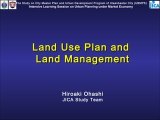
  • 1. The Study on City Master Plan and Urban Development Program of Ulaanbaatar City (UBMPS) Intensive Learning Session on Urban Planning under Market Economy Land Use Plan and Land Management Hiroaki Ohashi JICA Study Team 1
  • 2. Today’s Agenda • National Land Use Plan (National, Prefectural, & Municipal-Level Plans) in Japan • General Land Use Plan (Prefectural Level) in Japan • Land Use Planning and Regulations in City Planning Area (Municipal Level) in Japan • Introduction of Preparation Procedure of Land Use Planning (Municipal Level) in Japan 2
  • 3. Characteristics of National Land in Japan 306 174 26 Total Land Area 123 504 133 37,780,000 ha Total Population (as of March, 2005) Approx. 126,870,00 (persons) Bui 306 174 26 Ag Administrative Structure (as of Oct., 2006) 123 504 For 133 Wa Roa Central Government I so Ot h 2512 Unit: 0,000 ha 47 Prefectures Building Land A gr icult ur al Land 1,817 Municipalities For est Land Wat er Sur f ace, Riv er s, et c. • 779 Cities (15 Special Stated Cities) Roads • 842 Towns I solat ed Wilder ness • 196 Villages Ot her s 2512 3
  • 4. National Land Use Plans & General Land Use Plan Five Separate National Land Use Planning Law (NLUPL) Laws City Planning Area National Land Use Plan City Planning Area National-level Plan Agricultural Area Agricultural Area General Land Use Plan By Each Prefecture (1) General Land Use Plan Forest Area Map Forest Area Prefectural-level Plan (Five Categorized Areas) (2) Planning Document Natural Park Area Natural Park Area Land Transaction Regulation Municipal-level Plan (1) Permission Standard (2) Recommendation Standard Natural Natural Conservation Area Conservation Area 4
  • 5. Pictures for Five Categorized Areas City Planning Area City Planning Area Forest Area Forest Area Agricultural Area Agricultural Area 5
  • 6. Pictures for Five Categorized Areas Natural Park Area Natural Park Area Natural Conservation Area Natural Conservation Area 6
  • 7. Example of General Land Use Plan Map (Fukuoka Prefecture, Japan) Legends City Planning Area Agricultural Area Forest Area Natural Park Area Natural Conservation Area 7
  • 8. Structure of General Land Use Plan & Five Basic Laws Categories Plans Basic Laws City Planning Law City Planning Law City Planning Area (administered by Ministry of Land, City Planning Area City Planning Area (administered by Ministry of Land, City Planning Area Master Plan Infrastructure and Transport Master Plan Infrastructure and Transport (MLIT)) (MLIT)) (Prepared by Each Prefecture) Agricultural Promotion Areas Law Agricultural Promotion Areas Law Agricultural (administered by Ministry of General Land Use Plan Agricultural Area Agricultural (administered by Ministry of Agricultural Area Improvement Plan Agriculture, Forests and Fishing Improvement Plan Agriculture, Forests and Fishing (MAFF)) (MAFF)) Forest Law Forest Law (administered by Ministry of Forest Area Forest Plan (administered by Ministry of Forest Area Forest Plan Agriculture, Forests and Fishing Agriculture, Forests and Fishing (MAFF) (MAFF) National Park Law National Park Law Natural Park Area Park Plan (administered by Ministry of Natural Park Area Park Plan (administered by Ministry of Environment (MoE)) Environment (MoE)) National Conservation Law Natural Conservation National Conservation Law Natural Conservation Conservation Plan (administered by Ministry of Area Conservation Plan (administered by Ministry of Area Environment (MoE)) Environment (MoE)) 8
  • 9. Examples of Development Control Measures within Categorized Areas Categorized Areas which can be Available Development Control Measures Areas Designated City Planning • City Planning Area • Respective Development Permission System in Area • Urban Promotion Urban Promotion Area and Urban Control Area Area (within CPA) • Land Use Regulations • Urban Control Area • Building Code (within CPA) Agricultural • Agricultural • Restriction on Conversion of Agricultural Land Area Promotion Area in Agricultural Use District • Agricultural Use • Development Permission System in Agricultural District (within Use District Agricultural • Recommendation System and Public Promotion Area) Disclosure System for Development Activities within Agricultural Promotion Area except Agricultural Use District Forest Area • Forest Reserve • Development Permission System of Tree Area Cutting and Land Development in Forest • Target Area of Reserve Area Regional Forest • Development Permission System (for Land Plan (prepared by Development more than 1 ha) in Private Forest Each Prefecture) located in the Target Area of Regional Forest Plan 9
  • 10. Roles of General Land Use Plan (Prefecture Level) Comprehensively Coordinating Five Subordinate Plans Comprehensively Coordinating Five Subordinate Plans based on Five Separate Laws based on Five Separate Laws • Controlling Development Activities indirectly through Five Subordinate Plans Regulating Land Transaction for Preventing Land Speculation Regulating Land Transaction for Preventing Land Speculation •Designating “Controlled Area”, “Supervised Area”, etc. Requiring Review of Land Transaction Price and Objective of Land Transaction in Designated Areas at Prefectural Level Determining Measures for Idle Land Determining Measures for Idle Land 10
  • 11. Land Taxation System Categories Tax Types Targets to be Assessed & Assessment Criteria Tax on Land Registration License Tax Registration fee of land and/or building based Acquisition (National Tax) on assessed value of fixed assets Real Estate Acquisition Acquired real estate by buying land and/or Tax ( Prefectural Tax) building and constructing building based on assessed value of fixed assets Special Landholding Tax Acquired land based on land acquisition cost related to Land Acquisition (under suspension) (Municipal Tax) Land Inheritance Tax All properties including land based on (National Tax) assessed value of inherited properties (approx. 80 % of posted land price) Tax on Fixed Asset Tax (Municipal Land, building, and depreciable property based Landholding Tax) on assessed value of fixed assets (approx. 70 % of posted land price) City Planning Tax Land and/or building located in Urban (Municipal Tax) Promotion Area based on assessed value of fixed assets (approx. 70 % of posted land price) Special Landholding Tax Land which is hold for less than ten years related to Landholding based on land acquisition cost (under (Municipal Tax) suspension) Land Price Tax (National Land, etc. based on assessed value of Tax) inherited properties (approx. 80 % of posted land price) (under suspension) Tax on Land Levied through Personal Income Tax and Inhabitant Tax (in case of 11
  • 12. Municipal Master Plan & National Land Use Plan (Municipal-level Plan) National Land Use Plan (National-Level Plan) National Land Use Plan (Prefectural-Level Plan) Designation of City Planning Area Master Plan for City Planning Area (by the Prefectural Government) Municipal National Land Use Plan Basic (Municipal-Level Plan) Principles Municipal Master Plan (by the Municipality) Land Use Regulations Urban Facilities Urban Development Projects • Area Division (Senbiki System) • Zoning (Zones and Districts) • District Plan, etc. 12
  • 13. Area Division (Senbiki System) for Urban Growth Management Designating Line between Town and Country in City Planning Areas City Planning Area City Planning Area Urban Promotion Area (UPA) Urban Promotion Area (UPA) (Delineated by Each Prefecture) (Delineated by Each Prefecture) (Delineated by Each City) (Delineated by Each City) Agricultural Area Agricultural Area Areas which already built-up areas, Forest Area or Forest Area Areas which should be priority area Nature Park Area Nature Park Area for development in a planed manner within approximately ten years Nature Conservation Area Nature Conservation Area City Planning Urban Control Area (UCA) Area Urban Control Area Urban Control Area (UCA) (Delineated by Each City) (Delineated by Each City) (UCA) Area where urbanization should be restricted Urban Promotion Area (UPA) 13
  • 14. Urban Promotion Area (UPA) & Urban Control Area (UCA) Urban Promotion Area Urban Control Area Boundary of City Planning Area 14
  • 15. Development & Land Use Control in relation to Area Division (Senbiki System) Item Urbanization Promotion Area Urbanization Control Area Land Use Control Land use is controlled in Land use is regulated by accordance with Land Use plans from the agricultural Zoning, etc. for orderly use of side. Land Use Zoning is urban lands. not designated. Public Investment Public facilities such as roads, Public investment for the park, sewerage, etc. are promotion of agriculture approved and public Investment will be actively carried out. will be actively carried out. Urban Development Project Will be actively done. Will not be done. Land Development For development of more than The urban development Permission 1000m 2 , approval by the activities are strictly prefectural governor is controlled. necessary. Technical standards need to be me t . Conversion of Farmland Conversion must be reported to Official Approval from the local government. prefectural governor is required. City Planning Tax City Planning Taxes may be Cannot be levied. collected to generate revenue to find City Planning Projects. Source: “Urban Planning System in Japan 2 nd edition” JICA in corporation with MLIT, March 2007 15
  • 16. Zoning Map Category 1 Low-height Exclusive Residential Zone Category 2 Low-height Exclusive Residential Zone Category 1 Mid-height Exclusive Residential Zone Category 2 Mid-height Exclusive Residential Zone Category 1 Residential Zone Category 2 Residential Zone Semi-Residential Zone Neighborhood Commercial Zone Commercial Zone Semi-Industrial Zone Industrial Zone 16
  • 17. Background of Preparation of Land Use Plan Map(Fuzinomiya City, Shizuoka Prefecture) and Background of Fuzinomiya City • • Geological proximity to Tokyo Metropolitan Geological proximity to Tokyo Metropolitan Region Region • • Enriched natural and tourism resource Enriched natural and tourism resource Increase of residential, industrial and resort Increase of residential, industrial and resort development during high-growth period since 1965 development during high-growth period since 1965 Necessity of land use plan based on appropriate Necessity of land use plan based on appropriate land use planning methodology land use planning methodology Preparation History of Land Use-related Plans 1986 Fuzinomiya-City Comprehensive Development Plan (2 nd Comprehensive Plan) 1989 Fuzinomiya-City National Land Use Plan (1 st ) 2002 Fuzinomiya-City Urban Planning Master Plan 2005 Fuzinomiya-City National Land Use Plan (3 rd ) 17
  • 18. Preparation Procedure of Land Use Planning based on Land Resource Diagnosis (Municipal Level) Land Resource Diagnosis (Evaluation) for Land Use Planning • Geology • Soil • Vegetation • Flora & Fauna • Urbanization Land • Water • Agricultural Land • Cultural Heritages, • Forest Land etc • Disaster Prevention • Legislative • Water Resource Regulations • Natural Resource • Past Records of • Environmental Green Public Investment, etc. • Others 18
  • 19. Example of Preparation Procedure of Land Use Plan Map (Fuzinomiya City, Shizuoka Prefecture and Land Classification Map Overlapping Urbanization Land Suitability Map Urbanization Land Suitability Map Criteria Agricultural Land Suitability Map Agricultural Land Suitability Map Comprehensive Land Comprehensive Land Forest Land Suitability Map Use Suitability Map Use Suitability Map Forest Land Suitability Map Preservation Land Map for Preservation Land Map for Disaster Prevention Disaster Prevention Consideration Preservation Land Map for Preservation Land Map for of Policy Factor Water Resource Water Resource Preservation Land Map for Preservation Land Map for Natural Resource Natural Resource Land Use Plan Map Land Use Plan Map Environmental Green Environmental Green Land Map Land Map 19
  • 20. Urbanization Land Suitability Map Urbanization Land Suitability Map Agricultural Land Suitability Map Agricultural Land Suitability Map 20
  • 21. Forest Land Suitability Map Preservation Land Map for Preservation Land Map for Forest Land Suitability Map Disaster Prevention Disaster Prevention 21
  • 22. Preservation Land Map Preservation Land Map Preservation Land Map Preservation Land Map for Water Resource for Water Resource for Natural Resource for Natural Resource 22
  • 23. Environmental Green Land Environmental Green Land Legislative Regulation Legislative Regulation Map Map Map Map 23
  • 24. Comprehensive Land Use Comprehensive Land Use Land Use Plan Map Land Use Plan Map Suitability Map Suitability Map 24
  • 25. Summary • Establishment of Hierarchical System of Land Use Planning • Establishment of Development Control in Divided Areas based on the above Hierarchical System • Importance of Land Use Planning based on Analysis of Land Resource Placing Right Use in Right Place !! Placing Right Use in Right Place 25