Apidays Singapore 2024 - Building Digital Trust in a Digital Economy by Veron...
3 d model generation for deformation analysis using laser scanning data of a cooling tower
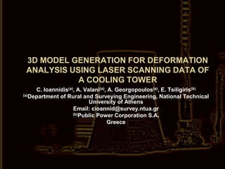
1. 3D MODEL GENERATION FOR DEFORMATION ANALYSIS USING LASER SCANNING DATA OF A COOLING TOWER C. Ioannidis(a), A. Valani(a), A. Georgopoulos(a), E. Tsiligiris(b) (a)Department of Rural and Surveying Engineering, National Technical University of Athens Email: cioannid@survey.ntua.gr (b)Public Power Corporation S.A. Greece
2. Introduction The Hellenic Public Power Corporation S.A. required the 3D survey of the external and internal surfaces and the production of a 3D solid model of an old cooling tower in order to record its current state, decide for repairs if necessary and investigate the possibility of upgrading it. NTUA was assigned with the task and the details of the survey and the results are presented.
3. Equipment HDS2500 (FOV 40ox40o) HDS3000 (FOV 360o horizontal and 270o vertical angle) spot size = 6mm position accuracy = ±6mm (in 50m range) Reflectorless total station
4. The tower in numbers 56 m 80 diagonals 97 m 40 pedestals 83 m
5. The tower in numbers Sn: Geodetic station Ln: Scanner set up 26 stations of the geodetic network that was established (3 stations inside the tower) 2,900 geodetically acquired check points 22,000,000 points acquired by the laser scanners 27 scanner set ups 6 days of fieldwork
6. Registration 27 scans to register 20 scans for the interior of the tower 10 for the lower part 10 for the upper part 7 scans for the exterior of the tower 16 targets were measured and used for registering the 10* scans of lower part of the interior 20 targets were measured and used for registering the scans of the exterior * 10 scans that cover the upper part of the interior were acquired with no targets
7. Registration with no targets Object shape The top of the tower is a horizontal ring Solution approximation A plane is fitted on a selection of points that belong on the top horizontal ring and through the coefficients of the equation of the plane the ω and φ rotations that must be applied so that the plane be horizontal are calculated Solution refinement The upper- and lower- part point clouds are compared via difference vectors that are calculated on a grid defined on the overlapping area and the relative ω and φ rotations and relative translation are thus eliminated
8. Registration Cyclone was used for the registration All of the scans registered in a common reference system For all overlapping scans cloud constraints were created There were no common targets nor overlapping scans between the interior and exterior Interior: 53 constraints (30 cloud constrains) Mean Absolute Error= 5 mm Exterior: 39 constraints (7 cloud constraints) Mean Absolute Error= 4 mm
9. 3D Modeling for Finite Element Analysis Finite Element Analysis (FEA): a computer-based numerical technique for calculating the strength and behavior of engineering structures 3D Models for FEA: Ordinary CAD models are usually unsuitable A mesh of a NURBS surface is normally required Required formats: IGES, ACIS, STEP and STL 3D Model characteristics: Simplified models “Geared” for FEA
10. Data preparation for 3D modeling Noise removal Creation of different point clouds for the parts of the tower Creation of 3D faces for parts that were impossible to scan (e.g. pedestals, inside part of the shell extending from the lintel up until the doorstep)
11. 3D Modeling of the Cooling-Tower Data: Laser scanner point clouds and 3D faces S/W: Raindrop Geomagic Studio 7 SHAPE MODE PHASE MODE Boundary definition Exporting to IGES Corrections of polygonal mesh NURBS creation and corrections Assembly of Tower parts Grid definition Polygonal mesh creation Patch definition and corrections
12. Shape Mode Polygonal mesh creation Assembly of Tower parts Corrections of polygonal mesh Boundary definition
13. Shape Mode Polygonal mesh creation Assembly of Tower parts Corrections of polygonal mesh Boundary definition
18. RelaxingShape Mode Polygonal mesh creation Assembly of Tower parts Corrections of polygonal mesh Boundary definition
19. Shape Mode Polygonal mesh creation Assembly of Tower parts Corrections of polygonal mesh Boundary definition
20. Phase Mode Patch definition and corrections Grid definition NURBS creation and corrections Exporting to IGES
21. Phase Mode Patch definition and corrections Grid definition NURBS creation and corrections Exporting to IGES
22. Phase Mode Patch definition and corrections Grid definition NURBS creation and corrections Exporting to IGES
23. Phase Mode Patch definition and corrections Grid definition NURBS creation and corrections Exporting to IGES
24. Accuracy evaluation GEODETIC DATA 1250 geodetically acquired points on the external surface of the tower Only 146 points deviate more than ± 3 cm from the polygonal surface model (μ =-1 cm, σ =±1.5 cm)
25. Accuracy evaluation MATHEMATICAL SURFACE A one-sheeted hyperboloid was fitted on the data and using the equation 18.000 simulation points were calculated There are areas where deviations of ±20 cm are observed but the greatest part fits the mathematical model quite well (μ =-2.4 cm, σ =±4cm)
26. Conclusions The use of a commercial laser scanner (±6mm at 50m) and the processing of the acquired data with Cyclone (registrations) and Geomagic (3D model generation) leads to results of adequate accuracy and satisfying quality for applications such as this