Submit Search
Upload
Gps
•
54 likes
•
10,428 views
Anmol Bagga
Follow
Technology
Business
Report
Share
Report
Share
1 of 32
Recommended
Global Positing System
Global Positing System
Global Positing System
Pranay Mondal
GLOBAL POSITIONING SYSTEM BASICS
GLOBAL POSITIONING SYSTEM
GLOBAL POSITIONING SYSTEM
Eminent Planners
A group presentation for the Technology Strategy and Organisation module focusing on the Global Positioning System (GPS) .
Global Positioning System (GPS)
Global Positioning System (GPS)
richard_craig
Introduction to gps and gnss
Introduction to gps and gnss
Vivek Srivastava
introduction-of-gnss part-1
introduction-of-GNSS-1
introduction-of-GNSS-1
Kutubuddin ANSARI
Presentation
GPS
GPS
Ramasubbu .P
very good presentation about how gps works
How gps works
How gps works
mfallaha
Introduction of gps global navigation satellite systems
Introduction of gps global navigation satellite systems
DocumentStory
Gps and its application REPORT
Gps and its application
Gps and its application
shubham paliwal
GNSS
GNSS
Bob Champoux
Introduction to GPS: 2nd Workshop of "Maps for Making Change" http://maps4change.cis-india.org http://www.tacticaltech.org/news/mapsforchange
Basics of GPS
Basics of GPS
Hardeep Rai
how gps works in mobile navigation
Gps
Gps
Vivek Bajpai
GPS definition
Gps
Gps
Mohamed Abdo
Global positioning system (gps)
Global positioning system (gps)
Gokul Saud
Working Principle of GPS System!
Global Positioning System
Global Positioning System
Rishi Shukla
all information about the GPS
Gps principle and working
Gps principle and working
Arnishprajapati
GPS
GPS
Pawan Kumar
Global Positioning System
Global Positioning System
Varun B P
Working and application of GPS
Gps ppt
Gps ppt
Rishabh Gandhi
the basic information about the global positioning system.
Global positioning system
Global positioning system
Dhaval Jalalpara
Aerospace and Remote Sensing
GPS (GLOBAL POSITIONING SYSTEM)
GPS (GLOBAL POSITIONING SYSTEM)
Abdul mannan Karim
get some knowledge about GPS
Working principle of gps
Working principle of gps
Shivamsanoo
For EPS Thursday Meeting. (English Presentation Space)
How GPS Works
How GPS Works
Daniel Kim
A presentation on GNSS Technologies
Global navigation satellite system based positioning combined
Global navigation satellite system based positioning combined
Mehjabin Sultana
This slide was made for the 'English Presentation Space' meeting. It explains what GPS is and shows it's application.
Introduction to GPS
Introduction to GPS
Daniel Kim
Geographical information systems (GIS)
Gps
Gps
Mohsin Siddique
global position system
gps technology
gps technology
Naga Dinesh
What is GPS?/ Elements of GPS/ Uses / Advantages/ Disadvantages
Global positioning system (GPS)
Global positioning system (GPS)
Chandana R
Introduction to navstar gps
Introduction to navstar gps
DocumentStory
informative ppt. including the interesting aspects of gps
GPS ppt.
GPS ppt.
Jawad Ali
More Related Content
What's hot
Gps and its application REPORT
Gps and its application
Gps and its application
shubham paliwal
GNSS
GNSS
Bob Champoux
Introduction to GPS: 2nd Workshop of "Maps for Making Change" http://maps4change.cis-india.org http://www.tacticaltech.org/news/mapsforchange
Basics of GPS
Basics of GPS
Hardeep Rai
how gps works in mobile navigation
Gps
Gps
Vivek Bajpai
GPS definition
Gps
Gps
Mohamed Abdo
Global positioning system (gps)
Global positioning system (gps)
Gokul Saud
Working Principle of GPS System!
Global Positioning System
Global Positioning System
Rishi Shukla
all information about the GPS
Gps principle and working
Gps principle and working
Arnishprajapati
GPS
GPS
Pawan Kumar
Global Positioning System
Global Positioning System
Varun B P
Working and application of GPS
Gps ppt
Gps ppt
Rishabh Gandhi
the basic information about the global positioning system.
Global positioning system
Global positioning system
Dhaval Jalalpara
Aerospace and Remote Sensing
GPS (GLOBAL POSITIONING SYSTEM)
GPS (GLOBAL POSITIONING SYSTEM)
Abdul mannan Karim
get some knowledge about GPS
Working principle of gps
Working principle of gps
Shivamsanoo
For EPS Thursday Meeting. (English Presentation Space)
How GPS Works
How GPS Works
Daniel Kim
A presentation on GNSS Technologies
Global navigation satellite system based positioning combined
Global navigation satellite system based positioning combined
Mehjabin Sultana
This slide was made for the 'English Presentation Space' meeting. It explains what GPS is and shows it's application.
Introduction to GPS
Introduction to GPS
Daniel Kim
Geographical information systems (GIS)
Gps
Gps
Mohsin Siddique
global position system
gps technology
gps technology
Naga Dinesh
What is GPS?/ Elements of GPS/ Uses / Advantages/ Disadvantages
Global positioning system (GPS)
Global positioning system (GPS)
Chandana R
What's hot
(20)
Gps and its application
Gps and its application
GNSS
GNSS
Basics of GPS
Basics of GPS
Gps
Gps
Gps
Gps
Global positioning system (gps)
Global positioning system (gps)
Global Positioning System
Global Positioning System
Gps principle and working
Gps principle and working
GPS
GPS
Global Positioning System
Global Positioning System
Gps ppt
Gps ppt
Global positioning system
Global positioning system
GPS (GLOBAL POSITIONING SYSTEM)
GPS (GLOBAL POSITIONING SYSTEM)
Working principle of gps
Working principle of gps
How GPS Works
How GPS Works
Global navigation satellite system based positioning combined
Global navigation satellite system based positioning combined
Introduction to GPS
Introduction to GPS
Gps
Gps
gps technology
gps technology
Global positioning system (GPS)
Global positioning system (GPS)
Viewers also liked
Introduction to navstar gps
Introduction to navstar gps
DocumentStory
informative ppt. including the interesting aspects of gps
GPS ppt.
GPS ppt.
Jawad Ali
This presentation is about GPS... what is it?why GPS? , how it works? and the applications of GPS. By Mostafa Hussien facebook profile: http://www.facebook.com/mstfahsin Twitter @MSTFAHSIN Tumblr mostafahussien.tumblr.com
"GPS" Global Positioning System [PDF]
"GPS" Global Positioning System [PDF]
Course Hero
Global positioning system ppt
Global positioning system ppt
Swapnil Ramgirwar
Gps
Gps
Vivek Bajpai
Global positioning System
Global positioning System
Global positioning System
ayushrajput
Introduction to global position system
Introduction to global position system
Introduction to global position system
University of Technology
PPT will be helpful to understand the basics of gps
Global positioning system
Global positioning system
Pooja Jain
its all about the GPS
(Emap) E Book Understanding The Gps
(Emap) E Book Understanding The Gps
rickymohanty
This is a presentation about the GPS technology.
Gps
Gps
zeaulodx
GPS
Gps
Gps
serdar1983
introduction of GPS, satellite navigation system,GPS space segment,control segment,user segment,GPS satellite signals,receivers,static ,kinematics and differential GPS system.
Global positioning system (gps)
Global positioning system (gps)
Vandana Verma
All information about GPS & GIS also in mining branch related detail and others. full concept
GPS & GIS
GPS & GIS
Chittranjan Vaishnav
It is not a fully descriptive presentation but, it can help you to survive in urgency. Schematic is copied. It's just a ppt.
Vehicle tracking system using GSM and GPS
Vehicle tracking system using GSM and GPS
Bharath Chapala
Gps tracking system
Gps tracking system
Sumit Kumar
TOTAL STATION SURVEY, TYPES OF TOTAL STATION, ERRORS IN TOTAL STATION SURVEYING
CE6404 ANNA UNIVERSITY Unit iii total station surveying
CE6404 ANNA UNIVERSITY Unit iii total station surveying
Dr Gopikrishnan T
ATOP SMART WATCH
ATOP SMART WATCH
Victor Zhu
detail info about GPS.. intro The Global Positioning System (GPS) is a satellite-based navigation system made up of a network of 24 satellites placed into orbit. The first GPS satellite was launched in 1978. In the year 1980, the government made the system available for civilian use. GPS works in any weather conditions, anywhere in the world, 24 hours a day. The 24 satellites that make up the GPS space segment are orbiting the earth about 12,000 miles above us.
Gps (global positioning system)
Gps (global positioning system)
Yousuf S A
Presentation proposes a formal approach to represent and analyse tag clouds, using the principles of cartography and graph theory.
Geotagging Photographs By Sanjay Rana
Geotagging Photographs By Sanjay Rana
sanjay_rana
Iirs gps dmc 2010
Iirs gps dmc 2010
Tushar Dholakia
Viewers also liked
(20)
Introduction to navstar gps
Introduction to navstar gps
GPS ppt.
GPS ppt.
"GPS" Global Positioning System [PDF]
"GPS" Global Positioning System [PDF]
Global positioning system ppt
Global positioning system ppt
Gps
Gps
Global positioning System
Global positioning System
Introduction to global position system
Introduction to global position system
Global positioning system
Global positioning system
(Emap) E Book Understanding The Gps
(Emap) E Book Understanding The Gps
Gps
Gps
Gps
Gps
Global positioning system (gps)
Global positioning system (gps)
GPS & GIS
GPS & GIS
Vehicle tracking system using GSM and GPS
Vehicle tracking system using GSM and GPS
Gps tracking system
Gps tracking system
CE6404 ANNA UNIVERSITY Unit iii total station surveying
CE6404 ANNA UNIVERSITY Unit iii total station surveying
ATOP SMART WATCH
ATOP SMART WATCH
Gps (global positioning system)
Gps (global positioning system)
Geotagging Photographs By Sanjay Rana
Geotagging Photographs By Sanjay Rana
Iirs gps dmc 2010
Iirs gps dmc 2010
Similar to Gps
gps fully explained!!
Global positioning system
Global positioning system
Jeevan Reddy Mandali
GPS STANDS FOR GLOBAL POSITIONING SYSTEM..... NOW A DAYS IT IS BECOMING MORE POPULAR.IT CAN BE USED ALL OVER THE GLOBE.
GPS DOCUMENT
GPS DOCUMENT
Tuhin_Das
Navigation and positioning are crucial to most human activities and yet the process has always been quite.
Gps device in the geological field mapping
Gps device in the geological field mapping
Ensaf Atef
Differential Global Positing System
Dgps seminar
Dgps seminar
anand0030
A Presentation on Gps
Global Positioning System
Global Positioning System
SouravKundu23
How gps works
How gps works
Hossam Zein
How GPS Works
How GPS Works
Gohar Ali
Global Positioning System (GPS)
Global Positioning System (GPS)
Nikhil Prathapani
A brief description of GPS and its role in Healthcare
Global Positioning System (GPS) in Helthcare
Global Positioning System (GPS) in Helthcare
Zulfiquer Ahmed Amin
A short summary about how GPS works and references to "key" parts of this system.
Gps
Gps
alexbar
A short summary about how GPS works and references to "key" parts of this system.
Gps
Gps
alexbar
Seminar on Global Positioning System
Gps seminar
Gps seminar
WazidulSyed
GPS
The GPS.pptx
The GPS.pptx
henrybarnes13
Global Positioning System (GPS) is a satellite based navigation system that can provide people who use it with their exact position on Earth, tell them how to get to another location, how fast they are moving, where they have been, how far they have gone, what time it is. GPS was originally designed to help the U.S. military with finding the accurate location of their soldiers, vehicles, planes and ships around the world. Now, GPS is used in cellular phones, navigation and map making. Space segments GPS satellites fly in medium Earth orbit (MEO) at an altitude of approximately 20,200 km (12,550 miles). Each satellite circles the Earth twice a day. The satellites in the GPS constellation are arranged into six equally-spaced orbital planes surrounding the Earth. Each plane contains four "slots" occupied by baseline satellites. This 24-slot arrangement ensures users can view at least four satellites from virtually any point on the planet. The control segment The control segment of the GPS system consists of a worldwide network of tracking stations. The master control station (MCS) located in the United States at Colorado Springs, Colorado. The primary task of the operational control segment is tracking the GPS satellites in order to determine and predict satellite locations, system integrity, behavior of the satellite atomic clocks, atmospheric data, the satellite almanac, and other considerations. The User segment The user segment includes all military and civilian users. With a GPS receiver connected to a GPS antenna, a user can receive the GPS signals, which can be used to determine his or her position anywhere in the world. GPS is currently available to all users worldwide at no direct charge. How it work? When a GPS receiver is first turned on, it downloads orbit information from all the satellites called an almanac. Once this information is downloaded, it is stored in the receiver’s memory for future use. The GPS receiver calculates the distance from each satellite to the receiver by using the distance formula: distance = velocity x time. The receiver determines position by using triangulation. When it receives signals from at least three satellites the receiver should be able to calculate its approximate position (a 2D position). The receiver needs at least four or more satellites to calculate a more accurate 3D position. The position can be reported in latitude/longitude. The two GPS codes are;- Coarse acquisition (or C/A-code) Precision (or P-code). The C/A-code is modulated onto the L1 carrier only, while the P-code is modulated onto both the L1 and the L2 carriers. This modulation is called biphase modulation, because the carrier phase is shifted by 180° when the code value changes from zero to one or from one to zero. Source of GPS error Satellite clock errors: Caused by slight discrepancies in each satellite’s four atomic clocks. Errors are monitored and corrected by the Master Control Station. Orbit errors:Satellite orbits.
GPS.pptx
GPS.pptx
Banaras Hindu University UP. Central University of Punjab Bathinda,
Gps eser
Gps eser
Hossam Zein
A presentation based on the fundamentals of GPS
Gps Niladri
Gps Niladri
Thedarkangel1
info about gps
Gps
Gps
Amith Kumar
brief of DGPS
Intro of Differential GPS.pptx
Intro of Differential GPS.pptx
maniatindia
A presentation about how GPS works
How_GPS_Works.ppt
How_GPS_Works.ppt
Sadiq Ramazan
Global positioning system
Global positioning system
Divya Lattoo
Similar to Gps
(20)
Global positioning system
Global positioning system
GPS DOCUMENT
GPS DOCUMENT
Gps device in the geological field mapping
Gps device in the geological field mapping
Dgps seminar
Dgps seminar
Global Positioning System
Global Positioning System
How gps works
How gps works
How GPS Works
How GPS Works
Global Positioning System (GPS)
Global Positioning System (GPS)
Global Positioning System (GPS) in Helthcare
Global Positioning System (GPS) in Helthcare
Gps
Gps
Gps
Gps
Gps seminar
Gps seminar
The GPS.pptx
The GPS.pptx
GPS.pptx
GPS.pptx
Gps eser
Gps eser
Gps Niladri
Gps Niladri
Gps
Gps
Intro of Differential GPS.pptx
Intro of Differential GPS.pptx
How_GPS_Works.ppt
How_GPS_Works.ppt
Global positioning system
Global positioning system
More from Anmol Bagga
Smart : Comprehensive and unified framework for test automation of web and mo...
Smart : Comprehensive and unified framework for test automation of web and mo...
Anmol Bagga
TAME-Test Automation Made Easy
TAME-Test Automation Made Easy
Anmol Bagga
Amplifiers Pesentation
Amplifiers Pesentation
Anmol Bagga
Home Appliances
Home Appliances
Anmol Bagga
Homeautomation
Homeautomation
Anmol Bagga
fuzzy logic
fuzzy logic
Anmol Bagga
Plasma Technology
Plasma Technology
Anmol Bagga
nano science and nano technology
nano science and nano technology
Anmol Bagga
Embedded system
Embedded system
Anmol Bagga
basic networking
basic networking
Anmol Bagga
Technology that identifies you based on your physical or behavioral traits- for added security to confirm that you are who you claim to be.(this ppt is very dear to me as i have given a talk on this topic twice. this also fetched me and migmar first prize at deen dayal upadhyay college- converging vectors - an inter college presentation competition organized by arya bhata science forum)
biometric technology
biometric technology
Anmol Bagga
More from Anmol Bagga
(11)
Smart : Comprehensive and unified framework for test automation of web and mo...
Smart : Comprehensive and unified framework for test automation of web and mo...
TAME-Test Automation Made Easy
TAME-Test Automation Made Easy
Amplifiers Pesentation
Amplifiers Pesentation
Home Appliances
Home Appliances
Homeautomation
Homeautomation
fuzzy logic
fuzzy logic
Plasma Technology
Plasma Technology
nano science and nano technology
nano science and nano technology
Embedded system
Embedded system
basic networking
basic networking
biometric technology
biometric technology
Recently uploaded
Presented by Mike Hicks
How to Troubleshoot Apps for the Modern Connected Worker
How to Troubleshoot Apps for the Modern Connected Worker
ThousandEyes
The value of a flexible API Management solution for Open Banking Steve Melan, Manager for IT Innovation and Architecture - State's and Saving's Bank of Luxembourg Apidays New York 2024: The API Economy in the AI Era (April 30 & May 1, 2024) ------ Check out our conferences at https://www.apidays.global/ Do you want to sponsor or talk at one of our conferences? https://apidays.typeform.com/to/ILJeAaV8 Learn more on APIscene, the global media made by the community for the community: https://www.apiscene.io Explore the API ecosystem with the API Landscape: https://apilandscape.apiscene.io/
Apidays New York 2024 - The value of a flexible API Management solution for O...
Apidays New York 2024 - The value of a flexible API Management solution for O...
apidays
Terragrunt, Terraspace, Terramate, terra... whatever. What is wrong with Terraform so people keep on creating wrappers and solutions around it? How OpenTofu will affect this dynamic? In this presentation, we will look into the fundamental driving forces behind a zoo of wrappers. Moreover, we are going to put together a wrapper ourselves so you can make an educated decision if you need one.
AWS Community Day CPH - Three problems of Terraform
AWS Community Day CPH - Three problems of Terraform
Andrey Devyatkin
Repurposing LNG terminals for Hydrogen Ammonia: Feasibility and Cost Saving. A report by Poten & Partners as part of the Hydrogen Asia 2024 Summit in Singapore. Copyright Poten & Partners 2024.
Repurposing LNG terminals for Hydrogen Ammonia: Feasibility and Cost Saving
Repurposing LNG terminals for Hydrogen Ammonia: Feasibility and Cost Saving
Edi Saputra
JAM, the future of Polkadot.
Polkadot JAM Slides - Token2049 - By Dr. Gavin Wood
Polkadot JAM Slides - Token2049 - By Dr. Gavin Wood
Juan lago vázquez
Scaling API-first – The story of a global engineering organization Ian Reasor, Senior Computer Scientist - Adobe Radu Cotescu, Senior Computer Scientist - Adobe Apidays New York 2024: The API Economy in the AI Era (April 30 & May 1, 2024) ------ Check out our conferences at https://www.apidays.global/ Do you want to sponsor or talk at one of our conferences? https://apidays.typeform.com/to/ILJeAaV8 Learn more on APIscene, the global media made by the community for the community: https://www.apiscene.io Explore the API ecosystem with the API Landscape: https://apilandscape.apiscene.io/
Apidays New York 2024 - Scaling API-first by Ian Reasor and Radu Cotescu, Adobe
Apidays New York 2024 - Scaling API-first by Ian Reasor and Radu Cotescu, Adobe
apidays
This reviewer is for the second quarter of Empowerment Technology / ICT in Grade 11
EMPOWERMENT TECHNOLOGY GRADE 11 QUARTER 2 REVIEWER
EMPOWERMENT TECHNOLOGY GRADE 11 QUARTER 2 REVIEWER
MadyBayot
Accelerating FinTech Innovation: Unleashing API Economy and GenAI Vasa Krishnan, Chief Technology Officer - FinResults Apidays New York 2024: The API Economy in the AI Era (April 30 & May 1, 2024) ------ Check out our conferences at https://www.apidays.global/ Do you want to sponsor or talk at one of our conferences? https://apidays.typeform.com/to/ILJeAaV8 Learn more on APIscene, the global media made by the community for the community: https://www.apiscene.io Explore the API ecosystem with the API Landscape: https://apilandscape.apiscene.io/
Apidays New York 2024 - Accelerating FinTech Innovation by Vasa Krishnan, Fin...
Apidays New York 2024 - Accelerating FinTech Innovation by Vasa Krishnan, Fin...
apidays
MS Copilot expands with MS Graph connectors
MS Copilot expands with MS Graph connectors
MS Copilot expands with MS Graph connectors
Nanddeep Nachan
Presentation from Melissa Klemke from her talk at Product Anonymous in April 2024
ProductAnonymous-April2024-WinProductDiscovery-MelissaKlemke
ProductAnonymous-April2024-WinProductDiscovery-MelissaKlemke
Product Anonymous
Following the popularity of "Cloud Revolution: Exploring the New Wave of Serverless Spatial Data," we're thrilled to announce this much-anticipated encore webinar. In this sequel, we'll dive deeper into the Cloud-Native realm by uncovering practical applications and FME support for these new formats, including COGs, COPC, FlatGeoBuf, GeoParquet, STAC, and ZARR. Building on the foundation laid by industry leaders Michelle Roby of Radiant Earth and Chris Holmes of Planet in the first webinar, this second part offers an in-depth look at the real-world application and behind-the-scenes dynamics of these cutting-edge formats. We will spotlight specific use-cases and workflows, showcasing their efficiency and relevance in practical scenarios. Discover the vast possibilities each format holds, highlighted through detailed discussions and demonstrations. Our expert speakers will dissect the key aspects and provide critical takeaways for effective use, ensuring attendees leave with a thorough understanding of how to apply these formats in their own projects. Elevate your understanding of how FME supports these cutting-edge technologies, enhancing your ability to manage, share, and analyze spatial data. Whether you're building on knowledge from our initial session or are new to the serverless spatial data landscape, this webinar is your gateway to mastering cloud-native formats in your workflows.
Cloud Frontiers: A Deep Dive into Serverless Spatial Data and FME
Cloud Frontiers: A Deep Dive into Serverless Spatial Data and FME
Safe Software
This project focuses on implementing real-time object detection using Raspberry Pi and OpenCV. Real-time object detection is a critical aspect of computer vision applications, allowing systems to identify and locate objects within a live video stream instantly.
Real Time Object Detection Using Open CV
Real Time Object Detection Using Open CV
Khem
Presentation on the progress in the Domino Container community project as delivered at the Engage 2024 conference
2024: Domino Containers - The Next Step. News from the Domino Container commu...
2024: Domino Containers - The Next Step. News from the Domino Container commu...
Martijn de Jong
Axa Assurance Maroc - Insurer Innovation Award 2024
Axa Assurance Maroc - Insurer Innovation Award 2024
Axa Assurance Maroc - Insurer Innovation Award 2024
The Digital Insurer
ICT role in 21 century education. How to ICT help in education
presentation ICT roal in 21st century education
presentation ICT roal in 21st century education
jfdjdjcjdnsjd
In this talk, we are going to cover the use-case of food image generation at Delivery Hero, its impact and the challenges. In particular, we will present our image scoring solution for filtering out inappropriate images and elaborate on the models we are using.
"I see eyes in my soup": How Delivery Hero implemented the safety system for ...
"I see eyes in my soup": How Delivery Hero implemented the safety system for ...
Zilliz
Manulife - Insurer Transformation Award 2024
Manulife - Insurer Transformation Award 2024
Manulife - Insurer Transformation Award 2024
The Digital Insurer
In this session, we will delve into strategic approaches for optimizing knowledge management within Microsoft 365, amidst the evolving landscape of Copilot. From leveraging automatic metadata classification and permission governance with SharePoint Premium, to unlocking Viva Engage for the cultivation of knowledge and communities, you will gain actionable insights to bolster your organization's knowledge-sharing initiatives. In this session, we will also explore how to facilitate solutions to enable your employees to find answers and expertise within Microsoft 365. You will leave equipped with practical techniques and a deeper understanding of how there is more to effective knowledge management than just enabling Copilot, but building actual solutions to prepare the knowledge that Copilot and your employees can use.
Strategies for Unlocking Knowledge Management in Microsoft 365 in the Copilot...
Strategies for Unlocking Knowledge Management in Microsoft 365 in the Copilot...
Drew Madelung
Webinar Recording: https://www.panagenda.com/webinars/why-teams-call-analytics-is-critical-to-your-entire-business Nothing is as frustrating and noticeable as being in an important call and being unable to see or hear the other person. Not surprising then, that issues with Teams calls are among the most common problems users call their helpdesk for. Having in depth insight into everything relevant going on at the user’s device, local network, ISP and Microsoft itself during the call is crucial for good Microsoft Teams Call quality support. To ensure a quick and adequate solution and to ensure your users get the most out of their Microsoft 365. But did you know that ‘bad calls’ are also an excellent indicator of other problems arising? Precisely because it is so noticeable!? Like the canary in the mine, bad calls can be early indicators of problems. Problems that might otherwise not have been noticed for a while but can have a big impact on productivity and satisfaction. Join this session by Christoph Adler to learn how true Microsoft Teams call quality analytics helped other organizations troubleshoot bad calls and identify and fix problems that impacted Teams calls or the use of Microsoft365 in general. See what it can do to keep your users happy and productive! In this session we will cover - Why CQD data alone is not enough to troubleshoot call problems - The importance of attributing call problems to the right call participant - What call quality analytics can do to help you quickly find, fix-, and prevent problems - Why having retrospective detailed insights matters - Real life examples of how others have used Microsoft Teams call quality monitoring to problem shoot problems with their ISP, network, device health and more.
Why Teams call analytics are critical to your entire business
Why Teams call analytics are critical to your entire business
panagenda
Created by Mozilla Research in 2012 and now part of Linux Foundation Europe, the Servo project is an experimental rendering engine written in Rust. It combines memory safety and concurrency to create an independent, modular, and embeddable rendering engine that adheres to web standards. Stewardship of Servo moved from Mozilla Research to the Linux Foundation in 2020, where its mission remains unchanged. After some slow years, in 2023 there has been renewed activity on the project, with a roadmap now focused on improving the engine’s CSS 2 conformance, exploring Android support, and making Servo a practical embeddable rendering engine. In this presentation, Rakhi Sharma reviews the status of the project, our recent developments in 2023, our collaboration with Tauri to make Servo an easy-to-use embeddable rendering engine, and our plans for the future to make Servo an alternative web rendering engine for the embedded devices industry. (c) Embedded Open Source Summit 2024 April 16-18, 2024 Seattle, Washington (US) https://events.linuxfoundation.org/embedded-open-source-summit/ https://ossna2024.sched.com/event/1aBNF/a-year-of-servo-reboot-where-are-we-now-rakhi-sharma-igalia
A Year of the Servo Reboot: Where Are We Now?
A Year of the Servo Reboot: Where Are We Now?
Igalia
Recently uploaded
(20)
How to Troubleshoot Apps for the Modern Connected Worker
How to Troubleshoot Apps for the Modern Connected Worker
Apidays New York 2024 - The value of a flexible API Management solution for O...
Apidays New York 2024 - The value of a flexible API Management solution for O...
AWS Community Day CPH - Three problems of Terraform
AWS Community Day CPH - Three problems of Terraform
Repurposing LNG terminals for Hydrogen Ammonia: Feasibility and Cost Saving
Repurposing LNG terminals for Hydrogen Ammonia: Feasibility and Cost Saving
Polkadot JAM Slides - Token2049 - By Dr. Gavin Wood
Polkadot JAM Slides - Token2049 - By Dr. Gavin Wood
Apidays New York 2024 - Scaling API-first by Ian Reasor and Radu Cotescu, Adobe
Apidays New York 2024 - Scaling API-first by Ian Reasor and Radu Cotescu, Adobe
EMPOWERMENT TECHNOLOGY GRADE 11 QUARTER 2 REVIEWER
EMPOWERMENT TECHNOLOGY GRADE 11 QUARTER 2 REVIEWER
Apidays New York 2024 - Accelerating FinTech Innovation by Vasa Krishnan, Fin...
Apidays New York 2024 - Accelerating FinTech Innovation by Vasa Krishnan, Fin...
MS Copilot expands with MS Graph connectors
MS Copilot expands with MS Graph connectors
ProductAnonymous-April2024-WinProductDiscovery-MelissaKlemke
ProductAnonymous-April2024-WinProductDiscovery-MelissaKlemke
Cloud Frontiers: A Deep Dive into Serverless Spatial Data and FME
Cloud Frontiers: A Deep Dive into Serverless Spatial Data and FME
Real Time Object Detection Using Open CV
Real Time Object Detection Using Open CV
2024: Domino Containers - The Next Step. News from the Domino Container commu...
2024: Domino Containers - The Next Step. News from the Domino Container commu...
Axa Assurance Maroc - Insurer Innovation Award 2024
Axa Assurance Maroc - Insurer Innovation Award 2024
presentation ICT roal in 21st century education
presentation ICT roal in 21st century education
"I see eyes in my soup": How Delivery Hero implemented the safety system for ...
"I see eyes in my soup": How Delivery Hero implemented the safety system for ...
Manulife - Insurer Transformation Award 2024
Manulife - Insurer Transformation Award 2024
Strategies for Unlocking Knowledge Management in Microsoft 365 in the Copilot...
Strategies for Unlocking Knowledge Management in Microsoft 365 in the Copilot...
Why Teams call analytics are critical to your entire business
Why Teams call analytics are critical to your entire business
A Year of the Servo Reboot: Where Are We Now?
A Year of the Servo Reboot: Where Are We Now?
Gps
1.
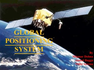
GLOBAL POSITIONING SYSTEM
By Migmar Dolma Anmol Bagga Nidhi Saxena
2.
3.
4.
3 Segments of
GPS Control Segment Space Segment User Segment Monitor Stations Ground Antennas Master Station GPS
5.
6.
GPS Ground Control
Stations Currently there are only five GPS monitoring station that feed the Master Control Station. GPS
7.
8.
9.
10.
11.
12.
13.
2D Triangulation GPS
14.
3D Triangulation GPS
15.
16.
17.
How does it
work? GPS
18.
19.
What do you
think? GPS 19000KM
20.
21.
22.
Sources Of Error
Sometimes the signals bounces off even before they hit the receivers or follow multipath . GPS are Line of sight transmission which is the ability to transmit between two objects without any other objects getting in the way. GPS
23.
24.
25.
26.
27.
28.
In a Nutshell
GPS
29.
30.
31.
32.

![Contents ,[object Object],[object Object],[object Object],[object Object],[object Object],[object Object],[object Object],[object Object],[object Object],GPS](data:image/gif;base64,R0lGODlhAQABAIAAAAAAAP///yH5BAEAAAAALAAAAAABAAEAAAIBRAA7)