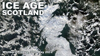
Ice Age Scotland
•Als PPTX, PDF herunterladen•
2 gefällt mir•1,229 views

The document discusses the benefits of meditation for reducing stress and anxiety. Regular meditation practice can help calm the mind and body by lowering heart rate and blood pressure. Studies have shown that meditating for just 10-20 minutes per day can have significant positive impacts on both mental and physical health over time.

Empfohlen
Weitere ähnliche Inhalte
Andere mochten auch
Andere mochten auch (20)
Mehr von Alan Doherty
Mehr von Alan Doherty (20)
Kürzlich hochgeladen
Kürzlich hochgeladen (20)
Hinweis der Redaktion
- Scotland’s landscape has been formed by three major components – Rocks, Ice and People. “They think it’s all over?” – Well maybe. You can make your own mind up. We can’t examine the Ice Age in Scotland without referring to the geology and the colonisation of our country. So, hang on to your hats as we cover the main events of the geology of Scotland in five slides!
- Scotland is made up of six major terranes or geological units. Our country didn’t exist as a single entity until about 410MYBP, when the major terranes or “islands” of rock that make up Scotland today slipped together along the major fault lines shown on the map. The oldest rocks in Scotland, by far, are the Lewisian gneisses, which formed in the Earth’s crust up to 3 billion years ago. A huge Ocean, called the Iapetus Ocean closed at the same time and “England” and “Scotland” became joined at the waist! So, the good Lord created paradise and provided us with our dodgy neighbours at the same time!
- A fold mountain range, perhaps as high as the Himalayas was created by the Scotland England collision. It is the heavily eroded stump of this mountain range which forms the Grampian Mountains today.
- The Carboniferous era is famous for providing Scotland with its coal deposits, but in landscape terms, the igneous activity at the start and end of this era was much more important. The early part of this geological period was marked by vast outpourings of lava that spewed out across the Midland Valley to build up, eg, the Campsies and the Gargunnock Hills.
- Differential erosion by ice is one of the reasons for Scotland’s varied landscapes. The landscape of Arthur’s Seat is repeated time and time again in the Midland Valley. From Dumbarton Rock to the Lomond Hills, the ice has removed the “softer” sedimentary covering and chiselled away at the igneous heritage of this geological period.
- From the point of view of West Lothian’s landscape, the early Carboniferous igneous activity had the greatest impact, providing us with all the craggy high points of our county (unitary authority), such as Cockleroi, Binny Craig, and Kirk o’Shotts.
- The most recent burst of igneous activity in Scotland was associated with the opening of the North Atlantic. The volcanoes and lavas and intrusions from this time have provided Scotland with some of its highest quality scenery.
- The Ice Age is a much more recent phenomenon. About 2 million years ago, the climate began to cool and ice began to collect in northern mountain ranges. The temperature oscillated between warm periods when the ice completely disappeared from Scotland to very cold periods when the whole of Scotland was covered with ice.
- Erosion and transportation dominate the work of the valley glaciers as the ice slides and flows its way down the mountainsides.
- Evidence of this erosion is supplied by striations – scratches on the bedrock caused by rocks embedded in the base of the ice moving down the slope. They are easy to spot just after the ice has melted away from an area.
- They are not so easy to spot 14,000 years after they were formed. This is Agassiz Rock on Blackford Hill in Edinburgh. The Swiss philosopher visited Edinburgh in 1840 and confirmed that these striations were evidence that Scotland had been covered by moving ice.
- It is even more difficult to spot the striations on the top of Cockleroi.
- Striations of course, give an indication of the movement of the ice sheet.
- So does the relief of the landscape. The Wallace Monument’s hill has a very distinctive shape.
- Cockleroi exhibits the samecharacteristcs. Spot the multiple tails?
- There is a perfectly shaped example of a crag and tail on the top of Blackford Hill which is itself a larger crag and tail.
- The most famous crag and tail is undoubtedly Edinburgh Castle Rock – a classic example of differential erosion.
- Erratics have been “chained off” most agricultural fields in Scotland. If you want to find erratics in farmland, then look in the walls and field boundaries. An exception to this is Cockleroi Hill, whose upper slopes have never been ploughed. Several very large erratics are to be found near the path on the way up.
- Striations and erratic trains provide a very accurate picture of ice movement and as early as 1887, maps such as the one above by Archibald Geikie were being published.
- Bogs start life as wet hollows in the land left behind by the melting ice. Plants grow but it is so wet that only plants such as mosses and reeds that do well. When the plants die, the waterlogged ground stops them from rotting and layer upon layer of decaying material builds up and forms peat.