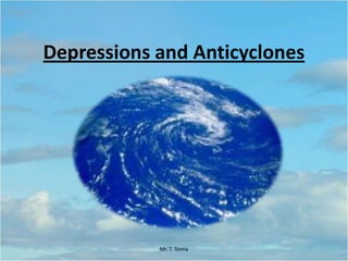
Lesson 1: Depressions and Anticyclones
•Als PPTX, PDF herunterladen•
4 gefällt mir•3,926 views

Form 4 Option Lesson

Empfohlen
Weitere ähnliche Inhalte
Was ist angesagt?
Was ist angesagt? (20)
Andere mochten auch
Andere mochten auch (20)
Ähnlich wie Lesson 1: Depressions and Anticyclones
Ähnlich wie Lesson 1: Depressions and Anticyclones (20)
Kürzlich hochgeladen
Kürzlich hochgeladen (20)
Lesson 1: Depressions and Anticyclones
- 1. Depressions and Anticyclones Mr. T. Tonna
- 2. Index • Key Words • What are Depressions & Anticyclones? • What are weather Charts? • Isobars • Fronts • Warm Sector • Different Weather Conditions • Forecasting • Class Task • Summary Mr. T. Tonna
- 3. Key Words Depression Anticyclone Warm Front Cold Front Occluded Front Warm Sector Mr. T. Tonna
- 4. What are Depressions • ‘Normal’ air pressure is 1016mb. • Depressions are low pressure systems that form in the mid- latitude region (30 -60 N/S) when warm air meets cold air. • When this occurs the warm air is forced above the colder air. It then cools and clouds form which produce rain. • Winds in depressions move in an anticlockwise direction in the northern hemisphere and clockwise in the southern hemisphere. • Characterised by fronts. Mr. T. Tonna
- 5. Anticyclones • Anticyclones are the opposite of depressions. • They are high pressure systems • Less common than depressions. • They usually bring nice weather. • Air descends, warms and acquires moisture. • Clear skies and little chance of rain. • If ground is cold low fog can occur. Mr. T. Tonna
- 6. Isobars • Isobars are lines of equal atmospheric pressure drawn on a meteorological map. Each line passes through a pressure of a given value, provided certain rules are followed. The rules for drawing isobars are- – Isobar lines may never cross or touch. – Isobar lines may only pass through pressures of 1000 + or - 4. In other words, allowable lines are 992, 996, 1000, 1004, 1008, and so on. – The atmospheric pressure is given in millibars (mb – Pressure lines are usually corrected or sea level so any differences in pressure due to altitude are ignored. Mr. T. Tonna
- 7. Fronts Warm Front Cold Front Occluded Front The Beginning of the depression The End of the Depression When the warm and cold fronts join. A Warm Front is labelled with a Red Semi-Circle. A Cold Front is labelled with a Blue Triangle. Occluded fronts are labelled with a mix of the two fronts. Mr. T. Tonna
- 8. Warm Sector • The warm sector is the area between the cold and warm front. It is usually associated with calm weather. Mr. T. Tonna
- 9. Weather Conditions in Depressions Mr. T. Tonna Precipitation/ Clouds Temperature Wind (Speed/ Strength) Visibility Before Depression No Rain, Cirrus / Cirrostratus Clouds Approx. 6 Degrees Calm, North Easterly Wind Good Approaching Warm Front Light Drizzle, Altostratus Clouds Approx. 6 Degrees Strong, Southerly Winds Good to Fair Arrival of Warm Front Continuous rain, Nimbostratus Clouds Slight Fall in Temperature South-Westerly Force 3-4 Worsens Warm Sector Little Rain, Patchy Stratus Clouds Rises to around 12 Degrees Westerly, Force 3 Limited Passing Cold Front Heavy Showers, Cumulonimbus Clouds. Falls Further North-Westerly, Force 8 Limited Post- Depression Showers, Cumulous Clouds clearing Low 3-4 Degrees. North-Westerly Force 6 Good
- 10. Mr. T. Tonna
- 11. Forecasting Weather Patterns • The Following Weather Charts will show areas experiencing a Mid-Latitude Depression. • Our Task is to analyse the chart and determine which weather characteristics a marked area is experiencing. • As well as this we shall discuss the future weather that area will be experiencing according to the mentioned weather characteristics of depressions. Mr. T. Tonna
- 12. Mr. T. Tonna
- 13. Mr. T. Tonna
- 14. Mr. T. Tonna
- 15. Mr. T. Tonna
- 16. Class Task – Read Pages 204-206 (A New Wider World- Waugh, D; Bushell, T) – Answer the following: • A Low pressure system is called a ________? • True or False: Anticyclones have pressures below 1016mb? • Are Depressions are associate with nice weather? • Warm air moves _____ cooler air during a depression. • London is currently in the warm sector of a depression what kind of weather would you expect there to be? Mr. T. Tonna
- 17. Summary • Depressions and Anticyclones are caused by pressure change. • Depressions are more common than Anticyclones in the Mid-Latitude regions. • Depressions bring complex whether phenomena with alternating bursts of showers and drizzles. • Using weather maps we are able to locate depressions and predict the weather of a certain area/locality. Mr. T. Tonna