SlideShare ist ein Scribd-Unternehmen logo
1 von 10
MY MAPS
DOMAIN:WETLANDS CONSERVATION
TOPIC: MAPPING THERAMSAR SITENKAM-WOURI
Study area: Country (Cameroon), Region (Littoral), Division (Nkamand Wouri),
Software: ENVI 4.7, GlobalMapper V15, ArcGIS10.1
Author : TCHAKOUDEU KEHOU Stéphane
DOMAIN:WILDLIFECONSERVATION
TOPIC: ANALYSIS OF ANTHROPOGENICTRENDS ONLARGEMAMMALS OF THE
LOWERNKAM WATERSHED (CAMEROON)
Study area: Country (Cameroon), Region (Littoral), Division (Nkam),
Subdivision (Yabassi)
Objective: Theaim was to determine the areas facing higher anthropogenic
effects to ease the prioritization of areas for the application of conservation
strategies
Methodology:
Villages Survey
Hunting areas Survey
Tools: Questionnaire, GPS
Software: ArcGIS 10.1 (Toolbox; Kerneldensity)
Results
Author : TCHAKOUDEU KEHOU Stéphane
DOMAIN:WILDLIFECONSERVATION
TOPIC: GEOGRAPHICAL DISTRIBUTION OF LARGER REPTILES HARVESTED IN
THE LOWER NKAM WATERSHED
Study area: Country (Cameroon), Region (Littoral), Division (Nkam),
Subdivision (Yabassi)
Objectives:
 Identify priority conservation areas ( hotspots)
 Identify critical areas for the survivalof certain species ( species with
reduced spatial distribution areas) so as to intensify efforts on the fight
against poaching in those areas
Methodology:
Villages Survey
Hunting areas Survey
Tools: Questionnaire, GPS
Software: ArcGIS 10.1, Excel
Results
Author : TCHAKOUDEU KEHOU Stéphane
DOMAIN:WILDLIFECONSERVATION
TOPIC: ANALYSIS OF HUNTING PRESSUREONLARGER REPTILES OF THE LOWER
NKAM WATERSHED (CAMEROON)
Study area: Country (Cameroon), Region (Littoral), Division (Nkam),
Subdivision (Yabassi)
Objective: Theaim was to determine the areas facing higher anthropogenic
effects to ease the prioritization of areas for the application of conservation
strategies
Methodology:
Villages Survey
Hunting areas Survey
Tools: Questionnaire, GPS
Software: ArcGIS 10.1 (Toolbox; Kerneldensity)
Results:
Author : TCHAKOUDEU KEHOU Stéphane
DOMAIN:WILDLIFECONSERVATION
TOPIC: IDENTIFICATION OF LARGER REPTILES HABITATS IN THE LOWER NKAM
WATERSHED (Cameroon)
Study area: Country (Cameroon), Region (Littoral), Division (Nkam),
Subdivision (Yabassi)
Objective: Identifying potentialhabitats of larger reptiles hunted in the area
Methodology:
Satellite images processing (LANDSATETM+7)
Land UseLand Cover Mapping
Field Validation
Tools: Questionnaire, GPS
Software: ENVI 4.7, ArcGIS 10.1
Results
Author : TCHAKOUDEU KEHOU Stéphane
TOPIC: INVENTORY OF VUNERABLESPECIES OF BIRD IN THE LOWER NKAM
WATERSHED
Study area: Country (Cameroon), Region (Littoral), Division (Nkam),
Subdivision (Yabassi)
Objective: Mapping thespatial distribution of vulnerablebirds in the area
Methodology:
Forestinventories
Villages Survey
Tools: Questionnaire, GPS
Software: ArcGIS 10.1, Excel
Results
Author : TCHAKOUDEU KEHOU Stéphane
TOPIC: ASSESSEMENTOF FISH FARMING POTENTIALS OF THELOWER NKAM
WATERSHED (Cameroon)
Study area: Country (Cameroon), Region (Littoral), Division (Nkam),
Subdivision (Yabassi)
Objective:
Methodology:
Rivers Survey
Topographic analysis (DEM)
Tools: Questionnaire, GPS
Software: GlobalMapper V15, ArcGIS 10.1, Excel
Results
Author : TCHAKOUDEU KEHOU Stéphane
TOPIC: ASSESSEMENTOF FISH FARMING POTENTIALS OF THETRANSITIONAL
PARTOF NKAM WATERSHED (Cameroon)
Study area: Country (Cameroon), Region (Littoral), Division (Nkam),
Subdivision (Yabassi)
Objective:
Methodology:
Rivers Survey
Topographic analysis (DEM)
Tools: Questionnaire, GPS
Software: GlobalMapper V15, ArcGIS 10.1, Excel
Results
Author : TCHAKOUDEU KEHOU Stéphane

Weitere ähnliche Inhalte

Was ist angesagt?

UAS based soil moisture monitoring
UAS based soil moisture monitoringUAS based soil moisture monitoring
UAS based soil moisture monitoringSalvatore Manfreda
 
Use of Unmanned Aerial Systems for Hydrological Monitoring
Use of Unmanned Aerial Systems for Hydrological MonitoringUse of Unmanned Aerial Systems for Hydrological Monitoring
Use of Unmanned Aerial Systems for Hydrological MonitoringSalvatore Manfreda
 
Use of UAV for Hydrological Monitoring
Use of UAV for Hydrological MonitoringUse of UAV for Hydrological Monitoring
Use of UAV for Hydrological MonitoringSalvatore Manfreda
 
Seeding metrics for image velocimetry performances
Seeding metrics for image velocimetry performancesSeeding metrics for image velocimetry performances
Seeding metrics for image velocimetry performancesSalvatore Manfreda
 
Detection of Flood Prone Areas using Digital Elevation Models
Detection of Flood Prone Areas using Digital Elevation ModelsDetection of Flood Prone Areas using Digital Elevation Models
Detection of Flood Prone Areas using Digital Elevation ModelsSalvatore Manfreda
 
Supervised classification and improved filtering method for shoreline detection.
Supervised classification and improved filtering method for shoreline detection.Supervised classification and improved filtering method for shoreline detection.
Supervised classification and improved filtering method for shoreline detection.Dr Amira Bibo
 
An integrative information aqueduct to close the gaps between global satellit...
An integrative information aqueduct to close the gaps between global satellit...An integrative information aqueduct to close the gaps between global satellit...
An integrative information aqueduct to close the gaps between global satellit...Salvatore Manfreda
 
Soil Moisture Retrievals from Unmanned Aerial Systems (UAS)
Soil Moisture Retrievals from Unmanned Aerial Systems (UAS)Soil Moisture Retrievals from Unmanned Aerial Systems (UAS)
Soil Moisture Retrievals from Unmanned Aerial Systems (UAS)Salvatore Manfreda
 
LARGE SCALE FLOOD MAPPING USING GEOMORPHIC METHODS
LARGE SCALE FLOOD MAPPING USING GEOMORPHIC METHODSLARGE SCALE FLOOD MAPPING USING GEOMORPHIC METHODS
LARGE SCALE FLOOD MAPPING USING GEOMORPHIC METHODSSalvatore Manfreda
 
Automatic Animal Detection - UAVs in Environmental Research Conference
Automatic Animal Detection - UAVs in Environmental Research ConferenceAutomatic Animal Detection - UAVs in Environmental Research Conference
Automatic Animal Detection - UAVs in Environmental Research ConferenceCamiel R. Verschoor
 
Montzka SMOS Validation IGARSS 2011.ppt
Montzka SMOS Validation IGARSS 2011.pptMontzka SMOS Validation IGARSS 2011.ppt
Montzka SMOS Validation IGARSS 2011.pptgrssieee
 
Use of UAS for hydraulic monitoring
Use of UAS for hydraulic monitoringUse of UAS for hydraulic monitoring
Use of UAS for hydraulic monitoringSalvatore Manfreda
 
Spitzer bright ultravista_faint_sources_in_cosmos_the_contribution_to_the_ove...
Spitzer bright ultravista_faint_sources_in_cosmos_the_contribution_to_the_ove...Spitzer bright ultravista_faint_sources_in_cosmos_the_contribution_to_the_ove...
Spitzer bright ultravista_faint_sources_in_cosmos_the_contribution_to_the_ove...Sérgio Sacani
 
Applications of soil spectroscopy on Land Health Surveillance
Applications of soil spectroscopy on Land Health SurveillanceApplications of soil spectroscopy on Land Health Surveillance
Applications of soil spectroscopy on Land Health SurveillanceLand Health Decisions (SD4) ICRAF
 
From Global satellite water cycle products to field scale satellite water states
From Global satellite water cycle products to field scale satellite water statesFrom Global satellite water cycle products to field scale satellite water states
From Global satellite water cycle products to field scale satellite water statesSalvatore Manfreda
 

Was ist angesagt? (20)

UAS based soil moisture monitoring
UAS based soil moisture monitoringUAS based soil moisture monitoring
UAS based soil moisture monitoring
 
Use of Unmanned Aerial Systems for Hydrological Monitoring
Use of Unmanned Aerial Systems for Hydrological MonitoringUse of Unmanned Aerial Systems for Hydrological Monitoring
Use of Unmanned Aerial Systems for Hydrological Monitoring
 
Use of UAV for Hydrological Monitoring
Use of UAV for Hydrological MonitoringUse of UAV for Hydrological Monitoring
Use of UAV for Hydrological Monitoring
 
Seeding metrics for image velocimetry performances
Seeding metrics for image velocimetry performancesSeeding metrics for image velocimetry performances
Seeding metrics for image velocimetry performances
 
Detection of Flood Prone Areas using Digital Elevation Models
Detection of Flood Prone Areas using Digital Elevation ModelsDetection of Flood Prone Areas using Digital Elevation Models
Detection of Flood Prone Areas using Digital Elevation Models
 
DRONES IN HYDROLOGY
DRONES IN HYDROLOGYDRONES IN HYDROLOGY
DRONES IN HYDROLOGY
 
Supervised classification and improved filtering method for shoreline detection.
Supervised classification and improved filtering method for shoreline detection.Supervised classification and improved filtering method for shoreline detection.
Supervised classification and improved filtering method for shoreline detection.
 
WG2 e-Meeting
WG2 e-MeetingWG2 e-Meeting
WG2 e-Meeting
 
An integrative information aqueduct to close the gaps between global satellit...
An integrative information aqueduct to close the gaps between global satellit...An integrative information aqueduct to close the gaps between global satellit...
An integrative information aqueduct to close the gaps between global satellit...
 
Soil Moisture Retrievals from Unmanned Aerial Systems (UAS)
Soil Moisture Retrievals from Unmanned Aerial Systems (UAS)Soil Moisture Retrievals from Unmanned Aerial Systems (UAS)
Soil Moisture Retrievals from Unmanned Aerial Systems (UAS)
 
LARGE SCALE FLOOD MAPPING USING GEOMORPHIC METHODS
LARGE SCALE FLOOD MAPPING USING GEOMORPHIC METHODSLARGE SCALE FLOOD MAPPING USING GEOMORPHIC METHODS
LARGE SCALE FLOOD MAPPING USING GEOMORPHIC METHODS
 
WCS_Congo_Final
WCS_Congo_FinalWCS_Congo_Final
WCS_Congo_Final
 
Poster_jayson_v3
Poster_jayson_v3Poster_jayson_v3
Poster_jayson_v3
 
Automatic Animal Detection - UAVs in Environmental Research Conference
Automatic Animal Detection - UAVs in Environmental Research ConferenceAutomatic Animal Detection - UAVs in Environmental Research Conference
Automatic Animal Detection - UAVs in Environmental Research Conference
 
Nature Conservation Drones
Nature Conservation DronesNature Conservation Drones
Nature Conservation Drones
 
Montzka SMOS Validation IGARSS 2011.ppt
Montzka SMOS Validation IGARSS 2011.pptMontzka SMOS Validation IGARSS 2011.ppt
Montzka SMOS Validation IGARSS 2011.ppt
 
Use of UAS for hydraulic monitoring
Use of UAS for hydraulic monitoringUse of UAS for hydraulic monitoring
Use of UAS for hydraulic monitoring
 
Spitzer bright ultravista_faint_sources_in_cosmos_the_contribution_to_the_ove...
Spitzer bright ultravista_faint_sources_in_cosmos_the_contribution_to_the_ove...Spitzer bright ultravista_faint_sources_in_cosmos_the_contribution_to_the_ove...
Spitzer bright ultravista_faint_sources_in_cosmos_the_contribution_to_the_ove...
 
Applications of soil spectroscopy on Land Health Surveillance
Applications of soil spectroscopy on Land Health SurveillanceApplications of soil spectroscopy on Land Health Surveillance
Applications of soil spectroscopy on Land Health Surveillance
 
From Global satellite water cycle products to field scale satellite water states
From Global satellite water cycle products to field scale satellite water statesFrom Global satellite water cycle products to field scale satellite water states
From Global satellite water cycle products to field scale satellite water states
 

Andere mochten auch

Pantit in Wakad
Pantit in WakadPantit in Wakad
Pantit in WakadPanditkkk
 
แบบเสนอโครงร่างโครงงานคอมพิวเตอร์ ส่งให้เพื่อนค่ะ
แบบเสนอโครงร่างโครงงานคอมพิวเตอร์  ส่งให้เพื่อนค่ะ แบบเสนอโครงร่างโครงงานคอมพิวเตอร์  ส่งให้เพื่อนค่ะ
แบบเสนอโครงร่างโครงงานคอมพิวเตอร์ ส่งให้เพื่อนค่ะ Warittha Nokmeerod
 
West Palm Beach Market design deck
West Palm Beach Market design deckWest Palm Beach Market design deck
West Palm Beach Market design deckSteve Brown
 
AGS Members' Day 2015 - Chairman's Address Presentation
AGS Members' Day 2015 - Chairman's Address PresentationAGS Members' Day 2015 - Chairman's Address Presentation
AGS Members' Day 2015 - Chairman's Address PresentationForumCourt
 
Social Impact Evaluation Report
Social Impact Evaluation ReportSocial Impact Evaluation Report
Social Impact Evaluation ReportColin Richardson
 
Seslide filmizle - Sesli Sohbet, Sesli Chat | Seslivaybe.com
Seslide filmizle - Sesli Sohbet, Sesli Chat | Seslivaybe.comSeslide filmizle - Sesli Sohbet, Sesli Chat | Seslivaybe.com
Seslide filmizle - Sesli Sohbet, Sesli Chat | Seslivaybe.comEcem Yar
 
Twan Paes - Action Learning - balanced leadership - drive it, Shape it, own it!
Twan Paes - Action Learning - balanced leadership - drive it, Shape it, own it!Twan Paes - Action Learning - balanced leadership - drive it, Shape it, own it!
Twan Paes - Action Learning - balanced leadership - drive it, Shape it, own it!Certes
 
Subliminal
SubliminalSubliminal
Subliminallsaac
 
Chcesz zmieniać innych? Zacznij od siebie. Jak zmotywować siebie i Zespół do...
Chcesz zmieniać innych? Zacznij od siebie.  Jak zmotywować siebie i Zespół do...Chcesz zmieniać innych? Zacznij od siebie.  Jak zmotywować siebie i Zespół do...
Chcesz zmieniać innych? Zacznij od siebie. Jak zmotywować siebie i Zespół do...Certes
 
Strategies to managing outsourcing vendors performance
Strategies to managing outsourcing vendors performanceStrategies to managing outsourcing vendors performance
Strategies to managing outsourcing vendors performanceWorkforce Group
 

Andere mochten auch (20)

ART_brochure
ART_brochureART_brochure
ART_brochure
 
Seminar
SeminarSeminar
Seminar
 
Pantit in Wakad
Pantit in WakadPantit in Wakad
Pantit in Wakad
 
แบบเสนอโครงร่างโครงงานคอมพิวเตอร์ ส่งให้เพื่อนค่ะ
แบบเสนอโครงร่างโครงงานคอมพิวเตอร์  ส่งให้เพื่อนค่ะ แบบเสนอโครงร่างโครงงานคอมพิวเตอร์  ส่งให้เพื่อนค่ะ
แบบเสนอโครงร่างโครงงานคอมพิวเตอร์ ส่งให้เพื่อนค่ะ
 
Alexa Anne Mallory
Alexa Anne MalloryAlexa Anne Mallory
Alexa Anne Mallory
 
Usa National Parks
Usa National ParksUsa National Parks
Usa National Parks
 
West Palm Beach Market design deck
West Palm Beach Market design deckWest Palm Beach Market design deck
West Palm Beach Market design deck
 
AGS Members' Day 2015 - Chairman's Address Presentation
AGS Members' Day 2015 - Chairman's Address PresentationAGS Members' Day 2015 - Chairman's Address Presentation
AGS Members' Day 2015 - Chairman's Address Presentation
 
Kimia dasar I
Kimia dasar IKimia dasar I
Kimia dasar I
 
Derecho hindú
Derecho hindúDerecho hindú
Derecho hindú
 
Social Impact Evaluation Report
Social Impact Evaluation ReportSocial Impact Evaluation Report
Social Impact Evaluation Report
 
Seslide filmizle - Sesli Sohbet, Sesli Chat | Seslivaybe.com
Seslide filmizle - Sesli Sohbet, Sesli Chat | Seslivaybe.comSeslide filmizle - Sesli Sohbet, Sesli Chat | Seslivaybe.com
Seslide filmizle - Sesli Sohbet, Sesli Chat | Seslivaybe.com
 
Twan Paes - Action Learning - balanced leadership - drive it, Shape it, own it!
Twan Paes - Action Learning - balanced leadership - drive it, Shape it, own it!Twan Paes - Action Learning - balanced leadership - drive it, Shape it, own it!
Twan Paes - Action Learning - balanced leadership - drive it, Shape it, own it!
 
เพลี้ย
เพลี้ยเพลี้ย
เพลี้ย
 
Subliminal
SubliminalSubliminal
Subliminal
 
เพลี้ย
เพลี้ยเพลี้ย
เพลี้ย
 
Chcesz zmieniać innych? Zacznij od siebie. Jak zmotywować siebie i Zespół do...
Chcesz zmieniać innych? Zacznij od siebie.  Jak zmotywować siebie i Zespół do...Chcesz zmieniać innych? Zacznij od siebie.  Jak zmotywować siebie i Zespół do...
Chcesz zmieniać innych? Zacznij od siebie. Jak zmotywować siebie i Zespół do...
 
Critical reading
Critical readingCritical reading
Critical reading
 
Mohamed Adel2
Mohamed Adel2Mohamed Adel2
Mohamed Adel2
 
Strategies to managing outsourcing vendors performance
Strategies to managing outsourcing vendors performanceStrategies to managing outsourcing vendors performance
Strategies to managing outsourcing vendors performance
 

Ähnlich wie My maps and gis

UAV Mangroves Rev 0 colour
UAV Mangroves Rev 0 colourUAV Mangroves Rev 0 colour
UAV Mangroves Rev 0 colourPeter Mellor
 
4_BELAIR_IGARSS_SMAP_CANADA.ppt
4_BELAIR_IGARSS_SMAP_CANADA.ppt4_BELAIR_IGARSS_SMAP_CANADA.ppt
4_BELAIR_IGARSS_SMAP_CANADA.pptgrssieee
 
Spectral Imaging of Coastal Environments G. Tsagkatakis
Spectral Imaging of Coastal Environments G. TsagkatakisSpectral Imaging of Coastal Environments G. Tsagkatakis
Spectral Imaging of Coastal Environments G. TsagkatakisBlue BRIDGE
 
BENTHIC DIVERSITY MAPPING AND ANALYSIS BASE ON REMOTE SENSING AND SEASCAPE EC...
BENTHIC DIVERSITY MAPPING AND ANALYSIS BASE ON REMOTE SENSING AND SEASCAPE EC...BENTHIC DIVERSITY MAPPING AND ANALYSIS BASE ON REMOTE SENSING AND SEASCAPE EC...
BENTHIC DIVERSITY MAPPING AND ANALYSIS BASE ON REMOTE SENSING AND SEASCAPE EC...IAEME Publication
 
LANDSAT_OBSERVAT_ON_SATELITE_SYSTEM_odewwwwww.ppt
LANDSAT_OBSERVAT_ON_SATELITE_SYSTEM_odewwwwww.pptLANDSAT_OBSERVAT_ON_SATELITE_SYSTEM_odewwwwww.ppt
LANDSAT_OBSERVAT_ON_SATELITE_SYSTEM_odewwwwww.pptMrLove13
 
FR2.L10.3: TOWARDS VALIDATION OF SMOS LAND PRODUCTS USING THE SYNERGY BETWEE...
 FR2.L10.3: TOWARDS VALIDATION OF SMOS LAND PRODUCTS USING THE SYNERGY BETWEE... FR2.L10.3: TOWARDS VALIDATION OF SMOS LAND PRODUCTS USING THE SYNERGY BETWEE...
FR2.L10.3: TOWARDS VALIDATION OF SMOS LAND PRODUCTS USING THE SYNERGY BETWEE...grssieee
 
The use of geoinformatics in mineral exploration and exploitation
The use of geoinformatics in mineral exploration and exploitationThe use of geoinformatics in mineral exploration and exploitation
The use of geoinformatics in mineral exploration and exploitationMarguerite Walsh
 
TU3.L09 - SPACEBORNE FULLY POLARIMETRIC TIME-SERIES DATASETS FOR LAND COVER A...
TU3.L09 - SPACEBORNE FULLY POLARIMETRIC TIME-SERIES DATASETS FOR LAND COVER A...TU3.L09 - SPACEBORNE FULLY POLARIMETRIC TIME-SERIES DATASETS FOR LAND COVER A...
TU3.L09 - SPACEBORNE FULLY POLARIMETRIC TIME-SERIES DATASETS FOR LAND COVER A...grssieee
 
OPWALL Project Proposal 2016
OPWALL Project Proposal 2016OPWALL Project Proposal 2016
OPWALL Project Proposal 2016Kevin Schmidt
 
Mapping and Monitoring Spatial-Temporal Cover Change of Prosopis Species Colo...
Mapping and Monitoring Spatial-Temporal Cover Change of Prosopis Species Colo...Mapping and Monitoring Spatial-Temporal Cover Change of Prosopis Species Colo...
Mapping and Monitoring Spatial-Temporal Cover Change of Prosopis Species Colo...inventionjournals
 
Natural Resources Management NAVFAC Atlantic
Natural Resources Management NAVFAC Atlantic Natural Resources Management NAVFAC Atlantic
Natural Resources Management NAVFAC Atlantic BryanHall58
 
Investigation of the Lake Victoria Region (Africa: Tanzania, Kenya and Uganda)
Investigation of the Lake Victoria Region (Africa: Tanzania, Kenya and Uganda)Investigation of the Lake Victoria Region (Africa: Tanzania, Kenya and Uganda)
Investigation of the Lake Victoria Region (Africa: Tanzania, Kenya and Uganda)Universität Salzburg
 
Screening and Modelling of Pilot Sites - Sardinia Symposium 2017
Screening and Modelling of Pilot Sites - Sardinia Symposium 2017Screening and Modelling of Pilot Sites - Sardinia Symposium 2017
Screening and Modelling of Pilot Sites - Sardinia Symposium 2017SMART GROUND Project H2020
 
Bouvet_IGARSS2011.ppt
Bouvet_IGARSS2011.pptBouvet_IGARSS2011.ppt
Bouvet_IGARSS2011.pptgrssieee
 
Habitat models: Predicting Sebastes presence in the Del Monte Shalebeds
Habitat models: Predicting Sebastes presence in the Del Monte ShalebedsHabitat models: Predicting Sebastes presence in the Del Monte Shalebeds
Habitat models: Predicting Sebastes presence in the Del Monte ShalebedsLisa Jensen
 

Ähnlich wie My maps and gis (19)

UAV Mangroves Rev 0 colour
UAV Mangroves Rev 0 colourUAV Mangroves Rev 0 colour
UAV Mangroves Rev 0 colour
 
4_BELAIR_IGARSS_SMAP_CANADA.ppt
4_BELAIR_IGARSS_SMAP_CANADA.ppt4_BELAIR_IGARSS_SMAP_CANADA.ppt
4_BELAIR_IGARSS_SMAP_CANADA.ppt
 
CV-resume
CV-resumeCV-resume
CV-resume
 
Spectral Imaging of Coastal Environments G. Tsagkatakis
Spectral Imaging of Coastal Environments G. TsagkatakisSpectral Imaging of Coastal Environments G. Tsagkatakis
Spectral Imaging of Coastal Environments G. Tsagkatakis
 
BENTHIC DIVERSITY MAPPING AND ANALYSIS BASE ON REMOTE SENSING AND SEASCAPE EC...
BENTHIC DIVERSITY MAPPING AND ANALYSIS BASE ON REMOTE SENSING AND SEASCAPE EC...BENTHIC DIVERSITY MAPPING AND ANALYSIS BASE ON REMOTE SENSING AND SEASCAPE EC...
BENTHIC DIVERSITY MAPPING AND ANALYSIS BASE ON REMOTE SENSING AND SEASCAPE EC...
 
LANDSAT_OBSERVAT_ON_SATELITE_SYSTEM_odewwwwww.ppt
LANDSAT_OBSERVAT_ON_SATELITE_SYSTEM_odewwwwww.pptLANDSAT_OBSERVAT_ON_SATELITE_SYSTEM_odewwwwww.ppt
LANDSAT_OBSERVAT_ON_SATELITE_SYSTEM_odewwwwww.ppt
 
20180910 en trebossen-cv
20180910 en trebossen-cv20180910 en trebossen-cv
20180910 en trebossen-cv
 
FR2.L10.3: TOWARDS VALIDATION OF SMOS LAND PRODUCTS USING THE SYNERGY BETWEE...
 FR2.L10.3: TOWARDS VALIDATION OF SMOS LAND PRODUCTS USING THE SYNERGY BETWEE... FR2.L10.3: TOWARDS VALIDATION OF SMOS LAND PRODUCTS USING THE SYNERGY BETWEE...
FR2.L10.3: TOWARDS VALIDATION OF SMOS LAND PRODUCTS USING THE SYNERGY BETWEE...
 
The use of geoinformatics in mineral exploration and exploitation
The use of geoinformatics in mineral exploration and exploitationThe use of geoinformatics in mineral exploration and exploitation
The use of geoinformatics in mineral exploration and exploitation
 
TU3.L09 - SPACEBORNE FULLY POLARIMETRIC TIME-SERIES DATASETS FOR LAND COVER A...
TU3.L09 - SPACEBORNE FULLY POLARIMETRIC TIME-SERIES DATASETS FOR LAND COVER A...TU3.L09 - SPACEBORNE FULLY POLARIMETRIC TIME-SERIES DATASETS FOR LAND COVER A...
TU3.L09 - SPACEBORNE FULLY POLARIMETRIC TIME-SERIES DATASETS FOR LAND COVER A...
 
OPWALL Project Proposal 2016
OPWALL Project Proposal 2016OPWALL Project Proposal 2016
OPWALL Project Proposal 2016
 
MappingMangroves
MappingMangrovesMappingMangroves
MappingMangroves
 
Mapping and Monitoring Spatial-Temporal Cover Change of Prosopis Species Colo...
Mapping and Monitoring Spatial-Temporal Cover Change of Prosopis Species Colo...Mapping and Monitoring Spatial-Temporal Cover Change of Prosopis Species Colo...
Mapping and Monitoring Spatial-Temporal Cover Change of Prosopis Species Colo...
 
Natural Resources Management NAVFAC Atlantic
Natural Resources Management NAVFAC Atlantic Natural Resources Management NAVFAC Atlantic
Natural Resources Management NAVFAC Atlantic
 
Stumpf et al, 2003
Stumpf et al, 2003Stumpf et al, 2003
Stumpf et al, 2003
 
Investigation of the Lake Victoria Region (Africa: Tanzania, Kenya and Uganda)
Investigation of the Lake Victoria Region (Africa: Tanzania, Kenya and Uganda)Investigation of the Lake Victoria Region (Africa: Tanzania, Kenya and Uganda)
Investigation of the Lake Victoria Region (Africa: Tanzania, Kenya and Uganda)
 
Screening and Modelling of Pilot Sites - Sardinia Symposium 2017
Screening and Modelling of Pilot Sites - Sardinia Symposium 2017Screening and Modelling of Pilot Sites - Sardinia Symposium 2017
Screening and Modelling of Pilot Sites - Sardinia Symposium 2017
 
Bouvet_IGARSS2011.ppt
Bouvet_IGARSS2011.pptBouvet_IGARSS2011.ppt
Bouvet_IGARSS2011.ppt
 
Habitat models: Predicting Sebastes presence in the Del Monte Shalebeds
Habitat models: Predicting Sebastes presence in the Del Monte ShalebedsHabitat models: Predicting Sebastes presence in the Del Monte Shalebeds
Habitat models: Predicting Sebastes presence in the Del Monte Shalebeds
 

Kürzlich hochgeladen

CCXG global forum, April 2024, Beatrice Cyiza
CCXG global forum, April 2024,  Beatrice CyizaCCXG global forum, April 2024,  Beatrice Cyiza
CCXG global forum, April 2024, Beatrice CyizaOECD Environment
 
CCXG global forum, April 2024, Marcia Rocha
CCXG global forum, April 2024,  Marcia RochaCCXG global forum, April 2024,  Marcia Rocha
CCXG global forum, April 2024, Marcia RochaOECD Environment
 
Little Green Ranger ESG Sustainability Report
Little Green Ranger ESG Sustainability ReportLittle Green Ranger ESG Sustainability Report
Little Green Ranger ESG Sustainability ReportKennethOng48
 
Project for the production of electricity.docx
Project for the production of electricity.docxProject for the production of electricity.docx
Project for the production of electricity.docxproject .
 
CCXG global forum, April 2024, Geraldine Ang
CCXG global forum, April 2024, Geraldine AngCCXG global forum, April 2024, Geraldine Ang
CCXG global forum, April 2024, Geraldine AngOECD Environment
 
Synthetic biology. Fanny Coppens, Sciensano.
Synthetic biology. Fanny Coppens, Sciensano.Synthetic biology. Fanny Coppens, Sciensano.
Synthetic biology. Fanny Coppens, Sciensano.pensoftservices
 
CCXG global forum, April 2024, Chiara Falduto
CCXG global forum, April 2024, Chiara FaldutoCCXG global forum, April 2024, Chiara Falduto
CCXG global forum, April 2024, Chiara FaldutoOECD Environment
 
CCXG global forum, April 2024, Manjeet Dhakal
CCXG global forum, April 2024,  Manjeet DhakalCCXG global forum, April 2024,  Manjeet Dhakal
CCXG global forum, April 2024, Manjeet DhakalOECD Environment
 
DETAILED LESSON FINAL DEMO TEACHING.docx
DETAILED LESSON FINAL DEMO TEACHING.docxDETAILED LESSON FINAL DEMO TEACHING.docx
DETAILED LESSON FINAL DEMO TEACHING.docxImilyAcma
 
CCXG global forum, April 2024, Geert Fremout
CCXG global forum, April 2024,  Geert FremoutCCXG global forum, April 2024,  Geert Fremout
CCXG global forum, April 2024, Geert FremoutOECD Environment
 
CCXG global forum, April 2024, Davi Bonavides
CCXG global forum, April 2024,  Davi BonavidesCCXG global forum, April 2024,  Davi Bonavides
CCXG global forum, April 2024, Davi BonavidesOECD Environment
 
Title-Role of forestry in restoration of degraded lands.pptx
Title-Role of forestry in restoration of degraded lands.pptxTitle-Role of forestry in restoration of degraded lands.pptx
Title-Role of forestry in restoration of degraded lands.pptxSagar Chaudhary
 
CCXG global forum, April 2024, Watcharin Boonyarit
CCXG global forum, April 2024,  Watcharin BoonyaritCCXG global forum, April 2024,  Watcharin Boonyarit
CCXG global forum, April 2024, Watcharin BoonyaritOECD Environment
 
CCXG global forum, April 2024, Amar Bhattacharya
CCXG global forum, April 2024,  Amar BhattacharyaCCXG global forum, April 2024,  Amar Bhattacharya
CCXG global forum, April 2024, Amar BhattacharyaOECD Environment
 
CCXG global forum, April 2024, Mia Ryan
CCXG global forum, April 2024,  Mia RyanCCXG global forum, April 2024,  Mia Ryan
CCXG global forum, April 2024, Mia RyanOECD Environment
 
Biodiversity and Health. Prof. Richard Kock.
Biodiversity and Health. Prof. Richard Kock.Biodiversity and Health. Prof. Richard Kock.
Biodiversity and Health. Prof. Richard Kock.pensoftservices
 
CCXG global forum, April 2024, Jo Tyndall
CCXG global forum, April 2024,  Jo TyndallCCXG global forum, April 2024,  Jo Tyndall
CCXG global forum, April 2024, Jo TyndallOECD Environment
 
LCCXG global forum, April 2024, Lydie-Line Paroz
LCCXG global forum, April 2024,  Lydie-Line ParozLCCXG global forum, April 2024,  Lydie-Line Paroz
LCCXG global forum, April 2024, Lydie-Line ParozOECD Environment
 
CCXG global forum, April 2024, Delio Rincon
CCXG global forum, April 2024,  Delio RinconCCXG global forum, April 2024,  Delio Rincon
CCXG global forum, April 2024, Delio RinconOECD Environment
 

Kürzlich hochgeladen (20)

CCXG global forum, April 2024, Beatrice Cyiza
CCXG global forum, April 2024,  Beatrice CyizaCCXG global forum, April 2024,  Beatrice Cyiza
CCXG global forum, April 2024, Beatrice Cyiza
 
CCXG global forum, April 2024, Marcia Rocha
CCXG global forum, April 2024,  Marcia RochaCCXG global forum, April 2024,  Marcia Rocha
CCXG global forum, April 2024, Marcia Rocha
 
Little Green Ranger ESG Sustainability Report
Little Green Ranger ESG Sustainability ReportLittle Green Ranger ESG Sustainability Report
Little Green Ranger ESG Sustainability Report
 
Project for the production of electricity.docx
Project for the production of electricity.docxProject for the production of electricity.docx
Project for the production of electricity.docx
 
CCXG global forum, April 2024, Geraldine Ang
CCXG global forum, April 2024, Geraldine AngCCXG global forum, April 2024, Geraldine Ang
CCXG global forum, April 2024, Geraldine Ang
 
Synthetic biology. Fanny Coppens, Sciensano.
Synthetic biology. Fanny Coppens, Sciensano.Synthetic biology. Fanny Coppens, Sciensano.
Synthetic biology. Fanny Coppens, Sciensano.
 
CCXG global forum, April 2024, Chiara Falduto
CCXG global forum, April 2024, Chiara FaldutoCCXG global forum, April 2024, Chiara Falduto
CCXG global forum, April 2024, Chiara Falduto
 
CCXG global forum, April 2024, Manjeet Dhakal
CCXG global forum, April 2024,  Manjeet DhakalCCXG global forum, April 2024,  Manjeet Dhakal
CCXG global forum, April 2024, Manjeet Dhakal
 
DETAILED LESSON FINAL DEMO TEACHING.docx
DETAILED LESSON FINAL DEMO TEACHING.docxDETAILED LESSON FINAL DEMO TEACHING.docx
DETAILED LESSON FINAL DEMO TEACHING.docx
 
CCXG global forum, April 2024, Geert Fremout
CCXG global forum, April 2024,  Geert FremoutCCXG global forum, April 2024,  Geert Fremout
CCXG global forum, April 2024, Geert Fremout
 
CCXG global forum, April 2024, Davi Bonavides
CCXG global forum, April 2024,  Davi BonavidesCCXG global forum, April 2024,  Davi Bonavides
CCXG global forum, April 2024, Davi Bonavides
 
Title-Role of forestry in restoration of degraded lands.pptx
Title-Role of forestry in restoration of degraded lands.pptxTitle-Role of forestry in restoration of degraded lands.pptx
Title-Role of forestry in restoration of degraded lands.pptx
 
CCXG global forum, April 2024, Watcharin Boonyarit
CCXG global forum, April 2024,  Watcharin BoonyaritCCXG global forum, April 2024,  Watcharin Boonyarit
CCXG global forum, April 2024, Watcharin Boonyarit
 
CCXG global forum, April 2024, Amar Bhattacharya
CCXG global forum, April 2024,  Amar BhattacharyaCCXG global forum, April 2024,  Amar Bhattacharya
CCXG global forum, April 2024, Amar Bhattacharya
 
CCXG global forum, April 2024, Mia Ryan
CCXG global forum, April 2024,  Mia RyanCCXG global forum, April 2024,  Mia Ryan
CCXG global forum, April 2024, Mia Ryan
 
Biodiversity and Health. Prof. Richard Kock.
Biodiversity and Health. Prof. Richard Kock.Biodiversity and Health. Prof. Richard Kock.
Biodiversity and Health. Prof. Richard Kock.
 
CCXG global forum, April 2024, Jo Tyndall
CCXG global forum, April 2024,  Jo TyndallCCXG global forum, April 2024,  Jo Tyndall
CCXG global forum, April 2024, Jo Tyndall
 
Health Facility Electrification: State of Play
Health Facility Electrification: State of PlayHealth Facility Electrification: State of Play
Health Facility Electrification: State of Play
 
LCCXG global forum, April 2024, Lydie-Line Paroz
LCCXG global forum, April 2024,  Lydie-Line ParozLCCXG global forum, April 2024,  Lydie-Line Paroz
LCCXG global forum, April 2024, Lydie-Line Paroz
 
CCXG global forum, April 2024, Delio Rincon
CCXG global forum, April 2024,  Delio RinconCCXG global forum, April 2024,  Delio Rincon
CCXG global forum, April 2024, Delio Rincon
 

My maps and gis

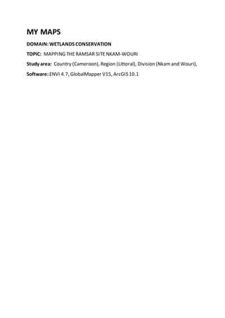
  • 1. MY MAPS DOMAIN:WETLANDS CONSERVATION TOPIC: MAPPING THERAMSAR SITENKAM-WOURI Study area: Country (Cameroon), Region (Littoral), Division (Nkamand Wouri), Software: ENVI 4.7, GlobalMapper V15, ArcGIS10.1
  • 2. Author : TCHAKOUDEU KEHOU Stéphane
  • 3. DOMAIN:WILDLIFECONSERVATION TOPIC: ANALYSIS OF ANTHROPOGENICTRENDS ONLARGEMAMMALS OF THE LOWERNKAM WATERSHED (CAMEROON) Study area: Country (Cameroon), Region (Littoral), Division (Nkam), Subdivision (Yabassi) Objective: Theaim was to determine the areas facing higher anthropogenic effects to ease the prioritization of areas for the application of conservation strategies Methodology: Villages Survey Hunting areas Survey Tools: Questionnaire, GPS Software: ArcGIS 10.1 (Toolbox; Kerneldensity) Results
  • 4. Author : TCHAKOUDEU KEHOU Stéphane DOMAIN:WILDLIFECONSERVATION TOPIC: GEOGRAPHICAL DISTRIBUTION OF LARGER REPTILES HARVESTED IN THE LOWER NKAM WATERSHED Study area: Country (Cameroon), Region (Littoral), Division (Nkam), Subdivision (Yabassi) Objectives:  Identify priority conservation areas ( hotspots)  Identify critical areas for the survivalof certain species ( species with reduced spatial distribution areas) so as to intensify efforts on the fight against poaching in those areas Methodology: Villages Survey Hunting areas Survey
  • 5. Tools: Questionnaire, GPS Software: ArcGIS 10.1, Excel Results Author : TCHAKOUDEU KEHOU Stéphane DOMAIN:WILDLIFECONSERVATION TOPIC: ANALYSIS OF HUNTING PRESSUREONLARGER REPTILES OF THE LOWER NKAM WATERSHED (CAMEROON) Study area: Country (Cameroon), Region (Littoral), Division (Nkam), Subdivision (Yabassi) Objective: Theaim was to determine the areas facing higher anthropogenic effects to ease the prioritization of areas for the application of conservation strategies Methodology: Villages Survey
  • 6. Hunting areas Survey Tools: Questionnaire, GPS Software: ArcGIS 10.1 (Toolbox; Kerneldensity) Results: Author : TCHAKOUDEU KEHOU Stéphane DOMAIN:WILDLIFECONSERVATION TOPIC: IDENTIFICATION OF LARGER REPTILES HABITATS IN THE LOWER NKAM WATERSHED (Cameroon) Study area: Country (Cameroon), Region (Littoral), Division (Nkam), Subdivision (Yabassi) Objective: Identifying potentialhabitats of larger reptiles hunted in the area
  • 7. Methodology: Satellite images processing (LANDSATETM+7) Land UseLand Cover Mapping Field Validation Tools: Questionnaire, GPS Software: ENVI 4.7, ArcGIS 10.1 Results Author : TCHAKOUDEU KEHOU Stéphane TOPIC: INVENTORY OF VUNERABLESPECIES OF BIRD IN THE LOWER NKAM WATERSHED Study area: Country (Cameroon), Region (Littoral), Division (Nkam), Subdivision (Yabassi) Objective: Mapping thespatial distribution of vulnerablebirds in the area
  • 8. Methodology: Forestinventories Villages Survey Tools: Questionnaire, GPS Software: ArcGIS 10.1, Excel Results Author : TCHAKOUDEU KEHOU Stéphane TOPIC: ASSESSEMENTOF FISH FARMING POTENTIALS OF THELOWER NKAM WATERSHED (Cameroon) Study area: Country (Cameroon), Region (Littoral), Division (Nkam), Subdivision (Yabassi) Objective:
  • 9. Methodology: Rivers Survey Topographic analysis (DEM) Tools: Questionnaire, GPS Software: GlobalMapper V15, ArcGIS 10.1, Excel Results Author : TCHAKOUDEU KEHOU Stéphane TOPIC: ASSESSEMENTOF FISH FARMING POTENTIALS OF THETRANSITIONAL PARTOF NKAM WATERSHED (Cameroon) Study area: Country (Cameroon), Region (Littoral), Division (Nkam), Subdivision (Yabassi) Objective: Methodology: Rivers Survey
  • 10. Topographic analysis (DEM) Tools: Questionnaire, GPS Software: GlobalMapper V15, ArcGIS 10.1, Excel Results Author : TCHAKOUDEU KEHOU Stéphane