David Bowman_AusPlots Forests: establishing a continental-scale monitoring network in the tall eucalypt forests of Australia
•
1 gefällt mir•566 views

The document describes plans to establish a continental-scale forest monitoring network called AusPlots-Forests in tall eucalypt forests across Australia. The network aims to improve understanding of tree growth and carbon dynamics in relation to climate gradients. It will build on existing permanent forest plot networks, with 40 new 1-hectare plots established across different climate zones. The plots will be remeasured every 5-10 years to monitor changes in forest structure and composition over time.

Empfohlen
Empfohlen
Weitere ähnliche Inhalte
Ähnlich wie David Bowman_AusPlots Forests: establishing a continental-scale monitoring network in the tall eucalypt forests of Australia
Ähnlich wie David Bowman_AusPlots Forests: establishing a continental-scale monitoring network in the tall eucalypt forests of Australia (20)
Mehr von TERN Australia
Mehr von TERN Australia (20)
David Bowman_AusPlots Forests: establishing a continental-scale monitoring network in the tall eucalypt forests of Australia
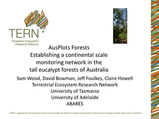
- 1. AusPlots Forests Establishing a continental scale monitoring network in the tall eucalypt forests of Australia Sam Wood, David Bowman, Jeff Foulkes, Claire Howell Terrestrial Ecosystem Research Network University of Tasmania University of Adelaide ABARES
- 3. The Starting Point • 2793 permanent inventory plots with 275,000 trees maintained by forestry agencies. • Relationships between climate variables, basal area and diameter increment. • ~24% decrease in stand basal area increment and ~17% decrease in diameter increment under A2 climate change scenarios (Prior et al. 2011). Prior, L.P., Williamson, G.D. & Bowman, D.M.J.S. (2011) Using permanent forestry plots to understand the possible effects of climate change on Australia's production forest estate. Department of Agriculture, Fisheries and Forestry. Canberra.
- 4. Aim of AusPlots-Forests • Establish a continental-scale plot based monitoring network • Improves our understanding of tree growth and carbon dynamics in tall eucalypt forests in relation to macro- environmental gradients across Australia. • Provide infrastructure for regionally based forest research • Build upon existing plot networks where possible. Warren Plot: 1854 Karri Regrowth
- 5. Sampling the environmental domain • Continental and regional climatic gradients
- 6. AusPlots-Forests in brief • 40 plots of 1 hectare • In mature tall eucalypt forests of Tas,Vic,WA, NSW,Qld. • Repeat measures every 5-10 years • Co-locate with existing inventory or research plots • Target conservation reserves • Focuson forest tree diversity and dynamics and their relationship to climate and site productivity • ....but also understorey biodiversity measures, soil attributes etc.
- 7. Why Tall Eucalypt Forests? • Cannot do it all, so lets do one system really well! • Spatially restricted: logistically efficient and cost effective • Spans macro-climates. • Dominate existing Permanent Inventory Plot infrastructure. • Valued for timber, conservation, recreation, carbon storage Carey Plot: 1852 Karri Regrowth
- 8. What are we measuring? All Trees >10cm DBH First Field Campaign: 100 Acacia Atherosperma Eucalyptus Nothofagus •Establish 100x100m grid, 25 subplots 80 Olearia Pomaderris Dicksonia •Location, diameter, height, species for trees 60 >10cm DBH (i.e. RAINFOR) 40 •Canopy cover using digital photography 20 •Herbarium voucher specimens and leaf samples (for genetics) for all species on plot 0 (e.g. AusPlots Rangelands) 0 20 40 60 80 100 •Soil metagenomics samples (e.g. AusPlots Rangelands) Subsequent Field Campaign: • soil characteristics, coarse woody debris, seedlings and saplings…….
- 9. Western Australia Collins Plot: Mature Karri
- 10. Western Australia Carey Sutton Dom. Species: Karri Dom. Species: Karri Tenure: National Park Tenure: National Park Age: 1852 Cohort Age: 1917 Cohort Measured: 1982;1987;1992;2000 Measured: 1981;1986;1991;1999 Warren Collins Dom. Species: Karri Dom. Species: Karri Tenure: National Park Tenure: Forest Reserve Age: 1854 Cohort Age: Mature Meas: 1981;1986;1991;1999;2007 Dombakup Measured: 1964;1971;1982 Dom. Species: Karri Tenure: Forest Reserve Age: 1857 Cohort Measured: 1981;1986;1999 Warren Plot: 1854 Karri Regrowth
- 11. Western Australia Dawson Mt Frankland Dom. Species: Karri Dom. Species: Karri + Yellow Tingle Tenure: Forest Reserve Tenure: Forest Reserve Age: 1937 Cohort Age: Mature Measured: 1982;1987;1995;2005 Measured: 2009 LIDAR Mt Clare Giants Dom. Species: Karri + Red Tingle Dom. Species: Karri + Red Tingle Tenure: Forest Reserve Tenure: Forest Reserve Age: Mature Age: 1937 Cohort + Mature Measured: New Plot Measured:1964;1972;1981;1986; 1991;1999 Giants Plot: Mature + 1937 Red Tingle and Karri Regrowth
- 12. Tasmania Dip River Warra 1 Dom. Species: Messmate Stringybark Dom. Species: Messmate Stringybark Tenure: Forest Reserve Tenure: Forest Reserve Age: 1920s Cohort Age: 1898/1934 Cohort Measured: 1972;1976;1986;1998 Measured: 2007 (Warra Wildfire Plot) Flowerdale Warra 2 Dom. Species: Messmate Stringybark Dom. Species: Messmate Stringybark Tenure: Forest Reserve Tenure: Forest Reserve Age: 1920s Cohort Age: 1898/1934 Cohort Measured: 1970;1974;1985;1997 Measured: New Plot (Flux Tower Supersite) Warra 2: 1898/1934 Messmate Stringybark regrowth
- 13. The campaign rolls on…… • Tasmania: Autumn 2013 • Victoria: Spring 2013 • NSW: Summer 2013/14 • Queensland: Autumn 2014 • Upload to AEKOS database. Publically available data. • Tier Two Measurements: i.e. soils, coarse woody debris, seedlings and saplings
- 14. A first step........ Other forest types Other growth stages