TrustArc Webinar - Stay Ahead of US State Data Privacy Law Developments
Canada: Allston Brighton: Green Streets Guide
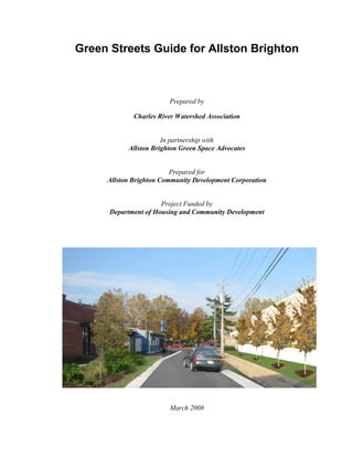
1. Green Streets Guide for Allston Brighton
Prepared by
Charles River Watershed Association
In partnership with
Allston Brighton Green Space Advocates
Prepared for
Allston Brighton Community Development Corporation
Project Funded by
Department of Housing and Community Development
March 2008
2. Green Streets Guide for Allston Brighton
Introduction
This guide is the result of an ongoing collaboration between Charles River Watershed
Association (CRWA) and Allston Brighton Community Development Corporation
(ABCDC) that seeks to explore the possibilities of implementing “green street” designs in
Allston Brighton. The guide is intended to be used by the Allston Brighton Green Space
Advocates (ABCDC) to advocate for green street retrofits in various development and
redevelopment projects being planned in the neighborhood and to work with various
departments in the City of Boston to incorporate these design considerations into any
street improvement project being implemented in the neighborhood.
In the first part of the guide, we define green streets and describe the elements that
comprise them, as well as define the design considerations that inform specific
suggestions for retrofitting streets in urban Boston. In the second part of the guide, we
analyze and explore applicability of green street designs to three different urban streets in
the Allston/Brighton neighborhood. We believe that many of the lessons learned from
this case study will be applicable to other urban areas in New England that have similar
climate, traffic regimes, and urban fabric conditions to those present in Boston
neighborhoods.
2 March 2008
3. Green Streets Guide for Allston Brighton
Table of Contents
Part 1: What is a Green Street? ............................................................................ 7
1.1 Elements of Green Streets (A) Public Realm ......................................................7
1.2 Elements of Green Streets (B) Private Realm....................................................10
1.3 General Design Considerations..........................................................................11
Part 2: Opportunities for Allston Brighton Streets ............................................... 17
2.1 Project Background............................................................................................17
2.2 Everett Street......................................................................................................20
2.3 Market Street......................................................................................................26
2.4 Brooks Street......................................................................................................34
2.5 Public-Private Site Recommendations...............................................................41
2.6 Summary of Recommended Green Street Design Elements .............................45
2.7 Maintenance.......................................................................................................50
3. References...................................................................................................... 51
Appendix:
Community Workshops: Newspaper Articles, Meeting Notes and Survey Results
March 2008 3
4.
5. Green Streets Guide for Allston Brighton
PART 1
What is a Green Street?
March 2008 5
6.
7. Green Streets Guide for Allston Brighton
1. What is a Green Street?
A “green street” is a signifier of a healthy neighborhood. On a green street part of the
public right-of-way is designed so that stormwater runoff is captured and cleaned by
vegetation and soils. Whether the vegetation consists of street trees, grass, or
“raingardens,” a green street offers a way to decrease water pollution and beautify
neighborhoods with additional vegetation. Furthermore, a green street is a place for
pedestrians to walk comfortably and safely; it is a place where the needs of community
and environment are balanced with the needs to accommodate the automobile.
From a watershed perspective, green streets differ from conventional city streets because
they are designed to retain raindrops where they fall and where possible replenish
groundwater instead of conveying water off the land via underground pipe networks.
Traditional pipe systems often cause flooding and water quality problems where the pipes
end at outfalls—in streams, rivers, lakes and oceans. Water that flows off paved surfaces
(stormwater runoff) is often contaminated with the byproducts from driving cars,
fertilizing lawns, and other intensive land uses. These pollutants include heavy metals,
oils and greases, excess nutrients, bacteria, and sediments. Water flowing through pipes
also moves faster, with less friction, than water that percolates slowly through vegetation
and soils in an undeveloped environment. The more pavement and rooftops in a
watershed, the more water is forced into the pipe network. These volumes of rainfall,
along with their toxic slew of contaminants, are delivered rapidly to receiving waters
causing flooding and erosion of streambanks and shorelines at the end of the pipes. Thus,
the environmental goals of green street design, a component of the Low Impact
Development (LID) approach, are to reduce the use of pipe networks and allow natural
drainage systems to carry and clean rainfall in cities.
1.1 Elements of Green Streets (A) Public Realm
Roadways: Although walkability is one of the goals of creating green streets, the street
greening process is not intended to close off roadways to automobile traffic. That said,
the first step in designing green streets is to analyze just how much space one needs in
order to accommodate cars, trucks, and emergency vehicles within the roadway. In many
cities, autos are allocated wider stretches of pavement than are necessary for mobility.
This both encourages driving at faster (often unsafe) speeds and translates to excessive
impervious surfaces which lead to poor hydrology and water quality. Green street
projects in Portland, Oregon and Seattle, Washington have shown that two-way, two-lane
residential street traffic can safely move within a twenty foot paved roadway; other
evidence recommends as little as eighteen feet.1 On heavy traffic mixed use, commercial,
and industrial streets, it may be necessary to have wider paved roadways, but regarding
auto-mobility, the question should be what the minimum practical width of pavement is,
rather than the maximum. Narrower paved roadway widths mean less impervious surface
1
The authors of the article “In Search of Cheap and Skinny Streets,” Bray and Rhodes, experimented with
two fire trucks passing each other and found that, with mirrors turned in, they could safely make it through
a street of eighteen feet in width!
March 2008 7
8. Green Streets Guide for Allston Brighton
to generate stormwater runoff and more space for pedestrian traffic, vegetation and water
quality improvements.
Vegetation: Within the streetscape trees, shrubs, ornamental plants and grasses create an
attractive ambiance, but also provide functions that make for better human habitat and
improve environmental quality.
Street Trees shade their surroundings, improve air quality, increase evaporation, provide
habitat, and reduce the urban heat island effect. The root zone of the tree pits in which
street trees are placed can also serve as a storage area for stormwater runoff. A
combination of engineered soils with extra pore space for water storage and a selection of
tree species that can tolerate “wet feet” and drought make expanded street tree networks,
a good option for reducing runoff and improving quality of life on urban streets.
Median Strips and Raingardens: In many cities grass or other vegetation in planting
strips and street medians have historically provided an aesthetic amenity and a buffer
between auto traffic and pedestrians. These green strips, with or without trees, can be
designed as raingardens and used to store and filter stormwater. In Portland, Oregon,
they are planted with fine-stemmed, water-tolerant vegetation and placed within the curbs
of the sidewalk; stormwater enters the strips through grates cut into the curb (Figure 1).
In a Seattle, Washington neighborhood development, the planting medians are designed
with two different aesthetic styles (Figure 2 & 3). The first example is similar to
Portland’s project within which water is held on the surface by plants. The fine-stemmed
vegetation acts as a filter, catching the particles and sediments in stormwater and trapping
many of the nutrients and heavy metals that are bound to them. In the second Seattle
example, water is held briefly on the grass surface but much of the stormwater is actually
stored underground in large cells of specially engineered soils. Collectively, these
strategies can serve as examples of ways to avoid directing runoff to overburdened
stormwater pipe infrastructure while retaining the mobility and safety functions of the
street right-of-way. Depending on the desired street configuration these plantings can be
located flanking the roadway adjacent to sidewalks or within median strips that separate
driving lanes.
Figure 1. Sidewalk Stormwater Planter on SW 12th Avenue in Portland, OR. (Courtesy Tracy Tackett,
Seattle Public Utilities)
8 March 2008
9. Green Streets Guide for Allston Brighton
Figure 2. Stormwater Bioretention Landscape at High Point in Seattle, WA. (Courtesy Tracy Tackett,
Seattle Public Utilities)
Figure 3. Grass Stormwater Channel with Subsurface Storage at High Point in Seattle, WA. (Courtesy
Tracy Tackett, Seattle Public Utilities)
Sidewalks: Wider sidewalks improve the pedestrian realm of the public right-of-way and
leave space for other street design elements such as street trees, benches, and lighting.
While sidewalks traditionally contribute to the sum of impervious area within a street
corridor, it is possible to reduce their effective imperviousness by paving sidewalks with
porous and permeable materials that allow water to flow through and recharge
groundwater, rather than runoff into the storm sewer pipe network.
Bike Lanes: Biking is a healthier and more sustainable form of local transportation than
driving. Bicycle safety is an important feature of any street design and, where possible,
should be incorporated into any green street retrofit. If a right-of-way is narrow and auto
traffic lane width needs confound the ability to designate a separate bike lane, the best
option for bikes may be slowing car traffic. Ways to do so include shared travels lanes
with appropriate signage, providing vegetation, pavement changes at intersections, visual
amenities, and other traffic calming elements within the streetscape.
March 2008 9
10. Green Streets Guide for Allston Brighton
Parking Lanes: While sometimes indistinguishable from the adjacent roadway in terms
of paved surfaces, parking lanes do not need to meet the traffic weight and speed
requirements that driving lanes do. Accordingly, they provide an opportunity to
incorporate alternative materials, such as porous asphalt or concrete and permeable
pavers. If there is adequate off-street parking, choosing to replace parking lanes with
bike lanes or vegetation will effectively reduce the amount of right-of-way allocated for
Underground Infrastructure/Utilities: While we can’t convert cities to their
predevelopment landscapes, we can be more selective about using natural systems of
plants and soils rather than artificial pipe systems to shape the watersheds in which we
live. Sometimes the surface width of the street right-of-way is not large enough to
incorporate significant areas of soil and vegetation. In that case, we must look beneath
the street itself as a place to store and treat stormwater. Infiltration trenches and
underground detention and retention chambers can greatly complement the other green
streets material mentioned above and work together to mimic natural hydrologic patterns
in urban neighborhood settings. (Note that by intervening underground we must be wary
of disturbing other existing utilities such as sanitary sewer and power lines.) In addition,
green street retrofits need not always require digging up and replacing existing pipes; the
older systems can be used for overflow in the case of larger storm events.
Plazas and Large Intersections: Large public spaces such as public plazas, traffic
circles, and wide intersections may be ideal locations to locate green street features such
as raingardens and deep tree pits. They may also serve as gathering places for the local
community and as sites for public art. Stormwater elements can be incorporated in these
high-visibility settings as demonstration projects, providing watershed education
opportunities for neighborhood residents.
1.2 Elements of Green Streets (B) Private Realm
Adjacent Patios, Driveways and Parking Areas: The water that flows along typical
city streets into catch basins and through underground pipes does not originate on streets
alone. Driveways and parking lots are often graded to flow from private property into the
public street right-of-way. Owners of adjacent property can lessen the burgeoning
volumes of rainfall that enters the public street system by reducing the runoff from their
property. Options include developing private raingardens2 into which runoff from
“hardscape” (patios and parking areas) can be directed, eliminating or reducing paved
areas and replacing them with porous pavers or permeable asphalt/concrete or amended
soils and vegetation. Maximizing vegetation on one’s property not only increases
absorption of water by plant roots, but increases evaporation, helping to cool the local
climate. (Note that heavily compacted turf and lawn vegetation with thick root mats are
surprisingly impervious to rainfall and can generate significant volumes of stormwater
runoff.)
2
Maplewood Minnesota has developed a thriving raingardens program in which the city offers neighbors a
selection of plant palettes and subsidizes costs for the landscaping in exchange for residents doing the
maintenance.
10 March 2008
11. Green Streets Guide for Allston Brighton
Rooftops and Water Collection: Roof area is also a large contributor to the total
rainfall volume that makes its way into public streets and storm sewer pipes. Property
owners can help reduce this runoff at the first place where it falls on their parcel by
converting flat and low slope roofs to green roofs (also known as “eco-roofs”).
Downspouts can also be disconnected from piped drainage systems (if they aren’t
already) and rainwater can be conveyed either into cisterns (rain barrels) for irrigation
water storage or conveyed directly into raingardens on the property. By thinking about
the ultimate destination of every drop of rainfall that lands on our private properties, we
can make enormous improvements in urban watershed hydrology and health.
1.3 General Design Considerations
In addition to the public and private realm retrofit approaches mentioned above, the
following considerations should be used as a checklist in development reviews and as a
part of any street retrofit design process.
Reduce Impervious Pavement
• Use porous pavement for areas such as under bicycle lanes, overflow parking
areas, emergency access roads and other low-traffic areas. Porous pavement can
be permeable asphalt, concrete, or pavers. However, pavers should not be used
where a smooth, even surface is required such as on bicycle lanes.
• Encourage the use of shared parking to reduce the size and number of parking
lots. Encourage underground or above ground parking structures for appropriately
sized development projects.
• Encourage shared driveways between adjacent development projects or
residences.
• Consider reducing parking requirements stipulated in the zoning code for
commercial, industrial and multifamily use so as to reduce net impervious area.
On-street parking or public parking lots in close proximity can provide some of
the required off-street parking supply3
Manage Run-Off Onsite
• Grade sidewalks so that stormwater runs off into adjacent unpaved areas such as
planting strips or landscaped private property.
• Use raingardens such as vegetated street swales and stormwater planters
whenever possible.
• Design stormwater facilities for specific runoff goals (e.g. 1 year storm) and
provide for overflow.
• All suggested BMPs should drain through infiltration or release to a designated
discharge point such as another BMP or existing stormwater pipes. When using
perforated pipes cleanouts need to be provided.
3
See Somerville [Zoning Bylaw, Article 9, §9.6.3] and Arlington [Zoning Ordinance, Article 8, §8.11] for
public parking lots and San Diego, CA [Municipal Code, Ch. 14, §142.0525] for on-street parking to count
toward required parking.
March 2008 11
12. Green Streets Guide for Allston Brighton
• For surface stormwater facilities keep slopes and depths as low as possible. This
will increase safety, prevent erosion, and improve aesthetics.
• For vegetated street swales place check dams every 12 to 20 feet to slow runoff.
• Place infiltration stormwater planters 10’ away from building foundations to
protect foundations.
• For enclosed stormwater drainage systems, consider in-line treatment strategies
including special structures to trap sediment (catch basins, sump pits, oil/grit
separators).
Improve Environment for Pedestrians and Bicyclists
• Whenever possible, provide adequately sized sidewalks that are handicap
accessible. According to Streetscape Guidelines for Boston’s Major Roads4
recommended sidewalk widths without trees are 12’-13’ and 13’ to 15’ with trees.
• Add bike lanes or other ways for safer riding such as shared roads. Use signs and
shared lane pavement markings (such as sharrows) to indicate that bikes and cars
share the travel lane.
• Include placement of bicycle racks on sidewalks and plazas. Refer to Boston
Bicycle Plan (Boston Transporation Department, May 2001) for recommended
racks, proper locations, and minimum clear space around racks.
• Use street calming techniques whenever possible; reduced lane width, extended
curbs, raised crosswalks, side-alternating parking lanes.
• Incorporate street furniture, trash receptacles, pedestrian scaled lighting and
public art where appropriate.5
Add Trees and Plants
• Plant street trees wherever possible. Follow Boston’s planting requirements6:
15’ from light pole
10’ from a driveway
20-40’ from an intersection (depending on the direction of traffic)
10’ from a fire hydrant
• Incorporate stormwater treatment into vegetated areas.
• Select plants that can withstand wet conditions and are appropriate for urban
environments in areas where runoff is stored and/or conveyed.
Observe Preferred Minimum/Maximum Dimensions
The following dimensions should be used only as guidelines. Detailed designs would
need to be developed for each street by designers and engineers including sizing of
stormwater facilities which is determined by site conditions such as soils, slope and
stormwater goals.
4
Boston Transportation Department, Streetscape Guidelines for Boston’s Major Roads, July 1999
5
Design of street amenities such as street furniture and lighting is not included in the scope of this
document.
6
City of Boston, Parks and Recreation Department
(http://www.cityofboston.gov/parks/streettrees/seasonal.asp)
12 March 2008
13. Green Streets Guide for Allston Brighton
Public Realm Component Dimensions Source*
Travel Lane Width Minimum: C
10’ (Collector)
9’ (Local Road)
Separate Bicycle Lane Width Minimum: C
4’ Min. (without parking)
5’ (next to parking)
Recommended: 5’
Shared Car and Bicycle Lane Minimum: 14’ C
Width
Parking Lane Width Minimum: 7’ A,C
(Parallel on-street) (For streets not plowed curb to curb 8’ Min)
Recommended: 8’
Bus Stop Curb Length Adjacent to Intersection: 60’ A
Mid-block: 80’
Sidewalk Width Minimum: A, ADA
4’ (clear, unobstructed) requirement
Recommended:
8’ (clear, unobstructed)
12-13’ without trees
13’-15’ with trees
Crosswalk Width Minimum: 10’ A
Tree pits Minimum: 4’x6’, 5’x 5’, 0.5’x10’ A
(without stormwater Recommended: 6’x 6’
management)
Stormwater Planter Minimum: 30” B
(Infiltration) Dimensions Storage Depth: Minimum 12”
Stormwater Planter (Flow- Minimum: 18” B
Through) Width Storage Depth: Minimum 12”
Slope: Maximum .5%
Vegetated Street Swale Minimum Width: 7’ B
Dimensions Storage Depth: 6”-12”
Maximum Side Slope: 3:1
Maximum Longitudinal Slope 60%
*Sources for Dimensions unless otherwise noted:
A: Streetscape Guidelines for Boston’s Major Roads (City of Boston 1999)
B: Portland Stormwater Management Manual (City of Portland 2004)
C: Project Development and Design Guidebook (Mass Highway 2006)
March 2008 13
17. Green Streets Guide for Allston Brighton
2. Opportunities for Allston Brighton Streets
2.1 Project Background
At Allston Brighton’s second annual “Green Gathering” in February 2006, 55 residents
joined together and stressed the need for a plan that articulated better access to and
awareness of the neighborhood’s parks and open spaces. The Allston Brighton CDC and
a group of fifty community activists launched the Allston Brighton Green Space
Connections planning process, a project whose goal is to contribute to community
revitalization by strengthening the network of public parks and making parklands
accessible to all modes of transportation.
The Allston Brighton Green Space Connections map proposes three types of green
corridors: Urban Boulevards, Local Greenways, and Green Linkage Streets (see Figure
4). This map forms the framework for planning and creating design guidelines on a
street-by-street basis.
Figure 4. Allston-Brighton Green Street Opportunities
March 2008 17
18. Green Streets Guide for Allston Brighton
In February 2007, the ABCDC received a grant from the Department of Housing and
Community Development to create design guidelines for green corridors, and hired
CRWA as a consultant to develop design guidelines for pilot streets in Allston Brighton.
Simultaneously the ABGSA undertook a collaborative effort to analyze a set of streets in
the Allston-Brighton, in order to select potential locations for green street retrofits. A
combination of factors including stormwater infrastructure challenges, auto and
pedestrian mobility issues, and community interest led to the selection of three streets for
in-depth analysis and conceptual design development for green streets.
The streets selected for analysis were Everett Street, Market Street, and Brooks Street
(See Map in Figure 5). Each street runs predominantly north-to-south, with stormwater
pipes that accept flows moving north to outfalls on the Charles River. The buried
stormwater infrastructure is roughly five feet beneath the ground surface in this part of
Boston and pipes are generally sloped downwards to carry flow by gravity. Each street
has its own set of mobility and safety challenges that would be aided by the creation of a
more pedestrian-friendly green street design. The design guidelines provide specific
instructions that the neighborhood can incorporate into future redevelopment plans to
improve streets for walkers and bicyclists, to make public parks more accessible, and to
strengthen the overall open space network in the neighborhood.
Figure 5. Pilot Green Street Types in Allston Brighton. Location of the three streets selected to represent
three types of Green Streets for developing design guidelines
18 March 2008
19. Green Streets Guide for Allston Brighton
Over the course of summer of 2007 community workshops were held to engage the local
neighborhoods and identify specific issues relevant to potential future street design
scenarios. Considerations included which streets can accommodate bike lanes, which
streets can accommodate street trees and other low-impact designs from the menu of
green infrastructure available. For more details on the workshops refer to Appendix-
Community Workshops: Newspaper Articles, Meeting Notes and Survey Results
March 2008 19
20. Green Streets Guide for Allston Brighton
2.2 Everett Street
Site Analysis
• Needs repaving
• Variable curb and sidewalk materials—brick, concrete, asphalt, many in disrepair.
• Pedestrian challenges, need for improved (wider) sidewalks and new crosswalks.
• Some “drains to Charles” stenciling
• Passes over Mass Pike and splits off
• Traffic safety challenges at overpass ramps
• Opportunities to collaborate with private lot and building owner(s) immediately
south of Mass Pike
• Narrow paved roadway width along much of street
• Road slopes at south end; most significant slopes are at Mass Pike overpasses
• Average right of way: 40’
• Right of way width may not provide enough room for bicycle
• Existing parking lanes only adjacent to Mass Pike overpass
• Hydrologic connection to Charles River at north is beneath parallel Teleford St. to
west, but visual connection is along Everett Street to Soldier’s Field Road Drive
where there is no overpass or safe crossing to the Charles River.
• Everett Street is classified as an urban collector and carries about 9,000 vehicles per
day.
• Connects North Beacon Street to Western Avenue.
Green Street Design Opportunities
• Create pedestrian linkages to river and down street, including potential new
overpass
• Add bicycle links (if possible)
• Include vegetation in parks and roadway as habitat (e.g. birds move between parks)
• Redesign hot spot intersection at Holton Street and Everett Street to prevent
frequent flooding
• Improve streetscape with trees, shrubs, benches, lighting, public art
• Linkages through private property and contributions of private property owners (e.g.
Harvard owned parcels) would help meet community and ecology goals.
20 March 2008
21. Green Streets Guide for Allston Brighton
Greening Guidelines
Proposed Improvements Location Refer To
Low Impact Development Herter Park Figure 6,
(LID) retrofit and parkland Section 2.5
enhancement and 2.6
Pocket Park 250 Everett Street and 90 Litchfield Street Figure 6
New pedestrian and bicycle West of Everett Street between Holton Figure 6,
path and LID retrofits Street and Western Avenue Section 2.5
and 2.6
Parking lot retrofit St. Anthony’s Figure 2,
Section 2.5
and 2.6
Green roofs St. Anthony’s and Gardner School Figure 2,
Section 2.5
Improved pedestrian and Soldier Field Road Figure 6,
bicycle crossing Section 2.6
Commercial Gateway Western Avenue and Everett Street and Figure 6,
treatment for node North Beacon Street and Everett Street Section 2.6
Improved Pedestrian and Western Avenue and Everett Street Figure 6,
bicycle access Section 2.6
Improved safety and node Holton Street and Everett Street Figure 6,
treatment Section 2.6
Improved safety and LID Beginning of Mass Pike overpass-both Figure 6,
retrofits south and north end Section 2.6
Improved bridge crossing Mass Pike overpass Figure 6,
Section 2.6
Improved vegetation Next to Mass Pike overpass Figure 6,
management and LID Section 2.6
retrofits
Improved connection Between Braintree Street and Guest Street Figure 6
Improved visibility and Between Everett Street and Playground on Figure 6
connection Hano Street
Streetscape improvements Brentwood Street and Holton Street Figure 6,
Section 2.6
Sidewalk and right-of-way Telford Street See Figure 6
(ROW) retrofit with tree Along all of Everett Street to 9,
planting Section 2.6
March 2008 21
22. Green Streets Guide for Allston Brighton
Figure 6. Everett Street. Greening Guidelines
22 March 2008
23. Green Streets Guide for Allston Brighton
Proposed Street Treatments
Figure 7. Everett Street Section. Stormwater Planters on both sides. Suggested anywhere along Everett
Street.
March 2008 23
24. Green Streets Guide for Allston Brighton
Figure 8. Everett Street Section. Swale on one side. Suggested next to Commercial Sites or Parking Lots.
24 March 2008
25. Green Streets Guide for Allston Brighton
Figure 9. Everett Street Section. Parking on one side and Stormwater Planter on the other. Suggested next
to Mass Pike Bridge.
March 2008 25
26. Green Streets Guide for Allston Brighton
2.3 Market Street
Site Analysis
• Travel lanes may be wider than necessary
• Steep slopes throughout
• Commercial areas at both ends. Larger parcels with high levels of imperviousness
to north; smaller parcels to south.
• Land Use is Residential in between two different commercial zones with different
scales: 1-Main Street with shops fronting public right of way; 2-Large scale
commercial where parking lot is street frontage
• Large parking area next to the Conservatory, across from Mapleton Street
• Parking lanes between Faneuil Street to Sparhawk Street are less crowded, maybe
space available to put in vegetation (trees with benches)
• Excessive flooding and ice build-up occurs at street intersections (at Ryan
Road/Market Street and Arlington Street/Sparhawk Street/Market Street
intersections)
• Poor drainage from side street is responsible for flooding (e.g. Arlington St. north)
• Need to connect Market Street visually and physically all the way to the Charles
River and to playgrounds and pocket parks in the area
• Need for safe pedestrian connections throughout
• Overpass at Soldier’s Field Road is tricky;
• Need green connection to the Charles River and landscape
• Traffic safety challenges at overpass ramps
• Need for bus stop connections
• Bicycle lanes may be possible
• Sidewalks are typically 9-10 ft. wide
• Market Street is classified as an urban collector and carries about 25,500 vehicles
per day.
• Runs between Commonwealth Avenue and Western Avenue.
Green Street Design Opportunities
• Create pedestrian linkages to the river, including potential new overpass
• Add bicycle links (if possible)
• Redo hot spot intersection with steep slopes and flooding problems at Arlington
Street,/Sparhawk Street
• Improve streetscape with trees, shrubs, benches, lighting, public art
• Slopes of street enhance visual connections and should be emphasized; could use
terraced model for stormwater treatment.
• Linkages through private property and contributions of private property owners
would help meet community and ecology goals
• Public Art and Green Infrastructure as part of way finding, signage along the path to
the River, pocket park north of the pike
• Opportunities to connect business district(s) at both ends of Market Street to
neighborhoods in between
26 March 2008
27. Green Streets Guide for Allston Brighton
• Incorporate stormwater management elements when designing needed
gateways/entryways to demarcate nodes at both ends of Market Street, e.g. the
Charles River or Brighton Center
• Provide a sense of place and arrival through enhancing the visual experience using
gardens, light fixtures, street furniture, trash barrels and kiosks.
• There may be an opportunity to create guidelines for the involvement of private
landowners.
March 2008 27
28. Green Streets Guide for Allston Brighton
Greening Guidelines
Proposed Improvements Location Refer To
Low Impact Development Along Charles River Figure 10,
(LID) retrofit and Section 2.5
parkland enhancement and 2.6
Parking lot retrofit • Parcel west of Leo M. Birmingham Figure 10,
Parkway Section 2.5
• New Lowe’s store and 2.6
• South of North Beacon Street
• Conservancy
• Lots along Market Street between
Arlington Street and Washington Street
Green roofs • Parcel west of Leo M. Birmingham Figure 10,
Parkway Section 2.5
• New Lowe’s store
• South of North Beacon Street
• Suitable buildings along Market Street
between Arlington Street and Washington
Street
Gateway treatment for • Soldier Field Road and Leo M. Figure 10,
node Birmingham Parkway Section 2.6
• Washington Street and Market Street
(Brighton Center)
Improved Pedestrian and • Soldier Field Road and Leo M. Figure 10
bicycle access Birmingham Parkway and 12
• From Leo M Birmingham Parkway to
Arsenal Mall
• From Leo M Birmingham Parkway to
parcels west of parkway
Improved pedestrian • Guest Street and Market Street Figure 10,
safety and node treatment • North Beacon Street and Market Street Section 2.6
LID retrofits to prevent • Ryan Road/Market Street intersection Figure 10
flooding • Arlington Street/Sparhawk Street/Market and 14,
Street intersection Section 2.6
Improved bridge crossing • Across Charles River to Arsenal Mall Figure 10,
• Mass Pike overpass Section 2.6
Improved connection Between Leo M. Birmingham Parkway and Figure 10
Portsmouth playground
Streetscape improvements • Guest Street Figure 10,
• Faneuil Street Section 2.6
Sidewalk and right-of-way • Along Leo M. Birmingham Parkway See Figure
(ROW) retrofit with tree • Along all of Market Street 10 to 14,
planting Section 2.6
28 March 2008
29. Green Streets Guide for Allston Brighton
Figure 10. Market Street Greening Guidelines.
March 2008 29
30. Green Streets Guide for Allston Brighton
Proposed Street Treatments
Figure 11: Market Street Section South of Mass Pike. Stormwater Planters within Parking lanes and Bike
Lanes on both sides.
Figure 12: Market Street Section North of Mass Pike. Boulevard with Swales, Stormwater Planters,
Raingarden, and Bike Lanes.
30 March 2008
31. Green Streets Guide for Allston Brighton
Figure 13: Market Street Options for Bus Stops with Bike Lane and Stormwater Planters.
March 2008 31
32. Green Streets Guide for Allston Brighton
Figure 14: Market Street Raised Intersection with Curb Extensions and Stormwater Planters. Suggested for
intersections in need of flooding mitigation and safety improvements (see Figure 10: Market Street
Greening Guidelines)
32 March 2008
33. Green Streets Guide for Allston Brighton
Figure 15: Before and after scenarios for greening Market Street
March 2008 33
34. Green Streets Guide for Allston Brighton
2.4 Brooks Street
Site Analysis
• Traffic calming needed; many accidents on blind hill going up Bigelow Street.; this
intersection is at a high point of Brooks Street
• Street slopes down both north and south with a hill crest in the middle
• Slope is near-flat at south end
• Traffic is worse at night coming from the Charles River (Nonantum Road) and
worse in the morning coming from Faneuil Street
• Parking conflicts; most residences are double-family size.
• Need for crosswalks, especially near convenience store.
• Need for improved underpass sidewalks
• Street is currently not safe for biking
• Street is slightly wider between Upcrest Road and Bigelow Street
• Sidewalks are narrow (typical width = 7’0”)
• Few street trees; trees in small tree pits = 18” x 18”
• Population is growing as lots are subdivided for new building construction.
• Brooks Street is classified as an urban collector.
• Runs between and Faneuil Street and Nonantum Road.
Green Street Design Opportunities
• Use speed bumps and other traffic calming techniques that incorporate stormwater
treatment elements, such as curb-bulbs with stormwater planters
• Incorporate terraced stormwater elements where slopes are steep
• Expand street tree network using stormwater planters
34 March 2008
35. Green Streets Guide for Allston Brighton
Greening Guidelines
Proposed Improvements Location Refer To
Low Impact Development Along Mass Pike Figure 16,
(LID) retrofit and Urban Section 2.5
Wild enhancement and 2.6
Preserve canopy cover and Interior of parcels between Dunboy Street and Figure 16
open space Brooks Street
Parking lot retrofit • On Woodmont Street next to Mass Pike Figure 16,
tunnel Section 2.5
and 2.6
Gateway or node • Faneuil Street and Brooks Street Figure 16,
treatment • Bigelow Street and Brooks Street Section 2.6
Commercial gateway • At Oliva Street and Brooks Street Figure 16,
treatment Section 2.6
Improved Pedestrian and • From Brooks Street to Charles River and Figure 16,
bicycle access parklands along the river Section 2.6
Intersection retrofit with • Oliva Street and Brooks Street Figure 16
traffic calming devices • Hobart Street and Brooks Street and 19,
such as bulb-outs • Bigelow Street and Brooks Street Section 2.6
LID retrofits to prevent • Along Woodmont Street Figure 16
flooding at intersections to • Along Newton Street and 19,
Brooks Street • Along Gerrish Street Section 2.6
• Along Bigelow Street
• Along Upcrest Road
Improved tunnel • Under Mass Pike Figure 16,
connection 20 and 21,
Section 2.6
Improved connection Between Brooks Street and Hobart Park Figure 16
Improved sidewalk and Adjacent to entrance to Mass Pike tunnel Figure 16
vegetation management and 21
Sidewalk and right-of-way • Along Brooks Street See Figure
(ROW) retrofit with tree 16 to 20,
planting Section 2.6
Downspout disconnects • Residential properties along Brooks Street See Figure
16,
Section 2.6
March 2008 35
36. Green Streets Guide for Allston Brighton
Figure 16: Brook Street Greening Guidelines
36 March 2008
37. Green Streets Guide for Allston Brighton
Proposed Street Treatments
Figure 17: Brooks Street Section: Stormwater Planter and Parking Lanes. Suggested south of Bigelow
Street.
Figure 18: Brook Street Section. Conveyance Swale on one side and Parking Lane on the other. Suggested
north of Bigelow Street.
March 2008 37
38. Green Streets Guide for Allston Brighton
Figure 19: Brook Street Plan showing Swales and Parking alternating sides (traffic calming).
38 March 2008
39. Green Streets Guide for Allston Brighton
Figure 20: Brook Street. Raised Intersection and Curb Extension with Stormwater Planters at Bigelow
Street.
Figure 21: Brook Street Section. Looking at Mass Pike Underpass. Stormwater Planters, Green Walls, and
Bike Lanes.
March 2008 39
40. Green Streets Guide for Allston Brighton
Figure 22: Before and after scenarios for greening Brooks Street with stormwater planters, porous
sidewalks and bike lanes in section looking at the Mass Pike underpass area
40 March 2008
41. Green Streets Guide for Allston Brighton
2.5 Public-Private Site Recommendations
• New construction or redevelopment projects contribute to green streets funding or
include green features to reduce stormwater runoff from project site itself.
Recommendations for reducing imperviousness on private residential lots along green streets Source Green
Streets METRO, OR
March 2008 41
42. Green Streets Guide for Allston Brighton
• Eliminate or mitigate for large areas of parking (especially that drain into public
right-of-way).
Recommendations for reducing imperviousness on parking lots along green streets
Source Green Streets METRO, OR
42 March 2008
43. Green Streets Guide for Allston Brighton
• Neighborhood-scale fundraising to support commercial districts by greening streets
and improving walkability.
Before and after scenarios for greening Braintree Street parking lot
March 2008 43
44. Green Streets Guide for Allston Brighton
• Green roofs for residential, commercial, and institutional sites
Green roof on residential garage
• Downspout disconnect into rain barrels, cisterns or stormwater planters and
raingardens
Rainbarrel Stormwater Planter
Cisterns
44 March 2008
45. Green Streets Guide for Allston Brighton
2.6 Summary of Recommended Green Street Design Elements
Permeable Pavement
Options for permeable pavement are porous concrete or asphalt and permeable pavers.
Benefits:
• Reduce runoff.
• Recharge groundwater (if soils allow infiltration).
• Filter pollutants.
• Superior performance in cold conditions (less prone to crack, needs less salt)
Applications - Public Realm:
• Sidewalks/Intersections
• Bike lanes
• Parking lanes
Applications – Private Realm:
• New/Retrofitted Developments – Paths, plazas
• Parking lots
• Driveways
Permeable Pavement on Sidewalks Porous Pavers in Parking Lane
Porous Pavers in Parking Lot.
March 2008 45
46. Green Streets Guide for Allston Brighton
Street Trees
Benefits:
• Improve pedestrian environment.
• Reduce runoff by intercepting rain
• Can be combined with stormwater planters/swales/raingardens to increase
infiltration
• Reduce heat island effect and cooling cost of adjacent buildings.
• Reduce and filter pollutants.
• Promote wildlife habitat.
Applications - Public Realm:
• Sidewalks
• Curb extensions
Applications – Private Realm:
• Private gardens
• New/Retrofitted Developments
• Parking lots
Tree in Stormwater Planter in Parking Lot Street Trees
46 March 2008
47. Green Streets Guide for Allston Brighton
Rain Gardens
Raingardens are landscaped depressions that collect and treat stormwater runoff. As
stormwater infiltrates through mulch, soils, and plant root systems pollutants such as
bacteria, nitrogen, phosphorus, heavy metals, oil and grease are retained, degraded, and
absorbed. Recommended rain garden types include stormwater planters, swales, and
infiltration basins. Stormwater planters are structures that either infiltrate (infiltration
planter) or slow and filter runoff (flow-through planters). Swales are planted depressions
with gentle slopes that slow and filter runoff. Infiltration basins are vegetated depressions
that store and infiltrate runoff.
Benefits:
• Enhance pedestrian environment.
• Reduce and slow runoff.
• Improve water quality.
• Recharge groundwater (if infiltration is possible).
• Reduce heat island effect.
• Promote wildlife habitat.
Applications - Public Realm:
• Sidewalks
• Roads and Intersections (curb extensions)
Applications – Private Realm:
• Private gardens
• New/Retrofitted Developments
• Parking lots
Swale in Curb Extension Raingarden in Parking Lot Stormwater Planter
Stormwater Planter next to Sidewalk Swale next to Sidewalk Raingardens in New Development
March 2008 47
48. Green Streets Guide for Allston Brighton
Curb Extensions/Raised Intersections
Benefits:
• Improve pedestrian environment.
• Slow traffic.
• Provide opportunities for runoff treatment and added vegetation.
Applications - Public Realm:
• Roads
• Intersections
Raised Intersection Curb Extension
Bike Lanes/Shared Roads
Benefits:
• Safer environment for bicyclists
• Slow traffic.
• Provide opportunities for runoff treatment when using permeable pavement.
Applications - Public Realm:
• Roads
• Sidwalk
Applications - Private Realm:
• New/Retrofit Development
Bike Lane on Sidwalk Shared Road Bike Lane in Road
48 March 2008
49. Green Streets Guide for Allston Brighton
Public Art/Street Furniture/Educational Interventions
Benefits:
• Create pedestrian-friendly environment.
• Engage the community, especially if participation in the design and
implementation of art projects is encouraged.
• Provide opportunities to connect neighborhood to the Charles River.
• Help the neighborhood recognize urban environments and can bring the
importance of water and plants back into people’s minds.
Applications - Public Realm:
• Sidewalks
• Bridge Crossings
• Intersections
Applications – Private Realm:
• New/Retrofitted Developments
Examples of Bridge Crossings
Improved Sidewalks and Intersections in Brookline, MA. Educational Sign in Portland, OR
March 2008 49
50. Green Streets Guide for Allston Brighton
2.7 Maintenance
Whatever green streets elements are designed and constructed, maintenance will play an
important role in their success. Maintenance activities within the street right-of-way can
eliminate flooding and improve water quality. They will affect structures and materials
as well as vegetation and soil health. Activities may range from general repairs of
sidewalks to vactoring (cleaning) out catch basins to street sweeping to pruning trees and
weeding other vegetated areas. Some of these activities are more common on typical
street designs; others are particular to green streets. Some maintenance duties—such as
emptying sedimentation structures or tree pruning—can be performed by city
departments; others—such as weeding rain gardens and inspecting catch basins for
clogging—may be accomplished by local residents and business owners who are
interested in helping a green street function properly. Maintenance programs should be
developed for all green streets; planners may want to borrow from maintenance manuals
used by cities with successful green streets and green alleys programs, such as Seattle,
Portland, Vancouver B.C. and Chicago.7 Ultimately, no green street should be planned
without consideration of maintenance objectives and needs and agreements as to who will
be responsible for maintenance activities during the project’s life.
• Regularly remove trapped sediment and pollutants to avoid resuspending them in
subsequent storms.
• Select grass species that produce a uniform cover of fine-hardy vegetation that
can withstand prevailing moisture conditions. Provide routine mowing to keep
grass in active growth phase and to maintain dense cover.
• Follow guidelines for erosion control techniques during construction of regional
streets and adjacent development projects.
7
Seattle, WA: Natural Drainage Systems Program
http://www.seattle.gov/util/About_SPU/Drainage_&_Sewer_System/Natural_Drainage_Systems/index.asp
Portland, OR: Green Streets Program
http://www.portlandonline.com/bes/index.cfm?c=44213&
Chicago, IL: CDOT Green Alleys Program
http://egov.cityofchicago.org/webportal/COCWebPortal/COC_EDITORIAL/GreenAlleyHandbook_Jan.pdf
Vancouver. B.C. Canada: City of Vancouver Country Lanes & Sustainable Streets Programs
http://www.city.vancouver.bc.ca/engsvcs/streets/design/enviro.htm
50 March 2008
51. Green Streets Guide for Allston Brighton
3. References
Bray, Terrence L. and Victor F. Rhodes. (1997). In search of cheap and skinny streets.
Places, 11(2): 32-40.
City of Boston (1999). Streetscape Guidelines for Boston’s Major Roads. Retrieved on December
18, 2007, from
http://www.cityofboston.gov/transportation/accessboston/pdfs/streetscape_guidelines.pdf
City of Maplewood. (2003). Creating a Rain Garden in Your Yard. Retrieved on July 16, 2007,
from http://www.ci.maplewood.mn.us/index.asp?Type=SEC&SEC=%7B6D539312-B870-467B-
8255-26B8FDBD5E5B%7D&DE=%7BB7D50FB1-1C85-415E-98CD-101B0D73F19C%7D.
City of Portland. Bureau of Environmental Services. A sustainable approach to stormwater.
Retrieved on July 16, 2007, from http://www.portlandonline.com/BES/index.cfm?c=34598.
City of Seattle. Seattle Public Utilities. Natural Drainage Systems. Retrieved on July 16, 2007,
from
http://www.seattle.gov/util/About_SPU/Drainage_&_Sewer_System/Natural_Drainage_Systems/
index.asp.
Hurley, Stephanie and Wilson, Megan. (2004). Great (Wet) Streets: Merging street design and
stormwater management to improve neighborhood streets. University of Washington Master’s
Thesis.
METRO (2002). Green Streets Innovative Solutions for Stormwater and Stream
Crossings. Portland, OR.
METRO (2002). Creating Livable Streets. Portland, OR.
Links to other Green Streets Programs:
Seattle, WA: Natural Drainage Systems Program
http://www.seattle.gov/util/About_SPU/Drainage_&_Sewer_System/Natural_Drainage_Systems/index.asp
Portland, OR: Green Streets Program
http://www.portlandonline.com/bes/index.cfm?c=44213&
Chicago, IL: CDOT Green Alleys Program
http://egov.cityofchicago.org/webportal/COCWebPortal/COC_EDITORIAL/GreenAlleyHandbook_Jan.pdf
Vancouver. B.C. Canada: City of Vancouver Country Lanes & Sustainable Streets Programs
http://www.city.vancouver.bc.ca/engsvcs/streets/design/enviro.htm
March 2008 51
52.
53. Green Streets Guide for Allston Brighton
Appendix
Community Workshops: Newspaper Articles,
Meeting Notes and Survey Results
March 2008 53
54.
55.
56.
57. Everett Street Greening Workshop: June 18, 2007
Combined Notes from Breakout Groups
River Access
1. General Goals
a. Make a pedestrian/bike pathway to the Charles along Everett Street
b. “Moving people” to the river, as well as water
c. Link parks in neighborhood to each other and Charles “ecologically” via
Everett St (i.e. birds can travel between parks)
2. Significance
a. Currently no pedestrian crosswalk at Soldier’s Field Rd and Everett St
b. Crossing Soldier’s Field Rd to reach the river is a “death trap” for
pedestrians and cyclists
c. Getting kids to the river on foot is unsafe
d. If Everett St not physically connected to the river the visual and mental
connection from street to river is lost: green street should follow Everett
the whole way
3. Suggested Solutions
a. Create a pedestrian overpass or underpass at Soldier’s Field
i. Could create a pedestrian bridge with a wind barrier to make it
more pedestrian friendly and provide an “identity marker” for
Allston Brighton on the Mass Pike
b. Depress Soldier’s Field Road at neighborhood end as well as Harvard end
(will hydrology work?)
c. Create a number of access points for bike riders along Everett so they can
use it to get to the Charles and follow the Charles to get downtown
d. Consider pedestrian bike access that goes right and left across road (“Y”
ramp); allows bike traffic to easily go separate ways along river
e. Turn Charles into a way for bike riders to get downtown
i. Charles is already a significant destination for bikes
ii. With better river access people could use it to get to work
f. Consider increasing access from Thomas Gardner School to the river (so
kids can experience open space)
g. Connect Ringer Park and playgrounds to Charles via Everett St
h. Consider resurfacing and making parking lot along Charles across from
Everett St green
i. Design something that is good for both hydrology and pedestrians
ii. Do not necessarily completely get rid of parking lot because river
is a regional asset, not just a local one
iii. Find way to accommodate trees, green spaces, and pedestrian paths
without dramatically reducing parking
i. Need to make passage safer with curb and street widening along Everett
j. Create a 20-foot green swath all along the western edge of Everett St
(north of the bridge across the pike) to incorporate various green strategies
in Harvard owned properties
58. Possible other Connections
1. Connect Everett St to Telford across parking lot
2. Improve intersection of Everett Street and Western Ave (currently “bleak”) –
need to improve the node and make it “greener”
3. Redesign Braintree Street
a. Could be a shortcut to Stop & Shop
b. Could make section of Everett St parallel to Mass pike bridge on the
southern end one way
Pedestrian and Bike Access to Everett
1. Goal: Create pedestrian and bike passages along Everett St
2. Significance
a. Encourages biking and walking: good for human health
b. Bikes currently go along North Harvard St to get to Charles, but if Everett
St improved it would provide additional access that would be used
3. Problems and Solutions
a. Street is too narrow in spots for both cyclists and cars to travel down
together à could squeeze a bike lane on Everett St
b. Speed bumps to slow down cars would be good if only affected cars (some
feel road is not too fast right now)
c. Is it possible to create an overpass over I-90 just for bikes that runs
parallel to the car overpass?
Safety on Everett Street
1. Significance
a. Corner of Holton and Everett is a “hot spot”
i. At least three accidents have taken place there
b. Both bridge intersections have safety issues due to poor visibility
c. Cars speed on newly smooth road
d. Slope too steep
e. No crosswalks with or without lights
f. Curb is sloped and in some places no curb at all (protects cars not
pedestrians)
2. Suggested solutions
a. Is it possible to eliminate left or right turns at the intersections?
b. Need consistent sidewalks and full curb at minimum
c. More trash barrels
d. Provide crosswalks where possible
i. Need one in front of BJH apartments: trees in the middle are just
weeds
e. Need traffic calming (i.e. one way streets as in Portland, OR)
Flooding/Storm water Management
1. Believe that parking lot on Charles (across from Everett St) and playground next
to it is prone to flooding
2. Other parking lots along Everett thought to face to some flooding
59. 3. Water builds up and floods near BJH apartments at the base of the Everett St
bridge at its southern end
4. Generally flooding is minor issue because road slopes down to river, but happens
in isolated spots
Physical Items on Street
1. “Tree up as much as possible”
2. Green Shrubbery to act as buffer
3. Benches (few places for them, but could someone give a piece of a parking lot for
a bench?)
4. Public Art Element that serves educational purpose
a. Call attention to hydrology (show how it works)
b. Explain access to river
c. Neighborhood would probably like ornamental pieces
d. Markers that are significant to the neighborhood à little sculptures
e. See example in Watertown designed by Dan Driscoll
f. Possibly use back of benches
g. Make vandal resistant
5. Interesting art and signage could lead pedestrians, bicyclists, and drivers to the
Charles
6. Street aesthetics might be better accepted if more “conventional” in appearance,
recommendations for ornamental plants within storm water plantings
7. Lighting
a. Change lighting to see sky at night
b. Lighting for pedestrians, not cars (cars have headlights)
c. Reduce lighting pollution (we over-light our streets right now)
d. Short light posts along sidewalk
Public Transit
1. Significance: There is no bus line along Everett St, but many surrounding it
2. Solution: Increased pedestrian access could help with access to public transit
Harvard Involvement
1. Significance
a. Harvard wants to move Charlesview to Brighton Mills and if Everett St is
green they may be more willing to go
b. Harvard and the city own the two properties at the northern segment of
Everett between Western and Soldiers Field
2. Solutions
a. Can Harvard pay for some of this?
b. Can greening be done in collaboration with Harvard?
Private Landowner contribution
1. Parking lots
a. Steel company (vacant property) to north of pike
60. b. Harvard’s proposed land swap for Charlesview Apartments along
Western/Everett could be partly greened
2. Street tree care
3. Space for benches
61. Notes from Market Street Greening Meeting
July 16, 2007
General Comments and Feedback on Market Street
• Travel lanes in street may be “wider than they need to be” so it is a good candidate
for introducing green infrastructure within the public right of way
• Goal is to increase interest along sidewalk for residents and employees with local
businesses to walk up to center (24 hour “eyes on the street”)
• Need to highlight the endpoints on both ends by creating “Gateways” and
reinforcing the visual link from the hill to the River
• Faneuil to Sparhawk parking lanes are less crowded, may be space available to put
in vegetation (trees with benches)
• Excessive flooding and ice build-up occurs at street intersections (e.g. close to Irish
Village, street before Faneuil)
• Flooding on Keenan St dead-end, downhill from Market
• Poor drainage from side Street is responsible for flooding issues (e.g. Arlington
Street north)
• Need to connect Market Street all the way to Charles River and playgrounds and
pocket parks in the area visually and physically
• Safe pedestrian connections are needed. Crucial to provide safe access to the River,
especially on the parkway for people walking to Arsenal Mall
• Bus stops and other public transit elements could be incorporated, benches in certain
areas. The bus stop for Route 86 should be moved closer to the parking lot so it is
not such a safety hazard
• Screening of parking lots with greenery
• Public Art and Green Infrastructure as part of way finding, signage along the path to
the River, pocket park north of the pike
Main Streets Market Street Charrette (March? 2007) Outcomes
• Mission to “Brand Brighton”
• Provide a sense of place and arrival through enhancing the visual experience
through tools like gardens, light fixtures, street furniture, trash barrels and kiosks.
Gateway/Entryway at ends of Market, demarcating River and Brighton Center
• Way finding techniques
• Signage - symbols and way finding (so people know where the parks are) +
informational signage for public education on green infrastructure
• Street Furnishing and Lighting, flower boxes, facades, kiosks
• Slopes of street enhance visual connections and should be emphasized
• Land Use is Residential in between two different commercial zones with different
scales: 1-Main Street with shops fronting public R/W; 2-large scale commercial
where parking lot is street frontage
• AB Historical Society Museum
62. Policy Issues
• Proposed Loews Home Center development and other larger commercial
establishments like CompUSA, that change the traffic patterns and appearance of
the area may be required to mitigate traffic impacts with public realm
improvements that include implementing stormwater BMPs within the public right
of way. Opportunity for wider sidewalks, introduction of larger and terraced tree
pits to retain water.
• Other?
Opportunities and Constraints
• Transitional aesthetics in terms of green infrastructure… different appearance in
residential vs. commercial areas. Maybe have a denser tree canopy and gardens in
the residential stretch.
• Market Street Commercial and LID goals can complement each other
• Involvement of Private Owners. Guidelines for private parking lots and incentives
for greening private businesses
History
• Cattle and leather market
• Could be identified through signage
• Bring back the gardens and the streams through street greening
Funding Options
• The main street workshop was funded through the Brown fund Grant.
• Consider the Mayor’s Cross Roads Initiative (as it relates to the Rose Kennedy
Greenway),
• Consider Emerald Necklace and other precedents where a solution for stormwater
management and combined sewer overflows is found through the design of the
public realm.
• Use mitigation money from redevelopment projects as a match for city funding for
street reconstruction.
63. Brooks St. Workshop, Oak Square YMCA
August 8, 2007
Street signage/indicators/traffic calming:
• Paint lines on the street
• There is a blind hill going up Bigelow St. Most of the accidents occur there. need
set of lights at Bigelow and Brooks.
• Street trees and street plantings on corners that are widened to prevent parking
would be an improvement.
• Speed bump out near Hobart Park. Minor gradual bumps
• Create curves on sidewalk to slow traffic (Winchester St)
• North Beacon St. Bridge needs light
• Crosswalk at convenience store would increase pedestrian visibility
Sidewalk Widening:
• Fire hydrants and corners where you don’t want parking could be green islands
• Some widening could take place near Winchester
• Gentle curve outs act as a permanently parked car.
• Eliminate one sidewalk on the one side of the underpass and then widen the other
side.
Street furniture:
• Get rid of overhead wires and put them underground
• Special paving materials that indicate conduit to the river.
• Historical Markers, like the Freedom Trail
• Trees in containers
• Less maintenance with the right trees planted.
• No stop sign speed bump out before crest.
• No parking signage
Urban Wild at Underpass:
• Urban wild owned by Turnpike Authority
• Pocket park? (may not be desired by residents)
• Manage vegetation to improve visibility at underpass
• Urban wilds by the underpass needs to be cared for. The urban wild floods near
underpass.
Resident Concerns:
• I don’t think you can narrow Brooks St. if you want to keep 2 lane traffic and
thereby access to river from Oak Square
• Brooks St. underpass is dangerous more of a pedestrian issue to get across river
• Difficult to get three entities (DCR, Mass Highway, and Mass Turnpike) to work
together. Someone needs to advocate for them to work together on this.
64. • Access to the MDC pool needs to be improved.
• Bike paths? This neighborhood is not bike friendly. Very narrow sidewalks
sometimes you share with a bicyclist. Concrete patch on Nonantum Rd. & Brooks
St. is dangerous.
• Parking is an issue. Need resident parking on Brooks St.
• There is a critical congestion of cars.
• People (abutters) have been buying lots from the City
Issue on street of buying green spots to build houses. Need to contact Jerry
McDermott; send letters to the zoning board.
• Light is on the other side of the street near the underpass, but the MDC pool is on
the other side.
• Traffic is worse at night from river
• Traffic is worse in the morning from Faneuil
65. Survey Results- Everett Street
Do you have more ideas that you didn’t get to discuss tonight? Your ideas are extremely
important to us. Please take a moment to fill out this survey based on the information we
discussed tonight. We will include your responses in our recommendations for improving
Everett Street.
1. How do you usually get to the Charles River (Please mark an “x” next to the
answer that best applies)?
a. Walking 3 c. Public Transportation ___ e. Running 1
b. Biking 1 d. Car 3 f. Other____
2. What parts and/or intersections of Everett Street do you see as most dangerous for
pedestrians and cyclists? Why?
• The bridge and the part that crosses to the river
• Everett Street Bridge
• Where the Everett St Bridge meets the part of Everett St coming from Lincoln
St
• Everett and Holton (3 accidents that I know of)
• Braintree and Everett: People trying to merge and oncoming drivers can’t see
3. What would make your trip as a pedestrian or cyclist easier, more accessible,
safer, or more enjoyable?
• Some kind of overpass crossing Soldier’s Field Rd
• Less Traffic
• More trees and plantings along street
• Wider sidewalks/trees in sidewalk (shade/less noise/looks better)
• I think it is good as is
4. What needs to be done to improve Everett Street and what should remain the
same?
• Make it greener ecologically and visibly
• Clean up
• More plantings and somehow find a way to make the pike bridge more
welcoming
• Make both ends of bridge and intersections safe
5. From the green menu we have presented tonight, what kinds of treatments would
you like to see on Everett Street? Where? Why?
• More trees and possibly artwork
66. 6. What specific improvements would you like to make on Everett Street? Please
list in order of priority.
• Street re-pavement, clean up, landscape
• Safety, more trees (shade/looks better/less noise), Bike Lane
• Intersection safety
7. How do you feel about widening sidewalks by reducing travel lane widths and/or
replacing a few parking spaces with tree pits along Everett Street?
• That’s a great idea
• No, we need parking
• I agree!
8. What would you do to improve the bridge crossing over the Pike and the overpass
on Soldiers Field Road? Are there other ways you can suggest to improve the
accessibility to the Charles River from the neighborhood?
• Create pedestrian and bike lanes
• Since planting may be difficult to maintain (or survive weather conditions),
maybe artwork that “softens” the crossing
9. Anything else you’d like to share?
• The Everett Street Bridge should say “Allston/Brighton” in big letters (let’s
show neighborhood pride)
10. Would you be willing to work with the Green Space Advocates on any of the
issues that we discussed tonight?
a. Yes 3 b. No ____
11. If so, how would you like to participate and what is the best way to contact you?
Please return your responses to Kate Jordan at the Allston Brighton Community
Development Corporation:
By Mail:
Allston Brighton Community Development Corporation
320 Washington Street, 3rd Floor
Brighton, MA 02135
Or By Fax:
(617) 787-0425
67. Survey Results- Brooks Street
Do you have more ideas that you didn’t get to discuss tonight? Your ideas are extremely
important to us. Please take a moment to fill out this survey based on the information we
discussed tonight. We will include your responses in our recommendations for improving
Brooks Street.
1. How do you usually get to the Charles River (Please mark an “x” next to the
answer that best applies)?
a. Walking _X__ c. Public Transportation ___ e. Running___
b. Biking___ d. Car___ f. Other____
2. What parts and/or intersections of Brooks Street do you see as most dangerous for
pedestrians and cyclists? Why?
Faneuil St. intersection – cars will not show down for pedestrians. The hill in
Brooks--no visibility. Traffic is fast. Commercial area near underpass--traffic
speeds
3. What would make your trip as a pedestrian or cyclist easier, more accessible,
safer, or more enjoyable?
Slower Traffic
Safer crossing
Aesthetic improvements at underpass
4. What needs to be done to improve Brooks Street and what should remain the
same?
For improvements, see #3 and others. Remain the same: - Preserve towns by
preventing owners from black topping front yards. It’s against code, but people
ignore codes, desperate for parking spaces. Also, preserve trees on the hill in old
public right of way behind properties on the odd numbered side of street.
5. From the green menu we have presented tonight, what kinds of treatments would
you like to see on Brooks Street? Where? Why?
More trees and / or other plantings Widening of one sidework + elimination of the
other sidewalk under underpass. Attractive (and permeable) new sidewalk
materials - esp at key spots.
6. What specific improvements would you like to make on Brooks Street? Please
list in order of priority.
See # 3. To slow traffic + increase safety introduce speed “bumps” as on
Winchester St. in Brookline and install pedestrian “cones” on crosswalks as in
Brookline. And “bump-outs” at fire hydrants.
68. 7. How do you feel about widening sidewalks by reducing travel lane widths and/or
replacing a few parking spaces with tree pits along Brooks Street?
I would like to see tree pits wherever possible but the possibilities are limited. The
organizers of this event may have understood how desperate people are for
parking spaces., and may not have considered the importance of a wide street for
the bus and fire trucks.
8. What would you do to improve the bridge crossing over the Pike and the overpass
on Soldiers Field Road? Are there other ways you can suggest to improve the
accessibility to the Charles River from the neighborhood?
Change sidewalks, as above # 5. Develop/ re –design areas to left and right
(standing in Brooks St.). Perhaps more murals out to more visible places in there
re-designed spaces.
9. Anything else you’d like to share?
1. Possible prune growth along river bank opposite Brooks St. to create a
pleasing view of the river.
2. Possible design a sign to be placed at nononferm rood weleaming people to
the residential community of brooks st and at river a low speed limit 25 mi /
HR
3. Be aware: most houses on Brook St. are doubles. This creates the population
density and demand for parking
4. About ¼ of the houses are entirely rented out and have absentee landlords.
10. Would you be willing to work with the Green Space Advocates on any of the
issues that we discussed tonight?
a. Yes _X__ b. No ____
11. If so, how would you like to participate and what is the best way to contact you?
Please return your responses to Kate Jordan at the Allston Brighton Community
Development Corporation:
By Mail:
Allston Brighton Community Development Corporation
320 Washington Street, 3rd Floor
Brighton, MA 02135
Or By Fax:
(617) 787-0425