Bhuvan2 d
•
0 likes•1,112 views

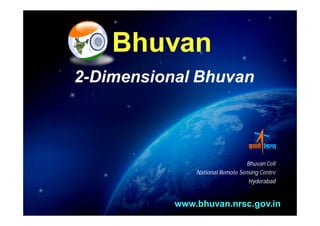
Bhuvan 2D is a web-based mapping application developed by the National Remote Sensing Centre that provides access to geospatial data and tools. It allows users to view live satellite imagery as an overlay map of India, perform geospatial analysis tools, and access archival weather, soil, and environmental data layers. Bhuvan 2D is built using open-source technologies and can measure distances and areas on the map, draw vector features, and export shapes to common file formats.
Report
Share
Report
Share
Download to read offline

Recommended
Recommended
Saudi Arabia [ Abortion pills) Jeddah/riaydh/dammam/+966572737505☎️] cytotec tablets uses abortion pills 💊💊
How effective is the abortion pill? 💊💊 +966572737505) "Abortion pills in Jeddah" how to get cytotec tablets in Riyadh " Abortion pills in dammam*💊💊
The abortion pill is very effective. If you’re taking mifepristone and misoprostol, it depends on how far along the pregnancy is, and how many doses of medicine you take:💊💊 +966572737505) how to buy cytotec pills
At 8 weeks pregnant or less, it works about 94-98% of the time. +966572737505[ 💊💊💊
At 8-9 weeks pregnant, it works about 94-96% of the time. +966572737505)
At 9-10 weeks pregnant, it works about 91-93% of the time. +966572737505)💊💊
If you take an extra dose of misoprostol, it works about 99% of the time.
At 10-11 weeks pregnant, it works about 87% of the time. +966572737505)
If you take an extra dose of misoprostol, it works about 98% of the time.
In general, taking both mifepristone and+966572737505 misoprostol works a bit better than taking misoprostol only.
+966572737505
Taking misoprostol alone works to end the+966572737505 pregnancy about 85-95% of the time — depending on how far along the+966572737505 pregnancy is and how you take the medicine.
+966572737505
The abortion pill usually works, but if it doesn’t, you can take more medicine or have an in-clinic abortion.
+966572737505
When can I take the abortion pill?+966572737505
In general, you can have a medication abortion up to 77 days (11 weeks)+966572737505 after the first day of your last period. If it’s been 78 days or more since the first day of your last+966572737505 period, you can have an in-clinic abortion to end your pregnancy.+966572737505
Why do people choose the abortion pill?
Which kind of abortion you choose all depends on your personal+966572737505 preference and situation. With+966572737505 medication+966572737505 abortion, some people like that you don’t need to have a procedure in a doctor’s office. You can have your medication abortion on your own+966572737505 schedule, at home or in another comfortable place that you choose.+966572737505 You get to decide who you want to be with during your abortion, or you can go it alone. Because+966572737505 medication abortion is similar to a miscarriage, many people feel like it’s more “natural” and less invasive. And some+966572737505 people may not have an in-clinic abortion provider close by, so abortion pills are more available to+966572737505 them.
+966572737505
Your doctor, nurse, or health center staff can help you decide which kind of abortion is best for you.
+966572737505
More questions from patients:
Saudi Arabia+966572737505
CYTOTEC Misoprostol Tablets. Misoprostol is a medication that can prevent stomach ulcers if you also take NSAID medications. It reduces the amount of acid in your stomach, which protects your stomach lining. The brand name of this medication is Cytotec®.+966573737505)
Unwanted Kif two medicines, whiAbortion pills in Saudi RIYADH (+919707899604 } Get Cytotec
Abortion pills in Saudi RIYADH (+919707899604 } Get CytotecAbortion pills in Riyadh +966572737505 get cytotec
More Related Content
Recently uploaded
Saudi Arabia [ Abortion pills) Jeddah/riaydh/dammam/+966572737505☎️] cytotec tablets uses abortion pills 💊💊
How effective is the abortion pill? 💊💊 +966572737505) "Abortion pills in Jeddah" how to get cytotec tablets in Riyadh " Abortion pills in dammam*💊💊
The abortion pill is very effective. If you’re taking mifepristone and misoprostol, it depends on how far along the pregnancy is, and how many doses of medicine you take:💊💊 +966572737505) how to buy cytotec pills
At 8 weeks pregnant or less, it works about 94-98% of the time. +966572737505[ 💊💊💊
At 8-9 weeks pregnant, it works about 94-96% of the time. +966572737505)
At 9-10 weeks pregnant, it works about 91-93% of the time. +966572737505)💊💊
If you take an extra dose of misoprostol, it works about 99% of the time.
At 10-11 weeks pregnant, it works about 87% of the time. +966572737505)
If you take an extra dose of misoprostol, it works about 98% of the time.
In general, taking both mifepristone and+966572737505 misoprostol works a bit better than taking misoprostol only.
+966572737505
Taking misoprostol alone works to end the+966572737505 pregnancy about 85-95% of the time — depending on how far along the+966572737505 pregnancy is and how you take the medicine.
+966572737505
The abortion pill usually works, but if it doesn’t, you can take more medicine or have an in-clinic abortion.
+966572737505
When can I take the abortion pill?+966572737505
In general, you can have a medication abortion up to 77 days (11 weeks)+966572737505 after the first day of your last period. If it’s been 78 days or more since the first day of your last+966572737505 period, you can have an in-clinic abortion to end your pregnancy.+966572737505
Why do people choose the abortion pill?
Which kind of abortion you choose all depends on your personal+966572737505 preference and situation. With+966572737505 medication+966572737505 abortion, some people like that you don’t need to have a procedure in a doctor’s office. You can have your medication abortion on your own+966572737505 schedule, at home or in another comfortable place that you choose.+966572737505 You get to decide who you want to be with during your abortion, or you can go it alone. Because+966572737505 medication abortion is similar to a miscarriage, many people feel like it’s more “natural” and less invasive. And some+966572737505 people may not have an in-clinic abortion provider close by, so abortion pills are more available to+966572737505 them.
+966572737505
Your doctor, nurse, or health center staff can help you decide which kind of abortion is best for you.
+966572737505
More questions from patients:
Saudi Arabia+966572737505
CYTOTEC Misoprostol Tablets. Misoprostol is a medication that can prevent stomach ulcers if you also take NSAID medications. It reduces the amount of acid in your stomach, which protects your stomach lining. The brand name of this medication is Cytotec®.+966573737505)
Unwanted Kif two medicines, whiAbortion pills in Saudi RIYADH (+919707899604 } Get Cytotec
Abortion pills in Saudi RIYADH (+919707899604 } Get CytotecAbortion pills in Riyadh +966572737505 get cytotec
Recently uploaded (20)
Call 8617370543 Sangli Call girls with real photos and phone numbers
Call 8617370543 Sangli Call girls with real photos and phone numbers
Call Girls In Gorakhpur Escorts ☎️8617370543 🔝 💃 Enjoy 24/7 Escort Service En...
Call Girls In Gorakhpur Escorts ☎️8617370543 🔝 💃 Enjoy 24/7 Escort Service En...
Call Girls Moradabad Just Call 8617370543 Top Class Call Girl Service Available
Call Girls Moradabad Just Call 8617370543 Top Class Call Girl Service Available
Call Girls in Perumbavoor / 9332606886 Genuine Call girls with real Photos an...
Call Girls in Perumbavoor / 9332606886 Genuine Call girls with real Photos an...
Satara call girl 8617370543♥️ call girls in satara escort service
Satara call girl 8617370543♥️ call girls in satara escort service
Foreigner Call Girls Mahim WhatsApp +91-9833363713, Full Night Service
Foreigner Call Girls Mahim WhatsApp +91-9833363713, Full Night Service
Hire 💕 8617370543 Mirzapur Call Girls Service Call Girls Agency
Hire 💕 8617370543 Mirzapur Call Girls Service Call Girls Agency
Osmanabad Call Girls Book Night 4k to 12k ️[8617370543] Escorts Girls Service
Osmanabad Call Girls Book Night 4k to 12k ️[8617370543] Escorts Girls Service
Ghansoli Escorts Services 09167354423 Ghansoli Call Girls,Call Girls In Ghan...
Ghansoli Escorts Services 09167354423 Ghansoli Call Girls,Call Girls In Ghan...
Gonda Nitya salvi 8617370543 VIP model college girls ...
Gonda Nitya salvi 8617370543 VIP model college girls ...
Top IPTV Subscription Service to Stream Your Favorite Shows in 2024.pdf
Top IPTV Subscription Service to Stream Your Favorite Shows in 2024.pdf
Models in Deira 0567006274 Deira Call girl Service
Models in Deira 0567006274 Deira Call girl Service
Dubai Call girls Service 0524076003 Call girls in Dubai
Dubai Call girls Service 0524076003 Call girls in Dubai
Turbhe Female Escorts 09167354423 Turbhe Escorts,Call Girls In Turbhe
Turbhe Female Escorts 09167354423 Turbhe Escorts,Call Girls In Turbhe
High Profile Escort in Dubai 0524076003 Dubai Escorts
High Profile Escort in Dubai 0524076003 Dubai Escorts
Call Girls in Kollam - 9332606886 Our call girls are sure to provide you with...
Call Girls in Kollam - 9332606886 Our call girls are sure to provide you with...
Thane Female Escorts-✔9833754194-Kalyan Reasonalble Escorts-Kurla Independent...
Thane Female Escorts-✔9833754194-Kalyan Reasonalble Escorts-Kurla Independent...
Abortion pills in Saudi RIYADH (+919707899604 } Get Cytotec
Abortion pills in Saudi RIYADH (+919707899604 } Get Cytotec
Featured
Featured (20)
Product Design Trends in 2024 | Teenage Engineerings
Product Design Trends in 2024 | Teenage Engineerings
How Race, Age and Gender Shape Attitudes Towards Mental Health
How Race, Age and Gender Shape Attitudes Towards Mental Health
AI Trends in Creative Operations 2024 by Artwork Flow.pdf
AI Trends in Creative Operations 2024 by Artwork Flow.pdf
Content Methodology: A Best Practices Report (Webinar)
Content Methodology: A Best Practices Report (Webinar)
How to Prepare For a Successful Job Search for 2024
How to Prepare For a Successful Job Search for 2024
Social Media Marketing Trends 2024 // The Global Indie Insights
Social Media Marketing Trends 2024 // The Global Indie Insights
Trends In Paid Search: Navigating The Digital Landscape In 2024
Trends In Paid Search: Navigating The Digital Landscape In 2024
5 Public speaking tips from TED - Visualized summary
5 Public speaking tips from TED - Visualized summary
Google's Just Not That Into You: Understanding Core Updates & Search Intent
Google's Just Not That Into You: Understanding Core Updates & Search Intent
The six step guide to practical project management
The six step guide to practical project management
Beginners Guide to TikTok for Search - Rachel Pearson - We are Tilt __ Bright...
Beginners Guide to TikTok for Search - Rachel Pearson - We are Tilt __ Bright...
Bhuvan2 d
- 1. Bhuvan 2-Dimensional Bhuvan Bhuvan Cell National Remote Sensing Centre Hyderabad www.bhuvan.nrsc.gov.in Bhuvan Cell, NRSC
- 2. Bhuvan www.bhuvan3.nrsc.gov.in www.bhuvan.nrsc.gov.in
- 3. Log-on to www.bhuvan.nrsc.gov.in/bhuvan/ & click on 2D button to get Bhuvan 2D page Search Send & Embed link options Bhuvan services Tools Geoprocess (WPS) Left Panel WMS manager Overview map Bhuvan 2D is developed using open-source solutions Bhuvan Cell, NRSC
- 4. Search by latitude, longitude Using Bhuvan Services and Tools Bhuvan Cell, NRSC
- 5. Live map as an overlay with Satellite Data for the Indian region Bhuvan Cell, NRSC
- 6. Reading of WMS GetCapability Bhuvan Cell, NRSC
- 7. Online WPS having ConvexHull, Douglas Peucker, Buffer, Intersection Algorithms Bhuvan Cell, NRSC
- 8. Ground Water Prospects, Watershed, Wasteland and Soil Bhuvan Cell, NRSC
- 9. Live Weather data from ISRO’s Automatic Weather Stations & Archival of the same for last three years Bhuvan Cell, NRSC
- 10. Potential Fishing Zone (PFZ), Chlorophyll (CHL), Sea Surface Temperature (SST) Bhuvan Cell, NRSC
- 11. Forest Fire, Heat Index, Flood, Drought, etc Bhuvan Cell, NRSC
- 12. Draw Tool : Point, Line and Polygon Extract as shape file Bhuvan Cell, NRSC
- 13. Distance , Area Measurement Bhuvan Cell, NRSC
- 14. Thank you!! For feedback and queries write to us at bhuvan@nrsc.gov.in