
Empfohlen
Weitere ähnliche Inhalte
Was ist angesagt?
Was ist angesagt? (20)
Ähnlich wie CLASS-IX : GEOGRAPHY-CHAPTER NO-02-PHYSICAL FEATURES OF INDIA
Ähnlich wie CLASS-IX : GEOGRAPHY-CHAPTER NO-02-PHYSICAL FEATURES OF INDIA (20)
Kürzlich hochgeladen
Kürzlich hochgeladen (20)
CLASS-IX : GEOGRAPHY-CHAPTER NO-02-PHYSICAL FEATURES OF INDIA
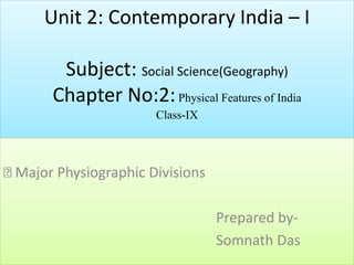
- 1. Unit 2: Contemporary India – I Subject: Social Science(Geography) Chapter No:2:Physical Features of India Class-IX Major Physiographic Divisions Prepared by- Somnath Das
- 2. Location: I. India has all major physical features of the earth, I.E. Mountains, plains, deserts, plateaus and islands. II. In india the soil colour varies from place to place as it is formed from different types of rocks. III. India is A large landmass formed during different geological periods. India's relief features are outcome of other processes like weathering, erosion and deposition. IV. India has varied physical features whose formation can be explained on the basis of the ‘theory of plate tectonics’. V. According to the theory of plate tectonics the seven major and minor plates that form the earth’s crust keep moving, causing stress and thus leading to folding, faulting and volcanic activity. Plates can have convergent, divergent and transform boundaries. VI. India's peninsular part is made from one of the oldest landmass of the world 'gondwana land'. It was A single landmass comprising of india, australia, south africa, south america and antarctica.
- 4. MAJOR PHYSIOGRAPHIC DIVISIONS The physical features of India can be grouped under the following physiographic divisions: (1) The Himalayan Mountains (2) The Northern Plains (3) The Peninsular Plateau (4) The Indian Desert (5) The Coastal Plains (6) The Islands
- 5. The Himalayan Mountains I. The Himalayas are young-fold mountains which are the loftiest and one of the most rugged mountain barriers of the world. II. The Himalayas are 2400 km long, 400 km to 150 km wide from Kashmir to Arunachal Pradesh respectively. III. The Himalayas have three parallel ranges in the longitudinal extent namely : — Great or Inner Himalayas also called Himadri. It is the highest mountain range with average height 6000 m. — Middle Himalayas or Himachal. The altitude varies between 3700 and 4500 m. It includes ranges like Pir Panjal, Dhaula Dhar and Mahabharat. — Outer Himalayas or Shivalik. It is outermost range with 900 to 1100 m average altitude. The longitudinal valley lying between and lesser Himalaya and Shiwaliks are known as Duns. ≥The Himalayas can be divided into four sections : — Punjab Himalayas — between Indus and Satluj. — Kumaon Himalayas — between Satluj and Kali. — Nepal Himalayas — between Kali and the Tista. — Assam Himalayas (Eastern Himalayas) — Between Tista and the Dibang (Tsangpo).
- 6. The Northern Plains I.It is formed by the interplay of the three major river systems - the Indus, the Ganga and the Brahmaputra. II.The Northern Plains spread over an area of 7 lakh sq. km, 240 km long and 240 km to 320 km broad. III.The rivers that flow to the plains from the mountains are involved in depositional work. IV. Difference in relief causes the Northern Plain to have four regions. — Bhabar — laying at the foot of Shiwaliks, a narrow 8 to 16 km wide belt of pebbles. —Terai — lying next to Bhabar, a wet and marshy area with wildlife and forests. —Bangar — Older alluvium plain which rises above the level of the flood plains. — Khadar — Younger alluvium of the flood plains.
- 7. The Peninsular Plateau I. The Peninsular Plateau is the tableland formed due to the breaking and drifting of the Gondwana land. II. It is composed of the old crystalline, igneous and metamorphic rocks. III. The plateau consists of two broad divisions, namely, the Central Highlands and the Deccan Plateau. IV. Central highlands lie north to river Narmada. V. The eastward extensions of Peninsular Plateau are locally known as Bundelkhand and Baghelkhand. The Chhota Nagpur Plateau marks the further eastward extension drained by the Damodar river. VI. The Deccan Plateau, a triangular mass, lies to the south of the river Narmada. VIII. The western and eastern edges of the Deccan Plateau are marked by the Western Ghats and the Eastern Ghats respectively. IX. The Western Ghats are higher than the Eastern Ghats. Anaimudi is the highest peak in Western Ghats ( 2695 m ) and Mahendragiri with 1501 m. is the highest peak in Eastern Ghats. X. A distinct feature of the peninsular plateau is the black soil area known as Deccan Trap.
- 8. Peninsular Plateau Region in India
- 10. The Indian Desert I. The undulating sandy plain covered with sand dunes towards the western margins of the Aravalli Hills is the Indian Desert. II.Crescent shaped dunes called barchans cover large parts of the Indian Desert. III. It has a very less rainfall around 150 mm. IV. Luni is the only large river in this region.
- 11. The Coastal Plains I. The Peninsular plateau is flanked by stretch of narrow coastal strips, running along the Arabian Sea on the west and the Bay of Bengal on the east. II. The western coast, sandwiched between the Western Ghats and the Arabian Sea, is a narrow plain. It consists of three sections. The northern part of the coast is called the Konkan (Mumbai – Goa), the central stretch is called the Kannad Plain, while the southern stretch is referred to as the Malabar coast. III. The plains along the Bay of Bengal are wide and level. IV. On the east the coastal strip is divided into Northern Circars and the Coromandal Coast from northern to southern part. V. Large rivers, such as the Mahanadi, the Godavari, the Krishna and the Kaveri have formed extensive delta on this coast. Lake Chilika is an important feature along the eastern coast.
- 12. The Coastal plains in India(Different names)
- 13. The Islands I. The Lakshadweep Islands group in the Arabian Sea is close to Kerala. II. The Lakshadweep Islands were formerly known as Laccadive, Minicoy and Amindive. III. The Andaman and Nicobar Islands are an elongated chain of islands located in the Bay of Bengal. IV. The Andaman and Nicobar Islands are an elevated portion of submarine mountains. The regions in India complements each other and makes the country richer in its natural resources. Mountains are the source of forests . Coastal areas support fishing and ports.