
Recommended
More Related Content
What's hot
What's hot (20)
Similar to Gis georeference
Similar to Gis georeference (20)
More from Shah Naseer
More from Shah Naseer (20)
Recently uploaded
Recently uploaded (20)
Gis georeference
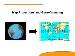
- 1. Map Projections and Georeferencing
- 2. What is a georeference? A numerical description of a place that can be mapped.
- 3. What is an acceptable georeference? A numerical description of a place that can be mapped and that describes the spatial extent of a locality and its associated uncertainties.
- 4. What is a coordinate system? • A coordinate system is a reference system used to represent the locations of geographic features, imagery, and observations, such as Global Positioning System (GPS) locations, within a common geographic framework. Each coordinate system is defined by the following: • Its measurement framework, which is either geographic (in which spherical coordinates are measured from the earth's center) or planimetric (in which the earth's coordinates are projected onto a two-dimensional planar surface) • Units of measurement (typically feet or meters for projected coordinate systems or decimal degrees for latitude-longitude) • Several hundred geographic coordinate systems and a few thousand projected coordinate systems are available for use. In addition, you can define a custom coordinate system.
- 5. Types of coordinate systems • A global or spherical coordinate system such as latitude-longitude. These are often referred to as geographic coordinate systems. • A projected coordinate system such as universal transverse Mercator (UTM), Albers Equal Area, or Robinson, all of which (along with numerous other map projection models) provide various mechanisms to project maps of the earth's spherical surface onto a two-dimensional Cartesian coordinate plane. Projected coordinate systems are referred to as map projections. Coordinate systems (both geographic and projected) provide a framework for defining real-world locations.
- 6. What is a spatial reference? • A spatial reference includes the following: • The coordinate system • The coordinate precision with which coordinates are stored (often referred to as the coordinate resolution) • Processing tolerances (such as the cluster tolerance) • The spatial extent covered by the dataset (often referred to as the spatial domain)
- 7. Coordinate Systems A geographical coordinate system uses a three-dimensional spherical surface to define locations on the earth. Divides space into orderly structure of locations. Two types: cartesian and angular (spherical)
- 8. Parallels and Meridians Meridians are great circles of constant longitude Example is the prime meridian latitude (φ): angular distance from equator longitude (λ): angular distance from standard meridian St. Louis 38° 39' N 90° 38' W New York 40° 47' N 73° 58' W Los Angeles 34° 3' N 118° 14' W Rome 41° 48' N 12° 36' E Sydney 33° 52' S 151° 12' E Parallels are circles of constant latitude Example is the equator
- 9. Earth’s Shape The shape of earth can be approximated as a sphere or spheroid. Most often it is modeled as a spheriod. a ba flattening )( − = ab WGS 84 (World Geodetic System of 1984) a = 6378.137 km b = 6356.752 km flattening = 1/ 298.257 = 0.00335
- 10. Datum While a spheroid approximates the shape of the earth, a datum defines the position of the ellipsoid relative to the center of the Earth The datum provides a frame of reference for measuring locations on the surface of the Earth A datum is chosen to align a spheroid to closely fit the Earth’s surface in a particular area
- 11. Datums It is important to ensure that the datum of a dataset matches with the datum setting of your GIS and with other data sets being used.
- 12. Map Projections: Flattening the Earth A map projection is the orderly transfer of positions of places on the surface of the earth to corresponding points on a flat map. is the systematic arrangement of the earth’s parallels and meridians onto a plane surface. uses mathematical formulas to relate spherical coordinates on the globe to flat, planar coordinates. [ ] = ϕ λ T y x
- 13. Distortion All projections introduce distortions in the map. Some projections minimize distortions in some of these properties at the expense of maximizing errors in others. Some projections are attempts to only moderately distort all of these properties. The map properties that are distorted during projection are: On Earth On Map Distance (length) Angle Area Scale Shape
- 14. Universal Transverse Mercator (UTM) • Implemented as an internationally standard coordinate system – Initially devised as a military standard • Uses a system of 60 zones – Maximum distortion is 0.04% • Transverse Mercator because the cylinder is wrapped around the Poles, not the Equator Zones are each six degrees of longitude numbered from west to east
- 15. Georeferences as Measurements • Some georeferences are metric – They define location using measures of distance from fixed places • E.g., distance from the Equator or from the Greenwich Meridian • Others are based on ordering – For example street addresses in most parts of the world order houses along streets • Others are only nominal – Placenames do not involve ordering or measuring
- 16. Converting Georeferences • GIS applications often require conversion of projections and ellipsoids – These are standard functions in popular GIS packages • Street addresses must be converted to coordinates for mapping and analysis – Using geocoding functions • Placenames can be converted to coordinates using gazetteers Gazetteers provide information about geographical areas or locations using place names and can be linked to coordinate systems .
- 17. Summary Projections are needed to represent 3-D surface on a flat plane There are hundreds of projections – choose the one that fits your mapping purpose best - preserve distance - preserve shape - preserve direction Choosing a coordinate system is also important (if you have are mapping a dataset, you should know it’s projection and coordinate system) Different coordinate systems use different datums in order to approximate the shape of the earth.
Editor's Notes
- testing slide 2
- testing slide 2