GIS-Optimized Pipeline Routing for Cost Savings
•Als PPTX, PDF herunterladen•
3 gefällt mir•1,674 views

Gis Application

Empfohlen
Weitere ähnliche Inhalte
Was ist angesagt?
Was ist angesagt? (20)
Andere mochten auch
Andere mochten auch (20)
Ähnlich wie GIS-Optimized Pipeline Routing for Cost Savings
Ähnlich wie GIS-Optimized Pipeline Routing for Cost Savings (20)
Mehr von Rishabh Gupta
Mehr von Rishabh Gupta (17)
Kürzlich hochgeladen
Kürzlich hochgeladen (20)
GIS-Optimized Pipeline Routing for Cost Savings
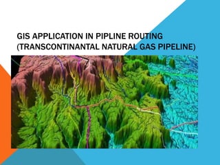
- 1. GIS APPLICATION IN PIPLINE ROUTING (TRANSCONTINANTAL NATURAL GAS PIPELINE)
- 2. INTRODUCTION A geographic information system (GIS) is a computer system designed to capture, store, manipulate, analyze, manage, and present all types of spatial or geographical data. The implementation of a Geographic Information System (GIS) can have a profound effect on management of large water and wastewater infrastructure assets. A GIS-enabled Suitability Model can be used to aid engineers and analysts in the selection of routes in large linear projects, greatly enhancing quality control while minimizing environmental impact. One such application is in routing pipeline.
- 3. STATEMENT OF PURPOSE Building pipelines to carry petroleum products is capital-intensive, so determining the optimum route is critical and can be significantly simplified through the use of ‘’least-cost path analysis’’. Therefore by the help of GIS-based least cost path analysis, we can produce more environmentally friendly routes, as well as reducing costs by up to 15%.
- 4. OBJECTIVES 1. The primary objective is to select a location that is cost-effective, environmentally appropriate, and meets the needs of the project. 2. PATH EVALUATION-GIS specialist analyze the route based on information provided by the modeler (map of all constraints that comprise the evaluation criteria for route analysis). From the suitability surface, an optimal path for the water pipeline is determined by applying an optimal path algorithm.
- 5. METHODOLOGY 1. GIS specialists and modelers use data and the information gathered by the modelers to analyze route for pipeline that is cost-effective, environmentally appropriate, and meets the needs of the project. 2. GIS specialist from the suitability surface, select an optimal path for the water pipeline by applying an optimal path algorithm. By applying the algorithm, the model takes a stepwise approach between a starting and ending point and it proceeds to calculate the most suitable route between the points by evaluating the criteria from the suitability surface.
- 6. PHASE PLAN Phase 1: Examination of natural gas supply and demand In the first phase of the method, the two main conditions for economic viability of the pipeline are validated :- 1. The necessity to secure sufficient gas supplies at the entrance of the pipeline. 2. Demand at the targeted markets.
- 7. Phase 2: Examination of alternative routes In the second phase the decision maker selects the group alternative routes. The alternative routes are then compared Comparison of the alternative routes requires the examination of large amounts of information regarding the routes.
- 8. Phase 3: Selection of optimum route This is where GIS plays an important role. Finding an optimal pipeline route using GIS can be accomplished using a least cost path (LCP) algorithm. Four parameters are required for a least cost path analysis: source raster, cost raster, cost distance measures, and an algorithm for deriving the least accumulative cost path. Finding the least accumulative cost path is an iterative process based on Dijkstra’s algorithm.
- 9. Comparison of GIS generated route and manually generated route In a comparison of a GIS-generated pipeline route and a manually generated shown in figure above, concluded that the GIS-developed route facilitated greater reduction in pipeline construction cost.
- 11. BUDGET On an average cost of constructing and routing pipeline is approximately under $300,000/inch-mile. These large-diameter (24-36 inches) projects are typically 120 miles in length and cost $500 million.
- 12. RISKS 1. PROJECT PANIC 2. UNDER GROUND WATER 3. CORROSION 4. ROAD WAYS 5. RESIDENTIAL AREAS 6. RIVER 7. HIGH VOLTAGE TRANSMISSION LINE 8. RELIABILITY
- 13. BENEFITS GIS proves to be a key tool for pipeline management, based on two strengths :- 1. Flexible and powerful map reporting capability. 2. Geo database as unique repository for geographic data related any type of records of file
- 14. CONCLUSION Development of new oil and gas pipeline routes in coming years is inevitable and selection of an optimal route is crucial to the success of any pipeline routing project. An optimal route will minimize economic loss and negative socio-environmental impacts, in addition to enhancing the pipes’ sustainability and prolonging its lifespan. . Empirical evidences suggest that GIS-based route selection is more efficient than manual route selection.