How insects directing its movement from its current location to another fixed location using external (allocentric) and/or internal (ideothetic) cues and returning to their home.
Also called 'Celestial navigation' is a technique for determining one’s geographic position by the observation of identified stars, planets, sun and the moon.
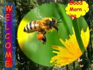
Here i took THREE model insects for this presentation such as Monarch butterfly, Social insects like Ants and Bees......
4. Introduction and History
Mechanisms involved in insect navigation
Navigation strategies in Monarch butterflies
Navigation strategies in Hymenoptera
Case studies and Summary
Conclusions and Future prospects
CONTENTS
5. Introduction
The process of an organism directing its movement from its
current location to another fixed location using external
(allocentric) and/or internal (ideothetic) cues.
Celestial navigation is a technique for determining one’s
geographic position by the observation of identified stars,
planets, sun and the moon
(Van Allena, 2004)
American journal of physics. 72 (11) : 1418-1424.
6. History
Insect navigation studies started in 1911 Santchi reported
some myrmicine species ants used the sun as a reference
point in navigating their home for their forage grounds.
Bees used as polarized sunlight in day time
Nocturnal Arthropods (amphipod crustaceans) relied on
the moon as a navigational aid.
7. Hymenopteran insects use Sky compass information not only from
Sun (Santschi, 1911)
but also from
Small patches of blue sky (Santschi, 1923),
and
Polarized skylight (Von Frisch, 1949).
8. Current interest in insect navigation derives
mainly from two sources:
1. Neurobiology
2. Behavioral Ecology
10. Use of Skylight cues in Orientation
Insects seem to be
specially predisposed to
use skylight cues for one
kind of orientation or
another.
Because their large-field
compound eyes often
view the entire celestial
hemisphere.
11. Selecting and Maintaining Direction
Visual stabilization of course:
Even if an animal does not select a course by celestial
cues, it can use retinal images of the sky to maintain its
course.
This is because the retinal image of any celestial cue does
not change as long as the animal moves along a straight
line but does change when the animal rotates.
12. Example: Tethered flying fruit flies, Drosophila are illuminated
from above with linearly polarized light, they fly straight, but
when the polarizers are removed and the flies are exposed to
diffuse overhead illumination, they engage in tortuous flight
maneuvers.
(Wolf et al., 1980)
13. Establishing geographical position
Animals, birds and insects alike-have been displaced from
home so that they had to navigate back by exploiting
information collected on site rather than en route, they relay
on earthbound cues.
14. Bee or ant is obviously able to form of its foraging area in the form
of fascinating "mental map“ .
Celestial and non-celestial systems of navigation are used
simultaneously or successively in establishing and reading this
map.
(Wehner, 1983)
15. First the ants were trained to visit a single feeder located 15 m
southeast of the nest
Ants that were released in the trained direction (SE) reach their
home earlier than others ( SW,NW,NE).
(Akesson and Wehner, 2002)
16. Skylight compass
If the insect is able to associate particular retinal
images of the sky with corresponding directions in
space, it can use the sky as a compass.
The skylight pattern moves during the course of
the day, an earthbound reference system is
required to set the compass.
17. Bees and ants forage over distances of several hundreds or
thousands of meters, must return repeatedly to the same point in
two-dimensional space.
Skylight compass
is used in the context
of a dead reckoning
(path integration)
strategy.
Sums the vectors of
distance and direction
travelled from a start point
to estimate current
position.
18. Spiders, Crabs , Isopods perform path integration by referring
exclusively to non-visual (e.g. Idiothetic) stimuli include.
Talitrid amphipods rely on y-axis orientation means the courses to
be steered run simply at right angles to this body axis line, either
landward or seaward, irrespective of the current position.
19. Ex:- 20 wasps of Polistes gallicus were displaced passively over a
distance of 1 km and then released within an arena which was
shielded from wind and obscured all visual landmarks
the wasps headed towards home
It is attributed that the wasps could see the sky (when displaced in
closed Plexiglass tubes, so they might have obtained some
information about the direction of their displacement.
(Ugolini, 1981)
20. Daytime compass
In the daytime sky the celestial hemisphere displays a set of
conspicuous visual cues:
The direct (un-polarized) light from the sun
The scattered (polarized) light from the sky
Well-defined pattern by angle of polarization, degree of
polarization, radiant intensity
All these parameters vary with the wavelength of light.
22. Light is scattered much more effectively in the short
wavelength than in the long wavelength range of the
spectrum.
Light is maximally polarized at an angular distance of
90° from the sun.
Angles of polarization (e-vector directions) are oriented
in such a way that they form concentric circles around
the Sun.
(Wehner,1983)
23. Pattern of e-vector directions : most reliable criterion under
atmospheric disturbances haze, fog, or clouds.
That insects and many other arthropods can use both direct
sunlight and scattered skylight as compass cues.
(Brines et al.,1982)
24. Time compensation
During the course of the day, sun and e-vector pattern
move across the sky. The movement of the sun along its arc
is uniform (150/h).
Rotation of the whole e-vector pattern about the north (or
south) pole of the sky.
The rate of movement is low at dawn and dusk, but high at
noon.
25. Relation between Arc, time and distance, in a great circle context
Earth’s circumference
24hrs 360 degrees of rotation
1 degree 60 nautical miles
360 degrees 21,600 nautical miles
15 degrees 900 nautical miles (1 h)
1 nautical mile 1,852 metres
(Wehner,1989)
26. Sun-azimuth/time curve, varies with latitude and time of year.
Bees trained at one longitude, then tested at another do not orient
in their true home direction.
27. Navigation mechanisms of migrating monarch butterflies
Michoacan, Mexico
300 million
(Reppert et al., 2010)
Case study
28. Monarch butterflies
North American Monarch butterfly late august to early
September leave their breeding sites in Eastern US and
Canada to migrate up to 3600 km to over wintering sites
forest of central Mexico.
Some individuals migrate at least as far Maryland and
Kansas and few they reach the northern US and majority
stops after reaching gulf cost states (Texas and Louisiana)
29. Model components and potential circuitry
involved in the TCSC
Time compensated sun
compass
Amazing antennae
Clock ells
Dorsal rim area and main
retina
Central complex
(Reppert et al., 2010)
31. Magnetic Compass
Magnetic particles are
found in the adult
Monarch; higher than
normal magnetic fields are
observed near the centre of
the over wintering areas
so butterflies are
attracted towards these
areas by sensing strong
areas.
(Mac Fadden and Jones, 1985)
32. Wind direction
During autumn butterflies selects flight altitude of up to
1250m above ground to take the advantage northeasterly
tail wind; they aggregate in staging areas when wind blows
from South and starts nectar- searching.
This indicates that tail winds are most conspicuous in
autumn migration of the Monarch butterfly.
(Reppert et al., 2010)
33. South west ward moment of wind in Autumn and
North ward or North east ward wind movement in the
Spring
3600 km journey of a 0.5gm butterfly possible.
(Wehner, 1989)
34. Navigation strategies in Hymenoptera
I. Route following/Piloting
1.Trail marking
2. Route memory or land marks
II. Path integration
1. Odometry by stride integration
2. Sensory inputs for path integration
3. Compass cues
4. Olfactory cues
III. Map like spatial distribution (Wolf, 2011)
37. Land marks / Snap shots
(Kohler and Wehner, 2005)
Australian desert ant,
Melophorus bagoti
38. Landmark orientation
One landmark provides
distance, but not direction
Animal must remember
location of goal relative to two
or more landmarks
39. Ant navigation
Desert ants forage to bring food
back to the nest
They do not use chemical trails
but navigate individually
Good navigation is crucial to
their own and the colony’s
survival
They can do this over large
distances (up to 1 km) and in
complex cluttered terrain
Desert ant,
Cataglyphis sp
41. Navigation by dead reckoning/
path integration
Use the direction and distance of each successive leg
during the outbound trip
Compute net vector and use compass to return home
Home
42. The Saharan desert an Cataglyphis fortis, travels
immense distances over sandy terrain, often
completely devoid of landmarks, as it searches for
food.
These creatures are able to return to their nest using a
direct route rather than by retracing their outbound
path.
43. Odometry by stride integration
Desert ant,
Cataglyphis fortis
(Collett et al., 2006)
Ant odometer
44. 3-D path integration by ants
(Wohlgemuth, 2001)
Trained uphill/downhill
with food source 8.7 m
Trained on flat track
with food source 5.2 m
Ant odometers record
horizontal distance moved
not actual distance traveled
Thus, they do not use time
or energy expended to
determine distance
46. Bee navigation strategies - Direction and Distance
Optic flow
Energy consumption
Direct sun light
Polarized light from sun
47. The Dance Language and Orientation of
Honey bee
The dance language of honey bees
Described by Karl von Frisch in
1940s to explain the ability of honey
bee foragers to recruit nest mates to
food
The Basic Facts
Forager honey bees, on returning
to nest, perform a "dance" which
contains information about the
distance and direction of food they
have found
48. When the food and sun are in the same
direction, the straight portion of the waggle
dance is directed upward.
When the food is at some angle to the right
(blue) or left (red) of the sun, the bee orients the
straight portion of her dance at the same angle to
the right or left of the vertical.
Bee language
49. Compass cues
Part of the honey bee's compound eye contains a
group of 150 specialized ommatidia called POL
area or Dorsal rim area.
In ommatidia microvillar directions of the
photoreceptors are arranged in a way, that mimics
the e-vector pattern in the sky which is called as
matched filtering.
50. Regular retinula is composed of 8 long receptors (R1–8)
and one short proximal receptor cell (R9), a dorsal rim
retinula contains 9 long cells with R9 strongly increased
in size.
In Apis mellifera, this modification arises through three
UV-receptors R-1, 5, 9 which mediate polarization
vision, forming large rhabdomeres.
51. As studied in Cataglyphis, the UV-receptors, that mediate
polarization vision in the ant and form microvilli that are
oriented 90° to each other.
52. (Thomas and Meyer, 1999)
Structural difference between regular and DRA ommatidia
55. Why some bees are active at night time?
Example: Megalopta atra (Halictidae) and Carpenter bee
Pressure from predators and parasites
Competition for limiting food source
Flowering pattern of local habitat
Minimize their loss of water
The larger optical apertures provided by superposition
compound eyes might allow for the detection of the
brightest stars and moon , but the evidence that moths use
such cues.
(Hurd and Linsky, 1970)
56. Talitrid amphipods use the moon as a reference point in selecting
and maintaining their seaward courses.
Amphipods have a number of alternative strategies at their
disposal depending on skyline cues
Earth's magnetic field,
Slope of the beach and
Direction of the prevailing winds.
57. The obstacles encountered in moon as a compass
Moon is visible for only a part of the night and on successive
nights, for different parts of the night.
Moon-azimuth/time curve changes much more drastically from
night to night than the sun-azimuth/time curve.
A lunar compass requires a timing mechanism (moon clock) that
operates independently, but how they are used in navigation is not
known.
58. Summary
Piloting and Route following
Use landmark to locate goal (nest, etc.)
Path integration (dead reckoning)
compute net vector by integrating distance traveled with
compass direction
Accumulates errors, only good for short distances
True navigation
Use compass and map (cognitive) to plot route
59.
60. Conclusions
Insects are not true astronavigators; some other mechanisms like
magnetic field, wind direction, geographical positions etc also used by
insects for their navigation.
Astronavigation is well developed in honey bees and ants: bees go for
foraging and navigate back to their home by using both celestial and non
celestial cues.
Insects have well developed compound eyes and nervous system to use
polarized light cues as e - vector orientation pattern for navigating their
home and forage places.
61. Future Prospects
Studies on Honey bees behavioral ecology relating to
influence of skylight cues may pave the way for
commercialization of bee keeping.