Hurricane Forecast 2010
•
1 like•276 views

"Hurricane Forecast" - Matt Belk, Meteorologist, National Weather Service

Recommended
More Related Content
What's hot
What's hot (20)
Viewers also liked
Similar to Hurricane Forecast 2010
Similar to Hurricane Forecast 2010 (20)
More from Rhode Island Emergency Management Agency
More from Rhode Island Emergency Management Agency (18)
Hurricane Forecast 2010
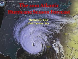
- 1. The 2010 Atlantic Hurricane Season Forecast Matthew H. Belk NWS Taunton, MA
- 2. Operational changes for this year A brief review of recent past hurricane seasons Factors influencing this forecast The 2010 Atlantic Hurricane Season Forecast Questions? Objectives
- 4. Watches now issued 48 hours prior to landfall (used to be 36 hours)
- 5. Warnings now issued 36 hours prior to landfall (used to be 24 hours)
- 6. Saffir-Simpson Hurricane Wind Scale updated
- 7. Categories derived from peak wind only
- 8. No longer contains impact statements for central pressure , storm surge ranges and flooding
- 9. Intent is to reduce confusion about expected impacts for a given category stormOperational Changes for This Year
- 11. 7 of these 10 classified as “hyperactive”
- 12. Of the 5 seasons not above normal
- 13. 4 were El Niño years (1997, 2002, 2006 and 2009)
- 14. 1 was after an El Niño year (2007)Hurricane Seasons Since 1995
- 15. More Recent Hurricane Seasons
- 16. Ophelia 2005! Post El Niño Cindy Tammy Don’t Forget: TD22 FEMA Hurricane Readiness Coastal Communities
- 17. FEMA Hurricane Readiness Coastal Communities 2006 - El Niño Near Normal Season Beryl
- 18. 2007 - ENSO Neutral Heading into Weak La Niña Barry Noel FEMA Hurricane Readiness Coastal Communities
- 19. 2008 - La Niña Hanna Kyle FEMA Hurricane Readiness Coastal Communities
- 20. 2009 – El Niño Danny Bill FEMA Hurricane Readiness Coastal Communities
- 21. Hurricane Forecast Factors Ongoing Multi-Decadal Signal During August-October Pattern Established in 1995, and still going Favorable for Atlantic Hurricane Development
- 22. Hurricane Forecast Factors Neutral ENSO now, with development of La Niña in June-August expected Pattern still under development Favorable for Atlantic Hurricane Development
- 23. Hurricane Forecast Factors Record high sea surface temperatures currently across the eastern tropical Atlantic Very Favorable for Atlantic Hurricane Development
- 27. Possibility La Niña develops this summer
- 28. Sea surface temperatures in the eastern tropical Atlantic well above normal
- 29. Forecast scheme does NOT account for storms which develop outside the main development regionHurricane Forecast Factors
- 30. 18-23 named storms (normal ≈ 10) 8-14 hurricanes (normal ≈ 6) 3-7 major hurricanes (normal ≈ 2) 85% probability of above normal season 10% probability of near normal season 70% confidence of accurate forecast The 2010 Atlantic Hurricane Forecast
- 31. Thank You! Any Questions? Matthew H. Belk Hurricane Program Leader NWS Taunton, MA Matthew.Belk@noaa.gov
Editor's Notes
- Earlier versions of this scale – known as the Saffir-Simpson Hurricane Scale – incorporated central pressure and storm surge as components of the categories. The central pressure was used during the 1970s and 1980s as a proxy for the winds as accurate wind speed intensity measurements from aircraft reconnaissance were not routinely available for hurricanes until 1990. Storm surge was also quantified by category in the earliest published versions of the scale dating back to 1972. However, hurricane size (extent of hurricane-force winds), local bathymetry (depth of near-shore waters), topography, the hurricane’s forward speed and angle to the coast also affect the surge that is produced. For example, the very large Hurricane Ike (with hurricane force winds extending as much as 125 mi from the center) in 2008 made landfall in Texas as a Category 2 hurricane and had peak storm surge values of about 20 ft. In contrast, tiny Hurricane Charley (with hurricane force winds extending at most 25 mi from the center) struck Florida in 2004 as a Category 4 hurricane and produced a peak storm surge of only about 7 ft. These storm surge values were substantially outside of the ranges suggested in the original scale.Thus to help reduce public confusion about the impacts associated with the various hurricane categories as well as to provide a more scientifically defensible scale, the storm surge ranges, flooding impact and central pressure statements are being removed from the scale and only peak winds are employed in this revised version – the Saffir-Simpson Hurricane Wind Scale. The impact statements below were derived from recommendations graciously provided by experts in hurricane boundary layer winds and hurricane wind engineering fields.
- Record warm SSTs are now present within the main development region (green box top right), with departures exceeding +1.5oC nearly everywhere east of the Caribbean Islands. Record warm temperatures were also present in March and April 2010, with area-averaged departures of +1.3oC observed in April. This monthly value is much larger than the previous record departure of +0.95oC seen in 1958. This warmth is much larger than anywhere else in the global tropics, and is further indication that climate conditions are favorable for hurricane development in the Atlantic basin.