SlideShare ist ein Scribd-Unternehmen logo
1 von 19
INTRODUCTION
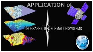
GIS is a collection of computer hardware,
software and geographic data to capture,
input, store, retrieve, manipulate, analyze,
display and output all forms of
geographically referenced information or
geospatial data in order to support decision
making for planning and management.
GIS has a large application in many
administrative ,institutional & commercial
fields.
Major GIS application Areas:
1. Urban management
2. Land Resources
3. Environment
4. Transportation
5. Facilities management
6. Business & location
based service
7. Public services
8. e-Government.
 Defence&Military Department
 Parks
 Permits
 Population
 Streets
 Executive
 Finance
 Fire Department
 IT
 Engineering
 Planning
 Utilities etcetera.
What have we
provided ?
GIS data
Maps
Overlays
Map books
Databases
URBAN MANAGEMENT
 GIS technology is used to analyze the urban
growth and its direction of expansion, and
to find suitable sites for further urban
development.
 Every day,Urban planners use Geographic
Information System (GIS) technology to
research, develop, implement, and monitor
the progress of their plans.
 GIS provides planners, surveyors, and
engineers with the tools they need to design
and map their neighborhoods and cities.
Another Fields Of Urban Management
 Land use/Zoning
 Transportation planning
 Mapping environmental health &
justice
 Water Quality & availability
 Population forecast
 Identify vulnerability
 Monitoring wells, hazardous waste
sites
 Mapping access to health care
facilities.
LAND RESOURCE
• By the help of GIS technology the agricultural,
water and forest resources can be well
maintain and manage.
• Revenue can be increased, operations and
maintenance cost can be reduced when GIS is
used to help manage space.
• In a number of countries, the separate
functions of land administration are being
drawn together through the creation of digital
cadastral databases, with these database they
can reuse land for suitable needs ,digital
taxation and many other purposes.
– GIS can be used in managing
transportation and logistical problems.
– GIS can help in monitoring rail systems
and road conditions and route modelling.
– Transport department use GIS to plan for
a new railway , highway route to manage
infrastructural and topographical data
into the GIS platform.
– Also used in Airline & airport route
planning,flight navigation system.
ENVIRONMENT
 The environmental professional uses GIS to
produce maps, inventory species, measure
environmental impact, or trace pollutants.
The environmental applications for GIS are
almost endless. It can be used to monitor the
environment and analyze changes.
 GIS is used to indicate the degree of
deforestation and vital causes for the
deforestation process. GIS is used to monitor
deforestation & it’s rate from past to present.
FACILITIES MANAGEMENT
 GIS has many uses and advantages in
the field of facility management. GIS
can be used by facility managers for
space management, visualization and
planning, emergency and disaster
planning and response.
 GIS platform provides more facilities
for smart planning , sustainable
practices , smart management &
services , smart policy making , smart
end-to-end solutions.
 The field of GIS is developing rapidly,
finding applications in an ever-
widening range of commercial context.
 GIS can keep a track of where the
customers are located, site business,
target marketing campaigns, and
optimize sales territories.
 It helps in market analysis,suitability
analysis and for finding the right sites
to locate new business and grow
existing ones.It has a great use in
home delivery business.
BUSINESS & COMMERCIAL BASIS
PUBLIC SERVICE
– Public safety and defense/military.
– Crime analysis,fire prevention,
emergency management.
– Epidermiology/Disease Tracking,Public
health analysis
– Data collecting,research,mapping To
prevent river erosion.
– A local government need GIS to map
flooding risk areas for evaluate the
flood potential level in the surrounding
area.
e-Government
– In Local Governments, GIS is used to
solve taxation problems. It is used to
maximize the government income.
– Public works/infrastructure
management (roads,water,electicity)
– Land planning and environmental
management.
– property records and management.
– Using GIS we can develop a digital
taxation system.
GIS IN AGRICULTURE
GIS is useful in many agricultural aspects to analysis
crop production,corn belt mapping,soil
mapping,weather observation,climatic change&its
effect for crop.
Dairy Industry:
o GIS is used in a various application in the dairy
industry, such as distribution of products,
production rate, location of shops and their selling
rate.
o It can be also possible to understand the demand of
milk and milk products in different region. GIS can
prove to be effective tool for planning and decision
making for any dairy industry it has added new
vistas in the field of dairy farm and management.
Continued-
• Irrigation water management:
o Water availability for irrigation purposes for
any area is vital for crop production . Irrigation
requirements of crop were determined by
considering the factors such as
evapotranspiration, Net Irrigation
Requirement, Field irrigation Requirement,
Gross Irrigation Requirement, and month total
volume of water required, by organizing them
in GIS environment.
Economic Development
• GIS technology is a valuable tool used for the
economic development.
• It helps in site selection, suitability analysis,
and for finding the right sites to locate new
business and grow existing ones.
• Within economic development, GIS is used to
support the emerging trend of economic
gardening, a new way to foster local and
regional economic growth by existing small
business in the community.
Economic Relation
Gis applications & Implement

Weitere ähnliche Inhalte

Was ist angesagt?

Applications of RS and GIS in Urban Planning by Rakshith m murthy
Applications of RS and GIS in Urban Planning by Rakshith m murthyApplications of RS and GIS in Urban Planning by Rakshith m murthy
Applications of RS and GIS in Urban Planning by Rakshith m murthys0l0m0n7
 
GIS and Remote Sensing to study urban-rural transformation during a fifty-yea...
GIS and Remote Sensing to study urban-rural transformation during a fifty-yea...GIS and Remote Sensing to study urban-rural transformation during a fifty-yea...
GIS and Remote Sensing to study urban-rural transformation during a fifty-yea...Maurizio Pollino
 
Application of gis in urban planning
Application of gis in urban planningApplication of gis in urban planning
Application of gis in urban planningWESLEY MELI
 
Geographical Information System and Karnataka Forest cover digitization
Geographical Information System and Karnataka Forest cover digitizationGeographical Information System and Karnataka Forest cover digitization
Geographical Information System and Karnataka Forest cover digitizationKamlesh Kumar
 
Using Gis To Solve City Problems
Using Gis To Solve City ProblemsUsing Gis To Solve City Problems
Using Gis To Solve City ProblemsAndrew Harrison
 
IRJET- Use Geotechnical to Analyze Agricultural use Changes to Support Urban ...
IRJET- Use Geotechnical to Analyze Agricultural use Changes to Support Urban ...IRJET- Use Geotechnical to Analyze Agricultural use Changes to Support Urban ...
IRJET- Use Geotechnical to Analyze Agricultural use Changes to Support Urban ...IRJET Journal
 
Turkey National practices on data collection methods for statistics on struct...
Turkey National practices on data collection methods for statistics on struct...Turkey National practices on data collection methods for statistics on struct...
Turkey National practices on data collection methods for statistics on struct...ExternalEvents
 
Introduction to gis and its application
Introduction to gis and its application Introduction to gis and its application
Introduction to gis and its application gandhinagar
 
Fundamentals of GIS
Fundamentals of GISFundamentals of GIS
Fundamentals of GISPallab Jana
 
Gis applications in civil engineering
Gis applications in civil engineeringGis applications in civil engineering
Gis applications in civil engineeringShanake Dissanayake
 
Farm Management software for Fleet Management and GPS vehicle monitoring prov...
Farm Management software for Fleet Management and GPS vehicle monitoring prov...Farm Management software for Fleet Management and GPS vehicle monitoring prov...
Farm Management software for Fleet Management and GPS vehicle monitoring prov...victoryermak
 
Things to know about geospatial technology
Things to know about geospatial technologyThings to know about geospatial technology
Things to know about geospatial technologyNI BT
 
Gis application in civil engineering
Gis application in civil engineeringGis application in civil engineering
Gis application in civil engineeringAmal C Varghese
 

Was ist angesagt? (19)

Applications of RS and GIS in Urban Planning by Rakshith m murthy
Applications of RS and GIS in Urban Planning by Rakshith m murthyApplications of RS and GIS in Urban Planning by Rakshith m murthy
Applications of RS and GIS in Urban Planning by Rakshith m murthy
 
Casos de uso do FME no IBGE
Casos de uso do FME no IBGECasos de uso do FME no IBGE
Casos de uso do FME no IBGE
 
GIS and Remote Sensing to study urban-rural transformation during a fifty-yea...
GIS and Remote Sensing to study urban-rural transformation during a fifty-yea...GIS and Remote Sensing to study urban-rural transformation during a fifty-yea...
GIS and Remote Sensing to study urban-rural transformation during a fifty-yea...
 
Application of gis in urban planning
Application of gis in urban planningApplication of gis in urban planning
Application of gis in urban planning
 
Geographical Information System and Karnataka Forest cover digitization
Geographical Information System and Karnataka Forest cover digitizationGeographical Information System and Karnataka Forest cover digitization
Geographical Information System and Karnataka Forest cover digitization
 
Using Gis To Solve City Problems
Using Gis To Solve City ProblemsUsing Gis To Solve City Problems
Using Gis To Solve City Problems
 
GIS AND GPS
GIS AND GPSGIS AND GPS
GIS AND GPS
 
IRJET- Use Geotechnical to Analyze Agricultural use Changes to Support Urban ...
IRJET- Use Geotechnical to Analyze Agricultural use Changes to Support Urban ...IRJET- Use Geotechnical to Analyze Agricultural use Changes to Support Urban ...
IRJET- Use Geotechnical to Analyze Agricultural use Changes to Support Urban ...
 
Turkey National practices on data collection methods for statistics on struct...
Turkey National practices on data collection methods for statistics on struct...Turkey National practices on data collection methods for statistics on struct...
Turkey National practices on data collection methods for statistics on struct...
 
Introduction to gis and its application
Introduction to gis and its application Introduction to gis and its application
Introduction to gis and its application
 
Fundamentals of GIS
Fundamentals of GISFundamentals of GIS
Fundamentals of GIS
 
Gis applications in civil engineering
Gis applications in civil engineeringGis applications in civil engineering
Gis applications in civil engineering
 
Food Security - How can remote sensing and GIS help?
Food Security - How can remote sensing and GIS help?Food Security - How can remote sensing and GIS help?
Food Security - How can remote sensing and GIS help?
 
Farm Management software for Fleet Management and GPS vehicle monitoring prov...
Farm Management software for Fleet Management and GPS vehicle monitoring prov...Farm Management software for Fleet Management and GPS vehicle monitoring prov...
Farm Management software for Fleet Management and GPS vehicle monitoring prov...
 
Presentation on gis and future trends
Presentation on gis and future trendsPresentation on gis and future trends
Presentation on gis and future trends
 
Hardik_Final_CV
Hardik_Final_CVHardik_Final_CV
Hardik_Final_CV
 
Agri future
Agri futureAgri future
Agri future
 
Things to know about geospatial technology
Things to know about geospatial technologyThings to know about geospatial technology
Things to know about geospatial technology
 
Gis application in civil engineering
Gis application in civil engineeringGis application in civil engineering
Gis application in civil engineering
 

Ähnlich wie Gis applications & Implement

DIGITIZATION OF CITIES ON GIS PLATFORM.pdf
DIGITIZATION OF CITIES ON GIS PLATFORM.pdfDIGITIZATION OF CITIES ON GIS PLATFORM.pdf
DIGITIZATION OF CITIES ON GIS PLATFORM.pdfHimanshuDeshmukh32
 
GIS Application Used in Urban Planning In India
GIS Application Used in Urban Planning In IndiaGIS Application Used in Urban Planning In India
GIS Application Used in Urban Planning In IndiaIRJET Journal
 
Remote Sensing and GIS and GPS
Remote Sensing and GIS and GPSRemote Sensing and GIS and GPS
Remote Sensing and GIS and GPSSouvik Roy
 
INTRODUCTION TO GIS AND GEOREFRENCING.pptx
INTRODUCTION TO GIS AND GEOREFRENCING.pptxINTRODUCTION TO GIS AND GEOREFRENCING.pptx
INTRODUCTION TO GIS AND GEOREFRENCING.pptxMEGHANA S
 
APPLICATIONS OF GIS IN REMOTE SENSING
APPLICATIONS OF GIS IN REMOTE SENSINGAPPLICATIONS OF GIS IN REMOTE SENSING
APPLICATIONS OF GIS IN REMOTE SENSINGsunilmahatosunil
 
Application of GIS (Geographical information system)
Application of GIS (Geographical information system)Application of GIS (Geographical information system)
Application of GIS (Geographical information system)Fayaz Ahamed A P
 
Transforming Complexity into Clarity: Explore GIS Mapping Solutions
Transforming Complexity into Clarity: Explore GIS Mapping SolutionsTransforming Complexity into Clarity: Explore GIS Mapping Solutions
Transforming Complexity into Clarity: Explore GIS Mapping SolutionsPolosoft Technologies
 
Chapter 1 introduction of gis
Chapter   1 introduction of gisChapter   1 introduction of gis
Chapter 1 introduction of gisAjay Ardeshana
 
2017 Basics of GIS
2017 Basics of GIS2017 Basics of GIS
2017 Basics of GISAtiqa khan
 
GIS as strategic management tool
GIS as strategic management toolGIS as strategic management tool
GIS as strategic management toolJonas Baile
 
Gis applications in tourism a tool for sustainable tourism
Gis applications in tourism  a tool for sustainable tourismGis applications in tourism  a tool for sustainable tourism
Gis applications in tourism a tool for sustainable tourismpankaj kumar
 
Olimem enterprises
Olimem enterprisesOlimem enterprises
Olimem enterprisesbeasty21
 
Implementing E-Agriculture in India from 2010-2020.
Implementing E-Agriculture in India from 2010-2020.Implementing E-Agriculture in India from 2010-2020.
Implementing E-Agriculture in India from 2010-2020.Siddharth Bhattacharya
 
GIS for geophysics.pptx
GIS for geophysics.pptxGIS for geophysics.pptx
GIS for geophysics.pptxThomasHundasa1
 

Ähnlich wie Gis applications & Implement (20)

Gis applications
Gis applicationsGis applications
Gis applications
 
Gis application
Gis applicationGis application
Gis application
 
DIGITIZATION OF CITIES ON GIS PLATFORM.pdf
DIGITIZATION OF CITIES ON GIS PLATFORM.pdfDIGITIZATION OF CITIES ON GIS PLATFORM.pdf
DIGITIZATION OF CITIES ON GIS PLATFORM.pdf
 
GIS Application Used in Urban Planning In India
GIS Application Used in Urban Planning In IndiaGIS Application Used in Urban Planning In India
GIS Application Used in Urban Planning In India
 
Remote Sensing and GIS and GPS
Remote Sensing and GIS and GPSRemote Sensing and GIS and GPS
Remote Sensing and GIS and GPS
 
INTRODUCTION TO GIS AND GEOREFRENCING.pptx
INTRODUCTION TO GIS AND GEOREFRENCING.pptxINTRODUCTION TO GIS AND GEOREFRENCING.pptx
INTRODUCTION TO GIS AND GEOREFRENCING.pptx
 
APPLICATIONS OF GIS IN REMOTE SENSING
APPLICATIONS OF GIS IN REMOTE SENSINGAPPLICATIONS OF GIS IN REMOTE SENSING
APPLICATIONS OF GIS IN REMOTE SENSING
 
Application of GIS (Geographical information system)
Application of GIS (Geographical information system)Application of GIS (Geographical information system)
Application of GIS (Geographical information system)
 
Transforming Complexity into Clarity: Explore GIS Mapping Solutions
Transforming Complexity into Clarity: Explore GIS Mapping SolutionsTransforming Complexity into Clarity: Explore GIS Mapping Solutions
Transforming Complexity into Clarity: Explore GIS Mapping Solutions
 
Chapter 1 introduction of gis
Chapter   1 introduction of gisChapter   1 introduction of gis
Chapter 1 introduction of gis
 
2017 Basics of GIS
2017 Basics of GIS2017 Basics of GIS
2017 Basics of GIS
 
FINAL 31,12,10
FINAL 31,12,10FINAL 31,12,10
FINAL 31,12,10
 
GIS as strategic management tool
GIS as strategic management toolGIS as strategic management tool
GIS as strategic management tool
 
Gis applications in tourism a tool for sustainable tourism
Gis applications in tourism  a tool for sustainable tourismGis applications in tourism  a tool for sustainable tourism
Gis applications in tourism a tool for sustainable tourism
 
gis_disciplines.pdf
gis_disciplines.pdfgis_disciplines.pdf
gis_disciplines.pdf
 
Olimem enterprises
Olimem enterprisesOlimem enterprises
Olimem enterprises
 
Gis in transportation
Gis in transportationGis in transportation
Gis in transportation
 
GISgIRR G1.pptx
GISgIRR G1.pptxGISgIRR G1.pptx
GISgIRR G1.pptx
 
Implementing E-Agriculture in India from 2010-2020.
Implementing E-Agriculture in India from 2010-2020.Implementing E-Agriculture in India from 2010-2020.
Implementing E-Agriculture in India from 2010-2020.
 
GIS for geophysics.pptx
GIS for geophysics.pptxGIS for geophysics.pptx
GIS for geophysics.pptx
 

Kürzlich hochgeladen

Past, Present and Future of Generative AI
Past, Present and Future of Generative AIPast, Present and Future of Generative AI
Past, Present and Future of Generative AIabhishek36461
 
home automation using Arduino by Aditya Prasad
home automation using Arduino by Aditya Prasadhome automation using Arduino by Aditya Prasad
home automation using Arduino by Aditya Prasadaditya806802
 
UNIT III ANALOG ELECTRONICS (BASIC ELECTRONICS)
UNIT III ANALOG ELECTRONICS (BASIC ELECTRONICS)UNIT III ANALOG ELECTRONICS (BASIC ELECTRONICS)
UNIT III ANALOG ELECTRONICS (BASIC ELECTRONICS)Dr SOUNDIRARAJ N
 
Internet of things -Arshdeep Bahga .pptx
Internet of things -Arshdeep Bahga .pptxInternet of things -Arshdeep Bahga .pptx
Internet of things -Arshdeep Bahga .pptxVelmuruganTECE
 
Instrumentation, measurement and control of bio process parameters ( Temperat...
Instrumentation, measurement and control of bio process parameters ( Temperat...Instrumentation, measurement and control of bio process parameters ( Temperat...
Instrumentation, measurement and control of bio process parameters ( Temperat...121011101441
 
An experimental study in using natural admixture as an alternative for chemic...
An experimental study in using natural admixture as an alternative for chemic...An experimental study in using natural admixture as an alternative for chemic...
An experimental study in using natural admixture as an alternative for chemic...Chandu841456
 
Arduino_CSE ece ppt for working and principal of arduino.ppt
Arduino_CSE ece ppt for working and principal of arduino.pptArduino_CSE ece ppt for working and principal of arduino.ppt
Arduino_CSE ece ppt for working and principal of arduino.pptSAURABHKUMAR892774
 
TechTAC® CFD Report Summary: A Comparison of Two Types of Tubing Anchor Catchers
TechTAC® CFD Report Summary: A Comparison of Two Types of Tubing Anchor CatchersTechTAC® CFD Report Summary: A Comparison of Two Types of Tubing Anchor Catchers
TechTAC® CFD Report Summary: A Comparison of Two Types of Tubing Anchor Catcherssdickerson1
 
Sachpazis Costas: Geotechnical Engineering: A student's Perspective Introduction
Sachpazis Costas: Geotechnical Engineering: A student's Perspective IntroductionSachpazis Costas: Geotechnical Engineering: A student's Perspective Introduction
Sachpazis Costas: Geotechnical Engineering: A student's Perspective IntroductionDr.Costas Sachpazis
 
Unit7-DC_Motors nkkjnsdkfnfcdfknfdgfggfg
Unit7-DC_Motors nkkjnsdkfnfcdfknfdgfggfgUnit7-DC_Motors nkkjnsdkfnfcdfknfdgfggfg
Unit7-DC_Motors nkkjnsdkfnfcdfknfdgfggfgsaravananr517913
 
Introduction to Machine Learning Unit-3 for II MECH
Introduction to Machine Learning Unit-3 for II MECHIntroduction to Machine Learning Unit-3 for II MECH
Introduction to Machine Learning Unit-3 for II MECHC Sai Kiran
 
Call Girls Narol 7397865700 Independent Call Girls
Call Girls Narol 7397865700 Independent Call GirlsCall Girls Narol 7397865700 Independent Call Girls
Call Girls Narol 7397865700 Independent Call Girlsssuser7cb4ff
 
Introduction-To-Agricultural-Surveillance-Rover.pptx
Introduction-To-Agricultural-Surveillance-Rover.pptxIntroduction-To-Agricultural-Surveillance-Rover.pptx
Introduction-To-Agricultural-Surveillance-Rover.pptxk795866
 
Virtual memory management in Operating System
Virtual memory management in Operating SystemVirtual memory management in Operating System
Virtual memory management in Operating SystemRashmi Bhat
 
IVE Industry Focused Event - Defence Sector 2024
IVE Industry Focused Event - Defence Sector 2024IVE Industry Focused Event - Defence Sector 2024
IVE Industry Focused Event - Defence Sector 2024Mark Billinghurst
 
Main Memory Management in Operating System
Main Memory Management in Operating SystemMain Memory Management in Operating System
Main Memory Management in Operating SystemRashmi Bhat
 
National Level Hackathon Participation Certificate.pdf
National Level Hackathon Participation Certificate.pdfNational Level Hackathon Participation Certificate.pdf
National Level Hackathon Participation Certificate.pdfRajuKanojiya4
 
THE SENDAI FRAMEWORK FOR DISASTER RISK REDUCTION
THE SENDAI FRAMEWORK FOR DISASTER RISK REDUCTIONTHE SENDAI FRAMEWORK FOR DISASTER RISK REDUCTION
THE SENDAI FRAMEWORK FOR DISASTER RISK REDUCTIONjhunlian
 
Gurgaon ✡️9711147426✨Call In girls Gurgaon Sector 51 escort service
Gurgaon ✡️9711147426✨Call In girls Gurgaon Sector 51 escort serviceGurgaon ✡️9711147426✨Call In girls Gurgaon Sector 51 escort service
Gurgaon ✡️9711147426✨Call In girls Gurgaon Sector 51 escort servicejennyeacort
 

Kürzlich hochgeladen (20)

Past, Present and Future of Generative AI
Past, Present and Future of Generative AIPast, Present and Future of Generative AI
Past, Present and Future of Generative AI
 
home automation using Arduino by Aditya Prasad
home automation using Arduino by Aditya Prasadhome automation using Arduino by Aditya Prasad
home automation using Arduino by Aditya Prasad
 
UNIT III ANALOG ELECTRONICS (BASIC ELECTRONICS)
UNIT III ANALOG ELECTRONICS (BASIC ELECTRONICS)UNIT III ANALOG ELECTRONICS (BASIC ELECTRONICS)
UNIT III ANALOG ELECTRONICS (BASIC ELECTRONICS)
 
Internet of things -Arshdeep Bahga .pptx
Internet of things -Arshdeep Bahga .pptxInternet of things -Arshdeep Bahga .pptx
Internet of things -Arshdeep Bahga .pptx
 
Instrumentation, measurement and control of bio process parameters ( Temperat...
Instrumentation, measurement and control of bio process parameters ( Temperat...Instrumentation, measurement and control of bio process parameters ( Temperat...
Instrumentation, measurement and control of bio process parameters ( Temperat...
 
An experimental study in using natural admixture as an alternative for chemic...
An experimental study in using natural admixture as an alternative for chemic...An experimental study in using natural admixture as an alternative for chemic...
An experimental study in using natural admixture as an alternative for chemic...
 
Arduino_CSE ece ppt for working and principal of arduino.ppt
Arduino_CSE ece ppt for working and principal of arduino.pptArduino_CSE ece ppt for working and principal of arduino.ppt
Arduino_CSE ece ppt for working and principal of arduino.ppt
 
TechTAC® CFD Report Summary: A Comparison of Two Types of Tubing Anchor Catchers
TechTAC® CFD Report Summary: A Comparison of Two Types of Tubing Anchor CatchersTechTAC® CFD Report Summary: A Comparison of Two Types of Tubing Anchor Catchers
TechTAC® CFD Report Summary: A Comparison of Two Types of Tubing Anchor Catchers
 
Sachpazis Costas: Geotechnical Engineering: A student's Perspective Introduction
Sachpazis Costas: Geotechnical Engineering: A student's Perspective IntroductionSachpazis Costas: Geotechnical Engineering: A student's Perspective Introduction
Sachpazis Costas: Geotechnical Engineering: A student's Perspective Introduction
 
Unit7-DC_Motors nkkjnsdkfnfcdfknfdgfggfg
Unit7-DC_Motors nkkjnsdkfnfcdfknfdgfggfgUnit7-DC_Motors nkkjnsdkfnfcdfknfdgfggfg
Unit7-DC_Motors nkkjnsdkfnfcdfknfdgfggfg
 
Introduction to Machine Learning Unit-3 for II MECH
Introduction to Machine Learning Unit-3 for II MECHIntroduction to Machine Learning Unit-3 for II MECH
Introduction to Machine Learning Unit-3 for II MECH
 
Call Girls Narol 7397865700 Independent Call Girls
Call Girls Narol 7397865700 Independent Call GirlsCall Girls Narol 7397865700 Independent Call Girls
Call Girls Narol 7397865700 Independent Call Girls
 
Introduction-To-Agricultural-Surveillance-Rover.pptx
Introduction-To-Agricultural-Surveillance-Rover.pptxIntroduction-To-Agricultural-Surveillance-Rover.pptx
Introduction-To-Agricultural-Surveillance-Rover.pptx
 
Virtual memory management in Operating System
Virtual memory management in Operating SystemVirtual memory management in Operating System
Virtual memory management in Operating System
 
IVE Industry Focused Event - Defence Sector 2024
IVE Industry Focused Event - Defence Sector 2024IVE Industry Focused Event - Defence Sector 2024
IVE Industry Focused Event - Defence Sector 2024
 
Main Memory Management in Operating System
Main Memory Management in Operating SystemMain Memory Management in Operating System
Main Memory Management in Operating System
 
young call girls in Green Park🔝 9953056974 🔝 escort Service
young call girls in Green Park🔝 9953056974 🔝 escort Serviceyoung call girls in Green Park🔝 9953056974 🔝 escort Service
young call girls in Green Park🔝 9953056974 🔝 escort Service
 
National Level Hackathon Participation Certificate.pdf
National Level Hackathon Participation Certificate.pdfNational Level Hackathon Participation Certificate.pdf
National Level Hackathon Participation Certificate.pdf
 
THE SENDAI FRAMEWORK FOR DISASTER RISK REDUCTION
THE SENDAI FRAMEWORK FOR DISASTER RISK REDUCTIONTHE SENDAI FRAMEWORK FOR DISASTER RISK REDUCTION
THE SENDAI FRAMEWORK FOR DISASTER RISK REDUCTION
 
Gurgaon ✡️9711147426✨Call In girls Gurgaon Sector 51 escort service
Gurgaon ✡️9711147426✨Call In girls Gurgaon Sector 51 escort serviceGurgaon ✡️9711147426✨Call In girls Gurgaon Sector 51 escort service
Gurgaon ✡️9711147426✨Call In girls Gurgaon Sector 51 escort service
 

Gis applications & Implement

  • 1.
  • 2.
  • 3. INTRODUCTION GIS is a collection of computer hardware, software and geographic data to capture, input, store, retrieve, manipulate, analyze, display and output all forms of geographically referenced information or geospatial data in order to support decision making for planning and management. GIS has a large application in many administrative ,institutional & commercial fields.
  • 4. Major GIS application Areas: 1. Urban management 2. Land Resources 3. Environment 4. Transportation 5. Facilities management 6. Business & location based service 7. Public services 8. e-Government.
  • 5.  Defence&Military Department  Parks  Permits  Population  Streets  Executive  Finance  Fire Department  IT  Engineering  Planning  Utilities etcetera. What have we provided ? GIS data Maps Overlays Map books Databases
  • 6. URBAN MANAGEMENT  GIS technology is used to analyze the urban growth and its direction of expansion, and to find suitable sites for further urban development.  Every day,Urban planners use Geographic Information System (GIS) technology to research, develop, implement, and monitor the progress of their plans.  GIS provides planners, surveyors, and engineers with the tools they need to design and map their neighborhoods and cities.
  • 7. Another Fields Of Urban Management  Land use/Zoning  Transportation planning  Mapping environmental health & justice  Water Quality & availability  Population forecast  Identify vulnerability  Monitoring wells, hazardous waste sites  Mapping access to health care facilities.
  • 8. LAND RESOURCE • By the help of GIS technology the agricultural, water and forest resources can be well maintain and manage. • Revenue can be increased, operations and maintenance cost can be reduced when GIS is used to help manage space. • In a number of countries, the separate functions of land administration are being drawn together through the creation of digital cadastral databases, with these database they can reuse land for suitable needs ,digital taxation and many other purposes.
  • 9. – GIS can be used in managing transportation and logistical problems. – GIS can help in monitoring rail systems and road conditions and route modelling. – Transport department use GIS to plan for a new railway , highway route to manage infrastructural and topographical data into the GIS platform. – Also used in Airline & airport route planning,flight navigation system.
  • 10. ENVIRONMENT  The environmental professional uses GIS to produce maps, inventory species, measure environmental impact, or trace pollutants. The environmental applications for GIS are almost endless. It can be used to monitor the environment and analyze changes.  GIS is used to indicate the degree of deforestation and vital causes for the deforestation process. GIS is used to monitor deforestation & it’s rate from past to present.
  • 11. FACILITIES MANAGEMENT  GIS has many uses and advantages in the field of facility management. GIS can be used by facility managers for space management, visualization and planning, emergency and disaster planning and response.  GIS platform provides more facilities for smart planning , sustainable practices , smart management & services , smart policy making , smart end-to-end solutions.
  • 12.  The field of GIS is developing rapidly, finding applications in an ever- widening range of commercial context.  GIS can keep a track of where the customers are located, site business, target marketing campaigns, and optimize sales territories.  It helps in market analysis,suitability analysis and for finding the right sites to locate new business and grow existing ones.It has a great use in home delivery business. BUSINESS & COMMERCIAL BASIS
  • 13. PUBLIC SERVICE – Public safety and defense/military. – Crime analysis,fire prevention, emergency management. – Epidermiology/Disease Tracking,Public health analysis – Data collecting,research,mapping To prevent river erosion. – A local government need GIS to map flooding risk areas for evaluate the flood potential level in the surrounding area.
  • 14. e-Government – In Local Governments, GIS is used to solve taxation problems. It is used to maximize the government income. – Public works/infrastructure management (roads,water,electicity) – Land planning and environmental management. – property records and management. – Using GIS we can develop a digital taxation system.
  • 15. GIS IN AGRICULTURE GIS is useful in many agricultural aspects to analysis crop production,corn belt mapping,soil mapping,weather observation,climatic change&its effect for crop. Dairy Industry: o GIS is used in a various application in the dairy industry, such as distribution of products, production rate, location of shops and their selling rate. o It can be also possible to understand the demand of milk and milk products in different region. GIS can prove to be effective tool for planning and decision making for any dairy industry it has added new vistas in the field of dairy farm and management.
  • 16. Continued- • Irrigation water management: o Water availability for irrigation purposes for any area is vital for crop production . Irrigation requirements of crop were determined by considering the factors such as evapotranspiration, Net Irrigation Requirement, Field irrigation Requirement, Gross Irrigation Requirement, and month total volume of water required, by organizing them in GIS environment.
  • 17. Economic Development • GIS technology is a valuable tool used for the economic development. • It helps in site selection, suitability analysis, and for finding the right sites to locate new business and grow existing ones. • Within economic development, GIS is used to support the emerging trend of economic gardening, a new way to foster local and regional economic growth by existing small business in the community. Economic Relation