1. Developed Cooperatively by:
U.S. Department of Energy, Idaho Operations Office;
U.S. Fish and Wildlife Service
September 2014
Candidate Conservation Agreement
for
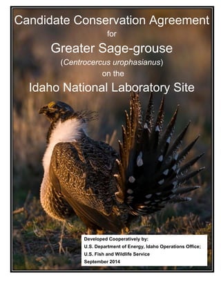
Greater Sage-grouse
(Centrocercus urophasianus)
on the
Idaho National Laboratory Site
2. Candidate Conservation Agreement for Greater Sage-grouse (Centrocercus urophasianus) DOE/ID-11514
September 2014
II
Candidate Conservation Agreement for Greater Sage-grouse
(Centrocercus urophasianus) on the Idaho National
Laboratory Site in Southeast Idaho
September 2014
Prepared by:
Gonzales-Stoller Surveillance, LLC, and Wildlife Conservation Society
Under the Environmental Surveillance, Education, and Research Program
(Contract No. DE-NE0000300),
and in Cooperation with
U.S. Department of Energy - Idaho Operations Office
and
U.S. Fish and Wildlife Service, Idaho State Office, Boise
3. Candidate Conservation Agreement for Greater Sage-grouse (Centrocercus urophasianus) DOE/ID-11514
September 2014
III
RECOMMENDED LITERATURE CITATION
Department of Energy, Idaho Operations Office (DOE), and U.S. Fish and Wildlife Service
(USFWS). 2014. Candidate conservation agreement for greater sage-grouse
(Centrocercus urophasianus) on the Idaho National Laboratory Site. DOE/ID-11514,
U.S. Department of Energy Idaho Operations Office, Idaho Falls, Idaho.
CONTRIBUTORS AND ACKNOWLEDGEMENTS
This agreement was prepared by the Environmental Surveillance, Education, and
Research (ESER) Program, through contracts DE-AC07-06ID14680 (2006-2010) and DE-
NE0000300 (2011-present) with DOE. The ESER contract was operated by S.M. Stoller
Corporation (Stoller) from 2006 through 2010 when the primary task was to inventory and
conduct research on greater sage-grouse. Gonzales-Stoller Surveillance, LLC (GSS), currently
operates the ESER contract (2011-2015).
The Wildlife Conservation Society (WCS) was subcontracted under the ESER contractor
from 2006 through June 2013 to perform research in support of this agreement and to take the
lead in writing and editing the document. Quinn Shurtliff (WCS and ESER) was the lead author
and editor, with substantial contributions by Jericho Whiting (ESER), Roger Blew (ESER), Amy
Forman (ESER), and Jeremy Shive (ESER). Technical assistance was provided by individuals
from DOE (Jack Depperschmidt, Betsy Holmes), U.S. Fish and Wildlife Service (Jason Pyron,
Greg Burak, Kathleen Hendricks, Katie Powell), ESER (Douglas Halford), WCS (Kristy Howe),
CH2M-WG Idaho (Jean Holdren), and Battelle Energy Alliance (John S. Irving). Jeremy Shive
and Kurt Edwards (ESER) provided Geographic Information System assistance, Jackie Hafla
(ESER) provided technical editing, and Brande Hendricks (Stoller) helped with document
formatting. Eric Gosswiller, Idaho National Laboratory (INL) Fire Chief, reviewed and edited
portions of the document relating to wildland fire. Members of the INL Site Land Use
Committee provided valuable input and perspective on earlier drafts of this document.
PHOTO CREDITS
The front cover photo shows a male greater sage-grouse displaying on an eastern Idaho
lek, used with permission from Idaho Falls photographer Terry R. Thomas. All rights reserved.
All other photos used throughout this document were provided by Kristy Howe and
Quinn Shurtliff.
4. Candidate Conservation Agreement for Greater Sage-grouse (Centrocercus urophasianus) DOE/ID-11514
September 2014
IV
EXECUTIVE SUMMARY
In March 2010, the U.S. Fish and Wildlife Service (USFWS) classified the greater sage-
grouse (Centrocercus urophasianus; hereafter sage-grouse) as a candidate for listing under the
Endangered Species Act (ESA) of 1973. This classification means that although the species
warrants protection under the ESA, it is currently precluded from being listed due to higher
agency priorities. However, in a 2011 U.S. district court lawsuit settlement, USFWS agreed to
make a final listing decision on all candidate species by 2016. A resulting agency work plan
commits USFWS to make a determination by 2015 to either list sage-grouse as threatened or
endangered, or to remove it from the candidate list.
In its 2010 listing decision, USFWS determined that the primary reason sage-grouse
warrants protection under the ESA is because the quantity and quality of sagebrush (Artemisia
tridentata) habitat upon which these birds rely continues to decline, in large measure due to
wildland fire and human infrastructure and associated activities. Another reason given by
USFWS is that there are insufficient regulatory mechanisms in place to ensure the long-term
survival of sage-grouse. One of the purposes of this Candidate Conservation Agreement (CCA)
is to address these threat factors as they apply to the Department of Energy, Idaho Operations
Office (DOE), and the Idaho National Laboratory (INL) Site, over which DOE has stewardship.
DOE’s hope is that implementation of conservation measures outlined in this agreement, coupled
with efforts from other federal, state, and private entities, will preclude the need for USFWS to
list sage-grouse under the ESA. However, if the sage-grouse is listed, this document will form
the basis of a Biological Assessment associated with a subsequent ESA Section 7 consultation
required for DOE activities described herein that may affect sage-grouse or its habitat should
they be listed. Thus, this CCA will support ESA compliance and enable DOE to confidently
make long-term land-use decisions, regardless of the future status of sage-grouse. Though DOE
understands that a listing of sage-grouse may result in changes to the conservation measures
outlined in this CCA, the land-use predictability provided through the CCA will increase the
attractiveness of the INL Site to potential projects.
Conservation Framework for the INL Site
This CCA introduces a conservation framework for the INL Site patterned after the State
Alternative developed in 2012 by Idaho Governor C. L. “Butch” Otter’s Sage-grouse Task Force
and submitted to U.S. Secretaries of Interior and Agriculture for incorporation into the National
Greater Sage-grouse Land Use Planning Strategy. The INL Site conservation framework
protects lands within a 1 km (0.6 mi) radius of all known active leks (i.e., traditional breeding
grounds) on the INL Site and establishes a Sage-grouse Conservation Area (SGCA) that limits
infrastructure development and human disturbance in approximately 68% of remaining
sagebrush-dominated communities. Leks protected by the SGCA support an estimated 74% of
the sage-grouse that breed on the INL Site.
USFWS and DOE (hereafter “parties”) desire that sage-grouse abundance on the INL Site
remains stable to increasing over time. To guard against declines, the conservation framework
includes population and habitat triggers for the SGCA that, if tripped by declining lek attendance
or loss of sagebrush habitat, would initiate an automatic response by the parties. If the
population trigger is tripped, USFWS would review the effectiveness of conservation measures
currently being implemented by DOE. The parties would then work cooperatively to determine
the cause of sage-grouse declines and whether DOE can make changes to improve conservation
5. Candidate Conservation Agreement for Greater Sage-grouse (Centrocercus urophasianus) DOE/ID-11514
September 2014
V
success. USFWS may suggest implementing new or adapting old conservation measures aimed
at achieving better results, or it may suggest that the parties renegotiate SGCA boundaries or
consider other mitigation options. If the habitat trigger is tripped, DOE will compensate for
sagebrush habitat loss by implementing one or more of the following mitigation actions: (1) alter
the boundary of the SGCA to include more sagebrush habitat, (2) participate in the State’s
“Framework for Mitigation of Impacts From Infrastructure Projects on Sage-Grouse and Their
Habitats”, or (3) initiate habitat restoration on Priority Restoration Areas the INL Site.
In addition to establishing a conservation framework, this document identifies primary
threats to sage-grouse and its habitats on the INL Site and introduces a set of new conservation
measures that DOE commits to implement to minimize those threats. Successful implementation
will promote the preservation of sagebrush habitat, reduce or eliminate threats to sage-grouse,
and increase understanding of habitat and population trends through long-term research and
monitoring. Because of unpredictable funding cycles and changing mission priorities and
requirements, it may not always be possible for DOE to perform all conservation measures
described herein in a timely manner. As funding becomes available, conservation measures will
be prioritized based on applicability to resolving the most immediate threats. If such situations
arise, DOE will work closely with USFWS to develop alternatives that are consistent with the
intent of this CCA while permitting DOE to pursue its mission.
New Conservation Measures
DOE herein commits to implement 13 conservation measures as it strives to achieve
objectives set forth for each threat. These measures are designed to address the eight threats that
impact sage-grouse and its key habitats on the INL Site. Conservation measures that have the
greatest potential to affect DOE operations are those that address new infrastructure development
(Section 10.2) and the potential for human disturbance of sage-grouse during the breeding season
(Section 10.9). Lands within existing infrastructure footprints (e.g., near facilities, roads, power
lines, and cellular towers, borrow sources) and ongoing DOE activities and operations are
exempt from most conservation measures (except seasonal time-of-day restrictions within Lek
Buffers) because these areas are considered mission-critical.
DOE’s goal for the INL Site (including areas outside the SGCA) is that new
infrastructure development results in no net loss of sagebrush habitat. To achieve this goal, DOE
has two approaches that apply to areas outside the SGCA. First, DOE will be guided by best
management practices when developing new infrastructure. These best management practices
embody a commitment to: (1) avoid fragmenting contiguous tracts of sagebrush habitat, (2)
minimize the amount of habitat edge created, (3) co-locate new infrastructure with existing
infrastructure, where practical, (4) design structures to minimize perching and nesting
opportunities for ravens, (5) avoid installing overhead power lines within 1 km of an active lek,
and (6) revegetate disturbed areas as soon as possible following disturbance, and (7) mark guy
wires and fences to minimize the risk of in-flight collisions. Second, DOE senior management
will be included in decision making whenever an activity that would potentially impact
sagebrush habitat is proposed outside the SGCA. DOE understands that protecting a
conservation bank of sagebrush habitat outside of the SGCA is a preferred way to protect its
mission interests in case of large-scale habitat losses within the SGCA (e.g., due to a wildland
fire).
6. Candidate Conservation Agreement for Greater Sage-grouse (Centrocercus urophasianus) DOE/ID-11514
September 2014
VI
Within the SGCA and Lek Buffers, DOE commits to avoid constructing new
infrastructure unless there are no feasible alternatives for accomplishing its mission objectives.
If DOE determines that a project cannot reasonably be accomplished without being located
within a Lek Buffer or the SGCA, DOE will contact USFWS early in the planning process and
provide its staff with sufficient information to allow them to determine if the proposed project is
sited to minimize impacts to sage-grouse within these areas. Depending on the scope and
potential impact of the proposed project and the status of the sage-grouse population and its
habitat, USFWS will determine whether an amendment to the CCA and/or associated
Conference Opinion is necessary. If USFWS determines that a proposed action requires a minor
amendment, it will complete the procedure within 60 days. However, a major amendment may
take longer. Inherent in this process is the need for DOE to communicate with USFWS early in
the project planning process to ensure that impacts to sage-grouse and its habitats are avoided,
minimized, or mitigated appropriately. USFWS may also recommend other measures that would
allow DOE to accomplish its mission while preserving the effectiveness of the CCA to
successfully conserve sage-grouse and its habitat on the INL Site.
Document Structure
This CCA is comprised of four main divisions, some of which consist of multiple
sections. The first division (Sections 1-3) explains what a CCA is and how it will benefit DOE.
It also provides a biological background of sage-grouse and an overview of the INL Site,
highlighting pertinent ecological research conducted on the Site over the past several decades.
These sections clarify that this agreement is solely between DOE and USFWS, and that INL Site
contractors remain accountable only to DOE.
The second division (Sections 4-8) briefly describes all INL Site projects, programs,
routine maintenance and operations, monitoring, and support activities that have the potential to
impact sage-grouse or the habitat upon which the species depends. The primary purpose of the
second division is to provide sufficient information to USFWS about operations at the INL Site
to enable its staff to draft a Conference or Biological Opinion. Sections 4-8 do not contain any
new commitments by DOE.
The third division (Sections 9-10) has two main purposes. The first is to describe DOE’s
new conservation framework (Section 9), including adaptive regulatory triggers that, if tripped,
would initiate additional cooperative action by DOE and USFWS. The second purpose (Section
10) is to describe and rate the primary threats to sage-grouse and its habitats on the INL Site.
After each threat summary, conservation measures are listed that DOE currently (i.e., prior to the
signing of the CCA) implements on the INL Site, followed by new conservation measures that
DOE proposes to implement upon signing the CCA. Section 10 also identifies DOE mission-
critical infrastructure and activities (i.e., constructed assets or activities deemed necessary to the
primary missions assigned to a particular site, without which operations would be disrupted or
placed at risk) that are excluded from certain conservation measures. Many of these measures
require little or no additional funds to implement.
The final division (Section 11) describes the monitoring and reporting plan associated
with this CCA. It also describes the process required to amend this agreement and the principle
of adaptive management upon which the CCA is based. This section outlines inventory and
monitoring tasks that DOE will support in upcoming years to track threats and indicators of sage-
grouse population and habitat trends. The monitoring activities will also provide data to permit
7. Candidate Conservation Agreement for Greater Sage-grouse (Centrocercus urophasianus) DOE/ID-11514
September 2014
VII
critical evaluation of the success of implemented conservation measures and achievement of the
CCA objectives. Each year, DOE will provide a written report to USFWS, and the two agencies
will meet to discuss the latest monitoring results, changes in DOE activities and mission
priorities, and other pertinent issues. Consistent re-evaluation and analysis of new information
will ensure that this agreement continues to benefit sage-grouse on the INL Site, is continuously
grounded in the best available science, and retains its value to both parties. The CCA is effective
for 20 years from the date of signing or until one of the parties chooses to withdraw. Either party
may withdraw from the agreement by providing the other party a written notice of intent to
withdraw no later than 30 days prior to the proposed termination date. The terminating party
will also include a written explanation of the reasons for withdrawal.
8. Candidate Conservation Agreement for Greater Sage-grouse (Centrocercus urophasianus) DOE/ID-11514
September 2014
VIII
TABLE OF CONTENTS
RECOMMENDED LITERATURE CITATION.......................................................................... III
CONTRIBUTORS AND ACKNOWLEDGEMENTS................................................................. III
PHOTO CREDITS........................................................................................................................ III
EXECUTIVE SUMMARY ..........................................................................................................IV
TABLE OF CONTENTS........................................................................................................... VIII
LIST OF FIGURES ...................................................................................................................... XI
LIST OF TABLES.......................................................................................................................XII
ACRONYMS............................................................................................................................. XIV
1. INTRODUCTION .............................................................................................................. 1
1.1 The U.S. Fish and Wildlife Service and Greater Sage-grouse................................ 1
1.2 A Candidate Conservation Agreement for Sage-grouse on the Idaho National
Laboratory Site........................................................................................................ 1
1.3 Relationship between this CCA and the Endangered Species Act ......................... 2
1.4 How Will This CCA Benefit DOE?........................................................................ 2
1.5 Goals and Adaptability of the CCA........................................................................ 3
2. BIOLOGICAL BACKGROUND AND RESEARCH HISTORY ON THE INL SITE .... 4
2.1 Range-wide Sage-grouse Biology and Population Trends ..................................... 4
2.2 Conservation Needs ................................................................................................ 4
2.3 Overview of the Idaho National Laboratory Site.................................................... 5
2.3.1 Description, Climate Geomorphology ........................................................ 5
2.3.2 Rivers and Streams...................................................................................... 6
2.3.3 Vegetation ................................................................................................... 6
2.3.4 Wildlife........................................................................................................ 6
2.3.5 Research and Conservation Provisions ....................................................... 7
2.4 Vegetation and Habitat Research on the INL Site.................................................. 7
2.4.1 Long-term Vegetation Plots ........................................................................ 7
2.4.2 Post-fire Vegetation Re-establishment........................................................ 8
2.4.3 Non-native Plant Invasion........................................................................... 9
2.5 Sage-grouse Research on the INL Site ................................................................. 10
2.5.1 Lek Route Surveys .................................................................................... 10
2.5.2 Historical Lek Surveys.............................................................................. 12
2.5.3 Sage-grouse Movements and Reproductive Success ................................ 12
2.5.4 Characterization of Breeding Habitat........................................................ 14
2.6 Current Status of Sage-grouse on the INL Site..................................................... 15
3. AUTHORITY ................................................................................................................... 16
9. Candidate Conservation Agreement for Greater Sage-grouse (Centrocercus urophasianus) DOE/ID-11514
September 2014
IX
4. ROUTINE MAINTENANCE ON THE INL SITE.......................................................... 16
4.1 Road Maintenance ................................................................................................ 16
4.2 Water Control Structures ...................................................................................... 17
4.3 Weed Management ............................................................................................... 17
4.4 Power Line Maintenance ...................................................................................... 17
4.5 Railroads ............................................................................................................... 17
5. SUPPORT ACTIVITIES ON THE INL SITE ................................................................. 19
5.1 Landfill Operations ............................................................................................... 19
5.2 Borrow Sources (gravel and silt/clay)................................................................... 19
5.3 Safeguards and Security Activities....................................................................... 20
5.4 Pre-Fire Preparation, Suppression, and Post-Fire Evaluation Activities.............. 20
6. MONITORING ACTIVITIES ON THE INL SITE......................................................... 21
6.1 Environmental Surveillance Monitoring............................................................... 21
6.2 Ecological Monitoring and Research.................................................................... 21
6.3 Cultural Resource Survey, Monitoring, and Research.......................................... 22
6.4 Groundwater Monitoring, Well Maintenance, and Abandonment Activities....... 22
6.5 National Oceanic and Atmospheric Administration (NOAA) Grid Activities and
Meteorological Stations ........................................................................................ 22
7. ONGOING PROJECTS AND PROGRAMS ON THE INL SITE .................................. 22
7.1 CERCLA Activities .............................................................................................. 23
7.2 National Security Test Range ............................................................................... 24
7.3 Critical Infrastructure Test Range Complex......................................................... 25
7.3.1 Wireless Test Bed...................................................................................... 25
7.3.2 Electric Power Reliability ......................................................................... 26
7.3.3 Nonproliferation........................................................................................ 26
7.3.4 Unmanned Aerial and Ground Vehicles ................................................... 27
7.4 Meteorological and Sound Detection and Ranging Towers ................................. 27
7.5 Stand-Off Experiment Range................................................................................ 27
7.6 Radiological Response Training Ranges .............................................................. 28
7.7 Construction of Remote-handled Low-level Radioactive Waste Facility ............ 28
8. NON-DOE ACTIVITIES ON THE INL SITE................................................................. 29
8.1 Maintenance of Commercial Power Line Rights-of-Way .................................... 29
8.2 Elk and Pronghorn Hunting .................................................................................. 29
8.3 Livestock Grazing, Weeds, and BLM Range Improvements ............................... 29
9. CONSERVATION FRAMEWORK FOR THE INL SITE.............................................. 32
9.1 Background........................................................................................................... 32
9.2 Protection of Active Leks ..................................................................................... 33
9.3 Establishment of a Sage-Grouse Conservation Area............................................ 33
9.4 Adaptive Regulatory Triggers............................................................................... 34
9.4.1 Population Trigger..................................................................................... 36
10. Candidate Conservation Agreement for Greater Sage-grouse (Centrocercus urophasianus) DOE/ID-11514
September 2014
X
9.4.2 Habitat Trigger .......................................................................................... 36
9.4.3 Response if Triggers are Tripped.............................................................. 38
9.4.4 Priority Restoration Areas......................................................................... 39
10. NEW CONSERVATION MEASURES AND OBJECTIVES BASED ON AN
ANALYSIS OF THREATS.............................................................................................. 42
10.1 Wildland Fire ........................................................................................................ 47
10.1.1 Threat Summary........................................................................................ 47
10.1.2 Fire History on the INL Site...................................................................... 47
10.1.3 Effects of Wildland Fire on Lek Persistence............................................. 49
10.1.4 Current Conservation Measures................................................................ 49
10.1.5 New Conservation Measures – Wildland Fire .......................................... 51
10.2 Infrastructure Development .................................................................................. 52
10.2.1 Threat Summary........................................................................................ 52
10.2.2 Current or Planned (for infrastructure not yet constructed) Conservation
Measures ................................................................................................... 53
10.2.3 New Conservation Measures – Infrastructure Development .................... 54
10.2.4 Mitigation.................................................................................................. 55
10.3 Annual Grasslands ................................................................................................ 56
10.3.1 Threat Summary........................................................................................ 56
10.3.2 New Conservation Measures – Annual Grasslands .................................. 57
10.4 Livestock............................................................................................................... 57
10.4.1 Threat Summary........................................................................................ 57
10.4.2 Current Conservation Measures................................................................ 58
10.4.3 New Conservation Measures – Livestock................................................. 59
10.5 Seeded Perennial Grasses ..................................................................................... 60
10.5.1 Threat Summary........................................................................................ 60
10.5.2 New Conservation Measures – Seeded Perennial Grasses........................ 61
10.6 Landfills and Borrow Sources .............................................................................. 61
10.6.1 Threat Summary........................................................................................ 62
10.6.2 Current Conservation Measures................................................................ 63
10.6.3 New Conservation Measures – Landfills and Borrow Sources................. 63
10.7 Raven Predation.................................................................................................... 64
10.7.1 Threat Summary........................................................................................ 64
10.7.2 New Conservation Measures – Raven Predation...................................... 65
10.8 Human Disturbance .............................................................................................. 66
10.8.1 Threat Summary........................................................................................ 66
10.8.2 Current Conservation Measures................................................................ 66
10.8.3 New Conservation Measures – Human Disturbance................................. 69
11. ADAPTIVE MANAGEMENT......................................................................................... 77
11.1 Monitoring Strategy.............................................................................................. 77
11.1.1 Task 1 – Lek Surveys................................................................................ 78
11.1.2 Task 2 – Historical Lek Surveys ............................................................... 78
11.1.3 Task 3 – Systematic Lek Discovery Surveys and Lek Route Establishment
................................................................................................................... 78
11. Candidate Conservation Agreement for Greater Sage-grouse (Centrocercus urophasianus) DOE/ID-11514
September 2014
XI
11.1.4 Task 4 – Raven Nest Surveys.................................................................... 79
11.1.5 Task 5 – Sagebrush Habitat Condition Trends.......................................... 79
11.1.6 Task 6 – Monitoring to Determine Changes in Sagebrush Habitat Amount
and Distribution ........................................................................................ 80
11.1.7 Task 7 – Inventory and Monitoring of Sage-grouse Habitat for Areas
Dominated by Non-native Annual Grasses............................................... 80
11.1.8 Task 8 – Monitor Unauthorized Expansion of the Infrastructure Footprint
Within the SGCA and Other Areas Dominated by Big Sagebrush. ......... 80
11.2 Comparison to the Monitoring Strategy of the State Alternative ......................... 81
11.3 Reporting............................................................................................................... 81
11.4 Amendments ......................................................................................................... 82
11.5 Duration of Agreement ......................................................................................... 82
12. SIGNATURES.................................................................................................................. 84
13. LITERATURE CITED ..................................................................................................... 85
LIST OF FIGURES
Figure 1. Boundaries of the INL Site with prominent geological sites, paved highways, and
other jurisdictional boundaries highlighted. Historic and contemporary stream/river
channels and playas on the INL Site are shown in blue. All natural surface water on
the INL Site is ephemeral and in most years does not reach playas and spreading areas.5
Figure 2. Sage-grouse leks and lek routes overlaid on wildland fire scars that have burned since
1994. The three lek routes (Lower Birch Creek, RWMC, and Tractor Flats) are
monitored annually by ESER. Special emphasis has been placed on the 2010
Jefferson fire, the largest documented in INL Site history. ..........................................11
Figure 3. Observed peak attendance of male sage-grouse across three established lek routes on
the INL Site...................................................................................................................12
Figure 4. Locations of radio-collared sage-grouse from March 2008 to June 2010. Nearly all of
the points north of the Site are from sage-grouse captured at the northern most leks,
whereas most of the points east, south and south-west are from sage-grouse captured
at the southeastern leks. Only six (11.5%) sage-grouse were captured on the three leks
in the southwestern portion of the INL Site, and only 57 locations (4.7%) were
recorded from those birds..............................................................................................13
Figure 5. Distance from lek of capture to the site of a female’s first nest of the year (1 km = 0.6
mi). ....................................................................................................................................
Figure 6. Infrastructure on the INL Site. Some active and closed landfills (yellow) are
displayed, but data are not available for all landfills. However, unmarked, active
landfills are all closely associated with facilities. .........................................................18
Figure 7. The INL Site in southeast Idaho, with depictions of rivers, paved roads, major
facilities, and their respective WAGs. WAG 10 encompasses the entire Site.............24
Figure 8. Portable communication tower .........................................................................................
12. Candidate Conservation Agreement for Greater Sage-grouse (Centrocercus urophasianus) DOE/ID-11514
September 2014
XII
Figure 9. High Frequency towers on T-21 near the southeast border of the INL Site..................26
Figure 10.BLM grazing allotments and seasonal big game hunting areas on the INL Site. .............
Figure 11.Known active sage-grouse leks on the INL Site in relation to the SGCA. Facilities and
existing infrastructure (e.g., power lines, railroads, highways, landfills, and borrow
sources) that fall within the SGCA are excluded from most conservation measures
outlined in Sections 10.2 and 10.9. ...............................................................................35
Figure 12. Priority Restoration Areas identified for active or passive restoration of sagebrush...41
Figure 13. Number of fires on the INL Site by origin type (n = 67), from 2001 through 2011. ...48
Figure 14. Number of ravens observed during annual spring breeding bird surveys on the INL
Site from 1985 to 2013. No data were collected in 1992 and 1993. The count in 2010
was an outlier and was not included. That year, 280 ravens were observed, most of
which were in a single flock..........................................................................................65
Figure 15. Definitions of some terms used in Section 10.9, which have been modified from a list
of standardized surface use definitions used by Wyoming BLM (see Information
Bulletin No. WY IB 2007-029, available at
http://www.blm.gov/pgdata/etc/medialib/blm/wy/resources/efoia/
IBs/2007.Par.50407.File.dat/wy2007-029.pdf).............................................................70
LIST OF TABLES
Table 1. Juvenile:adult female ratios from wing-barrel count data from IDFG collected in two
regions that border the INL Site. Research suggests that a ratio ≥ 2.25 reflects a stable
to increasing population (Connelly et al. 2000a)..........................................................14
Table 2. Grazing allotments that include INL Site land. The fifth column from the left shows
how much each allotment contributes to the total area on the INL Site under grazing
management. The column on the far right identifies when BLM plans to review the
condition of each allotment based on Idaho Standards for Rangeland Health (ISRH),
assuming no serious resource issues (e.g., wildland fire) trigger an earlier review......30
Table 3. Nineteen threats to sage-grouse on the INL Site, including Site-specific threats and
those identified by the Idaho Sage-grouse Advisory Committee (ISAC 2006) and the
COT (USFWS 2013). Threats are grouped by one of the five factors (A-E) used by
USFWS to determine listing status of a species, and each threat is rated according to
its relative impact on the INL Site. Within each factor grouping, threats are listed
from highest to lowest based on the ISAC ranking. Threats identified by the COT
(USFWS 2013) as “present but localized” are marked by a single asterisk and “present
and widespread” by a double asterisk...........................................................................44
Table 4. Active and inactive borrow sources on the INL Site (see also Fig. 6). The pit boundary
is the official boundary around each pit that represents the area authorized for
excavation (i.e., pit footprint), whereas the excavated area is the amount of land that
had been disturbed through 2011. New seasonal time-of-day restrictions are listed in
the last column. Asterisks indicate where active sage-grouse leks are within 1 km (0.6
mi) of the pit..................................................................................................................62
13. Candidate Conservation Agreement for Greater Sage-grouse (Centrocercus urophasianus) DOE/ID-11514
September 2014
XIII
Table 5. Summary of conservation measures that DOE will implement, which are designed to
ameliorate threats identified in Section 10. For each threat, DOE has established an
overarching conservation objective. The comparable objective from the COT report
(USFWS 2013) is also provided, where applicable. .....................................................73
14. Candidate Conservation Agreement for Greater Sage-grouse (Centrocercus urophasianus) DOE/ID-11514
September 2014
XIV
ACRONYMS
ATRC Advanced Test Reactor Complex
AMWTP Advanced Mixed Waste Treatment Plant
BLM Bureau of Land Management
BMPs Best Management Practices
CCA Candidate Conservation Agreement
CERCLA Comprehensive Environmental Response, Compensation, and Liability
Act
CFA Central Facilities Area
CITRC Critical Infrastructure Test Range Complex
COT Conservation Objectives Team
DOE Department of Energy, Idaho Operations Office
EA Environmental Assessment
ESA Endangered Species Act
ESR Emergency Stabilization and Rehabilitation
ESER Environmental Surveillance, Education, and Research
F&SS Facility and Site Services
FFA/CO Federal Facilities Agreement and Consent Order
GIS Geographic Information System
GSS Gonzales-Stoller Surveillance, LLC
IDFG Idaho Department of Fish and Game
INL Idaho National Laboratory
INTEC Idaho Nuclear Technology and Engineering Center
ISAC Idaho Sage-grouse Advisory Committee
ISRH Idaho Standards for Rangeland Health
LTV Long-term Vegetation
MFC Materials and Fuels Complex
NEPA National Environmental Policy Act
NERP National Environmental Research Park
NEW net explosive weight
NOAA National Oceanic and Atmospheric Administration
NRF Naval Reactors Facility
N&HS National and Homeland Security
15. Candidate Conservation Agreement for Greater Sage-grouse (Centrocercus urophasianus) DOE/ID-11514
September 2014
XV
NSTR National Security Test Range
PBF Power Burst Facility
RRTR Radiological Response Training Ranges
RWMC Radioactive Waste Management Complex
SGCA Sage-grouse Conservation Area
SODAR Sound Detection and Ranging
SOX Stand-off experiment range
SSER Sagebrush Steppe Ecosystem Reserve
Stoller S.M. Stoller Corporation
TAN Test Area North
TSF Technical Support Facility
UAV unmanned aerial vehicle
UGV unmanned ground vehicle
USFWS United States Fish and Wildlife Service
USGS United States Geological Survey
WAGs Waste Area Groups
WCS Wildlife Conservation Society
WNv West Nile virus
WTB wireless test bed
16. Candidate Conservation Agreement for Greater Sage-grouse (Centrocercus urophasianus) DOE/ID-11514
September 2014
1
1. INTRODUCTION
1.1 The U.S. Fish and Wildlife Service and Greater Sage-grouse
Pursuant to the Endangered Species Act (ESA), the U. S. Fish and Wildlife Service
(USFWS) is responsible for conducting status reviews of species that may be at risk of
extinction. Although information on the biological status and threats to a species may be
sufficient to warrant listing it as threatened or endangered under the ESA, often higher priority
listing actions preclude USFWS from taking such action. Species that fall within this “warranted
but precluded” category are known as candidate species. USFWS conducts an annual review of
all candidate species’ status including population changes and effectiveness of conservation
measures implemented. Any changes may necessitate a change in the species’ listing status. For
example, the species listing priority may be upgraded or downgraded or the species may be
completely removed from the candidate list (i.e., status has improved such that listing is no
longer warranted).
Since 1999, multiple petitions have been submitted to USFWS requesting that the agency
list greater sage-grouse (Centrocercus urophasianus– hereafter sage-grouse) under the ESA
(Connelly et al. 2004). In March 2010, USFWS issued a finding that sage-grouse was warranted
but precluded from listing due to higher priorities (Federal Register 2010). Thus, it is currently
classified as a candidate species. In a U.S. district court lawsuit settlement of 2011, USFWS
agreed to make a final listing decision for sage-grouse by end of September, 2016 (i.e., the
species will either be removed from the candidate list or be listed under the ESA).
1.2 A Candidate Conservation Agreement for Sage-grouse on the Idaho
National Laboratory Site
Federal agencies with land management authorities
may enter into a Candidate Conservation Agreement (CCA)
with USFWS to conserve candidate or at risk species within
their jurisdictions. A CCA is a voluntary agreement between
USFWS and one or more public or private entities in which
the partners identify threats to the candidate species and its
key habitats and develop conservation measures and
objectives aimed at avoiding or minimizing those threats. In
2007, with the sage-grouse having been petitioned multiple
times for listing under the ESA (Connelly et al. 2004), the
Department of Energy, Idaho Operations Office (DOE)
recognized that the best way to maintain flexibility in
performing its mission activities on the Idaho National
Laboratory Site (INL Site or Site) was to enter into a CCA with USFWS and implement
conservation measures designed to protect sage-grouse and its key habitats. DOE assigned the
task of developing the CCA to its Environmental Surveillance, Education, and Research (ESER)
Program, which subcontracted the Wildlife Conservation Society (WCS) to lead the effort. The
ESER program collected substantial data on sage-grouse lek attendance, habitat distribution and
quality, and sage-grouse patterns of use on the INL Site (Section 2.5).
DOE’s mission is to
develop and deliver cost-
effective solutions to both
fundamental and
advanced challenges in
nuclear and other energy
resources, national
security, and
environmental
management.
17. Candidate Conservation Agreement for Greater Sage-grouse (Centrocercus urophasianus) DOE/ID-11514
September 2014
2
1.3 Relationship between this CCA and the Endangered Species Act
If the sage-grouse is proposed for listing, DOE, under Section 7(a)(2) of the ESA, must
ensure that actions it funds, authorizes, or carries out are not likely to jeopardize the continued
existence of the species or adversely modify or destroy designated critical habitat. This would
involve an in-depth biological assessment of a proposed action by DOE to determine what
effects, if any, the proposed action would have on ‘listed’ sage-grouse within the action area (i.e.,
footprint plus a defined area of effect). If the results of the assessment indicate the proposed
action ‘may affect’ sage-grouse or its designated critical habitat, DOE will be required under
Section 7(a)(2) of the ESA to initiate consultation (or conference) with USFWS (before the sage-
grouse becomes formally listed the process is referred to as conferencing; after listing, the same
process is known as consultation).
Because sage-grouse is currently a candidate species, DOE is not required by the ESA to
conference/consult with USFWS regarding mission activities on the INL Site. However, due to
the ongoing possibility that sage-grouse could be proposed for listing, DOE has been proactive in
developing this CCA cooperatively with USFWS. Furthermore, DOE understands that potential
work delays and the development of additional conservation measures, should sage-grouse
become listed, may be minimized through the development of this CCA. Although not required
by the ESA, DOE and USFWS may choose to voluntarily move through the conference process
while sage-grouse are still a candidate for listing, once the CCA has been signed. This
collaboration will help ensure that a Conference Opinion, which analyzes the potential effects of
DOE activities and the implementation of conservation measures identified in this CCA, is
developed in advance of a possible sage-grouse listing.
With this CCA in place, a Conference Opinion would be relatively simple to accomplish
because USFWS concludes that implementation of conservation measures described herein meet
the conservation level necessary to comply with CCA policy and meet the conservation needs of
sage-grouse. Should sage-grouse become listed, USFWS would review the Conference Opinion
in coordination with DOE to determine whether the information used in the Conference Opinion
remains relevant based on the status and threats to the species. If so, USFWS would confirm the
Conference Opinion as the Biological Opinion and any take limitations or terms and conditions
identified in the Incidental Take Statement would become binding. An Incidental Take
Statement addresses adverse effects that lead to take of individuals, and provides a mechanism
for a Federal agency (e.g., DOE), to proceed with mission activities with an exemption from take
prohibitions outlined in section 9 of the ESA. Mission activities could proceed as outlined in the
CCA, or as modified should minor changes be warranted to further minimize the level of take
expected and to meet the conservation goals of the species. Future actions or activities that are
outside the scope of this CCA would be discussed with USFWS early in project planning to
ensure compliance with the ESA, and may include possible amendments to the CCA and/or
additional section 7 consultation if the species is listed.
1.4 How Will This CCA Benefit DOE?
This CCA does not include assurances or guarantees by USFWS that no further
conservation actions would be required should sage-grouse become listed in the future.
However, as described above, if the sage-grouse becomes listed, the CCA will serve as a basis
for the Conference Opinion and Biological Opinion, pursuant to Section 7 of the ESA. The
conservation measures presented herein were developed with the goal of fulfilling the
18. Candidate Conservation Agreement for Greater Sage-grouse (Centrocercus urophasianus) DOE/ID-11514
September 2014
3
requirements of Section 7 consultation; however, those requirements may change with new
information regarding species status or conservation needs. Because there is extensive biological
information and knowledge of sage-grouse on the INL Site and across the range, should the
species become listed, it is likely that no further conservation measures would be required by
USFWS, assuming that agreed-upon measures are being properly implemented.
This CCA not only promotes actions that will benefit sage-grouse, it also establishes a
less onerous and more predictable process for DOE to comply with the ESA should sage-grouse
become listed. Such a measure of certainty will allow DOE to make long-term plans with
confidence knowing it is unlikely that additional land-use restrictions would be enacted if the
sage-grouse becomes listed. Furthermore, this level of confidence will increase the
attractiveness of the INL Site for new DOE programs and projects.
When a species is listed, USFWS designates habitat judged to be critical for the recovery
of the species. If USFWS finds that a federal landowner is committed to conserving the listed
species and has been proactively and effectively implementing conservation measures prior to a
final listing decision, it may exempt lands under the agency’s jurisdiction from being designated
as critical habitat. Although there is no way to know beforehand whether suitable habitat on the
INL Site would be exempt from such a designation if sage-grouse was listed, DOE’s compliance
with the conditions of this CCA may support such an exemption, if monitoring indicates that
sage-grouse conservation goals are realized. At a minimum, the CCA will streamline the
consultation process and reduce the workload of both USFWS and DOE.
DOE has already benefited from the process of developing this CCA through the positive
working relationships that have been forged with USFWS officials. Through the process,
USFWS officials have become familiar with the INL Site and its mission activities, and those
officials are therefore better able to respond when DOE has inquiries about how the status of
sage-grouse will affect its ability to accomplish its mission.
1.5 Goals and Adaptability of the CCA
USFWS recognizes that INL Site activities currently have a relatively low impact on
sage-grouse compared to many activities that occur on nearby public and private lands. As such,
this CCA is not intended to restrict DOE mission-critical activities in favor of sage-grouse
conservation. Rather, the primary goal of this agreement is to identify objectives and associated
conservation measures that DOE will implement to minimize threats to sage-grouse and its
critical habitat on the INL Site. Successful implementation of these measures will provide a high
level of confidence for DOE that it will retain maximum flexibility for continuing its mission to
develop and deliver cost-effective solutions to challenges of nuclear and other energy resources,
national and homeland security, and environmental management. In addition, this CCA aims to
ensure adequate conservation measures, adaptive management potential, and monitoring
obligations to allow a Conference Opinion to be converted into a Biological Opinion on the
effective date of any decision to list the sage-grouse, thus preventing costly work delays for
DOE.
This CCA is a voluntary and amendable document, intended to be adapted to conform
with new sage-grouse and/or habitat data or changing circumstances at the INL Site. By signing
this agreement, DOE commits to seek funding to implement conservation measures presented
herein. However, given the uncertainty of annual budgets, it may not be possible to implement
19. Candidate Conservation Agreement for Greater Sage-grouse (Centrocercus urophasianus) DOE/ID-11514
September 2014
4
some conservation measures in a timely manner. As funding becomes available, conservation
measures will be prioritized based on applicability to resolving the most immediate threats. If
new DOE mission requirements make it impossible to fully comply with or implement any
conservation measure, DOE and USFWS will meet to discuss alternatives that would ensure the
conservation intent of this CCA while allowing DOE to pursue its mission objectives.
2. BIOLOGICAL BACKGROUND AND RESEARCH HISTORY ON THE
INL SITE
2.1 Range-wide Sage-grouse Biology and Population Trends
Populations of sage-grouse have declined in recent decades (Connelly et al. 2004, Garton
et al. 2011), and the species’ range-wide distribution across western North America has been
reduced to nearly half of its historic distribution (Schroeder et al. 2004, Connelly et al. 2011a).
Although the rate of decline of this species has slowed over the past two decades (Connelly et al.
2004, Garton et al. 2011), there is concern for the future of sage-grouse because of its reliance on
sagebrush (Artemisia spp.), which is a central component in an ecosystem that has been greatly
altered during the past 150 years and is currently at risk due to a variety of threats (Knick et al.
2003, Connelly et al. 2004). Not only are healthy stands of sagebrush necessary year-round for
sage-grouse to survive, during summer, young sage-grouse require a diverse understory of native
forbs and grasses as well. This vegetation provides protection from predators and supplies high-
protein insects, necessary for rapidly growing chicks (Connelly et al. 2011b).
2.2 Conservation Needs
USFWS has concluded that sage-grouse warrant ESA protection primarily because of
two factors: the impacts of habitat fragmentation and the inadequacy of existing regulatory
mechanisms to protect the species (Federal Register 2010). Fragmentation of contiguous
sagebrush-dominated habitat is caused by a variety of mechanisms including wildland fire,
infrastructure development, and invasive weeds. In the eastern portion of the sage-grouse range,
fossil fuel development is the primary driver of habitat fragmentation, whereas in the western
portion, including southeast Idaho, wildland fire and invasive weeds are the greatest sources of
fragmentation (Federal Register 2010). Hence, in Idaho, the greatest conservation needs for
sage-grouse are that private and governmental landowners take actions to limit further
fragmentation of sagebrush-dominated habitats and to rehabilitate and reconnect suitable habitat
patches.
As stated above, the second factor contributing to the need to list sage-grouse is the
inadequacy of existing regulatory mechanisms. This issue applies primarily to the Bureau of
Land Management (BLM), because that agency manages over 50% of the land that is currently
occupied by sage-grouse. However, other agencies with substantial land holdings in key sage-
brush habitat, including DOE, can address the second factor by formally committing to set sage-
grouse as a conservation priority when making land-use decisions.
20. Candidate Conservation Agreement for Greater Sage-grouse (Centrocercus urophasianus) DOE/ID-11514
September 2014
5
2.3 Overview of the Idaho National Laboratory Site
2.3.1 Description, Climate Geomorphology
The INL Site encompasses 2,303 km2
(889 mi2
) of land that was withdrawn from the
public domain or purchased by the Department of Energy (Fig. 1). It is located at the northern
extent of the Great Basin and is characterized as a sagebrush steppe ecosystem in a cold desert
environment. Annual precipitation averages 208 mm (8.2 in.), with most precipitation typically
falling in May and June. Snow cover may persist from 2 weeks to several months in the winter.
Figure 1. Boundaries of the INL Site with prominent geological sites, paved highways, and other
jurisdictional boundaries highlighted. Historic and contemporary stream/river channels and playas
on the INL Site are shown in blue. All natural surface water on the INL Site is ephemeral and in
most years does not reach playas and spreading areas.
Mean maximum daily temperature on the southern end of the INL Site ranges from -2.2 °C (28
°F) in January to 30.6 °C (87 °F) in July, with extreme annual fluctuations ranging from 40.6 °C
(105 °F) to -43.9 °C (-47 °F; http://niwc.noaa.inel.gov/climate.htm). Mean elevation of the INL
Site is approximately 1,500 m (4,920 ft). Surficial geology is strongly influenced by volcanic
deposits, and soils often include shallow, windblown sand or loess over basalt, although deeper
aeolian deposits can be found on leeward sides of basalt outcrops. Because soil movement
patterns are influenced by abundant basalt outcrops and frequent windy conditions, transitions
between soils types and textures may be quite abrupt (Forman et al. 2010).
21. Candidate Conservation Agreement for Greater Sage-grouse (Centrocercus urophasianus) DOE/ID-11514
September 2014
6
2.3.2 Rivers and Streams
Little surface water exists during spring and summer on the INL Site. The Big Lost
River and Birch Creek drainages are both diverted upstream for agricultural purposes. Only
during years of high flow does water from the Big Lost River reach the INL Site where it drains
into an ephemeral wetland known as the Big Lost River Sinks. This ephemeral wetland is the
only substantial water source on the INL Site, not including a number of man-made waste
treatment ponds near facilities.
2.3.3 Vegetation
Plant communities on the INL Site have been classified into 27 vegetation types (Shive et
al. 2011). Much of the INL Site is dominated by Wyoming big sagebrush (Artemisia tridentata
ssp. wyomingensis), Basin big sagebrush (Artemisia tridentata. ssp. tridentata), or a combination
of both subspecies. Many big sagebrush-dominated shrublands are accompanied by a diverse,
native, perennial grass and forb understory. The most abundant understory grass species include:
needle and thread grass (Hesperostipa comata), streambank wheatgrass (Elymus lanceolatus),
bluebunch wheatgrass (Pseudoroegneria spicata), Indian ricegrass (Achnatherum hymenoides),
Sandberg bluegrass (Poa secunda), and bottlebrush squirreltail (Elymus elymoides). Forb
composition can be quite variable across the INL Site, but some of the most widely distributed
and abundant species include: flaxleaf plainsmustard (Schoenocrambe linifolia), Hood’s phlox
(Phlox hoodii), cushion buckwheat (Eriogonum ovalifolium), and freckled milkvetch (Astragalus
lentiginosus). Communities dominated by Utah Juniper (Juniperus osteosperma) also occur, but
with limited spatial extent on the INL Site.
Plant communities dominated by herbaceous species and shrubs other than big sagebrush
are numerous and widespread, but generally occupy less total area than those dominated by big
sagebrush. Dominant shrubs in non-big sagebrush communities may include green rabbitbrush
(Chrysothamnus viscidiflorus), sickle saltbush (Atriplex falcata), black sagebrush (Artemisia
nova), three-tip sagebrush (Artemisia tripartita), low sagebrush (Artemisia arbuscula), spiny
hopsage (Grayia spinosa), and shadscale (Atriplex confertifolia). Dominant grasses in native,
herbaceous communities may include streambank wheatgrass, needle and thread grass, western
wheatgrass (Pascopyrum smithii), Indian ricegrass, bluebunch wheatgrass, and Sandberg
bluegrass. Non-native species tend to occur with high frequency but low relative abundance in
plant communities across the INL Site (Forman et al. 2013); however, these species can become
locally abundant within a community of native vegetation.
A few plant communities are entirely dominated by non-native species, which have
replaced natives to the extent that remnants of the pre-invasion community are unidentifiable.
The most common non-native plant communities are dominated by crested wheatgrass
(Agropyron cristatum and A. desertorum), cheatgrass (Bromus tectorum), and tall tumblemustard
(Sisymbrium altissimum).
2.3.4 Wildlife
The INL Site provides habitat for a diverse array of wildlife species, eight of which are
sagebrush specialists that are restricted to sagebrush habitats during the breeding season or year-
round (Paige and Ritter 1999, Rowland et al. 2006). Reynolds et al. (1986) documented 164
bird, 39 mammal, nine reptile, six fish, and one amphibian species on the INL Site (including
single observations and accidental occurrences), for a total of 219 vertebrate species.
22. Candidate Conservation Agreement for Greater Sage-grouse (Centrocercus urophasianus) DOE/ID-11514
September 2014
7
Several mammalian species that occur on the INL Site are common or potential predators
of adult and juvenile sage-grouse, including coyote (Canis latrans), American badger (Taxidea
taxus), bobcat (Lynx rufus), and long-tailed weasel (Mustela frenata; Patterson 1952, Schroeder
et al. 1999). Predatory avian species on the INL Site include ferruginous hawk (Buteo regalis),
golden eagle (Aquila chrysaetos), red-tailed hawk (Buteo jamaicensis), rough-legged hawk (B.
lagopus), northern harrier (Circus cyaneus), and Swainson’s hawk (B. swainsoni). The common
raven (Corvus corax), coyote, and American badger are nest predators that commonly prey on
sage-grouse eggs (Coates et al. 2008).
2.3.5 Research and Conservation Provisions
The INL Site provides unique ecological research opportunities, in part because it has
been subjected to minimal anthropogenic disturbance for approximately 70 years. Anderson and
Inouye (2001) concluded that the composition and cover of plant communities on the INL Site
are similar to that of nearby ungrazed kipukas within Craters of the Moon National Monument
(Tisdale et al. 1965, Passey et al. 1982), which are considered pristine. Additionally, the federal
government has made provisions that include environmental research as one of the primary
purposes for the land.
In 1975, the INL Site was designated as a National Environmental Research Park (NERP)
with a primary research objective to develop methods for assessing the environmental impact of
energy development activities and for predicting and mitigating those impacts. The NERP
achieves these objectives by facilitating use of this outdoor laboratory by university and
government researchers. In 1999, approximately 298 km2
(115 mi2
) located in the northwest
corner of the INL Site were set aside by a U.S. Secretary of Energy proclamation as a Sagebrush
Steppe Ecosystem Reserve (SSER; Fig. 1). Like the NERP, the SSER is to provide opportunities
to study a relatively undisturbed sagebrush steppe ecosystem. The SSER is to be managed for
the primary purpose of maintaining current, native plant communities, which promote a diversity
of plant species and vegetation types and are fairly representative of communities across the INL
Site (Forman et al. 2003).
2.4 Vegetation and Habitat Research on the INL Site
2.4.1 Long-term Vegetation Plots
Vegetation research and monitoring have been conducted across the INL Site since 1950,
when the Long-Term Vegetation (LTV) plots were established. The LTV project, as well as
numerous additional studies, provides a basis for understanding the dynamics and processes of
sagebrush-steppe vegetation specific to the INL Site. This information allows investigators to
assess the habitat quality of plant communities, estimate the likelihood of change in response to
stressors, and determine the efficacy of proposed habitat management strategies.
Data generated from the LTV transects comprises one of the oldest, largest, and most
comprehensive vegetation data sets for the sagebrush-steppe ecosystem in North America.
These data are an excellent resource for understanding patterns of vegetation change and the
potential effects of long-term vegetation dynamics on habitat for sage-grouse. They also
facilitate INL Site-specific assessments of the applicability of theoretical models to describe
temporal change in sagebrush-steppe vegetation. Some of the most notable conclusions from
analyses of the LTV data include:
23. Candidate Conservation Agreement for Greater Sage-grouse (Centrocercus urophasianus) DOE/ID-11514
September 2014
8
Native plant communities have an enormous capacity for short- and long-term
temporal change in species composition in the absence of major disturbance
(Anderson and Inouye 2001);
Changes over the past 60 years have not been directional, nor have they been
predictable based on successional models or the more contemporary state-and
transition models (Anderson and Inouye 2001);
Temporal variability in weather patterns and spatial heterogeneity in resources appear
to affect the composition of native plant communities at the scale of the entire INL
Site more than any other non-anthropogenic factor, including fire (Colket and
Bunting 2003).
Trend analyses from the LTV data set indicate that big sagebrush cover across the INL
Site began declining in the 1970s and has continued to decline in the decades since (Anderson
and Inouye 1999, Forman et al. 2010). Its abundance is currently less than half of what it was
when it was first sampled in 1950, making the ongoing trend a significant concern for sagebrush-
obligate species. Initial declines were attributed to die-offs resulting from a combination of
factors including: anoxic soil conditions and increased pathogen loads due to a series of wet
years, increased herbivory because of exceptionally high vole (Microtus spp.) and leporid
(Sylvilagus spp., Lepus spp, and Brachylagus spp.) populations, and increases in defoliating
insects like aroga moths (Aroga spp.; Anderson and Inouye 1999). Following the initial die-off
episode, additional sagebrush losses were attributed to wildland fire. During the most recent
analysis of the LTV data set, however, data sampled over the last 2 decades were normalized to
factor out sagebrush losses due to fire, and the trend in declining sagebrush abundance across the
Site was unchanged (Forman et al. 2010). This suggests that the effects of fire on sagebrush
populations are localized and that continued declines in abundance are more widespread.
Ongoing sagebrush research at the INL Site reveals that individuals are not dying from advanced
age, nor is a significant disturbance required for big sagebrush to regenerate. These two results
are significant because management actions elsewhere in sagebrush steppe have been based on
these assumptions. Hence, although it is not yet clear what mechanisms are responsible for big
sagebrush population declines on the INL Site, researchers continue to eliminate incorrect
hypotheses.
2.4.2 Post-fire Vegetation Re-establishment
Historically, wildland fire was a natural disturbance in the sagebrush steppe, with average
fire rotation intervals of 200 to 350 years (Baker 2011). In recent years, however, the frequency
of large fires is thought to have increased throughout western North America, in part due to non-
native plant invasion and intensified human land use (which also increases the potential for
human-caused ignition [Miller et al. 2011]). Consequently, sagebrush loss due to wildfire has
become one of the major threats to the persistence of sagebrush-obligate species.
The effects of fire and the patterns of post-fire vegetation recovery have been
documented repeatedly on the INL Site. Colket and Bunting (2003) indicated that the time
required for sagebrush to re-establish to pre-burn abundance levels varied greatly from one stand
to another and that recruitment events were highly episodic. Blew and Forman (2010), after
monitoring the results of a post-fire aerial seeding of sagebrush, suggested that because of the
24. Candidate Conservation Agreement for Greater Sage-grouse (Centrocercus urophasianus) DOE/ID-11514
September 2014
9
episodic nature of big sagebrush establishment, aerial seeding on the INL Site would likely have
a 10% probability of success in any given year.
Blew and Forman (2010) also documented sagebrush recruitment patterns in unplanted
burns. They found that seed availability may not necessarily be as prohibitive to re-
establishment as previously thought, and that most burn scars they surveyed had at least some
sagebrush establishment within the first 5 to 10 years post-fire. However, full recovery to pre-
burn levels of big sagebrush cover takes decades (Colket 2003).
Additional studies from the INL Site and other southeast Idaho locations have
demonstrated that when native plant communities are in good ecological condition prior to a
burn, they generally recover as diverse, native plant communities within a few growing seasons
post-burn (Ratzlaff and Anderson 1995, Blew and Forman 2010). Ratzlaff and Anderson (1995)
also reported that revegetation efforts designed to expedite the recovery process, especially those
involving soil disturbance, damaged native plants that had survived and resprouted post-fire,
resulting in fewer native species and increased non-native species abundance. Data collected on
the INL Site following drill seeding after a 1996 fire showed similar results (Jones and Blew
1998). Hoover and Germino (2012) reported that the spatial patterning at the micro scale of soil
nutrient resources and other soil characteristics were retained following fire and subsequent
erosion at the INL Site. They concluded that plant diversity is increased in this ecosystem by the
microsite patterns of coppice (perennial-plant resource islands) and relatively bare interspace.
Management that maintains this patterning is important for maintaining post-fire plant diversity.
This includes maintenance of the surface crust formation on the interspaces, which contributes to
the stability and resilience of the micro-scale spatial patterning of resources and plant community
composition.
2.4.3 Non-native Plant Invasion
Sagebrush habitat loss due to non-native species invasions and the subsequent
displacement of native plant species and communities is an increasing problem across the
sagebrush-steppe ecosystem, and has the potential to adversely affect INL Site habitats as well.
Eleven species designated as noxious weeds in Idaho have been documented on the INL Site.
These species occur sporadically, and in some locations infestations on the scale of one to a few
acres have been observed. Of greater concern are other non-native species (not classified as
noxious) that are distributed widely across the INL Site. These are frequently encountered, but
their total vegetative cover is low relative to native shrubs and grasses. However, they have been
documented to form large, depauperate stands in a few locations on the INL Site (Shive et al.
2011). These species include crested wheatgrass, cheatgrass, and a number of introduced, annual
forbs including saltlover (Halogeton glomeratus), Russian thistle (Salsola kali), desert alyssum
(Alyssum desertorum), kochia (Bassia scoparia), and various mustards (Sisymbrium spp. and
Descurainia spp.).
The distribution and dynamics of non-native plant populations and their effects on
sagebrush-steppe habitats at the INL Site have been documented in vegetation maps (Shive et al.
2011), as a component of the LTV project (Forman et al. 2010), and in several species-specific
studies (Perkins and Nowak 2010, Rew et al. 2012). Many of these species were documented on
the INL Site as early as 1950, but their distributions and frequency of occurrence have increased
through time (Forman et al. 2010). However, with the exception of crested wheatgrass, non-
native species have generally only come to dominate areas that have been subject to repeated
25. Candidate Conservation Agreement for Greater Sage-grouse (Centrocercus urophasianus) DOE/ID-11514
September 2014
10
disturbance events and/or severe soil disturbance. LTV researchers have postulated that high
native plant species cover and low annual variability in total cover by native species have
translated into plant communities of good-ecological condition that are somewhat resistant to
invasion (Anderson and Inouye 2001). Thus, an emphasis on maintaining healthy, native, plant
communities is likely an important strategy for limiting the risk of most non-native species
invasions. Conversely, crested wheatgrass has been documented to move into otherwise healthy
plant communities and displace native species (Marlette and Anderson 1986, Forman et al.
2010, Rew et al. 2012), forming near monocultures. Native plant communities appear to have
very little resistance to crested wheatgrass encroachment on the INL Site.
2.5 Sage-grouse Research on the INL Site
Sage-grouse have been studied on the INL Site for more than three decades. During that
time, a wide variety of questions have been addressed, providing insight into seasonal
movements (Connelly and Ball 1982, Connelly et al. 1988), habitat use (Connelly and Ball 1982,
1987, Connelly 1982), the response of sage-grouse to disturbance and different land management
practices (Connelly and Ball 1979, Connelly et al. 1981, Connelly 1982), and the movement of
radionuclides off-site via sage-grouse vectors (Connelly and Markham 1983). Lek route surveys
were performed sporadically during the 1970s-1990s until consistent, annual efforts began in the
late 1990s. Connelly et al. (1981) reported that 51 leks were known to be active on or near the
INL Site. In 2013, 49 leks were classified as active, including several that have been discovered
as a result of increased monitoring efforts over the past five years.
2.5.1 Lek Route Surveys
As part of an effort to track trends of sage-grouse abundance in the region, three lek
routes (Lower Birch Creek, Tractor Flats, and Radioactive Waste Management Complex
[RWMC]) were established on the INL Site by the Idaho Department of Fish and Game (IDFG)
in the mid-1990s, and have been monitored annually since. In addition, a variety of leks not
associated with the current routes have been monitored sporadically since the early 1950s.
Unfortunately, much of the data collected from leks that are not part of annually surveyed routes
are of limited value for estimating historical trends, because methods of data collection are
unknown or they varied substantially from year to year.
Currently, 19 (37%) of the known active leks on the INL Site are included in the three
survey routes (Fig. 2). Since 1999, these routes have been surveyed in accordance with IDFG
protocols. However, the number of leks monitored annually across the three routes has increased
from 12 to 23 (including three inactive leks) during that time. Over the past 14 years, more birds
were observed in 2005 and 2006 than have been recorded either before or since (Fig. 3).
26. Candidate Conservation Agreement for Greater Sage-grouse (Centrocercus urophasianus) DOE/ID-11514
September 2014
11
Figure 2. Sage-grouse leks and lek routes overlaid on wildland fire scars that have burned since
1994. The three lek routes (Lower Birch Creek, RWMC, and Tractor Flats) are monitored annually by
ESER. Special emphasis has been placed on the 2010 Jefferson fire, the largest documented in INL
Site history.
27. Candidate Conservation Agreement for Greater Sage-grouse (Centrocercus urophasianus) DOE/ID-11514
September 2014
12
Figure 3. Observed peak attendance of male sage-grouse across three established lek routes on
the INL Site.
2.5.2 Historical Lek Surveys
Beginning in spring 2009, ESER biologists began performing annual surveys of historical
lek sites that had been originally documented by Connelly (1982), IDFG, BLM, and others.
Many of these sites had not been surveyed in nearly 30 years. Biologists had surveyed 63
historic lek sites by 2011 and classified 17 of them as active (Shurtliff and Whiting 2009,
Whiting and Bybee 2011). In addition, six new leks were discovered serendipitously while
driving between lek sites. The historical lek surveys are scheduled to continue at least through
2016, at which time biologists will be able to identify which of the historical sites are used by
sage-grouse.
2.5.3 Sage-grouse Movements and Reproductive Success
During spring 2008 and 2009, 52 sage-grouse (31 females, 21 males) were captured at 13
leks and equipped with radio-transmitting collars. Those birds were subsequently tracked
throughout the year to obtain data regarding movements and seasonal habitat-use patterns (Fig.
4). Sage-grouse on the INL Site were seasonally migratory, as most of the birds moved off-Site
after the breeding season. The fewest number of sage-grouse occurred on the INL Site in August
and September (2-year mean of lowest monthly proportion of marked sage-grouse on the INL
Site = 19.1% [N = 21.5]). These results were driven by female movement as most females,
including those that successfully hatched a clutch, moved off-Site during summer in search of
insects and forbs associated with moister habitats or higher elevations. By late fall (October -
November), sage-grouse began to return to the INL Site, with highest numbers of grouse on the
INL Site in March and April (Fig. 4; Whiting et al. 2014).
0
50
100
150
200
250
1999 2001 2003 2005 2007 2009 2011 2013
NumberofGrouse
Year
Tractor Flats
RWMC
Lower Birch Creek
28. Candidate Conservation Agreement for Greater Sage-grouse (Centrocercus urophasianus) DOE/ID-11514
September 2014
13
Figure 4. Locations of radio-collared sage-grouse from March 2008 to June 2010. Nearly all of the
points north of the Site are from sage-grouse captured at the northern most leks, whereas most of
the points east, south and south-west are from sage-grouse captured at the southeastern leks.
Only six (11.5%) sage-grouse were captured on the three leks in the southwestern portion of the INL
Site, and only 57 locations (4.7%) were recorded from those birds.
29. Candidate Conservation Agreement for Greater Sage-grouse (Centrocercus urophasianus) DOE/ID-11514
September 2014
14
Some collared sage-grouse traveled greater distances between seasonal habitats than has
been reported previously from the INL Site. The maximum seasonal distance (one-way) traveled
by a male was ~108 km (67 mi), whereas the maximum seasonal distance (one-way) traveled by
a female was ~66 km (41 mi; Whiting et al. 2014). Those results reinforce findings from an
earlier study of sage-grouse on the INL Site (Connelly 1982; Connelly et al. 1988) and
demonstrate that sage-grouse that use the INL Site occupy the landscape beyond the INL Site
boundaries.
During 2008 and 2009, investigators located a total of 44 sage-grouse nests (20 in 2008,
24 in 2009) and documented 30% and 46% apparent nest success, respectively. When re-nest
attempts were included, 33% of females in 2008 and 52% in 2009 successfully hatched at least
one egg. Ten of the 44 nests were located off the INL Site, where hens had a total of 30%
apparent nest success over the 2 years (Whiting et al. 2014).
Connelly et al. (2011c) examined 29 studies that reported sage-grouse nest success
throughout its range. Average nest success in unaltered habitats was 51% whereas average nest
success in altered habitats was 37%. Although the INL Site consists of relatively unaltered
habitat, nest success during 2008 and 2009 (mean = 38%) was similar to that which is expected
in altered habitats. Many factors may contribute to annual nest success of sage-grouse, and data
from hunter-harvested birds in areas surrounding the INL Site suggest that nest success on the
INL Site likely mirrors regional patterns. IDFG reported that juvenile/adult female ratios
calculated from wing-barrel counts (i.e., surveys of hunter-harvested bird wings that provide sex
and age information used to assess the survival of chicks) were relatively low in 2008 compared
with other years, and higher in 2009 in two regions that border the INL Site (IDFG, unpublished
data; Table 1). Those juvenile/adult female ratios indicate that chick survival was relatively low
in 2008 throughout the region. Thus, although nest success was low on the INL Site, there is no
evidence that threats to sage-grouse during the breeding season were greater on the INL Site than
in surrounding areas.
Table 1. Juvenile:adult female ratios from wing-barrel count data from IDFG collected in two
regions that border the INL Site. Research suggests that a ratio ≥ 2.25 reflects a stable to
increasing population (Connelly et al. 2000a).
* Sample size was too small for accurate productivity estimates.
2.5.4 Characterization of Breeding Habitat
Male sage-grouse form leks in natural or man-made clearings within or adjacent to
nesting habitat (Connelly et al. 2000a). As a result, biologists often characterize breeding habitat
by calculating the distance that a pre-specified proportion of collared hens nest from their lek of
capture. The median distance from a female’s lek of capture on the INL Site to the location of
her first nesting attempt was 4.1 km (2.6 mi; n = 26, range 0.1 to 49 km). Additionally, 62% of
nests fell within 5 km (3.1 mi), 77% of nests fell within 7 km (4.3 mi), and 85% of nests fell
within 9 km (5.6 mi) of the female leks of capture (Fig. 5).
Region 2012 2011 2010 2009 2008 2007 2006 2005
Upper Snake 0.82 1.55 2.31 2.17 1.84 1.16 2.74 2.97
Big Desert 0.45 0.92* 2.76* 3.46* 1.64 0.85* 2.26 3.36
30. Candidate Conservation Agreement for Greater Sage-grouse (Centrocercus urophasianus) DOE/ID-11514
September 2014
15
2.6 Current Status of Sage-grouse on the INL Site
Regionally (i.e., Snake, Salmon, and Beaverhead regions), sage-grouse populations are
estimated to have declined 57% between 1965 and 2007, as indicated by male attendance at leks
(Garton et al. 2011). The steepest declines occurred from the 1960s through the early 1990s
(Connelly et al. 2004; Garton et al. 2011), but recent analyses indicate that population trends
have stabilized since 1992 (Garton et al. 2011). Although standardized lek surveys were not
conducted consistently on the INL Site prior to 1999, it is reasonable to assume that sage-grouse
on the INL Site followed a similar trend relative to regional populations.
The radio telemetry study described above confirms previous findings (Connelly 1982)
that many of the sage-grouse on the INL Site are seasonally migratory, and are therefore
susceptible to threats outside the control of DOE. During the wintering and breeding seasons,
sage-grouse return to the INL Site, so DOE can minimize its impact on sage-grouse by making
land use decisions that avoid disrupting sage-grouse at lek sites and altering sagebrush-
dominated habitat used for nesting and over-winter survival.
Although sage-grouse that occur on the INL Site appear to be stable, there is reason for
concern regarding long-term population trends because of the large amount of sagebrush that has
been lost due to wildland fire in recent years. In 2010, the Jefferson fire quickly grew into the
largest fire ever recorded on the INL Site, burning 32,012 ha (79,103 acres) within Site
boundaries (Fig. 2), 16,726 ha (41,330 acres) of which had been dominated by big sagebrush.
The following summer, the second largest fire in recent INL Site history (T-17 fire) burned
17,807 ha (44,002 acres), including 12,443 ha (30,746 acres) of big sagebrush. Given the
relatively pristine nature of some of the areas burned during those and other recent fires,
sagebrush should be able to reestablish naturally over the next several decades. In the meantime,
0
1
2
3
4
5
6
1 2 3 4 5 6 7 8 9 >9
#NestsInitiated2008-2009
(n=26)
Kilometers from female lek of capture
Figure 5. Distance from lek of capture to the site of a female’s first nest of the year (1 km =
0.6 mi).
31. Candidate Conservation Agreement for Greater Sage-grouse (Centrocercus urophasianus) DOE/ID-11514
September 2014
16
a large amount of suitable nesting and wintering habitat has been lost, reducing the short-term
capacity of the INL Site to support sage-grouse.
3. AUTHORITY
USFWS is authorized to enter into a CCA with federal agencies and other cooperating
partners under Sections 2 and 7 of the ESA (16 U.S.C. Sections 1531 and 1536). Entering into
this agreement does not constitute a transfer of authority from DOE to USFWS, nor does it
authorize the latter to dictate how INL Site contractors should operate with regards to sage-
grouse conservation. DOE retains that authority and is responsible for ensuring that contractors
comply with conservation measures agreed upon herein (see Sections 9 and 10).
4. ROUTINE MAINTENANCE ON THE INL SITE
This section describes maintenance activities occurring regularly on the INL Site that
have a potential to impact sage-grouse or its habitats. Conservation measures associated with
each activity that are designed to protect sage-grouse and its habitats are listed in Sections 10.2
and 10.9.
4.1 Road Maintenance
Unpaved roads on the INL Site are routinely used by DOE, the United States Geological
Survey (USGS), BLM, INL Site contractors, and rights-of-way grantees. These groups use the
roads to conduct security exercises, perform mission-critical activities, evacuate facility areas,
combat wildland fires, access power line and other easements, monitor wells, and perform
cultural and biological surveys. The extent of road maintenance depends on the intended use,
and can be categorized under the following priority levels:
Priority 1: Roads used for emergency evacuation and security response activities. This
level of maintenance requires grading roadways within existing rights-of-way. Priority 1
roads have a gravel surface.
Priority 2: Provides graded access to the Idaho Nuclear Technology and Engineering
Center (INTEC) percolation ponds, the Experimental Field Station, and the National
Security Test Range (NSTR) from the Materials and Fuels Complex (MFC) facility.
Roads and ground personnel will maintain Priority 2 roads passable and grade them as
needed.
Priority 3: Two-track roads maintained as passable to 4x4 vehicles for wildland fire
access. Maintaining Priority 3 roads consists of filling pot holes by dumping gravel fill
material in a hole or rut, and then using the dump vehicle to level and compact fill by
driving back and forth over new material (“dump and level” method). These roads are
not graded.
Priority 4: Two-track roads receiving no maintenance except with appropriate reviews
and surveys.
32. Candidate Conservation Agreement for Greater Sage-grouse (Centrocercus urophasianus) DOE/ID-11514
September 2014
17
4.2 Water Control Structures
The INL Site maintains several stream diversion structures that were installed to direct
water away from facilities and prevent flooding. The main diversion is on the Big Lost River
near the RWMC facility, where a large portion of spring run-off water can be diverted onto
playas called Spreading Areas (Fig. 1) to protect downstream facilities. This diversion has
redirected water to the spreading areas 11 times since 1990. Other control structures are located
near Test Area North (TAN), MFC, and the community of Howe. Birch Creek is diverted
upstream of the INL Site for irrigation and hydropower. After the irrigation season ends, water
returns to the INL Site in a ditch that terminates at the T-28 North gravel pit. Overflow from the
gravel pit is diverted approximately 1 mi east, protecting the TAN and Specific Manufacturing
Capability facility from possible flooding. Facility and Site Services (F&SS) inspects the main
diversion near RWMC biannually, while the other three are checked annually. F&SS also
performs regular preventative maintenance on the diversions during their inspections, including
road grading, clearing obstructions from culverts, patching embankments, noxious weed control,
and reseeding as needed with a native grass seed mix.
4.3 Weed Management
The INL Site conducts weed control ‘patrols’ throughout the spring, summer, and fall to
help identify and control noxious (and sometimes invasive) weeds. F&SS maintains a database
of known weed infestations and annually checks those locations to control weed growth. Naval
Reactors Facility (NRF) also maintains a separate database for the same purpose. Most of the
locations where F&SS identifies and eradicates weeds are off-road along INL Site boundaries,
river channels, and in grazing allotments. These sites are accessed either on foot or using an all-
terrain vehicle (all-terrain vehicles are not taken off two-track roads).
4.4 Power Line Maintenance
Maintenance of power lines and associated infrastructure (Fig. 6) by DOE and
commercial utility companies requires travel on priority level roads 1-4 (Section 4.1).
Maintenance activities include replacing power poles, maintaining lines, and servicing
transformers. A 61 m (200 ft) diameter area is required around each structure to maneuver
equipment and perform maintenance activities. Other activities may involve off-road travel
under power lines or to reach power poles.
DOE has little to no interaction with utility companies regarding maintenance activities
within utility power easements. However, stipulations are set forth in a Memorandum of
Understanding between DOE and BLM Upper Snake field office requiring right-of-way grantees
to take mitigating action to reduce potential impacts of construction and maintenance activities
(see Section 10.2).
4.5 Railroads
There are approximately 46.7 km (29 mi) of railroad tracks on the INL Site, including
main lines and spurs. DOE maintains 32.2 km (20 mi) of rail line from the southern boundary of
the INL Site to NRF (including NRF spurs). Spurs leading to the Advanced Mixed Waste
Treatment Plant (AMWTP) near RWMC, INTEC, Central Facilities Area (CFA), and RWMC
are not used or maintained (Fig. 6). Weekly maintenance occurs on the main and spur lines
along the length of INL Site’s portion of the track. Vegetation control, which is in accordance
33. Candidate Conservation Agreement for Greater Sage-grouse (Centrocercus urophasianus) DOE/ID-11514
September 2014
18
Figure 6. Infrastructure on the INL Site. Some active and closed landfills (yellow) are displayed,
but data are not available for all landfills. However, unmarked, active landfills are all closely
associated with facilities.
34. Candidate Conservation Agreement for Greater Sage-grouse (Centrocercus urophasianus) DOE/ID-11514
September 2014
19
with the Federal Railroad Administration Track Safety Standard, aims to limit fire hazards along
tracks. In addition, DOE uses sterilizing herbicide in spring and fall, and additional weed
abatement throughout the summer growing season as needed.
Annual and monthly inspections of rail lines occur before any shipment. In the recent
past, no more than 8-10 trains per year have used the tracks, and those only during summer
months. In the foreseeable future, there may be a need to run one train per month year round.
Activity along the railway is predominantly in the form of a maintenance vehicle that runs along
the rails and heavy trucks and equipment on the adjacent access road. During rail shipments,
vehicles accompany the train along the entire route using the adjacent roadway.
5. SUPPORT ACTIVITIES ON THE INL SITE
This section describes activities that support current INL Site operations and have a
potential to impact sage-grouse or its habitats. Conservation measures associated with each
activity that are designed to protect sage-grouse and its habitats are listed in Sections 10.1, 10.6.,
and 10.9.
5.1 Landfill Operations
Landfill operations consist primarily of picking up and burying industrial, construction,
or municipal waste from around the INL Site. All landfills are located near facilities (Fig. 6),
some of which were capped and revegetated after having been filled to capacity. Waste is
dumped in designated areas within the landfill, and cover material is applied as needed.
5.2 Borrow Sources (gravel and silt/clay)
Borrow sources at the INL Site support a variety of activities including infrastructure
maintenance, new construction, environmental restoration, waste management, and deactivation,
decontamination, and decommissioning. Seven active INL Site pits produce gravel: T-28 North,
T-28 South, Lincoln Blvd., Monroe Blvd., T-12, Adams Boulevard, and NRF pit (Fig. 6). One
active pit (Rye Grass Flats) produces silt/clay. Several other borrow sources are inactive,
undeveloped, or held in reserve for future needs. Material is hauled from active pits to various
INL Site project areas at all times of the year, although extremely wet or cold conditions can
limit operation capability in the pits. DOE completed an environmental assessment (EA) that
defined the number and size of silt-clay borrow sources on the INL Site (DOE-ID 1997). Any
time the dig face on an INL Site borrow source is expanded, a new environmental evaluation of
that action is completed.
Borrow source needs will increase greatly when engineered surface barriers are
constructed at INTEC and RWMC under the Comprehensive Environmental Response,
Compensation, and Liability Act (CERCLA; 42 USC § 9601 et seq., 1980). As much as 3.2
million m3
(4.2 million yd3
) of borrow materials will be required (Bean and Jolley 2009).
Currently active borrow sources will not be adequate, either because sufficient types and
volumes of materials are not available (e.g., topsoil and riprap) or because borrow sources are
not proximal to construction sites. Expanding existing borrow sources and developing former or
new borrow sources will be essential. In particular, spreading areas proximal to RWMC will be
developed as a borrow source if surveys conclude the spreading areas can provide suitable
35. Candidate Conservation Agreement for Greater Sage-grouse (Centrocercus urophasianus) DOE/ID-11514
September 2014
20
quantities of required materials. Mitigation offsets for seasonal and time-of-day restrictions on
operations likely will be necessary to meet construction schedules.
5.3 Safeguards and Security Activities
The INL Site protective force patrols in vehicles on T-roads and secondary roads,
primarily around the main Site facilities (e.g., MFC, INTEC, Advanced Test Reactor Complex
[ATRC]), but could be anywhere on the INL Site. Personnel may need to drive or walk cross-
country to apprehend or investigate trespassers anywhere on the INL Site, at any hour, and in any
season.
During exercises (or a real security event), personnel may access areas up to several
hundred yards outside a facility fence. There may be rare occasions, usually when training a
Special Response Team, when a group of the protective force would perform a multi-mile cross-
country training exercise on foot.
Contractors at the MFC Live Fire Range and the CFA Main Live Fire Range shoot an
assortment of weapons, including handguns, various caliber rifles, and automatic weapons
(machine guns). In addition, the main range has a section used for explosive training, primarily
breaching. In support of this training (and a real security emergency), an explosive magazine
storage area has been established 3.1 km (1.9 mi) north of MFC along T-25.
5.4 Pre-Fire Preparation, Suppression, and Post-Fire Evaluation Activities
The INL Site has in place a Wildland Fire Management Plan that details pre-fire, fire-
suppression, and post-fire activities (INL 2011). Pre-fire activities include (1) making annual
inspections on the INL Site wildland urban interfaces to identify defensible space measures such
as mowing vegetation around buildings and structures; (2) annual mowing along main INL Site
roadways, parking lots, facility fences, and explosives ranges to isolate human-caused ignition
sources and improve man-made barriers to fire progression; and (3) annual inspection of a series
of unpaved roads to ensure they are passable for effective response access to fire ignitions. In
addition, the INL Fire Department has attempted to develop a fire detection system, which would
remotely monitor areas following lightning strikes to detect smoldering fires and improve
capability to contain fires before they become large. The research project attempted to use
surveillance cameras positioned on the tops of Howe Peak and East Butte and had two
objectives. One was to determine if the cameras could be successfully used to provide additional
information on a reported smoke plume. The second was to use off-the-shelf change detection
software to automatically identify a smoke plume. The second objective results suggest that the
software confused dust with smoke and produced substantial false positives. Further
development of the detection system is not currently planned, but the INL Fire Department will
continue to use the system to gather intelligence to improve wildland fire detection and response
times.
Once a fire has ignited, firefighters use a staged response for suppression. The fire
department has established two preparedness levels. Preparedness Level 1 is implemented at the
onset of wildland fire season and requires the initial dispatch of two wildland fire engines and a
water tender to all confirmed wildland fires. Additional resources, including wildland engines
and BLM resources, are available and requested by the incident commander when judged
necessary. Preparedness Level 2 is implemented when the INL Site fire danger rating and fuel
conditions indicate the sustained potential for fire ignition and significant growth development,
36. Candidate Conservation Agreement for Greater Sage-grouse (Centrocercus urophasianus) DOE/ID-11514
September 2014
21
generally in July. Initial response is increased from two to four wildland engines during
Preparedness Level 2 and BLM resources are requested for all fire ignitions. Additionally, an
INL dozer and additional water tenders are staged and dedicated for wildland fire response
during Preparedness Level 2.
Commonly employed fire-fighting techniques include the utilization of a direct attack
using minimum impact suppression tactics that reduce or eliminate soil disturbance. These
tactics have been successful for most INL Site fires, including all fires initiated by INL Site
operations. When fires become large due to fuel and/or weather influence, the use of dozer-
constructed containment lines and indirect tactics, including backfiring operations, are generally
necessary to safely and effectively contain the fire.
The INL Site maintains its own fleet of wildland fire engines, heavy equipment, wildland
fire trained personnel, an Emergency Communications Center, and a mobile Incident Command
Center. DOE maintains a mutual aid agreement with BLM and other federal, state and local fire
agencies.
6. MONITORING ACTIVITIES ON THE INL SITE
This section describes monitoring activities on the INL Site that have a potential to
impact sage-grouse or its habitats. Conservation measures associated with each activity that are
designed to protect sage-grouse and its habitats are listed in Section 10.9.
6.1 Environmental Surveillance Monitoring
Environmental surveillance monitoring is performed to identify key contaminants
released into the environment, evaluate different pathways through which contaminants move in
the environment, and determine the potential effects of these contaminants on the environment
and the public. These site-wide environmental monitoring programs are supported by routine
activities including air, soil, water, and biota sampling.
Training exercises designed to simulate an environmental spill or release are conducted
periodically. During such exercises, the INL Site Emergency Response organization dispatches
personnel around the affected area to take samples of air, water, soil, depositing contaminants,
direct radiation, etc. In some exercises, sample teams are sent longer distances downwind.
These sample teams generally stay on existing roads, with short distance foot travel off-road.
Occasionally, off-road vehicle travel is necessary to reach a sample location quickly.
6.2 Ecological Monitoring and Research
Ecological monitoring and research activities are supported by the Environmental
Surveillance and Land Management Support Tasks within the ESER program. Specific activities
may include: conducting annual wildlife and periodic vegetation surveys, establishing small (< 2
ha [5 acre]) research plots, installing structures to house research instrumentation, small-scale
excavation and soil coring, establishing telemetry stations to transmit data, conducting ground
and aerial surveys of wildlife and habitat, capturing and marking wildlife, and performing other
similar activities related to ecological, environmental, or radiological research consistent with the
mission of the ESER program. Activities may be conducted in remote areas Site-wide or at the
Experimental Field Station.