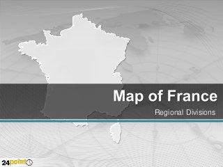
France - Editable PPT Map

A deck of 35 easy to edit slides - the Editable PowerPoint Map of France has separate maps for each state and region like Alsace, Basse Normandie, Bretagne and Champagne Ardenne. All regions can be pulled apart and customized - recolor or re-size. To know the name of each region/ administrative division, open the Selection Pane. To open the Selection Pane, go to the Home tab. Under the editing group click on the little arrow under “Select” and click on Selection Pane. You will now see the names for each of the region. Also included are demographic maps, maps for presenting data, maps showing the major cities like Paris and Nice and assorted editable icons with the flag colors. Download this map today! http://www.24point0.com/ppt-shop/editable-ppt-map-france

Recommended
Recommended
More Related Content
More from 24point0
Recently uploaded
Recently uploaded (20)
France - Editable PPT Map
- 2. France National Capital Strait of Dover BELGIUM English Channel LUXEMBOURG GERMANY Paris FRANCE Atlantic Ocean SWITZERLAND ITALY Bay of Biscay Ligurian Sea Gulf of Lion SPAIN ANDORRA Mediterranean Sea
- 3. France National Capital NORD-PASDE-CALAIS HAUTENORMANDIE PICARDIE Amiens Rouen Caen BASSE NORMANDIE Rennes BRETAGNE Lille Metz PARIS ILE-DEFRANCE PAYS DE LA LOIRE Chalons-enChampagne Strasbourg LORRAINE ALSACE CHAMPAGNE ARDENNE Orleans Besancon Dijon CENTRE Nantes BOURGOGNE FRANCHECOMTE ClermontFerrand Poitiers POITOU CHARENTES Lyon Limoges LIMOUSIN AUVERGNE RHONE ALPES Bordeaux AQUITAINE MIDI-PYRENEES Montpellier Toulouse LANGUEDOCROUSSILLON PROVENCE-ALPESCOTE D’AZUR Marseille CORSICA Ajaccio
- 4. France Major Cities Dunkerque Calais Boulogne-sur-Mer Lille Arras Amiens Charleville-Mezietes Cherbourg Rouen Metz Reim Caen Brest Strasbourg Chalsons Alencon Rennes Nancy PARIS Troyes Le Mans Mulhouse Orleans Belfort Dijon Angers Tours Nantes Besancon Bourges Nevers Beaune Poitiers La Rochelle Limoges ClermontFerrand Lyon Grenoble Saint-Etienne Perigueux Bordeaux Rodez Montpellier Toulouse Biarritz Tarbes Beziers Carcassonne Avignon Monte Carlo Nice Marseille Toulon Bastia Perpignan Ajaccio Bonifacio
- 5. France Auvergne Moulins ALLIER Clermont Ferrand PUY-DE-DOME HAUTE-LOIRE CANTAL Le Puy en Velay Aurillac
- 8. DOWNLOAD our maps and diagrams and discover the advantages of native PowerPoint images. Crisp and Clear: much sharper than clip art Change size without loss of resolution Change color to all or part of an image Remove parts of an image to highlight Combine images to create something new
- 9. Makeovers Fast From This To This Customer Discovery Step-by-Step Product Hypothesis Customer and Problem Hypothesis Distribution and Pricing Hypothesis Demand creation Hypothesis Market type Hypothesis Competitive Hypothesis Test “Product” Hypothesis Friendly first Contacts Problem Presentation Customer Understanding Market Knowledge Test “Product” Hypothesis First reality cheack Verity the Problem “Product” Presentation Verify the Product Yet more Customer Visits Verity the Business Model Second Reality cheack Iterate or Exit 1st Advisory Board Verify
- 10. You Can Do So Much MORE… Compare Clear and Sharp Resolution Resize without loss Combine parts Change colors Separate parts Be creative
- 11. Change colors Change size Separate pieces