NDGeospatialSummit2022 - NDDOT ROADWAY DATA FROM PAST TO PRESENT A TALE OF INNOVATION IN ROADWAY DATA COLLECTION
•
0 gefällt mir•15 views

Presented during the 2022 North Dakota Geospatial Summit in Bismarck, ND, September 14-15.

Empfohlen
Empfohlen
Weitere ähnliche Inhalte
Ähnlich wie NDGeospatialSummit2022 - NDDOT ROADWAY DATA FROM PAST TO PRESENT A TALE OF INNOVATION IN ROADWAY DATA COLLECTION
Ähnlich wie NDGeospatialSummit2022 - NDDOT ROADWAY DATA FROM PAST TO PRESENT A TALE OF INNOVATION IN ROADWAY DATA COLLECTION (20)
Mehr von North Dakota GIS Hub
Mehr von North Dakota GIS Hub (20)
Kürzlich hochgeladen
Kürzlich hochgeladen (20)
NDGeospatialSummit2022 - NDDOT ROADWAY DATA FROM PAST TO PRESENT A TALE OF INNOVATION IN ROADWAY DATA COLLECTION
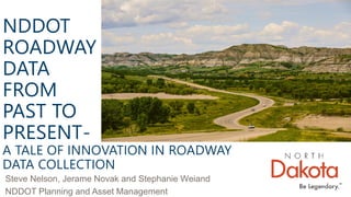
- 1. NDDOT ROADWAY DATA FROM PAST TO PRESENT- A TALE OF INNOVATION IN ROADWAY DATA COLLECTION Steve Nelson, Jerame Novak and Stephanie Weiand NDDOT Planning and Asset Management
- 2. ▪ 106,530 miles of roadway ▪ Update and maintains road centerlines. ▪ Track attribute information. ▪ Comply with Federal and State regulations ▪ Provides maps for the public. ▪ Utilize Roads and Highways extension and ArcMap. NORTH DAKOTA’S ROAD SYSTEM
- 3. Why does the NDDOT collect roadway data? Where are the roads? How do we collect data? How is the data displayed? How is the data used by the NDDOT? How can you use the data?
- 4. WHY DOES THE NDDOT COLLECT ROADWAY DATA?
- 5. FEDERAL REQUIREMENTS • Federal Aid Highway Program • Why fund states? • Yearly HMPS Submittal - HPMS Data Collection Field Manual (dot.gov) • HMPS data – extent, use, condition and performance of public road systems. • MIRE • LRS Data • ARNOLD
- 6. STATE REQUIREMENTS • 24-01-02 – Designation of state highway system • 24-01.03.1 – Highway Performance Classification Plan • 24-01.07 –Maps of state, county and municipal systems. • 24-03-21 – Preparation of Road maps – Publication of tourist information.
- 7. 24-01-02 – Designation of state highway system
- 8. 24-01.03.1 – Highway Performance Classification Plan
- 9. 24-01.07 –Maps of state, county and municipal systems.
- 10. 24-03-21 – Preparation of Road maps – Publication of tourist information.
- 13. WHERE ARE THE ROADS?
- 14. PLSS SYSTEM
- 17. ▪ 6 X 6 Miles ▪ Subdivided into 36 sections ▪ Sections are 1 x 1 Mile TOWNSHIPS
- 18. ▪ Sections are divided even further ▪ Corrections ▪ Century Code 24-07-03 SECTIONS
- 19. ROAD CLASSIFICATIONS ▪ Federal Highway Road Classification System ▪ Federal Aid is based on this system.
- 20. INTERSTATE
- 22. ARTERIAL
- 23. COLLECTOR
- 24. LOCAL AND COUNTY
- 25. Functional Class Map for Burleigh County
- 27. ROAD CENTERLINES ▪ What is a centerline? ▪ Routes and how they are used in our LRS ▪ Single versus dual carriageway?
- 29. H o w D o W e C o l l e c t O u r D a t a ? ( N o t T h i s Wa y )
- 30. Maps showing centerlines and other features have been collected since the 1930’s
- 31. Up until 1955, counties were inventoried on a 15-year cycle.
- 32. NELSON 1936 & 1946
- 33. AERIAL INVENTORY • 1955 Test of 1 Township • 2-person crew 3 days • Plane took 1.5 hours
- 34. WHY AERIAL INVENTORY? • Cost per mile much cheaper • Cover much more territory • It was found aerial inventory methods produced better inventory data in much less time than any other inventory method
- 35. WHY HAVE A GROUND CREW? • Map congested areas – city streets • Meet with City Officials • Quality Control check
- 36. AERIAL INVENORTY METHOD • Fly 500 – 800 feet above ground • Would fly one direction at a time • Flew this way until 1977
- 37. AERIAL INVENTORY METHOD - REVISED • To save time and plane time, elevation above ground raised to 1200 – 1500 • Would fly one direction (south for example) and inventory 1- mile east • This saved about 40% in plane time • This method was used until 2006
- 38. DATA SOURCES • Federal Sources • FHWA federal road data • USDA NAIP aerial imagery • Data from any Federal division that owns or maintains roadways (Department of Interior, U.S. Forest Service, etc.). • State Sources • NDDES E911 data • NDDOT Pathweb data/imagery • Other NDDOT departments • County Sources • County GIS data • County parcel data • Construction plans • County road superintendentssupervisors • Other documentation from county engineers and/or planners • City/Local Sources • City GIS data • City parcel data • City plats • Subdivision plats • Construction plans • Other documentation from city engineers and/or planners • Other Sources • Google map imagery • Google street view imagery • Feedback from external parties (public input, property owner, government official, etc.) • Visual Inspection – driving roads
- 39. STATE HIGHWAYS • Needed to be tracked closely • Maintenance Districts needed to know which roads to maintain • State Century code dictates amount of mileage
- 40. TRACKING STATE HIGHWAYS • Highway Control Sections were kept in a book • It would describe the section • It would record the mileage • Mileage was maintained this way until the early 70’s
- 41. TRACKING STATE HIGHWAYS • Starting in the early 70’s State Highways were tracked by Common Data Referencing System (CDRS) Map • It shows begin and end reference points • It also shows reference points at intersections • This map is still produced today – Route and Mileage Map
- 43. H o w D o W e D i s p l a y O u r D a t a ?
- 44. MEDIA TYPES • Linen was used in the 1930’s and 1940’s • Clear foil like K&E Stabline film in 1950’s and 1960’s • Negative emulsion film for scribing in the 1970’s – 1990’s
- 45. REGISTERING DATA • This process began in the 1950’s as is the basis for our data today • All pins represent section corners or some sort of horizontal control that came off aerial photos or plotted points • Aerial photos were supplied to DOT from Department of Agriculture
- 46. TRANSITION TO DIGITAL • Mid 1990’s began GIS talk • Company from Colorado was hired to digitize all County Base Map data • Arc Info tile data • Several years of Base Map Data were created. • Base Map Data CD ended when NDHUB began housing data
- 47. CENTERLINE EDITING • Arc Info Workstation first editing software • Non-State Highways or as referenced of the NDHUB, Roads County were maintained separately from State Highways • Original centerlines contained 34 fields • 2010 county tiles were imported into 1 SDE layer • 2016 all roads were incorporated into 1 LRS • Many years have been spent aligning centerlines
- 48. STATE HIGHWAY CENTERLINE EDITING • Mid 1990’s, needed to track State Highway projects and assets • RIMS was implemented • RIMS is based a reference point table which tells the distance between reference points • LRS was created and is still maintained today • Edited by Arc Info Workstation and ArcMap editing and GP tools
- 50. HOW IS THE DATA USED BY THE NDDOT?
- 51. ▪ Centerline is the backbone of our data ▪ One line, many uses IT STARTS WITH A SINGLE LINE
- 52. ▪ Using aerial imagery, centerlines are drawn first. ▪ East to West ▪ South to North LINES, MEASURES, AND THE LRS
- 53. ▪ Centerlines entered into Linear Reference System (LRS) as Routes ▪ Each route has a beginning and end measure ▪ Many measure points in between. LINES, MEASURES, AND THE LRS Start Measure 0.0000 End Measure 0.5000 Measures 0.0000 to 0.5000
- 54. ▪ Routes then act as anchors to other lines and points. ▪ Multiple datasets can be attached to one route LINES, MEASURES, AND THE LRS Route 003 Route 002 Route 001
- 55. ▪ Routes then act as anchors to other lines and points. ▪ Multiple segments can be attached to one route LINES, MEASURES, AND THE LRS Route 003 Municipal Ownership 0.0 to 0.5 Route 002 Municipal Ownership 11.2158 to 12.025 Route 002 County Ownership 12.025 to 12.254 Route 001 State Ownership 0.00 to 50.687
- 56. ▪ One route can be associated to multiple events ▪ LRS segments can be edited with the actual route remaining intact. LINES, MEASURES, AND THE LRS Speed Limit 65 Speed Limit 25 Speed Limit 45 Municipal Municipal County State Intersection Intersection
- 57. ▪ Segments are tied to the route. ▪ If a route is edited, the segment measurements are recalculated so the segment doesn’t move IT’S ALL CONNECTED Measure 0.0 Measure 0.3 Segment 1 0.0 to 0.175 Segment 2 0.175 to 0.3 New Addition (0.1)
- 58. ▪ Segments are tied to the route. ▪ If a route is edited, the segment measurements are recalculated so the segment doesn’t move ▪ New segments are manually added IT’S ALL CONNECTED Measure 0.1 Measure 0.0 Measure 0.4 Segment 1 0.1 to 0.275 Segment 2 0.375 to 0.4 New Segment 0.0 to 0.1
- 59. REPORTING HPMS ▪ Highway Performance Monitoring System ▪ Data sent to Federal Highway and dispersed to other Federal agencies ▪ Over 70 roadway characteristics MIRE ▪ Model Inventory of Roadway Elements ▪ Similar to HPMS – data is sent to federal highway ▪ Collects attributes related to safety, centerlines, and intersections. ▪ Over 200 data items used.
- 60. REPORTING Certified Mileage ▪ Annual report for Federal Highway ▪ Total miles of drivable public roads (not trails) in the state ▪ Over 88,000 certified miles Transportation Handbook ▪ Annual publication about the NDDOT ▪ Data stored in our LRS systems is used throuought the handbook ▪ Found on the NDDOT website
- 61. State Highway Miles ▪ Number of highway miles that are “State Highways” ▪ Required in ND century code ▪ Cannot exceed 7% of total milage and cannot exceed 7,700 miles REPORTING
- 62. MAPS ▪ NDDOT uses roadway data for a number of maps ▪ Basemaps ▪ Highway Maps ▪ Special request maps for grants and reports
- 64. HOW CAN YOU USE THE DATA?
- 65. ▪ First published in 1924 ▪ Digital since 2004 ▪ Separate GDB ▪ Compared to official roadway data ▪ Print and electronic copies available ND HIGHWAY MAP
- 66. ▪ NDDOT maintains over 300 basemaps ▪ All counties ▪ All incorporated cities ▪ Functional classification overlay BASEMAPS
- 67. ▪ NDDOT maintains over 300 basemaps ▪ All counties ▪ All incorporated cities ▪ Functional classification overlay BASEMAPS
- 68. ▪ Visualize data collected in the field ▪ Used for daily and annual traffic reporting TRAFFIC MAPS
- 69. ▪ State base map ▪ Rail maps ▪ Highway Systems ▪ And more! OTHER MAPS
- 70. ▪ Raw data is available for download from NDDOT website ▪ dot.nd.gov DOWNLOADABLE DATA
- 71. ▪ A variety of roadway and other NDDOT data is available for download on the ND GIS Hub ▪ Just search “NDDOT” DOWNLOADABLE DATA
- 73. QUESTIONS?