SlideShare a Scribd company logo
1 of 37
Canal Head works and Distribution system
Asst Prof: Mitali Shelke
St. John College of Engineering and Management, Palghar
Department of Civil Engineering
A canal is an artificial channel constructed on ground to carry water to the fields either from the river
or from a reservoir.
Canals can be classified into following ways:
1. Classification based on nature of source of supply:
a) Permanent canal b) Inundation canal
A canal is said to be permanent when it is fed by a permanent source of supply. The canal is a well
made up regular graded channel. It has also permanent masonry works for regulation and distribution
of supplies. A permanent canal is also sometimes known as perennial canal when the sources from
which canal takes is an ice fed perennial river.
Inundation canals usually draw their supplies from rivers whenever there is a high stage in the river.
They are not provided with any head works for diversion of river water to the canal. They are
however provided with the canal head regulator. The head of the canal has to be changed to some
times to suit the changing pattern of river course.
2. Classification based on financial output:
a) Productive canal b) Protective canal
Productive canals are those which yield a net revenue to the nation after full development of irrigation
in the area.
Protective canal is a sort of relief work constructed with the idea of protecting a particular area from
famine.
3. Classification based on function of the canal:
a) Irrigation canal b) Carrier canal c) Feeder canal d) Navigation canal e) Power canal
An irrigation canal carries water to the agricultural fields. A carrier canal besides doing irrigation
carries water for another canal. Upper Chenab canal is the example of such a canal.
A feeder canal is constructed with the idea of feeding two or more canals.
4. Classification based on boundary surface of the canal
a) Alluvial canals b) Non alluvial canal c) Rigid boundary canals
An alluvial canal is the one which is excavated in alluvial soils such as silt. A non alluvial canal is
the one which is excavated in non alluvial soils such as loom clay, hard soil or rock. Rigid boundary
canals are those which have rigid sides and rigid base such as lined canal.
5. Classification based on discharge and its relative importance in given network of canals
a) Main canal b) Branch canal c) Major distributary d) Minor distributary e) Water course
6. Classification based on canal alignment
a) Contour canal b) Watershed canal c) Side slope canal
โ€ข Canal alignment:
โ€ข A canal has to be aligned in such a way that it covers the entire area proposed to be irrigated with
shortest possible length and at the same time its cost including the cost of cross drainage works is
minimum.
โ€ข A shorter length of canal ensures less loss of head due to friction and smaller loss of discharge due
to seepage and evaporation so that additional areas can be brought under cultivation.
According to alignment the canals may be classified as:
a) Ridge canal b) Contour canal c) Side slope canal
โ€ข Ridge canal: Ridge canal also called as watershed canal is aligned along a water shade and runs
for most of its length on a watershed.
โ€ข When a channel is on the watershed it can command areas on both banks and hence a large area
can be brought under cultivation
โ€ข When the water shade takes a very sharp loop the canal should be aligned straight to save
considerable idle length.
โ€ข The area of the loop between the watershed and the canal cannot be irrigated by this canal as there
will be higher ground on this side and some other arrangement has to be made if the irrigation is
important in that area.
โ€ข The canal checks the drainage of this part and the cross drainage work has to be provided.
โ€ข Cost analysis should be made before a lining the canal straight to reduce its length. The canal has
also to leave watershed to bypass towns and villages situated at the watershed.
General considerations for alignment
1. The alignment of the canal should be such as to ensure a) the most economical way of
distributing the water to the land b) as high a command as possible and c) minimum number of
cross drainage works
2. The alignment of canal on watershed being the most economical is preferred.
3. Length of the main canal from point where it takes off from a river to a point where it mounts
on a watershed should be minimum
4. The contour alignment should be changed this way or that way in order to reduce the number of
cross drainage works to a minimum
5. The alignment should avoid villages, roads, places of worship and other valuable properties.
6. The alignment should pass through the balanced depth of cutting. If not it should involve
minimum depth of cutting on minimum height of filling.
7. The number of acute curves should be minimum
8. The alignment should not be made in a rocky or cracked strata.
Alignment of a field channel or water course:
Maintenance of field channel is the responsibility of the farmers and its alignment should have
following features:
1. They should be laid along field boundaries
2. They should be capable of supplying sufficient water to the tail end
3. Separate field channels should be provided for high and low lands
4. The field channels should not pass through Rocky or cracked strata.
Losses in canals:
Losses should be properly accounted otherwise lesser quantity of water will be available for
cultivation at the tail end.
1. Evaporation losses 2. Transpiration losses 3. Seepage losses
1. Evaporation losses: Depends upon - a) climatic factors such as temperature, humidity and wind
velocity.
b) kennel factors such as surface area, water depth and velocity of flow.
โ€ข Maximum loss occurs in summer when temperatures are high and wind velocities are also high.
โ€ข Losses are maximum in unlined canals due to a wider water surface area, shallow water depth and
low velocity.
โ€ข The average evaporation loss per day may vary between 4mm to 10mm.
2. Transpiration losses: This takes place through lot of vegetation and weed growth along the bank
of the canal. This loss forms a extremely small part of total loss.
3. Seepage losses: Seepage losses constitutes a major portion of the loss in an unlined canal. These
are due to:
a) Absorption of water in the upper layers of soil below the canal bed
b) Percolation of water into the water table thus raising the water table.
โ€ข If the water table is much lower seepage losses are only due to absorption.
โ€ข Percolation losses are always much more than the absorption losses.
โ€ข Rate of water loss: Canal losses may be expressed in following methods-
1. As Cumecs per million square metre of the wetted perimeter
2. As a depth of water lost per day over the wetted perimeter
3. As percentage of the canal discharge
4. As percentage per kilometre length of the canal
โ€ข In absence of any data the transmission losses may be taken as 2.5 cumecs per million square
metre of wetted perimeter for unlined canals and as 0.60 cumecs per million square metre of
wetted perimeter for lined canals.
โ€ข In UP the loss QL in cumecs per kilometre length of unlined canal is given by
โ€ข In Punjab and Haryana the losses in unlined canals in cumecs per million square metre of wetted
perimeter is given by:
โ€ข The central water power commission recommends following values of losses in unlined canals:
โ€ข Losses are sometimes expressed as percentage of total discharge as given below:
1. Main canal and branches : 15% to 20%
2. Distributaries and minors : 6% to 7%
3. Water courses : 17% to 22%
โ€ข In Punjab following formula is used for The losses in lined canal in cumecs per million square
metres of wetted perimeter.
โ€ข As per CWPC and IS: 1745 - 1968 the transmission losses in lined canals can be taken as 0.6
cumecs per million square metres of wetted perimeter.
Cross section of irrigation canal:
โ€ข A typical and most desired section of canal is shown below: This section is partly in cutting and
partly in filling and aims at balancing the quantity of earthwork in excavation with that in filling.
โ€ข Sometimes when the natural surface level NSL is above the top of the bank the entire canal
section will have to be in cutting and it shall be called as canal in cutting. When the NSL is lower
than the bed level of canal the entire canal section will have to be built in filling and called as
canal in filling.
1. Side slopes: it should be such that they are stable depending upon the type of the soil.
Comparatively steeper slope can be provided in cutting rather than in filling as the soil in the
former case shall be more stable.
โ€ข 1H : 1V (1 : 1) to 1 ยฝ H : 1V slope in cutting and
โ€ข 1 ยฝ H : 1V to 2H : 1V in filling
โ€ข The side of channel with silt laiden water gets silted up to a slope of ยฝ : 1 with the passage of
time as shown in the figure:
2. Berms: berm is a horizontal distance left at ground level between the toe of the bank and top edge
of the cutting.
โ€ข The berm is provided in such a way that the bed line and bank line remains parallel.
โ€ข If S1 : 1 is slope in cutting and S2 : 1 in filling then Initial berm width = (S2 - S1)d1
โ€ข After the water flows in the channel for sometime the silt gets deposited on the sides giving a
slope of ยฝ : 1. The position of the berm changes from ground level to FSL and its width becomes
equal to (S2 - ยฝ) y.
โ€ข If S2 = 1 ยฝ then final width = y i.e equal to depth of the canal
Free board: The margin between FSL and Bank level is known as free board.
The amount of free board depends upon the size of the channel.
Banks: The primary purpose of banks is to retain water.
They can be used as the means of communication and as inspection paths. They should be wide
enough so that a minimum cover of 0.5 metre is available above the saturation line. High banks will
have to be designed as earth dams.
Service roads: Service roads are provided on canals for inspection purposes and may simultaneously
serve as the means of communication in remote areas. They are provided 0.4 metre to 1 metre above
FSL depending upon the size of the channel.
Dowla: As a measure of safety in driving dowlas 0.3 metre high and 0.3 to 0.6 metre wide at top, with
side slopes of 1 ยฝ : 1 to 2:1 are provided along the banks.
They also help in preventing slope erosion due to rains.
Back berm or counter berms: Even after providing sufficient section for bank embankment the
saturation gradient line may cut the downstream end of the bank. in such case saturation line can
be kept covered at least by 0.5 with the help of counter berms. The strait saturation gradient line
may be drawn with the following slopes
Spoil banks: When the earthwork in excavation exceeds earthwork in filling even after providing
maximum width of bank embankments extra earth has to be disposed of economically.
To dispose of this earth by mechanical transport it may become very costly and an economical mode
of its disposal may be found out in the forms of collecting the soil on the edge of the bank
embankment itself.
The soil is deposited in the form of heaps on both banks or any one of the bank.
These heaps of soil are discontinued at suitable intervals and longitudinal drains running by their
sides are excavated for the disposal of rainwater.
Cross drains through the spoil banks may also be excavated if needed.
Borrow pits: When earthwork in filling exceeds the earthwork in excavation earth has to be brought
from somewhere. The pits which are dug for bringing earth are known as borrow pits.
If such pits are excavated outside the channel they are known as external borrow pits and if they are
within the channel known as internal borrow pits.
The borrow pits should start from a point at a distance more than 5 metres from the toe of small
channels, and 10 metre for large channels.
The width of the pits โ€˜b' should be less than half the width of the canal โ€˜Bโ€™ and should be dug in the
centre. The depth of these pits should be equal to or less than 1 metre.
Maintenance of irrigation canals:
The problems which are posed by irrigation channel during their use and require constant attention
are:
1. Silting of canal
2. Weed and plant growth
3. Failure of weaker banks
4. Hollow created by burrowing animals causing seepage and piping
5. Canal breaches due to piping, overflowing of canal.
Remedial measures for the problems discussed above:
1. Silting of canals: Silt deposited reduces the effective canal cross section and carrying capacity
of the channel.
To prevent too much silt deposition channel should be properly designed to ensure a velocity which
neither causes any silting nor scoring in the channel
โ€ข Attempt should be made to remove the silt from the entering water to the canal.
โ€ข In practice in spite of all the measures taken certain amount of silt definitely enters the canal also
a certain amount of silt is added by scouring action within the channel.
โ€ข Hence silts should be removed periodically by desilting operations.
โ€ข Desilting can be carried out by actually excavating the silt manually (when the canal is dry) or by
dredgers (when canal is either dry or running).
โ€ข The extent of silting in the canal can be found out from measuring the silt depth over bed bars.
โ€ข The excavated silt should not be deposited above the canal banks as the same silt may find its way
back into the desilted channel
2. Weed and plant growth:
โ€ข Irrigation canals normally get infected with aquatic weed growth.
โ€ข The weed growth obstructs the flow of water, reduces the carrying capacity of channel, and
hamper the efficiency.
โ€ข The weed growth may also sometimes impart harmful qualities to irrigation water.
โ€ข Weed growth can be controlled by maintaining higher velocities in canals or sometimes they have
to be physically removed from the canal in order to improve the efficiency.
โ€ข In newly constructed canals regular inspections should be done to locate any spot where the weed
growth has set in. Weeds from such spots should be removed completely so that infestation does
not spread.
โ€ข In old canals where aquatic weed growth is found suitable mechanical or chemical methods may
be employed at early stage as possible.
3. Failure of weaker banks:
โ€ข The banks of the canal should be made in full design width and should be maintained at such (as
per IS provisions).
โ€ข The canal banks get eroded at various places and must be repaired and all cuts and breaches
should be filled up with suitable soil and proper tamping.
โ€ข When a canal reach runs in filling, the banks are subjected to water pressure. In this case damage
can occur to the banks and they should be given extra strength by increasing their sections.
โ€ข In order to keep the cost of construction low additional soil for increasing the bank section may be
obtained by natural silting process.
โ€ข In this a sufficient wider section is provided and a part of it later gets silted forming the additional
Bank.
4. Canal breaches: It is an opening or a gap developed in the Canal bank due to erosion of some
portion of the bank.
When water starts flowing out of such a breach it starts becoming deeper and wider unless remedial
measures are taken immediately to plug the breach. The breaches in the canal may be caused due to
following reasons:
a) Breach due to faulty design or construction of the canal banks
b) Breach due to overflow of the canal
c) Breach due to seepage or piping
d) Breach due to intentional cuts made by cultivators
Closure of breaches:
โ€ข In small minors and distributaries a breach may be closed by dumping huge quantities of earth
simultaneously from both sides of the gap.
โ€ข As water of the breech spreads on adjoining land there is usually no outside nearby place to
borrow Earth for closing the breach.
โ€ข The earth has to be collected either by cutting the outside slope of the existing Bank or from spoil
banks or berms of the canal.
โ€ข it is essential to store huge quantities of Earth on both sides of the gap before closing the breach
โ€ข The closing process should be started from both sides of the breach at the same time.
โ€ข In case of bigger canals the above procedure cannot be adopted as use discharge from Canal may
wash off the dumped soil.
โ€ข It is necessary to reduce the flow through the breach.
Canal lining:
Necessity:
1. To minimise the seepage losses in Canal
2. to increase the discharge in Canal section by increasing the velocity
3. To prevent erosion of bed and side due to high velocities
4. To retard the growth of weeds
5. To reduce maintenance of canal.
Advantages of lining:
1. Prevents seepage loss and does more area can be irrigated by the water saved hence the cost of
irrigation is reduced.
2. The lining of canal is an important anti water logging measure is it reduces the seepage to the
adjoining land
3. The lining provides smooth surface hence the rugosity coefficient decreases. The resistance to
flow also decreases and hence the velocity of flow in the lined canal increases.
4. The increased velocity minimises the losses due to evaporation.
5. The increased velocity helps to provide a narrow cross-section for lined canals.
6. Higher velocity prevents silting of channel
7. Lining makes the bank more stable in light textured soil
8. Lining reduces maintenance cost and possibility of breaching due to increased stability of section.
9. Lining of canal prevents or reduces weed growth
10. Lining of canal increases available head for power generation.
11. Canal lining assures economical water distribution
12. Canal lining prevent water to come in contact with harmful salts during transit
Disadvantages of canal lining:
1. Requires heavy initial investment
2. lining being permanent it is difficult to shift the outlets very often
3. It is very difficult to repair the damaged lining
4. A lined channel section is without a berm. Hence the additional safety which berm provides is
absent in lined channels.
Main types of concrete lining used in India are:
1. HARD SURFACE TYPE LINING:
a) Cement concrete Lining
b) Shotcrete Lining
c) Precast concrete Lining
d) Cement Mortar Lining
e) Brick Lining
f) Stone blocks Lining
g) Asphaltic Lining
2. EARTH TYPE LINING:
a) Soil cement Lining
b) Clay puddle Lining
c) Sodium carbonate Lining
a) Cement concrete Lining
โ€ข It has high initial cost so its use is limited.
โ€ข It has excellent hydraulic properties.
โ€ข Thickness varies from 5-10cm for M 15 concrete and 7.5 to 15cm for M 10 concrete.
โ€ข Earthen banks has self-supporting slope
โ€ข Reinforcement is provided if needed. It prevents gap and failure due to grades. It also reduces
width of temperature crack.
โ€ข Provided in panels of about 3m length.
b) Shotcrete lining
โ€ข Shotcrete consumes large amount of cement.
โ€ข Cement and Sand in the ratio (1:4) is shot at the subgrade through a nozzle.
โ€ข Thickness of this type of lining varies from 2.5 to 6.5 cm.
โ€ข Shotcrete is also used for repair of old but sound concrete lining.
c) Precast concrete Lining
โ€ข This consists of precast slabs usually 90cm x 30cm in size.
โ€ข Thickness of each slab varies from 5 to 6.5 cm.
โ€ข Blocks are manufactured with an interlocking arrangement.
โ€ข Slabs are laid on well prepared and compacted subgrade.
d) Cement Mortar Lining
โ€ข It is usually used as sandwich material between brick layers.
โ€ข Thickness for this type of lining is kept from 1 to 4 cm.
โ€ข A large amount of cement is consumed in this type of lining and thus it is quite costly.
e) Brick Lining
โ€ข It consists of a single or double layer of brick masonry.
โ€ข The size of brick is restricted to 30x15x5 cm for convenience of handling.
โ€ข This type of lining has been used in Punjab on Bhakra and Haveli canals.
โ€ข It is hydraulically as efficient as concrete lining.
โ€ข In case of failure repair can be done easily
f) Asphaltic Lining
โ€ข It is a controlled mixture of asphalt and grade aggregate mixed and placed at high temperature
of 200โฐC.
โ€ข It is covered with 30 cm layer of earth material for protection.
โ€ข The mix is placed either by hand or by an equipment similar to that of concrete.
g) Soil cement Lining
โ€ข In this the mixture in proportion of 90 to 95% soil and 10 to 5% cement is thoroughly mixed dry
and is then added with water to raise the moisture content to optimum.
โ€ข It is therefore placed on the subgrade and properly compacted.
h) Clay puddle Lining
โ€ข Clay puddle is produced from clay by first exposing clay to weathering.
โ€ข It is then mixed with water to bring it to the saturation and is pugged thoroughly under manโ€™s or
cattleโ€™s feet.
โ€ข Lining thickness is 30 cm.
โ€ข It is then protected by layer of earth material.
i) Sodium carbonate Lining
โ€ข The mixture consists of clayey soil and sodium carbonate in a proportion of 10% clay and 6%
sodium carbonate.
โ€ข Thickness is kept as 10 cm.
โ€ข This type of canal is used on small canals.
j) Stone blocks Lining
โ€ข This consists of undressed stone block set in mortar and laid over a prepared subgrade.
โ€ข The lining is able to check seepage effectively but has a considerable resistance to water flow.
โ€ข Dressed stone block lining is effective but costly.
Waterlogging:
โ€ข An agricultural land is said to be waterlogged when its productivity or fertility is affected by the
high water table.
โ€ข The depth of water table at which it tends to make soil water logged and harmful to the growth of
plants life depends upon the height of capillary fringe.
โ€ข The adverse effects of high water table on the yield of crops also depends upon the nature of crop
grown.
Effects of waterlogging:
1. Inhibiting activity of soil bacteria
2. Decrease in available capillary water
3. Fall in soil temperature
4. Defective air circulation
5. Rise of salt
6. Delay in cultivation operations
7. Growth of wild flora
8. Adverse effect on community health
Causes of waterlogging:
1. Inadequate surface drainage
2. Seepage from canal system
3. Over irrigation of fields
4. Obstruction of natural drainage
5. Obliteration of natural drainage
6. Inadequate capacity for arterial drainage
7. Construction of a water reservoir
8. Natural obstruction to the flow of groundwater
Remedial measures:
1. Efficient surface drainage
2. Under drainage by tile drains
3. Reducing percolation from canals
4. Restriction of irrigation
5. Lining of watercourses
6. Removing obstruction in natural drainage
7. Prevention of seepage from water reservoir
8. Depletion of groundwater storage by pumping
9. Changes in crop pattern
10. Adoption of sprinkler method for irrigation.

More Related Content

What's hot

Modes of failure earth dams
Modes of failure   earth damsModes of failure   earth dams
Modes of failure earth dams
saibabu48
ย 
Canal outlets
Canal outletsCanal outlets
Canal outlets
saibabu48
ย 

What's hot (20)

Diversion headwork
Diversion headwork Diversion headwork
Diversion headwork
ย 
Open Channel Flow
Open Channel FlowOpen Channel Flow
Open Channel Flow
ย 
Irrigation canals
Irrigation canalsIrrigation canals
Irrigation canals
ย 
Spillways & energy dissipator
Spillways & energy dissipatorSpillways & energy dissipator
Spillways & energy dissipator
ย 
Diversion headworks
Diversion headworksDiversion headworks
Diversion headworks
ย 
Modes of failure earth dams
Modes of failure   earth damsModes of failure   earth dams
Modes of failure earth dams
ย 
Diversion head work
Diversion head workDiversion head work
Diversion head work
ย 
Canal
CanalCanal
Canal
ย 
Spillways
SpillwaysSpillways
Spillways
ย 
Dams and spillways
Dams and spillwaysDams and spillways
Dams and spillways
ย 
Diversion Headwork in Canal
 Diversion Headwork in Canal  Diversion Headwork in Canal
Diversion Headwork in Canal
ย 
Canal Regulation & Cross Drainage Works
Canal Regulation & Cross Drainage WorksCanal Regulation & Cross Drainage Works
Canal Regulation & Cross Drainage Works
ย 
Diversion head works
Diversion head worksDiversion head works
Diversion head works
ย 
Diversion Headworks
Diversion HeadworksDiversion Headworks
Diversion Headworks
ย 
Canal Fall
Canal FallCanal Fall
Canal Fall
ย 
Canal regulation works. m4pptx
Canal regulation works. m4pptxCanal regulation works. m4pptx
Canal regulation works. m4pptx
ย 
Canal outlets
Canal outletsCanal outlets
Canal outlets
ย 
design of weirs
design of weirsdesign of weirs
design of weirs
ย 
Open Channel VS Pipe Flow
Open Channel VS Pipe FlowOpen Channel VS Pipe Flow
Open Channel VS Pipe Flow
ย 
Canal alignment
Canal alignmentCanal alignment
Canal alignment
ย 

Similar to WREII Canals Head Works and Distribution system

CIV_604_IHS-6th_CIVIL-Chapter-3_Notes.pdf
CIV_604_IHS-6th_CIVIL-Chapter-3_Notes.pdfCIV_604_IHS-6th_CIVIL-Chapter-3_Notes.pdf
CIV_604_IHS-6th_CIVIL-Chapter-3_Notes.pdf
RamenRoyAEKHSD2PWRD
ย 

Similar to WREII Canals Head Works and Distribution system (20)

08. Classification of Canals.pdf
08. Classification of Canals.pdf08. Classification of Canals.pdf
08. Classification of Canals.pdf
ย 
Module-5.pptx
Module-5.pptxModule-5.pptx
Module-5.pptx
ย 
Canals
CanalsCanals
Canals
ย 
Irrigation Channels
Irrigation ChannelsIrrigation Channels
Irrigation Channels
ย 
Canal irrigation
Canal irrigationCanal irrigation
Canal irrigation
ย 
Unit 4-canal
Unit 4-canalUnit 4-canal
Unit 4-canal
ย 
Module 03 Distribution Works.pptx
Module 03 Distribution Works.pptxModule 03 Distribution Works.pptx
Module 03 Distribution Works.pptx
ย 
Canal of design
Canal of designCanal of design
Canal of design
ย 
CIV_604_IHS-6th_CIVIL-Chapter-3_Notes.pdf
CIV_604_IHS-6th_CIVIL-Chapter-3_Notes.pdfCIV_604_IHS-6th_CIVIL-Chapter-3_Notes.pdf
CIV_604_IHS-6th_CIVIL-Chapter-3_Notes.pdf
ย 
presentation of industrial training irrigation (2).pptx
presentation of industrial training irrigation (2).pptxpresentation of industrial training irrigation (2).pptx
presentation of industrial training irrigation (2).pptx
ย 
Irrigation Engg Lec 03.pptx
Irrigation Engg Lec 03.pptxIrrigation Engg Lec 03.pptx
Irrigation Engg Lec 03.pptx
ย 
Canal Irrigation
Canal IrrigationCanal Irrigation
Canal Irrigation
ย 
โ€ข Sediment Transport โ€ข The Earthen Canal Section โ€ข Lined Canals & Its Advantages
โ€ข Sediment Transport โ€ข The Earthen Canal Section โ€ข Lined Canals & Its Advantagesโ€ข Sediment Transport โ€ข The Earthen Canal Section โ€ข Lined Canals & Its Advantages
โ€ข Sediment Transport โ€ข The Earthen Canal Section โ€ข Lined Canals & Its Advantages
ย 
Cross drainage work.pptx
Cross drainage work.pptxCross drainage work.pptx
Cross drainage work.pptx
ย 
Geological factor for canal alignment
Geological factor for canal alignmentGeological factor for canal alignment
Geological factor for canal alignment
ย 
Canal irrigation (Mr. Kiran B. Mane)
Canal irrigation (Mr. Kiran B. Mane)Canal irrigation (Mr. Kiran B. Mane)
Canal irrigation (Mr. Kiran B. Mane)
ย 
Canal Regulation & Canal Types
Canal Regulation & Canal TypesCanal Regulation & Canal Types
Canal Regulation & Canal Types
ย 
1 grassed water ways
1 grassed water ways1 grassed water ways
1 grassed water ways
ย 
Design of a channel Reach
Design of a channel ReachDesign of a channel Reach
Design of a channel Reach
ย 
10. Kenedy's and Lacey's Theory (Supply).pdf
10. Kenedy's and Lacey's Theory (Supply).pdf10. Kenedy's and Lacey's Theory (Supply).pdf
10. Kenedy's and Lacey's Theory (Supply).pdf
ย 

Recently uploaded

UNIT - IV - Air Compressors and its Performance
UNIT - IV - Air Compressors and its PerformanceUNIT - IV - Air Compressors and its Performance
UNIT - IV - Air Compressors and its Performance
sivaprakash250
ย 
Call for Papers - Educational Administration: Theory and Practice, E-ISSN: 21...
Call for Papers - Educational Administration: Theory and Practice, E-ISSN: 21...Call for Papers - Educational Administration: Theory and Practice, E-ISSN: 21...
Call for Papers - Educational Administration: Theory and Practice, E-ISSN: 21...
Christo Ananth
ย 
Double rodded leveling 1 pdf activity 01
Double rodded leveling 1 pdf activity 01Double rodded leveling 1 pdf activity 01
Double rodded leveling 1 pdf activity 01
KreezheaRecto
ย 
Call Now โ‰ฝ 9953056974 โ‰ผ๐Ÿ” Call Girls In New Ashok Nagar โ‰ผ๐Ÿ” Delhi door step de...
Call Now โ‰ฝ 9953056974 โ‰ผ๐Ÿ” Call Girls In New Ashok Nagar  โ‰ผ๐Ÿ” Delhi door step de...Call Now โ‰ฝ 9953056974 โ‰ผ๐Ÿ” Call Girls In New Ashok Nagar  โ‰ผ๐Ÿ” Delhi door step de...
Call Now โ‰ฝ 9953056974 โ‰ผ๐Ÿ” Call Girls In New Ashok Nagar โ‰ผ๐Ÿ” Delhi door step de...
9953056974 Low Rate Call Girls In Saket, Delhi NCR
ย 
Call Girls in Ramesh Nagar Delhi ๐Ÿ’ฏ Call Us ๐Ÿ”9953056974 ๐Ÿ” Escort Service
Call Girls in Ramesh Nagar Delhi ๐Ÿ’ฏ Call Us ๐Ÿ”9953056974 ๐Ÿ” Escort ServiceCall Girls in Ramesh Nagar Delhi ๐Ÿ’ฏ Call Us ๐Ÿ”9953056974 ๐Ÿ” Escort Service
Call Girls in Ramesh Nagar Delhi ๐Ÿ’ฏ Call Us ๐Ÿ”9953056974 ๐Ÿ” Escort Service
9953056974 Low Rate Call Girls In Saket, Delhi NCR
ย 
UNIT-V FMM.HYDRAULIC TURBINE - Construction and working
UNIT-V FMM.HYDRAULIC TURBINE - Construction and workingUNIT-V FMM.HYDRAULIC TURBINE - Construction and working
UNIT-V FMM.HYDRAULIC TURBINE - Construction and working
rknatarajan
ย 
FULL ENJOY Call Girls In Mahipalpur Delhi Contact Us 8377877756
FULL ENJOY Call Girls In Mahipalpur Delhi Contact Us 8377877756FULL ENJOY Call Girls In Mahipalpur Delhi Contact Us 8377877756
FULL ENJOY Call Girls In Mahipalpur Delhi Contact Us 8377877756
dollysharma2066
ย 

Recently uploaded (20)

UNIT - IV - Air Compressors and its Performance
UNIT - IV - Air Compressors and its PerformanceUNIT - IV - Air Compressors and its Performance
UNIT - IV - Air Compressors and its Performance
ย 
Call for Papers - Educational Administration: Theory and Practice, E-ISSN: 21...
Call for Papers - Educational Administration: Theory and Practice, E-ISSN: 21...Call for Papers - Educational Administration: Theory and Practice, E-ISSN: 21...
Call for Papers - Educational Administration: Theory and Practice, E-ISSN: 21...
ย 
Double rodded leveling 1 pdf activity 01
Double rodded leveling 1 pdf activity 01Double rodded leveling 1 pdf activity 01
Double rodded leveling 1 pdf activity 01
ย 
Call Girls Walvekar Nagar Call Me 7737669865 Budget Friendly No Advance Booking
Call Girls Walvekar Nagar Call Me 7737669865 Budget Friendly No Advance BookingCall Girls Walvekar Nagar Call Me 7737669865 Budget Friendly No Advance Booking
Call Girls Walvekar Nagar Call Me 7737669865 Budget Friendly No Advance Booking
ย 
Thermal Engineering-R & A / C - unit - V
Thermal Engineering-R & A / C - unit - VThermal Engineering-R & A / C - unit - V
Thermal Engineering-R & A / C - unit - V
ย 
The Most Attractive Pune Call Girls Budhwar Peth 8250192130 Will You Miss Thi...
The Most Attractive Pune Call Girls Budhwar Peth 8250192130 Will You Miss Thi...The Most Attractive Pune Call Girls Budhwar Peth 8250192130 Will You Miss Thi...
The Most Attractive Pune Call Girls Budhwar Peth 8250192130 Will You Miss Thi...
ย 
KubeKraft presentation @CloudNativeHooghly
KubeKraft presentation @CloudNativeHooghlyKubeKraft presentation @CloudNativeHooghly
KubeKraft presentation @CloudNativeHooghly
ย 
Water Industry Process Automation & Control Monthly - April 2024
Water Industry Process Automation & Control Monthly - April 2024Water Industry Process Automation & Control Monthly - April 2024
Water Industry Process Automation & Control Monthly - April 2024
ย 
ONLINE FOOD ORDER SYSTEM PROJECT REPORT.pdf
ONLINE FOOD ORDER SYSTEM PROJECT REPORT.pdfONLINE FOOD ORDER SYSTEM PROJECT REPORT.pdf
ONLINE FOOD ORDER SYSTEM PROJECT REPORT.pdf
ย 
Top Rated Pune Call Girls Budhwar Peth โŸŸ 6297143586 โŸŸ Call Me For Genuine Se...
Top Rated  Pune Call Girls Budhwar Peth โŸŸ 6297143586 โŸŸ Call Me For Genuine Se...Top Rated  Pune Call Girls Budhwar Peth โŸŸ 6297143586 โŸŸ Call Me For Genuine Se...
Top Rated Pune Call Girls Budhwar Peth โŸŸ 6297143586 โŸŸ Call Me For Genuine Se...
ย 
(INDIRA) Call Girl Bhosari Call Now 8617697112 Bhosari Escorts 24x7
(INDIRA) Call Girl Bhosari Call Now 8617697112 Bhosari Escorts 24x7(INDIRA) Call Girl Bhosari Call Now 8617697112 Bhosari Escorts 24x7
(INDIRA) Call Girl Bhosari Call Now 8617697112 Bhosari Escorts 24x7
ย 
UNIT-II FMM-Flow Through Circular Conduits
UNIT-II FMM-Flow Through Circular ConduitsUNIT-II FMM-Flow Through Circular Conduits
UNIT-II FMM-Flow Through Circular Conduits
ย 
BSides Seattle 2024 - Stopping Ethan Hunt From Taking Your Data.pptx
BSides Seattle 2024 - Stopping Ethan Hunt From Taking Your Data.pptxBSides Seattle 2024 - Stopping Ethan Hunt From Taking Your Data.pptx
BSides Seattle 2024 - Stopping Ethan Hunt From Taking Your Data.pptx
ย 
Call Girls Pimpri Chinchwad Call Me 7737669865 Budget Friendly No Advance Boo...
Call Girls Pimpri Chinchwad Call Me 7737669865 Budget Friendly No Advance Boo...Call Girls Pimpri Chinchwad Call Me 7737669865 Budget Friendly No Advance Boo...
Call Girls Pimpri Chinchwad Call Me 7737669865 Budget Friendly No Advance Boo...
ย 
Unit 1 - Soil Classification and Compaction.pdf
Unit 1 - Soil Classification and Compaction.pdfUnit 1 - Soil Classification and Compaction.pdf
Unit 1 - Soil Classification and Compaction.pdf
ย 
Booking open Available Pune Call Girls Pargaon 6297143586 Call Hot Indian Gi...
Booking open Available Pune Call Girls Pargaon  6297143586 Call Hot Indian Gi...Booking open Available Pune Call Girls Pargaon  6297143586 Call Hot Indian Gi...
Booking open Available Pune Call Girls Pargaon 6297143586 Call Hot Indian Gi...
ย 
Call Now โ‰ฝ 9953056974 โ‰ผ๐Ÿ” Call Girls In New Ashok Nagar โ‰ผ๐Ÿ” Delhi door step de...
Call Now โ‰ฝ 9953056974 โ‰ผ๐Ÿ” Call Girls In New Ashok Nagar  โ‰ผ๐Ÿ” Delhi door step de...Call Now โ‰ฝ 9953056974 โ‰ผ๐Ÿ” Call Girls In New Ashok Nagar  โ‰ผ๐Ÿ” Delhi door step de...
Call Now โ‰ฝ 9953056974 โ‰ผ๐Ÿ” Call Girls In New Ashok Nagar โ‰ผ๐Ÿ” Delhi door step de...
ย 
Call Girls in Ramesh Nagar Delhi ๐Ÿ’ฏ Call Us ๐Ÿ”9953056974 ๐Ÿ” Escort Service
Call Girls in Ramesh Nagar Delhi ๐Ÿ’ฏ Call Us ๐Ÿ”9953056974 ๐Ÿ” Escort ServiceCall Girls in Ramesh Nagar Delhi ๐Ÿ’ฏ Call Us ๐Ÿ”9953056974 ๐Ÿ” Escort Service
Call Girls in Ramesh Nagar Delhi ๐Ÿ’ฏ Call Us ๐Ÿ”9953056974 ๐Ÿ” Escort Service
ย 
UNIT-V FMM.HYDRAULIC TURBINE - Construction and working
UNIT-V FMM.HYDRAULIC TURBINE - Construction and workingUNIT-V FMM.HYDRAULIC TURBINE - Construction and working
UNIT-V FMM.HYDRAULIC TURBINE - Construction and working
ย 
FULL ENJOY Call Girls In Mahipalpur Delhi Contact Us 8377877756
FULL ENJOY Call Girls In Mahipalpur Delhi Contact Us 8377877756FULL ENJOY Call Girls In Mahipalpur Delhi Contact Us 8377877756
FULL ENJOY Call Girls In Mahipalpur Delhi Contact Us 8377877756
ย 

WREII Canals Head Works and Distribution system

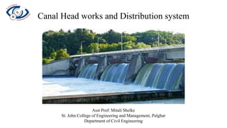
  • 1. Canal Head works and Distribution system Asst Prof: Mitali Shelke St. John College of Engineering and Management, Palghar Department of Civil Engineering
  • 2. A canal is an artificial channel constructed on ground to carry water to the fields either from the river or from a reservoir. Canals can be classified into following ways: 1. Classification based on nature of source of supply: a) Permanent canal b) Inundation canal A canal is said to be permanent when it is fed by a permanent source of supply. The canal is a well made up regular graded channel. It has also permanent masonry works for regulation and distribution of supplies. A permanent canal is also sometimes known as perennial canal when the sources from which canal takes is an ice fed perennial river. Inundation canals usually draw their supplies from rivers whenever there is a high stage in the river. They are not provided with any head works for diversion of river water to the canal. They are however provided with the canal head regulator. The head of the canal has to be changed to some times to suit the changing pattern of river course.
  • 3. 2. Classification based on financial output: a) Productive canal b) Protective canal Productive canals are those which yield a net revenue to the nation after full development of irrigation in the area. Protective canal is a sort of relief work constructed with the idea of protecting a particular area from famine. 3. Classification based on function of the canal: a) Irrigation canal b) Carrier canal c) Feeder canal d) Navigation canal e) Power canal An irrigation canal carries water to the agricultural fields. A carrier canal besides doing irrigation carries water for another canal. Upper Chenab canal is the example of such a canal. A feeder canal is constructed with the idea of feeding two or more canals.
  • 4. 4. Classification based on boundary surface of the canal a) Alluvial canals b) Non alluvial canal c) Rigid boundary canals An alluvial canal is the one which is excavated in alluvial soils such as silt. A non alluvial canal is the one which is excavated in non alluvial soils such as loom clay, hard soil or rock. Rigid boundary canals are those which have rigid sides and rigid base such as lined canal. 5. Classification based on discharge and its relative importance in given network of canals a) Main canal b) Branch canal c) Major distributary d) Minor distributary e) Water course 6. Classification based on canal alignment a) Contour canal b) Watershed canal c) Side slope canal
  • 5. โ€ข Canal alignment: โ€ข A canal has to be aligned in such a way that it covers the entire area proposed to be irrigated with shortest possible length and at the same time its cost including the cost of cross drainage works is minimum. โ€ข A shorter length of canal ensures less loss of head due to friction and smaller loss of discharge due to seepage and evaporation so that additional areas can be brought under cultivation. According to alignment the canals may be classified as: a) Ridge canal b) Contour canal c) Side slope canal โ€ข Ridge canal: Ridge canal also called as watershed canal is aligned along a water shade and runs for most of its length on a watershed. โ€ข When a channel is on the watershed it can command areas on both banks and hence a large area can be brought under cultivation
  • 6. โ€ข When the water shade takes a very sharp loop the canal should be aligned straight to save considerable idle length. โ€ข The area of the loop between the watershed and the canal cannot be irrigated by this canal as there will be higher ground on this side and some other arrangement has to be made if the irrigation is important in that area. โ€ข The canal checks the drainage of this part and the cross drainage work has to be provided. โ€ข Cost analysis should be made before a lining the canal straight to reduce its length. The canal has also to leave watershed to bypass towns and villages situated at the watershed.
  • 7. General considerations for alignment 1. The alignment of the canal should be such as to ensure a) the most economical way of distributing the water to the land b) as high a command as possible and c) minimum number of cross drainage works 2. The alignment of canal on watershed being the most economical is preferred. 3. Length of the main canal from point where it takes off from a river to a point where it mounts on a watershed should be minimum 4. The contour alignment should be changed this way or that way in order to reduce the number of cross drainage works to a minimum 5. The alignment should avoid villages, roads, places of worship and other valuable properties. 6. The alignment should pass through the balanced depth of cutting. If not it should involve minimum depth of cutting on minimum height of filling. 7. The number of acute curves should be minimum 8. The alignment should not be made in a rocky or cracked strata.
  • 8. Alignment of a field channel or water course: Maintenance of field channel is the responsibility of the farmers and its alignment should have following features: 1. They should be laid along field boundaries 2. They should be capable of supplying sufficient water to the tail end 3. Separate field channels should be provided for high and low lands 4. The field channels should not pass through Rocky or cracked strata.
  • 9. Losses in canals: Losses should be properly accounted otherwise lesser quantity of water will be available for cultivation at the tail end. 1. Evaporation losses 2. Transpiration losses 3. Seepage losses 1. Evaporation losses: Depends upon - a) climatic factors such as temperature, humidity and wind velocity. b) kennel factors such as surface area, water depth and velocity of flow. โ€ข Maximum loss occurs in summer when temperatures are high and wind velocities are also high. โ€ข Losses are maximum in unlined canals due to a wider water surface area, shallow water depth and low velocity. โ€ข The average evaporation loss per day may vary between 4mm to 10mm.
  • 10. 2. Transpiration losses: This takes place through lot of vegetation and weed growth along the bank of the canal. This loss forms a extremely small part of total loss. 3. Seepage losses: Seepage losses constitutes a major portion of the loss in an unlined canal. These are due to: a) Absorption of water in the upper layers of soil below the canal bed b) Percolation of water into the water table thus raising the water table. โ€ข If the water table is much lower seepage losses are only due to absorption. โ€ข Percolation losses are always much more than the absorption losses. โ€ข Rate of water loss: Canal losses may be expressed in following methods- 1. As Cumecs per million square metre of the wetted perimeter 2. As a depth of water lost per day over the wetted perimeter 3. As percentage of the canal discharge 4. As percentage per kilometre length of the canal
  • 11. โ€ข In absence of any data the transmission losses may be taken as 2.5 cumecs per million square metre of wetted perimeter for unlined canals and as 0.60 cumecs per million square metre of wetted perimeter for lined canals. โ€ข In UP the loss QL in cumecs per kilometre length of unlined canal is given by โ€ข In Punjab and Haryana the losses in unlined canals in cumecs per million square metre of wetted perimeter is given by: โ€ข The central water power commission recommends following values of losses in unlined canals:
  • 12. โ€ข Losses are sometimes expressed as percentage of total discharge as given below: 1. Main canal and branches : 15% to 20% 2. Distributaries and minors : 6% to 7% 3. Water courses : 17% to 22% โ€ข In Punjab following formula is used for The losses in lined canal in cumecs per million square metres of wetted perimeter. โ€ข As per CWPC and IS: 1745 - 1968 the transmission losses in lined canals can be taken as 0.6 cumecs per million square metres of wetted perimeter.
  • 13. Cross section of irrigation canal: โ€ข A typical and most desired section of canal is shown below: This section is partly in cutting and partly in filling and aims at balancing the quantity of earthwork in excavation with that in filling. โ€ข Sometimes when the natural surface level NSL is above the top of the bank the entire canal section will have to be in cutting and it shall be called as canal in cutting. When the NSL is lower than the bed level of canal the entire canal section will have to be built in filling and called as canal in filling.
  • 14. 1. Side slopes: it should be such that they are stable depending upon the type of the soil. Comparatively steeper slope can be provided in cutting rather than in filling as the soil in the former case shall be more stable. โ€ข 1H : 1V (1 : 1) to 1 ยฝ H : 1V slope in cutting and โ€ข 1 ยฝ H : 1V to 2H : 1V in filling โ€ข The side of channel with silt laiden water gets silted up to a slope of ยฝ : 1 with the passage of time as shown in the figure:
  • 15. 2. Berms: berm is a horizontal distance left at ground level between the toe of the bank and top edge of the cutting. โ€ข The berm is provided in such a way that the bed line and bank line remains parallel. โ€ข If S1 : 1 is slope in cutting and S2 : 1 in filling then Initial berm width = (S2 - S1)d1 โ€ข After the water flows in the channel for sometime the silt gets deposited on the sides giving a slope of ยฝ : 1. The position of the berm changes from ground level to FSL and its width becomes equal to (S2 - ยฝ) y. โ€ข If S2 = 1 ยฝ then final width = y i.e equal to depth of the canal
  • 16. Free board: The margin between FSL and Bank level is known as free board. The amount of free board depends upon the size of the channel. Banks: The primary purpose of banks is to retain water. They can be used as the means of communication and as inspection paths. They should be wide enough so that a minimum cover of 0.5 metre is available above the saturation line. High banks will have to be designed as earth dams.
  • 17. Service roads: Service roads are provided on canals for inspection purposes and may simultaneously serve as the means of communication in remote areas. They are provided 0.4 metre to 1 metre above FSL depending upon the size of the channel. Dowla: As a measure of safety in driving dowlas 0.3 metre high and 0.3 to 0.6 metre wide at top, with side slopes of 1 ยฝ : 1 to 2:1 are provided along the banks. They also help in preventing slope erosion due to rains.
  • 18. Back berm or counter berms: Even after providing sufficient section for bank embankment the saturation gradient line may cut the downstream end of the bank. in such case saturation line can be kept covered at least by 0.5 with the help of counter berms. The strait saturation gradient line may be drawn with the following slopes
  • 19. Spoil banks: When the earthwork in excavation exceeds earthwork in filling even after providing maximum width of bank embankments extra earth has to be disposed of economically. To dispose of this earth by mechanical transport it may become very costly and an economical mode of its disposal may be found out in the forms of collecting the soil on the edge of the bank embankment itself. The soil is deposited in the form of heaps on both banks or any one of the bank. These heaps of soil are discontinued at suitable intervals and longitudinal drains running by their sides are excavated for the disposal of rainwater. Cross drains through the spoil banks may also be excavated if needed.
  • 20. Borrow pits: When earthwork in filling exceeds the earthwork in excavation earth has to be brought from somewhere. The pits which are dug for bringing earth are known as borrow pits. If such pits are excavated outside the channel they are known as external borrow pits and if they are within the channel known as internal borrow pits. The borrow pits should start from a point at a distance more than 5 metres from the toe of small channels, and 10 metre for large channels. The width of the pits โ€˜b' should be less than half the width of the canal โ€˜Bโ€™ and should be dug in the centre. The depth of these pits should be equal to or less than 1 metre.
  • 21. Maintenance of irrigation canals: The problems which are posed by irrigation channel during their use and require constant attention are: 1. Silting of canal 2. Weed and plant growth 3. Failure of weaker banks 4. Hollow created by burrowing animals causing seepage and piping 5. Canal breaches due to piping, overflowing of canal. Remedial measures for the problems discussed above: 1. Silting of canals: Silt deposited reduces the effective canal cross section and carrying capacity of the channel. To prevent too much silt deposition channel should be properly designed to ensure a velocity which neither causes any silting nor scoring in the channel
  • 22. โ€ข Attempt should be made to remove the silt from the entering water to the canal. โ€ข In practice in spite of all the measures taken certain amount of silt definitely enters the canal also a certain amount of silt is added by scouring action within the channel. โ€ข Hence silts should be removed periodically by desilting operations. โ€ข Desilting can be carried out by actually excavating the silt manually (when the canal is dry) or by dredgers (when canal is either dry or running). โ€ข The extent of silting in the canal can be found out from measuring the silt depth over bed bars. โ€ข The excavated silt should not be deposited above the canal banks as the same silt may find its way back into the desilted channel
  • 23. 2. Weed and plant growth: โ€ข Irrigation canals normally get infected with aquatic weed growth. โ€ข The weed growth obstructs the flow of water, reduces the carrying capacity of channel, and hamper the efficiency. โ€ข The weed growth may also sometimes impart harmful qualities to irrigation water. โ€ข Weed growth can be controlled by maintaining higher velocities in canals or sometimes they have to be physically removed from the canal in order to improve the efficiency. โ€ข In newly constructed canals regular inspections should be done to locate any spot where the weed growth has set in. Weeds from such spots should be removed completely so that infestation does not spread. โ€ข In old canals where aquatic weed growth is found suitable mechanical or chemical methods may be employed at early stage as possible.
  • 24. 3. Failure of weaker banks: โ€ข The banks of the canal should be made in full design width and should be maintained at such (as per IS provisions). โ€ข The canal banks get eroded at various places and must be repaired and all cuts and breaches should be filled up with suitable soil and proper tamping. โ€ข When a canal reach runs in filling, the banks are subjected to water pressure. In this case damage can occur to the banks and they should be given extra strength by increasing their sections. โ€ข In order to keep the cost of construction low additional soil for increasing the bank section may be obtained by natural silting process. โ€ข In this a sufficient wider section is provided and a part of it later gets silted forming the additional Bank.
  • 25. 4. Canal breaches: It is an opening or a gap developed in the Canal bank due to erosion of some portion of the bank. When water starts flowing out of such a breach it starts becoming deeper and wider unless remedial measures are taken immediately to plug the breach. The breaches in the canal may be caused due to following reasons: a) Breach due to faulty design or construction of the canal banks b) Breach due to overflow of the canal c) Breach due to seepage or piping d) Breach due to intentional cuts made by cultivators
  • 26. Closure of breaches: โ€ข In small minors and distributaries a breach may be closed by dumping huge quantities of earth simultaneously from both sides of the gap. โ€ข As water of the breech spreads on adjoining land there is usually no outside nearby place to borrow Earth for closing the breach. โ€ข The earth has to be collected either by cutting the outside slope of the existing Bank or from spoil banks or berms of the canal. โ€ข it is essential to store huge quantities of Earth on both sides of the gap before closing the breach โ€ข The closing process should be started from both sides of the breach at the same time. โ€ข In case of bigger canals the above procedure cannot be adopted as use discharge from Canal may wash off the dumped soil. โ€ข It is necessary to reduce the flow through the breach.
  • 27. Canal lining: Necessity: 1. To minimise the seepage losses in Canal 2. to increase the discharge in Canal section by increasing the velocity 3. To prevent erosion of bed and side due to high velocities 4. To retard the growth of weeds 5. To reduce maintenance of canal. Advantages of lining: 1. Prevents seepage loss and does more area can be irrigated by the water saved hence the cost of irrigation is reduced. 2. The lining of canal is an important anti water logging measure is it reduces the seepage to the adjoining land 3. The lining provides smooth surface hence the rugosity coefficient decreases. The resistance to flow also decreases and hence the velocity of flow in the lined canal increases.
  • 28. 4. The increased velocity minimises the losses due to evaporation. 5. The increased velocity helps to provide a narrow cross-section for lined canals. 6. Higher velocity prevents silting of channel 7. Lining makes the bank more stable in light textured soil 8. Lining reduces maintenance cost and possibility of breaching due to increased stability of section. 9. Lining of canal prevents or reduces weed growth 10. Lining of canal increases available head for power generation. 11. Canal lining assures economical water distribution 12. Canal lining prevent water to come in contact with harmful salts during transit
  • 29. Disadvantages of canal lining: 1. Requires heavy initial investment 2. lining being permanent it is difficult to shift the outlets very often 3. It is very difficult to repair the damaged lining 4. A lined channel section is without a berm. Hence the additional safety which berm provides is absent in lined channels.
  • 30. Main types of concrete lining used in India are: 1. HARD SURFACE TYPE LINING: a) Cement concrete Lining b) Shotcrete Lining c) Precast concrete Lining d) Cement Mortar Lining e) Brick Lining f) Stone blocks Lining g) Asphaltic Lining 2. EARTH TYPE LINING: a) Soil cement Lining b) Clay puddle Lining c) Sodium carbonate Lining
  • 31. a) Cement concrete Lining โ€ข It has high initial cost so its use is limited. โ€ข It has excellent hydraulic properties. โ€ข Thickness varies from 5-10cm for M 15 concrete and 7.5 to 15cm for M 10 concrete. โ€ข Earthen banks has self-supporting slope โ€ข Reinforcement is provided if needed. It prevents gap and failure due to grades. It also reduces width of temperature crack. โ€ข Provided in panels of about 3m length. b) Shotcrete lining โ€ข Shotcrete consumes large amount of cement. โ€ข Cement and Sand in the ratio (1:4) is shot at the subgrade through a nozzle. โ€ข Thickness of this type of lining varies from 2.5 to 6.5 cm. โ€ข Shotcrete is also used for repair of old but sound concrete lining.
  • 32. c) Precast concrete Lining โ€ข This consists of precast slabs usually 90cm x 30cm in size. โ€ข Thickness of each slab varies from 5 to 6.5 cm. โ€ข Blocks are manufactured with an interlocking arrangement. โ€ข Slabs are laid on well prepared and compacted subgrade. d) Cement Mortar Lining โ€ข It is usually used as sandwich material between brick layers. โ€ข Thickness for this type of lining is kept from 1 to 4 cm. โ€ข A large amount of cement is consumed in this type of lining and thus it is quite costly. e) Brick Lining โ€ข It consists of a single or double layer of brick masonry. โ€ข The size of brick is restricted to 30x15x5 cm for convenience of handling. โ€ข This type of lining has been used in Punjab on Bhakra and Haveli canals. โ€ข It is hydraulically as efficient as concrete lining. โ€ข In case of failure repair can be done easily
  • 33. f) Asphaltic Lining โ€ข It is a controlled mixture of asphalt and grade aggregate mixed and placed at high temperature of 200โฐC. โ€ข It is covered with 30 cm layer of earth material for protection. โ€ข The mix is placed either by hand or by an equipment similar to that of concrete. g) Soil cement Lining โ€ข In this the mixture in proportion of 90 to 95% soil and 10 to 5% cement is thoroughly mixed dry and is then added with water to raise the moisture content to optimum. โ€ข It is therefore placed on the subgrade and properly compacted. h) Clay puddle Lining โ€ข Clay puddle is produced from clay by first exposing clay to weathering. โ€ข It is then mixed with water to bring it to the saturation and is pugged thoroughly under manโ€™s or cattleโ€™s feet. โ€ข Lining thickness is 30 cm. โ€ข It is then protected by layer of earth material.
  • 34. i) Sodium carbonate Lining โ€ข The mixture consists of clayey soil and sodium carbonate in a proportion of 10% clay and 6% sodium carbonate. โ€ข Thickness is kept as 10 cm. โ€ข This type of canal is used on small canals. j) Stone blocks Lining โ€ข This consists of undressed stone block set in mortar and laid over a prepared subgrade. โ€ข The lining is able to check seepage effectively but has a considerable resistance to water flow. โ€ข Dressed stone block lining is effective but costly.
  • 35. Waterlogging: โ€ข An agricultural land is said to be waterlogged when its productivity or fertility is affected by the high water table. โ€ข The depth of water table at which it tends to make soil water logged and harmful to the growth of plants life depends upon the height of capillary fringe. โ€ข The adverse effects of high water table on the yield of crops also depends upon the nature of crop grown. Effects of waterlogging: 1. Inhibiting activity of soil bacteria 2. Decrease in available capillary water 3. Fall in soil temperature 4. Defective air circulation 5. Rise of salt 6. Delay in cultivation operations 7. Growth of wild flora 8. Adverse effect on community health
  • 36. Causes of waterlogging: 1. Inadequate surface drainage 2. Seepage from canal system 3. Over irrigation of fields 4. Obstruction of natural drainage 5. Obliteration of natural drainage 6. Inadequate capacity for arterial drainage 7. Construction of a water reservoir 8. Natural obstruction to the flow of groundwater
  • 37. Remedial measures: 1. Efficient surface drainage 2. Under drainage by tile drains 3. Reducing percolation from canals 4. Restriction of irrigation 5. Lining of watercourses 6. Removing obstruction in natural drainage 7. Prevention of seepage from water reservoir 8. Depletion of groundwater storage by pumping 9. Changes in crop pattern 10. Adoption of sprinkler method for irrigation.