SlideShare a Scribd company logo
1 of 42
Download to read offline
Mercator Ocean Quarterly Newsletter #27 – October 2007 – Page 1
GIP Mercator Ocean
Quarterly Newsletter
Editorial – October 2007
Manchots Adélie et ocean Austral.
Credits: http://www.institut-polaire.fr
http://www.annee-polaire.fr
Greetings all,
What does your imagination tell you when you think about the Austral Ocean ? Perhaps this place reminds you of the “Roaring
Forties” and the “Screaming fifties”, the drift of the icebergs, the only passage free of ice to go around the earth, an inhospitable
area, the Antarctic continent, penguins… Actually, the Austral Ocean is a keystone for the interocean exchanges of heat,
freshwater and anthropogenic tracers: it is the meeting point of the Indian, Atlantic and Pacific Oceans. It also plays a key role in
the global carbon cycle.
This issue is dedicated to this particular place. It will present to us some of the important oceanographic projects concerning the
Austral Ocean: Flostral, Survostral, GoodHope, the Drake Campaign and analysis done to better understand its dynamic and its
role from model (Drakkar project, …) and observations (ARGO, dedicated campaigns, satellite data sets, …).
Mercator Ocean Quarterly Newsletter #27 – October 2007 – Page 2
GIP Mercator Ocean
The first article, written by Pouget & al., focuses on the performances of one of the global Mercator 1/4° model (PSY3v1) at
Drake Passage by comparing it with in situ data gathered from R.V Polarsten in 2006.
The second one, from Le Sommer & al., presents an overview of some results obtained on the Southern Ocean processes and
climate variability through the use of the Drakkar hierarchy of ocean/ice models.
The next one explains what the Survostral and Flostral projects are and it gathers some results deduced from the data collected
during these campaigns. Authors of this article are Salle JB and Morrow R.
The last one, written by Speich S. and Arhan M., presents the GoodHope project and summarizes some results of the work
done from the hydrographic data sets obtained in the scope of this project.
In this issue, we would also like to approach a central topic on the future of operational oceanography: MyOcean: part of the
GMES European Projet. This subject is introduced in the News pages by Pierre Bahurel.
I hope you enjoy this issue.
Mercator Ocean Quarterly Newsletter #27 – October 2007 – Page 3
GIP Mercator Ocean
Contents
Quarterly Newsletter ..................................................................................................................................... 1 
MyOcean, the EU project for a “marine core service” ..................................................................................... 4 
Performances of Mercator Model (PSY3v1 1/4° showcase products) at Drake Passage ................................... 6 
Monitoring Southern Ocean dynamics with ARGO floats and XBT‐SSS data: the SURVOSTRAL and FLOSTRAL 
projects ....................................................................................................................................................... 12 
Southern Ocean processes and climate variability in the DRAKKAR hierarchy of ocean/sea‐ice models ........ 20 
Good‐Hope / Southern Ocean: A study and monitoring of the Indo‐Atlantic connections (An international co‐
operative project. A process study and a contribution to CLIVAR – Southern Ocean) .................................... 29 
Notebook .................................................................................................................................................... 42 
 
 
Mercator Ocean Quarterly Newsletter #27 – October 2007 – Page 4
MyOcean, the EU project for a “marine core service”
By Pierre Bahurel1
1
Mercator-Ocean, 8/10 rue Hermès, 31520 Ramonville st Agne
In the first half of 2007, Mercator Ocean and its European partners have translated into practical propositions and a 3-
year action plan (the “MyOcean” project) expectations from EU and its Member States for a European “Marine Core
Service”.
Mercator Ocean is leading the “MyOcean” project for a European Marine Core Service.
MyOcean has been proposed to the European Commission (FP7 Space program) to go from existing initiatives in operational
oceanography into a pan-European “marine core service”. The project should start in 2008, for a 3-year duration.
The existence of a European marine core service has been identified in the top three priorities of the EU GMES program for a
European “global monitoring for environment and security” capacity (the two others being land and emergency services). The
GMES Marine Core Service Implementation Group has been clearly defined by EU and Member States expectations. MyOcean
is a direct answer to this political priority.
The strength of this collective answer of European key players in oceanography is a demonstration of maturity of European
oceanography. We knew from previous EU and international works that it was worth doing it; we know now that it is doable and
key players are ready to commit themselves.
For GMES and for the European oceanography, MyOcean is without any doubts the best opportunity to get the “marine core
service” requested to enhance marine services development in the Member States (both public and private sectors) as well as
European agencies, and strengthen the European voice and role at international level.
Within the coordination of MyOcean, within its responsability for the European global ocean component and its regional
expectations, Mercator Ocean is deeply involved to ensure the success of an operational pan-european capacity, fully
integrated in user value chains.
What is MyOcean about?
With the GMES program and its Marine Core Service (MCS) fast-track, the European community (EC) is consolidating past
efforts in pre-operational ocean monitoring and forecasting capacity in Europe through precursors run in FP6 MERSEA and
BOSS4GMES or GSE MARCOAST and POLARVIEW.
The MyOcean consortium as proposed to EC (69 partners over 28 countries) proposes to deliver a pan-European MCS product
and service portfolio through a robust and optimised ocean monitoring and forecasting core infrastructure. The validation
process planned through a 3-year experience enables to organise the user-driven service up to pre-operational phase with
propositions addressing the MCS long-term roadmap.
Thanks to the existing community and efficient networks like EuroGOOS, MyOcean provides core information on the ocean in
all areas of benefit identified by the MCS Implementation Group to key categories of users: the EU agencies (EEA, EMSA, ...),
the Member States service providers (Met offices, coast guards, ...), the Intergovernmental bodies or their members (OSPAR,
HELCOM, ...).
The Global ocean and the European seas are monitored with an eddy-resolving capacity, based on assimilation of space and in
situ data into 3D models, representing the physical state, the ice and the ecosystems of the ocean; in the past (25 years), in
real-time and in the future (1-2 weeks). The high-quality products rely on the aggregation of European modelling tools and the
scientific methods are produced through a strong cross-fertilization between operational and research communities.
Observations, model-based data, and added-value products are generated – and enhanced by dedicated expertise – by the
following production units:
• Six Thematic Assembly Centers, each of them dealing with a specific set of observation data: Sea Level, Ocean
colour, Sea Surface Temperature, Sea Ice, In Situ data and Wind data,
• Seven Monitoring and Forecasting Centers to serve the Global Ocean, the Arctic area, the Baltic Sea, the Atlantic
North-West shelves area, the Atlantic Iberian-Biscay-Ireland area, the Mediterranean Sea and the Black sea.
Intermediate and final users discover, view and get the products by means of a central web desk, a central re-active manned
service desk and experts within regional services. Routine/bulk delivery, expert forecaster interpretation, human support for
emergencies, response to specific queries (non-emergency) and user training are the proposed types of service.
Mercator Ocean Quarterly Newsletter #27 – October 2007 – Page 5
MyOcean, the EU project for a “marine core service”
In addition, the MyOcean consortium commits to provide users with operational and qualified products and services. Therefore,
certifications thoroughly the whole operational chains are undertaken by a Quality Management System with dedicated Key
Performances Indicators and Metrics. The operational commitments – in compliance with user’s requirements – are defined in
contractual agreements between data suppliers, production units and users at the levels of procurement, production and
service, respectively.
For sake of integration and assessment of services, several operational downstream services are implemented for a full
operational capability demonstration in oil spill pollution monitoring, sea ice monitoring, ecosystem health and marine
environment strategy. A strong involvement from key users enables the qualification of the MyOcean products portfolio to
ensure a complete readiness towards long-term operational oceanography services in European waters.
Project status (December 2007)
The proposal has been evaluated in the second half of 2007 by the European Commission, and will be discussed in the first half
of 2008. The project is plan for a 3-year period, starting in 208 and ending in 2011.
Mercator Ocean Quarterly Newsletter #27– October 2007 – Page 6
Performances of Mercator Model (PSY3V1 1/4° showcase products) at Drake Passage
Performances of Mercator Model (PSY3v1 1/4° showcase products)
at Drake Passage
By Guillaume Pouget1
, Felix Stoehr* and Christine Provost1
1
LOCEAN, UMR 7159, UPMC, T45-55, 5E, 4 place Jussieu, 75259 Paris cedex 05
* Now at ESO, Karl-Schwarzschild-Strasse, D-85748 Garching bei München, Allemagne
Introduction
We compared the Mercator showcase outputs of the 1/4° global Mercator system (PSY3v1) and the in situ data gathered from
R.V. Polarstern in the Drake Passage in January-February 2006. We identified limitations and skills. We then analysed one year
of surface velocities in sight of the recovery, in April 2008, of the moorings installed in January 2006.
Comparison between the Mercator showcase outputs and the Drake 2006 data
set
The PSY3v1 1/4 ° showcase outputs are interpolated from the “native” outputs. They have a 1/4 degree horizontal resolution, 43
levels in the vertical and a temporal resolution of 1 day.
The data gathered during the cruise ANTXXIII-3 consist of hydrographic and velocity measurements. The data were obtained
during two crossings of the Drake Passage below Jason-1 ground track 104: leg 1 (Jan 16 to Jan 26 2006, southward) and leg 2
(from Jan 31 to Feb 6, northward) (Figure1). The variables that can be compared are temperature, salinity, and related
parameters (density, potential vorticity) and horizontal velocity.
Moorings and stations on the way to Antarctica Stations on the way back to Punta Arenas
Leg 1: Jan 16 – Jan 26 2006 Leg 2: Jan 31 to Feb 6 2006
Figure 1
Hydrological stations from R.V. Polarstern ANTXXIII/3 cruise across Drake Passage, in red. M1 to M10 are the moorings to be
recovered in April 2008. Moorings M1 through M5 will be redeployed.
Mercator Ocean Quarterly Newsletter #27– October 2007 – Page 7
Performances of Mercator Model (PSY3V1 1/4° showcase products) at Drake Passage
The Antarctic Circumpolar Current (ACC) is closely associated with three deep-reaching oceanic frontal systems : from North to
South the Subantarctic Front (SAF), the Polar Front (PF), the Southern ACC Front (SACCF) (Orsi et al. 1995). The mean
location of these deep fronts reflects the bottom topography (Figure 2).
Figure 2
Mean location of the main fronts in Drake Passage (from Orsi et al., 1995) superimposed on the bottom topography; Jason-1
ground track 104 is in red. From North to South: SAF, PF, SACCF. Bottom topography: WSR stands for the West Scotia Ridge
which separates the Yaghan Basin to the north from the Ona Basin to the south.
Temperature and salinity gathered during the cruise are plotted together with corresponding Mercator PSY3v1 values on
diagrams that depict water masses distribution in the Drake passage (Figure 3).
PF
SAF
SACCF
track
104
Yaghan Bassin
Ona Bassin
WSR
Mercator Ocean Quarterly Newsletter #27– October 2007 – Page 8
Performances of Mercator Model (PSY3V1 1/4° showcase products) at Drake Passage
Figure 3
Temperature-Salinity diagrams. Observations in green, Mercator ouputs in blue. leg 1(left) and leg 2 (right). The main water
masses are indicated: Subantarctic Zone Water (SAZW), Polar Front Zone Water (PFZW), Antarctic Surface Water (ASW),
Winter Water (WW), Upper Circumpolar Deep Water (UCDW), Lower Circumpolar Deep Water (LCDW) and Antarctic Bottom
Water (ABW)
Mercator showcase outputs are missing a few water masses, particularly those located in the Ona Basin south of the Polar
Front, namely, the ASW, the WW, and the waters south of the ACC (south of the SBdy). Mercator showcase outputs are also
missing the very densest ABW, probably because showcase outputs do not have the deepest levels.
Sections of individual parameters obtained with the in situ vertical profiles undersampled to match the Mercator resolution were
compared then to those obtained from the showcase products interpolated to the time and location of each hydrographic station.
On the salinity sections, the positions of the fronts correspond to the positions of the gradients; in the model the SAF is located
too north, whereas the PF is quite well located (Figure 4).
Figure 4
Salinity during leg 1: Mercator showcase outputs (left) and observations (right).
ABW
UCDW
SAZW
WW
South of ACC
ASW
PFZW
SAZW
WW
UCDW
ABW
ASW
PFZW
SAF
SAF
PF
PF
Mercator Ocean Quarterly Newsletter #27– October 2007 – Page 9
Performances of Mercator Model (PSY3V1 1/4° showcase products) at Drake Passage
The model SAZW between 55.5 and 56°S and between 200 to 1000 m is saltier than the data SAZW by 0.2 (Figure 5). In the
south of the section, the ASW and the WW are missing in the model, and, as a consequence, Mercator waters are saltier by
more than 0.2 between 57°S and 59°S around the depth of 100 m.
Figure 5
Salinity differences between Mercator showcase ouputs and the in situ vertical profiles.
Sections of potential temperature and density show that in the north of the section, water masses are too cold (by -1.8 °C), and
too dense by 0.1 σθ units in the model (not shown). In the south of the section, due to the absence of ASW and WW in the
model, the waters are warmer by 2.5°C. Similar conclusions are drawn when examining leg 2.
From mid-leg1 to mid-leg2 (separated by approximatively 10 days), the mesoscale evolution can be observed at depth. Figure 6
shows that, compared to in situ data, Mercator showcase outputs are able to describe the water masses evolutions with a
qualitative good agreement.
Figure 6
Differences between leg 2 and leg 1 in density (σθ units). Left: degraded CTD data to the Mercator resolution, right: Mercator
showcase outputs.
Analysis of the Mercator velocity outputs during the year 2006, in sight of the
moorings recovery in April 2008
The moorings installed along Jason-1 ground track 104 in 2006 (Figure 1) will be recovered in April 2008, and provide 2-year-
long velocity time series at different depths. In that perspective, we examined the Mercator PSY3v1 velocities along track 104,
during a period of 351 days (from January 14 2006 to December 31 2006).
As we used the showcase outputs (already re-interpolate products), the calculation of integrated quantities such as transport is
inaccurate. Thus, we focused on the surface velocity (Figure 7). The SAF is found around the latitude of 55.5°S and the PF
around 57.5°S. The SACCF is splitted in two branches 59°S and 60.2°S with smaller intensities (Barré et al., 2007). The
Mercator Ocean Quarterly Newsletter #27– October 2007 – Page 10
Performances of Mercator Model (PSY3V1 1/4° showcase products) at Drake Passage
locations of the four fronts change with time, especially that of the PF. The most intense velocities are found in the SAF, while
negative velocities are associated with recirculations in the Drake Passage.
Figure 7
Mercator cross track velocity along Jason ground track 104 as a function of time. Units in m.s
-1
. Time is in days starting January
14 2006.
A wavelet analysis of the surface velocities was performed. The example in Figure 8 (point located at latitude 55.3 S in the SAF)
shows a power peak around a period of 40 days; this peak can be explained in terms of shelf waves. Such waves are expected
to have a period comprised in the range 30-70 days. The bottom slope is the restoring force.
Figure 8
Wavelet analysis of the cross track surface velocity at 55.3 S.
Mercator Ocean Quarterly Newsletter #27– October 2007 – Page 11
Performances of Mercator Model (PSY3V1 1/4° showcase products) at Drake Passage
Figure 9
Significant periods as a function of latitude along track 104. Blue scale to the left: periods above the level of confidence (in
days). Green scale to the right: bathymetry along the track in meters.
Periods in the interval 30-70 days are found on the continental slope then they disappear when the bathymetry becomes flat,
and reappear along the West Scotia Ridge. In the Ona Basin, such periods are found only at a few locations.
Conclusion
A comparison between the data obtained in the Drake Passage during the 2006 cruise and the Mercator showcase outputs
shows that the model captures well the structure changes between the two legs of the cruise (in 10 days). However, water
masses south of the Polar Front such as the Antarctic Surface Water and Winter Water are not present in the model : this may
be due to the absence of a prognostic sea-ice model in PSY3v1, and the subsequent water mass formation. In the north, the
Subantarctic Zone Water is too salty and too cold thus too dense. One year of surface velocities across Jason-1 track 104 were
analysed, revealing the presence of shelf waves along slopes. We shall now use the “native” outputs of the model, to examine
integrated quantities such as transport across the Drake Passage.
References
Orsi, A.H., T. Withworth III et W.D. Nowlin Jr. (1995). On the meridional extent and fronts of the Antarctic Circumpolar Current.
Deep Sea Research, Part I 42:641-673.
Barré N., C. Provost, N. Sennechael and J-H. Lee, 2007: Circulation in the Ona Basin, Southern Drake Passage. J. Geophys.
Res., in press
Mercator Ocean Quarterly Newsletter #27– October 2007 – Page 12
Monitoring Southern Ocean dynamics with ARGO floats and XBT-SSS data
Monitoring Southern Ocean dynamics with ARGO floats and XBT-
SSS data: the SURVOSTRAL and FLOSTRAL projects
By Jean-Baptiste Sallee and Rosemary Morrow1
1
LEGOS, 14 avenue Edouard Belin, 31400 Toulouse
Introduction
The Southern Ocean is a key region in the understanding of the global ocean circulation and its role on climate. The strong wind
forcing in the “Roaring Forties” and the “Screaming fifties”, coupled with the intense heat loss surrounding the ice-covered
Antarctic continent, drives an important overturning circulation which affects the whole water column, from the surface waters
down to the bottom waters at 5-6 km depth. Indeed, the Southern Ocean is the keystone for the global ocean circulation,
providing the major link between the Pacific, Atlantic and Indian Oceans. This region acts like a pump house for the other major
oceans, drawing deep waters south towards the Antarctic Circumpolar Current (ACC), where they are modified and re-exported
north as mode and intermediate waters (500 – 1500 m depth) and bottom waters (> 4000 m depth).
Despite its key role in the global ocean circulation, the Southern Ocean has always suffered from a lack of in-situ observations,
due to its remote and hostile environment, far from regular shipping lanes. The few historical measurements were mostly
available in summer, and provided only a large-scale vision of the mean ocean structure. In this International Polar Year, we
would like to review the scientific results from two long-term Southern Ocean in-situ monitoring programmes: SURVOSTRAL
and FLOSTRAL. Both of these projects contribute near real time in-situ observations for assimilation in the MERCATOR
operational system.
SURVOSTRAL is an international collaborative programme between France, Australia and the US, established in 1992 to
monitor the long-term upper ocean temperature evolution and the sea surface salinity (SSS) evolution, across the Southern
Ocean. The programme is based on repeat high-density XBT profiles and underway sampling of SSS, undertaken 6-10 times
per year from October through to March, between Hobart, Australia (43°S), and the French Antarctic Base at Dumont Durville
(66°S) (see Figure 1). This high-density repeat line is adjacent to the WOCE SR3 CTD repeat section, which has obtained 7 full-
depth CTD sections between Hobart and Antarctica over the same period, and in all seasons. The 15 years of XBT-SSS
observations have allowed us to calculate interannual baroclinic transport variations (Rintoul et al., 2002) and subsurface
temperature anomalies (Sokolov and Rintoul, 2003), study the mixed layer evolution in the Subantarctic Zone (Rintoul and Trull,
2002) and in the Antarctic Zone (Chaigneau et al. 2004), address the role of mesoscale eddies in transferring heat and salt
across the Subantarctic Front (Morrow et al., 2004) and the eddy kinetic energy response to variations in the mean jet (Morrow
et al., 2003). In this article we will review a recent study on the subsurface temperature changes which are contributing to the
decadal sea level rise observed in this part of the Southern Ocean (Morrow et al., 2007).
Mercator Ocean Quarterly Newsletter #27– October 2007 – Page 13
Monitoring Southern Ocean dynamics with ARGO floats and XBT-SSS data
Figure 1
Positions of the ARGO profiling floats that are active on 7-Nov-2007 (in red, from argo.ocean.fsu.edu). Weekly mean position of
the Polar Front (PF) is in light blue, and the Subantarctic Front (SAF) in blue, after Sallée et al. (2007a). The weekly position of
the sea ice extent is in cyan-blue. The SURVOSTRAL XBT-SSS line is marked in black bold, near 150°E. The region of
FLOSTRAL ARGO float deployment in 2003-2004 is marked in green. No FLOSTRAL floats are still active on 7-Nov-2007.
The FLOSTRAL project is a French contribution to the international ARGO program, which aims to seed the world’s ocean with
profiling floats every 300 km. During FLOSTRAL, 30 profiling PROVOR floats were launched in the southern Indian Ocean in
2003 and 2004 (see Figure 1). The ARGO programme has revolutionised Southern Ocean observations. Since 2004, hundreds
of ARGO floats have been deployed south of 25°S, providing 78000 new vertical profiles of temperature and salinity. Four years
of ARGO profiles have effectively doubled the number of hydrographic observations available in the Southern Ocean. The
ARGO observations are also more regularly positioned and cover all seasons (see Figure 2, from Sallée et al., 2007a). So for
the first time we can monitor the ocean dynamics in winter, the period when most of the deep and intermediate waters form.
These ARGO data have allowed us to develop a new high-resolution climatology with data more equally distributed in all
seasons (Sallée et al., 2007a). Based on the mean characteristics from this climatology, and the variable sea level component
from altimetry, we have also developed a technique for monitoring the weekly movement of the main polar fronts, and analysing
their response to atmospheric forcing (Sallée et al., 2007a). A new cross-stream eddy diffusion parameter has also been
derived for the Southern Ocean from 15 years of surface drifters (Sallée et al., 2007b). This article will review two recent studies
using ARGO floats and satellite observations to examine Subantarctic mode water formation, in the southeast Indian sector
(Sallée et al., 2006) and in a circumpolar sense (Sallée et al., 2007c).
Mercator Ocean Quarterly Newsletter #27– October 2007 – Page 14
Monitoring Southern Ocean dynamics with ARGO floats and XBT-SSS data
Figure 2 (left)
Monthly and (right) spatial percentage of ARGO profiles from 2002-2007 compared to historical hydrographic profiles collected
over the last 20 years, based on gridded one degree binned statistics. ARGO profiles contribute greatly in winter, and in the
centre of the ocean gyres, far from the coasts.
SURVOSTRAL project: Subsurface temperature changes contributing to
Southern Ocean sea level rise
Recent studies on global sea level rise based on Topex-Poseidon satellite altimetry data have noted a strong increase in sea
level in various parts of the Southern Ocean (Figure 3a) over the period 1993-2003 (Lombard et al., 2005). The dynamical
processes governing the sea level rise are not well understood. Different authors have calculated the steric expansion in the
upper 700 m from global in-situ data (Guinehut et al., 2004; Willis et al., 2004; Ishii et al., 2005) and found that it explains only
50-60% of the observed global sea level rise. They attribute the other 40-50% to ocean mass changes. The difference between
the TOPEX altimetric sea level rise and the steric expansion over the upper 700 m depth is shown in Figure 3b. The largest
differences occur in the Southern Ocean. The difference is sea level rise could be due to the barotropic response to variations in
the wind forcing (e.g. Vivier et al., 1999), mass changes from freshwater input (e.g. more precipitation or ice melt), or from
deeper steric changes from warming or freshening at deeper ocean levels.
Mercator Ocean Quarterly Newsletter #27– October 2007 – Page 15
Monitoring Southern Ocean dynamics with ARGO floats and XBT-SSS data
Figure 3
Global distribution of sea level rise (in mm/yr) from (top panel) Topex-Poseidon altimetric observations over 1993-2003; (bottom
panel) difference map of Topex – ARMOR 0/700dB in-situ data projection (after Lombard et al., 2005). The study region is
outlined in black.
Morrow et al. (2007) have examined the cause of the observed sea level rise in the region south of Australia, using 13 years of
repeat hydrographic data from the WOCE-SR3 sections, and the SURVOSTRAL XBT and surface salinity data. The XBT and
CTD hydrographic data show a poleward shift in the position of the Subtropical and the Subantarctic Fronts over the period
(Figure 4a, b). In the Antarctic Zone, the Antarctic Surface Water has become warmer and fresher, and the Winter Water tongue
has become warmer, fresher, thinner and shallower.
Mercator Ocean Quarterly Newsletter #27– October 2007 – Page 16
Monitoring Southern Ocean dynamics with ARGO floats and XBT-SSS data
Figure 4
Upper panel: Mean XBT temperature change between the early 1990s (1992-1996) and 2000-2004, calculated over 0-500 m
depth, from Tasmania at 43°S to Antarctica at 66°S. The Subantarctic Zone (SAZ) and Antarctic Zone (AZ) discussed in the text
are delimited by the vertical black lines. The position of the STF and SAF are marked. Middle panel: Mean Temperature
change (left) and salinity change (right) calculated from WOCE SR3 CTD sections over 0-2000 m depth. The difference shows
the most recent section in Nov 2001 minus a composite of 3 summer sections during the early 1990s (Mar 1993, Jan 1994, Jan
1995). Lower panel : Steric height change calculated from these CTD sections, i;e. the steric height change from Nov 2001
minus the mean of Mar 1993 - Jan 1994 - Jan 1995, using a 500 db reference level versus a 2000 dB reference level. The
strong negative anomaly at 50°S is due to a cold meander at the SAF in Nov 2001. Note the southward movement of the STF in
the upper panel’s XBT data shows a temperature anomaly to 400 m, whereas the CTD data show another strong temperature
anomaly between 600 – 1500 m due to changes in the deeper branch of the Tasman outflow. The deeper warming in the
Antarctic Zone from 52-62°S contributes to a steric height increase of ~3 cm over the 10 years, equivalent to the observed sea
level rise from altimetry.
The 82 XBT sections used in the study provide reliable statistics over the period, but are limited to the upper 500 m depth.
These upper ocean temperature changes account for only part of the altimetric sea level rise. The CTD sections show similar
upper ocean changes, but the deeper layers are also warmer and slightly saltier (Figure 4b) and the trend in observed sea level
can be explained by steric expansion over the upper 2000 m (Figure 4c). A simple Sverdrup transport model shows how large-
scale changes in the wind-forcing, related to the Southern Annular Mode, may contribute to the deeper warming south of the
Polar Front (Morrow et al., 2007).
Unfortunately, the deeper 700-2000 m changes are monitored with a limited number of CTD sections, and only one section is
available in the later 2000-2004 period (during November 2001). So synoptic variability (e.g; mesoscale frontal movements) can
impact on these results. A new SR3 CTD section will be undertaken in January 2008 which combined with the ongoing ARGO
Mercator Ocean Quarterly Newsletter #27– October 2007 – Page 17
Monitoring Southern Ocean dynamics with ARGO floats and XBT-SSS data
profiles, will provide information on the post 2004 deeper temperature and salinity changes. Monitoring these deeper changes is
necessary for the higher latitudes where climate variations impact more rapidly on the intermediate and deep waters. ARGO,
combined with repeat XBT and CTD lines, will enormously aid our understanding of the upper ocean changes after 2000.
FLOSTRAL project: Using ARGO floats to study Subantarctic mode water
formation
This study focuses on the formation of mode waters, which are a large volume of water formed in the deep winter mixed layers
on the northern side of the ACC. At the end of each winter, these mode waters are subducted and then circulate around 600 m
depth within the subtropical gyres, carrying with them the climate signature, nutrients and carbon that were obtained during their
formation period. They are an important indicator of climate change and carbon uptake. With the new ARGO observations, we
have been able to precisely monitor their winter formation sites for the first time (Figure 5). At large scales, their winter
temperature evolution is mainly governed by cooling from air-sea fluxes and the wind-driven Ekman transport across the ACC
(Sallee et al., 2006, 2007c). However, in certain key regions where the flow is constrained by bathymetry, the energetic eddy
field also contributes to diffusing heat across the formation region, and modifying the deep winter mixed layer convection (Sallee
et al., 2006, 2007b, 2007c).
Figure 5
Winter mixed layer depth in the Southern Ocean from a combination of Argo (from 2002-2007) and ship data.
Strong eddy diffusion occurs, for example, upstream of the Kerguelen Plateau, where the bathymetry forces the SAF
northwards in close contact with the Agulhas Retroflection. In this zone, both the eddy diffusion coefficient and the meridional
temperature gradients are strong (Sallée et al., 2006, 2007b, 2007c). The strong eddy diffusion and mixing is also apparent in
the subsurface ARGO profiles between Crozet and Kerguelen (Figure 6). In the region between Crozet and Kerguelen Plateau
from 50-70°E (in blue on Figure 6), the mesoscale eddies induce strong interleaving and mixing between the warmer subtropical
water masses of the Agulhas (in red) and the cooler Polar Frontal Zone waters (in black). This helps break the strongly stratified
Agulhas waters, so that the downstream water masses (in cyan) have become cooler, fresher, and slightly denser. This mixing
occurs from the surface waters, right down through the mode and intermediate density classes and even reaching the upper
circumpolar deep water ~27.4 kg/m
3
. This “destabilisation” of the stratified Subantarctic waters allows the deep winter mixed
layers to form downstream, as seen in Figure 5. Sallée et al. (2007c) have shown that the eddy diffusion terms are small in a
circumpolar average, but can be locally important, in key regions such as around Kerguelen Plateau, downstream of New
Zealand and Drake Passage, and downstream of the mid-Pacific Fracture Zone.
Mercator Ocean Quarterly Newsletter #27– October 2007 – Page 18
Monitoring Southern Ocean dynamics with ARGO floats and XBT-SSS data
Figure 6
Temperature-salinity structure upstream and downstream of the Kerguelen Plateau from a composite of 2 ARGO floats (WM0
No. 1900042 and No.1900164). (upper panel) Position map of the analysed profiles. Colours are linked with the T–S plot (lower
panel). The black star corresponds to profiles from the south of the SAF, red profiles are upstream in the Agulhas Retroflection,
blue are in the SAZ between Crozet and Kerguelen, and cyan are downstream of Kerguelen. Temperature in °C, salinity in psu.
These studies have revealed the complexities in terms of spatial and temporal distribution of the mode water characteristics
during their formation. Our next step is to understand how these mode waters circulate and modify the dynamics and heat
content of the subtropical gyres over periods of 5-10 years. The ongoing ARGO profiling float programme will provide the key
tool for monitoring these longer term changes, allowing us to better understand the “beating heart” within the subtropical ocean
circulation.
References
Chaigneau A, Morrow R, 2002. Surface temperature and salinity variations between Tasmania and Antarctica, 1993-1999.
Journal of Geophysical Research – Oceans, 107 (C12): Art. No. 8020.
Chaigneau, A., R. M. Morrow, and S. R. Rintoul, 2004. Seasonal and interannual evolution of the mixed layer in the Antarctic
Zone south of Tasmania. Deep-Sea Research I, 51/12, 2047-2072.
Guinehut, S., P.Y. Le Traon, G. Larnicol and S. Philipps. Combining Argo and remote-sensing data to estimate the ocean three-
dimensional temperature fields – a first approach based on simulated observations. J. Mar. Sys., 46, 85-98, 2004.
Ishii, M., M. Kimoto, K. Sakamoto and S.I. Iwasaki, 2005. Steric sea level changes estimated from historical ocean subsurface
temperature and salinity analyses, J. Oceanography, submitted.
Lombard A., Cazenave A, Le Traon P.Y. and M. Ishii, 2005. Contribution of thermal expansion to present-day sea level change
revisited, Global and Planetary Change, 47, 1-16.
Mercator Ocean Quarterly Newsletter #27– October 2007 – Page 19
Monitoring Southern Ocean dynamics with ARGO floats and XBT-SSS data
Morrow, R., Valladeau, G., and Sallee, J. (2007). Observed subsurface signature of Southern Ocean decadal sea level rise.
Prog. Oceanogr. (in press).
Morrow R, Brut A, Chaigneau A, 2003. Seasonal and interannual variations of the upper ocean energetics between Tasmania
and Antarctica. Deep-Sea Research I, 50, 339-356.
Morrow, R. M., J.-R. Donguy, A. Chaigneau and S. R. Rintoul, 2004. Cold-core anomalies at the Subantarctic Front, south of
Tasmania. Deep-Sea Research I, 51, 1417-1440.
Rintoul, S. R. and T. W. Trull, 2002. Seasonal evolution of the mixed layer in the Subantarctic Zone south of Australia. Journal
of Geophysical Research, 106, 31,447-31,460.
Rintoul, S. R., S. Sokolov, and J. Church, 2002. A six year record of baroclinic transport variability of the Antarctic Circumpolar
Current at 140°E, derived from XBT and altimeter measurements. Journal of Geophysical Research – Oceans, 107 (C10):
art.no. 3155.
Sallee, J., Speer, K. and Morrow, R. (2007a). Southern ocean fronts and their variability to climate modes. J. of Climat. (in
press)
Sallee, J., Morrow, R., Speer, K., and Lumpkin, R. (2007b). An estimate of Lagrangian eddy statistics and diffusion in the mixed
layer of the Southern Ocean. J. Mar. Res. (submitted)
Sallee, J., Morrow, R., and Speer, K. (2007c). Eddy heat diffusion and Subantarctic Mode Water formation. Geophys. Res. Lett.
(submitted)
Sallee, J., Wienders, N., Morrow, R., and Speer, K. (2006). Formation of Subantarctic mode water in the Southeastern Indian
Ocean. Ocean Dynamics, 56 :525–542.
Sokolov, S. and S. R. Rintoul, 2002: The structure of Southern Ocean fronts at 140E. Journal of Marine Systems, 37, 151-184.
Sokolov, S. and S. R. Rintoul, 2003: The subsurface structure of interannual temperature anomalies in the Australian sector of
the Southern Ocean. Journal of Geophysical Research - Oceans, 108 (C9): Art. No. 3285.
Sokolov, S. and S. R. Rintoul, 2007. Multiple jets of the Antarctic Circumpolar Current south of Australia. Journal of Physical
Oceanography, 37, 1394-1412.
Willis, J.K., D. Roemmich, and B. Cornuelle, 2004. Interannual variability in upper-ocean heat content, temperature and
thermosteric expansion on global scales, J. Geophys. Res., 109, C12036, doi:10.1029/2003JC002260.
Vivier, F., K.A. Kelly and M. Harismendy,2005. Causes of large-scale sea level variations in the Southern Ocean: Analyses of
sea level and a barotropic model. J. Geophys. Res., 110, C09014, doi:10.1029/2004JC002773, 2005
Mercator Ocean Quarterly Newsletter #27 – October 2007 – Page 20
Southern Ocean processes and climate variability in the DRAKKAR hierarchy of ocean/sea-ice models
Southern Ocean processes and climate variability in the DRAKKAR
hierarchy of ocean/sea-ice models
By Julien Le Sommer1
, Bernard Barnier1
, Laurent Brodeau1
, Aurélie Duchez1
, Mélanie Juza1
,
Gurvan Madec2
, Pierre Mathiot1
, Jean-Marc Molines1
, Thierry Penduff11
and Anne-Marie
Treguier3
1
LEGI, BP 53X, 38041 Grenoble cedex 09
2
LOCEAN, Université Paris 6, 4 Place Jussieu, Paris 75252 cedex 05
3
LPO, B.P. 70, 29280 Plouzané
Introduction
In recent years, the DRAKKAR modeling group (see http://www.ifremer.fr/lpo/drakkar) has put significant effort in extending its
initial focus from the North Atlantic and Nordic Seas toward the global ocean. This extension was initially motivated by the
similarity of the scientific questions between different oceanic basins regarding the processes controlling water mass formation
and variability on seasonal to decadal time scale. This also comes from the fact that common tools are needed to tackle these
scientific questions, namely global model configurations. This effort has yielded a set of coordinated scientific activities
concentrated on the Southern Ocean within the DRAKKAR consortium. Some of these activities are reported in the present
article.
Being a key element of the climate system, the Southern Ocean is still a challenging topic for ocean modelers with its sparse
observations and the wide range of scales involved in its dynamics. In this context, the DRAKKAR group aims at understanding
the mechanisms involved in climate variability in the Southern Ocean and at improving the ability of the next generation of
ocean climate models to represent those mechanisms. More precisely, our activities focus on understanding (i) the dynamics
and the variability of the Antarctic circumpolar current (ACC), (ii) the mechanisms involved in the life cycle of Antarctic bottom
waters (AABW) and (iii) those involved in the life cycle of intermediate and mode waters (AAIW and SAMW).
We believe that meeting those objectives requires interplay between observations, theoretical work and “realistic” modeling. In
order to foster such interactions, the DRAKKAR project produces coupled ocean/sea-ice hindcast simulations of the past 50
years with a hierarchy of global and regional models of various horizontal resolutions from 2° to 1/4°. Hereafter, we give a
survey of recent developments related to the Southern Ocean objectives of the DRAKKAR project including the key
improvements of model configurations, the validation strategy and the first scientific results.
Key improvements of the DRAKKAR hierarchy of models
The base DRAKKAR model hierarchy consists of global configurations with horizontal resolutions at the equator ranging from 2°
to 1/4 °: namely ORCA2, ORCA1, ORCA05 and ORCA025. ORCA025 is a joint MERCATOR/DRAKKAR development project.
The MERCATOR component is currently running in operational mode. These configurations are sharing the same type of
tripolar grid, with an isotropic Mercator mesh in the Southern Hemisphere. As an example, at 60°S ORCA025 has ~14km
horizontal resolution in both the zonal and the meridional direction. In order to meet its scientific objectives regarding the
Southern Ocean, the DRAKKAR group has also implemented two regional model configurations to simulate the global ocean
south of 30°S. These two model configurations, namely PERIANT025 and PERIANT05, with 0.25° and 0.5° horizontal resolution
respectively, are used for model development, sensitivity studies and regional scale studies. In addition, several model
developments have also significantly improved our modeling capabilities in the Southern Ocean. The most striking improvement
is due to a new momentum advection scheme, which effect on the mean path of the ACC has been reported by Barnier et al.
(2006). The mechanisms involved in this sensitivity have been described in detail by Le Sommer et al. (2007) and Penduff et al.
(2007). Some other significant improvements regarding the Southern Ocean are detailed in the following sections.
Improvement of the mixed layer with a new TKE scheme
The summer mixed layer was generally too shallow in model configuration based on NEMO. This bias can reduce the ability of
the model to represent adequately the formation of mode waters in the ACC belt. A modified TKE scheme (Madec, 2006) has
been included in our model configurations. The new TKE scheme has an enhanced vertical penetration of the turbulent kinetic
energy. It accounts for the effect of surface waves and includes a parameterization of the effect of the Langmuir cells on vertical
mixing. A series of tests has been carried out with ORCA025 and the climatology of de Boyer Montegut et al. (2004) has been
used to measure the impact of the new TKE scheme. This is shown in Figure 1, which compares the mixed layer depth in
January in two model runs (with and without the new TKE scheme) with the climatology of de Boyer Montegut et al. (2004). As
expected the new TKE scheme increases the summer mixed layer, bringing its value closer to the climatology. Nevertheless,
Mercator Ocean Quarterly Newsletter #27 – October 2007 – Page 21
Southern Ocean processes and climate variability in the DRAKKAR hierarchy of ocean/sea-ice models
the DRAKKAR model configurations displays a bias in the winter mixed layer, being usually too deep, which is presumably due
to the thermal forcing. Investigations are being conducted to reduce this bias.
Figure 1
Southern hemisphere summer mixed layer depth (in meter) from the climatology by de Boyer Montegut (2004) (top panel), from
run ORCA025-G42 without the new TKE scheme (second panel) and from run ORCAO25-G43b with the new TKE scheme
(bottom panel).
Downscaling and parameterization of katabatic winds
Because sea-ice plays an essential role in ocean ventilation in the Southern Ocean (see e.g. Saenko et al., 2002), much effort
has been put on improving the representation of sea-ice in the DRAKKAR hierarchy of models. Katabatic winds are important in
coastal sea-ice formation and dynamics along the Antarctic coast. It is the main factor leading to the formation of coastal
polynya. Still, atmospheric reanalyses poorly represent katabatic winds. This is because the dynamics of katabatic winds, which
is strongly influenced by small scale orography, is not explicitly represented in atmospheric GCMs. Being convinced that
katabatic winds should be included in ocean climate models, the DRAKKAR group has developed an approach to take into
account the dynamical effect of katabatic winds in ocean/sea-ice models (Mathiot et al., 2007). A comparison between winds
from ERA40 reanalysis, from regional scale atmospheric simulations with MAR (Gallée et Shayes, 1994) and from in situ
Mercator Ocean Quarterly Newsletter #27 – October 2007 – Page 22
Southern Ocean processes and climate variability in the DRAKKAR hierarchy of ocean/sea-ice models
automatic weather station data has been conducted by Petrelli et al. (2007) in the Terra Nova Bay Sector, revealing that the
wind is generally too weak in ERA40. Extending the comparison along the Antarctic coast, our investigations confirm this result
but also show that the ERA40 wind stresses have a rather correct direction. We have therefore introduced an empirical
correction factor for ERA40 wind stress to account for katabatic winds near the antarctic coast. Figure 2, which shows the
scatter plots of ERA40 wind stress versus those from MAR simulations which has yielded the correction factor. Sensitivity
studies with PERIANT05 have shown that the correction of katabatic winds increases the amplitude and extent of coastal
polynya and that colder and saltier waters are produced around Antarctica, which T-S properties compare better with
observations. Further developments are sought in order to include the thermodynamic effect of katabatic winds on atmospheric
temperature and moisture.
Figure 2
Scatterplots of zonal wind stress (right panel) and meridional wind stress (left panel) in ERA 40 reanalysis versus MAR regional
atmospheric simulation. The regression coefficient b and the scale factor p giving a zero offset for MAR wind stress are
indicated in each panel.
Continuous improvement of the forcing function
Having gained in experience from the CLIPPER project, the DRAKKAR group is continuously working on improving the surface
forcing and surface fields used in its simulations (see e.g.Barnier et al. , 2006). The general approach and recent developments
in this respect have been reported by Brodeau et al. (2007). The starting data of reference is the CORE data set developed by
Large and Yeager (2004). This reference data set has been modified by the implementation of surface atmospheric state
variables derived from ERA40 reanalysis. Corrections have been performed on the selected ERA40 input fields to adjust
temporal discontinuities and regional biases. This approach has produced a forcing data set, named DFS3 which has been
extensively tested at coarse resolution (2°horizontal resolution) with ORCA2. In the Southern Ocean, the sparsity and relatively
low quality of available atmospheric data is such that our empirical approach has led to significant improvements in models
solutions. As an example, Figure 3 shows how a systematic cold bias in SST has been corrected in the Southern Ocean by
canceling south of 15°S a correction imposed by Large and Yeager (2004) on the downwelling short wave radiation, thus
bringing it back to its observed value from the original ISCCP-FD product (Zhang et al., 2004).
Mercator Ocean Quarterly Newsletter #27 – October 2007 – Page 23
Southern Ocean processes and climate variability in the DRAKKAR hierarchy of ocean/sea-ice models
Figure 3
Left panel: zonal mean downwelling short wave radiation between 1984 and 2004 from CORE dataset, from DFS3 dataset and
from the original ISCCP-FD data. Right panel: zonal mean of the standard deviation of SST error between the interannual
climatology by Hurrel et al. (2006) and two ORCA2 runs for data sets between 1984 and 2004. DFS3.2 refers to a run with the
CORE short wave radiation.
Validation tools and assessment against observations in the Southern Ocean
The DRAKKAR team has implemented global validation tools to assess the realism of its ocean/sea-ice simulations. The
approach combines the use of satellite products, historical hydrographic data and ARGO floats data in order to estimate biases
in the model mean state and variability. At high latitudes, a specific effort is also put on validating the model sea-ice. The
validation of the first ORCA025 reference run mean state and mean circulation has been documented by Barnier et al. (2006)
and Penduff et al. (2007b). Hereafter, we describe the approach used to validate the time-varying model solutions, with a
special focus on the Southern Ocean. The interested reader would find a more detailed presentation of the validation tools used
in the DRAKKAR project in Penduff et al. (2007).
Sea-ice concentration and sea-ice extent
The large-scale of the model sea-ice is validated against observations by examining the seasonal cycle of sea-ice extent. So
far, the model exhibits a slightly too strong seasonal cycle with a quasi-total melting in summertime, especially in the Weddell
Sea. Noticeably such biases were also observed in ORCA2 by Timmermann et al. (2005) and in the 1/4° MERCATOR global
configuration as reported by Garric and Charpentier (2005). Nevertheless, a striking feature of the DRAKKAR-ORCA025 model
is its ability to capture mesoscale patterns in sea-ice concentration. This is shown in Figure 4 with a comparison of sea-ice
concentration in run ORCA025-G70 versus sea-ice concentration estimated using satellite passive microwave data (Sea Ice
Index by Fetterer et al., 2002). In parallel to the assessment of sea-ice concentration and extent, an in-depth validation of the
sea-ice model dynamic component has also been undertaken in collaboration with glaciologists at LGGE/CNRS in order to
assess the realism of the rheology used in NEMO sea-ice model LIM2
Mercator Ocean Quarterly Newsletter #27 – October 2007 – Page 24
Southern Ocean processes and climate variability in the DRAKKAR hierarchy of ocean/sea-ice models
Figure 4
Sea ice concentration in November 2002 estimated using satellite passive microwave data from the Sea Ice Index (Fetterer et
al., 2002) and in run ORCA025-G70.
Assessment of the variability in the Southern Ocean
The key ingredient of our validation strategy is the collocation of model output at the geographical location, depths and instants
of observational data sets. This allows for the validation to be independent on the model grid and time-step. This has been done
both with hydrographic data (in situ profiles including ARGO floats) from 1958 to today and with AVISO weekly altimetric maps
over the period 1993-present (Penduff et al., 2007). The time coverage and regularity of altimetric data allows not only to
estimate the misfits between model solutions and observed data but also to assess the degree of realism of the time-variability
of the model solution. We remind that our models are not constrained with data-assimilation so that a “free” SLA variability, not
correlated with observations, is likely to emerge from dynamical nonlinearities. Following this approach, the solutions of ORCA2
and ORCA025 have been assessed in terms of interannual Sea Level Anomaly (SLA) variability after collocation onto altimetric
maps. This is illustrated in Figure 5, which shows the first two modes of variability in the large-scale, low-frequency SLA from
altimetry between 1993 an 2004 in the Southern Ocean, the associated principal component and the projection of the SLA of
the two model runs with different horizontal resolution onto the observed modes of variability. Given their spatial patterns, the
first two modes are most likely related to ENSO and the Southern Annular Mode (SAM) respectively. A significant part of the
model variability is shown to project onto these observed modes of variability, although the correlation with the observed
principal component is not statistically significant for the second projection. Still, the Southern Ocean exhibits an interesting
behavior in that respect. While in other oceanic basins the percentage of variance associated with the projection onto the first
modes of variability increases with increasing resolution, it doesn’t seem to vary that much in the Southern Ocean. We did note
however, that the total variance of SLA increases significantly with increasing resolution from 2° to 0.25° (not shown). This,
together with other indications (like e.g. the point wise correlation of model SLA with the observed SLA), seems to suggest that
an intrinsic variability, which is not correlated with observations, emerges in our simulations in the Southern Ocean with
horizontal resolution increasing from coarse to eddy-admitting. This intrinsic variability, most likely due to nonlinear interactions,
is currently being investigated.
Mercator Ocean Quarterly Newsletter #27 – October 2007 – Page 25
Southern Ocean processes and climate variability in the DRAKKAR hierarchy of ocean/sea-ice models
Figure 5
Normalized first and second EOFs of the large scale, low frequency sea level anomaly (SLA) from altimetry between 1993 and
2004 in the Southern Ocean (left panel), the associated principal component and the projection of the model SLA on the
observed EOFs for run ORCA2-G70 and run ORCA025-G70 (right panel). The legend also indicates the percentage of variance
associated with the projection and the correlation with the observed principal component.
Bridging from observation to theory with hindcast model simulations
As stated in the introduction, our rationale is that much can be learned through the confrontation of theoretical works and
“realistic” modeling. This is of particular relevance in the Southern Ocean where observations are much sparser than in other
oceanic basins. In that sense, the DRAKKAR hierarchy of models helps filling the gap between observations and theories. In
this last section, we briefly illustrate this statement with two recent studies carried out within the DRAKKAR group.
Southern Ocean overturning across streamlines in the ACC
Being a key component of the global meridional circulation, the meridional circulation in the Antarctic Circumpolar Current
(ACC) is a much debated topic within the oceanographic community. It is believed to be made of two cells: an upper one (aka
the "shallow" cell) associated with mode water formation and a lower one (aka the "deep" cell) associated with AABW formation.
The amplitudes of both cells, their relation with the air-sea fluxes and the role of mesoscale eddy fluxes have motivated a
number of studies. However, no consistent picture of the detailed structure of the overturning cells has emerged. In order to
interpret the meridional circulation to water mass transformation, it is necessary to calculate it with density, rather than depth, as
the vertical coordinate. In the past 15 years, the upper meridional cell has been calculated in many models which generally
showed a surface Equatorward branch in the same direction as the Ekman drift, but lower in amplitude because the mean
Mercator Ocean Quarterly Newsletter #27 – October 2007 – Page 26
Southern Ocean processes and climate variability in the DRAKKAR hierarchy of ocean/sea-ice models
Ekman flow is partially cancelled by eddy mass fluxes. However the most recent high resolution models display a puzzling
surface flux in the opposite direction, poleward (Hallberg and Gnanadesikan, 2006). In a recent study using ORCA025, Treguier
et al. (2007) have shown that this is an artefact of averaging the circulation along latitude lines, rather than following the
convoluted path of the ACC.
Figure 6
Meridional transport streamfunction calculated in density space as a function of σ and remapped as a function of depth using
the mean depth of σ surfaces in run ORCA025-G70. A red color (positive) corresponds to a clockwise circulation, and blue color
to a counterclockwise circulation. left panel: averaged along streamlines ; right panel: zonal average. Contours interval is 2 Sv
and the zero contour is indicated by a thick line.
Figure 6 shows the meridional transport stream-function calculated in density space and remapped as a function of depth (see
the caption for details), averaged along the ACC streamlines or zonally averaged. The meridional circulation across streamlines
agrees with the theoretical view: an equatorward mean transport in the upper layers with amplitude 12Sv, lower than the Ekman
transport (28 Sv) because it is partially canceled by a poleward eddy mass flux. An opposite poleward surface flow arises when
averaging along latitude lines, because of the large meridional excursions of the ACC, notably in the Brazil-Malvinas confluence
zone; this mean poleward surface circulation stands out in high resolution models like ORCA025, although it does not show up
in low resolution (more viscous) solutions. Moreover, theory suggests that the surface circulation across streamlines is related to
the surface buoyancy forcing. Treguier et al. (2007) also show that this relation is probably not as straightforward as simple two-
dimensional models would suggest. In particular, theory doesn't consider the complex 3-dimensional structure of the ACC, nor
the temperature and salinity spatial distribution, nor the non-linearities in the equation of state.
Zapiola Anticyclone transport variability: role of mesoscale eddies
Another illustration of our approach, bridging from observation to theory with realistic modeling, is given by an ongoing study of
the processes driving the variability of the Zapiola Anticyclone. The Zapiola Anticyclone is an intense anticyclonic circulation in
the Argentine basin centered on a topographic anomaly known as the Zapiola Drift. The Zapiola Anticyclone is mostly a
barotropic feature with a barotropic transport ranging from 50Sv to 100Sv with a strong temporal interanual to decadal
variability. The Zapiola Anticyclone is located in the South Atlantic at 45°S and is associated with a local minimum in Eddy
Kinetic Energy (EKE). It is believed that this intense circulation has a profound impact on climate variability and regional South-
Mercator Ocean Quarterly Newsletter #27 – October 2007 – Page 27
Southern Ocean processes and climate variability in the DRAKKAR hierarchy of ocean/sea-ice models
Atlantic meteorology. Still, the mechanisms responsible for its persistence and its variability are not well-known. It is generally
accepted that this circulation is associated with the interaction of mesoscale turbulence with topography and that it should be
consistent with the theoretical explanation proposed by Dewar (1998). This theory argues that the anticyclone is supported by
eddy mass fluxes which induce a pressure anomaly above the Zapiola Drift. In a series of recent papers (Barnier et al., 2006; Le
Sommer et al., 2007; Penduff et al., 2007b), it has been shown that the global ORCA025 model configuration is performing very
well in representing circulation features due to current-topography interactions. In the Southern Atlantic, the model solutions
exhibit a Zapiola Anticyclone (see Figure 9 of Barnier et al. (2006)) and the patterns of EKE in this region are also realistically
reproduced (see Figure 10 of Barnier et al. (2006)). This observation has motivated an investigation of the mechanisms driving
the Zapiola Anticyclone and the variability of its transport. Firstly, it has been shown that the model dynamics are consistent with
Dewar's (1998) considerations. This is illustrated in Figure 7 which shows the eddy potential vorticity flux (here essentially an
eddy mass flux) and its convergence within a closed large-scale potential vorticity contour. Thus, in ORCA025 runs, mesoscale
eddies bring anomalous thickness above the Zapiola Drift, as expected from theoretical arguments. On the other hand, the
variability of the transport has also been investigated. The first results suggest that, in the model runs, the decadal variability of
the Zapiola Anticyclone transport is associated with the global equilibration of the ACC, thus suggesting that the Zapiola
Anticyclone is part of the ACC subpolar belt. In addition, a vigorous interannual variability affects the year to year variation of the
transport. This interannual variability is not correlated with local wind forcing and might be intrinsically generated by the system.
Investigations are still being conducted with the DRAKKAR model hierarchy in order to understand the origin of this variability.
Figure 7
Eddy potential vorticity flux in years 1993-1995 in run ORCA025-G70 over the Zappiola ridge at 2000m (left panel) and
convergence of horizontal eddy potential vorticity flux within the closed f H contour drawn on the map as a function of
depth (right panel). The upper layers, corresponding to the surface Ekman layer, are not shown.
Concluding remarks
The DRAKKAR consortium is putting together research groups from Brest, Grenoble, Kiel, Moscow, Reading and Southampton.
It is developing jointly with MERCATOR a hierarchy of basin scale to global scale ocean/sea-ice models. The DRAKKAR
consortium is therefore participating in the design of the next generation of operational and Climate Ocean models at eddy
admitting to eddy resolving resolutions. This effort will help both setting up the basis of the next MERCATOR reanalysis and
understanding climate variability in the global ocean. In this paper, we have given a brief overview of recent activities focusing
on the Southern Ocean within the French DRAKKAR group. More precisely, we have shown that recent model improvements of
the DRAKKAR models, including a new TKE scheme, a parameterization of katabatic winds and the continuous improvement of
the forcing function, has led our global 0.25° simulations to a good degree of realism in the Southern Ocean. In addition, specific
validation tools have been implemented to estimate the performance of the model against hydrography and altimetry. Such a
framework now allows detailed studies of the dynamics and variability of the Southern Ocean, two recent examples being the
study of the meridional circulation across streamlines in the ACC and an analysis of the processes driving the variability of the
Zappiola anticyclone. Although this was not reported here, the DRAKKAR consortium is also playing an active role in other
activities in the Southern Ocean, including the implementation of a regional scale coupled ocean/sea-ice/atmosphere model
undertaken in collaboration with LGGE/CNRS. In the future, the DRAKKAR group expects the DRAKKAR hierarchy of models to
Mercator Ocean Quarterly Newsletter #27 – October 2007 – Page 28
Southern Ocean processes and climate variability in the DRAKKAR hierarchy of ocean/sea-ice models
become an extensively used platform for studies of climate variability in the global ocean. In this perspective, we expect the
DRAKKAR project to foster a closer collaboration between groups involved in field campaigns and the modelers’ community.
References
Barnier et al., 2006: Impact of partial steps and momentum advection schemes in a global ocean circulation model at eddy
permitting resolution. Ocean Dynamics, DOI: 10.1007/s10236-006-0082-1.
Barnier B., L. Brodeau and T. Penduff: 2006. Ocean surface forcing and surface fields. MERCATOR Quarterly Newsletter N°22,
4-7.
Brodeau L., B. Barnier, T. Penduff, A.-M. Treguier and S. Gulev, 2007: An ERA40 based atmospheric forcing for global ocean
circulation models. in preparation for Ocean Modelling.
de Boyer Montégut, C., G. Madec, A. S. Fischer, A. Lazar, and D. Iudicone, 2004: Mixed layer depth over the global ocean: an
examination of profile data and a profile-based climatology, Journal of Geophysical Research, 109. C12003.
Dewar, W.K., 1998: Topography and barotropic transport control by bottom friction. Journal of Marine Research, Vol. 56, 295-
328.
Fetterer, F., K. Knowles, W. Meier, and M. Savoie, 2002, updated 2007: Sea ice index. Boulder, CO: National Snow and Ice
Data Center. Digital media.
Gallée H. and G. Shayes, 1994: Development of a three dimensional meso-scale primitive equations model, katabatic winds
simulation in the area of Terra Nova Bay, Ant. Mon. Weather Rev., 122, 671-685.
Garric G. and P. Charpentier, 2005: La banquise : nouvelle composante du projet MERCATOR. MERCATOR Quarterly
Newsletter N°16, 4-11.
Hallberg, R., and A. Gnanadesikan, 2006: The Role of Eddies in Determining the Structure and Response of the Wind-Driven
Southern Hemisphere Overturning: Results from the Modeling Eddies in the Southern Ocean (MESO) Project. J. Phys.
Oceanogr., 36, 2232-2252.
Hurrell, J.W., J.J. Hack, D. Shea, J.M. Caron, and J. Rosinski, 2006: A new sea surface temperature and sea ice boundary data
set for the Community Atmosphere Model. J. of Climate, submitted as a note.
Large W.G. and S. G. Yeager, 2004: Diurnal to decadal global forcing for ocean and sea-ice models: The data sets and flux
climatologies. Technical Report TN-460+STR, NCAR, 105pp
Le Sommer, J., Penduff, T., Theetten, S., Madec, G., & Barnier, B., 2007: How momentum advection schemes influence
current-topography interactions at eddy-permitting resolution. Ocean Modelling, in revision.
Madec, G., 2007 : the NEMO ocean engine, Note du Pôle de Modélisation de L'IPSL.
Mathiot P., B. Barnier, H. Gallée, J.M. Molines and T. Penduff, 2007: Correction of katabatic winds in ERA40 and its effect on
polynya and shelf water in Antarctica. Geophysical Research Abstracts, vol.9, 02795.
Penduff, T, M. Juza, and B Barnier, 2007a: Assessing The Realism Of Ocean Simulations Against Hydrography And Altimetry.
CLIVAR Exchanges, Vol.12(3), pp.11-12.
Penduff, T., Le Sommer, J., Barnier, B., Molines, J.-M., & Madec, G., 2007b: Impact of momentum and tracer advection
schemes, partial step, and sidewall boundary conditions in a 1/4° global ocean simulations. Ocean Science, in revision.
Petrelli, P., N.L. Bindoff and A. Bergamasco, 2007: The sea ice dynamics of Terra Nova Bay and Ross Ice Shelf Polynyas
during a spring and winter simulation. Journal of Geophysical Research, submitted.
Saenko, O.A. A. Schmittner and A.J. Weaver : 2002. On the role of wind-driven sea ice motion on ocean ventilation. Journal of
Physical Oceanography, 32, 3376-3395.
Timmermann, R., H. Goosse, G. Madec, T. Fichefet, C. Ethe and V. Duliere, 2005 : On the representation of high latitude
processes in the ORCA-LIM global coupled sea ice-ocean model. Ocean Modelling, 8, 1-2, 175-201.
Treguier A.-M., M. England, S. R. Rintoul, G. Madec, J. Le Sommer, and J.-M. Molines, 2007: Southern Ocean overturning
across streamlines in an eddying simulation of the Antarctic Circumpolar Current. Ocean Science Discussions, 4, 653-698.
Zhang, Y-C., W.B. Rossow, A.A. Lacis, V. Oinas and M.I. Mishchenko, 2004: Calculation of radiative fluxes from the surface to
top of atmosphere based on ISCCP and other global data sets: Refinements of the radiative transfer model and the input data.
J. Geophys. Res., 109.
Mercator Ocean Quarterly Newsletter #27 – October 2007 – Page 29
Good-Hope / Southern Ocean: A study and monitoring of the Indo-Atlantic connections
Good-Hope / Southern Ocean: A study and monitoring of the Indo-
Atlantic connections (An international co-operative project. A
process study and a contribution to CLIVAR – Southern Ocean)
By Sabrina Speich and Michel Arhan1
1
Laboratoire de Physique des Océans, UMR 6523 CNRS-IFREMER-UBO, Brest, France & the GOODHOPE TEAM1
Introduction
Interocean exchanges play an important role in global climate in response to variations of local or remote heat and freshwater
fluxes via the global ocean circulation. Pathways and mechanisms of oceanic heat and fresh water transports are critical issues
in the comprehension of the present climate and its stability. This global ocean transport is coupled to convective overturning,
happening essentially in the North Atlantic and in the Southern Ocean, which links the full ocean volume to the climate at
decade-to-century time-scales. In the following we will refer to this global circulation with the term of "Meridional Overturning
Circulation" (MOC). But what is the MOC structure, and how does it feed back into convective processes and their associated
climate phenomena? Because observations are sparse, the detailed global structure of the MOC remains poorly understood.
The Southern Ocean is a critical crossroad for this process as it provides an interocean communication route for heat and
freshwater (climate) anomalies, as well as anthropogenic tracers (Sloyan & Rintoul, 2001; Sarmiento et al., 2004). The polar-
extrapolar communication of heat and freshwater helps to close the hydrological cycle through the production of Antarctic
Intermediate Water and Subantarctic Mode Water (AAIW and SAMW). The Southern Ocean plays also a key role in the global
carbon cycle due to unique features involving both dynamical and biological processes (Sabine et al. 2004). In particular, the
outcropping of deep-waters as well as formation of AAIW, SAMW and Antarctic Bottom Water provide an important mean of
gases such as CO2, to be exchanged between the deep sea and the atmosphere. Also, AAIW and SAMW transfer nutrients
northward within the thermocline. Recent hypotheses suggest that this transfer could sustain a large part of the primary and
export productions of the world ocean (up to 75%, Sarmiento et al., 2004).
The Antarctic Circumpolar Current (ACC) is by far the largest conduit for interbasin exchanges. Very recent analyses of satellite
and in situ observations have uncovered that the Southern Ocean is a very turbulent region (Sokolov and Rintoul, 2007a;
2007b; Sallée et al. 2007). This is particular true for the ACC. Indeed, this current that is the most intense of the world ocean is
not flowing eastward as an homogeneous wide flow but it is concentrated on a number of quasi-permanent circumpolar jets
(Figure 1). These jets are limited by fronts that dynamically separate water masses. Their positions are determined by
topographic steering (Gordon et al., 1978; Rintoul et al., 2001) and by the wind stress curl (Nowlin and Klinck, 1986). These
frontal systems are thought to be the sites of formation of SAMW and AAIW.
1
Sabrina Speich, Michel Arhan, Guillaume Dencausse, Pierre Branellec, Norbert Cortes, Catherine Kermabon, Stéphane
Leizour, Annaig Prigent LPO, UMR 6539 CNRS-IFREMER-UBO, Brest, France - Sergey Gladyshev, Alexey Sokov Shirshov
Institute of Oceanography, Moskow, Russia - Silvia Garzoli, Gustavo Goni, NOAA-AOML, Miami, USA - Isabelle Ansorge,
Johann Lutijeharms, Mathieu Rouaoult, Sebastiaan Swart, University of Cape Town, South Africa - Eberhard Fahrbach, Olaf
Boebel, AWI Bremerhaven, Germany - Monika Rhein, University of Bremen, Germany - Marta Alvarez, IMEDEA CSIC, Palma
de Mallorca, Spain – Deirdre Byrne, University of Maine, USA - Alexander Klepikov, AARI, St. Petersbourg, Russia – Peter Jan
van Leeuwen, IMAU, Utrecht, The Netherlands.
Mercator Ocean Quarterly Newsletter #27 – October 2007 – Page 30
Good-Hope / Southern Ocean: A study and monitoring of the Indo-Atlantic connections
Figure 1
Intensity of the Southern Ocean geostrophic velocity computed from the CLS altimetry derived Absolute Dynamical Topography
for November 11, 2006. The figure shows the existence of multiple intense jets that compose the Antarctic Circumpolar Current
(colours are function of the intensity of the velocity. These jets materialize the limit of multiple circumpolar fronts (contours).
Models indicate that the response of the Southern Ocean to global warming will be a critical factor determining the ocean’s
future uptake of anthropogenic CO2. However the scarcity of direct observations has greatly hampered our understanding of the
physical and biogeochemical environment. The challenge of understanding Southern Ocean dynamics and biogeochemistry is
exacerbated by the strong link between mesoscale processes and large-scale processes.
Prior to 1990, most of our knowledge of the Southern Ocean was based on detailed measurements in Drake Passage and
occasional coarse-resolution hydrographic sections at other locations. The past fifteen years have seen a significant expansion
in observations of the Southern Ocean, including circumpolar surveys conducted as part of large international experiments while
global ocean and climate models have received an increasing attention. While an intense monitoring effort has been undertaken
in Drake Passage and South of Australia, two of the three Southern Ocean chokepoints, the one south off Africa, that is the
largest, has been undersampled until 2004 despite its importance in interocean exchanges and MOC structure and stability.
Indeed, south of Africa, the Southern Ocean plays a unique role in providing the export channel for North Atlantic Deep Water
(NADW) to the global ocean and by importing heat and salt from the Indian and Pacific oceans. This region is influenced by the
largest turbulence observed in the ocean. In this region the eastward flowing ACC, the South Atlantic Current and NADW meet
with the westward injection of flowing Indian waters carried by the Agulhas Current leading to water masses exchanges through
jets, meanders, vortex and filaments interactions. These local mesoscale interactions and the derived meridional fluxes
constitute perhaps the major link between the Southern Ocean and the MOC by impacting, for example, the transformation and
subduction of SAMW and AAIW (Hazeleger and Drijfhout, 2000; Leach et al., 2002; Schmid et al., 2003; Mémery et al., 2005)
Mercator Ocean Quarterly Newsletter #27 – October 2007 – Page 31
Good-Hope / Southern Ocean: A study and monitoring of the Indo-Atlantic connections
GOODHOPE project
Because of the lack of observations in this key region of the world ocean, in early 2003 we decided to initiate an observational
project, named GOODHOPE by the Cape of Good Hope, within an International partnership. (Figure 2). The international
partnership is gathering together means (in terms of human, observing platforms, ship time and general financial support) from
11 different institutions and six countries (France, South Africa, United States, Germany, Russia and Spain). The project has
been approved in 2003 by the International CLIVAR panel and endorsed by SCAR
2
and CliC
3
. The project aims at studying the
full-depth oceanic exchanges between the Indian, Atlantic and Southern oceans, in a latitude band that encompasses the
subtropical domain between South Africa and the Subtropical Front (~35°S-40°S), and the ACC (~40°S-55°S). Specific
objectives are a better knowledge of the temporal variability of the ACC transport, a study of property modifications experienced
by the exchanged waters, an improved understanding of the mechanisms involved in these exchanges throughout the water
column and, of course, a long term monitoring of water properties, dynamics and air-sea exchanges in time.
Figure 2
Map showing the GOODHOPE monitoring line between Cape Town and Neumayer station. This line lies very close to that
occupied during WOCE (SR2). It has been conceived to follow the closest TOPEX/POSEIDON-JASON1 altimeters flight path
(nb 133) and to overlap at its southern end (south of 50°S) with the German WECCON transect which is sampled with full depth
hydrology every two years and by a line of moorings since the early 90s.
In the following we present ongoing studies from GOODHOPE data analyses together with syntheses of historical and satellite
data and on the ongoing effort of regional modelling and global models analyses.
Results
The field activity of the program rests on repeated and high resolution expendable bathythermograph (XBT) samplings
(NOAA/Miami, University of Cape Town), on hydrology measurements along the same line (three realizations performed by the
2 SCAR : Scientific Committee on Antarctic Research (http://www.scar.org/)
3 CliC : Climate and Cryosphere (CliC) Project (http://clic.npolar.no/)
Mercator Ocean Quarterly Newsletter #27 – October 2007 – Page 32
Good-Hope / Southern Ocean: A study and monitoring of the Indo-Atlantic connections
Shirshov Institute of Moscow, and a French multidisciplinary one, BONUS-GOODHOPE, planned early 2008 in the framework of
the International Polar Year), and on regular launchings of PROVOR/ARGO profilers (LPO/Brest). A first description of water
masses and full depth transport observations along the GOODHOPE transect in late 2004 can be found in Gladyshev et al.
(2007). Since it starts, GOODHOPE has been one of the major projects in improving the data coverage of the Southern Ocean
in terms of number of available monthly profiles (Figure 3).
Figure 3
Number of XBTs, ARGO floats or CTDs monthly profiles for a) July 2001 and b) for February 2007. Courtesy of NOAA-AOML
Out of 48 PROVOR floats launched since early 2004 in the framework of GOODHOPE, 37 were still active in June 2007, and a
total of about 2800 hydrology profiles down to 2000 m had been gathered through the CORIOLIS data centre (Figure 4). This
data base has proven to be a very important source of new quantitative information for the region. For example, these data
proved to be very successful to describe the surface mixed layer seasonal variations that has not been possible to achieve with
any other available data set. Displayed on Figure 5 are the annual cycles of the mixing layer depth in the subtropical and
subantarctic zones, for the longitudes interval 0°W-40°E. The allotment of a profile to a given zone was done on the basis of its
surface dynamic height value (referenced to 1500 m), a value of this parameter having previously been ascribed to the
Subtropical Front from neighbouring historical and the more recent GOODHOPE hydrological data. For both regions that are
shown in Figure 5, the mixing layer depth shows a pronounced seasonal cycle with depths of the order of 200 m.
Mercator Ocean Quarterly Newsletter #27 – October 2007 – Page 33
Good-Hope / Southern Ocean: A study and monitoring of the Indo-Atlantic connections
Figure 4
Trajectories and profile locations of GOODHOPE ARGO floats (years 2004 to 2007, here limited to 0°W-40°W). Green (red)
dots mark floats that were active (no longer active) in June 2007. Climatological ACC fronts locations (derived from Orsi et al.
1995) are also shown : red dashed line is the position of the Subtropical Front; yellow dashed line show the Subantarctic Front;
the green dashed line shows the location of the Polar Front; the blue dashed line show the Southern ACC front and the violet
one the Southern Boundary.
With the relatively important number of deployed profiling floats we can try to assess the influence of thermohaline properties
exchanged south of Africa. One of the most important aspects concerns the ventilation of the South Atlantic thermocline. This
ventilation occurs through waters that have been recently in contact with the atmosphere. How this happens and what are the
water masses that penetrate the thermocline and from where they come from. A question that was often arising is the direct
ventilation of the South Atlantic from ACC waters. The Southern Ocean Atlantic sector has long been known as a weak
contributor of SAMW to lower latitudes (McCartney, 1977). Although annual cycles of the mixed layer depth stand out in both
zones, low average winter values around 130 m in the subantarctic zone confirm this weak contribution (Figure 5). The
pronounced scatter of the winter mixed layer depths around their average values reflects significant exchanges across the
Subtropical Front. Parcels of relatively fresh Subantarctic Surface Water shed into the subtropical domain are associated with
thin mixed layers. On the other hand, eddies of subtropical water penetrating the subantarctic zone may, owing to their saline
nature, favour convection reaching downward to ~300 m.
Hence, the winter mixing-layer depth assessed from the GOODHOPE-ARGO floats profiles shows that the rate of formation of
SAMW is relatively low in the region. Nonetheless, observations from these same ARGO floats and CTD data from
GOODHOPE cruises suggest strong winter convection in some Agulhas rings. This accounts for a production of a local variety
of Mode Water that is injected in the Atlantic through rings propagation. This local Mode Water is different from the classic
SAMW inflowing from the Indian Ocean and the Agulhas Current.
Mercator Ocean Quarterly Newsletter #27 – October 2007 – Page 34
Good-Hope / Southern Ocean: A study and monitoring of the Indo-Atlantic connections
Figure 5
Depth of oceanic mixed layer from ARGO-PROVOR profiles south of South Africa in the subtropical (upper) and subantarctic
(lower) domains
Relatively deep convection happens in this region in the core of southern advected Agulhas rings. Figure 6 illustrates an
extreme case where convection reached 390 m. The lower panels showing the float locations superimposed onto concomitant
maps of absolute sea surface height (SSH: Ducet et al., 2000, Rio and Hernandez, 2004) confirm that this deep convective
event occurred in an eddy of subtropical water shed in the subantarctic zone. Previous occasional samplings of eddies with a
subsurface homogenized core in the Cape Basin (e.g. Arhan et al., 1999) suggested a formation of these structures in the
subantarctic zone, before their northwestward propagation and subduction beneath lighter Atlantic subtropical waters. The
present observation by ARGO floats in the formation region complements the previous ones. An altimetric tracking of these
vortices shows that they originate in the subdivision of newly-spawned Agulhas rings encountering the Agulhas Ridge. Intense
cooling and convection of the eddy core waters may occur during autumn or winter transit through the subantarctic domain,
leading to the formation of vertically homogenized water with temperatures that may reach downward to about 12°C. This locally
ventilated water has higher oxygen concentrations than the remotely formed SAMW (of Indian Ocean origin) present in the
Agulhas retroflection (Gordon et al., 1987). The ongoing study aims to better evaluate the amount and role of this water in the
ventilation of the Atlantic Ocean thermocline and understand the behaviour of the eddies that convey it.
Figure 6
Upper: Deep (390 m) homogenized core water of an eddy in the ACC subantarctic zone south of South Africa. Lower: SSH
maps showing the eddy and positions of the PROVOR float which was trapped in it for more than 20 days.
Mercator Ocean Quarterly Newsletter #27 – October 2007 – Page 35
Good-Hope / Southern Ocean: A study and monitoring of the Indo-Atlantic connections
Another water mass that is of very particular interest for South Atlantic thermocline ventilation is the AAIW. The penetration of
this water in each southern hemisphere basin is still under debate. Does it come from particular regions of the subantarctic belt
or does it spreads northward homogeneously from the entire circumpolar region? This question is of particular importance for
the Atlantic sector and its fresh-water budget. The ARGO data set proves to be suitable also to investigate about this question.
Indeed, while data from the Southern Ocean are usually concentrated along particular hydrographic sections, ARGO profiling
floats spread large oceanic regions giving access to an unprecedented vertical and horizontal distribution. This is particular true
for the GOODHOPE ARGO data. Deployed along the GOODHOPE transect they have spread eastward and northward giving a
satisfactory sampling of the Southern Ocean region south of Africa. These data are used to evaluate the South Atlantic AAIW
ventilation from the Southern Ocean south of Africa. Their analyses suggest a direct inflow from the Indian Ocean and a weak
contribution from the water locally ventilated. Indeed, the collected ARGO salinity profiles show a well defined zonality of the
salinity minimum values. No meridian exchanges are evident connecting directly the subantarctic region with the subtropics in
the south-east Atlantic just west off Africa, while the figure shows a clear inflow of Indian Ocean salinity minimum waters into the
South-East Atlantic (Figure 7).
Figure 7
Vertical salinity minimum for AAIW. Values are from the GOODHOPE ARGO profiling floats deployed since early 2004 in the
region. Salinity values greater 34.3 are characteristic for water masses inflowing from the Indian Ocean. Salinity values lower
than 34.3 are typical for waters recently ventilated in the Southern Ocean.
Despite the increased hydrographic effort and the ARGO programme, Southern Ocean sampling is limited in terms of time
series. Indeed, in situ data are useful to get both, a climatology or surface and subsurface seasonal variability of the large-scale
circulation. It is far to be enough to uncover higher scales of variability (spatial and in particular temporal) and still insufficient to
monitor interannual to inderdecadal large-scale variations. For this reason, the development of proxy methods could provide an
attractive alternative to evaluate ocean dynamics. In the framework of the GOODHOPE project we are using and further
developing such a kind of approach for the ACC dynamics already initiate partially south of Australia (Rintoul et al., 2002;
Sokolov and Rintoul, 2007a) and in the Drake Passage (Sokolov et al. 2004). This method relies on the fact that variations in
the potential energy and geopotential height at the sea surface reflect changes in the baroclinic structure of the water column
with depth.
A first study estimated the 2500 db ACC baroclinic transport south of Africa from historical XBTs data that makes use of an
empirical relation between mid-depth temperature and potential energy (Legeais et al. 2005). Recently we expanded our study
to dynamic height instead of potential energy derived from repeat, high-density GOODHOPE XBT casts (Figure 8). In both
studies extensive variability in the transports was found in the northern domain of the ACC and is likely caused by the intrusion
of Agulhas Rings, shed off by the Agulhas Retroflection, across the Sub-Tropical Front (STF). Thanks to the increased
resolution of the XBTs casts, the new study gave better results as for distinguishing and evaluating the baroclinic transport for
each frontal region. South of the STF, the majority of the baroclinic transport falls into relatively neat pockets for each ACC
fronts defined by Orsi et al. (1995). Each of these fronts turns out to be made of multiple jets. The Sub-Antarctic Front (SAF)
and Antarctic Polar Front (APF) are responsible for the largest percentage of such a transport for the ACC's in the GOODHOPE
region, with 29% and 25% contributions, respectively (Swart et al., 2007).
Mercator Ocean Quarterly Newsletter #27 – October 2007 – Page 36
Good-Hope / Southern Ocean: A study and monitoring of the Indo-Atlantic connections
Figure 8
(a) Mean baroclinic transport, relative to 2500 dbar, per half degree latitude for five XBT occupations along the GOODHOPE
transect. (b) The respective standard deviation for the baroclinic transports. Arrows represent the mean latitudinal positions of
the three inner ACC fronts from the five hydrographic sections. From Swart et al. (2007).
The interest of using dynamic height comes from the possibility to extend time and space coverage by using satellite derived
altimetry. We did so, using the satellite altimetry available along the GOODHOPE transect (whose largest fraction goes over the
altimeter 133 ground-track). To obtain a dynamic height series, we combined the altimeter Mean Sea Level Anomaly (MSLA)
data with the mean sea surface height computed from repeated CTD sections along GOODHOPE. By applying the tight
empirical relationships we developed for XBTs, we derived a weekly time series for the baroclinic transport referenced to 2500
db. More over, we applied to the dynamical eight time series another empirical relationship we built by correlating dynamic
height values with Temperature and Salinity profiles obtained from both historical and GOODHOPE CTDs in the region and at
homogeneously sampled depth. This method, known as the Gravest Empirical Mode (GEM: Sun and Watts, 2001), allows us to
reconstruct a weekly time series of Temperature and Salinity profiles for the first 2500 m of the water column along the ACC
portion of the GOODHOPE section. Such a time series can now be analysed to better understand the varying structure and
transport of the ACC and its related heat and salt contents as it is illustrated in Figure 9. In the upper panel of this figure (Figure
9a) a Hovmüller diagram shows the weekly varying heat content anomaly along the GOODHOPE section for the ACC latitude
band during the Topex/Poseidon-Jason1 satellite missions. The highest variability happens between the subtropical and
subantarctic region (the uppermost part of the diagram), where the dynamics is characterized by eddies. The SAF (43.5°S –
45°S) shows relatively low frequency variability that appears clearly peaking around a six-year period when the heat content is
summed up for the entire frontal region (Figure 9b). The variability of APF (around 50°S) seems to be very different, peaking at
higher frequency and suggesting a high decorrelated behaviour for the two regions.
Mercator Ocean Quarterly Newsletter #27 – October 2007 – Page 37
Good-Hope / Southern Ocean: A study and monitoring of the Indo-Atlantic connections
Figure 9
(a) Heat content anomaly occuring along the GOODHOPE transect as derived from satellite altimetry, for the period October
1992 to the end of 2005. (b) The heat anomaly is summed over the SAF (between 43-45.5
o
S) revealing a ~6 year signal. This
varying trend may be related to Antarctic Circumpolar Wave or Southern Antarctic Mode.
Despite the increased data sampling brought with the onset of GOODHOPE and the availability of proxy Temperature and
Salinity time series, many questions on the detailed regional dynamical processes and interocean exchanges remain open.
Numerical general circulation ocean models represent an alternative, even if they only approximate reality. Indeed, numerical
models not only provide varying 3D fields, they also can be used to test hypotheses on physical processes. This is why we
choose to approach the dynamical understanding of this region of the world ocean by various modelling approaches. We used
global ocean models for the present-day climate to fully reconstruct the North Atlantic related MOC (Figure 10: Speich et al.,
2007). This same approach is used together with recently developed diagnostic techniques (Iudicone et al., 2007) to investigate
the air-sea and ocean dynamics coupling in coupled models of the present, past and future climate (PMIP2 and IPCC
simulations). The large number of available simulations represents an optimal set to reach a sufficient number of experiments
for results being quasi-statistically qualified.
Mercator Ocean Quarterly Newsletter #27 – October 2007 – Page 38
Good-Hope / Southern Ocean: A study and monitoring of the Indo-Atlantic connections
Figure 10
Lagrangian derived reconstruction of the global AMOC. Its structure is shown as median pathways between successive oceanic
sections crossed by water particles. The colors indicate the mean depth of the transfer between two given sections. The AMOC
is defined here as the thermocline waters (in orange, red and pink) transformed into NADW (blue) in the North Atlantic sector.
Pathways show the upper and lower branches of the AMOC. Numbers quantify the mass transfers between control sections
(transports are expressed in Sverdrups 1 Sv = 10
6
m s
-1
). 17.4 Sv of NADW flow southward from the North Atlantic and are
replaced by 0.6 Sv from the Pacific Ocean through Strait of Bering and 16.8 Sv of thermocline water flowing northward from the
equator.
A regional modelling approach is then used to increase the ocean model resolution compared to that of the global ocean
models, in order to simulate the highly nonlinear character of the local dynamics. Also, because of their limited cost, they can be
run efficiently. This makes possible to obtain a large number of sensitivity tests on various parametrizations, forcings and
processes. For example, through a hierarchy of experiments we investigate the role of the shape and steepness of the
bathymetry as well as of open ocean and atmospheric forcings and model resolution. The dynamical links and the water mass
origins and exchanges are analysed with Lagrangian quantitative diagnostics. The results are discussed in terms of physical
processes inducing or influencing the Agulhas Retroflection, the rings shedding, and the general cyclone genesis and dynamics
in the upwelling region (Figure 11; Speich et al., 2006). These numerical experiments show that the net Indo-Atlantic interocean
exchange is very sensitive to the topography and geometry (the steepness of the South-African continental slope, the small
radius of deformation of the continental slope at the southern tip of the continent, the presence of a large Agulhas Bank, the
narrowing induced by the existence of the Agulhas Plateaus well as to the specific mid-latitude location of the Agulhas
Retroflection and to the mean thermohaline ocean structure. This last point shows how interocean exchange can be affected by
slight modifications of the mean ocean state: in a warmer and slightly fresher upper 1500 m ocean, the interocean exchange is
enhanced. Moreover, it is shown that variations in the Indo-Atlantic thermohaline structure and interocean exchanges affect
significantly the waters transferred across the slope along the Agulhas Bank and the efficiency of the Southern Benguela
upwelling.
Mercator Ocean Quarterly Newsletter #27 – October 2007 – Page 39
Good-Hope / Southern Ocean: A study and monitoring of the Indo-Atlantic connections
Figure 11
Bottom topography (left), mean annual sea surface height, SST and Lagrangian Agulhas water transport connections for a
steep slope (upper row), a smooth slope (central row) and a very smooth slope (bottom row) resulting from regional simulations
achieved with the ROMS UCLA-IRD community model.
Eulerian and Lagrangian observations, satellite data and numerical models have already shown the complexity of the turbulent
interocean exchanges between the Southern, Indian and Atlantic oceans. While in situ and satellite observations allow a rough
evaluation of the transport and thermohaline characteristics of this highly variable oceanic region, they are not sufficient to fully
understand and evaluate the turbulent processes that control the local mass, heat and fresh-water exchanges. On the other
hand, the recently developed statistical and Lagrangian analyses of eddies simulated by regional ocean models offers promising
bases for the development of more robust estimates of the conservation and propagation of eddy properties. In this framework,
we have developed a technique based on wavelet decomposition to identify coherent structures in models and to follow water
mass properties along their tracks. We applied this technique successfully to our ROMS simulations. This diagnostic tool
complemented with a Lagrangian dissemination of numerical particles in selected cyclones and anticyclones made possible to
diagnose the 3D eddies varying properties, to track their remote origins in term of water masses. By this technique it was also
feasible to evaluate the mass transfers associated to the eddies and to detect local mixing processes (Figure 12: Speich et al.
2006; Doglioli et al. 2006; 2007).
Mercator Ocean Quarterly Newsletter #27 – October 2007 – Page 40
Good-Hope / Southern Ocean: A study and monitoring of the Indo-Atlantic connections
Figure 12
Regional models coupled to newly developed analyses have been applied to the GOODHOPE oceanic region to deepen our
understanding of mesocale and submesoscale role in interocean exchanges south of Africa. a) the rich dynamics of the
subtropical-subantarctic zones of the GOODHOPE region as it is reproduced by a regional simulation at 1/10° of resolution
performed with the ROMS-IRD-UCLA model (in the figure it is shown a snapshot of the relative vorticity field); b) tracking in time
of a cyclone developing on the Benguela slope in the regional model via a wavelet diagnostics (Speich et al. 2006; Doglioli et al.
2006; 2007).
Conclusion
All these preliminary results illustrate how rich this oceanic sector is in terms of dynamics and physical processes. All this
dynamical processes need to be better understood in order to improve our knowledge on the role of the Southern Ocean as a
driving factor of the MOC and global climate. The adventure continues early 2008 in the framework of the International Polar
Year through the BONUS-GOODHOPE multidisciplinary action (www.univ-brest.fr/IUEM/BONUS-GOODHOPE/).
References
Arhan M., H. Mercier and J.R.E. Lutjeharms, 1999: The disparate evolution of three Agulhas rings in the South Atlantic Ocean.
J. Geophys. Res., 104, C9, 20987-21005.
Budillon, G., and Rintoul, SR (2003). Fronts and upper ocean. thermal variability south of new Zealand. Antarctic Science, 15.
141-152.
Doglioli, A., M. Veneziani, B. Blanke, S. Speich, A. Griffa, 2006 : A Lagrangian analysis of the Indian-Atlantic interocean
exchange in a regional model, Geophys. Res. Lett., Vol. 33, No. 14, L14611 10.1029/2006GL02649825.
Doglioli, A., B. Blanke, S. Speich, and G. Lapeyre, 2007: Tracking eddies in a regional model of the “Cape Basin” off South
Africa. J. Geophys. Res.,112 (2007) C05043, doi:10.1029/2006JC003952.
Ducet N., P.Y. Le Traon and G. Reverdin, 2000: Global high-resolution mapping of ocean circulation from TOPEX/Poseidon and
ERS-1 and –2. J. Geophys. Res., 105, 19477-19498.
Gladyshev, S., M. Arhan, A. Sokov, and S. Speich, 2007: A hydrographic section from South Africa southwestward to the
southern limit of the Antarctic Circumpolar Current at the Greenwich meridian. Deep Sea, submitted.
Gordon A.L., J.R.E. Lutjeharms, and M.L. Gründlingh, 1987: Stratification and circulation at the Agulhas Retroflection. Deep-
Sea Res., Part A, 34, 565-599.
Gordon, A.L., E. Molinelli, and T. Baker (1978) Large scale relative dynamic topography of the Southern Ocean. J. Geophys.
Res., 83(C6): 3023-3032.
Hazeleger, W. and S.S. Drijfhout (2000), Eddy subduction in a model of the subtropical gyre. J. Phys. Oceanogr., 30, 4, 677-
695, doi:10.1175/1520-0485.
Mercator Ocean newsletter 27

More Related Content

Viewers also liked

Antarctica
AntarcticaAntarctica
Antarctica
dakij
 
3A Penguin Research
3A Penguin Research3A Penguin Research
3A Penguin Research
jrick1
 

Viewers also liked (20)

alex+amanda!
alex+amanda!alex+amanda!
alex+amanda!
 
пінгвін / the Penguins
пінгвін / the Penguinsпінгвін / the Penguins
пінгвін / the Penguins
 
Antarctica Christmas 2008
Antarctica  Christmas 2008Antarctica  Christmas 2008
Antarctica Christmas 2008
 
Antarctica 1
Antarctica 1Antarctica 1
Antarctica 1
 
Arctic
ArcticArctic
Arctic
 
Striped Icebergs
Striped IcebergsStriped Icebergs
Striped Icebergs
 
Glaciers
GlaciersGlaciers
Glaciers
 
Steppes Travel | What Can A Costa Rica Holiday Offer You?
Steppes Travel | What Can A Costa Rica Holiday Offer You?Steppes Travel | What Can A Costa Rica Holiday Offer You?
Steppes Travel | What Can A Costa Rica Holiday Offer You?
 
Glaciers project
Glaciers projectGlaciers project
Glaciers project
 
Classic Antarctica Slide Show
Classic Antarctica Slide ShowClassic Antarctica Slide Show
Classic Antarctica Slide Show
 
Section 3
Section 3Section 3
Section 3
 
Antarctica
AntarcticaAntarctica
Antarctica
 
The Frozen World
The Frozen WorldThe Frozen World
The Frozen World
 
3A Penguin Research
3A Penguin Research3A Penguin Research
3A Penguin Research
 
Exploring A Million Penguins
Exploring A Million PenguinsExploring A Million Penguins
Exploring A Million Penguins
 
Steppes Travel | What Can An Antarctica Cruise Offer?
Steppes Travel | What Can An Antarctica Cruise Offer?Steppes Travel | What Can An Antarctica Cruise Offer?
Steppes Travel | What Can An Antarctica Cruise Offer?
 
Explorers'club
Explorers'clubExplorers'club
Explorers'club
 
Thinking outside the box moreh lmorim 2011
Thinking outside the box moreh lmorim 2011Thinking outside the box moreh lmorim 2011
Thinking outside the box moreh lmorim 2011
 
Powerpoint
PowerpointPowerpoint
Powerpoint
 
Antarcticalsn1
Antarcticalsn1Antarcticalsn1
Antarcticalsn1
 

Similar to Mercator Ocean newsletter 27

Mercator Ocean newsletter 41
Mercator Ocean newsletter 41Mercator Ocean newsletter 41
Mercator Ocean newsletter 41
Mercator Ocean International
 
Mercator Ocean newsletter 17
Mercator Ocean newsletter 17Mercator Ocean newsletter 17
Mercator Ocean newsletter 17
Mercator Ocean International
 
Mercator Ocean newsletter 24
Mercator Ocean newsletter 24Mercator Ocean newsletter 24
Mercator Ocean newsletter 24
Mercator Ocean International
 
Mercator Ocean newsletter 29
Mercator Ocean newsletter 29Mercator Ocean newsletter 29
Mercator Ocean newsletter 29
Mercator Ocean International
 
Mercator Ocean newsletter 35
Mercator Ocean newsletter 35Mercator Ocean newsletter 35
Mercator Ocean newsletter 35
Mercator Ocean International
 
Mercator Ocean newsletter 31
Mercator Ocean newsletter 31Mercator Ocean newsletter 31
Mercator Ocean newsletter 31
Mercator Ocean International
 
Mercator Ocean Journal 54 - MyOcean to Copernicus Marine Service
Mercator Ocean Journal 54 - MyOcean to Copernicus Marine ServiceMercator Ocean Journal 54 - MyOcean to Copernicus Marine Service
Mercator Ocean Journal 54 - MyOcean to Copernicus Marine Service
Mercator Ocean International
 
Mercator Ocean newsletter 34
Mercator Ocean newsletter 34Mercator Ocean newsletter 34
Mercator Ocean newsletter 34
Mercator Ocean International
 
DSD-NL 2014 - EU Data Landscape - 3. Jerico 2014 Gorringe_2
DSD-NL 2014 - EU Data Landscape - 3. Jerico 2014 Gorringe_2DSD-NL 2014 - EU Data Landscape - 3. Jerico 2014 Gorringe_2
DSD-NL 2014 - EU Data Landscape - 3. Jerico 2014 Gorringe_2
Deltares
 
Climate Change Impacts In Europe
Climate Change Impacts In EuropeClimate Change Impacts In Europe
Climate Change Impacts In Europe
rcysostenibilidad
 
Mercator Ocean newsletter 37
Mercator Ocean newsletter 37Mercator Ocean newsletter 37
Mercator Ocean newsletter 37
Mercator Ocean International
 
Mercator Ocean newsletter 39
Mercator Ocean newsletter 39Mercator Ocean newsletter 39
Mercator Ocean newsletter 39
Mercator Ocean International
 

Similar to Mercator Ocean newsletter 27 (20)

Mercator Ocean newsletter 41
Mercator Ocean newsletter 41Mercator Ocean newsletter 41
Mercator Ocean newsletter 41
 
Mercator Ocean newsletter 17
Mercator Ocean newsletter 17Mercator Ocean newsletter 17
Mercator Ocean newsletter 17
 
Mercator Ocean newsletter 24
Mercator Ocean newsletter 24Mercator Ocean newsletter 24
Mercator Ocean newsletter 24
 
Mercator Ocean newsletter 29
Mercator Ocean newsletter 29Mercator Ocean newsletter 29
Mercator Ocean newsletter 29
 
Mercator Ocean newsletter 35
Mercator Ocean newsletter 35Mercator Ocean newsletter 35
Mercator Ocean newsletter 35
 
Mercator Ocean newsletter 31
Mercator Ocean newsletter 31Mercator Ocean newsletter 31
Mercator Ocean newsletter 31
 
Mercator Ocean Newsletter 51
Mercator Ocean Newsletter 51Mercator Ocean Newsletter 51
Mercator Ocean Newsletter 51
 
Evaluation of Ocean Syntheses - March 2015 presentation
Evaluation of Ocean Syntheses - March 2015 presentationEvaluation of Ocean Syntheses - March 2015 presentation
Evaluation of Ocean Syntheses - March 2015 presentation
 
Mercator Ocean Journal 54 - MyOcean to Copernicus Marine Service
Mercator Ocean Journal 54 - MyOcean to Copernicus Marine ServiceMercator Ocean Journal 54 - MyOcean to Copernicus Marine Service
Mercator Ocean Journal 54 - MyOcean to Copernicus Marine Service
 
Mercator Ocean newsletter 34
Mercator Ocean newsletter 34Mercator Ocean newsletter 34
Mercator Ocean newsletter 34
 
DSD-NL 2014 - EU Data Landscape - 3. Jerico 2014 Gorringe_2
DSD-NL 2014 - EU Data Landscape - 3. Jerico 2014 Gorringe_2DSD-NL 2014 - EU Data Landscape - 3. Jerico 2014 Gorringe_2
DSD-NL 2014 - EU Data Landscape - 3. Jerico 2014 Gorringe_2
 
Análisis económico de algunos impactos del cambio climático en Europa: un enf...
Análisis económico de algunos impactos del cambio climático en Europa: un enf...Análisis económico de algunos impactos del cambio climático en Europa: un enf...
Análisis económico de algunos impactos del cambio climático en Europa: un enf...
 
Climate Change Impacts In Europe
Climate Change Impacts In EuropeClimate Change Impacts In Europe
Climate Change Impacts In Europe
 
Mercator Ocean newsletter 38
Mercator Ocean newsletter 38Mercator Ocean newsletter 38
Mercator Ocean newsletter 38
 
Mercator Ocean newsletter 37
Mercator Ocean newsletter 37Mercator Ocean newsletter 37
Mercator Ocean newsletter 37
 
Mercator Ocean newsletter 39
Mercator Ocean newsletter 39Mercator Ocean newsletter 39
Mercator Ocean newsletter 39
 
Mercator Ocean Journal #56 : Special Copernicus Marine Service
Mercator Ocean Journal #56 : Special Copernicus Marine ServiceMercator Ocean Journal #56 : Special Copernicus Marine Service
Mercator Ocean Journal #56 : Special Copernicus Marine Service
 
MED-DESIRE newsletter 01 eng
MED-DESIRE newsletter 01 engMED-DESIRE newsletter 01 eng
MED-DESIRE newsletter 01 eng
 
A coastal and river basin
A coastal and river basinA coastal and river basin
A coastal and river basin
 
Baltic SCOPE kick-off - Cross-border planning in Adriatic Ionian MSP*
Baltic SCOPE kick-off - Cross-border planning in Adriatic Ionian MSP*Baltic SCOPE kick-off - Cross-border planning in Adriatic Ionian MSP*
Baltic SCOPE kick-off - Cross-border planning in Adriatic Ionian MSP*
 

More from Mercator Ocean International

More from Mercator Ocean International (20)

Product showcase nws_mfc_004
Product showcase nws_mfc_004Product showcase nws_mfc_004
Product showcase nws_mfc_004
 
Product showcase med_mfc
Product showcase med_mfcProduct showcase med_mfc
Product showcase med_mfc
 
Product showcase mfc_bs
Product showcase mfc_bsProduct showcase mfc_bs
Product showcase mfc_bs
 
Samuelsen arcmfc bgc_overview
Samuelsen arcmfc bgc_overviewSamuelsen arcmfc bgc_overview
Samuelsen arcmfc bgc_overview
 
Product showcase arc_mfc_002
Product showcase arc_mfc_002Product showcase arc_mfc_002
Product showcase arc_mfc_002
 
Zoombi cmems ga_se_h2020_slider
Zoombi cmems ga_se_h2020_sliderZoombi cmems ga_se_h2020_slider
Zoombi cmems ga_se_h2020_slider
 
Coastobs cmems ga_se_h2020_slider
Coastobs cmems ga_se_h2020_sliderCoastobs cmems ga_se_h2020_slider
Coastobs cmems ga_se_h2020_slider
 
Nemo fes cmems-ga_se_h2020_slider
Nemo fes cmems-ga_se_h2020_sliderNemo fes cmems-ga_se_h2020_slider
Nemo fes cmems-ga_se_h2020_slider
 
Wave flow cmems_ga_se_h2020_slider
Wave flow cmems_ga_se_h2020_sliderWave flow cmems_ga_se_h2020_slider
Wave flow cmems_ga_se_h2020_slider
 
Bioptimod massimili cmems-ga_se_h2020_slider
Bioptimod massimili cmems-ga_se_h2020_sliderBioptimod massimili cmems-ga_se_h2020_slider
Bioptimod massimili cmems-ga_se_h2020_slider
 
Optima cmems ga_se_h2020_slider
Optima cmems ga_se_h2020_sliderOptima cmems ga_se_h2020_slider
Optima cmems ga_se_h2020_slider
 
Combat cmems ga_se_h2020_slider
Combat cmems ga_se_h2020_sliderCombat cmems ga_se_h2020_slider
Combat cmems ga_se_h2020_slider
 
Curae cmems ga_se_h2020_slider
Curae cmems ga_se_h2020_sliderCurae cmems ga_se_h2020_slider
Curae cmems ga_se_h2020_slider
 
Lambda cmems ga_se_h2020_slider
Lambda cmems ga_se_h2020_sliderLambda cmems ga_se_h2020_slider
Lambda cmems ga_se_h2020_slider
 
Genoa cmems ga_se_h2020_slider
Genoa cmems ga_se_h2020_sliderGenoa cmems ga_se_h2020_slider
Genoa cmems ga_se_h2020_slider
 
Scrum2 cmems ga_se_h2020_slider
Scrum2 cmems ga_se_h2020_sliderScrum2 cmems ga_se_h2020_slider
Scrum2 cmems ga_se_h2020_slider
 
Hive cmems ga_se_h2020_slider
Hive cmems ga_se_h2020_sliderHive cmems ga_se_h2020_slider
Hive cmems ga_se_h2020_slider
 
Medsub cmems ga_se_h2020_slider
Medsub cmems ga_se_h2020_sliderMedsub cmems ga_se_h2020_slider
Medsub cmems ga_se_h2020_slider
 
Increase cmems ga_se_h2020_slider
Increase cmems ga_se_h2020_sliderIncrease cmems ga_se_h2020_slider
Increase cmems ga_se_h2020_slider
 
Product showcase tac_sst_010
Product showcase tac_sst_010Product showcase tac_sst_010
Product showcase tac_sst_010
 

Recently uploaded

Recently uploaded (20)

Role of Copper and Zinc Nanoparticles in Plant Disease Management
Role of Copper and Zinc Nanoparticles in Plant Disease ManagementRole of Copper and Zinc Nanoparticles in Plant Disease Management
Role of Copper and Zinc Nanoparticles in Plant Disease Management
 
Green Marketing
Green MarketingGreen Marketing
Green Marketing
 
Trusted call girls in Fatehabad 9332606886 High Profile Call Girls You Can...
Trusted call girls in Fatehabad   9332606886  High Profile Call Girls You Can...Trusted call girls in Fatehabad   9332606886  High Profile Call Girls You Can...
Trusted call girls in Fatehabad 9332606886 High Profile Call Girls You Can...
 
Jumping Scales and Producing peripheries.pptx
Jumping Scales and Producing peripheries.pptxJumping Scales and Producing peripheries.pptx
Jumping Scales and Producing peripheries.pptx
 
Top Call Girls in Dholpur { 9332606886 } VVIP NISHA Call Girls Near 5 Star Hotel
Top Call Girls in Dholpur { 9332606886 } VVIP NISHA Call Girls Near 5 Star HotelTop Call Girls in Dholpur { 9332606886 } VVIP NISHA Call Girls Near 5 Star Hotel
Top Call Girls in Dholpur { 9332606886 } VVIP NISHA Call Girls Near 5 Star Hotel
 
Test bank for beckmann and ling s obstetrics and gynecology 8th edition by ro...
Test bank for beckmann and ling s obstetrics and gynecology 8th edition by ro...Test bank for beckmann and ling s obstetrics and gynecology 8th edition by ro...
Test bank for beckmann and ling s obstetrics and gynecology 8th edition by ro...
 
High Profile Call Girls Service in Udhampur 9332606886 High Profile Call G...
High Profile Call Girls Service in Udhampur   9332606886  High Profile Call G...High Profile Call Girls Service in Udhampur   9332606886  High Profile Call G...
High Profile Call Girls Service in Udhampur 9332606886 High Profile Call G...
 
Russian Call girls in Dubai 0508644382 Dubai Call girls
Russian Call girls in Dubai 0508644382 Dubai Call girlsRussian Call girls in Dubai 0508644382 Dubai Call girls
Russian Call girls in Dubai 0508644382 Dubai Call girls
 
RA 7942:vThe Philippine Mining Act of 1995
RA 7942:vThe Philippine Mining Act of 1995RA 7942:vThe Philippine Mining Act of 1995
RA 7942:vThe Philippine Mining Act of 1995
 
Faridabad Call Girl ₹7.5k Pick Up & Drop With Cash Payment 8168257667 Badarpu...
Faridabad Call Girl ₹7.5k Pick Up & Drop With Cash Payment 8168257667 Badarpu...Faridabad Call Girl ₹7.5k Pick Up & Drop With Cash Payment 8168257667 Badarpu...
Faridabad Call Girl ₹7.5k Pick Up & Drop With Cash Payment 8168257667 Badarpu...
 
Hertwich_EnvironmentalImpacts_BuildingsGRO.pptx
Hertwich_EnvironmentalImpacts_BuildingsGRO.pptxHertwich_EnvironmentalImpacts_BuildingsGRO.pptx
Hertwich_EnvironmentalImpacts_BuildingsGRO.pptx
 
Delivery in 20 Mins Call Girls Dungarpur 9332606886Call Girls Advance Cash O...
Delivery in 20 Mins Call Girls Dungarpur  9332606886Call Girls Advance Cash O...Delivery in 20 Mins Call Girls Dungarpur  9332606886Call Girls Advance Cash O...
Delivery in 20 Mins Call Girls Dungarpur 9332606886Call Girls Advance Cash O...
 
Environmental Topic : Soil Pollution by Afzalul Hoda.pptx
Environmental Topic : Soil Pollution by Afzalul Hoda.pptxEnvironmental Topic : Soil Pollution by Afzalul Hoda.pptx
Environmental Topic : Soil Pollution by Afzalul Hoda.pptx
 
Sensual Call Girls in Surajpur { 9332606886 } VVIP NISHA Call Girls Near 5 St...
Sensual Call Girls in Surajpur { 9332606886 } VVIP NISHA Call Girls Near 5 St...Sensual Call Girls in Surajpur { 9332606886 } VVIP NISHA Call Girls Near 5 St...
Sensual Call Girls in Surajpur { 9332606886 } VVIP NISHA Call Girls Near 5 St...
 
Hook Up Call Girls Rajgir 9332606886 High Profile Call Girls You Can Get T...
Hook Up Call Girls Rajgir   9332606886  High Profile Call Girls You Can Get T...Hook Up Call Girls Rajgir   9332606886  High Profile Call Girls You Can Get T...
Hook Up Call Girls Rajgir 9332606886 High Profile Call Girls You Can Get T...
 
Mira Road Reasonable Call Girls ,09167354423,Kashimira Call Girls Service
Mira Road Reasonable Call Girls ,09167354423,Kashimira Call Girls ServiceMira Road Reasonable Call Girls ,09167354423,Kashimira Call Girls Service
Mira Road Reasonable Call Girls ,09167354423,Kashimira Call Girls Service
 
Low Rate Call Girls Boudh 9332606886 HOT & SEXY Models beautiful and charmin...
Low Rate Call Girls Boudh  9332606886 HOT & SEXY Models beautiful and charmin...Low Rate Call Girls Boudh  9332606886 HOT & SEXY Models beautiful and charmin...
Low Rate Call Girls Boudh 9332606886 HOT & SEXY Models beautiful and charmin...
 
Presentation: Farmer-led climate adaptation - Project launch and overview by ...
Presentation: Farmer-led climate adaptation - Project launch and overview by ...Presentation: Farmer-led climate adaptation - Project launch and overview by ...
Presentation: Farmer-led climate adaptation - Project launch and overview by ...
 
Top Call Girls in Bishnupur 9332606886 High Profile Call Girls You Can Get...
Top Call Girls in Bishnupur   9332606886  High Profile Call Girls You Can Get...Top Call Girls in Bishnupur   9332606886  High Profile Call Girls You Can Get...
Top Call Girls in Bishnupur 9332606886 High Profile Call Girls You Can Get...
 
Presentation: Farmer-led climate adaptation - Project launch and overview by ...
Presentation: Farmer-led climate adaptation - Project launch and overview by ...Presentation: Farmer-led climate adaptation - Project launch and overview by ...
Presentation: Farmer-led climate adaptation - Project launch and overview by ...
 

Mercator Ocean newsletter 27

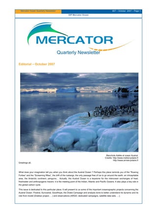
  • 1. Mercator Ocean Quarterly Newsletter #27 – October 2007 – Page 1 GIP Mercator Ocean Quarterly Newsletter Editorial – October 2007 Manchots Adélie et ocean Austral. Credits: http://www.institut-polaire.fr http://www.annee-polaire.fr Greetings all, What does your imagination tell you when you think about the Austral Ocean ? Perhaps this place reminds you of the “Roaring Forties” and the “Screaming fifties”, the drift of the icebergs, the only passage free of ice to go around the earth, an inhospitable area, the Antarctic continent, penguins… Actually, the Austral Ocean is a keystone for the interocean exchanges of heat, freshwater and anthropogenic tracers: it is the meeting point of the Indian, Atlantic and Pacific Oceans. It also plays a key role in the global carbon cycle. This issue is dedicated to this particular place. It will present to us some of the important oceanographic projects concerning the Austral Ocean: Flostral, Survostral, GoodHope, the Drake Campaign and analysis done to better understand its dynamic and its role from model (Drakkar project, …) and observations (ARGO, dedicated campaigns, satellite data sets, …).
  • 2. Mercator Ocean Quarterly Newsletter #27 – October 2007 – Page 2 GIP Mercator Ocean The first article, written by Pouget & al., focuses on the performances of one of the global Mercator 1/4° model (PSY3v1) at Drake Passage by comparing it with in situ data gathered from R.V Polarsten in 2006. The second one, from Le Sommer & al., presents an overview of some results obtained on the Southern Ocean processes and climate variability through the use of the Drakkar hierarchy of ocean/ice models. The next one explains what the Survostral and Flostral projects are and it gathers some results deduced from the data collected during these campaigns. Authors of this article are Salle JB and Morrow R. The last one, written by Speich S. and Arhan M., presents the GoodHope project and summarizes some results of the work done from the hydrographic data sets obtained in the scope of this project. In this issue, we would also like to approach a central topic on the future of operational oceanography: MyOcean: part of the GMES European Projet. This subject is introduced in the News pages by Pierre Bahurel. I hope you enjoy this issue.
  • 3. Mercator Ocean Quarterly Newsletter #27 – October 2007 – Page 3 GIP Mercator Ocean Contents Quarterly Newsletter ..................................................................................................................................... 1  MyOcean, the EU project for a “marine core service” ..................................................................................... 4  Performances of Mercator Model (PSY3v1 1/4° showcase products) at Drake Passage ................................... 6  Monitoring Southern Ocean dynamics with ARGO floats and XBT‐SSS data: the SURVOSTRAL and FLOSTRAL  projects ....................................................................................................................................................... 12  Southern Ocean processes and climate variability in the DRAKKAR hierarchy of ocean/sea‐ice models ........ 20  Good‐Hope / Southern Ocean: A study and monitoring of the Indo‐Atlantic connections (An international co‐ operative project. A process study and a contribution to CLIVAR – Southern Ocean) .................................... 29  Notebook .................................................................................................................................................... 42     
  • 4. Mercator Ocean Quarterly Newsletter #27 – October 2007 – Page 4 MyOcean, the EU project for a “marine core service” MyOcean, the EU project for a “marine core service” By Pierre Bahurel1 1 Mercator-Ocean, 8/10 rue Hermès, 31520 Ramonville st Agne In the first half of 2007, Mercator Ocean and its European partners have translated into practical propositions and a 3- year action plan (the “MyOcean” project) expectations from EU and its Member States for a European “Marine Core Service”. Mercator Ocean is leading the “MyOcean” project for a European Marine Core Service. MyOcean has been proposed to the European Commission (FP7 Space program) to go from existing initiatives in operational oceanography into a pan-European “marine core service”. The project should start in 2008, for a 3-year duration. The existence of a European marine core service has been identified in the top three priorities of the EU GMES program for a European “global monitoring for environment and security” capacity (the two others being land and emergency services). The GMES Marine Core Service Implementation Group has been clearly defined by EU and Member States expectations. MyOcean is a direct answer to this political priority. The strength of this collective answer of European key players in oceanography is a demonstration of maturity of European oceanography. We knew from previous EU and international works that it was worth doing it; we know now that it is doable and key players are ready to commit themselves. For GMES and for the European oceanography, MyOcean is without any doubts the best opportunity to get the “marine core service” requested to enhance marine services development in the Member States (both public and private sectors) as well as European agencies, and strengthen the European voice and role at international level. Within the coordination of MyOcean, within its responsability for the European global ocean component and its regional expectations, Mercator Ocean is deeply involved to ensure the success of an operational pan-european capacity, fully integrated in user value chains. What is MyOcean about? With the GMES program and its Marine Core Service (MCS) fast-track, the European community (EC) is consolidating past efforts in pre-operational ocean monitoring and forecasting capacity in Europe through precursors run in FP6 MERSEA and BOSS4GMES or GSE MARCOAST and POLARVIEW. The MyOcean consortium as proposed to EC (69 partners over 28 countries) proposes to deliver a pan-European MCS product and service portfolio through a robust and optimised ocean monitoring and forecasting core infrastructure. The validation process planned through a 3-year experience enables to organise the user-driven service up to pre-operational phase with propositions addressing the MCS long-term roadmap. Thanks to the existing community and efficient networks like EuroGOOS, MyOcean provides core information on the ocean in all areas of benefit identified by the MCS Implementation Group to key categories of users: the EU agencies (EEA, EMSA, ...), the Member States service providers (Met offices, coast guards, ...), the Intergovernmental bodies or their members (OSPAR, HELCOM, ...). The Global ocean and the European seas are monitored with an eddy-resolving capacity, based on assimilation of space and in situ data into 3D models, representing the physical state, the ice and the ecosystems of the ocean; in the past (25 years), in real-time and in the future (1-2 weeks). The high-quality products rely on the aggregation of European modelling tools and the scientific methods are produced through a strong cross-fertilization between operational and research communities. Observations, model-based data, and added-value products are generated – and enhanced by dedicated expertise – by the following production units: • Six Thematic Assembly Centers, each of them dealing with a specific set of observation data: Sea Level, Ocean colour, Sea Surface Temperature, Sea Ice, In Situ data and Wind data, • Seven Monitoring and Forecasting Centers to serve the Global Ocean, the Arctic area, the Baltic Sea, the Atlantic North-West shelves area, the Atlantic Iberian-Biscay-Ireland area, the Mediterranean Sea and the Black sea. Intermediate and final users discover, view and get the products by means of a central web desk, a central re-active manned service desk and experts within regional services. Routine/bulk delivery, expert forecaster interpretation, human support for emergencies, response to specific queries (non-emergency) and user training are the proposed types of service.
  • 5. Mercator Ocean Quarterly Newsletter #27 – October 2007 – Page 5 MyOcean, the EU project for a “marine core service” In addition, the MyOcean consortium commits to provide users with operational and qualified products and services. Therefore, certifications thoroughly the whole operational chains are undertaken by a Quality Management System with dedicated Key Performances Indicators and Metrics. The operational commitments – in compliance with user’s requirements – are defined in contractual agreements between data suppliers, production units and users at the levels of procurement, production and service, respectively. For sake of integration and assessment of services, several operational downstream services are implemented for a full operational capability demonstration in oil spill pollution monitoring, sea ice monitoring, ecosystem health and marine environment strategy. A strong involvement from key users enables the qualification of the MyOcean products portfolio to ensure a complete readiness towards long-term operational oceanography services in European waters. Project status (December 2007) The proposal has been evaluated in the second half of 2007 by the European Commission, and will be discussed in the first half of 2008. The project is plan for a 3-year period, starting in 208 and ending in 2011.
  • 6. Mercator Ocean Quarterly Newsletter #27– October 2007 – Page 6 Performances of Mercator Model (PSY3V1 1/4° showcase products) at Drake Passage Performances of Mercator Model (PSY3v1 1/4° showcase products) at Drake Passage By Guillaume Pouget1 , Felix Stoehr* and Christine Provost1 1 LOCEAN, UMR 7159, UPMC, T45-55, 5E, 4 place Jussieu, 75259 Paris cedex 05 * Now at ESO, Karl-Schwarzschild-Strasse, D-85748 Garching bei München, Allemagne Introduction We compared the Mercator showcase outputs of the 1/4° global Mercator system (PSY3v1) and the in situ data gathered from R.V. Polarstern in the Drake Passage in January-February 2006. We identified limitations and skills. We then analysed one year of surface velocities in sight of the recovery, in April 2008, of the moorings installed in January 2006. Comparison between the Mercator showcase outputs and the Drake 2006 data set The PSY3v1 1/4 ° showcase outputs are interpolated from the “native” outputs. They have a 1/4 degree horizontal resolution, 43 levels in the vertical and a temporal resolution of 1 day. The data gathered during the cruise ANTXXIII-3 consist of hydrographic and velocity measurements. The data were obtained during two crossings of the Drake Passage below Jason-1 ground track 104: leg 1 (Jan 16 to Jan 26 2006, southward) and leg 2 (from Jan 31 to Feb 6, northward) (Figure1). The variables that can be compared are temperature, salinity, and related parameters (density, potential vorticity) and horizontal velocity. Moorings and stations on the way to Antarctica Stations on the way back to Punta Arenas Leg 1: Jan 16 – Jan 26 2006 Leg 2: Jan 31 to Feb 6 2006 Figure 1 Hydrological stations from R.V. Polarstern ANTXXIII/3 cruise across Drake Passage, in red. M1 to M10 are the moorings to be recovered in April 2008. Moorings M1 through M5 will be redeployed.
  • 7. Mercator Ocean Quarterly Newsletter #27– October 2007 – Page 7 Performances of Mercator Model (PSY3V1 1/4° showcase products) at Drake Passage The Antarctic Circumpolar Current (ACC) is closely associated with three deep-reaching oceanic frontal systems : from North to South the Subantarctic Front (SAF), the Polar Front (PF), the Southern ACC Front (SACCF) (Orsi et al. 1995). The mean location of these deep fronts reflects the bottom topography (Figure 2). Figure 2 Mean location of the main fronts in Drake Passage (from Orsi et al., 1995) superimposed on the bottom topography; Jason-1 ground track 104 is in red. From North to South: SAF, PF, SACCF. Bottom topography: WSR stands for the West Scotia Ridge which separates the Yaghan Basin to the north from the Ona Basin to the south. Temperature and salinity gathered during the cruise are plotted together with corresponding Mercator PSY3v1 values on diagrams that depict water masses distribution in the Drake passage (Figure 3). PF SAF SACCF track 104 Yaghan Bassin Ona Bassin WSR
  • 8. Mercator Ocean Quarterly Newsletter #27– October 2007 – Page 8 Performances of Mercator Model (PSY3V1 1/4° showcase products) at Drake Passage Figure 3 Temperature-Salinity diagrams. Observations in green, Mercator ouputs in blue. leg 1(left) and leg 2 (right). The main water masses are indicated: Subantarctic Zone Water (SAZW), Polar Front Zone Water (PFZW), Antarctic Surface Water (ASW), Winter Water (WW), Upper Circumpolar Deep Water (UCDW), Lower Circumpolar Deep Water (LCDW) and Antarctic Bottom Water (ABW) Mercator showcase outputs are missing a few water masses, particularly those located in the Ona Basin south of the Polar Front, namely, the ASW, the WW, and the waters south of the ACC (south of the SBdy). Mercator showcase outputs are also missing the very densest ABW, probably because showcase outputs do not have the deepest levels. Sections of individual parameters obtained with the in situ vertical profiles undersampled to match the Mercator resolution were compared then to those obtained from the showcase products interpolated to the time and location of each hydrographic station. On the salinity sections, the positions of the fronts correspond to the positions of the gradients; in the model the SAF is located too north, whereas the PF is quite well located (Figure 4). Figure 4 Salinity during leg 1: Mercator showcase outputs (left) and observations (right). ABW UCDW SAZW WW South of ACC ASW PFZW SAZW WW UCDW ABW ASW PFZW SAF SAF PF PF
  • 9. Mercator Ocean Quarterly Newsletter #27– October 2007 – Page 9 Performances of Mercator Model (PSY3V1 1/4° showcase products) at Drake Passage The model SAZW between 55.5 and 56°S and between 200 to 1000 m is saltier than the data SAZW by 0.2 (Figure 5). In the south of the section, the ASW and the WW are missing in the model, and, as a consequence, Mercator waters are saltier by more than 0.2 between 57°S and 59°S around the depth of 100 m. Figure 5 Salinity differences between Mercator showcase ouputs and the in situ vertical profiles. Sections of potential temperature and density show that in the north of the section, water masses are too cold (by -1.8 °C), and too dense by 0.1 σθ units in the model (not shown). In the south of the section, due to the absence of ASW and WW in the model, the waters are warmer by 2.5°C. Similar conclusions are drawn when examining leg 2. From mid-leg1 to mid-leg2 (separated by approximatively 10 days), the mesoscale evolution can be observed at depth. Figure 6 shows that, compared to in situ data, Mercator showcase outputs are able to describe the water masses evolutions with a qualitative good agreement. Figure 6 Differences between leg 2 and leg 1 in density (σθ units). Left: degraded CTD data to the Mercator resolution, right: Mercator showcase outputs. Analysis of the Mercator velocity outputs during the year 2006, in sight of the moorings recovery in April 2008 The moorings installed along Jason-1 ground track 104 in 2006 (Figure 1) will be recovered in April 2008, and provide 2-year- long velocity time series at different depths. In that perspective, we examined the Mercator PSY3v1 velocities along track 104, during a period of 351 days (from January 14 2006 to December 31 2006). As we used the showcase outputs (already re-interpolate products), the calculation of integrated quantities such as transport is inaccurate. Thus, we focused on the surface velocity (Figure 7). The SAF is found around the latitude of 55.5°S and the PF around 57.5°S. The SACCF is splitted in two branches 59°S and 60.2°S with smaller intensities (Barré et al., 2007). The
  • 10. Mercator Ocean Quarterly Newsletter #27– October 2007 – Page 10 Performances of Mercator Model (PSY3V1 1/4° showcase products) at Drake Passage locations of the four fronts change with time, especially that of the PF. The most intense velocities are found in the SAF, while negative velocities are associated with recirculations in the Drake Passage. Figure 7 Mercator cross track velocity along Jason ground track 104 as a function of time. Units in m.s -1 . Time is in days starting January 14 2006. A wavelet analysis of the surface velocities was performed. The example in Figure 8 (point located at latitude 55.3 S in the SAF) shows a power peak around a period of 40 days; this peak can be explained in terms of shelf waves. Such waves are expected to have a period comprised in the range 30-70 days. The bottom slope is the restoring force. Figure 8 Wavelet analysis of the cross track surface velocity at 55.3 S.
  • 11. Mercator Ocean Quarterly Newsletter #27– October 2007 – Page 11 Performances of Mercator Model (PSY3V1 1/4° showcase products) at Drake Passage Figure 9 Significant periods as a function of latitude along track 104. Blue scale to the left: periods above the level of confidence (in days). Green scale to the right: bathymetry along the track in meters. Periods in the interval 30-70 days are found on the continental slope then they disappear when the bathymetry becomes flat, and reappear along the West Scotia Ridge. In the Ona Basin, such periods are found only at a few locations. Conclusion A comparison between the data obtained in the Drake Passage during the 2006 cruise and the Mercator showcase outputs shows that the model captures well the structure changes between the two legs of the cruise (in 10 days). However, water masses south of the Polar Front such as the Antarctic Surface Water and Winter Water are not present in the model : this may be due to the absence of a prognostic sea-ice model in PSY3v1, and the subsequent water mass formation. In the north, the Subantarctic Zone Water is too salty and too cold thus too dense. One year of surface velocities across Jason-1 track 104 were analysed, revealing the presence of shelf waves along slopes. We shall now use the “native” outputs of the model, to examine integrated quantities such as transport across the Drake Passage. References Orsi, A.H., T. Withworth III et W.D. Nowlin Jr. (1995). On the meridional extent and fronts of the Antarctic Circumpolar Current. Deep Sea Research, Part I 42:641-673. Barré N., C. Provost, N. Sennechael and J-H. Lee, 2007: Circulation in the Ona Basin, Southern Drake Passage. J. Geophys. Res., in press
  • 12. Mercator Ocean Quarterly Newsletter #27– October 2007 – Page 12 Monitoring Southern Ocean dynamics with ARGO floats and XBT-SSS data Monitoring Southern Ocean dynamics with ARGO floats and XBT- SSS data: the SURVOSTRAL and FLOSTRAL projects By Jean-Baptiste Sallee and Rosemary Morrow1 1 LEGOS, 14 avenue Edouard Belin, 31400 Toulouse Introduction The Southern Ocean is a key region in the understanding of the global ocean circulation and its role on climate. The strong wind forcing in the “Roaring Forties” and the “Screaming fifties”, coupled with the intense heat loss surrounding the ice-covered Antarctic continent, drives an important overturning circulation which affects the whole water column, from the surface waters down to the bottom waters at 5-6 km depth. Indeed, the Southern Ocean is the keystone for the global ocean circulation, providing the major link between the Pacific, Atlantic and Indian Oceans. This region acts like a pump house for the other major oceans, drawing deep waters south towards the Antarctic Circumpolar Current (ACC), where they are modified and re-exported north as mode and intermediate waters (500 – 1500 m depth) and bottom waters (> 4000 m depth). Despite its key role in the global ocean circulation, the Southern Ocean has always suffered from a lack of in-situ observations, due to its remote and hostile environment, far from regular shipping lanes. The few historical measurements were mostly available in summer, and provided only a large-scale vision of the mean ocean structure. In this International Polar Year, we would like to review the scientific results from two long-term Southern Ocean in-situ monitoring programmes: SURVOSTRAL and FLOSTRAL. Both of these projects contribute near real time in-situ observations for assimilation in the MERCATOR operational system. SURVOSTRAL is an international collaborative programme between France, Australia and the US, established in 1992 to monitor the long-term upper ocean temperature evolution and the sea surface salinity (SSS) evolution, across the Southern Ocean. The programme is based on repeat high-density XBT profiles and underway sampling of SSS, undertaken 6-10 times per year from October through to March, between Hobart, Australia (43°S), and the French Antarctic Base at Dumont Durville (66°S) (see Figure 1). This high-density repeat line is adjacent to the WOCE SR3 CTD repeat section, which has obtained 7 full- depth CTD sections between Hobart and Antarctica over the same period, and in all seasons. The 15 years of XBT-SSS observations have allowed us to calculate interannual baroclinic transport variations (Rintoul et al., 2002) and subsurface temperature anomalies (Sokolov and Rintoul, 2003), study the mixed layer evolution in the Subantarctic Zone (Rintoul and Trull, 2002) and in the Antarctic Zone (Chaigneau et al. 2004), address the role of mesoscale eddies in transferring heat and salt across the Subantarctic Front (Morrow et al., 2004) and the eddy kinetic energy response to variations in the mean jet (Morrow et al., 2003). In this article we will review a recent study on the subsurface temperature changes which are contributing to the decadal sea level rise observed in this part of the Southern Ocean (Morrow et al., 2007).
  • 13. Mercator Ocean Quarterly Newsletter #27– October 2007 – Page 13 Monitoring Southern Ocean dynamics with ARGO floats and XBT-SSS data Figure 1 Positions of the ARGO profiling floats that are active on 7-Nov-2007 (in red, from argo.ocean.fsu.edu). Weekly mean position of the Polar Front (PF) is in light blue, and the Subantarctic Front (SAF) in blue, after Sallée et al. (2007a). The weekly position of the sea ice extent is in cyan-blue. The SURVOSTRAL XBT-SSS line is marked in black bold, near 150°E. The region of FLOSTRAL ARGO float deployment in 2003-2004 is marked in green. No FLOSTRAL floats are still active on 7-Nov-2007. The FLOSTRAL project is a French contribution to the international ARGO program, which aims to seed the world’s ocean with profiling floats every 300 km. During FLOSTRAL, 30 profiling PROVOR floats were launched in the southern Indian Ocean in 2003 and 2004 (see Figure 1). The ARGO programme has revolutionised Southern Ocean observations. Since 2004, hundreds of ARGO floats have been deployed south of 25°S, providing 78000 new vertical profiles of temperature and salinity. Four years of ARGO profiles have effectively doubled the number of hydrographic observations available in the Southern Ocean. The ARGO observations are also more regularly positioned and cover all seasons (see Figure 2, from Sallée et al., 2007a). So for the first time we can monitor the ocean dynamics in winter, the period when most of the deep and intermediate waters form. These ARGO data have allowed us to develop a new high-resolution climatology with data more equally distributed in all seasons (Sallée et al., 2007a). Based on the mean characteristics from this climatology, and the variable sea level component from altimetry, we have also developed a technique for monitoring the weekly movement of the main polar fronts, and analysing their response to atmospheric forcing (Sallée et al., 2007a). A new cross-stream eddy diffusion parameter has also been derived for the Southern Ocean from 15 years of surface drifters (Sallée et al., 2007b). This article will review two recent studies using ARGO floats and satellite observations to examine Subantarctic mode water formation, in the southeast Indian sector (Sallée et al., 2006) and in a circumpolar sense (Sallée et al., 2007c).
  • 14. Mercator Ocean Quarterly Newsletter #27– October 2007 – Page 14 Monitoring Southern Ocean dynamics with ARGO floats and XBT-SSS data Figure 2 (left) Monthly and (right) spatial percentage of ARGO profiles from 2002-2007 compared to historical hydrographic profiles collected over the last 20 years, based on gridded one degree binned statistics. ARGO profiles contribute greatly in winter, and in the centre of the ocean gyres, far from the coasts. SURVOSTRAL project: Subsurface temperature changes contributing to Southern Ocean sea level rise Recent studies on global sea level rise based on Topex-Poseidon satellite altimetry data have noted a strong increase in sea level in various parts of the Southern Ocean (Figure 3a) over the period 1993-2003 (Lombard et al., 2005). The dynamical processes governing the sea level rise are not well understood. Different authors have calculated the steric expansion in the upper 700 m from global in-situ data (Guinehut et al., 2004; Willis et al., 2004; Ishii et al., 2005) and found that it explains only 50-60% of the observed global sea level rise. They attribute the other 40-50% to ocean mass changes. The difference between the TOPEX altimetric sea level rise and the steric expansion over the upper 700 m depth is shown in Figure 3b. The largest differences occur in the Southern Ocean. The difference is sea level rise could be due to the barotropic response to variations in the wind forcing (e.g. Vivier et al., 1999), mass changes from freshwater input (e.g. more precipitation or ice melt), or from deeper steric changes from warming or freshening at deeper ocean levels.
  • 15. Mercator Ocean Quarterly Newsletter #27– October 2007 – Page 15 Monitoring Southern Ocean dynamics with ARGO floats and XBT-SSS data Figure 3 Global distribution of sea level rise (in mm/yr) from (top panel) Topex-Poseidon altimetric observations over 1993-2003; (bottom panel) difference map of Topex – ARMOR 0/700dB in-situ data projection (after Lombard et al., 2005). The study region is outlined in black. Morrow et al. (2007) have examined the cause of the observed sea level rise in the region south of Australia, using 13 years of repeat hydrographic data from the WOCE-SR3 sections, and the SURVOSTRAL XBT and surface salinity data. The XBT and CTD hydrographic data show a poleward shift in the position of the Subtropical and the Subantarctic Fronts over the period (Figure 4a, b). In the Antarctic Zone, the Antarctic Surface Water has become warmer and fresher, and the Winter Water tongue has become warmer, fresher, thinner and shallower.
  • 16. Mercator Ocean Quarterly Newsletter #27– October 2007 – Page 16 Monitoring Southern Ocean dynamics with ARGO floats and XBT-SSS data Figure 4 Upper panel: Mean XBT temperature change between the early 1990s (1992-1996) and 2000-2004, calculated over 0-500 m depth, from Tasmania at 43°S to Antarctica at 66°S. The Subantarctic Zone (SAZ) and Antarctic Zone (AZ) discussed in the text are delimited by the vertical black lines. The position of the STF and SAF are marked. Middle panel: Mean Temperature change (left) and salinity change (right) calculated from WOCE SR3 CTD sections over 0-2000 m depth. The difference shows the most recent section in Nov 2001 minus a composite of 3 summer sections during the early 1990s (Mar 1993, Jan 1994, Jan 1995). Lower panel : Steric height change calculated from these CTD sections, i;e. the steric height change from Nov 2001 minus the mean of Mar 1993 - Jan 1994 - Jan 1995, using a 500 db reference level versus a 2000 dB reference level. The strong negative anomaly at 50°S is due to a cold meander at the SAF in Nov 2001. Note the southward movement of the STF in the upper panel’s XBT data shows a temperature anomaly to 400 m, whereas the CTD data show another strong temperature anomaly between 600 – 1500 m due to changes in the deeper branch of the Tasman outflow. The deeper warming in the Antarctic Zone from 52-62°S contributes to a steric height increase of ~3 cm over the 10 years, equivalent to the observed sea level rise from altimetry. The 82 XBT sections used in the study provide reliable statistics over the period, but are limited to the upper 500 m depth. These upper ocean temperature changes account for only part of the altimetric sea level rise. The CTD sections show similar upper ocean changes, but the deeper layers are also warmer and slightly saltier (Figure 4b) and the trend in observed sea level can be explained by steric expansion over the upper 2000 m (Figure 4c). A simple Sverdrup transport model shows how large- scale changes in the wind-forcing, related to the Southern Annular Mode, may contribute to the deeper warming south of the Polar Front (Morrow et al., 2007). Unfortunately, the deeper 700-2000 m changes are monitored with a limited number of CTD sections, and only one section is available in the later 2000-2004 period (during November 2001). So synoptic variability (e.g; mesoscale frontal movements) can impact on these results. A new SR3 CTD section will be undertaken in January 2008 which combined with the ongoing ARGO
  • 17. Mercator Ocean Quarterly Newsletter #27– October 2007 – Page 17 Monitoring Southern Ocean dynamics with ARGO floats and XBT-SSS data profiles, will provide information on the post 2004 deeper temperature and salinity changes. Monitoring these deeper changes is necessary for the higher latitudes where climate variations impact more rapidly on the intermediate and deep waters. ARGO, combined with repeat XBT and CTD lines, will enormously aid our understanding of the upper ocean changes after 2000. FLOSTRAL project: Using ARGO floats to study Subantarctic mode water formation This study focuses on the formation of mode waters, which are a large volume of water formed in the deep winter mixed layers on the northern side of the ACC. At the end of each winter, these mode waters are subducted and then circulate around 600 m depth within the subtropical gyres, carrying with them the climate signature, nutrients and carbon that were obtained during their formation period. They are an important indicator of climate change and carbon uptake. With the new ARGO observations, we have been able to precisely monitor their winter formation sites for the first time (Figure 5). At large scales, their winter temperature evolution is mainly governed by cooling from air-sea fluxes and the wind-driven Ekman transport across the ACC (Sallee et al., 2006, 2007c). However, in certain key regions where the flow is constrained by bathymetry, the energetic eddy field also contributes to diffusing heat across the formation region, and modifying the deep winter mixed layer convection (Sallee et al., 2006, 2007b, 2007c). Figure 5 Winter mixed layer depth in the Southern Ocean from a combination of Argo (from 2002-2007) and ship data. Strong eddy diffusion occurs, for example, upstream of the Kerguelen Plateau, where the bathymetry forces the SAF northwards in close contact with the Agulhas Retroflection. In this zone, both the eddy diffusion coefficient and the meridional temperature gradients are strong (Sallée et al., 2006, 2007b, 2007c). The strong eddy diffusion and mixing is also apparent in the subsurface ARGO profiles between Crozet and Kerguelen (Figure 6). In the region between Crozet and Kerguelen Plateau from 50-70°E (in blue on Figure 6), the mesoscale eddies induce strong interleaving and mixing between the warmer subtropical water masses of the Agulhas (in red) and the cooler Polar Frontal Zone waters (in black). This helps break the strongly stratified Agulhas waters, so that the downstream water masses (in cyan) have become cooler, fresher, and slightly denser. This mixing occurs from the surface waters, right down through the mode and intermediate density classes and even reaching the upper circumpolar deep water ~27.4 kg/m 3 . This “destabilisation” of the stratified Subantarctic waters allows the deep winter mixed layers to form downstream, as seen in Figure 5. Sallée et al. (2007c) have shown that the eddy diffusion terms are small in a circumpolar average, but can be locally important, in key regions such as around Kerguelen Plateau, downstream of New Zealand and Drake Passage, and downstream of the mid-Pacific Fracture Zone.
  • 18. Mercator Ocean Quarterly Newsletter #27– October 2007 – Page 18 Monitoring Southern Ocean dynamics with ARGO floats and XBT-SSS data Figure 6 Temperature-salinity structure upstream and downstream of the Kerguelen Plateau from a composite of 2 ARGO floats (WM0 No. 1900042 and No.1900164). (upper panel) Position map of the analysed profiles. Colours are linked with the T–S plot (lower panel). The black star corresponds to profiles from the south of the SAF, red profiles are upstream in the Agulhas Retroflection, blue are in the SAZ between Crozet and Kerguelen, and cyan are downstream of Kerguelen. Temperature in °C, salinity in psu. These studies have revealed the complexities in terms of spatial and temporal distribution of the mode water characteristics during their formation. Our next step is to understand how these mode waters circulate and modify the dynamics and heat content of the subtropical gyres over periods of 5-10 years. The ongoing ARGO profiling float programme will provide the key tool for monitoring these longer term changes, allowing us to better understand the “beating heart” within the subtropical ocean circulation. References Chaigneau A, Morrow R, 2002. Surface temperature and salinity variations between Tasmania and Antarctica, 1993-1999. Journal of Geophysical Research – Oceans, 107 (C12): Art. No. 8020. Chaigneau, A., R. M. Morrow, and S. R. Rintoul, 2004. Seasonal and interannual evolution of the mixed layer in the Antarctic Zone south of Tasmania. Deep-Sea Research I, 51/12, 2047-2072. Guinehut, S., P.Y. Le Traon, G. Larnicol and S. Philipps. Combining Argo and remote-sensing data to estimate the ocean three- dimensional temperature fields – a first approach based on simulated observations. J. Mar. Sys., 46, 85-98, 2004. Ishii, M., M. Kimoto, K. Sakamoto and S.I. Iwasaki, 2005. Steric sea level changes estimated from historical ocean subsurface temperature and salinity analyses, J. Oceanography, submitted. Lombard A., Cazenave A, Le Traon P.Y. and M. Ishii, 2005. Contribution of thermal expansion to present-day sea level change revisited, Global and Planetary Change, 47, 1-16.
  • 19. Mercator Ocean Quarterly Newsletter #27– October 2007 – Page 19 Monitoring Southern Ocean dynamics with ARGO floats and XBT-SSS data Morrow, R., Valladeau, G., and Sallee, J. (2007). Observed subsurface signature of Southern Ocean decadal sea level rise. Prog. Oceanogr. (in press). Morrow R, Brut A, Chaigneau A, 2003. Seasonal and interannual variations of the upper ocean energetics between Tasmania and Antarctica. Deep-Sea Research I, 50, 339-356. Morrow, R. M., J.-R. Donguy, A. Chaigneau and S. R. Rintoul, 2004. Cold-core anomalies at the Subantarctic Front, south of Tasmania. Deep-Sea Research I, 51, 1417-1440. Rintoul, S. R. and T. W. Trull, 2002. Seasonal evolution of the mixed layer in the Subantarctic Zone south of Australia. Journal of Geophysical Research, 106, 31,447-31,460. Rintoul, S. R., S. Sokolov, and J. Church, 2002. A six year record of baroclinic transport variability of the Antarctic Circumpolar Current at 140°E, derived from XBT and altimeter measurements. Journal of Geophysical Research – Oceans, 107 (C10): art.no. 3155. Sallee, J., Speer, K. and Morrow, R. (2007a). Southern ocean fronts and their variability to climate modes. J. of Climat. (in press) Sallee, J., Morrow, R., Speer, K., and Lumpkin, R. (2007b). An estimate of Lagrangian eddy statistics and diffusion in the mixed layer of the Southern Ocean. J. Mar. Res. (submitted) Sallee, J., Morrow, R., and Speer, K. (2007c). Eddy heat diffusion and Subantarctic Mode Water formation. Geophys. Res. Lett. (submitted) Sallee, J., Wienders, N., Morrow, R., and Speer, K. (2006). Formation of Subantarctic mode water in the Southeastern Indian Ocean. Ocean Dynamics, 56 :525–542. Sokolov, S. and S. R. Rintoul, 2002: The structure of Southern Ocean fronts at 140E. Journal of Marine Systems, 37, 151-184. Sokolov, S. and S. R. Rintoul, 2003: The subsurface structure of interannual temperature anomalies in the Australian sector of the Southern Ocean. Journal of Geophysical Research - Oceans, 108 (C9): Art. No. 3285. Sokolov, S. and S. R. Rintoul, 2007. Multiple jets of the Antarctic Circumpolar Current south of Australia. Journal of Physical Oceanography, 37, 1394-1412. Willis, J.K., D. Roemmich, and B. Cornuelle, 2004. Interannual variability in upper-ocean heat content, temperature and thermosteric expansion on global scales, J. Geophys. Res., 109, C12036, doi:10.1029/2003JC002260. Vivier, F., K.A. Kelly and M. Harismendy,2005. Causes of large-scale sea level variations in the Southern Ocean: Analyses of sea level and a barotropic model. J. Geophys. Res., 110, C09014, doi:10.1029/2004JC002773, 2005
  • 20. Mercator Ocean Quarterly Newsletter #27 – October 2007 – Page 20 Southern Ocean processes and climate variability in the DRAKKAR hierarchy of ocean/sea-ice models Southern Ocean processes and climate variability in the DRAKKAR hierarchy of ocean/sea-ice models By Julien Le Sommer1 , Bernard Barnier1 , Laurent Brodeau1 , Aurélie Duchez1 , Mélanie Juza1 , Gurvan Madec2 , Pierre Mathiot1 , Jean-Marc Molines1 , Thierry Penduff11 and Anne-Marie Treguier3 1 LEGI, BP 53X, 38041 Grenoble cedex 09 2 LOCEAN, Université Paris 6, 4 Place Jussieu, Paris 75252 cedex 05 3 LPO, B.P. 70, 29280 Plouzané Introduction In recent years, the DRAKKAR modeling group (see http://www.ifremer.fr/lpo/drakkar) has put significant effort in extending its initial focus from the North Atlantic and Nordic Seas toward the global ocean. This extension was initially motivated by the similarity of the scientific questions between different oceanic basins regarding the processes controlling water mass formation and variability on seasonal to decadal time scale. This also comes from the fact that common tools are needed to tackle these scientific questions, namely global model configurations. This effort has yielded a set of coordinated scientific activities concentrated on the Southern Ocean within the DRAKKAR consortium. Some of these activities are reported in the present article. Being a key element of the climate system, the Southern Ocean is still a challenging topic for ocean modelers with its sparse observations and the wide range of scales involved in its dynamics. In this context, the DRAKKAR group aims at understanding the mechanisms involved in climate variability in the Southern Ocean and at improving the ability of the next generation of ocean climate models to represent those mechanisms. More precisely, our activities focus on understanding (i) the dynamics and the variability of the Antarctic circumpolar current (ACC), (ii) the mechanisms involved in the life cycle of Antarctic bottom waters (AABW) and (iii) those involved in the life cycle of intermediate and mode waters (AAIW and SAMW). We believe that meeting those objectives requires interplay between observations, theoretical work and “realistic” modeling. In order to foster such interactions, the DRAKKAR project produces coupled ocean/sea-ice hindcast simulations of the past 50 years with a hierarchy of global and regional models of various horizontal resolutions from 2° to 1/4°. Hereafter, we give a survey of recent developments related to the Southern Ocean objectives of the DRAKKAR project including the key improvements of model configurations, the validation strategy and the first scientific results. Key improvements of the DRAKKAR hierarchy of models The base DRAKKAR model hierarchy consists of global configurations with horizontal resolutions at the equator ranging from 2° to 1/4 °: namely ORCA2, ORCA1, ORCA05 and ORCA025. ORCA025 is a joint MERCATOR/DRAKKAR development project. The MERCATOR component is currently running in operational mode. These configurations are sharing the same type of tripolar grid, with an isotropic Mercator mesh in the Southern Hemisphere. As an example, at 60°S ORCA025 has ~14km horizontal resolution in both the zonal and the meridional direction. In order to meet its scientific objectives regarding the Southern Ocean, the DRAKKAR group has also implemented two regional model configurations to simulate the global ocean south of 30°S. These two model configurations, namely PERIANT025 and PERIANT05, with 0.25° and 0.5° horizontal resolution respectively, are used for model development, sensitivity studies and regional scale studies. In addition, several model developments have also significantly improved our modeling capabilities in the Southern Ocean. The most striking improvement is due to a new momentum advection scheme, which effect on the mean path of the ACC has been reported by Barnier et al. (2006). The mechanisms involved in this sensitivity have been described in detail by Le Sommer et al. (2007) and Penduff et al. (2007). Some other significant improvements regarding the Southern Ocean are detailed in the following sections. Improvement of the mixed layer with a new TKE scheme The summer mixed layer was generally too shallow in model configuration based on NEMO. This bias can reduce the ability of the model to represent adequately the formation of mode waters in the ACC belt. A modified TKE scheme (Madec, 2006) has been included in our model configurations. The new TKE scheme has an enhanced vertical penetration of the turbulent kinetic energy. It accounts for the effect of surface waves and includes a parameterization of the effect of the Langmuir cells on vertical mixing. A series of tests has been carried out with ORCA025 and the climatology of de Boyer Montegut et al. (2004) has been used to measure the impact of the new TKE scheme. This is shown in Figure 1, which compares the mixed layer depth in January in two model runs (with and without the new TKE scheme) with the climatology of de Boyer Montegut et al. (2004). As expected the new TKE scheme increases the summer mixed layer, bringing its value closer to the climatology. Nevertheless,
  • 21. Mercator Ocean Quarterly Newsletter #27 – October 2007 – Page 21 Southern Ocean processes and climate variability in the DRAKKAR hierarchy of ocean/sea-ice models the DRAKKAR model configurations displays a bias in the winter mixed layer, being usually too deep, which is presumably due to the thermal forcing. Investigations are being conducted to reduce this bias. Figure 1 Southern hemisphere summer mixed layer depth (in meter) from the climatology by de Boyer Montegut (2004) (top panel), from run ORCA025-G42 without the new TKE scheme (second panel) and from run ORCAO25-G43b with the new TKE scheme (bottom panel). Downscaling and parameterization of katabatic winds Because sea-ice plays an essential role in ocean ventilation in the Southern Ocean (see e.g. Saenko et al., 2002), much effort has been put on improving the representation of sea-ice in the DRAKKAR hierarchy of models. Katabatic winds are important in coastal sea-ice formation and dynamics along the Antarctic coast. It is the main factor leading to the formation of coastal polynya. Still, atmospheric reanalyses poorly represent katabatic winds. This is because the dynamics of katabatic winds, which is strongly influenced by small scale orography, is not explicitly represented in atmospheric GCMs. Being convinced that katabatic winds should be included in ocean climate models, the DRAKKAR group has developed an approach to take into account the dynamical effect of katabatic winds in ocean/sea-ice models (Mathiot et al., 2007). A comparison between winds from ERA40 reanalysis, from regional scale atmospheric simulations with MAR (Gallée et Shayes, 1994) and from in situ
  • 22. Mercator Ocean Quarterly Newsletter #27 – October 2007 – Page 22 Southern Ocean processes and climate variability in the DRAKKAR hierarchy of ocean/sea-ice models automatic weather station data has been conducted by Petrelli et al. (2007) in the Terra Nova Bay Sector, revealing that the wind is generally too weak in ERA40. Extending the comparison along the Antarctic coast, our investigations confirm this result but also show that the ERA40 wind stresses have a rather correct direction. We have therefore introduced an empirical correction factor for ERA40 wind stress to account for katabatic winds near the antarctic coast. Figure 2, which shows the scatter plots of ERA40 wind stress versus those from MAR simulations which has yielded the correction factor. Sensitivity studies with PERIANT05 have shown that the correction of katabatic winds increases the amplitude and extent of coastal polynya and that colder and saltier waters are produced around Antarctica, which T-S properties compare better with observations. Further developments are sought in order to include the thermodynamic effect of katabatic winds on atmospheric temperature and moisture. Figure 2 Scatterplots of zonal wind stress (right panel) and meridional wind stress (left panel) in ERA 40 reanalysis versus MAR regional atmospheric simulation. The regression coefficient b and the scale factor p giving a zero offset for MAR wind stress are indicated in each panel. Continuous improvement of the forcing function Having gained in experience from the CLIPPER project, the DRAKKAR group is continuously working on improving the surface forcing and surface fields used in its simulations (see e.g.Barnier et al. , 2006). The general approach and recent developments in this respect have been reported by Brodeau et al. (2007). The starting data of reference is the CORE data set developed by Large and Yeager (2004). This reference data set has been modified by the implementation of surface atmospheric state variables derived from ERA40 reanalysis. Corrections have been performed on the selected ERA40 input fields to adjust temporal discontinuities and regional biases. This approach has produced a forcing data set, named DFS3 which has been extensively tested at coarse resolution (2°horizontal resolution) with ORCA2. In the Southern Ocean, the sparsity and relatively low quality of available atmospheric data is such that our empirical approach has led to significant improvements in models solutions. As an example, Figure 3 shows how a systematic cold bias in SST has been corrected in the Southern Ocean by canceling south of 15°S a correction imposed by Large and Yeager (2004) on the downwelling short wave radiation, thus bringing it back to its observed value from the original ISCCP-FD product (Zhang et al., 2004).
  • 23. Mercator Ocean Quarterly Newsletter #27 – October 2007 – Page 23 Southern Ocean processes and climate variability in the DRAKKAR hierarchy of ocean/sea-ice models Figure 3 Left panel: zonal mean downwelling short wave radiation between 1984 and 2004 from CORE dataset, from DFS3 dataset and from the original ISCCP-FD data. Right panel: zonal mean of the standard deviation of SST error between the interannual climatology by Hurrel et al. (2006) and two ORCA2 runs for data sets between 1984 and 2004. DFS3.2 refers to a run with the CORE short wave radiation. Validation tools and assessment against observations in the Southern Ocean The DRAKKAR team has implemented global validation tools to assess the realism of its ocean/sea-ice simulations. The approach combines the use of satellite products, historical hydrographic data and ARGO floats data in order to estimate biases in the model mean state and variability. At high latitudes, a specific effort is also put on validating the model sea-ice. The validation of the first ORCA025 reference run mean state and mean circulation has been documented by Barnier et al. (2006) and Penduff et al. (2007b). Hereafter, we describe the approach used to validate the time-varying model solutions, with a special focus on the Southern Ocean. The interested reader would find a more detailed presentation of the validation tools used in the DRAKKAR project in Penduff et al. (2007). Sea-ice concentration and sea-ice extent The large-scale of the model sea-ice is validated against observations by examining the seasonal cycle of sea-ice extent. So far, the model exhibits a slightly too strong seasonal cycle with a quasi-total melting in summertime, especially in the Weddell Sea. Noticeably such biases were also observed in ORCA2 by Timmermann et al. (2005) and in the 1/4° MERCATOR global configuration as reported by Garric and Charpentier (2005). Nevertheless, a striking feature of the DRAKKAR-ORCA025 model is its ability to capture mesoscale patterns in sea-ice concentration. This is shown in Figure 4 with a comparison of sea-ice concentration in run ORCA025-G70 versus sea-ice concentration estimated using satellite passive microwave data (Sea Ice Index by Fetterer et al., 2002). In parallel to the assessment of sea-ice concentration and extent, an in-depth validation of the sea-ice model dynamic component has also been undertaken in collaboration with glaciologists at LGGE/CNRS in order to assess the realism of the rheology used in NEMO sea-ice model LIM2
  • 24. Mercator Ocean Quarterly Newsletter #27 – October 2007 – Page 24 Southern Ocean processes and climate variability in the DRAKKAR hierarchy of ocean/sea-ice models Figure 4 Sea ice concentration in November 2002 estimated using satellite passive microwave data from the Sea Ice Index (Fetterer et al., 2002) and in run ORCA025-G70. Assessment of the variability in the Southern Ocean The key ingredient of our validation strategy is the collocation of model output at the geographical location, depths and instants of observational data sets. This allows for the validation to be independent on the model grid and time-step. This has been done both with hydrographic data (in situ profiles including ARGO floats) from 1958 to today and with AVISO weekly altimetric maps over the period 1993-present (Penduff et al., 2007). The time coverage and regularity of altimetric data allows not only to estimate the misfits between model solutions and observed data but also to assess the degree of realism of the time-variability of the model solution. We remind that our models are not constrained with data-assimilation so that a “free” SLA variability, not correlated with observations, is likely to emerge from dynamical nonlinearities. Following this approach, the solutions of ORCA2 and ORCA025 have been assessed in terms of interannual Sea Level Anomaly (SLA) variability after collocation onto altimetric maps. This is illustrated in Figure 5, which shows the first two modes of variability in the large-scale, low-frequency SLA from altimetry between 1993 an 2004 in the Southern Ocean, the associated principal component and the projection of the SLA of the two model runs with different horizontal resolution onto the observed modes of variability. Given their spatial patterns, the first two modes are most likely related to ENSO and the Southern Annular Mode (SAM) respectively. A significant part of the model variability is shown to project onto these observed modes of variability, although the correlation with the observed principal component is not statistically significant for the second projection. Still, the Southern Ocean exhibits an interesting behavior in that respect. While in other oceanic basins the percentage of variance associated with the projection onto the first modes of variability increases with increasing resolution, it doesn’t seem to vary that much in the Southern Ocean. We did note however, that the total variance of SLA increases significantly with increasing resolution from 2° to 0.25° (not shown). This, together with other indications (like e.g. the point wise correlation of model SLA with the observed SLA), seems to suggest that an intrinsic variability, which is not correlated with observations, emerges in our simulations in the Southern Ocean with horizontal resolution increasing from coarse to eddy-admitting. This intrinsic variability, most likely due to nonlinear interactions, is currently being investigated.
  • 25. Mercator Ocean Quarterly Newsletter #27 – October 2007 – Page 25 Southern Ocean processes and climate variability in the DRAKKAR hierarchy of ocean/sea-ice models Figure 5 Normalized first and second EOFs of the large scale, low frequency sea level anomaly (SLA) from altimetry between 1993 and 2004 in the Southern Ocean (left panel), the associated principal component and the projection of the model SLA on the observed EOFs for run ORCA2-G70 and run ORCA025-G70 (right panel). The legend also indicates the percentage of variance associated with the projection and the correlation with the observed principal component. Bridging from observation to theory with hindcast model simulations As stated in the introduction, our rationale is that much can be learned through the confrontation of theoretical works and “realistic” modeling. This is of particular relevance in the Southern Ocean where observations are much sparser than in other oceanic basins. In that sense, the DRAKKAR hierarchy of models helps filling the gap between observations and theories. In this last section, we briefly illustrate this statement with two recent studies carried out within the DRAKKAR group. Southern Ocean overturning across streamlines in the ACC Being a key component of the global meridional circulation, the meridional circulation in the Antarctic Circumpolar Current (ACC) is a much debated topic within the oceanographic community. It is believed to be made of two cells: an upper one (aka the "shallow" cell) associated with mode water formation and a lower one (aka the "deep" cell) associated with AABW formation. The amplitudes of both cells, their relation with the air-sea fluxes and the role of mesoscale eddy fluxes have motivated a number of studies. However, no consistent picture of the detailed structure of the overturning cells has emerged. In order to interpret the meridional circulation to water mass transformation, it is necessary to calculate it with density, rather than depth, as the vertical coordinate. In the past 15 years, the upper meridional cell has been calculated in many models which generally showed a surface Equatorward branch in the same direction as the Ekman drift, but lower in amplitude because the mean
  • 26. Mercator Ocean Quarterly Newsletter #27 – October 2007 – Page 26 Southern Ocean processes and climate variability in the DRAKKAR hierarchy of ocean/sea-ice models Ekman flow is partially cancelled by eddy mass fluxes. However the most recent high resolution models display a puzzling surface flux in the opposite direction, poleward (Hallberg and Gnanadesikan, 2006). In a recent study using ORCA025, Treguier et al. (2007) have shown that this is an artefact of averaging the circulation along latitude lines, rather than following the convoluted path of the ACC. Figure 6 Meridional transport streamfunction calculated in density space as a function of σ and remapped as a function of depth using the mean depth of σ surfaces in run ORCA025-G70. A red color (positive) corresponds to a clockwise circulation, and blue color to a counterclockwise circulation. left panel: averaged along streamlines ; right panel: zonal average. Contours interval is 2 Sv and the zero contour is indicated by a thick line. Figure 6 shows the meridional transport stream-function calculated in density space and remapped as a function of depth (see the caption for details), averaged along the ACC streamlines or zonally averaged. The meridional circulation across streamlines agrees with the theoretical view: an equatorward mean transport in the upper layers with amplitude 12Sv, lower than the Ekman transport (28 Sv) because it is partially canceled by a poleward eddy mass flux. An opposite poleward surface flow arises when averaging along latitude lines, because of the large meridional excursions of the ACC, notably in the Brazil-Malvinas confluence zone; this mean poleward surface circulation stands out in high resolution models like ORCA025, although it does not show up in low resolution (more viscous) solutions. Moreover, theory suggests that the surface circulation across streamlines is related to the surface buoyancy forcing. Treguier et al. (2007) also show that this relation is probably not as straightforward as simple two- dimensional models would suggest. In particular, theory doesn't consider the complex 3-dimensional structure of the ACC, nor the temperature and salinity spatial distribution, nor the non-linearities in the equation of state. Zapiola Anticyclone transport variability: role of mesoscale eddies Another illustration of our approach, bridging from observation to theory with realistic modeling, is given by an ongoing study of the processes driving the variability of the Zapiola Anticyclone. The Zapiola Anticyclone is an intense anticyclonic circulation in the Argentine basin centered on a topographic anomaly known as the Zapiola Drift. The Zapiola Anticyclone is mostly a barotropic feature with a barotropic transport ranging from 50Sv to 100Sv with a strong temporal interanual to decadal variability. The Zapiola Anticyclone is located in the South Atlantic at 45°S and is associated with a local minimum in Eddy Kinetic Energy (EKE). It is believed that this intense circulation has a profound impact on climate variability and regional South-
  • 27. Mercator Ocean Quarterly Newsletter #27 – October 2007 – Page 27 Southern Ocean processes and climate variability in the DRAKKAR hierarchy of ocean/sea-ice models Atlantic meteorology. Still, the mechanisms responsible for its persistence and its variability are not well-known. It is generally accepted that this circulation is associated with the interaction of mesoscale turbulence with topography and that it should be consistent with the theoretical explanation proposed by Dewar (1998). This theory argues that the anticyclone is supported by eddy mass fluxes which induce a pressure anomaly above the Zapiola Drift. In a series of recent papers (Barnier et al., 2006; Le Sommer et al., 2007; Penduff et al., 2007b), it has been shown that the global ORCA025 model configuration is performing very well in representing circulation features due to current-topography interactions. In the Southern Atlantic, the model solutions exhibit a Zapiola Anticyclone (see Figure 9 of Barnier et al. (2006)) and the patterns of EKE in this region are also realistically reproduced (see Figure 10 of Barnier et al. (2006)). This observation has motivated an investigation of the mechanisms driving the Zapiola Anticyclone and the variability of its transport. Firstly, it has been shown that the model dynamics are consistent with Dewar's (1998) considerations. This is illustrated in Figure 7 which shows the eddy potential vorticity flux (here essentially an eddy mass flux) and its convergence within a closed large-scale potential vorticity contour. Thus, in ORCA025 runs, mesoscale eddies bring anomalous thickness above the Zapiola Drift, as expected from theoretical arguments. On the other hand, the variability of the transport has also been investigated. The first results suggest that, in the model runs, the decadal variability of the Zapiola Anticyclone transport is associated with the global equilibration of the ACC, thus suggesting that the Zapiola Anticyclone is part of the ACC subpolar belt. In addition, a vigorous interannual variability affects the year to year variation of the transport. This interannual variability is not correlated with local wind forcing and might be intrinsically generated by the system. Investigations are still being conducted with the DRAKKAR model hierarchy in order to understand the origin of this variability. Figure 7 Eddy potential vorticity flux in years 1993-1995 in run ORCA025-G70 over the Zappiola ridge at 2000m (left panel) and convergence of horizontal eddy potential vorticity flux within the closed f H contour drawn on the map as a function of depth (right panel). The upper layers, corresponding to the surface Ekman layer, are not shown. Concluding remarks The DRAKKAR consortium is putting together research groups from Brest, Grenoble, Kiel, Moscow, Reading and Southampton. It is developing jointly with MERCATOR a hierarchy of basin scale to global scale ocean/sea-ice models. The DRAKKAR consortium is therefore participating in the design of the next generation of operational and Climate Ocean models at eddy admitting to eddy resolving resolutions. This effort will help both setting up the basis of the next MERCATOR reanalysis and understanding climate variability in the global ocean. In this paper, we have given a brief overview of recent activities focusing on the Southern Ocean within the French DRAKKAR group. More precisely, we have shown that recent model improvements of the DRAKKAR models, including a new TKE scheme, a parameterization of katabatic winds and the continuous improvement of the forcing function, has led our global 0.25° simulations to a good degree of realism in the Southern Ocean. In addition, specific validation tools have been implemented to estimate the performance of the model against hydrography and altimetry. Such a framework now allows detailed studies of the dynamics and variability of the Southern Ocean, two recent examples being the study of the meridional circulation across streamlines in the ACC and an analysis of the processes driving the variability of the Zappiola anticyclone. Although this was not reported here, the DRAKKAR consortium is also playing an active role in other activities in the Southern Ocean, including the implementation of a regional scale coupled ocean/sea-ice/atmosphere model undertaken in collaboration with LGGE/CNRS. In the future, the DRAKKAR group expects the DRAKKAR hierarchy of models to
  • 28. Mercator Ocean Quarterly Newsletter #27 – October 2007 – Page 28 Southern Ocean processes and climate variability in the DRAKKAR hierarchy of ocean/sea-ice models become an extensively used platform for studies of climate variability in the global ocean. In this perspective, we expect the DRAKKAR project to foster a closer collaboration between groups involved in field campaigns and the modelers’ community. References Barnier et al., 2006: Impact of partial steps and momentum advection schemes in a global ocean circulation model at eddy permitting resolution. Ocean Dynamics, DOI: 10.1007/s10236-006-0082-1. Barnier B., L. Brodeau and T. Penduff: 2006. Ocean surface forcing and surface fields. MERCATOR Quarterly Newsletter N°22, 4-7. Brodeau L., B. Barnier, T. Penduff, A.-M. Treguier and S. Gulev, 2007: An ERA40 based atmospheric forcing for global ocean circulation models. in preparation for Ocean Modelling. de Boyer Montégut, C., G. Madec, A. S. Fischer, A. Lazar, and D. Iudicone, 2004: Mixed layer depth over the global ocean: an examination of profile data and a profile-based climatology, Journal of Geophysical Research, 109. C12003. Dewar, W.K., 1998: Topography and barotropic transport control by bottom friction. Journal of Marine Research, Vol. 56, 295- 328. Fetterer, F., K. Knowles, W. Meier, and M. Savoie, 2002, updated 2007: Sea ice index. Boulder, CO: National Snow and Ice Data Center. Digital media. Gallée H. and G. Shayes, 1994: Development of a three dimensional meso-scale primitive equations model, katabatic winds simulation in the area of Terra Nova Bay, Ant. Mon. Weather Rev., 122, 671-685. Garric G. and P. Charpentier, 2005: La banquise : nouvelle composante du projet MERCATOR. MERCATOR Quarterly Newsletter N°16, 4-11. Hallberg, R., and A. Gnanadesikan, 2006: The Role of Eddies in Determining the Structure and Response of the Wind-Driven Southern Hemisphere Overturning: Results from the Modeling Eddies in the Southern Ocean (MESO) Project. J. Phys. Oceanogr., 36, 2232-2252. Hurrell, J.W., J.J. Hack, D. Shea, J.M. Caron, and J. Rosinski, 2006: A new sea surface temperature and sea ice boundary data set for the Community Atmosphere Model. J. of Climate, submitted as a note. Large W.G. and S. G. Yeager, 2004: Diurnal to decadal global forcing for ocean and sea-ice models: The data sets and flux climatologies. Technical Report TN-460+STR, NCAR, 105pp Le Sommer, J., Penduff, T., Theetten, S., Madec, G., & Barnier, B., 2007: How momentum advection schemes influence current-topography interactions at eddy-permitting resolution. Ocean Modelling, in revision. Madec, G., 2007 : the NEMO ocean engine, Note du Pôle de Modélisation de L'IPSL. Mathiot P., B. Barnier, H. Gallée, J.M. Molines and T. Penduff, 2007: Correction of katabatic winds in ERA40 and its effect on polynya and shelf water in Antarctica. Geophysical Research Abstracts, vol.9, 02795. Penduff, T, M. Juza, and B Barnier, 2007a: Assessing The Realism Of Ocean Simulations Against Hydrography And Altimetry. CLIVAR Exchanges, Vol.12(3), pp.11-12. Penduff, T., Le Sommer, J., Barnier, B., Molines, J.-M., & Madec, G., 2007b: Impact of momentum and tracer advection schemes, partial step, and sidewall boundary conditions in a 1/4° global ocean simulations. Ocean Science, in revision. Petrelli, P., N.L. Bindoff and A. Bergamasco, 2007: The sea ice dynamics of Terra Nova Bay and Ross Ice Shelf Polynyas during a spring and winter simulation. Journal of Geophysical Research, submitted. Saenko, O.A. A. Schmittner and A.J. Weaver : 2002. On the role of wind-driven sea ice motion on ocean ventilation. Journal of Physical Oceanography, 32, 3376-3395. Timmermann, R., H. Goosse, G. Madec, T. Fichefet, C. Ethe and V. Duliere, 2005 : On the representation of high latitude processes in the ORCA-LIM global coupled sea ice-ocean model. Ocean Modelling, 8, 1-2, 175-201. Treguier A.-M., M. England, S. R. Rintoul, G. Madec, J. Le Sommer, and J.-M. Molines, 2007: Southern Ocean overturning across streamlines in an eddying simulation of the Antarctic Circumpolar Current. Ocean Science Discussions, 4, 653-698. Zhang, Y-C., W.B. Rossow, A.A. Lacis, V. Oinas and M.I. Mishchenko, 2004: Calculation of radiative fluxes from the surface to top of atmosphere based on ISCCP and other global data sets: Refinements of the radiative transfer model and the input data. J. Geophys. Res., 109.
  • 29. Mercator Ocean Quarterly Newsletter #27 – October 2007 – Page 29 Good-Hope / Southern Ocean: A study and monitoring of the Indo-Atlantic connections Good-Hope / Southern Ocean: A study and monitoring of the Indo- Atlantic connections (An international co-operative project. A process study and a contribution to CLIVAR – Southern Ocean) By Sabrina Speich and Michel Arhan1 1 Laboratoire de Physique des Océans, UMR 6523 CNRS-IFREMER-UBO, Brest, France & the GOODHOPE TEAM1 Introduction Interocean exchanges play an important role in global climate in response to variations of local or remote heat and freshwater fluxes via the global ocean circulation. Pathways and mechanisms of oceanic heat and fresh water transports are critical issues in the comprehension of the present climate and its stability. This global ocean transport is coupled to convective overturning, happening essentially in the North Atlantic and in the Southern Ocean, which links the full ocean volume to the climate at decade-to-century time-scales. In the following we will refer to this global circulation with the term of "Meridional Overturning Circulation" (MOC). But what is the MOC structure, and how does it feed back into convective processes and their associated climate phenomena? Because observations are sparse, the detailed global structure of the MOC remains poorly understood. The Southern Ocean is a critical crossroad for this process as it provides an interocean communication route for heat and freshwater (climate) anomalies, as well as anthropogenic tracers (Sloyan & Rintoul, 2001; Sarmiento et al., 2004). The polar- extrapolar communication of heat and freshwater helps to close the hydrological cycle through the production of Antarctic Intermediate Water and Subantarctic Mode Water (AAIW and SAMW). The Southern Ocean plays also a key role in the global carbon cycle due to unique features involving both dynamical and biological processes (Sabine et al. 2004). In particular, the outcropping of deep-waters as well as formation of AAIW, SAMW and Antarctic Bottom Water provide an important mean of gases such as CO2, to be exchanged between the deep sea and the atmosphere. Also, AAIW and SAMW transfer nutrients northward within the thermocline. Recent hypotheses suggest that this transfer could sustain a large part of the primary and export productions of the world ocean (up to 75%, Sarmiento et al., 2004). The Antarctic Circumpolar Current (ACC) is by far the largest conduit for interbasin exchanges. Very recent analyses of satellite and in situ observations have uncovered that the Southern Ocean is a very turbulent region (Sokolov and Rintoul, 2007a; 2007b; Sallée et al. 2007). This is particular true for the ACC. Indeed, this current that is the most intense of the world ocean is not flowing eastward as an homogeneous wide flow but it is concentrated on a number of quasi-permanent circumpolar jets (Figure 1). These jets are limited by fronts that dynamically separate water masses. Their positions are determined by topographic steering (Gordon et al., 1978; Rintoul et al., 2001) and by the wind stress curl (Nowlin and Klinck, 1986). These frontal systems are thought to be the sites of formation of SAMW and AAIW. 1 Sabrina Speich, Michel Arhan, Guillaume Dencausse, Pierre Branellec, Norbert Cortes, Catherine Kermabon, Stéphane Leizour, Annaig Prigent LPO, UMR 6539 CNRS-IFREMER-UBO, Brest, France - Sergey Gladyshev, Alexey Sokov Shirshov Institute of Oceanography, Moskow, Russia - Silvia Garzoli, Gustavo Goni, NOAA-AOML, Miami, USA - Isabelle Ansorge, Johann Lutijeharms, Mathieu Rouaoult, Sebastiaan Swart, University of Cape Town, South Africa - Eberhard Fahrbach, Olaf Boebel, AWI Bremerhaven, Germany - Monika Rhein, University of Bremen, Germany - Marta Alvarez, IMEDEA CSIC, Palma de Mallorca, Spain – Deirdre Byrne, University of Maine, USA - Alexander Klepikov, AARI, St. Petersbourg, Russia – Peter Jan van Leeuwen, IMAU, Utrecht, The Netherlands.
  • 30. Mercator Ocean Quarterly Newsletter #27 – October 2007 – Page 30 Good-Hope / Southern Ocean: A study and monitoring of the Indo-Atlantic connections Figure 1 Intensity of the Southern Ocean geostrophic velocity computed from the CLS altimetry derived Absolute Dynamical Topography for November 11, 2006. The figure shows the existence of multiple intense jets that compose the Antarctic Circumpolar Current (colours are function of the intensity of the velocity. These jets materialize the limit of multiple circumpolar fronts (contours). Models indicate that the response of the Southern Ocean to global warming will be a critical factor determining the ocean’s future uptake of anthropogenic CO2. However the scarcity of direct observations has greatly hampered our understanding of the physical and biogeochemical environment. The challenge of understanding Southern Ocean dynamics and biogeochemistry is exacerbated by the strong link between mesoscale processes and large-scale processes. Prior to 1990, most of our knowledge of the Southern Ocean was based on detailed measurements in Drake Passage and occasional coarse-resolution hydrographic sections at other locations. The past fifteen years have seen a significant expansion in observations of the Southern Ocean, including circumpolar surveys conducted as part of large international experiments while global ocean and climate models have received an increasing attention. While an intense monitoring effort has been undertaken in Drake Passage and South of Australia, two of the three Southern Ocean chokepoints, the one south off Africa, that is the largest, has been undersampled until 2004 despite its importance in interocean exchanges and MOC structure and stability. Indeed, south of Africa, the Southern Ocean plays a unique role in providing the export channel for North Atlantic Deep Water (NADW) to the global ocean and by importing heat and salt from the Indian and Pacific oceans. This region is influenced by the largest turbulence observed in the ocean. In this region the eastward flowing ACC, the South Atlantic Current and NADW meet with the westward injection of flowing Indian waters carried by the Agulhas Current leading to water masses exchanges through jets, meanders, vortex and filaments interactions. These local mesoscale interactions and the derived meridional fluxes constitute perhaps the major link between the Southern Ocean and the MOC by impacting, for example, the transformation and subduction of SAMW and AAIW (Hazeleger and Drijfhout, 2000; Leach et al., 2002; Schmid et al., 2003; Mémery et al., 2005)
  • 31. Mercator Ocean Quarterly Newsletter #27 – October 2007 – Page 31 Good-Hope / Southern Ocean: A study and monitoring of the Indo-Atlantic connections GOODHOPE project Because of the lack of observations in this key region of the world ocean, in early 2003 we decided to initiate an observational project, named GOODHOPE by the Cape of Good Hope, within an International partnership. (Figure 2). The international partnership is gathering together means (in terms of human, observing platforms, ship time and general financial support) from 11 different institutions and six countries (France, South Africa, United States, Germany, Russia and Spain). The project has been approved in 2003 by the International CLIVAR panel and endorsed by SCAR 2 and CliC 3 . The project aims at studying the full-depth oceanic exchanges between the Indian, Atlantic and Southern oceans, in a latitude band that encompasses the subtropical domain between South Africa and the Subtropical Front (~35°S-40°S), and the ACC (~40°S-55°S). Specific objectives are a better knowledge of the temporal variability of the ACC transport, a study of property modifications experienced by the exchanged waters, an improved understanding of the mechanisms involved in these exchanges throughout the water column and, of course, a long term monitoring of water properties, dynamics and air-sea exchanges in time. Figure 2 Map showing the GOODHOPE monitoring line between Cape Town and Neumayer station. This line lies very close to that occupied during WOCE (SR2). It has been conceived to follow the closest TOPEX/POSEIDON-JASON1 altimeters flight path (nb 133) and to overlap at its southern end (south of 50°S) with the German WECCON transect which is sampled with full depth hydrology every two years and by a line of moorings since the early 90s. In the following we present ongoing studies from GOODHOPE data analyses together with syntheses of historical and satellite data and on the ongoing effort of regional modelling and global models analyses. Results The field activity of the program rests on repeated and high resolution expendable bathythermograph (XBT) samplings (NOAA/Miami, University of Cape Town), on hydrology measurements along the same line (three realizations performed by the 2 SCAR : Scientific Committee on Antarctic Research (http://www.scar.org/) 3 CliC : Climate and Cryosphere (CliC) Project (http://clic.npolar.no/)
  • 32. Mercator Ocean Quarterly Newsletter #27 – October 2007 – Page 32 Good-Hope / Southern Ocean: A study and monitoring of the Indo-Atlantic connections Shirshov Institute of Moscow, and a French multidisciplinary one, BONUS-GOODHOPE, planned early 2008 in the framework of the International Polar Year), and on regular launchings of PROVOR/ARGO profilers (LPO/Brest). A first description of water masses and full depth transport observations along the GOODHOPE transect in late 2004 can be found in Gladyshev et al. (2007). Since it starts, GOODHOPE has been one of the major projects in improving the data coverage of the Southern Ocean in terms of number of available monthly profiles (Figure 3). Figure 3 Number of XBTs, ARGO floats or CTDs monthly profiles for a) July 2001 and b) for February 2007. Courtesy of NOAA-AOML Out of 48 PROVOR floats launched since early 2004 in the framework of GOODHOPE, 37 were still active in June 2007, and a total of about 2800 hydrology profiles down to 2000 m had been gathered through the CORIOLIS data centre (Figure 4). This data base has proven to be a very important source of new quantitative information for the region. For example, these data proved to be very successful to describe the surface mixed layer seasonal variations that has not been possible to achieve with any other available data set. Displayed on Figure 5 are the annual cycles of the mixing layer depth in the subtropical and subantarctic zones, for the longitudes interval 0°W-40°E. The allotment of a profile to a given zone was done on the basis of its surface dynamic height value (referenced to 1500 m), a value of this parameter having previously been ascribed to the Subtropical Front from neighbouring historical and the more recent GOODHOPE hydrological data. For both regions that are shown in Figure 5, the mixing layer depth shows a pronounced seasonal cycle with depths of the order of 200 m.
  • 33. Mercator Ocean Quarterly Newsletter #27 – October 2007 – Page 33 Good-Hope / Southern Ocean: A study and monitoring of the Indo-Atlantic connections Figure 4 Trajectories and profile locations of GOODHOPE ARGO floats (years 2004 to 2007, here limited to 0°W-40°W). Green (red) dots mark floats that were active (no longer active) in June 2007. Climatological ACC fronts locations (derived from Orsi et al. 1995) are also shown : red dashed line is the position of the Subtropical Front; yellow dashed line show the Subantarctic Front; the green dashed line shows the location of the Polar Front; the blue dashed line show the Southern ACC front and the violet one the Southern Boundary. With the relatively important number of deployed profiling floats we can try to assess the influence of thermohaline properties exchanged south of Africa. One of the most important aspects concerns the ventilation of the South Atlantic thermocline. This ventilation occurs through waters that have been recently in contact with the atmosphere. How this happens and what are the water masses that penetrate the thermocline and from where they come from. A question that was often arising is the direct ventilation of the South Atlantic from ACC waters. The Southern Ocean Atlantic sector has long been known as a weak contributor of SAMW to lower latitudes (McCartney, 1977). Although annual cycles of the mixed layer depth stand out in both zones, low average winter values around 130 m in the subantarctic zone confirm this weak contribution (Figure 5). The pronounced scatter of the winter mixed layer depths around their average values reflects significant exchanges across the Subtropical Front. Parcels of relatively fresh Subantarctic Surface Water shed into the subtropical domain are associated with thin mixed layers. On the other hand, eddies of subtropical water penetrating the subantarctic zone may, owing to their saline nature, favour convection reaching downward to ~300 m. Hence, the winter mixing-layer depth assessed from the GOODHOPE-ARGO floats profiles shows that the rate of formation of SAMW is relatively low in the region. Nonetheless, observations from these same ARGO floats and CTD data from GOODHOPE cruises suggest strong winter convection in some Agulhas rings. This accounts for a production of a local variety of Mode Water that is injected in the Atlantic through rings propagation. This local Mode Water is different from the classic SAMW inflowing from the Indian Ocean and the Agulhas Current.
  • 34. Mercator Ocean Quarterly Newsletter #27 – October 2007 – Page 34 Good-Hope / Southern Ocean: A study and monitoring of the Indo-Atlantic connections Figure 5 Depth of oceanic mixed layer from ARGO-PROVOR profiles south of South Africa in the subtropical (upper) and subantarctic (lower) domains Relatively deep convection happens in this region in the core of southern advected Agulhas rings. Figure 6 illustrates an extreme case where convection reached 390 m. The lower panels showing the float locations superimposed onto concomitant maps of absolute sea surface height (SSH: Ducet et al., 2000, Rio and Hernandez, 2004) confirm that this deep convective event occurred in an eddy of subtropical water shed in the subantarctic zone. Previous occasional samplings of eddies with a subsurface homogenized core in the Cape Basin (e.g. Arhan et al., 1999) suggested a formation of these structures in the subantarctic zone, before their northwestward propagation and subduction beneath lighter Atlantic subtropical waters. The present observation by ARGO floats in the formation region complements the previous ones. An altimetric tracking of these vortices shows that they originate in the subdivision of newly-spawned Agulhas rings encountering the Agulhas Ridge. Intense cooling and convection of the eddy core waters may occur during autumn or winter transit through the subantarctic domain, leading to the formation of vertically homogenized water with temperatures that may reach downward to about 12°C. This locally ventilated water has higher oxygen concentrations than the remotely formed SAMW (of Indian Ocean origin) present in the Agulhas retroflection (Gordon et al., 1987). The ongoing study aims to better evaluate the amount and role of this water in the ventilation of the Atlantic Ocean thermocline and understand the behaviour of the eddies that convey it. Figure 6 Upper: Deep (390 m) homogenized core water of an eddy in the ACC subantarctic zone south of South Africa. Lower: SSH maps showing the eddy and positions of the PROVOR float which was trapped in it for more than 20 days.
  • 35. Mercator Ocean Quarterly Newsletter #27 – October 2007 – Page 35 Good-Hope / Southern Ocean: A study and monitoring of the Indo-Atlantic connections Another water mass that is of very particular interest for South Atlantic thermocline ventilation is the AAIW. The penetration of this water in each southern hemisphere basin is still under debate. Does it come from particular regions of the subantarctic belt or does it spreads northward homogeneously from the entire circumpolar region? This question is of particular importance for the Atlantic sector and its fresh-water budget. The ARGO data set proves to be suitable also to investigate about this question. Indeed, while data from the Southern Ocean are usually concentrated along particular hydrographic sections, ARGO profiling floats spread large oceanic regions giving access to an unprecedented vertical and horizontal distribution. This is particular true for the GOODHOPE ARGO data. Deployed along the GOODHOPE transect they have spread eastward and northward giving a satisfactory sampling of the Southern Ocean region south of Africa. These data are used to evaluate the South Atlantic AAIW ventilation from the Southern Ocean south of Africa. Their analyses suggest a direct inflow from the Indian Ocean and a weak contribution from the water locally ventilated. Indeed, the collected ARGO salinity profiles show a well defined zonality of the salinity minimum values. No meridian exchanges are evident connecting directly the subantarctic region with the subtropics in the south-east Atlantic just west off Africa, while the figure shows a clear inflow of Indian Ocean salinity minimum waters into the South-East Atlantic (Figure 7). Figure 7 Vertical salinity minimum for AAIW. Values are from the GOODHOPE ARGO profiling floats deployed since early 2004 in the region. Salinity values greater 34.3 are characteristic for water masses inflowing from the Indian Ocean. Salinity values lower than 34.3 are typical for waters recently ventilated in the Southern Ocean. Despite the increased hydrographic effort and the ARGO programme, Southern Ocean sampling is limited in terms of time series. Indeed, in situ data are useful to get both, a climatology or surface and subsurface seasonal variability of the large-scale circulation. It is far to be enough to uncover higher scales of variability (spatial and in particular temporal) and still insufficient to monitor interannual to inderdecadal large-scale variations. For this reason, the development of proxy methods could provide an attractive alternative to evaluate ocean dynamics. In the framework of the GOODHOPE project we are using and further developing such a kind of approach for the ACC dynamics already initiate partially south of Australia (Rintoul et al., 2002; Sokolov and Rintoul, 2007a) and in the Drake Passage (Sokolov et al. 2004). This method relies on the fact that variations in the potential energy and geopotential height at the sea surface reflect changes in the baroclinic structure of the water column with depth. A first study estimated the 2500 db ACC baroclinic transport south of Africa from historical XBTs data that makes use of an empirical relation between mid-depth temperature and potential energy (Legeais et al. 2005). Recently we expanded our study to dynamic height instead of potential energy derived from repeat, high-density GOODHOPE XBT casts (Figure 8). In both studies extensive variability in the transports was found in the northern domain of the ACC and is likely caused by the intrusion of Agulhas Rings, shed off by the Agulhas Retroflection, across the Sub-Tropical Front (STF). Thanks to the increased resolution of the XBTs casts, the new study gave better results as for distinguishing and evaluating the baroclinic transport for each frontal region. South of the STF, the majority of the baroclinic transport falls into relatively neat pockets for each ACC fronts defined by Orsi et al. (1995). Each of these fronts turns out to be made of multiple jets. The Sub-Antarctic Front (SAF) and Antarctic Polar Front (APF) are responsible for the largest percentage of such a transport for the ACC's in the GOODHOPE region, with 29% and 25% contributions, respectively (Swart et al., 2007).
  • 36. Mercator Ocean Quarterly Newsletter #27 – October 2007 – Page 36 Good-Hope / Southern Ocean: A study and monitoring of the Indo-Atlantic connections Figure 8 (a) Mean baroclinic transport, relative to 2500 dbar, per half degree latitude for five XBT occupations along the GOODHOPE transect. (b) The respective standard deviation for the baroclinic transports. Arrows represent the mean latitudinal positions of the three inner ACC fronts from the five hydrographic sections. From Swart et al. (2007). The interest of using dynamic height comes from the possibility to extend time and space coverage by using satellite derived altimetry. We did so, using the satellite altimetry available along the GOODHOPE transect (whose largest fraction goes over the altimeter 133 ground-track). To obtain a dynamic height series, we combined the altimeter Mean Sea Level Anomaly (MSLA) data with the mean sea surface height computed from repeated CTD sections along GOODHOPE. By applying the tight empirical relationships we developed for XBTs, we derived a weekly time series for the baroclinic transport referenced to 2500 db. More over, we applied to the dynamical eight time series another empirical relationship we built by correlating dynamic height values with Temperature and Salinity profiles obtained from both historical and GOODHOPE CTDs in the region and at homogeneously sampled depth. This method, known as the Gravest Empirical Mode (GEM: Sun and Watts, 2001), allows us to reconstruct a weekly time series of Temperature and Salinity profiles for the first 2500 m of the water column along the ACC portion of the GOODHOPE section. Such a time series can now be analysed to better understand the varying structure and transport of the ACC and its related heat and salt contents as it is illustrated in Figure 9. In the upper panel of this figure (Figure 9a) a Hovmüller diagram shows the weekly varying heat content anomaly along the GOODHOPE section for the ACC latitude band during the Topex/Poseidon-Jason1 satellite missions. The highest variability happens between the subtropical and subantarctic region (the uppermost part of the diagram), where the dynamics is characterized by eddies. The SAF (43.5°S – 45°S) shows relatively low frequency variability that appears clearly peaking around a six-year period when the heat content is summed up for the entire frontal region (Figure 9b). The variability of APF (around 50°S) seems to be very different, peaking at higher frequency and suggesting a high decorrelated behaviour for the two regions.
  • 37. Mercator Ocean Quarterly Newsletter #27 – October 2007 – Page 37 Good-Hope / Southern Ocean: A study and monitoring of the Indo-Atlantic connections Figure 9 (a) Heat content anomaly occuring along the GOODHOPE transect as derived from satellite altimetry, for the period October 1992 to the end of 2005. (b) The heat anomaly is summed over the SAF (between 43-45.5 o S) revealing a ~6 year signal. This varying trend may be related to Antarctic Circumpolar Wave or Southern Antarctic Mode. Despite the increased data sampling brought with the onset of GOODHOPE and the availability of proxy Temperature and Salinity time series, many questions on the detailed regional dynamical processes and interocean exchanges remain open. Numerical general circulation ocean models represent an alternative, even if they only approximate reality. Indeed, numerical models not only provide varying 3D fields, they also can be used to test hypotheses on physical processes. This is why we choose to approach the dynamical understanding of this region of the world ocean by various modelling approaches. We used global ocean models for the present-day climate to fully reconstruct the North Atlantic related MOC (Figure 10: Speich et al., 2007). This same approach is used together with recently developed diagnostic techniques (Iudicone et al., 2007) to investigate the air-sea and ocean dynamics coupling in coupled models of the present, past and future climate (PMIP2 and IPCC simulations). The large number of available simulations represents an optimal set to reach a sufficient number of experiments for results being quasi-statistically qualified.
  • 38. Mercator Ocean Quarterly Newsletter #27 – October 2007 – Page 38 Good-Hope / Southern Ocean: A study and monitoring of the Indo-Atlantic connections Figure 10 Lagrangian derived reconstruction of the global AMOC. Its structure is shown as median pathways between successive oceanic sections crossed by water particles. The colors indicate the mean depth of the transfer between two given sections. The AMOC is defined here as the thermocline waters (in orange, red and pink) transformed into NADW (blue) in the North Atlantic sector. Pathways show the upper and lower branches of the AMOC. Numbers quantify the mass transfers between control sections (transports are expressed in Sverdrups 1 Sv = 10 6 m s -1 ). 17.4 Sv of NADW flow southward from the North Atlantic and are replaced by 0.6 Sv from the Pacific Ocean through Strait of Bering and 16.8 Sv of thermocline water flowing northward from the equator. A regional modelling approach is then used to increase the ocean model resolution compared to that of the global ocean models, in order to simulate the highly nonlinear character of the local dynamics. Also, because of their limited cost, they can be run efficiently. This makes possible to obtain a large number of sensitivity tests on various parametrizations, forcings and processes. For example, through a hierarchy of experiments we investigate the role of the shape and steepness of the bathymetry as well as of open ocean and atmospheric forcings and model resolution. The dynamical links and the water mass origins and exchanges are analysed with Lagrangian quantitative diagnostics. The results are discussed in terms of physical processes inducing or influencing the Agulhas Retroflection, the rings shedding, and the general cyclone genesis and dynamics in the upwelling region (Figure 11; Speich et al., 2006). These numerical experiments show that the net Indo-Atlantic interocean exchange is very sensitive to the topography and geometry (the steepness of the South-African continental slope, the small radius of deformation of the continental slope at the southern tip of the continent, the presence of a large Agulhas Bank, the narrowing induced by the existence of the Agulhas Plateaus well as to the specific mid-latitude location of the Agulhas Retroflection and to the mean thermohaline ocean structure. This last point shows how interocean exchange can be affected by slight modifications of the mean ocean state: in a warmer and slightly fresher upper 1500 m ocean, the interocean exchange is enhanced. Moreover, it is shown that variations in the Indo-Atlantic thermohaline structure and interocean exchanges affect significantly the waters transferred across the slope along the Agulhas Bank and the efficiency of the Southern Benguela upwelling.
  • 39. Mercator Ocean Quarterly Newsletter #27 – October 2007 – Page 39 Good-Hope / Southern Ocean: A study and monitoring of the Indo-Atlantic connections Figure 11 Bottom topography (left), mean annual sea surface height, SST and Lagrangian Agulhas water transport connections for a steep slope (upper row), a smooth slope (central row) and a very smooth slope (bottom row) resulting from regional simulations achieved with the ROMS UCLA-IRD community model. Eulerian and Lagrangian observations, satellite data and numerical models have already shown the complexity of the turbulent interocean exchanges between the Southern, Indian and Atlantic oceans. While in situ and satellite observations allow a rough evaluation of the transport and thermohaline characteristics of this highly variable oceanic region, they are not sufficient to fully understand and evaluate the turbulent processes that control the local mass, heat and fresh-water exchanges. On the other hand, the recently developed statistical and Lagrangian analyses of eddies simulated by regional ocean models offers promising bases for the development of more robust estimates of the conservation and propagation of eddy properties. In this framework, we have developed a technique based on wavelet decomposition to identify coherent structures in models and to follow water mass properties along their tracks. We applied this technique successfully to our ROMS simulations. This diagnostic tool complemented with a Lagrangian dissemination of numerical particles in selected cyclones and anticyclones made possible to diagnose the 3D eddies varying properties, to track their remote origins in term of water masses. By this technique it was also feasible to evaluate the mass transfers associated to the eddies and to detect local mixing processes (Figure 12: Speich et al. 2006; Doglioli et al. 2006; 2007).
  • 40. Mercator Ocean Quarterly Newsletter #27 – October 2007 – Page 40 Good-Hope / Southern Ocean: A study and monitoring of the Indo-Atlantic connections Figure 12 Regional models coupled to newly developed analyses have been applied to the GOODHOPE oceanic region to deepen our understanding of mesocale and submesoscale role in interocean exchanges south of Africa. a) the rich dynamics of the subtropical-subantarctic zones of the GOODHOPE region as it is reproduced by a regional simulation at 1/10° of resolution performed with the ROMS-IRD-UCLA model (in the figure it is shown a snapshot of the relative vorticity field); b) tracking in time of a cyclone developing on the Benguela slope in the regional model via a wavelet diagnostics (Speich et al. 2006; Doglioli et al. 2006; 2007). Conclusion All these preliminary results illustrate how rich this oceanic sector is in terms of dynamics and physical processes. All this dynamical processes need to be better understood in order to improve our knowledge on the role of the Southern Ocean as a driving factor of the MOC and global climate. The adventure continues early 2008 in the framework of the International Polar Year through the BONUS-GOODHOPE multidisciplinary action (www.univ-brest.fr/IUEM/BONUS-GOODHOPE/). References Arhan M., H. Mercier and J.R.E. Lutjeharms, 1999: The disparate evolution of three Agulhas rings in the South Atlantic Ocean. J. Geophys. Res., 104, C9, 20987-21005. Budillon, G., and Rintoul, SR (2003). Fronts and upper ocean. thermal variability south of new Zealand. Antarctic Science, 15. 141-152. Doglioli, A., M. Veneziani, B. Blanke, S. Speich, A. Griffa, 2006 : A Lagrangian analysis of the Indian-Atlantic interocean exchange in a regional model, Geophys. Res. Lett., Vol. 33, No. 14, L14611 10.1029/2006GL02649825. Doglioli, A., B. Blanke, S. Speich, and G. Lapeyre, 2007: Tracking eddies in a regional model of the “Cape Basin” off South Africa. J. Geophys. Res.,112 (2007) C05043, doi:10.1029/2006JC003952. Ducet N., P.Y. Le Traon and G. Reverdin, 2000: Global high-resolution mapping of ocean circulation from TOPEX/Poseidon and ERS-1 and –2. J. Geophys. Res., 105, 19477-19498. Gladyshev, S., M. Arhan, A. Sokov, and S. Speich, 2007: A hydrographic section from South Africa southwestward to the southern limit of the Antarctic Circumpolar Current at the Greenwich meridian. Deep Sea, submitted. Gordon A.L., J.R.E. Lutjeharms, and M.L. Gründlingh, 1987: Stratification and circulation at the Agulhas Retroflection. Deep- Sea Res., Part A, 34, 565-599. Gordon, A.L., E. Molinelli, and T. Baker (1978) Large scale relative dynamic topography of the Southern Ocean. J. Geophys. Res., 83(C6): 3023-3032. Hazeleger, W. and S.S. Drijfhout (2000), Eddy subduction in a model of the subtropical gyre. J. Phys. Oceanogr., 30, 4, 677- 695, doi:10.1175/1520-0485.