Mercator Ocean newsletter 22

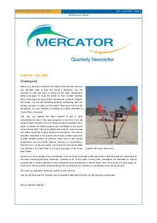
Greetings all, Before you pack your swimsuit and head to the sea this summer, you definitely need to read this month’s newsletter. You are sensitive to cold and want to check out the water temperature before plunging? So read the article on how multiple satellites allow producing new sea surface temperature products (Roquet, this issue). You are still hesitating between windsurfing and kitesurfing and want to check out the winds? Then have a look at the description of a new method to estimate wind fields (Bentamy & Croize-Fillon, this issue). And why not reading the other articles to get a more comprehensive view of the latest progress in the field of air-sea surface fluxes? Barnier et al. are introducing this newsletter with a paper reviewing the latest progress and challenges in the ocean surface fluxes field. They first highlight the need for more accurate and higher resolution surface fluxes and momentum. This point is hereafter illustrated in two papers which both combine data from multiple satellite systems to produce robust sets of sea surface temperature and wind fields (Roquet, Bentamy & Croize-Fillon). Dhomps et al., in the next paper, are testing the new winds fields from Bentamy & Croize-Fillon in a model simulation of the South East Pacific. Barnier et al. also mention that uncertainties in the turbulent exchange coefficients used in bulk formulae are quite large at the eddy permitting/resolving resolution. Skachko et al, in the paper coming next, investigate the possibility to reduce uncertainties in those coefficients using sequential data assimilation of ARGO floats. And the last but not least paper by Ayoub et al. allows a better understanding of the sensitivity of our models to uncertainties in the forcing function. We wish you a pleasant reading as well as a nice summer, And we will meet again in October, with a newsletter dedicated this time to high frequency processes. Have a pleasant reading!

Recommended
More Related Content
Viewers also liked
Viewers also liked (11)
More from Mercator Ocean International
More from Mercator Ocean International (20)
Recently uploaded
Recently uploaded (20)
Mercator Ocean newsletter 22
- 1. Mercator Ocean Quarterly Newsletter #22 – July 2006 – Page 1 GIP Mercator Océan Quarterly Newsletter Editorial - July 2006 Greetings all, Before you pack your swimsuit and head to the sea this summer, you definitely need to read this month’s newsletter. You are sensitive to cold and want to check out the water temperature before plunging? So read the article on how multiple satellites allow producing new sea surface temperature products (Roquet, this issue). You are still hesitating between windsurfing and kite- surfing and want to check out the winds? Then have a look at the description of a new method to estimate wind fields (Bentamy & Croize-Fillon, this issue). And why not reading the other articles to get a more comprehensive view of the latest progress in the field of air-sea surface fluxes? Barnier et al. are introducing this newsletter with a paper reviewing the latest progress and challenges in the ocean surface fluxes field. They first highlight the need for more accurate and higher resolution surface fluxes and momentum. This point is hereafter illustrated in two papers which both combine data from multiple satellite systems to produce robust sets of sea surface temperature and wind fields (Roquet, Bentamy & Croize-Fillon). Dhomps et al., in the next paper, are testing the new winds fields from Bentamy & Croize-Fillon in a model simulation of the South East Pacific. Credits: http://www.benoa.net Barnier et al. also mention that uncertainties in the turbulent exchange coefficients used in bulk formulae are quite large at the eddy permitting/resolving resolution. Skachko et al, in the paper coming next, investigate the possibility to reduce uncertainties in those coefficients using sequential data assimilation of ARGO floats. And the last but not least paper by Ayoub et al. allows a better understanding of the sensitivity of our models to uncertainties in the forcing function. We wish you a pleasant reading as well as a nice summer, And we will meet again in October, with a newsletter dedicated this time to high frequency processes. Have a pleasant reading!
- 2. Mercator Ocean Quarterly Newsletter #22 – July 2006 – Page 2 GIP Mercator Océan Contents News: Ocean Surface Forcing and Surface Fields............................................................................................. 4 MERSEA satellite SST activities and products................................................................................................... 8 Near real time blended surface wind characteristics ....................................................................................... 13 Use of a wind-stress blended dataset to drive a regional Mercator 1/4° configuration. ............................... 20 Air-sea fluxes correction by sequential data assimilation............................................................................... 24 A study of model errors in surface layers due to uncertainties in the atmospheric forcing fields.............. 29 Notebook ............................................................................................................................................................. 39
- 3. Mercator Ocean Quarterly Newsletter #22 – July 2006 – Page 3 GIP Mercator Océan Glossary Agencies: ESA: European Spatial Agency (http://www.esa.int/esaCP/index.html) EUMETSAT: European Organization for the Exploitation of Meteorological Satellites (http://www.eumetsat.int/) NASA: National Aeronautics and Space Administration (http://www.nasa.gov/) NOAA: National Oceanographic and Atmospheric Administration (http://www.noaa.gov/) Various satellites launched by the agencies: ENVISAT, ERS, GOES, AQUA, TRMM (Tropical Rainfall Measurement Mission), MSG (Meteosat Second Generation) Instruments on board of satellites: AVHRR: Advanced Very High Resolution Radiometer ATSR: Along Track Scanning Radiometer AATSR: Advanced Along Track Scanning Radiometer SEVIRI: Spinned Enhanced Visible and Infra-red Radiometer Imager AMSR-E: Advanced Microwave Scanning Radiometer TMI: TRMM Microwave Imager Project acronyms: GODAE: Global Ocean Data Assimilation Experiment (http://www.bom.gov.au/bmrc/ocean/GODAE/) MEDSPIRATION project: ESA funded project (http://www.medspiration.org/) MERSEA: Marine and Environment and Security for the European Area (http://www.mersea.eu.org/) Satellite Products: L2P products: Level-2 Pre-processed products (standard content and format definition for satellite-derived mono-sensor SST products, defined by the GHRSST Pilot Project)
- 4. Mercator Ocean Quarterly Newsletter #22 – July 2006 – Page 4 News : Ocean surface forcing and surface fields News: Ocean surface forcing and surface fields By Bernard Barnier, Laurent Brodeau and Thierry Penduff Equipe de Modélisation des Ecoulements Océaniques à Moyenne et grande échelle (MEOM) Laboratoire des Ecoulements Géophysique et Industriels, Grenoble Exchanges of energy and water occurring at the air-sea interface establish links and feedbacks between the atmosphere and the ocean, and are key processes in the climate and weather systems. There are great needs in climate and oceanographic research for high quality estimates of large scale fluxes of heat, freshwater and momentum. There has been substantial progress in our knowledge of the ocean surface fluxes in recent years. Nevertheless, new challenges have emerged, stimulated by the use of eddy-resolving ocean general circulation models (OGCMs) to investigate the ocean decadal variability and by the rapid development of operational oceanography. The state of our knowledge in the field of air-sea exchanges of energy and water is comprehensively covered in the report on air-sea fluxes from the WCRP working group (1). For in-depth considerations on the need of surface fluxes in operational ocean analysis and forecasting systems, we recommend the book chapter by W. Large (2). Surface flux estimates Attempts to produce climatologies and long-term (decadal) time series of the air-sea flux fields differ in many aspects. For example, Figure 1 compares over a 17-years period, the downward radiations provided by the CORE data set (3) (basically a satellite observation based product), with the one from the ERA40 data set (4) (the recent atmospheric re-analysis performed at ECMWF). Both data sets are considered as state of the art products in terms of flux estimates. In the long term mean, the ERA40 product compared to the CORE one shows a deficit of radiation on the equatorial band and an excess at higher latitudes (Figure 1a). Globally, the ocean receives more radiation (between 2 to 5 Wm-2) with ERA40 (Figure 1b). But the most striking difference between the two data sets is found in their representation of the inter-annual variability (Figure 1cd): ERA40 is showing a quite unrealistic decreasing trend in the inter-tropical band. Similar differences are found between climatologies and time series of the other heat and freshwater fluxes (5). Reasons for that are many, and the lack of observational data is one. But there is one major difficulty for heat flux estimation which is intrinsic to the nature of the fluxes: while the magnitude of individual heat flux components is of the order of a few 100 Wm-2, the net heat flux and the inter-annual variability of the fluxes are of the order of a few 10 Wm-2, and the long-term changes in heat content (or heat transport) of the world ocean is consistent with changes in surface heat flux of a few Wm-2. Thus, the difference of a few W/m2 pointed out in radiative fluxes of CORE and ERA40 (Figure 1b) is significant. This places stringent requirements on the accuracy of flux calculations, since a 10% error on a flux component may introduce a first order bias in the net heat balance. This likely explains why biases can be observed between flux estimates using different sources and retrieval methods. The accuracy of flux calculations is therefore a critical issue. If uncertainties on air-sea fluxes are difficult to quantify because of a lack of direct measurements, they decrease as time and space averaging is performed. The best known constraint is that the long-term mean heat and freshwater fluxes should balance near zero at global scale. However, the use of high resolution ocean models in research and operational systems demands fluxes and surface variables with global coverage at spatial-scales of the order of 10 km and time-scale of a few hours. To meet this demand on every flux or variable entering the forcing function of an OGCM is presently out of range. The accuracy of flux calculation at these scales is thus a new challenge, which is presently taken up with satellite measurements and numerical weather prediction models. Two papers in this newsletter focus on this issue, and present on-going efforts to estimate a consistent set of wind fields at a 6 hour sampling from satellite measurements (paper by A. Bentamy and D. Croize-Fillon), and to produce highly sampled SST (paper by H. Roquet).
- 5. Mercator Ocean Quarterly Newsletter #22 – July 2006 – Page 5 News : Ocean surface forcing and surface fields a b c d Figure 1 Comparison over the period 1984-2000 of the zonal average of the total down-welling radiation (solar plus infrared) provided by CORE (red line) and ERA40 (blue line) data sets. Are shown: a) the distribution with latitude of the long term (17 years) mean, b) the global averaged annual mean for individual years, and the year to year variations in ERA40 (c) and CORE (d). Ocean surface forcing At first thought, the ocean/atmosphere coupling in the surface exchanges is so strong that driving an ocean-only model (i.e. not coupled with an atmospheric model) with observed surface fluxes (i.e. fluxes obtained from observation of surface variables) could be considered as a silly exercise. Nevertheless, oceanographers have been very successful in running ocean-only models in those conditions, provided that some kinds of parameterisation of the ocean feedbacks were used. Therefore, in the process of constructing a forcing function for OGCMs, it would be an error to separate the problem of the estimation and accuracy of surface fluxes and other surface variables, from that of the formulation of the surface boundary condition used by the model. In the NEMO community, two different methods are commonly used to account for the ocean feedbacks on the forcing fluxes, which put different requirements on the surface fields. The flux correction method [6] simply utilizes the global observed flux fields (radiative fluxes (solar and infrared), turbulent fluxes (wind stress, sensible and latent heat, evaporation), precipitation and river runoff). The ocean feedback is parameterised by a relaxation to an observed sea surface temperature (SST) (with a time scale which varies with space and time expressing the sensitivity of the surface fluxes to small changes in SST. The operational MERCATOR analysis system presently uses a simplified version where the relaxation time scale is kept constant.). There are several criticisms levelled at this method. One is that the model SST is not fully prognostic (but it allows a prognostic meridional heat transport). This criticism can be ignored when performing ocean analysis or re-analysis (i.e. with data assimilation) for which a prognostic SST is not an issue. In that case the feedback term may be seen as a "physically consistent nudging" of the model solution to the observed SST and it contributes to constrain the model to remain close to observations (albeit not in an optimal way). Another serious criticism is that the physical consistency between the various components of the forcing (like between evaporation and latent heat) could be lost or seriously degraded when the flux correction become large, which happens frequently in model simulations. In forecast model calculation (i.e. with no data assimilation) this may deteriorate the model solution.
- 6. Mercator Ocean Quarterly Newsletter #22 – July 2006 – Page 6 News : Ocean surface forcing and surface fields NDLR: Per definition, Latent Heat flux (QE) and Evaporation (E) are proportional [W. Large, 2] (eq. 1). Eq. (1) QE=-ΛE where Λ=2.5 x 10 6 j/kg In numerical simulation using the flux correction method, QE and E are initially proportional. However, as the simulation is being performed, QE and E end up not to be proportional anymore. Indeed, the largest part of the flux correction is attributed to a correction of QE, without any proportional correction applied to the E field. The initial E stays out the same during the whole simulation, whereas QE is being modified because of the flux correction. Hence, the physical consistency between QE and E is being lost or degraded throughout the simulation when the flux correction becomes large. The bulk method (7) utilizes bulk aerodynamic formulae and the model SST to calculate the turbulent fluxes (which are locally most sensitive to changes in SST). Observed flux fields are used for the downward solar and infrared radiation, precipitation and river runoff just as in the flux correction method. The representation of the ocean feedbacks is not explicit but lies in the bulk formulae. Air-sea physics are better accounted for in this formulation than in the flux correction method, which introduces additional degrees of freedom. However, as we already mentioned, uncertainties on the exchange coefficients are quite large at the eddy permitting/resolving resolution, and the coefficients used in bulk formulae may need to be adjusted. An interesting approach to that issue is presented in this newsletter by S. Skachko et al., who investigate the possibility to estimate the turbulent exchange coefficients using sequential data assimilation of ARGO heat and salinity profiles in a realistic coarse resolution global model. The demand of air-sea fluxes expressed by the ocean modelling community is increasing rapidly: the need to resolve the diurnal cycle at global scale with a few km scales is already strong. But increasing the accuracy of flux estimation at global scale is a particularly difficult problem. Meeting the demands expressed by our community will certainly require important additional observational means and long term efforts. It is thus likely that uncertainties in the forcing function of ocean models will remain large for some time. It is therefore important that we increase our understanding of the sensitivity of our models to uncertainties in the forcing function. This issue is addressed in this Newsletter from two different angles. A paper by N. Ayoub et al. explores on monthly time scales the errors induced in the surface layers of a ¼ North Atlantic model by uncertainties in the atmospheric forcing fields. Interestingly, this study is among the first using ensemble simulations with an eddy-permitting model. Another paper by A.L. Dhomps et al. investigates the sensitivity of a South East Pacific regional Mercator configuration to presently available high resolution surface wind fields (obtained from blending Quickscat satellite winds and ECMWF analysis). Concluding remarks Our experience in the Clipper and Drakkar projects is that every time we undertook a new series of simulations with a given model configuration, we had to do an empirical correction and adaptation of the available forcing data. Unfortunately, there is no simple methodology to define the forcing function of a simulation. A common approach to decide which forcing data to select is to carry out flux calculations using bulk aerodynamics formulae and observed SST. Fluxes obtained are then extensively compared to other flux data sets, and empirical corrections are performed on various fields, usually in order to correct obvious biases, and to have mean heat and freshwater fluxes balanced to nearly zero at global scale and providing acceptable meridional heat transports. However, this does not assure that these properties of the corrected fluxes will be conserved during model integration (due to the parameterisation of ocean feebacks). We have many examples of models going in a way opposite to that expected using the above procedure (8). Our present impression is that an accurate definition of the forcing requires dedicated sensitivity experiments using the model configuration. It is not clear that significantly coarser resolution models can be used for such sensitivity experiments. Examples with NEMO are that the 2° global configuration ORCA2 shows, in long term calculations, a sensitivity to the forcing fields different than that shown by the 1/2° configuration ORCA05, whereas ORCA05 and ORCA025 (1/4° configuration) tends to show a similar sensitivity. And we may have different sensitivity with eddy permitting model (as the 1/12° resolution future Mercator configuration). References WGASF, 2000: Intercomparison and validation of ocean-atmosphere energy flux fields, Final report of the joint WCRP/SCOR Working Group on Air Sea Fluxes, WCRP-112, WMO/TD-No 1036, 303 pp. Large W., 2006: Surface fluxes for practitioners of global ocean data assimilation, in Ocean Weather Forecasting, Springer, E.P. Chassignet and J. Verron (eds.), 229-270. Large, W. G. and Yeager, S. G. 2004, Diurnal to Decadal Global Forcing For Ocean and Sea-Ice Models: The Data Sets and Flux Climatologies. NCAR technical note, 62 pp.
- 7. Mercator Ocean Quarterly Newsletter #22 – July 2006 – Page 7 News : Ocean surface forcing and surface fields European Centre for Medium-Range Weather Forecasts, 2002: The ERA-40 Archive. Béranger K., B. Barnier, S. Gulev and M. Crépon, 2006 : Comparing twenty years of precipitation estimates from different sources over the world ocean. Ocean Dynamics, Vol. 56-2, 104-138, DOI: 10.1007/s10236-006-0065-2 2006. Barnier B., 1998: Forcing the Ocean, in Ocean Modeling and Parameterization. E. P. Chassignet and J. Verron (eds.), Kluwer Academic Publishers, The Netherlands, 45-80. Large W. G., G. Danabasoglu, S. C. Doney, J. C. McWilliams, 1997: Sensitivity to surface forcing and boundary layer mixing in a global ocean model: annual mean climatology. J. Phys. Oceanogr., 27, 2418-2447. Brodeau L., T. Penduff, and B. Barnier, 2006: Sensitivity of DRAKKAR global simulations to two existing and a hybrid atmospheric forcing functions. Proceedings of the OSTST meeting, Venice, 16-18 March 2006
- 8. Mercator Ocean Quarterly Newsletter #22 – July 2006 – Page 8 MERSEA satellite SST activities and products MERSEA satellite SST activities and products By Hervé Roquet1 with a large contribution from all MERSEA partners 1 Météo-France DP/CMS - Lannion. Introduction The MERSEA project includes an important activity dedicated to remote sensing in order to provide the MERSEA ocean modelling and assimilation centres with the needed Sea Surface Height, Sea Surface Temperature (SST), Ocean Colour and Sea Ice Products. This paper gives an overview of the different satellite SST data sources available, and of the GODAE international satellite SST context. Then the MERSEA R&D activities on satellite SST are described, as well as the expected MERSEA SST analysis products. A large variety of satellite SST data sources and producers During the past ten years, a large number of satellite SST products, derived by different groups or agencies from various satellite sensors and platforms, have become available in near real-time. The instruments used are all passive sensors (radiometers), measuring the natural radiation emitted by the earth surface and propagating through the atmosphere. Two main families of instruments exist, one measuring the radiation in the infra-red wavelengths, the other one the microwave wavelengths. Infra-red radiometers Since the 70s, operational infra-red radiometers are carried on board meteorological polar orbiting satellites, in particular the AVHRR instrument on board the NOAA satellites. The primary objective of this instrument was the imaging of clouds and weather systems for meteorological applications. Nevertheless, by combining the radiation measurements from infra-red window channels at 3.7, 11 and 12 µm, sea surface temperature can be retrieved in the absence of clouds with a typical accuracy of 0.4 – 0.5 ºK (accuracy estimation derived by computing the RMS (Root Mean Square) difference between collocated satellite and buoy measurements). These measurements offer a good horizontal resolution (1 km) and potentially a global coverage, with the important exception of cloudy areas. However, their accuracy is limited not only by the radiometric quality of the AVHRR instrument (noise, calibration), but more importantly by the number of atmospheric effects which have to be accounted for: cloud detection, atmospheric correction for water vapour and aerosols. More recently, infra-red radiometers have been designed specifically for the retrieval of high accuracy SSTs, in particular the European ATSR and AATSR instruments on board the ESA ERS and ENVISAT satellites. These instruments have an improved on board calibration, and make use of dual views at nadir and 20° incidence angle for an improved cloud detection and atmospheric correction, leading in principle to an accuracy of 0.2 – 0.3 ºK. The main drawback of these instruments is their limited coverage, due to a much narrower swath than the AVHRR instruments. Since the 90s, the new generation of operational meteorological geostationary satellites (in particular the NOAA GOES and the EUMETSAT MSG series) are carrying radiometers with similar infra-red window channels as the AVHRR instrument. SST products are being retrieved in real-time from these measurements, with a similar accuracy as the AVHRR SSTs. Their horizontal resolution is coarser (3 – 5 km), but their great contribution comes from their high temporal sampling (up to 15 minutes), which improves also significantly their geographical coverage (because clouds are moving). The geostationary SST products provide also a unique data source for the study of the sea surface temperature diurnal evolution. Microwave radiometers Two microwave radiometers, AMSR-E on board the NASA AQUA satellite and TMI on board the NASA TRMM satellite, are currently used to retrieve in near real-time SST products. The horizontal resolution of these products is around 25 km, and their accuracy around 0.6 – 0.7 ºK. The great advantage of microwave measurements compared to infra-red ones is that SST can be retrieved even through non-precipitating clouds, which is very beneficial in terms of geographical coverage. However, along with their coarse resolution, their main drawback is that they cannot be used close to the coast or the sea ice edge, because of contamination through the signal received from antenna secondary lobes. The role of the GODAE High Resolution SST (GHRSST) Pilot Project In the framework of GODAE, a GHRSST Pilot Project has been launched in 2000, to address key R&D issues related to SST retrieval from satellite measurements, and to define and implement a worldwide organisation for the production, distribution,
- 9. Mercator Ocean Quarterly Newsletter #22 – July 2006 – Page 9 MERSEA satellite SST activities and products archiving and validation of the high resolution SST products required by GODAE (see http://www.ghrsst-pp.org/ for more information). This project, still underway, has been very successful and fruitful, in particular in the following areas: - the definition and adoption by all the satellite SST producers of a common definition of SST (skin/under-skin/bulk), and of common standards for satellite SST products format (“L2P” format, based on NetCDF) and content (confidence levels, bias and error standard deviation estimates, ancillary information about sea ice, wind, solar radiation etc…..), - the implementation of a Global and Regional Data Analysis Centre (GDAC) and of Regional Data Assembly Centres (RDACs), in charge at global and regional level of the production and/or collection, distribution, archiving and validation of satellite SST products. The European RDAC has been developed and is being operated in cooperation between SOC (Southampton Oceanography Center), IFREMER and Météo-France in the framework of the ESA MEDSPIRATION project (MEDSPIRATION products available from ftp://ftp.ifremer.fr/ifremer/medspiration/, and GDAC products from ftp://podaac.jpl.nasa.gov/GHRSST ). MERSEA R&D activities on satellite SST The MERSEA R&D activities on satellite SST are complementary to the ones performed in the context of the GHRSST project, to meet the requirements of the MERSEA modelling and assimilation activities. One of the major needs of MERSEA is the production of regional and global high quality SST analyses, combining available “L2P” satellite SST products made available by the GHRSST GDAC and RDACs. The pre-requisite for this is the implementation of a continuous validation of each data source, for error characterisation and quality control purposes. In the context of a combined use of these satellite SST products within an analysis/assimilation system, it is extremely important to characterize and correct for inter-sensor biases. The current strategy for MERSEA is to consider the AATSR SST products, because of their high accuracy, as the reference to correct the biases of the other data sources. Figure 1 is showing as an example the monthly mean differences between MSG (SEVIRI) and AATSR SST products from January to December 2005, computed from collocated measurements within 5° x 5° boxes. The main feature from this comparison is a cold bias of MSG SST products between 0 and 20°N, due to the presence of aerosols (Saharan dust). Figure 2 is an illustration for a test case in the Tropical Atlantic Ocean on April 4 2005, of the importance of the inter-sensor bias correction (here for MSG and AATSR SST products) before combining them within an analysis scheme. This inter-sensor bias correction scheme is being implemented at Météo France as part of the near real-time processing chain for the production of MERSEA SST analyses.
- 10. Mercator Ocean Quarterly Newsletter #22 – July 2006 – Page 10 MERSEA satellite SST activities and products Figure 1 Monitoring of monthly mean differences between MSG (SEVIRI) and AATSR SST(ºC) products from January to December 2005.
- 11. Mercator Ocean Quarterly Newsletter #22 – July 2006 – Page 11 MERSEA satellite SST activities and products a) b) Figure 2 High Resolution SST (ºC) analysis in the Tropical Atlantic Ocean on April 4 2005, combining MSG and AATSR SST products a) without correction of inter-sensor biases b) with correction. MERSEA SST products For the needs of MERSEA ocean modelling and assimilation systems, daily near real-time High Resolution SST analyses are being developed, combining available “L2P” satellite SST products. The first version of these analyses should be available from October 2006 on, for the following domains and horizontal resolutions: - Global analysis at 10 km horizontal resolution - Atlantic Ocean analysis at 5 km horizontal resolution - Mediterranean Sea analysis at 2 km horizontal resolution - High Latitude analysis (including Norwegian Sea and Baltic Sea) at 2 km horizontal resolution Conclusion and perspectives A lot of efforts are underway at international and european levels to make available in near real-time high quality satellite SST products, and to validate and exploit them within analysis schemes in the MERSEA context. However a lot of scientific work, including impact studies still has to be performed to define the best way of assimilating High Resolution SST products into ocean models. The answer is probably not the same for each modelling and assimilation system (global, regional or coastal).
- 12. Mercator Ocean Quarterly Newsletter #22 – July 2006 – Page 12 MERSEA satellite SST activities and products The perspective in the medium term is probably not the assimilation of gridded SST analyses, but rather of intermediate “super- collated” SST products, resulting from the selection and merging of SST observations from each sensor (“L2P” products) into a single data set, corrected for inter-sensor biases, but preserving the original sampling, resolution and error characteristics of each data source.
- 13. Mercator Ocean Quarterly Newsletter #22 – July 2006 – Page 13 Near real time blended surface wind characteristics Near real time blended surface wind characteristics By Abderrahim Bentamy1 and Denis Croizé-Fillon2 1 Laboratoire d’Océanographie Spatiale – Ifremer Brest 2 Laboratoire d’Océanographie Spatiale, CERSAT – Ifremer Brest Blended wind fields In order to enhance the spatial and temporal resolution of surface wind, the remotely sensed wind retrievals are blended to the operational ECMWF wind analyses over the global ocean. The blending method aims at providing 6-hourly gridded wind speed and direction, as well as zonal and meridional stresses at global scale. The spatial resolution of the resulting wind fields is 0.25° in longitude and latitude. The remotely sensed wind observations are derived from near real time measurements performed by a) Seawinds scatterometer onboard QuikSCAT satellite and b) three Special Sensor Microwave Imager (SSM/I) onboard DMSP satellites F13, F14, and F15. ECMWF analyses are available at synoptic time (00h:00; 06h:00; 12h:00; 18h:00) on a regular latitude- longitude grid of size 0.5625°×0.5625°. The blended wind fields are obtained using the following method. ECMWF analyses are interpolated in space and time over each satellite swath occurring within 3 hours from the synoptic time. We evaluate differences at each scatterometer and radiometer wind cell of about 0.25° resolution. The differences are used through an objective method to estimate global wind fields retaining : first, ECMWF minus QuikSCAT wind differences in swath regions, and second, available and valid ECMWF minus SSM/I wind differences, in the temporal and/or spatial QuikSCAT unsampled areas. SSM/I retrieved surface wind speed is considered as a regionalized variable. On average, it is related to QuikSCAT wind speed through a linear relationship which is determined: on the one hand from QuikSCAT and buoy and on the other hand from SSM/I and buoy comparison results (Bentamy et al, 2002). More details about data, objective method and computation algorithm may be found in Bentamy et al. (2006). The blended wind fields are calculated from April 2004 until April 2006. They are considered as test data that will provide useful insight for near real time production of high space and time resolution at global and regional scales. Data are available at IFREMER and freely distributed upon request. The files are in NetCDF format supported by several scientific softwares. This study is performed within MFSTEP (http://www.bo.ingv.it/mfstep), MERSEA (http://www.mersea.eu.org), and MERCATOR (http://www.mercator-ocean.fr) projects. The aim of this paper is to provide with the main characteristics of these new wind field estimates in terms of accuracy as well as spatial and temporal features at global and local scales. Accuracy of blended wind fields The 6-hourly blended winds are compared with near surface winds derived from two datasets: a) from QuikSCAT scatterometer wind observations and b) from moored buoy wind measurements. The comparison with those two data sets is not straightforward as they are not independent data: a) QuikSCAT winds retrieval are used to compute the blended estimates and are also assimilated into the ECMWF numerical model since 22d January 2002 (Hersbach et al, 2004), b) Buoy measurements are assimilated into the ECMWF numerical model. Nevertheless, the comparison procedure is relevant as it mainly aims at investigating how the objective method retains scatterometer observations. Moreover, the goal is to meet the accuracy results derived from comparison between remotely sensed wind observations and buoy wind measurements determined by several authors (Ebutchi et al, 2002). Buoy Comparisons More than 190 moored buoys are used: 8 moorings located off the French and English coasts and maintained by UK Met-Office and/or Météo-France (hereafter indicated as ODAS buoys), 10 buoys provided by Puertos del Estado located off shore and near shore of Spain (distributed by EPPE, Spanish Ente Publico Puertos del Estado Network), 96 buoys provided by the National Data Buoy Center (NDBC) and located off and near U.S coasts, 66 buoys of the “Tropical Atmosphere Ocean” (TAO) array located in the equatorial Pacific, and 13 buoys of the “Pilot Research Moored Array in the Tropical Atlantic” (PIRATA) network located in the equatorial Atlantic. NDBC, ODAS, and TAO provide hourly winds, while EPPE and PIRATA are 3-hourly and 10 minutes sampled, respectively. Furthermore, buoy winds are measured at various heights. The raw buoy wind speeds are thus converted to a 10 meters standard height, using logarithmic profile and assuming atmospheric neutral stability. For comparison purposes, the valid 10m
- 14. Mercator Ocean Quarterly Newsletter #22 – July 2006 – Page 14 Near real time blended surface wind characteristics buoy winds occurring 3 hours from the synoptic time are arithmetically averaged. At each buoy location and for each 6 hours epoch, all available and valid blended estimates within a radius of 0.25° are selected and averaged. They are then compared to the 6-hourly averaged buoy wind estimates. Figure 1 6-hourly averaged collocated buoy wind speeds as a function of blended wind speeds during January until July 2005
- 15. Mercator Ocean Quarterly Newsletter #22 – July 2006 – Page 15 Near real time blended surface wind characteristics Figure 2 Same as Figure 1 but for wind direction. Figures 1 and 2 illustrate the results for wind speed and direction for the time period January to July 2005. Table 1 summarizes the related statistical parameters. Generally speaking, blended wind speed and direction compare well with buoy estimates. One can notice that the comparisons do not exhibit any systematic biases for wind speed and direction at the five buoy arrays. The wind speed correlation coefficients range from 0.80 to 0.90, while the wind direction vector correlations exceed 1.50, except at PIRATA array (Note that vector correlation coefficient can vary in-between 0 and 2 by definition). The Root Mean Square (RMS) difference (buoy minus blended) for wind speed values are less than 2m/s. Using the statistical characteristics of 6- hourly buoy wind data (not shown), it is found that the mean difference values are about 3% of buoy mean wind speed estimated from the whole buoys and during the comparison period. Wind Speed Wind Direction Length Bias (m/s) Std (m/s) Cor. Bias (degree) Std (degree) Vector Cor ODAS 6580 -0.22 1.80 0.90 -1 16 1.89 EPPE 2263 -0.61 1.92 0.86 1 26 1.69 NDBC 53019 0.23 1.76 0.88 -6 23 1.80 TAO 36181 -0.21 1.36 0.82 -2 20 1.69 PIRATA 4507 -0.47 1.23 0.80 -2 16 1.48 Table 1 Statistical comparisons of wind speed and direction derived from collocated buoy and blended data during January – July 2005. Bias and Std stand for mean of differences and the standard deviation respectively. Cor is the correlation coefficient (in-between 0 and 1 by definition) and Vector Cor is the Vector correlation coefficient (in-between 0 and 2 by definition).
- 16. Mercator Ocean Quarterly Newsletter #22 – July 2006 – Page 16 Near real time blended surface wind characteristics The lowest correlation values of wind speed are found at TAO and PIRATA areas, while the highest values are found at ODAS region (table 1). The large number of low wind speeds (more than 20% of TAO buoy winds are less than 5m/s, (not shown)) and the poor sampling scheme of polar satellites are the main reasons for low correlation values found over the tropical areas. Excluding TAO and PIRATA buoy wind speed less than 3m/s yields to RMS wind speed difference decreasing of about 16% (not shown). Figure 3 illustrates during February 2005 an example of wind speed distribution and sampling scheme impact. At the PIRATA equatorial location (35°W – 0°N) the buoy (in green) and blended (in blue) wind speed time series exhibit a worth agreement than at higher latitude location (38°W – 15°N). One can notice that the blended winds retrieve fairly well the remotely sensed wind observations (shown in red symbols). Figure 3 Time series of wind speed derived from PIRATA buoys (in green), blended (in blue), from ECMWF (in black), and from QuikSCAT observations (red symbols) at the buoy locations : 0°N- 35°W (left), and 15°N – 35°W (right). The results at NDBC and EPPE regions (table 1) are quite similar to previous results related to QuikSCAT wind observation accuracy (see for instance Ebuchi et al, 2002). However, these comparisons involve off-shore as well as near-shore buoys. For instance, when considering NDBC buoys moored off-shore (distance from land larger than 250 km), the wind speed and direction correlation values increase to 0.94 and 1.90 respectively. The RMS differences are about 1.50m/s for wind speed, and 17° for wind direction. For NDBC buoys located near-shore (distance from land less than 30km), the wind speed and direction correlations are 0.86 and 1.64, respectively. It is noticeable that the mean difference values of near-shore buoy and blended wind estimates are quite low (about 0.15m/s for wind speed and 6° for wind direction) and the corresponding standard deviations are about 1.80m/s and 22°. The accuracy of the blended satellite wind data is also investigated for high wind conditions. The sampling length of such events from buoy measurements is generally quite poor. Indeed, less than 4% of buoy wind speeds (most are from NDBC and ODAS networks) exceed 15m/s, during the period January – July 2005. As expected, the correlation between buoy and blended wind speed estimates decreases for such wind condition (not shown). However it is still statistically significant and reaches 0.70. The bias does not exceed 0.42m/s and the standard deviation is less than 2.50m/s. Global Comparisons At global scale, the blended wind field quality is investigated using QuikSCAT and SSM/I collocated wind observations as well as ECMWF wind analysis. The main goal is to highlight how the blended analysis retrieves the remotely sensed wind observations.
- 17. Mercator Ocean Quarterly Newsletter #22 – July 2006 – Page 17 Near real time blended surface wind characteristics Figure 4 Example of Blended wind speed (in color) and direction field (black arrows) over the Mediterranean Sea for 12th March 2006 at 00h:00 (left). Right figure shows the QuikSCAT observations used to estimate the blended wind vectors. Figure 4 shows an example of QuikSCAT wind observations and 6-hourly gridded wind field estimated for the first epoch of 13th March 2006. It indicates that the main wind patterns observed by the scatterometer are clearly restored by the blended analysis. Mediterranean Sea North Atlantic Tropical Atlantic Bias (m/s) Rms (m/s) Cor Bias (m/s) Rms. (m/s) Cor. Bias (m/s) Rms. (m/s) Cor. Sat / Blnd 0.00 0.25 0.99 0.00 0.28 0.99 0.01 0.28 0.99W Sat /ECM 0.45 1.43 0.96 0.28 1.06 0.96 0.58 1.00 0.96 Sat/Blnd 0.00 0.24 0.99 0.00 0.29 0.99 0.01 0.27 0.99U Sat/ECM -0.16 1.08 0.92 0.03 0.81 0.92 0.03 0.97 0.86 Sat/Blnd 0.00 0.25 0.99 0.00 0.31 0.99 0.02 0.29 0.99V Sat/ECM 0.33 1.27 0.96 0.13 1.01 0.95 -0.61 1.03 0.93 Table 2 Statistical parameters characterizing the comparisons between satellite observation and blended analysis on the one hand, and between satellite observations and ECMWF wind analysis on the other hand, during the period January – July 2005. Bias and Rms stand for mean and root mean square of differences, respectively. Cor is the correlation coefficient. W, U, V state for wind speed, zonal and meridional wind components, respectively. Sat, Blnd, ECM are for Satellite, blended, and ECMWF winds. The comparison of the remotely sensed and satellite blended winds are investigated in various oceanic regions. Table 2 summarizes the comparisons results. Results related to satellite observation and ECMWF analysis are shown too. On average, the bias between satellite observation and blended wind analysis is very low. The RMS values do not exceed 0.31m/s. Comparisons between ECMWF and resulting blended wind fields are performed for various spatial and temporal scales. Figure 5 illustrates an example of such comparisons performed for January and August 2005. The blended wind fields exhibit the main known wind features (Figure 5a and 5b). Lowest winds occur in the equatorial area. Wind speeds increase poleward from the equator, with the largest wind speed in the northern ocean during winter season, and in the southern ocean during summer season. For instance, at 55°N (Figure 5a) and 55°S (Figure 5b) in the Atlantic Ocean, the wind speed values exceed 18m/s. At the equator, the mean wind speed is about 5.70m/s in winter and 7.12m/s in summer. Such statistics indicate that the ratio of high latitude to equatorial wind speed is more than 2. One can notice that the moving of ITCZ is clearly depicted between January and August.
- 18. Mercator Ocean Quarterly Newsletter #22 – July 2006 – Page 18 Near real time blended surface wind characteristics Figure 5 January and August 2005 wind speed monthly maps for a) and b) blended And c) and d) difference between ECMWF and blended . The difference between ECMWF and blended (ECMWF minus blended) 6-hourly wind speed are shown in Figure 5c and 5d for January and August 2005, respectively. On average, the blended wind speeds are slightly larger than ECMWF analyses. The overall difference biases in January and August are about –0.90m/s and –0.50m/s, respectively. The difference patterns indicate that ECMWF analysis underestimates the wind speed amplitude at tropical latitudes, especially in the eastern tropical Atlantic and Pacific regions. In these regions, the mean difference exceeds 2m/s. At high southern latitudes (40°S), positive difference biases occur in several areas during winter season and are about 0.50m/s. Summary In an examination of the accuracy of the blended surface wind speed and direction (and the related wind components), various comparisons were performed using in-situ and remotely sensed measurements as references. In general, the blended winds agree well with 6-hourly averaged buoy wind estimates. The wind speed correlation coefficients are high and exceed significantly 0.80. The RMS differences between blended and buoy wind speed and direction are less than 2m/s and 26° respectively. Using only off shore buoy data enhances the comparison statistics. The comparison between collocated blended and remotely sensed winds indicate that the two sources are very close to one another and that no systematic bias was found at global or local scales. References Bentamy A., H-L Ayina, P. Queffeulou, D. Croize-Fillon ; 2006 : Improved Near Real Time Surface Wind Resolution over The Mediterranean Sea. Submitted to Ocean Journal. Bentamy A., K B. Katsaros, M. Alberto, W. M. Drennan, E. B. Forde, 2002: Daily surface wind fields produced by merged satellite data. American Geophys. Union, 343-349.
- 19. Mercator Ocean Quarterly Newsletter #22 – July 2006 – Page 19 Near real time blended surface wind characteristics Hersbach, H., Stoffelen, A., and de Haan, S.: The improved C-band geophysical model function CMOD5, Proceeding of the Envisat & ERS Symposium Salzburg (A), 6–10 September 2004. Ebuchi N., H. C. Graber, and M. J. Caruso, 2002 : Evaluation of wind vectors observed by QuikSCAT/SeaWinds using ocean buoy data, J. Atmos. Oceanic Tech., Vol 19, 2049- 2062.
- 20. Mercator Ocean Quarterly Newsletter #22 – July 2006 – Page 20 Use of a wind-stress blended dataset to drive a regional Mercator ¼° configuration Use of a wind-stress blended dataset to drive a regional Mercator 1/4° configuration. By Anne-Lise Dhomps1 , Gilles Garric2 , Yann Drillet2 and Abderrahim Bentamy3 1 Mercator-Océan , 2 CERFACS - Mercator-Océan, 3 Laboratoire d’océanographie spatiale – Ifremer Brest Introduction The ECMWF (European Centre for Medium range Weather and Forecasts, Reading) analyses and re-analyses represent one of the most reliable atmospheric dataset in time and space. In analyses or forecasts mode, the Mercator-Ocean operational systems are presently driven at the surface by ECMWF atmospheric conditions. However, the use of atmospheric fields from Atmosphere General Circulation Model (GCM) to constraint Oceanic GCMs implies spatial interpolation from the atmospheric grid to the oceanic one. It creates inconsistencies for example near the coast where the two land-sea masks do not match exactly (i.e. with atmospheric land values used as oceanic values and vice-versa). These mismatches are particularly large in the presence of high continental topography near the oceanic coast where a strong localised atmospheric circulation can disturb the coastal oceanic circulation. Moreover, the IFS (Integrated Forecast System) ECMWF spectral model produces Gibbs fringing near the relief, phenomenon particularly well marked close to high mountains. [Echevin et al., 2005] highlighted recently the unrealistic circulation in the South-East Pacific simulated by the previous version of the Mercator-Ocean global model constrained by the ERA40 (ECMWF Reanalyses) products. This was undoubtedly due to an unrealistic strong and persistent ERA40 wind stress curl along the Peru-Chile coastline. This area, characterised by strong and persistent upwellings all year long and by one of the world’s four major eastern boundary current systems (see [Strub et al., 1998] for more details), is highly dependent on the accuracy of the atmospheric forcing. The idea of this paper is to test in the South East Pacific the near real time blended wind datasets developed by the CERSAT (Centre ERS d’Archivage et de Traitement) and described by [Bentamy and Croize-Fillon, this issue]. Merging ECMWF wind analyses with measurements of winds performed by both scatterometer (QuickScat) and radiometers (DMSP, Defense Metorological satellites Program) instruments allow a better spatial sampling (25 km) than ECMWF analyses. Bentamy and Croize-Fillon (this issue) show how the blended winds retrieve fairly well the 6-hourly average buoy wind estimates at five buoy arrays representing different wind regimes. The blended winds dataset is particularly well adapted to the global Mercator-Ocean operational system because it is using the operational ECMWF wind analyses, has a 0.25° spatial resolution and a near real time production. The goal of this study is to measure the impact of the dynamical atmospheric forcing in setting a coastal circulation and in preconditioning upwelling mesoscale processes. It is not to improve the representation of the upwelling systems as our eddy permitting resolution model is not adapted for this purpose. Tools and method With the closeness of the Andes Cordillera and strong upwellings, the South-East Pacific area is a particularly well adapted area to study the realism of the real time blended wind datasets. We have developed a South-East Pacific regional configuration [100°W-67°W; 5°N-40°S] with closed boundary conditions relaxed to temperature and salinity profiles from [Levitus et al., 2001]. We use the OPA9 (NEMO) code developed at LOCEAN [Madec et al., 1998] with the ¼° horizontal resolution Mercator-Ocean configuration (hereafter ORCA025_LIM). Briefly, this is a configuration with 46 vertical z-levels (refined at the surface (1m) and coarse at the bottom (500 m)); we use the partial cells to represent the bottom topography, the free surface formulation, isopycnal diffusion, biharmonic horizontal viscosity, the recently implemented vorticity scheme conserving energy and enstrophy and finally, a daily sea surface salinity damping towards the seasonal Levitus climatology. The reader can refer to a very close configuration described in [Barnier et al., 2006] to appreciate in more details the impact of these recent state of the art numerical schemes on the mean flow patterns and distribution of eddy kinetic energy solved by this model. In order to assess the blended products impact on the Peru-Chile coastal circulation, two experiments are performed over the year 2005 with the regional configuration described above. The first one, hereafter T01, is forced with the ECMWF analysis wind stress (mean daily sampling at ~0.35° resolution) and the second one, hereafter T02, with the wind stress coming from Blended winds and calculated by the CERSAT (mean daily sampling at ~0.25° resolution). They are both initialised with Levitus climatology.
- 21. Mercator Ocean Quarterly Newsletter #22 – July 2006 – Page 21 Use of a wind-stress blended dataset to drive a regional Mercator ¼° configuration Results Gibbs fringing disappearance The inclusion of the satellite signals in the ECMWF analysis to build the blended product allows removing almost entirely the Gibbs fringing (Figure 1). Although small regular oscillations are still present far from the coast, Figure 1 shows a complete disappearance of the waves at the coast found in the ECMWF analysis. These stationary waves found usually in the spectral atmospheric general circulation model are undoubtedly the source of unrealistic oceanic circulation. Figure 1 30°S Zonal mean of the mean July-August-September 2005 zonal wind-stress component for the ECMWF analysis (black line) and for the blended dataset (red line) in N/m-². 30°S being the latitude where the Gibbs phenomenon is the most pronounced. The coastal surface circulation The Peru coastal circulation presents three major currents: the equatorward surface Peru Coastal Current (PCC), the poleward sub-surface Peru-Chili Countercurrent (PCCC) and the Poleward Undercurrent (PUC) (at ~100 m depth). The last two currents come from branches of the Equatorial Undercurrent (See [Strub et al., 1998] for more details of the coastal ocean circulation off western South America). Figure 2 shows the surface current modelled by the two experiments. The noisy ECMWF wind stresses patterns (not shown) are at the origin of the very noisy PCC modelled by T01. This is the direct consequence of the land-sea mismatches between the atmospheric and ocean models. We can also note that the PCC modelled by T01 is northward. A previous experiment using the ¼° OPA8.2 model and forced by the coarser resolution ERA40 ECMWF analysis was showing a southward PCC. This difference is due to the better resolution (and closer to the ORCA025_LIM resolution) of the ECMWF analyses (~0.35°) used in T01 than the coarser resolution of the ERA40 ECMWF (~1.1°) grid fields. As can be seen on Figure 2, the use of blended wind stresses products in T02 allows removing entirely the noise in the surface coastal Peru current systems. However, the northward PCC modelled by T02 has almost completely vanished revealing instead a non-coherent spatial pattern along the coast (Figure 2). The blended wind stresses products in this area are weaker than the ECMWF analyses (not shown). Moreover, the momentum transfer coefficient used to evaluate the CERSAT blended wind products is weak compared to the literature. Thus, the treatment at the coast in the objective method used to build the blended products needs to be studied in more details. The latter assertion is confirmed by [Bentamy and Croize-Fillon, this issue] who noticed that the correlation of wind speed and direction between their blended products and buoys data increased when they remove the near-shore (distance from coast less than 250km) buoys in their analysis. This depicts the fact that blended wind stresses products are less accurate when approaching the coast.
- 22. Mercator Ocean Quarterly Newsletter #22 – July 2006 – Page 22 Use of a wind-stress blended dataset to drive a regional Mercator ¼° configuration Figure 2 Annual mean of surface currents (cm/s) along the Peru coast modelled by the T01 experiment (left) and the T02 experiment (right). Figure 3 shows the temperature profile at 12°S (Peru coast) for the T01 and T02 experiments and for the ARMOR reanalyses 1 . The T01 coastal temperature profile is closer to the ARMOR temperature analyses than the T02 experiment. Even if the ARMOR analyses are masked well off-shore the coast, the T02 experiment reveals warmer water masses and a weak upwelling system compared to what is currently observed [Strub et al., 1998]. This deficiency is clearly the consequence of the weak northward blended wind stresses which inhibits the set up of the upwelling systems by the Ekman pumping. Figure 3 Vertical [0-240m] and meridional [85°W-77°W] section of the annual mean temperature (°C) at 12°S for the T01 experiment (upper left), the T02 experiment (upper right) and the ARMOR reanalyses (bottom right) 1 http://www.mercator-ocean.fr/html/systemes_ops/armor/index_en.html
- 23. Mercator Ocean Quarterly Newsletter #22 – July 2006 – Page 23 Use of a wind-stress blended dataset to drive a regional Mercator ¼° configuration The coastal subsurface circulation The T01 experiment shows a well developed PCC and PCCC compared to the T02 experiment (Figure 4). This highlights again a better magnitude and direction in general of the ECMWF wind stress than the blended wind stress in this area. However, the T02 experiment allows a reinforcement of the PUC which presupposes a better wind stress shear at the surface in the blended wind products (Figure 4). Figure 4 Annual mean of the meridional current (cm/s) from the surface to 240 m depth at 12°S (Peru) and between 85°W to 77°W; positive values are northward. Concluding remarks This short note presents preliminary results highlighting the importance of the wind-forced oceanic coastal circulation. On the one hand, compared to the ECMWF analysis, the blended wind-stresses dataset from CERSAT shows a more comprehensive spatial pattern at the coast and allows the development of the Poleward Undercurrent. On the other hand, the Peru-Chile Current driven by the blended wind stresses is less intense than what should be observed. The formulation chosen to calculate the blended wind stresses reveals a weak transfer coefficient. This may explain the weak coastal surface current, and consecutively, the weak upwellings. Moreover, these results led us to plan other works by using the wind blended products and calculate in NEMO the induced wind stress with a more appropriate bulk formulation. This work initiated a collaboration between the operational oceanography and the atmospheric ‘remote sensing’ community. This ended in fruitful discussions and in positive feedbacks for the two communities. This work should be continuing in order to better understand the impact of such products in areas of strong atmospheric-induced oceanic circulation or to evaluate the oceanic response to the scales resolved by the blended products. Acknowledgements The authors gratefully acknowledge V. Echevin for helpful comments. References Barnier, B., G. Madec, and c. authors, (2006), Impact of partial steps and momentum advection schemes in a global ocean circulation model at eddy permitting resolution, Ocean Dynamics, Accepted. Echevin, V., P. Marchesiello, and P. Penven, (2005), Modelling of eastern boundary upwelling systems with Mercator, Mercator Ocean Quart. Newsletter, 18, 18-22. Levitus, S., J.I. Antonov, T.P. Boyer, and C. Stephens, World Ocean Database 1998, (2001), National Oceanographic Data Center, Silver Spring, MD. Madec, G., P. Delecluse, M. Imbard, and C. Levy, OPA 8.1 general circulation model reference manual, (1998), Notes de l'Institut Pierre-Simon Laplace (IPSL) - Universite P. et M. Curie, B102 T15-E5, 4 place Jussieu, Paris cedex 5, 91p. Strub, P.T., J.M. Mesias, V. Montecino, J. Rutllant, and S. salinas, Coastal ocean circulation off western South America, in The Sea, volume 11, pp. 273-313, ed. Allan R. Robinson and Kenneth H. Brink, John Willey & Sons, Inc., 1998 85W 83W 81W 79W 77W 85W 83W 81W 79W 77W
- 24. Mercator Ocean Quarterly Newsletter #22 – July 2006 – Page 24 Air-sea fluxes correction by sequential data assimilation Air-sea fluxes correction by sequential data assimilation. By Sergey Skachko, Jean-Michel Brankart, Frédéric Castruccio, Pierre Brasseur and Jacques Verron Equipe de Modélisation des Ecoulements Océaniques à Moyenne et grande échelle (MEOM) - Grenoble. Bulk formulations parameterizing turbulent air sea fluxes are one of the main sources of error in present ocean model prediction. The objective of this study is to control the turbulent exchange coefficients using sequential data assimilation and oceanic observations. The method is to increase the control vector of the assimilation scheme by the model parameters that should be controlled. In this paper, we focus on the particular example of estimating two bulk coefficients driving the sensible and latent heat fluxes as well as the evaporation flux of a global ocean model, by assimilating temperature and salinity profiles with a horizontal and temporal sampling similar to the ARGO float deployment expected in the near future. The results of twin experiments show that the method is able to correctly estimate the large scale variations of the bulk coefficients, leading to a significant improvement of the atmospheric forcing applied to the ocean model. Consequently, the method could be directly usable by existing ocean operational systems to produce more realistic forecasts of the thermohaline characteristics of the mixed layer. Why correcting the fluxes with sequential data assimilation? Turbulent momentum, heat and fresh water fluxes at the air-sea interface (usually computed using bulk formulations) are one of the main sources of error in present ocean models (Large, W., 2006). They strongly penalize the capacity to provide a realistic operational forecast of the thermohaline characteristics of the mixed layer and of the surface ocean currents. This is the reason why we decided to investigate how to improve these fluxes by assimilating oceanic observations. A natural way to address this problem would be to use a 4D-VAR variational assimilation scheme, including the fluxes in the control parameters of the model, in addition to the initial condition (Roquet et al., 1993; Stammer et al., 2004). However, such procedure is very hard to set up and computationally very expensive. Moreover, the existing MERCATOR operational systems are based on sequential assimilation schemes that would get great benefit from an improvement in the fluxes. This is why it is useful to look for alternate schemes that are numerically cheap and easy to implement in the existing systems. Our starting point is a classical reduced order Kalman filter or optimal interpolation scheme in which the background error covariance matrix is represented by a set of 3D error modes in the state space of the ocean model. In this study, we use an assimilation scheme derived from the SEEK filter (Pham et al, 1998). However, the method is directly applicable in any assimilation scheme of the same kind, like ensemble optimal interpolation schemes, ensemble Kalman filters (Evensen, 2003), or any variant of reduced order Kalman filters: the RRSQRT scheme (Heemink et al., 2001), the ESSE system (Lermusiaux and Robinson, 1999), or the SEEK filter. How to correct the fluxes with sequential data assimilation? The general method to identify model parameters (like the air-sea fluxes) using a Kalman filter is to augment the filter control space by including these parameters, in addition to the state variables. This technique, although very common in the engineering literature (Cox, 1964; Ho and Whalen, 1963; Nelson and Stear, 1976; Ljung, 1979), has not often been used in atmospheric or oceanographic applications of the Kalman filter (Aksoy et al., 2006). If the purpose of the Kalman filter is to control the air-sea fluxes, the control parameters could be the fluxes themselves or the atmospheric fields from which they are computed. However, we found preferable to include in the control vector a few key parameters of the bulk formula, (i) because they are more likely to persist in time (the aim is to improve the forecast), (ii) because they are likely to be as easily controllable by ocean observations (provided that we only include parameters that are linearly linked to the value of the flux), and (iii) because they can be assumed to be the real source of error (even if we will probably be lead to compensate errors on the atmospheric parameters by correcting the bulk coefficients). In the example discussed below, we augment the control vector of the assimilation scheme with two bulk parameters: the latent and sensible heat flux coefficients EC and HC , in addition to prognostic variables of the model. These turbulent bulk coefficients are involved in the computation of the following quantities: - the latent heat flux: ( )aSEaL qqWLCCQ −= ,0max (1) - the evaporation fresh water flux: LQE L /= (2) - the sensible heat flux: ( )awHaS TTWCCCQ −= (3)
- 25. Mercator Ocean Quarterly Newsletter #22 – July 2006 – Page 25 Air-sea fluxes correction by sequential data assimilation Where L is the vaporization latent heat, sq and aq are the surface and atmospheric specific humidities, aC the air density, C the air specific heat, W the wind speed, wT and aT the air and sea surface temperature. Hence, in our example, the estimation vector then writes [ ]HE CCVUST ,,,,, instead of [ ]VUST ,,, . Consequently, from observations of temperature and salinity it will be possible to infer a correction to the bulk coefficients. Obviously the estimation will strongly depend on the background error covariance between these 6 variables; this is the pattern of the correlation between [ ]ST, and [ ]HE CC , that will govern the computation of a correction to [ ]HE CC , from a diagnostics of error in the [ ]ST, fields. In order to generate this covariance matrix, we build an ensemble of ocean models, characterized by various values of the parameters (constant horizontally for each model). For every member of the ensemble, EC and HC values are obtained as random numbers sampled from a normal distribution with mean values 33 10.14,1,10.18,1 −− == HE CC , (corresponding to the false ocean, see paragraph below for the definition of the “false ocean”) and a variance 3 10.15,0 − =C . The dispersion of the parameters in this ensemble is chosen to be consistent with a priori information on the parameters error covariance. From this ensemble of ocean models, we compute an ensemble of forecasts (in the augmented estimation space), that we use to parameterise the background error covariance matrix. Two different approaches have been considered to implement the correction of the parameters into the model. In the first one, we assume that the system can be controlled by adjusting the bulk parameters only: there is no more direct correction of the state vector, and the correction is applied by restarting the model from the initial condition of the current assimilation cycle using the corrected parameters. In the second one, the state vector of the model is corrected as in the original scheme (using Incremental Analysis Update (IAU) like in Ourmières et al., 2006), and the new parameters are taken into account in the next forecast. Results from a one-year assimilation experiment In this section, we discuss an example in which only the latent heat flux coefficient ( )EC and the sensible heat flux coefficient ( )HC are included in the control vector. The two new approaches are compared to the original scheme (without parameter correction) using twin assimilation experiments with the ORCA2/ OPA global ocean configuration, that are designed as follows. The reference simulation (the true ocean) is the standard ORCA2 interannual simulation for the year 1993, with the original ORCA2 bulk formula (in which ( )EC and ( )HC receive very complex parametrizations depending in particular on the stability of the air column close to the sea surface). The relaxation terms towards climatological sea surface salinity and temperature data have been excluded from the model equations. Synthetic observations of temperature and salinity profiles are then sampled from this reference simulation to be assimilated in a perturbed simulation (the false ocean) in which the values of the bulk coefficients ( )EC and ( )HC are kept constant in space and time. The initial condition of the false ocean is kept the same as the initial condition of the reference simulation, so that the only source of difference between the true ocean and the false ocean is model error due to ( )EC and ( )HC . The observations of temperature and salinity profiles from the true ocean are sampled every 10 days, down to 216 m depth, and every two nodes of the model horizontal grid. This observation sampling is meant to simulate roughly the horizontal ARGO float distribution that can be expected in the near future. The vertical extension of the profiles is limited to the upper 216 m because this region is mostly influenced by the surface processes that are expected to be controlled by the bulk coefficients.
- 26. Mercator Ocean Quarterly Newsletter #22 – July 2006 – Page 26 Air-sea fluxes correction by sequential data assimilation Figure 1 Spatial distributions of RMS errors (in degrees Celsius) on SST 10-day forecasts for the original assimilation scheme (left-hand plot), the first variant of parameter correction (central plot), the second variant of parameter correction (right-hand plot). Figure1 shows maps of root mean square (RMS) error on sea surface temperature (SST) 10-day forecasts comparing the original assimilation scheme (left panel) to the two new schemes with parameter correction. The RMS errors are calculated with respect to the referenced simulation data. We can see that the RMS error in the original scheme is everywhere larger than the RMS error corresponding to the new schemes. Generally speaking, the RMS error on SST 10-day forecast is especially reduced by the correction of the parameters in regions where the error was large in the original scheme, making the resulting error maps more homogeneous over the world ocean. Figure 2 RMS error (x 10 3 ) (dimensionless) on the latent heat flux exchange coefficient ( )EC for the original assimilation scheme (left- hand plot), the first variant of parameter correction (central plot), the second variant of parameter correction (right-hand plot). Figure 2 shows maps of RMS error on the parameter comparing the original assimilation scheme (left panel) to the two new schemes with parameter correction. We can see the RMS error for the original scheme is generally much larger than the RMS error corresponding to the new schemes. There are large discrepancies between the values of constant coefficients of the false model and the coefficients values of true ocean almost everywhere in the world ocean. The most significant discrepancies are observed in the area along the Asian coast of North Pacific, Labrador Sea in Atlantic and in the South Indian Ocean, as well as the Antarctic coast. This is indubitably the reason of the poor SST forecast quality of the original scheme described above. On the contrary, the schemes including parameter correction demonstrate a good ability to reproduce correctly the spatial distribution of the true coefficients from their constant values almost everywhere in the world ocean (central and right-hand plots on the Figure 2) during the full period of our experiments. The overall quality of the bulk coefficients for these two methods is quite similar, though the first variant provides more reliable results in the South Ocean along the entire Antarctic coast. Since forecasts quality of sea surface temperature (Figure 1) and the salinity (not shown) as well as the bulk parameters (Figure 2) was improved with new methods with respect to the original scheme, we can expect that the fluxes themselves computed using formula (1), (2) and (3) will also be improved. This is illustrated by Figure 3 showing the spatial distributions of the RMS error values on the latent (upper plots) and sensible (lower plots) heat fluxes respectively for the original scheme (left-hand
- 27. Mercator Ocean Quarterly Newsletter #22 – July 2006 – Page 27 Air-sea fluxes correction by sequential data assimilation column), the first (centre column) and the second (right-hand column) variants of the scheme. The evaporation flux is linked to the latent heat flux by equation (2), so that the results for evaporation are obvious from the latent heat flux results. Figure 3 Spatial distribution of RMS error values (W / m 2 ) on the latent heat flux (upper plots) and the sensible heat flux (lower plots) for the initial scheme (left-hand column), the first variant (centre column) and second (right-hand column) variants of the scheme. As we can gather from this figure, both new methods involving bulk parameters estimation improve significantly the quality of the latent and sensible heat fluxes, applied to the model, with respect to the original scheme. These new variants result in significant decrease of discrepancies, caused by perturbed bulk parameters, taking place mainly in such high energetic regions like Gulf Stream, Kuroshivo as far as in the Tropical belt in Pacific, Indian and Atlantic oceans. The new methods improve also the surface fluxes near the Antarctic coast. Generally, the RMS error values for the new methods taking into account parameters estimation are smaller than the corresponding values of the original scheme. The only case where our estimation method experiences difficulties is the Western Equatorial Pacific for the sensible heat flux. Here the estimated sensible heat flux values diverge slightly from the flux values of the reference model, and the RMS error values are larger than in the original scheme. At this stage of the study, however, there is no clear explanation of this problem yet. Concluding remarks Two procedures for estimating turbulent air-sea flux bulk parameters by Kalman filtering techniques have been implemented and tested with a one-year assimilation experiment (see Skachko et al., 2006 for more details about the method and about the experiment). Both are based on the augmentation of the control vector by the parameters that must be estimated, with covariance matrices in the augmented control space computed using ensemble experiments. The first procedure focuses on the correction of the model parameters, without any possibility of correcting other sources of errors. It has been designed to perform ocean modelling where simulations are not corrupted by systematic errors in the air-sea fluxes, and this algorithm can be viewed as an optimal flux correction procedure using ocean observation (like SST and SSS). It could beneficially replace the classical Newtonian relaxation to sea surface temperature and salinity, without introducing any non-physical term in the model equations. The second procedure combines a correction of the model parameters with a correction of the full model state vector. It has been designed to work in complement to an existing assimilation scheme, thus allowing dealing with other sources of errors, controlled by other kinds of observations. Results of twin experiments show that both methods lead to accurate estimations of the parameters, and to a significant improvement in the analysis and forecast of the mixed layer thermohaline characteristics. The positive results give us a
- 28. Mercator Ocean Quarterly Newsletter #22 – July 2006 – Page 28 Air-sea fluxes correction by sequential data assimilation background for future work: to apply this method in a more realistic problem with assimilation of real data profiles. However, several questions still need to be answered. How many bulk parameters is it possible to control using only oceanic observations? What is the impact of initial error in the ocean state? In other words, is it possible to control the full system, i.e. the ocean state and the flux parameters, with the available ocean observation system? References Aksoy A., F. Zhang, J. W. Nielsen-Gammon, Ensemble-based simultaneous state and parameter estimation with MM5. Geophysical Research Letters, Vol. 33, No. 12, L12801 doi: 10.1029/2006GL026186, 2006; Cox, H., On the estimation of state variables and parameters for noisy dynamic systems, IEEE Tran. Automat. Contr., 9 , 5 12, 1964; Evensen, G., The ensemble Kalman filter: Theoretical formulation and practical implementation, Ocean Dynamics, 53 , 343 367, 2003; Heemink, A. W., M. Verlaan, and A. J. Segers, Variance reduced ensemble kalman filtering, Monthly Weather Review, 129 , 1718 1728, 2001; Ho, Y., and B. Whalen, An approach to the identification and control of linear dynamics systems with unknown parameters, IEEE Tran. Automat. Contr., 8 , 255 256, 1963; Large, W., Surface fluxes for practioners of global ocean data assimilation. in: GODAE, an Integrated view of Oceanography : Ocean Weather Forecasting in the 21st Century (J. Verron and E. Chassignet Eds.), Springer, 577 pages 2006; Lermusiaux, P. F. J., and A. R. Robinson, Data assimilation via error subspace statistical estimation. Part I: Theory and schemes, Monthly Weather Review, 127 , 1385 1407, 1999.; Ljung, L., Asymptotic behavior of the extended kalman filter as a parameter estimator for linear systems, IEEE Tran. Automat. Contr., 24 , 36 50, 1979; Nelson, L., and E. Stear, The simultaneous on-line estimation of parameters and states in linear systems, IEEE Tran. Automat. Contr., 21 , 94 98, 1976.; Ourmières, Y., J.-M. Brankart, L. Berline, P. Brasseur, and J. Verron, Incremental analysis update implementation into a sequential ocean data assimilation system, 2006, Journal of Atmospheric and Oceanic Technologies, in press; Pham, D. T., J. Verron, and M. C. Roubaud, Singular evolutive extended Kalman filter with EOF initialization for data assimilation in oceanography, J. Marine. Sys., 16 , 323 340, 1998; Roquet, H., S. Planton, and P. Gaspar, Determination of ocean surface heat fluxes by a variational method, Journal of Geophysical Research, 98, No. C6, june 15 , 10,211 10,221, 1993; Skachko S., J.-M. Brankart, F. Castruccio, P. Brasseur, J. Verron, Estimating turbulent air-sea flux bulk parameters by sequential data assimilation, submitted to Remote Sensing of Environment, July 2006; Stammer, D., K. Ueyoshi, A. Kohl, W. Large, S. Josey, and C. Wunsch, Estimating air-sea fluxes of heat, freshwater, and momentum through global ocean data assimilation, Journal of Geophysical Research, 109(C5), 2004, 10.1029/2003JC002082.
- 29. Mercator Ocean Quarterly Newsletter #22 – July 2006 – Page 29 A study of model errors in surface layers due to uncertainties in the atmospheric forcing fields A study of model errors in surface layers due to uncertainties in the atmospheric forcing fields By Nadia Ayoub1 , Marc Lucas1 , Bernard Barnier1 , Thierry Penduff1 , Guillaume Valladeau2 and Pierre De Mey2 (1) LEGI/CNRS - Grenoble, (2) LEGOS/CNRS - Toulouse Introduction Estimates of model errors should be available to users of OGCM simulations for research purposes or operational applications. They are necessary for the evaluation of the degree of realism of the simulation as well as for better interpreting model-data misfits. In particular, data assimilation or state estimation methods require the specification of model errors. The latter are given as the covariance matrix of forecast or background errors on the control variables. Estimation of model errors is sometimes based on model-data comparisons, but this is not an easy approach because model-data discrepancies include uncertainties on the observations themselves and representation errors that should be distinguished from intrinsic model errors. Finally, it implies some limitations on the space and time scales over which the evaluation is made (since data are not available everywhere at every model time step); stationarity and isotropy hypotheses are then usually made to extrapolate towards the non-observed scales. Ensemble methods offer the possibility to quantitatively estimate model errors and test the robustness of a simulation in response to given perturbations on state variables, parameters and boundary/initial conditions. They constitute the basis of the so-called Ensemble Kalman Filter (Evensen, 2003), where the forecast error covariance matrices are computed from statistics on an ensemble of simulations generated by randomly perturbing initial conditions (or any parameters or boundary conditions). The estimation of errors in OGCM is an issue which has not really been addressed yet, in all likelihood because of complexity of the problem and of numerical computation limitations. Recently, it has received more attention in particular through the use of ensemble methods (see among recent studies: Wirth and Ghil (2000), Auclair et al. (2003)). Model errors arise from various sources: non-represented or mis-represented physics (approximations in the equations, parameterizations for unresolved processes, uncertainties of parameters values), discretization (of the equations) and boundary conditions (initial, surface, lateral and at the bottom). Errors in the atmospheric forcing are expected to have significant impact at different space and time scales. For example, a local error on the wind velocity amplitude influences the local and ‘instantaneous’ vertical mixing in the mixed layer but has a cumulated and remote effect as well through the generation of waves. Atmospheric forcing errors include errors in the atmospheric fields themselves and errors in the air-sea exchange formulation (e.g. bulk formulae). Most of the time, OGCMs are forced with NWP fields such as the ECMWF or NCEP (re)analyses, for which uncertainties are usually not provided. According to the different sources of atmospheric uncertainties that one considers, many questions arise on the induced ocean response. For example, how deep is the impact of the uncertainties in the water column? To what extent does it depend on the state of the ocean (e.g. stratified or well-mixed)? What are the relative impacts of small-scale errors and large-scale trends? What is the ocean feedback to small-scale perturbations in the atmospheric forcing? Our project aims at answering some of these questions in the context of an eddy-permitting simulation in the North Atlantic. The objective is to explore the model errors in surface layers and at monthly time scales due to uncertainties in the atmospheric forcing fields. We use an ensemble method where the forcing is perturbed and we characterize the errors from the ensemble statistics of the induced ocean perturbations. The period of study is September 1994 – March 1995. In parallel, we have started a sensitivity study on interannual runs comparing the impacts of using two different reanalysis products to force our model. This work is in progress. This note presents our method and preliminary results. Description of the circulation model and the numerical experiments Ocean circulation model We use the NEMO-OPA9 model in the NATL4 configuration from the DRAKKAR project (Theetten and Tréguier, 2004). The model is discretized on an irregular ¼° so-called “ORCA” grid with 46 vertical levels. Bottom topography is represented with partial steps. The domain covers the North and Tropical Atlantic, from 20°S to 80°N. Lateral boundaries at the south, north, in the eastern Mediterranean Sea and north of Scandinavia are closed, with relaxation to climatological temperature and salinity (hereafter T,S) fields. OPA is coupled to the LIM sea-ice model at high latitudes. Vertical diffusion is handled by a TKE scheme. Air-sea fluxes are formulated via the Large and Yeager (2004) bulks. The atmospheric variables are the air temperature, relative humidity, zonal and meridional wind fields at 10 m every 6 hours, short-wave and long-wave radiative heat fluxes every 24 h and precipitations every 24 h. In the reference and ensemble runs (see § 2.2), the atmospheric fields come from the ERA40 reanalysis (Uppala et al., 2005); in other runs, we use the CORE products of Large and Yeager (2004) derived from the NCEP/NCAR reanalysis and satellite observations. ERA40 and CORE fields have the same temporal sampling (except for the
- 30. Mercator Ocean Quarterly Newsletter #22 – July 2006 – Page 30 A study of model errors in surface layers due to uncertainties in the atmospheric forcing fields precipitation that is given as monthly averages in CORE) and comparable horizontal resolution (1.125º on longitude and latitude for ERA40; 1.875º for longitude and ~1.9º in latitude for CORE). There is no relaxation for temperature and salinity to climatological values at surface or at depth. Numerical experiments The so-called ‘reference run’ consists of a 14-year simulation, from Jan. 1987 to Dec. 2000, forced with the ERA40 atmospheric fields. The model starts from rest and from climatological T, S fields. A second 14-year simulation is performed using CORE atmospheric forcing fields (‘CORE run’). Then a third simulation is made over the period Sep. 94 – Mar. 95; the initial conditions are the Reference run fields for Aug. 31st 1994 whereas the atmospheric forcing fields are the CORE products (‘Mixed run’). The associated runs are listed in Table 1. Atmospheric forcing Simulations Jan. 87 – Aug. 94 Sep. 94 – Mar. 95 Apr. 95 – Dec. 2000 Reference ERA40 ERA40 ERA40 CORE CORE CORE CORE Mixed ERA40 CORE Ensemble ERA40 ERA40+perturbations Table 1 The study is made of two complementary approaches. The first approach is a ‘classical’ sensitivity study where simulations with different atmospheric forcing are compared. By comparing the CORE and Reference runs, one can estimate the integrated effect of different forcings with similar space/time sampling over a long period. From Sep. 94 to Mar. 95, the discrepancies between the Reference and Mixed runs should help us to understand the impact of different forcings on short time scales, in addition to the analysis based on the ensemble method (see below). Lastly, comparing the differences Reference-Mixed and CORE-Mixed runs should underline the effect of forcing vs. the effect of initial conditions. The second approach is based on an ensemble method over the period Sep. 94 –Mar. 95. The period from September to March corresponds to the seasonal deepening of the mixed-layer at mid and high latitudes; we therefore expect the impact of atmospheric uncertainties in subsurface to be maximum during these months. The ERA40 fields are perturbed and an ensemble of simulations is then generated with the perturbed forcing. The impact of atmospheric perturbations is analyzed from the ensemble statistical properties. 50 members are generated. This number is a compromise between the large number of members needed for statistical significance and what we can computationally afford with such a model. Comparisons between ERA40 and CORE forced simulations Our work is in three steps; the analysis is currently in progress and we present here a few examples of the kind of analysis we are doing at each step. We first attempt to evaluate qualitatively the realism of the reference run; this includes comparisons over the period 1993-2000 with satellite data of Sea Surface Temperature (SST) and Sea Level Anomaly (SLA, computed with respect to the mean surface height over 1993-1998) . SLA data consist in 10-day maps of objectively interpolated TOPEX/POSEIDON and ERS1/2 observations on a 1/3° grid; this is an AVISO/CLS product made available to us by the CTOH at LEGOS (Toulouse, France). Figure 1 compares the SLA variability over 1993-2000 as modeled in the reference run and deduced from satellite data. The model variability is lower than the observed one over the whole basin, with maximum values of 30 cm in the Gulf Stream whereas they reach more than 80 cm in the data. Several reasons may account for this underestimation: the insufficient resolution of turbulence at mesoscale, possible errors or missing small time/spatial scales in the atmospheric forcing fields, and to a lesser extent the non-representation of steric effects in the model. However, the spatial distribution in terms of areas of minimum (North-East Atlantic and western equatorial region) and maximum (Gulf Stream and Azores Current regions) variability is well represented in the model.
- 31. Mercator Ocean Quarterly Newsletter #22 – July 2006 – Page 31 A study of model errors in surface layers due to uncertainties in the atmospheric forcing fields Figure 1 SLA standard deviation a) over 1993-2000 in the Reference run (left) and b) the observations(right). Unit is cm. As a second step, we compare the mean circulation over 1993-2000 and its variability as represented in the Reference and CORE simulations. Figures 1a and 2 show that both forcing datasets lead to the similar overall underestimation of the SLA variability. There are however significant local differences, such as at 30°W-55°N and in the western tropical area, where the variability is slightly higher in the CORE simulation; ERA40 and CORE wind stress display some differences in the tropical area (not shown), confirming as previously assumed, that errors in the wind stress fields may be responsible for local underestimation of SLA variability.
- 32. Mercator Ocean Quarterly Newsletter #22 – July 2006 – Page 32 A study of model errors in surface layers due to uncertainties in the atmospheric forcing fields Figure 2 SLA standard deviation over 1993-2000 in the CORE run. Unit is cm. Finally, we focus over the period Sep. 94 – Mar. 95 and analyze differences between the Reference, CORE and Mixed runs, mainly in terms of the representation of surface heat content. The simulations lead to significant differences in the mixed-layer depth (MLD) estimate. For example, at high latitudes, in late winter, the mixed-layer depth tends to be overestimated in the three simulations (not shown) with respect to observations; this is due to the lack of spatial resolution in NATL4 which results in the underestimation of the summer re-stratification (Barnier, pers. comm., 2005). However, differences in the MLD of about 400 to 1000 m are obtained in the Labrador and Irminger seas between the runs, with the deepest mixed-layer in the CORE simulation. In the Mixed run, mixed-layer depths have values varying between those in CORE and Reference runs. In the Gulf Stream area and North-East Atlantic, the influence of initial conditions seems larger than the forcing influence, whereas in the deep convection area of the Labrador Sea it is the inverse situation (i.e. larger impact of the forcing). At 5°N (Figure 3), striking differences appear in the mixed-layer depth zonal distribution and time evolution. For example, in the Reference run we observed a shallowing episode of about 50 m in December that is not reproduced in the two other simulations. It is interesting to note that, west of 40°W in November-December, the mixed-layer depth in the Mixed run offers little resemblance with both the CORE and ERA40 runs, illustrating the non-linear combination of the effects due to changes in initial conditions and atmospheric forcing.
- 33. Mercator Ocean Quarterly Newsletter #22 – July 2006 – Page 33 A study of model errors in surface layers due to uncertainties in the atmospheric forcing fields Figure 3 Variations as a function of time and longitude of the mixed-layer depth at 5°N in the Reference (left), Mixed (center) and CORE (right) runs. Unit is m. Ensemble runs Estimation of the a priori uncertainties of ERA40 fields The perturbations to generate are meant to represent uncertainties on the ERA40 fields. This supposes an a priori quantitative knowledge of these uncertainties all over the basin and over the whole period of study. To our knowledge, there is no such estimate. At this point, several choices can be made to estimate the uncertainties for a limited range of scales and/or of physical processes. Perhaps, the most straightforward method consists in taking random fields with a priori space and time decorrelation scales (e.g. Andreu-Burillo et al., 2002). Such a method supposes that one can perform a large ensemble since the a priori error space itself has a large dimension. To reduce it, one can choose to consider non-biased errors whose variability (for a given variable) is the same as the variability of the variable itself. This is done, for example, by computing EOFs of the atmospheric fields over the period of study and restricting the error space as the subspace spanned by the dominating EOFs (e.g. Auclair et al., 2003;. Lamouroux et al., 2006). At ECMWF, within seasonal forecasting projects (e.g. Vialard et al., 2003), errors on wind stress are estimated by comparing ECMWF analyses to monthly fields built from observations at NOC (Southampton, Josey et al., 2002). The perturbations are then interpolated in time to get daily perturbations. This method gives an objective estimate of ECMWF uncertainties, although it supposes that the NOC fields are errors free, which is unlikely. In our case, we attempt to get an uncertainties estimate for the space and time scales contained in the ERA40 fields. To achieve it, we build the perturbations from the differences between ERA40 fields and their equivalent in the CORE products that have a comparable sampling. Such a choice has been made as well by Leeuwenburgh (2005) in a data assimilation study in the Tropical Pacific ; its motivations and the detailed method to generate the perturbations are however different from ours. It is clear that by this approach, our errors estimate do not represent the full range of errors in the ERA40 variables, mainly because both ECMWF and NCEP NWP models are based on similar physical assumptions and also because common observations are used in both assimilations systems or as boundary conditions. As a consequence, the main features of the large scale atmospheric circulation and variability are expected to be similarly represented in the two reanalyses. The ‘errors’ defined by the differences between ERA40 and CORE are the signature of 1) the differences between the ECMWF and NCEP atmospheric models (physical parameterizations, numerical schemes), 2) the differences between the data assimilation systems and 3) the adjustments made by Large and Yeager (2004) on the original NCEP/NCAR reanalysis to create the CORE products. However, the differences in terms of radiative fluxes have a different nature since, in the CORE datasets, they are derived from satellite observations (International Satellite Cloud Climatology Project flux products). Finally, we choose not to include in our a priori errors the time mean of the differences between ERA40 and CORE. Generation of the perturbations We perturb the following atmospheric variables: the 10 m air temperature (t10) and wind velocity (zonal and meridional components, u10 and v10) every 6 hour and the short-wave solar radiation (Qsol) every day. During the model integration, this leads to changes on wind stress, heat and fresh water fluxes. The perturbations are computed as follows: we first compute the EOFs of the differences between ERA40 and CORE for each variable over the period of study. The EOFs are multivariate for t10, u10 and v10, and univariate for Qsol. The first multivarite and univariate EOFs explain 8% and 14% of the variance respectively. The EOFs are characterized by a high-temporal variability. The latter is superimposed to seasonal-like signals for the first 2 modes (both multivariate and univariate). The first EOF for Qsol (Figure 4) has a large amplitude in the tropics where ERA40 solar fluxes are indeed known to suffer from large inaccuracies (Brodeau et al., 2006). For u10 and v10, the EOFs
- 34. Mercator Ocean Quarterly Newsletter #22 – July 2006 – Page 34 A study of model errors in surface layers due to uncertainties in the atmospheric forcing fields display ‘sub-basin’ spatial scales and coastal small-scales features; t10 EOFs scales tend to be smaller, with larger amplitude at high latitudes. We keep the first 20 EOF modes that explain 50% of the variance in the univariate and multivariate cases. The perturbations on the atmospheric variables are then built from random combinations of the first 20 EOF modes. The model is integrated with the perturbed atmospheric forcing from the same initial conditions, from Sep. 94 to Mar. 95. We generate an ensemble of 50 simulations. As the analysis is in progress, results presented here are based on the first 30 ensemble members. The model outputs are 5-day averages. Spatial distribution of the ensemble spread Figures 4 to 7 shows the distribution of the ensemble standard deviation in SST, Sea Surface Height (SSH), temperature at 100 m and net heat flux at the end of the integration period (March 1995). We first note that significant perturbations are obtained on the surface fields; maximal values reach 1°C and 12 cm in SST and SSH respectively (Figures 4 and 5). The maximum spread is observed in regions of high mesoscale activity and strong currents (Gulf Stream, Labrador Sea boundary currents) in both SST and SSH. The impact of atmospheric perturbations on SST is significant in the whole tropical region, whereas it is confined to the Northern Brazilian coast for SSH. The impact is significant in subsurface since it reaches 1°C at 100 m (Figure 6) and 0.5°C at 1000 m (not shown) in Mar. 95. In contrast, it is very weak in the North East Atlantic both in surface and at depth. Note the intensification in subsurface in the Equatorial region and off the Brazilian coast in the northern Tropics (Figures 4 and 6). In agreement with the ensemble variability on SST, the perturbations on the net heat flux (Figure 7) are mainly located in the Gulf Stream with values between 30 and 100 W/m2 and, to a lesser extent in the Labrador Sea and tropical region. They are very weak in the North East Atlantic. We suggest that the ocean feedback on air-sea fluxes (through the bulk formulae) tends to reduce the impact of perturbations on the net heat flux everywhere except in the Gulf Stream area. Whether this is linked to the space/time characteristics of the atmospheric variables perturbations is a possibility that we cannot exclude. The ensemble spread in both wind stress components (not shown) show significant values in the western tropical region between 0 and 10°N, in the western subtropical gyre, in the Labrador and Nordic Seas. Except close to the Greenland coasts, the perturbations do not exceed 10% of the zonal and meridional wind stress amplitudes at the same date. The patterns of wind stress and SSH perturbations are very coherent. Figure 4 Ensemble standard deviation for SST (in °C) on 29/03/1995
- 35. Mercator Ocean Quarterly Newsletter #22 – July 2006 – Page 35 A study of model errors in surface layers due to uncertainties in the atmospheric forcing fields Figure 5 Ensemble standard deviation for SSH (in m) on 29/03/1995. Figure 6 Ensemble standard deviation for the temperature (in °C) at 100 m on 29/03/1995
- 36. Mercator Ocean Quarterly Newsletter #22 – July 2006 – Page 36 A study of model errors in surface layers due to uncertainties in the atmospheric forcing fields Figure 7 Ensemble standard deviation for the net heat flux at surface (in W/m2) on 29/03/1995 The maps of Figures 4 to 7 are representative of the situation at the end of the study period. The ensemble spread varies along with time, displaying significant changes in amplitude and spatial patterns. However, the regions of maximum and minimum spread remain the same through the integration. Time evolution of the ensemble spread The analysis in the previous section indicates large discrepancies in the ocean response to atmospheric perturbations between different regions, with differences in amplitude and in horizontal, vertical and time distributions. We have therefore decided to focus on three regions and on the impact of the atmospheric perturbations on temperature profiles. This study is reported in a paper in preparation (Lucas et al., 2006). We just comment here one of the figures showing the temporal evolution of the ensemble spread for the mean SST in three boxes (Figure 8). The boxes are about 12°x12° and are located in the Gulf Stream area (Region 1), in the Northern Tropics (Region 2) and in the North Eastern Atlantic (Region 3) – see Figure 4. Figure 8 illustrates the very different behaviors from one region to the other. In Region 1, we observe a monotonic increase of the spread; the latter is generated by the Gulf Stream instabilities (eddies, meanders). In Region 2, the spread widens until November, then become very narrow and, from the end of January increases again. In Region 3, it narrows from November- December and starts to widen again at the end of March; these variations are clearly linked to the deepening of the mixed layer as winter progresses and its rapid shallowing in March. As the mixed-layer deepens, perturbations on SST are ‘mixed’ over a deeper water column and are therefore dampened.
- 37. Mercator Ocean Quarterly Newsletter #22 – July 2006 – Page 37 A study of model errors in surface layers due to uncertainties in the atmospheric forcing fields Figure 8 Evolution as a function of time of the differences between each member and the ensemble mean in SST. The SST is first averaged over the three regions of interest before computing the difference with the ensemble mean. Unit is °C. Conclusion This study aims to characterize the sensitivity of a simulation to atmospheric forcing at interannual and monthly time scales. A first approach allows us to discuss the impact on ocean circulation that one can expect when forcing a model with the ERA40 reanalysis or with CORE products. We show here the impact on the surface variability over 1993-2000 after a 7-year spin-up as well as the differences obtained on the mixed-layer depth estimate and variability on a few months time scales. The second approach is based on an ensemble method and leads to a quantitative estimate of ‘errors’ due to perturbations on the atmospheric forcing. These are intended to represent uncertainties on ERA40 fields. We show however that the limited knowledge of ‘objective’ errors on ERA40 leads us to restrict the space of ERA40 uncertainties that we explore by choosing to estimate them from the differences between ERA40 and CORE variables. To our knowledge, it is the first time that model errors at basin scale, over several months and in a realistic configuration are estimated with such a method. Preliminary results show the complexity of the oceanic response and illustrate the richness of the method. In particular, they underline the degree of non- stationarity and non-isotropy of model errors – as already clearly demonstrated in coastal models (e.g. Auclair et al., 2003; Jordà, 2005). The impact of the perturbations on oceanic variables is clearly linked to the dynamics and evolves according to different processes (advection, vertical mixing, vertical diffusion). For this reason, the errors space-time structure might be predictable at least to some extent. However, in some regions, the ocean feedback on air-sea fluxes seems to dampen the effect on fluxes of perturbations on atmospheric variables; this might be due to our specific choice of perturbations but it makes the prediction of errors amplitude difficult locally. This study is in progress; current and future works are mainly dedicated to the estimation of errors on other surface fields and on covariances between different variables. It is clear that, as long as there is no objective and realistic information on the forcing uncertainties, it remains very difficult to estimate the contribution of the errors due to atmospheric uncertainties to model-data discrepancies. One expects however that