
Recommended
More Related Content
What's hot
What's hot (20)
Similar to Geoinformatics handbook
Similar to Geoinformatics handbook (20)
Recently uploaded
Recently uploaded (20)
Geoinformatics handbook
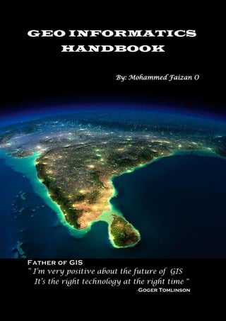
- 1. GEO INFORMATICS HANDBOOK By: Mohammed Faizan O Father of GIS “ I’m very positive about the future of GIS It’s the right technology at the right time ” -Goger Tomlinson
- 2. 2 contents page no 1.Introduction……………………..……………………….4 2.Top GIS software 2.1 Open source software ……………………………5 2.2 Commercial software ……….……………………8 3.Top Remote sensing software ………………………12 4.Top Photogrammerty software 4.1 Open source software………………………….. 15 4.2 Commercial software…………………………… 17 5. Top 25 Satellite maps 5.1 colour Imagery…………………………………… 20 5.2 Beyond visible……………………………………. 23 5.3 Humanitarian Relief……………………………. 25 5.4 Weather forecast………………………………… 25 5.5 Specialty satellite maps………………………… 26 6. Free GIS Data Sources ……………………………… 27 ( Best Global Raster and Vector Datasets) 7. Free Global DEM Data Sources……………………. 33 8. Free LIDAR Data Sources……………………………37 9. Category wise free GIS Data sources……………..39 10.References …………………………………………….48
- 3. 3 About Mohammed Faizan O B.E Geo Informatics (II Year) Institute Of Remote Sensing College Of Engineering Guindy Anna University, Chennai 600 025 Email Id: faizan1675273@gmail.com
- 4. 4 1.Introduction Geoinformatics is the science and the technology which develops and uses information science infrastructure to address the problems of geography, cartography, geosciences and related branches of science and engineering. ✓ A geographic information system (GIS) is a system designed to capture, store, manipulate, analyse, manage, and present all types of geographical data. ✓ Remote sensing is the acquisition of information about an object or phenomenon without making physical contact with the object and thus in contrast to on-site observation, especially the Earth. ✓ Photogrammetry is the science of making measurements from photographs. The input to photogrammetry is photographs, and the output is typically a map, a drawing, a measurement, or a 3D model of some real-world object or scene. A digital elevation model (DEM) is a 3D CG representation of a terrain's surface – commonly of a planet (e.g. Earth), moon, or asteroid – created from a terrain's elevation data. DEMs are used often in geographic information systems, and are the most common basis for digitally produced relief maps. LIDAR, which stands for Light Detection and Ranging, is a remote sensing method that uses light in the form of a pulsed laser to measure ranges (variable distances) to the Earth. These light pulses—combined with other data recorded by the airborne system— generate precise, three-dimensional information about the shape of the Earth and its surface characteristics. Spatial data, also known as geospatial data, is information about a physical object that can be represented by numerical values in a geographic coordinate system. Generally speaking, spatial data represents the location, size and shape of an object on planet Earth such as a building, lake, mountain or township. The data for GIS can be derived from various sources. A wide variety of data sources exist for both spatial and attribute data. People can use topo maps, aerial photographs, satellite images, data of ground surveys, readily available reports and government or research publications.
- 5. 5 2.GIS SOFTWARE 2.1 Open source software: 1.QGIS 3 Open source flows in the DNA of QGIS 3. It’s been genetically tailored to break the mould of commercial GIS. Not only because it’s now in 3D. But QGIS plugins still give you the power to analyze like the Incredible Hulk. Download link:https://qgis.org/en/site/forusers/download.html 2.QGIS 2 QGIS 2 is the largest community effort in the history of GIS. And because it’s community-driven, it’s wildly innovative and inventive. Even though QGIS 2 is completely open source, it still rivals the best. Download link: https://download.qgis.org 3.gvSIG* If you eat, sleep and breathe GIS, gvSIG is free and open source GIS software. Its features may surprise you. For example, it has a field app, 3D capabilities and a desktop application. But it’s light on documentation. Especially, anything in English. Download link: http://www.gvsig.com/en/products/gvsig-desktop/downloads 4.GRASS GIS* GRASS GIS is one of those suites that let you geoprocess until the night falls. It’s a loaded gun with sophisticated tools. It’s so powerful that you can unleash GRASS GIS in QGIS as a separate toolbox. But its clunky interface and stubborn map projection rules hold it back. Download link: https://grass.osgeo.org/download
- 6. 6 5.WhiteBox GAT* WhiteBox GAT is the diamond in the rough. If you need terrain and hydrological analysis, then it’s a superb choice. The LiDAR support is out-of-this-world. But it also has 360+ plugin tools. It deserves a higher ranking. But it’s just not strong in mapping, editing and data management. Download link: https://jblindsay.github.io/ghrg/Whitebox/download.shtml 6.ILWIS* The 80s are making a comeback. As part of it, ILWIS is still embracing the era. But if you need remote sensing tools, it’s a decent place to look. There’s also 3D visualizations and stereo imaging. Despite its desperate need for makeover, ILWIS is versatile in specific niches. Download link: https://www.itc.nl/ilwis/download 7.SAGA GIS* The name of the game for SAGA GIS is geoscience. If you go down this rabbit hole, you may get lost. Documentation lacks do much that you don’t even know the input and output. But it has some of the rarest tools you’ll ever find in GIS software. Download link: https://sourceforge.net/projects/saga-gis/files/latest/download 8.GeoDA GeoDa is a specialist in statistical tools. As you work in this open source GIS software, you explore spatial statistics. Through state- of-the-art geo-visualizations and geo-simulations, it’s the ultimate tool for spatial modeling. Download link: https://geodacenter.github.io/download.html 9.MapWindow MapWindow is an open source project. While it does about 90% of what GIS users need, it specializes in hydrology. It still struggles with some of the basics. But it’s a decent volunteer effort. Download link: https://www.mapwindow.org/#download
- 7. 7 10.uDig Volunteers world-wide work on this open source desktop application. Most of the focus for uDig is on database viewing and editing. Even today, updates continue to roll in. But the interface really just needs a fresh coat of paint. Download link: http://udig.refractions.net/download 11.Falconview FalconView is a flight simulator so it’s unfair to compare in this list of GIS software. If you want to do fly-throughs, Georgia Tech built it for this purpose. Otherwise, you can render features in 3D like LiDAR and elevation. Download link: https://falconview.software.informer.com/5.1 12.OpenJump GIS Jump GIS is good at doing the basics. It started as a tool for data conflation. Then, it grew into a modest size open source project. Despite its light functionality, developers still support the project. Download link: http://sourceforge.net/projects/jump- pilot/files/OpenJUMP/1.15 13.OrbisGIS OrbisGIS is still a work-in-progress. It’s now released as a cross- platform open source GIS software package. Specifically, OrbisGIS is designed by and for research. Download link: https://github.com/orbisgis/orbisgis/releases/download 14.Diva GIS Diva GIS is an open source GIS software package that’s simple and light-weight. Biologists use it for mapping biological richness and diversity distribution. It’s functional. But there’s not a lot here for mapping and functionality. Download link: https://www.diva-gis.org/download *Also Remote Sensing Software
- 8. 8 2.2 commercial software: 1.ArcGIS Pro ArcGIS Pro modernizes GIS with a ribbon interface, 64-bit processing and 3D integration. It’s a massive overhaul with a focus on quickness, ingenuity and cartography. Even though ArcGIS Pro is a big machine with lots of moving parts, it earns top spot. Download link: https://pro.arcgis.com/en/pro-app/get-started/install-and-sign-in-to- arcgis-pro.htm 2.ArcGIS Desktop ArcGIS Desktop is cutting edge in GIS. It raises the bar to the next level by doing what other GIS software can’t. Its success is that it’s expandable. From field apps to modeling and scripting, ArcGIS is a powerhouse for all things GIS. Download link: https://store.esri.com/content/esri/en-us/arcGISDesktop.html 3.Hexagon Geomedia GeoMedia has 40+ years of history. But lately, it’s taken a bit of a slide. Nevertheless, it’s still solid as GIS software. Especially, when you pair it up with ERDAS Imagine, you get arguably the best suite in remote sensing. Download link:https://download.hexagongeospatial.com. 4.MapInfo Professional At its core, MapInfo Professional is all about locational intelligence. And just like GeoMedia, it’s been a tale of shrinking market share. But don’t get fooled. MapInfo is still gifted as an well-rounded GIS software suite. Download link: https://www.filehorse.com/download-mapinfo-pro 5. FME (Feature Manipulation Engine) Feature Manipulation Engine FME® isn’t a full-fledged GIS package. It’s extremely powerful and has a surprisingly active community. In fact, its yearly World Tour is a blast to attend. But just don’t use FME® for making maps. Download link: https://www.safe.com/support/downloads
- 9. 9 6.Global Mapper Global Mapper is like a “Swiss army knife” in GIS analysis. It’s straight-forward to get started. But at the same time, it has an incredible amount of flexibility. For example, it has powerful display for LiDAR and elevation. Download link: https://www.bluemarblegeo.com/products/global-mapper- download.php 7.Cadcorp Cadcorp meshes GIS with CAD. In a near flawless way, it adds rich functionality for mapping and styling. In a ribbon interface, inter-operability and web mapping both shine in Cadcorp Download link: https://www.cadcorp.com/products/downloads 8.GE SmallWorld If you’re in utilities, then GE Smallworld is for you. When GE acquired SmallWorld, it rose as the top GIS software for utility companies. The key is its robust data model which allows various geometry properties per object. Download link: https://www.safe.com/fme/fme-desktop/trial-download/ 9.Manifold GIS Manifold System is something you can just pick up and get accustomed to quickly. Its highlights are its intuitive interface, programmability and 64-bit processing. Manifold GIS has a solid set of tools. But without the high price tag. Download link: http://manifold.net/updates/downloads.shtml 10.TatukGIS TatukGIS is straightforward and well-rounded. Its leading features include its state-of-the-art editing, format support and scripting environment. Fun fact: The origin of TatukGIS is based on Tatuk Lake in British Columbia, Canada. Download link: https://www.tatukgis.com/Downloads.aspx
- 10. 10 11.Maptitude Maptitude stands out as one of the more affordable one-stop shop GIS platforms on the market. While it’s true that Maptitude is a low cost, professional GIS, you might want to look elsewhere for higher level analysis. Download link: https://www.caliper.com/learning/sections/download 12.Golden Software MapViewer MapViewer is part of the Golden Software suite. Alongside Surfer and Didger, you get a nice mix of 3D, analysis and editing capabilities. But it’s key feature is how you can produce professional quality thematic maps. Download link: https://filecr.com/windows/golden-software-mapviewer 13.AutoCAD Map 3D If you started using Autodesk, AutoCAD Map 3D has the same look and feel to it. Basically, AutoCAD Map bridges the gap between CAD and GIS. You get map layouts, data management and editing capabilities. By linking CAD and GIS, you get the best of both worlds. Download link: https://knowledge.autodesk.com/support/autocad-map-3d/downloads 14.Bentley Map Bentley Map combines the power of CAD with the strengths of traditional GIS. For example, it offers robust inter-operability, overlay tools and high quality cartographical output. It’s not only for 2D. But you can perform GIS analysis in 3D too. Download link: https://en.freedownloadmanager.org/Windows-PC/Bentley-Map.html 15.IDRISI Terrset IDRISI by Clark Labs is mostly for raster analysis and image processing. For example, it’s equipped with 300+ analysis tools. But it also focuses on Earth modeling too. For example, it has modules for land change, biodiversity modeling and climate change. Download link: https://clarklabs.org/download
- 11. 11 16.TNT GIS TNTview, TNTedit, TNTmips and TNTscript are part of the MicroImages GIS software family. At the basic level, TNTview is an open viewer. As you move up the license levels, each one adds extra capabilities. Overall, it’s a decent option for all-around mapping, analysis and editing. Download link: https://www.microimages.com/downloads/index.htm Software name % of user Software name % of user ArcGIS Pro 98% Maptitude 69% ArcGIS Desktop 97% Golden software Map Viewer 68% Q GIS3 96% AutoCAD Map 3D 69% QGIS2 95% ILWIS 67% Hexagon Geomedia 86% SAGA GIS 66% MapInfo 85% GeoDa 65% FME 82% Bentley Map 64% Global Mapper 81% IDRISI Terrset 61% gvSIG 80% TNT GIS 50% GRASS GIS 77% MapWindow 50% WhiteBox GAT 75% uDig 49% Cadcorp 74% FalconView 48% GE Smallworld 73% OpenJump GIS 45% Manifold GIS 71% Orbis GIS 37% TalukGIS 70% Diva GIS 24%
- 12. 12 3.remote sensing software 1.OSSIM (Open Source Software Image Map) OSSIM is a high performance open source remote sensing software application. It’s good with compatibility. If you need some remote sensing direction for high spatial resolution imagery, OSSIM might be the answer you have been searching for. Download link: https://sourceforge.net/projects/ossim/files/latest/download 2.E-foto E-foto is the digital photogrammetry specialist in the group of open source remote sensing software. The core functionality is Photo triangulation, Stereoscopic modelling and Digital elevation model extraction. This software provides a fully functional photogrammetry tool set to use at no cost. Download link: http://www.efoto.eng.uerj.br/download 3.InterImage InterImage is a bit different from the other open source remote sensing software on this list.The core theme of automatic image interpretation is object-based image analysis (OBIA). This involves segmentation, exploring their spectral, geometric and spatial properties and then classification. Download link: http://www.lvc.ele.puc-rio.br/projects/interimage/download 4.Opticks Opticks is a remote sensing application that supports imagery, video (motion imagery), SAR, multi spectral, hyper spectral and other types of remote sensing data. Opticks supports processing remote sensing video in the same manner as it supports imagery, which differentiates it from other remote sensing applications. Download link: https://www.download82.com/download/windows/opticks-sdk
- 13. 13 5.PolSAR PRO For synthetic aperture radar, you may want to into look PolSARPro. There’s a wide range of tools like radar decompositions, inSAR processing and calibration. Another neat part of this software is the graph processing framework where users can automate workflow. You need to take a look at PolSARPro if you’re working with full or dual polarization SAR data. Download link: https://earth.esa.int/web/polsarpro/download 6.ORFEO Toolbox (OTB): Optical and Radar Federated Earth Observation ORFEO is an image processing library aims at high spatial resolution data. It’s a mixed bag of remote sensing tools including: Image segmentation, classification and filtering ,Change detection and Radiometry, PCA and pan sharpening. This type of object based image analysis is a rare feature seen in software nowadays. Download link: https://www.orfeo-toolbox.org/download 7.The Sentinel Toolbox The Sentinel Toolbox consists of 3 separate applications: • Sentinel-1 Toolbox (SAR applications) • Sentinel-2 Toolbox (High-resolution optical applications) • Sentinel-3 Toolbox (High resolution optical applications) Sentinel-2 has become the gold standard for open satellite data. In order to process the vast amounts of data collected by Sentinel-2A/2B, users can use the Sentinel Toolbox. One of the highlights of the Sen2cor plugin which allows users to correct for atmospheric effects and classify images.If you download Sentinel-1 synthetic aperture radar data, you can process your data with the Sentinel-1 toolbox. Download link:https://sentinel.esa.int/web/sentinel/toolboxes 8.CLASlite CLASlite remote sensing software is designed specifically for images of forests. The software captures images of dense tropical forest via satellite imaging; convert the images into highly detailed maps that can be readily searched for deforestation, logging and other forest disturbance events. The process of conversion goes through calibration, pre- processing, and atmospheric correction and so on. Download link: https://claslite.software.informer.com/download
- 14. 14 9.OpenEV OpenEV is an open-source geospatial toolkit and a frontend to that toolkit. OpenEV was developed using Python and uses the GDAL library to display georeferenced images and elevation data. The application also has image editing capabilities and uses Open GL to display elevation data in 3-D. Download link: http://openev.sourceforge.net/index.php?page=download 10.ENVI (Environment for Visualizing Images)* ENVI is software for processing and analyzing geospatial imagery. ENVI handles hyperspectral, LiDAR, and other remotely sensed data sets easily with both wizard based approaches and allowing users to program operations. The main benefit of using ENVI is for the analysis and visualization of spectral and hyperpsectral data. ENVI has internal workflows and allows users to customize procedures with their IDL programming language. Download link: https://envi.software.informer.com/download 11.ERDAS IMAGINE* Erdas Imagine is an image processing software package that allows users to process both geospatial and other imagery as well as vector data. Erdas can also handle hyperspectral imagery and LiDAR from various sensors. Erdas also offers a 3D viewing module (VirtualGIS) and a vector module for modeling. Erdas is integrated within other GIS and remote sensing applications and the storage format for the imagery can be read in many other applications (*.img files) and that is the advantage of this package. Download link: https://download.hexagongeospatial.com/en/download 12.PCI Geomatica* PCI Geomatica is a remote sensing desktop software package for processing earth observation data, designed by PCI Geomatics. Geomatica is aimed primarily at faster data processing and allows users to load satellite and aerial imagery where advanced analysis can be performed. Geomatica has been used by many educational institutions and scientific programs throughout the world to analyze satellite imagery. Download link: https://www.pcigeomatics.com/resources/downloads *Commerical Software
- 15. 15 4.photogrammetry software 4.1 Open source software: 1.3DF Zephyr This professional photogrammetry software is built for user-friendliness. Its UI lowers the entry barriers for beginners and facilitates generating 3D scans with easy to use wizards that explain the process and help choose the right settings. 3DF Zephyr is capable of aligning photogrammetry data with laser scans. 3DF Zephyr allows you to draw shapes using the imagery as a reference. Download link: https://www.3dflow.net/ 2.Meshroom Meshroom is a free, open-source 3D Reconstruction Software based on the AliceVision Photogrammetric Computer Vision framework. You can Learn more details about the pipeline on AliceVision website. Currently, it runs on Linux and Microsoft Windows 64-bit editions. Download link: https://alicevision.github.io/#meshroom 3.MicMac MicMac is a free, open-source photogrammetry software. MicMac has proven itself as a versatile tool that has been successfully used in fields like cartography, environmental protection, forestry, cultural heritage preservation, and private industries. Using MicMac, it is possible to generate 3D models and orthographic images. Download link: https://micmac.ensg.eu/index.php/Accueil 4.OpenMVG OpenMVG is a library targetted to photogrammetry that is popular within the Multiple View Geometry (MVG) community and computer- vision scientists. It tends to focus on the structure from motion (SfM) technique of photogrammetry, with a number of the integrated tools built around this. This photogrammetry pipeline requires compiling to use and takes some computer savvy to get up and running on Windows or Linux. Download link: https://github.com/openMVG/openMVG
- 16. 16 5.Multi-View Environment The Multi-View Environment, MVE is a complete end-to-end pipeline for image-based geometry reconstruction. It features Structure-from-Motion, Multi-View Stereo and Surface Reconstruction. If you wish to automate your steps, you can use the command-line applications, but most features are also available from the user interface UMVE directly. Download link: https://www.gcc.tu-darmstadt.de/home/proj/mve/ 6.Regard3D Regard3D is a free and open-source photogrammetry software that uses the structure from motion (SfM) method to generate 3D models. Although Regard3D is free, it is still a very powerful piece of software.It converts photos of an object, taken from different angles, into a 3D model of this object. Download link: http://www.regard3d.org/index.php 7.VisualSFM As indicated by its name, VisualSFM is a photogrammetry software that uses the structure from motion (SfM) method to generate point clouds. Users can choose between working with the command-line or a GUI. The program can detect and match features and adjust bundles Please note that this program is only free for personal, non-profit or academic use. Download link: http://ccwu.me/vsfm/ 8.COLMAP COLMAP is a free photogrammetry software available for download from Github. You can run either from the command-line or operate it like any other program with a GUI.COLMAP can reconstruct 3D objects automatically either from single-camera or stereo setups. Download link: https://colmap.github.io/index.html 9.AutoDesk REMAKE This software isn’t technically free, but it’s free for educational use. This means that if you’re using it to learn about photogrammetry, that’s fine, but you can’t use it for commercial applications. All you have to do is open it up, select your input images under the Create 3D tab and select your preferred quality settings. Download link: https://www.autodesk.com/products/remake/overview
- 17. 17 4.2 commercial software: 1.WebODM WebODM is created by the folks at OpenDroneMap. It’s designed to be user-friendly and uses aerial images from drones to produce elevation models, textured 3D models, geo-referenced maps and point clouds.It can be used on your computer offline and can also be loaded to servers to use from the cloud. Download link: https://www.opendronemap.org/webodm/ 2.Trimble Inpho Trimble Inpho was designed by Trimble Geospatial for a wide range of uses, including national mapping, forestry, agriculture, mining, utility and energy, urban development, defense and disaster response.Trimble Geospatial has over 30 years of experience and boasts cutting-edge technologies along with robust tech support. Download link: https://geospatial.trimble.com/products-and-solutions/inpho 3.SOCET GXP SOCET GXP is a photogrammetry software that uses satellite and aerial imagery. It’s primarily designed to analyze images, produce intelligence, test sensor models and extract and edit terrain. SOCET GXP is used in real- life applications like homeland security, disaster relief and in humanitarian efforts, as well as defense missions. Download link: https://www.geospatialexploitationproducts.com/content/socet-gxp/ 4. LiMapper LiMapper offers advanced software tools for professionals. It is capable of efficiently handling more than 10,000 images per project. Offering a suite of editing functions such as bundle block and stitching line adjustments, lets you capitalize on its improved accuracy and easier workflow. Download link: https://greenvalleyintl.com/software/limapper/ 5.Reality Capture RealityCapture is photogrammetry software which creates 3D models out of unordered photographs or laser scans without seams. The most common fields of its current use are cultural heritage, full body scanning, gaming, surveying, mapping, visual effects and virtual reality in general. Download link: https://www.capturingreality.com/Home
- 18. 18 6.DroneDeploy DroneDeploy is an easy to use aerial photogrammetry software that covers the entire process from flight to finished 3D model.Using their mobile app - which is available on both Android and iOS - it's possible to transform a range of DJI drones into reliable and powerful mapping tools. Download link: https://www.dronedeploy.com/ 7.PhotoModeler Using this tool you can take accurate measurements and generate 3D models for a wide variety of purposes. Inside the photogrammetry software, you can choose between 3 different methods to generate your model: Manually match common features between images, automatically generate a 3D model from coded targets, or generate point clouds from overlapping images. Download link: https://www.photomodeler.com/products/features.php 8.IMAGINE PHOTOGRAMMERTY IMAGINE Photogrammetry is a software application for performing photogrammetric operations on imagery and extracting information from imagery. IMAGINE Photogrammetry is significant because it is a leading commercial photogrammetry application that is used by numerous national mapping agencies, regional mapping authorities as well as commercial mapping firms. IMAGINE Photogrammetry is widely used in academic research. Download link: https://www.hexagongeospatial.com/products/power- portfolio/imagine-photogrammetry 9.WithnessPRO WitnessPRO is a professional photogrammetry software that was developed with a high degree of accuracy in mind. Capable of producing a point-cloud to a mind- boggling resolution of 1 pixel, this software supports both close-range and aerial photogrammetry. Download link: https://www.photometrix.com.au/iwitnesspro-v4/ 11.Pix4D Pix4D is a beginning-to-end photogrammetry solution. That means it not only comprises the generation of point clouds, 3D meshes or elevation maps from imagery, but it also assists in the capture of suitable images. Pix4Dcapture controls the drone’s flight path to ensure enough overlap between the images for photogrammetry processing. Download link: https://pix4d.com/
- 19. 19 10.Elcovision 10 Generate from images of normal cameras or drones fully automatically high- precision and highly detailed 3D models and point clouds in almost laser scan quality. Since its market launch in 1986 as the world's first 3D photogrammetry system for PCs, ELCOVISION 10 has presented many groundbreaking. Download link: https://en.elcovision.com/ 12.DatuSurvey DatuSurvey is a professional photogrammetry software from Datumate. It allows users to both generate 1:100 scale maps with just a 3cm margin of error and use close-range photogrammetry for scanning small-scale objects. The software uses Image GPS data to accurately stitch photos together, resulting in more precise models. Download link: https://www.datumate.com/products/datusurvey/ 13.Bentley Context Capture ContextCapture is capable of generating 3D models of entire cityscapes without human intervention. Hence, the program is suitable for large infrastructure projects and sites of large size.It enables users to edit meshes, generate cross- sections, extract ground and break lines. Of course, you can enrich your model GIS and engineering data to support the design process. Download link: https://www.bentley.com/de/products/brands/contextcapture 14.Agisoft Metashape Agisoft Metashape — formerly known as Agisoft Photoscan — is a professional photogrammetry software that is a popular choice for GIS applications. The software is available in Standard and Pro versions, the standard version is sufficient for interactive media tasks, while the Pro version is designed for authoring GIS content It is suitable for both close-range photogrammetry and aerial photogrammetry. Download link: http://www.agisoft.com/ 15.AutoDesk RECAP Autodesk® ReCap™ brings real-world, as-built data into your workflow, allowing you to begin designing with true context instead of a blank screen. Utilizing digital captures of physical environments, the Autodesk ReCap family of products enables the creation of 3D models that can be the starting point for new designs. Download link: https://www.autodesk.com/products/recap/overview
- 20. 20 5.top 25 satellite maps: 5.1 color imagery 1.Google Maps Google Maps is the ULTIMATE tool for satellite maps. It’s grown over the years. So has its features: Like it’s panoramic street views, Its 3D perspectives are mind- blowingly insane. And almost everyone’s favorite: finding their house with its solid addressing system. But the best part about Google Maps is that it’s regularly updated. website link: https://maps.google.com/ 2.Google Earth Pro Google Earth Pro was originally the business-oriented upgrade to Google Earth, with features such as a movie maker and data importer. Google Earth Pro is currently the standard version of the Google Earth desktop application as of version 7.3. The Pro version includes add-on software for movie making, advanced printing, and precise measurements, and is currently available for Windows, Mac OS X 10.8 or later, and Linux. website link: https://www.google.com/earth/versions/ 3.NASA WorldView NASA’s Worldview aims at real-time imagery delivery. That is, Earth how it is “right now”. This tool from NASA's Earth Observing System Data and Information System (EOSDIS) provides the capability to interactively browse global, full-resolution satellite imagery and then download the underlying data, including data from the Global Precipitation Measurement Missions. But there’s more: It shows over 800 layers of satellite imagery. And typically, most have just a 3 hour delay in time. website link: https://worldview.earthdata.nasa.gov/
- 21. 21 4.Mapbox Mapbox is the location data platform for mobile and web applications. We provide building blocks to add location features like maps, search, and navigation into any experience you create. First, head over to Mapbox. Next, go to its satellite view. As you zoom in, you’ll see high resolution satellite maps. website link: https://www.mapbox.com/ 5.Esri World Imagery World Imagery provides one meter or better satellite and aerial imagery in many parts of the world and lower resolution satellite imagery worldwide .You can contribute your imagery to this map and have it served by Esri via the Community Maps Program. Quickly and effectively, you can view satellite maps down to 3cm in pixels. website link: https://www.arcgis.com/home/item.html 6.Esri WayBack Atlas Esri’s Way Back Atlas is like going through a time machine. Similar to Google Earth Pro, you can selectively choose from satellite maps back in time.But this atlas holds a secret wealth of information. For example, New York has 100+ satellite maps dating back to 2014.Esri’s World Imagery layer (#5) serves as the best available of all satellite maps Website link: http://livingatlas.arcgis.com/wayback/ 7.HERE Maps HERE Technologies (trading as HERE) is a company that provides mapping and location data and related services to individuals and companies. Here captures location content such as road networks, buildings, parks and traffic patterns. But as part of its platform, it delivers satellite maps for drivers. website link: https://wego.here.com/
- 22. 22 7.Yahoo! Maps Yahoo! Maps was a free online mapping portal provided by Yahoo! Functionality included local weather powered by The Weather Channel, printing maps, and local reviews powered by Yelp. Its satellite maps are behind its competitors in several regards. For example, it lacks 3D, street views and imagery updates. website link: https://maps.yahoo.com/b/ 8.HERE Maps HERE Technologies (trading as HERE) is a company that provides mapping and location data and related services to individuals and companies. Here captures location content such as road networks, buildings, parks and traffic patterns. But as part of its platform, it delivers satellite maps for drivers. website link: https://wego.here.com/ 9.Planet Explorer Planet Explorer is like the goldmine of satellite maps.It doesn’t just show satellite maps from 120+ micro satellites. But you get nearly daily updates at 2.5 m resolutionFirst, you’ll have to register an account. It’s free for the first 15 days. But after that, you’ll have to pay. website link: https://www.planet.com/explorer/ 10.MDA NaturalVue For a coarse view of the Earth, MDA NaturalVue is at 15 meter resolution. Just to give you perspective on what that means:First, find a soccer field on the map. Then, count the number of pixels. If you count 20 or so, it’s so coarse that you won’t even be able to recognize center field. website link: https://www.arcgis.com/home/item.html
- 23. 23 11.MapQuest MapQuest (stylized as mapquest) is an American free online web mapping service owned by Verizon Media. It was launched in 1996 as the first commercial web mapping service.When you visit MapQuest, you’ll get an automatic feeling of nostalgia. Official MapQuest website, find driving directions, maps, live traffic updates and road conditions. Find nearby businesses, restaurants and hotels. website link: http://mapquest.com/satellite-maps 12.Bing Map Bing Maps is a web mapping service provided as a part of Microsoft's Bing suite of search engines and powered by the Bing Maps for Enterprise framework Bing’s street views are sparse and it doesn’t have oblique views like Google Maps.But Bing Maps still serves 10+ TB of imagery. While some imagery can be years out of date, populated areas still have frequent updates. website link: https://www.bing.com/maps 5.2 Beyond Visible 13.Sental Playground Sentinel Playground utilizes Sentinel Hub technology to enable easy-to-use discovery and exploring of full-resolution Sentinel-2, Landsat 8, DEM and MODIS imagery, along with access to the EO data products. It is a graphical interface to a complete and daily updated Sentinel-2 archive, a massive resource for anyone interested in Earth's changing surface, natural or manmade.Application is perfect for someone, who wants to find the latest available images of forest fire, a nice looking poster, observe drought or simply understand, how earth observation products are built website link: https://apps.sentinel-hub.com/sentinel-playground/
- 24. 24 14.Landsat Explorer The launch of Landsat-1 in 1972 was a hingepoint for space satellites. It was a milestone moment which prompted the 40+ years of archiving our planet’s history.Hundreds of satellites have followed Landsat’s path into space. But it wasn’t just in color.In the Landsat Explorer, you can see the world in new ways like near infrared, a spectral index or like how our eyes see it website link: http://landsatexplorer.esri.com/ 15.USGS Earth Explorer The EarthExplorer user interface is an online search, discovery, and ordering tool developed by the United States Geological Survey (USGS). EarthExplorer supports the searching of satellite, aircraft, and other remote sensing inventories through interactive and textual-based query capabilities. Through the interface, users can identify search areas, datasets, and display metadata, browse and integrated visual services within the interface. website link: https://earthexplorer.usgs.gov/ 16.Leaflet Leaflet is the leading open-source JavaScript library for mobile-friendly interactive maps. Weighing just about 38 KB of JS , it has all the mapping features most developers ever need. Leaflet is designed with simplicity, performance and usability in mind. website link: https://leafletjs.com/ 17.Cesium Viewer Similar to Leaflet, Cesium lets users build their own customized webmaps.But because Cesium is all in 3D, viewing is off the charts.The Cesium Viewer is joined by satellite maps like Bing, Esri and Mapbox website link: https://cesiumjs.org
- 25. 25 5.3 Humanitarian satellite maps 18.Tomnod/GeoHIVE GeoHIVE enables organizations, small and large, to do more with geospatial data. Our cutting edge Machine Learning models and highly accurate crowdsourced data are all powered by Maxar’s high resolution satellite imagery. Tomnod leverages the power of crowdsourcing during times of crisis. DigitalGlobe is shifting the Tomnod platform to GeoHIVE. website link: https://geohive.digitalglobe.com/ 19.DigitalGlobe Open Data DigitalGlobe has two flavors of open data:First, its Open Data Program supports major global crisis events like earthquakes, hurricanes and forest fires.During these humanitarian events, they release each photo into the public domain under the Creative Commons 4.0 license.Secondly, DigitalGlobe has product samples available for around the globe. website link: https://www.digitalglobe.com/ecosystem/open-data 5.4 weather forecasting 20.NOAA Weather Rader NOAA’s 3D map is the first out-of-the-gate. The trick to this one is how it gives you near real-time weather.In this global map, you can see the weather from space as it would appear from our eyes.Alternatively, the near infrared lets you tackle the challenge through a different lens. website link: https://satellitemaps.nesdis.noaa.gov 21.GOES Viewer GOES knows weather. These geostationary satellites update our weather every 5 minutes. But how do you see it?First, head over to the GOES Imagery Viewer. Next, select your target region.This will lead you into satellite maps for weather. Finally, choose your view and get an updated snapshot of satellite weather. website link: https://www.star.nesdis.noaa.gov/GOES/index.php
- 26. 26 22.Latest 24 As NOAA satellites silently circles Earth, we get a preview of our planet from space.Instead of a 3D perspective, NOAA has built a set of satellite maps that targets weather with a top-down view.In fact, you can interactively fast-forward and rewind the weather from the last 24 hours each day. website link: https://satellitemaps.nesdis.noaa.gov 5.5 Speciaity satellite maps 23. Night View How does Earth look like at night? And what is the extent of human settlement on the landscape?By stitching 400+ images from space, NASA had compiled the most comprehensive night view in its black marble map.As seen in this night view map, major cities illuminate the sky the most. website link: https://worldview.earthdata.nasa.gov 24.Global Forest Map When a tree falls in the forest, satellites hear the impact. Anyone who doubts the severity of deforestation can browse it in the Global Forest Watch.First, go to the Global Forest Watch. By default, cleared forests are on. Countries like Indonesia, Brazil and Peru light up.If you zoom in, it has satellite maps like Planet’s 120+ constellation website link: https://www.globalforestwatch.org/map 25. NASA(FIRMS) The Fire Information for Resource Management System (FIRMS) delivers global MODIS-derived hotspots and fire locations. The active fire locations represent the center of a 1-kilometer pixel that is flagged by the MOD14/MYD14 Fire and Thermal Anomalies Algorithm as containing one or more fires within the pixel. website link: https://firms.modaps.eosdis.nasa.gov/
- 27. 27 6. FREE GIS DATA SOURCES: 1.Esri Open Data Hub • The Esri Open Data Hub is a hidden gold mine of free GIS data. For example, it now houses over 250,000+ open data sets from 5,000+ organizations worldwide. For this reason, we have it at the top of our list of free GIS data. • In some cases, you’ll have to sift through piles of data because they’re not conveniently merged into one. Despite the extra effort, this is still arguably your best chance to find exactly what you’re looking for. • In any case, the search is convenient with a map preview of the extent and table. Alternatively, you can search by topic or location and download data in multiple GIS formats. Ultimately, there is nothing more thorough for GIS data than the Esri Open Data Hub. • website link: http://opendata.arcgis.com/ 2.United Nations Environment Programme • United Nations Environment Programme (UNEP) is the authoritative source for UN data. For example, it holds more than 500 variables such as freshwater, climate and health. • I must admit. I found it a bit difficult to explore the GIS data because the interfaces takes awhile to get used to. If you click advanced, you can filter “Geospatial Data Sets”. From here, you can download free GIS data like climate, disasters and ecosystems. • website link: http://geodata.grid.unep.ch/
- 28. 28 3.Natural Earth • Natural Earth Data is number 2 on the list because it best suits the needs of cartographers. By and large, all the key cultural and physical vector GIS datasets are at a global scale conveniently for you to use. The raster datasets also provide beautiful hillshade relief for your map. • The best part is Natural Earth Data is in public domain. So this means that you have the right to use, modify and disseminate the data in any manner. • Here’s more details for Natural Earth data. From a cartography standpoint, it’s a no-brainer. Download Natural Earth Data now. • website link: http://www.naturalearthdata.com/downloads 4.USGS Earth Explorer • For satellite and aerial imagery, the USGS Earth Explorer is one of the largest free sources of data. Registration is free. • A friendly user-interface makes accessing remote sensing data simple. In fact, it even has a bulk download application if you need to download more than one data sets. • Download data from more than 300 data collections that span over 75 years of coverage. Includes USGS satellite imagery, historical and recent USGS aerial photography, elevation data, land cover products, Lidar point cloud data, Digital Line Graphs (DLGs), Digital Orthophoto Quads (DOQs), and much more. • website link: http://earthexplorer.usgs.gov/
- 29. 29 5.OpenStreet Map • GIS users are harnessing the power of OpenStreetMap (OSM) as a means to crowdsourced data. The result of crowd-sourcing is highly detailed data. But I say detailed with cautious optimism. • While OSM is open to the public, it’s also created by the public. So this means that accuracy varies based on the creator. From my experience, the accuracy is very good. And people like you and me are working on completeness every day. • For GIS analysts seeking free GIS data at a street level, OSM is exactly what you are looking for. • website link: https://gisgeography.com/openstreetmap-download-osm-data/ 6.SEDAC • NASA’s Socioeconomic Data and Applications Center (SEDAC) shows human interactions with the environment. SEDAC has a wide variety of coarse global free GIS data. • I like the SEDAC map viewer because you can select GIS thematic maps of the socioeconomic data. If you want to assemble the data yourself, there’s that option too. • Socioeconomic data includes a range of topics such as agriculture, climate and health. • website link: http://sedac.ciesin.columbia.edu/
- 30. 30 7.Open Topography • Open Topography provides a portal to high spatial resolution topographic data and tools. In particular, it houses LiDAR Data, which is a rare, precious resource nowadays. • Currently, Open Topography has collected 300 high resolution datasets. Most are point clouds. But some are just available in raster format. • If you can’t find LiDAR data for your area of interest, the next best thing is a global DEM. These free GIS data sets are also available on Open Topography too. • website link: http://www.opentopography.org/ 8.NEO • Imagine seeing daily snapshots of climate and environmental conditions of Earth. NASA’s Earth Observations (NEO) is like a real-time climate snapshot of the world. • NEO focuses on 5 themes with 50+ global datasets, mostly climate-related. For example, data ranges from aerosols, chlorophyll to sea surface temperature. • All are free GIS data sets that you can download in JPEG, GeoTIFF and Google Earth formats. All raster grids are atmosphere, energy, land, life and ocean GIS data. • website link: http://neo.sci.gsfc.nasa.gov/
- 31. 31 9.Sentinels Satellite Data • Sentinel-2 is the highest resolution satellite imagery available to the public for free. Its interface is the Copernicus Open Access Hub. • First, you have to register to create an account. But it’s well-worth the time. Next, select your area of interest by right-clicking on the map. • Finally, select the S2A or S2B product you want to download and download. 10-meter resolution satellite data readily available at your fingertips. • website link: https://scihub.copernicus.eu/dhus 10.Terra Populus • Terra Populus (TerraPop for short) integrates census data from over 160 countries around the world. In fact, it spans up to six decades for household- level and aggregate data for more than 80 countries. • The unique thing about it is how you can explore temporal and spatial changes. It’s not only for researches. But everyone can access changes in the human-environment system for geographic space. • TerraPop also includes your basic land cover, land use, and climate data. It’s supported by the National Science Foundation and the University of Minnesota. User-friendly interface with customized temporal data delivery. • website link: https://www.terrapop.org/
- 32. 32 11.ISCGM Global Mapping • Global Map still packs some serious punch with their free GIS data. For example, global land cover and percent tree cover are the two key datasets here. But that’s not all. It has cultural and natural vector datasets in here too. • Since the move, registration is no longer required. Despite the lack of updates, ISCGM free GIS data is still a source that many of us can use in our maps. • Data types: Boundaries, drainage, transportation, population centers, elevation, land cover, land use and vegetation. • website link: https://globalmaps.github.io/ 12.FAO GeoNetwork • FAO GeoNetwork which is another portal of free GIS data from the United Nations. • The focus of GeoNetwork is to improve global sustainable development. For example, global agriculture, food security and fisheries are some of its key free GIS data. • Search wide range of categories and filter by country. • website link: http://www.fao.org/geonetwork
- 33. 33 7. FREE GLOBAL DEM DATA SOURCES: 1.Space Shuttle Radar Topography Mission (SRTM) NASA only needed 11 days to capture Shuttle Radar Topography Mission (SRTM) 30-meter digital elevation model. Using two radar antennas and a single pass, it collected sufficient data to generate a digital elevation model using a technique known as interferometric synthetic aperture radar (inSAR). C-Band penetrated canopy cover to the ground better but SRTM still struggled in sloping regions with foreshortening, layover and shadow. In late 2014, the United States government released the highest resolution SRTM DEM to the public. This 1-arc second global digital elevation model has a spatial resolution of about 30 meters. Also, it covers most of the world with absolute vertical height accuracy of less than 16m Download the SRTM data: SRTM DEM data is being housed on the USGS Earth Explorer. To download, select your area of interest. Under the data sets tab, select Digital Elevation > SRTM > SRTM 1- ArcSecond Global . 2. ASTER Global Digital Elevation Model ASTER GDEM boasted a global resolution of 90 meters with a resolution of 30 meters in the United States. Despite its high-resolution and greater coverage (80% of the Earth), dissatisfied users expressed issues with its artifacts often in cloudy areas. ASTER GDEM used stereoscopic pairs and digital image correlation methods. Based on two images at different angles, it used stereopairs and photogrammetry to measure elevation. However, the amount of cloud cover affected the accuracy of ASTER which wasn’t the case for SRTM DEM. Because of how passive and active sensors work, this had the most significant effect on quality of DEM. Download the SRTM data: You can download the ASTER DEM data for free from the USGS Earth Explorer. Under the data sets tab, select Digital Elevation > ASTER .
- 34. 34 3. JAXA’s Global ALOS 3D World ALOS World 3D is a 30-meter resolution digital surface model (DSM) captured by the Japan Aerospace Exploration Agency’s (JAXA). Recently, this DSM has been made available to the public. The neat thing about is that it is the most precise global-scale elevation data now. It uses the Advanced Land Observing Satellite “DAICHI” (ALOS) based on stereo mapping from PRISM. Download link: http://www.eorc.jaxa.jp/ALOS/en/aw3d30/ 4. Light Detection and Ranging (LiDAR)* LiDAR stands for Light Detection and Ranging. It measures the distance to a target by illuminating it with a pulsed laser light and then measuring the reflected pulses with a sensor. Life is not very easy when it comes to get LiDAR data. Even though there are certain websites to retrieve LiDAR data, there is not free coverage for the entire Globe. Some web sources provide free data for a limited number of places, while some countries provide LiDAR data via their own webpages. Download link: http://www.opentopography.org/ 5.Mars Orbiter Laser Altimeter (MOLA) The Mars Orbiter Laser Altimeter (MOLA) was one of five instruments on the Mars Global Surveyor (MGS) spacecraft, which operated in Mars orbit.However, . The MOLA instrument transmitted infrared laser pulses towards Mars at a rate of 10 times per second, and measured the time of flight to determine the range (distance) of the MGS spacecraft to the Martian surface. The range measurements resulted in precise topographic maps of Mars. The precision maps are applicable to studies in geophysics, geology and atmospheric circulation. MOLA also functioned as a passive radiometer, and measured the radiance of the surface of Mars. Download link: http://chrisherwig.org/planets/map/terrain/
- 35. 35 6.EU-DEM The Digital Elevation Model over Europe (EU-DEM) is a Digital Surface Model (DSM) representing the first surface as illuminated by the sensors. The EU-DEM dataset is a realization of the Copernicus program, managed by the European Commission, DG Enterprise and Industry. EU-DEM is a hybrid product based on SRTM and ASTER GDEM data fused by a weighted averaging approach and it has been generated as a contiguous dataset divided into 1 degree by 1 degree tiles, corresponding to the SRTM naming convention. Download link: https://www.eea.europa.eu/data-and-maps/data/eu-dem. 7.NOAA Globe The NOAA National Centers for Environmental Information (NCEI) announces the full release of the Global Land One-kilometer Base Elevation (GLOBE) digital elevation data set.GLOBE was an international effort to create a global digital elevation model (DEM) on a nominal 1-kilometer grid. GLOBE was an activity of the Committee on Earth Observation Satellites (CEOS), part of the historic Focus I of the International Geosphere-Biosphere Programme's Data and Information System (IGBP-DIS). Source data include satellite imagery, aerial photography, satellite altimetry, cadastral survey data, and hardcopy topographic maps converted to digital format. The source data were converted to 16-bit binary raster grids by a variety of techniques, including stereoprofiling, image pattern recognition, contour-to-grid and point-to-grid surface generation. Download link: https://www.ngdc.noaa.gov/mgg/topo/globe.html 8.GMTED 2010 The GMTED2010 stands for Global Multi-resolution Terrain Elevation Data 2010, which has a global coverage and contains raster elevation datasets for each of the 30, 15 & 7.5 arc second spatial resolutions. It has been produced by the collaboration of U.S. Geological Survey (USGS) and the National Geospatial-Intelligence Agency. GMTED2010 may be used for maps of small to medium scale.The easiest way to download data from GMTED2010 is via the Earth Explorer by selecting the area of your interest. Download link: https://topotools.cr.usgs.gov/GMTED_viewer/
- 36. 36 9.OpenDEM* Another source of free available DEM datasets is the portal of Open Digital Elevation . OpenDEM provides very High- Resolution DEMs (<= 2m) but once again only for limited parts of the World. You may see the places with available data on a convenient web map at http://opendem.info/opendemsearcher.html, from which you may also download the data. Download link https://www.ngdc.noaa.gov 10.3DEP The 3D Elevation Program is managed by the U.S. Geological Survey (USGS) National Geospatial Program to respond to growing needs for high-quality topographic data and for a wide range of other three- dimensional (3D) representations of the Nation's natural and constructed features. All 3DEP products are available, free of charge and without use restrictions. The USGS National Map 3D Elevation Program (3DEP) is a project that provides the most detailed and accurate DEMs with 1 meter resolution, but only for the United States. It is available via the DATA.GOV at the elevation section Download link:https://catalog.data.gov/dataset 10.GTOPO30 GTOPO30 has been provided by the USGS and it is a digital elevation model (DEM) with a global coverage and a horizontal grid spacing of 30 arc seconds (approximately 1 Km). GTOPO30 was produced from several raster and vector sources of topographic information. We loaded data from GTOPO30 in our QGIS project of Matterhorn, just to confirm that from medium to large scales the cell size is that large that almost nothing is shown on screen, while only in smaller scales GTOPO30 seems to make sense. Accuracy: According to DTED and USGS DEM the absolute vertical accuracy of GTOP30 varies from ±30 meters. Download link: https://lta.cr.usgs.gov/GTOPO30 *Also LIDAR Data Sources
- 37. 37 8. FREE LIDAR DATA SOURCES: 1.National Ecological Observatory Network (NEON) One of the cool things about the National Ecological Observatory Network (NEON) is that they are funded by the National Science Foundation. Another neat thing about NEON is the amazing work they are doing with airborne LiDAR to map out vegetation stands. Although some of NEON’s data may not have sufficient QA/QC to meet the end-user’s needs, we still think NEON’s airborne LiDAR data has some serious potential. • Minimal selection of LiDAR because in construction phase and Beginning of a collection of publicly available LiDAR. Download link: http://www.neoninc.org/ 2. LIDAR Data Online Who knows? This may be where the future of LiDAR is going – a global LiDAR map. Don’t laugh. We have the Earth mapped with optical imagery already. LiDAR Online’s mission is ambitious. No matter where you live, this data source shows you exactly where on Earth is LiDAR. Admittedly, a little bare now in terms of LiDAR sources, LiDAR Online shows a lot of promise. • LiDAR spans the globe – mostly Europe, North and South America and Africa • Webmap with points delineating free LiDAR data sources. Download link: http://www.lidar-online.com/ 3.NOAA Digital Coast NOAA’s mission (in the sense of LiDAR data) is clear. Overall, they want to capture coastal area LiDAR data. Then, they serve this data openly to the public. NOAA’s Digital Coast webmap gives you the ability to know exactly where coastal LiDAR is located in the United States. This makes your search for coastal LiDAR data a no- brainer. Go with NOAA. • Slick web application to search, analyze and download free LiDAR data. • Draw area of interest and click LiDAR data download Download link: http://www.coast.noaa.gov/dataviewer/#
- 38. 38 4.United States Inter-agency Elevation Inventory There’s been a movement in the United States for a National LiDAR Dataset. This initiative is being led by the United States Inter-agency Elevation Inventory (USIEI). NOAA and USGS are spearheading this collaborative effort. Several states have already moved forward in their own collections. To see exactly which states they are, the USIEI Inventory gives you this information along with vertical accuracy, point spacing, and date of collection. • LiDAR sources are decentralized with partial and incomplete data across the United States • USIEI LiDAR data viewer displays the nationwide listing of known high-accuracy topographic data Download link: http://coast.noaa.gov/inventory/# 5. LIDAR DATA FOR THE UNITED KINGDOM Centre for the Environmental Data Archival (CEDA) maintains the Free LIDAR data of the United Kingdom. CEDA hosts numerous datasets on behalf of the Natural Environment Research Council (NERC). Download link: http://www.ceda.ac.uk 6. GIPUZKOA.NET (SPAIN) The LIDAR data of the North of Spain is free which can be accessible by visiting their English version web map. Click on the grid map to download the data. Data are in LAS files of 1 sq km. the Spanish Spain government has provided free LIDAR data, you can directly download from their website Download link: ftp://ftp.geo.euskadi.net/lidar/ 7.GEOSUD GEOSUD is based in France. The French website maintains the access of Free LIDAR data of few countries. These countries are from Europe, Asia, Africa and South America. To download free LiDAR data from Geosud, Download link: http://ids.equipex-geosud.fr
- 39. 39 9.Category wise Free GIS Data sources Transport and Communications Data • Open Flights: Airport, airline and route data across the globe. Data is provided as CSV files which can be easily processed to produce GIS outputs. Data includes all known airports, and a large number of routes between airports. • World Port Index: Dataset from the National Geospatial Intelligence Agency listing approximately 3700 ports across the world, with location and facilities offered. • Global Roads Open Access Data Set: A vector dataset of roads across the world, using a globally consistent data model, and suitable for mapping at the 1:250,000 level. Only roads between settlements are included, not residential streets, and the dataset is accurate to approximately 50m. • Undersea Telecommunications Cables: Open source undersea telecommunication cables map, updated frequently Buildings, Roads and Points of Interest Data • OpenStreetMap: Crowd-sourced data for the whole world consisting of most things you’d find on a standard local paper map: points of interest, buildings, roads and road names, ferry routes etc.
- 40. 40 • SimpleGeo’s Places: Point of Interest data from SimpleGeo, provided as a 2Gb Zip file and licensed under the Creative Commons license. Contains over 21 million POIs for over 63 countries. • Nuclear Power Station locations: Locations of all nuclear power stations worldwide (according tthe IAEA), provided as a Google Fusion Table. Population Data • Gridded Population of the World: Includes raw population, population density, both historic, current and predicted. • Global Rural-Urban Mapping Project: Based on the above, but includes information on rural and urban population balances. • WorldPop: High-resolution, contemporary data on population across Africa, Asia and Central/Southern America. Combines the AfriPop, AmeriPop and AsiaPop projects. • Large Urban Areas 1950-2050: Historic, current and future estimates of populations in large urban areas of the world. • Global Urban Extent: Maps showing urban extent across the world, at 500m resolution, derived from MODIS images. Requires email to author to download • GeoHive: Population and country statistics. Not provided in GIS data formats, but can easily be converted from CSV Snow/Ice, Lakes, Oceans and other Water Sources Data • Randolph Glacier Inventory: A global inventory of glacier outlines, including some multi-temporal data. Major focus on quality control. • NSIDC Frozen Ground maps: Maps of various types of frozen ground (permafrost) in the Arctic and various other areas
- 41. 41 • Multisensor Analyzed Sea Ice Extent (MAISE): Sea ice extent for the Northern Hemisphere from the NSIDC. • Coastal Water Quality: Quality of coastal waters across the globe measured by chlorophyll concentrations from SeaWIFS satellite. Data for 1998 and 2007. • Global Reservoir and Dam Database: Geographically-referenced data on all reservoirs with a storage capacity of more than 0.1 cubic kilometres. The data consists of polygons outlining reservoirs at high spatial resolution with extensive metadata about the dam and reservoir. Administrative Boundaries Data • Natural Earth: Includes countries, disputed areas, first-order admin (departments, states etc), populated places, urban polygons, parks and protected areas and water boundaries. Available at multiple levels of detail. • GADM: Global administrative boundaries, with extensive attribute sets. Covers countries and up to four levels of internal administrative boundary (states, departments, counties etc). (For Land Cover see above) • UN Second Administrative Level Boundaries: Multi-level administrative boundaries data for the world, created in co-ordination with national mapping agencies. Contains information on historic changes since 1990. • World Borders: World country borders with attributes including country codes (FIPS, ISO etc), area and populations. • Europe in the World: Administrative boundaries for Europe with lots of attribute data for each country/region including information on economy, demography and infrastructure. • CShapes – Historical Boundaries: Historical state boundaries and capitals post-WW2, world-wide, including all changes and dates of changes. • VLIZ Maritime Boundaries: Maritime boundaries and areas of Exclusive Economic Zones, including detailed attribute data on treaties etc. From the Flanders Marine Institute. • TZ timezones: A map of timezone areas in the world as used in the Unix TZ database format, from which we get the naming Europe/London, America/New_York etc. In shapefile format
- 42. 42 Land and Ocean Boundaries Data • GSHHS: A Global Self-consistent, Hierarchical, High-resolution Shoreline Database – which basically means it’s good quality (no internal inconsistencies, good accuracy). Hydrology Data • HydroSHEDS: Hydrological data and maps based on the STRM elevation data. Includes river networks, watershed boundaries, drainage directions and flow accumulations for the globe. • Catchment Characterisation and Modelling: Data on river basins, catchments and rivers for the European Union area. • Major Watersheds of the World Deliniation: Vector data showing the outlines of major watersheds (river basins) across the world. • Water Isotopes: Global grids of hydrogen and oxygen isotope composition of precipitation and environmental waters in ArcGRID format. Data can be downloaded for whole globe or individual continents. Weather and Climate Data •
- 43. 43 • Satellite Application Facility on Climate Monitoring: Provides near real-time and retroactively-generated datasets of cloud cover, type and temperature, surface radiation budget and temperatures, amongst others. • Climate Analysis Indicators Tool: Carbon Dioxide emissions data by country, and by US state, including measures of adaption. • International Satellite Cloud Climatology Project: Monthly averages of a number of cloud variables including cloud cover (and associated breakdown by frequency), cloud top temperature, cloud water path, cloud optical thickness etc. • Climatological Database for the world’s oceans (CLIWOC): Data compiled from ships logs compiled during voyages between 1750 and 1850. Includes various meteorological observations, broken down by date, ship and year. • IRI/LDEO Climate Data Library: A wide range of over 300 datasets from various climate models and datasets. • World Ozone and Ultraviolet Radiation Data Center: Extensive set of data collected from many stations across the world, recording ozone information (from ozonesonde ascents) and ground-level ultraviolet irradiance. • WorldClim: Climate data for past, present and predicted future conditions. Includes temperature (min, max, mean) and precipitation. 1km x 1km resolution. • NCAR GIS Climate Change Scenarios: Lots of data from the National Centre for Atmospheric Research models, including data used by the IPCC in their reports. • CRU Climate Datasets: Various datasets including temperature, precipitation, pressure, drought, paleoclimate and others, from the (infamous) Climate Research Unit at the University of East Anglia. High and low resolution datasets available. • Downscaled GCM Portal: A wide range of downscaled (that is, higher resolution data) created from the outputs of a wide range of GCMs. Covers the majority of important climate variables. • European Climate Assessment and Dataset: Gridded observation data across Europe, including cloudiness, temperature, precipitation, humidity, pressure, snow and sunshine. • Global Potential Evapotranspiration and Aridity Index: Potential Evapotranspiration data and indices of aridity at 30 arc-second resolution in raster format. • GlobAerosol: Aerosol data in raster format (provided as NetCDF files), including estimations of AOD at 550nm and the Angstrom coefficient. • Global Aerosol Climatology Project: Monthly averages of Aerosol Optical Thickness and the Angstrom exponent from 1981 to 2006.
- 44. 44 Land Cover and Land Use • USGS Land Cover Institute: Great set of links to almost all land cover datasets. Links here include most of the datasets below, and many more esoteric data such as river observations, aquifers data and ocean colour information.Although the page starts with US data, it continues with data for other continents lower down the page • Corine Land Cover Map: Europe only. Satellite derived land cover, available as at 1990, 2000 and 2006 in vector and raster formats. 100m and 250m resolutions. • GLOBCOVER: Global land cover dataset at 300m resolution from the MERIS sensor on the ENVISAT satellite. • MODIS Global Land Cover: 1km and 4km resolution global land cover maps derived from MODIS images. • UMD GLC: 1km resolution global land cover maps from the University of Maryland created using a classification tree approach from MODIS data • GLC2000: Global land cover map for the year 2000 created from the VEGETATION instrument on the SPOT-4 satellite. Individual continents were classified by local experts, increasing the quality of the classification overall. • Global Land Cover by National Mapping Organisations: 1km data of land cover for the globe, with a classification scheme based on the UN FAO LCCS, facilitating easy comparison with other land cover products. • Global Lakes and Wetlands Database: Global vector datasets showing areas of lakes, reservoirs, wetlands, swamps, bogs etc. • Vegetation Map at Last Glacial Maximum: Broad-scale map of the world showing vegetation cover at the Last Glacial Maximum (25,000 – 15,000 BP) • Grassland GIS: Grassland extent data, along with grassland usage (eg. livestock intensity per area of grassland) • Forest GIS: Percentage tree-cover, population density and tree cover, share of wood in fuel consumption etc. • PALSAR Forest/Non-Forest map: A very detailed (50m resolution) forest map for the whole globe, created from SAR data. • Global Land Use Dataset: Gridded data at 0.5 degree resolution showing population density, potential natural vegetation, cropland extent, grazing
- 45. 45 land extent, built-up land extent, crop extent (for 18 major crops) and land suitability for cultivation. • Human Influence and Footprint: Human Influence Index and Human Footprint calculated from various factors which exert human influence on ecosystems, for example population distribution, urban areas, navigable rivers etc. Available at 30 arc-second resolution. • Global Agricultural Lands: Extent and intensity of use of agricultural lands (both cropland and pasture) in 2000 from MODIS and SPOT images and agricultural inventory data. • Global Irrigated Area and Rainfed Crops Areas: Vector mapping of global irrigated cropland and rainfed cropland. • Crop Calendar GIS: Gridded data on planting dates and harvesting dates across the world for 19 crops. Available at 5 minute and 0.5 degree resolutions. • EarthStat: Agricultural Land Use and potential use: A number of GIS datasets on agricultural land use, including global cropland and pasture from 1700 to 2007, harvested areas and yields for 175 crops, and global fertiliser application rates. • ESPON Urban Morphological Data: Data on urban areas for Europe including many attributes. • European Urban Morphological Zones: Data derived from the CORINE landcover dataset showing all sets of urban areas lying less than 200m apart. Natural Disasters Data • Lightning and Atmospheric Electricity Dataset: Wide range of data on lightning activity, including average flashes per grid cell per year. • Natural Disaster Hazards: Hazard Frequency, Mortality and Economic Loss Risk as gridded data for the globe. Covers cyclones, drought, earthquakes, flood, landslide, volcano and a combination of them all (‘multihazard’). • USGS Earthquakes Database: KML files of all earthquakes recorded by the USGS (across the whole world) from 1973 to present. Available as one dataset or grouped by magnitude or year. • Global Seismic Hazard Map: Gridded data showing hazard risk of seismic activity across the globe. • IBTrACS: Hurricane and tropical cyclone tracks, including attributes such as minimum pressure, maximum winds.
- 46. 46 • NOAA/WDC Historical Tsunami Database: Location information of tsunami sources and run-up events, including many attributes (eg. maximum water height, travel time). Available in TSV format which can be imported into GIS systems. • Global Burnt Area: 1km resolution map of areas of burnt vegetation across the world. Aggregated products at 0.5 and 1 degree resolutions are also available. • MODIS Fire Detection Data: Frequently updated data (including last 7 days of fires) in 1km grid format, derived from thermal anomalies from MODIS data. • NOAA Historical Hurricane Tracks: Hurricane tracks for all North/Central American hurricanes.Data can be exported by clicking the Download button on the top right. • Natural Disaster Hotspots: A wide range of geographic data on natural disasters (including volcanoes, earthquakes, landslide, flood and ‘multihazards’) with hazard frequency, economic loss etc. Ecology Data • Carbon Dioxide Information Analysis Center: All data products from this center are available for download, including atmospheric CO2 concentrations (including the famous Mauna Loa dataset), precipitation data, long-term modelling data and more. • UNEP WCMC: Variety of datasets from the United Nations Environment Programme including global wetlands, global distribution of coral reefs, mangrove distributions and more. • Aquamaps: Standardised distribution maps for over 11,000 species of fish, marine mammals and invertebrates. *Data available for download under High Resolution Maps and Environmental Data links. • Terrestrial Ecoregions of the World: Vector data showing a biogeographic classification of terrestrial ecological regions across the world. • Freshwater Ecoregions of the World: Vector data showing a biogeographic classification of freshwater ecological regions across the world. • Marine Ecoregions of the World: Vector data showing a biogeographic classification of marine ecological regions across the world.
- 47. 47 • BioFRESH: Contemporary distributions of freshwater species, mapped in vector format across the world. • World Spatial Database of Protected Areas: Global vector database of marine and terrestrial protected areas. Rather complicated to download from – instructions at bottom of linked page. • IUCN 2013 Red List: Set of shapefiles produced by the IUCN showing the distribution of endangered species of plants and animals across the world. • Global High Resolution Soil Water Balance: Raster data containing actual evapotranspiration and soil water deficit with a resolution of 30 arcseconds (approx 1km). • Global Carbon Storage in Soils: Gridded carbon storage in soils for the world, from the World Resources Institute. • ReefBase GIS: GIS data about coral reefs worldwide, including extensive attribute data. • Human Impacts to Marine Ecosystems: Data from the National Center for Ecological Analysis and Synthesis on human impacts to marine ecosystems. Includes fishing impacts, ocean acidification, sea surface temperature, pollutants and more. • Atlas of the Biosphere: Raster maps of environmental variables including soil pH, potential evapotranspiration, average snow depth and many more. • Lifemapper: Species distribution maps – both recorded and predicted (based on climate, terrain and land cover). Covers a huge number of species. *Data is available by clicking on Species, searching for a species and then clicking on the number of points and choosing the SHP link at the top. Alternatively, web services are available. • WWF World Ecoregions: Shapefile of ecoregions as defined by the WWF Conservation Science Program. • Anthropogenic Biomes: Ecosystem unit maps derived from human interactions with ecosystems creating ‘anthropogenic biomes’. Gridded data at 5 arc-seconds available. • Amphibian Species Distribution Grids: Approximately 1km resolution gridded data showing species distribution. One file per species. • Net Primary Productivity: Gridded Net Primary Productivity data across the globe, including a novel measure of ‘Human Appropriation of NPP’ measuring how much of the NPP of an area humans are using. • World Soil Information: Gridded datasets covering the world’s soils at a maximum resolution of 5 arc-minutes with 22 attributes for each cell including organic carbon content, gypsum content, water capacity etc. Data is given for topsoil and subsoil. More detailed datasets for individual countries and continents are available. • Harmonized World Soil Database: Combining regional and national soil databases and maps from many countries under the Land Use Change programme of the UN FAO. Includes soil units and parameters (such as pH, depth, and texture) and is at a resolution of 30 arc-seconds.
- 48. 48 Mineral Resources/Oil and Gas • Mineral Resources Data System: Vector data of mineral resources across the world including names, locations, descriptions, geological characteristics etc. • Volcanogenic Massive Sulphide deposits: Information on VMS deposits from across the world with attribute data. • North Sea Oil Offshore Maps and GIS – English sector: Maps from the UK government showing licensing information, locations of wells and country- ownership boundaries. • North Sea Oil Offshore Maps and GIS – Dutch sector: Same as above but for the Dutch-controlled area of the North Sea. • North Sea Oil Offshore Maps and GIS – Netherland sector: Same as above but for Netherland-controlled area of the North Sea. 10.References Links • https://qgis.org • http://www.3dbeginners.com • http://www.gvsig.com • https://grass.osgeo.org • https://jblindsay.github.io • https://pro.arcgis.com • https://sourceforge.net • https://www.mapwindow.org • https://www.diva-gis.org • https://www.safe.com • http://google.com/earth • https://worldview.earthdata.nasa.gov • https://www.mapbox.com/maps/satellite • http://livingatlas.arcgis.com/wayback • https://www.bing.com/maps
- 49. 49 • http://mapquest.com/satellite-maps • https://apps.sentinel-hub.com • https://gisgeography.com / • https://monde-geospatial.com/ • https://www.usgs.gov • https://www.ngdc.noaa.gov • https://www.opendem.info • https://www.globalforestwatch.org • https://www.3dbeginners.com • https://www.all3dp.com • https://envi.software.informer.com • http://www.gisresources.com/ • https://lidarradar.com • https://sentinel.esa.int • https://envi.software.informer.com • https://www.3dnatives.com • https://www.autodesk.com • https://3dinsider.com/photogrammetry-software • https://worldview.earthdata.nasa.gov/ • https://geohive.digitalglobe.com/ • https://satellitemaps.nesdis.noaa.gov • https://www.globalforestwatch.org/map • https://firms.modaps.eosdis.nasa.gov/ • http://opendata.arcgis.com/ • http://geodata.grid.unep.ch/ • http://www.naturalearthdata.com • http://sedac.ciesin.columbia.ed • http://www.opentopography.org/ • http://neo.sci.gsfc.nasa.gov/ • https://scihub.copernicus.eu/dhus • https://www.terrapop.org/ • https://www.ngdc.noaa.gov • https://www.ngdc.noaa.gov • http://www.coast.noaa.gov • http://www.ceda.ac.uk
- 50. 50 Dr. Roger F.Tomlinson (1933-2014) “The Father OF GIS” It was Dr.Roger F.Tomlinson who first coined the term geographic information system (GIS). He created the first computerized geographic information system in the 1960s while working for the Canadian government a geographic database still used today by municipalities across Canada for land planning. Born in England ,he settled in Canada after military service and attending university, where his work in geomorphology led to applying computerized methods for handling map information.Tomlinson has had a distinguished career as a pioneer in GIS and developed Tomlinson associates Ltd., which provides geographic consulting services. For 12 years, he was chairman of the international geographical union GIS commission . He was also president of the Canadian associates of geographers and most recently was recipient of the prestigious alexander graham bell medal awarded only once before by the national geographic society. Tomlinson was also the author of Thinking about GIS :Geographic Information System planning for managers, one of the most widely read books on the subject.