SlideShare a Scribd company logo
1 of 38
Download to read offline
TOPOGRAPHIC MAPS
FOR EARTH SCIENCE
F. Martin Brown
Head, Science Department
Fountain Valley School
Colorado Springs, Colo.
Lecturer in Earth Sciences
Colorado College
Ray W. Thompson
Lakewood High School
Long Beach, Calif.
I
I
I
I
I
I
I
'lI
I
i
SILVER BURDETT COMPANY
A Divisìon of General Learning Corporation nMORRISTOWN, NEW JERSEY . Park Ridge, llt. . palo Alto . Dallas . Ailanta
CElNTENTE¡
Map Exercise Page
SILVER BURDETT EARTH SCIENCE PROGRAM
Earth Science, and Teacher's Edition
F. Martin Brown
Grace H. Kemper
John H. Lewis
I
2
3
4
5
6
7
I
9
10
11
12
13
14
t5
16
17
18
t9
20
21
22
23
24
25
26
27
28
29
30
Reading a Map . Cumberland, Md.-Pa.-W. Va.
Profiles and Gradients . Mendocino, CaliÍ.
The Township Grid . EÍtingham, lll.
Making an Overlay . Cayucos, Calif .
Streams I . Voltaire, N. Dak.
Streams ll . Neu¡ Bloomfield, Pa.
Streams lll . Thousand Springs, ldaho
Deltas . Breton Sound, La.
Sand Hills . Ashby, Nebr.
Water Table in Limestone Country . Lake Wales, Fla.
lce Fields and Alpine Glaciers . Mount Fairweather, Alaska
Alpine Glaciation , Mount Evans, Colo.
Continental Glaciation , Ayer, Mass.
Drumlins . Palmyra, N. Y.
Plateaus 1 . Promontory Butte, Ariz.
Canyons . Bright Angel, Ariz.
Plateaus ll . Sf. Paul, Ark.
Drainage Patterns . Monadnock, N. H.
Folded Mountains . Strasburg, Va.
Faults . Jellico, Calif.
Fault Block Mountains . Santaquin, Utah
Domes . Sundance, Wyo.
Volcanics I , Menan Buttes, tdaho
Volcanics ll . Mount Lassen, Calit.
Shorelines I , Beaulorf, N. C.
Shorelines ll . Bay City, Tex.
Shorelines lll . Point Reyes, Calif.
Shorelines lV . Kingston, R. I.
Coastal Details . Greenport, N. Y.
Submergent Coasts . Bangor, Maine
Exercise Answers
1
3
5
7
o
11
13
15
17
19
2'l
23
25
27
29
31
33
35
37
39
41
43
45
47
49
51
53
55
57
59
60
Laboratory lnvestigations in Earth Science,
and Teacher's Edition
F. Martin Brown
Grace H. Kemper
John H. Lewis
Topographic Maps for Eailh Science
F. Martin Brown
Ray W. Thompson
Stereoscopic Aerial Photographs for Earth Science
John K. Snobble
Tests
F. Martin Brown
Grace H. Kemper
OTHER SCIENCE OFFERINGS FROM SILVER BURDETT
Silver Burdett Biology Program
Silver Burdett Chemistry Program
Silver Burdett Physics Program
Silver Burdett Science Program (K-6)
Silver Burdett Student Laboratory Program
Terms, Tables, and Skills
21 st Century Monografics
@ 1970 General Learning Corporation. All Rights Reserved. Printed
in the United States of America . Philippines Gopyright 1970 by General
Learning Corporation . Publisherj simultaneously in Canada
This publication, or parts thereof, may not be reproduced in any form by
photographic, electrostatic, mechanical, or any othèr ínethod, for any use,
including information storage and retrieval, without written permission
from the publisher.
iI
I
'l
i
INTFIcltrIUCTIclN
¡¡ map is a drawing on a flat surface of the features that are found
l{ on the curved surface of the earth' For relatively small areas
such representation is not difficult. For large areas, however, reducing
the curvature of the earth to a flat piece of paper causes distortions.
You have seen this on any map of a large area such as North America'
The maps you will use in this book cover sufficiently small areas that
the errors caused by the flatness of a piece of paper are very slight.
There are many kinds of maps. Each of these is drawn for a specific
purpose. Most of you are familiar with automobile road maps. Present-
ing information about roads is the most important purpose of road
maps. The maps in this book are made for another purpose, This
purpose is to represent the shape of the land. Ä term that is used for
the shape of the land is terrain. Maps that emphasize terrain are called
topographöc maps. The word topography combines two Greek words:
topos, meaning place and graphein, meaning to write. On a topo-
graphic map the cartographer (map drawer) uses various symbols or
signs to show the shape of the land, such as hills and valleys, and
other features he wants to include. He uses conventional symbols just
as we use the conventional symbol S in writing to indicate a sizzling
sort of sound.
On the opposite page you will see the more common conventional
symbols that are used by the cartographers of the United States
Geological Survey (U.S.G.S.), who made the maps we are using.
When you use the maps, refer to this page, until you know all the
symbols you need. The symbols printed in blue represent water
features and those in brown, land features. Man-made features are
in black, sometimes with red added. Vegetation, when it is included
on a map, is printed in green. These are the conventional uses of
color on the U.S.G.S. maps; green has not been included on your maps,
The maps in this book are parts of topographic quadrangles:
topographic because they show the features of the land, and quad-
rangles because they have four corners. The full sheets from which
your maps have been taken represent systematic parts of the grid of
latitude and longitude that covers the United States. Many of your
maps are parts of 7.5-minute quadrangles. These cover 7.5 minutes
of latitude ( about 8.6 miles ) and 7.5 minutes of longitude (about
6.5 miles). Another frequently used size is 15 minutes of latitude and
longitude.
The distances between any two points on a map and between the
same two points on the ground have a definite relationship, This re-
lationship is expressed by the scale of the map. The map scale can
be stated in several ways. On the sides of the opposite page are two
of the scales for the maps you will use, The 7.5-minute quadrangles
are drawn to a scale of t:24,000. This means that l inch on the map
represents 24,000 inches on the ground. How many ground feet does
a map inch equal? The 15-minute quadrangles are drawn to a scale
of 1:62,500. Therefore l inch of the map represents 62,500 inches or
about 1 mile on the ground. On the maps using a scale of I:250,000,
I inch on the map represents 250,000 inches or about 4 miles on
the ground.
{
i
l
< -i
'r- 'i
i 'T
t,
r. a''
('
I
+
ilrlilll
0 2 3 4
-----,oOil -----..----oGas
5 MILES
-n
o
o
-{
U>
o
rm
iÞ
5
ooo
at¡.|
:
N
MILE SCALE 1:62500
lctPCIG¡FIAFHIC MAP SYrvlBclLg
Hârd surface, heavy duty road, lour or more lanes .--,
Hard surface, heavy duty road, two or three lanes,.....-,-,,,,-,-,
Unimproved dirt road-Trail-.,..,.-.,.-,,.,.,,
Buildings (dwelling, place of employment, etc.)..-.....-.---.--.......,..
Wells other thán water (labeled as to type)-
Located or landmark object-Windmi11..,,,,,,.,,,....
Horizontal and vertical control stâtion: tablel, sp¡rit level elevãtion.
Township or range l¡ne, U.S. land survey,-,.,,,.
Township or range line, approximate location......
Section line, U.S. land survey.--...-.......
Section line, approximate locat¡on.,
ooo
o
Hard surface, medium duty road, four or more lanes-....-.-..-,-.,,, ,...-----
BMÂ3899
oooo
ooo
trt
lt
t¡J
J
oU)
IJJ
J lndex contour., lntermediate contour..-..-.-.-..-...,,-,-:,,,.,.
Supplementary contour............. .. . Depression contours..
Levee....
Sand area........
Perennial streams.......-.....
Water well-Spring....
Large rapids....
ri'l_¡:¡¡a-;ljin
l:11.i..:i.:_,, r "jj::r: :I
'!l--.:r,-il'l¡J Grável beach -,, ..........
Disappearing stream...
Small falls-.-.-...
Piling or dolphin..--,,-,,
Sunken wreck.-.,.
ffi
f ì,rí.1.ì,.::r
ra1-ir:¡.!:::7
r{*.uru
oooo
. -. - -.9î:.
Small rapids..
:-----æl--
-,+
Marsh (swamp)
-/'-a-/
+
+
Rock or coral reef..........
¡o
wooded ,.narsh-.,...,..--..,, I
woods or brushwood....... E
vineyard,,..,. liìã#,*T-ï*ffi=*il
Mangrove.... n oooo
-ït
m
m
I
Orchard--...
Scrub,-..,--.. ffi.æK,q
ffi
ti......=...'ii,.l
00929:t 3lvcs tool
Õ
Ó O.T cuiT¿BERLAND aUÃDRANGLE
MARYLÄ,ND-PENNSYLVANIA-WEST VIRGINIA
7.5 MTNUTE SERTES (TOpOcR.A.pHrc)
NE/4 FROSTBURG 15' OUADRÀNGLE
4l'30" 78.45' Map: Cumberland, Md.-Pa.-W. Va.
Contour inlerval: 20 feet.
Scale: 1:24,000 (1 in. : 2000 ft.)
Reference: 39"37'30"N, 78'5/30"W
l¡lN THE opposrTE Pecr is the NE corner of a United
V States Geological Survey topographic map. The
upper right corner shows the location of the area
included on the entire map. On a U.S,G,S. map,
information about who did the mapping and how it
was done appears in the lower left corner of each
sheet. The scale information is centered at the bottom.
You will also ffnd information about the relationship
between magnetic ( compass ) north and true north
at the bottom of the map, On U.S.G.S. maps, true
north is always in the direction of the top of the sheet.
A. At the corners and along the border lines of the
map you will ffnd the geographic coordinates. The
geographic coordinates in the SW corner of a map
are the reference for the map.
I. What are the latitude and longitude of the NE
comer of the map?
2. This quadrangle is 7.5 minutes square. What desig-
nation of longitude and latitude would you ffnd
in the SW corner?
3. Notice that there is a large black cross (+)in the
lower left portion of the map. This marks the
intersection of what lines of longitude and latitude?
B. The brown lines on the map are called contour
lines. Each line connects all the points that are at the
same elevation above sea level. Notice that each fffth
line is heavier than the others. Also notice that on this
map each of these heavier lines is labeled with a
number that is an even multiple of 100.
4. What change in elevation does each of the ffner
lines indicate?
'In the SE corner of the map, there is a narrow
region where the contour lines are relatively far apart.
On both sides of this region, and more or less parallel
with it, the contour lines are closer together, Notice
how the contour lines are numbered, This is the wav a
mountain ridge is represented by contour lines.
5. What is the elevation of the high point of this
. ridge?
6. What is the elevation of thevalleyaroundEllerslie?
7. How high above the valley is the high point of
the ridge?
8. Examine the contour Iines on the west side of the
ridge. Are they closer together above or below the
1200-foot contour line?
MAP EXERCISE 1
READING A MAP
9. What does your answer to Item I suggest to you
about the steepness of the slope?
10. Test your answer to ltem I this way: Measure
the distance between the 1200- and 1400-foot
contour lines. It is 0.25 inch. The scale of the
map is 1:24,000. How many feet does 0.25 inch
represent?
11. By dividing the change in elevation (200 feet) by
the number of hundred (5) horizontal feet,.you
arrive at the gradient per I00 feet. What is the
gradient in the area measured in Item l0?
12. Now determine the gradient per 100feet between
the 1000- and 1200-foot contour lines. What is it?
13. State a general ¡ule that you can use to relate
contour lines to the gradient of a slope,
C. In the NW part of the map, there is a house. It
is high on the mountain and all alone. A road leads to
this house.
14. How far in a direct line is this house from its
nearest neighbor?
15. How high above its neighbor is this house?
16. What is the straightJine gradient between the two
housesP
17. Most automobiles have difficulty climbing a rough,
unpaved road with I2Vo grade of slope (12-
foot climb per 100 feet). Would it be easy to drive
to the house high on the mountainP
D. Measures of the gradient of land slopes usually
are given in feet per 100 feet. Major streams usually
have such low gradients that it is usual to state the
gradient of a stream in feet per mile. Wills Creek is
the stream that flows by Ellerslíe. Close to the southern
edge of the map you see a corìtgur line that crosses,
Wills Creek. Follow the creek north until you ffnd the
next place a contour line crosses.it.
18. How much has the stream changed in elevation
between these contour linesP
19. What is the map distance along the creek between
the linesP
20. What is the gradient per 100 feet?
21. What is an easy way to convert your answer for
Item 20 to a per-mile gradient?
22. What is the per-mile gradient of the stream?
'i
:ri
ii
42i30"
i
{
I
f
1
S
:
iIN
É
¿
30o JACKSSch
=P
t
-
3
543
lt
ll
nt2
^'tai ll
il
ll
ll
il
lL
íI
I
+
I
I
I
I
I
I
I
I
I
I
I
OLFR IV
I
I
LITTL
cù
I
end,oeino Ba
0*
*
D
*
*o
.*
*
*
,pp
&o
,
*
åv
t62
0
o
72
7A
78
o ¡9
lwell
€r
I
I
It
]I//
ìl
Map: Mendocino, Galif.
Contour interval: 40 feet
(Dotted lines are half intervals, or 20 feet.)
Scale: 1:24,000 (1 in. = 2000 ft.)
Reference: 39"15'N,'123' 48'W
E xpERTENcED MAp READERS can visualize the slopes
l- that are represented by a series of contour lines.
Beginning map readers learl to do this by making
profiles. Near the middle of the map you will see a
horizontal red line, partly solid and partly broken,
which is the boundry between T16N and T17N.
You will develop a profile along this line from the left
to the right edge of the map. You will draw your
profile on a.piece of ten-line graph paper. On this
paper the lines are spaced 0.10 inch apart in both
directions.
A. The ffrst step is to lay your graph paper along
the line you have selected to proffle. This is the red
vap rxrnctsE e
PRt]FILES
AN D GRADIENTS
200 vertical feet on the þround.'Locatb the inark you
made to represent the coastline. Using the vertical
lines as a guide, traùsfe¡ that mark to the 'O-eleva-
tion line that you have designated. 
Now find thd mark that repre-pents the 200-fo9t
contoûr line and transfer it to the ffrst light-blue line,
ì¡/hiàh represents the 200-foot'elevation. Trj, to fft the
four contoûrs betwedn 0 and 200 in their proper places
between the 0 line and the 200-foot line of your profile.
Now transfer the 400-foot-contour-line position to your
proffle, and then the four lines that lie between the
200-foot and 400-foot contour lines. Continue in this
way until you -have properly located the position of
each contour line on your proffle.
Starting at sea level, connect the points you have
marked on your profile with a smoothiy curving line.
Continue in this way until you have a line that extends
across the distance that represents the width of the
map. You now .have a natural-scale profile, which
approximates the actual contours of the slopes.
At this scale, small ups and downs practically dis-
appear. To make them more evident, we usually draw
profiles with vertical exaggeration. Make another pro-
file directly below the one you just constructed. This,
time, Iet each light horizontal line represent an
increase in elevation of 40 feet. Each of the horizontal
lines on the graph paper now represents a contour line,
4. What is the vertical scale now?
15. How much exaggeration does this represent?
6. Which of your proffles was the easier to draw?
C. Make a north-south profile of aìother part of the
map, Use the red line that separates section 32 from
section 33 as a guideline. Make the profile from the
north edge of the map to Schoolhouse Creek, Use a
5 X vertical exaggeration in your profile.
7. How does this north-south profile differ from your
east-west profile?
line described above. Next, use a sharply
pencil to mark on the graph paper where the
of the map, thd coastline, and eaóh of the
pointed
left edge
lines intersect with the paþer. Norv number
tour line according to. its elevation above sea
Your.next job is to decide upon the scale, you want
to use for the oertical distances in your proffle. (The
horizontal scale has already been determined by the
scale of the map.)
1. How many feet are represented by one inch on the
map?
2. Using the scale from Item l, determine the distance
represented by the side of one of the small squares
on the graph paper.
3. If you use the vertical side of one of the small
squares to represent a 200-foot change in eleva-,
-tion, your proffle will be proportional to the actual
slopes of the land. Using this vertical scale, deter-
mine what fraction of the height of a square on
the graph paper represents the elevation change
between two 40-foot contour lines.
B. Now try to use this vertical scale to draw a proffle.
Here is how you do it, T,abel one of the heavy blug
lines on the graph paper 0, and label the next heavy
blue line above it 2000. By doing this, you havi¡ created
a ve¡tical scale-that is the same as the horizontal one:
1 in.-: 2000 ft. This scale makes the spacing between
the horizontal lines on the graph paper equivalent to
3
L4
SHELBY CO
C
(
ïCA
éJs
I
357 358 R. s E.
3262 I s 7
39"15',
R.4 E 350000m.E. 351 s52 353 354 355
40'
1345000m.N.
Map: Effingham, lll.
Conlour ¡nlerval: 10 fget
Scale: 1:62,500 (1 in. : 5208 Ít.)
Relerence: 39"06'N, 88'45'W
MAP EXERCISE 3
THE TOWNSHIP GRID
4344
4343
T,9
I N 1?85, A sysrEM of surveying and mapping the
r United States was adopted by Congress. It was
known as the United States Land Office Survey. It
mapped all the unsettled part of the country westward
from western New York State. The plan was to divide
the country into regular townships 6 miles on a side.
Bach of these was further divided into 36 sectioús I
mile square. A numbering system was used that allowed
every section to have a distinctive number and each
township withín a large area to have its own distinc-
tive designation. The townships are numbered north
and south from a base line and east and west from a
principal meridian. t -
A. Look at the western and northern margins of the
map. There you will ffnd red numbers such as T9N
and R4E (Township I North and Range 4 East). Part
of the boundary line between Shelby and Bffingham
counties crosses the township that is designated TgN,
R4B. That boundary follows the line that separates
sections 15 and 22 in township T9N,R4E.
Notice that the sections of T9N across the northern
part of the map are uniformly laid out. In the southern
part of the map, T8N, this is not so. The surveying of
the southern part was not so well done as that of the
northern part. Notice that the sections are not square
and the north-south lines do not meet those of the
northern part of the map. Such errors are not uncom-
mon in regions surveyed in the early part of the last
century. Many of the surveyors were poorly trained,
and they used instruments that were rather crude.
B. Find the town of Shumway. Notice the short-
dashed lines that deffne its limits. The major portion
of Shumway occupies the NW% of section 33, TgN,
R5B. The rest of the town is in the NEY¿ of the NE%
of section 32, T9N,R5E. You can see by this example
how the designation for a particular piece of land is
composed.
I. Draw a square that is 3 inches on a side and divide
it into 36 squares each 1/z inch on a side. Examine
the system used on the map to designate sections.
Number the squares on your diagram according
to the township system.
2. Draw a square that is 2 inches oú a side. Divide
this into four l-inch squares. Each of these repre-
sents a quarter seótion,^and the whole a full section.
Label the southeast quarter section SE. Label the
. southwestern quarter of the northeastern quarter
section, SWr/¿. How should the t/E quarter section
in the extreme southwestern part of the section
be designated?
3. In the lower left portion of the map, find St. Pauls
Ch. Write the full designation for the church
property, including the township designation.
4, Near the western (left) margin of the map, ffnd
the village of Holland. Write a full description of
the location of the village.
5. Identify a landmark that has this location: NE7¿
of NE% of section 18, T9N,R5E.
6. What word is pri4ted in section 14, T9N,RSB?
7. Approximately how far to the west (left) of the
border of your map is the western boundary of
Range 4 East (R4E )?
8. A. normal section contains 640 acres (l square
mile). How many acres are there in a quarter
section? How many acres are there in the NWY¿
of the NW7¿ of a section?
9. Approximately how many acres are there in the
town of Shumway?
10. Approximately how many acres are there in sec-
tion 4, TBN,RSE?
a
N
U)
o
z
J
!
ô
I
l
E
:
ts
o
4338
10'
4333
T8N,
a
5
t-
-3e8Èj!ÊãËrà8t3Ë-EËãå,€EåëEÉÈÈZåå
ËË¡Ëy:¡¡åïËEËËåå3å;E"i=É:;E;ëE
å3Ê.!ËË5;ei.,!5;fi==ËTË;dõge¡ãs,>
E€;s!F.ËE:sa,ÉÈltE!=t:i€åe]:äiti:sa;ïilj:åFür*çåËiË;peçnrrçÉ!:åÉE
iåÈ¡EË3ËEiË!ËË+.9¡iäl+Ë?tËrå::çË+P^E=.giEËtES*E-^Ãeqà-dsp-qÃ.q!ré'=ãgúË
Ê,ç¡aã:iEs1ïE:ÈË€õ;ÊEEE:;ËE-yi"r;-23å
åËlååååqãååå¡åIEåå.å.ËåËtrË¡ti'i¡ë=åË¡,åË1g
=
ËE¿'zte'tÏÉ'FFËf:#:iÉe;E732Ì;:;Ê:¿ir
F;:gJJiFËËËå:Ë:ËËËËEËJåiËiå€iEåEËËËÊEËã
"Ë.È¡ËËls5¡Èd.ñoooÊ¡;€:;sÀ'€:EÈr
ËHÀãËãÐáEiäEÐg€ïtçnå;ï€5åHã
ãËsä:ilË::ËËEã***.Ë5gË:;Ëqä¡
äå3;EiÈÈã:g".iË+;E:i=:¡EP=E;!it
gç;E.ËåååË;åEã==ÈË
ïsË*FsËã+nã¡
ËË*åËå€åË
åtEråËtËtråiËËsgãååËËåE,ã*isr:Ë;
tãz';ii
'
iåfiiEgE*ËãËätåËÊjËÉgEË?,=E
ir|íåËåå:ËElEu;;:Ë=ñîi3¡¡:rEË'Ë¡iisF5åËããEËElËçÏ
-=
'IrEtÉ
?:Ë+såï+
7izr5i-â;È;¡É;iËËËÉËËËËËËËEr1äË;Ëíåå
ö¡:EgEÈg¡EÏ+;=ôicâ{,¡ô
":E
:eËãËå;iëÈ*Ë
fär.lr
-Jal-l-E
HLULU
X'-
urO
È
c5
=v
-
>
.-}
ã=oôtc!u)
tôo
E"FÈo.ci
?roa-
ò5co
sËHs
igs.
8:-s..daP
s'E$Ë
'i'e/.-
':."...
o
ao
,ú
.T
f
Loo..6a'
BAY
o
-0
:
--t7o"
(ì
íl
.,i
c.
9
.!
oÕ
Ots
t)
F
o
@
0
¿:) <--
<?o
O-
MFp: Voltaire, N. Dak.
Contour inlerval: 5 feet
Scale: 1:24,000 (1 in. : 2000 Ít.)
Reference: 48"04'N, 100"52'W
MAP EXERCISE 5
STREAM S I
i
1
I
i
1
a.HE MAp AccoMpANyrNc this exercise shows a small
I portion of north-central North Dakota, It is a
region that was under the continental glacier during
the lce Ages. The surface here is largely covered ¡/ith
ground moraine. In this exercise you will focus on the
Souris River. The country here is so fat that a small
contour interval (5-foot) has been used. If a 100-foot
contour interval had been used, very few contour lines
would appear on the map. Such a large interval would
not show the terrain features that you will study.
A. Examine the course of the Souris River.
1. How would you describe this stream?
2. Approximately how wide is the foodplain of the
river?
3. What is the straightline distance from where the
river enters the map to where it leaves the map?
4, What is the approximate length of the river's
course between these same points?
5. What does the difference between these two dis-
tances do to the river's gradient?
6. The river drops about 2 feet in elevation across the
map. Mhat is its gradient per 100 feet? per mile?
7. What do you estimate to be the rate at which the
river flows: very slowly, slowly, or rapidly?
B. Examine the floodplain of the river. Notice the
peculiar way the contour lines along the river run into
one another. This indicates that natural levees occur,
and that at some places they are at least 5 feet high.
8. What happened just east of Westgaard Cem. in
section 3?
9. Has what you described in.Item 8 occurred any-
where else on the map?
10. Notice that there are numerous elongated depres-
sions in the floodplain. What are these?
11. How high is the floodplain blufi in section 33,
adjacent to the long, narrow lake?
12. What do you suspect is the origin of the generally
fat land between the present floodplain blufi and
the steep bank in the northern third of section 33
and most of section 32?
13. There is a suggestion of a similar structure in
sections 9 and 17. May this have been formed at
the same time or not?
C. Study the water features, other than Souris River,
shown on the map.
14. What kind of water features are there?
15. What does your answer to Item 14 suggest to you
about the drainage system in the region?
16. What may be responsible for the feature referred
to in Item 15?
s
0
0
9
Map: New Bloomfield, Pa.
Contour inlerval: 20 feet
Scale: 1:62,500 (1 in. = 5208 Ít.)
Relerence: 40'17'N, 77'15'W
rrHE MOUNTAINS AND RTDGES ShOWn On this mAp are
I composed of sedimentary rocks that are exposed
at the end of an eroded syncline. Some of the rocks
are more easily eroded than others. Sherman Creek is
probably a superposed stream that flowed across the
peneplain before stream erosion excavated valleys in
the soft rock and left the harder strata standing as
ridges. There are several examples of stream capture
shown on the map. There are also good examples of
trellis drainage pattern. These are difficult to see
because there is so much other detail on the map. To
make the streams and their patterns easier to see, you
must prepare an overlay, (See Map Exercise 4, )
A. Register your overlay with the triangulation point
718 at Centre Sch. in the upper left part of the map,
BM 690 near the edge of the map in the upper NB
portion, and BM 932 at Sterretts Gap in Blue Moun-
tain near the bottom of the map. On your overlay,
trace all the streams that lie between Mahanoy Ridge
and Sherman Creek, and SW of Sherman Creek west
of Shermans Dale Sch. and north of Little Mountain.
Remove the overlay from the map and place it on
a piece of white paper so your drawing will be clearly
visible. Look at the pattern of streams that you have
traced in the vicinity of Pine Grove Sch., east of the
center of the map. This is a fine example of trellis
drainage.
l. How would you describe trellis drainage?
MAP EXERCISE E¡
STREAMS II
B. Notice that the main tributaries of the upper
part of the Pine Grove Sch. stream flow in the same
valley as a stream that flows SW and into Sherman
Creek. Once that stream was the only one in the valley.
The headwaters of the Pine Grove Sch. stream cap-
tured a large part of the water that flows in the valley.
Now turn your attention to Pisgah Run, SE of Pisgah
Ridge, Try to discover the stream capture that took
place in that area. Make a sketch that shows how the
itt"u-, flowed before capture. Look at the region
between Mahanoy Ridge and Rattlesnake Ridge on
your overlay. It looks as though Perry Furnace Run
may have captured the headwaters of the stream at
the SE foot of Mahanoy Ridge, a tributary of Little
Juniata River. Study the map in that area.
2. Did stream capture occur there or not?
3. How did you form your opinion?
C. Study the topography of the summit of Blue
Mountain, the boundary between Perry Co. and
Cumberland Co. There are many gaps present.
4. What kind of gaps do yo,t r"ãf
- -
D. Now study Little Mountain, just north of Blue
Mountain. Replace your overlay, being careful to
register it exactly as you had it originally.
5. Mark your overlay with a W for each of the water
gaps that you ffnd and an X for each of the wind
gaps.
11
,o
,
3t82
l
I
.;
Map: Thousand Springs, ldaho
Conlour ihlerval: 20 feet
(Dotted lines are half intervals, or 10 feet.)
Scale: 1:24,000 (1 in. : 2000 ft.)
Relerence: 42"40'N, 114e52'W
M ",ffi ;ffi:ïtî 1ili î:t i::*:îi:J ii*T
sheets. The map shows a portion of that country about
halfway between Boise and Pocatello. The lava flow
averages about 200 feet thick here. The lava flow
followed down valleys and buried the stream beds. It
spread over the adjacent land and has produced a lava
plain. Along the Snake River this plain has some of
the characteristics of a plateau.
A. Examine the Snake River. The contour lines across
the river are drawn at 5-foot intervals.
l. In which direction is the river flowing?
2. At two places on the river, the cartographer has
marked a series of blue dashes across the river.
What do these representP
3. What causes the feature identiffed in Item 2?
4. Study the middle portion of the map. Notice the
hill that is about 3220 feet high, west of the river.
Bxamine the terrain that surrounds this hill. If the
sur{ace of the Snake River were 60 feet higher
than it now is, where would the river flow?
5. Examination of the ground shows that there are
many river pebbles and water-worn boulders in
the valley between Falls Creek and SE to the
Snake River. Does this conffrm your answer to
Item 4?
6. What would you call the valley from the Flume
across the Snake River to the mouth of Falls Creek?
7. Where else on this map can the same feature you
identiffed in Item 6 be located?
13
MAP EXER Cß87
STREAMS III
B. Tum your attention to the land east of the Snake
River. This is part of the lava plain.
8. Has there been much erosion of this plain since it
was formed?
9. What is the evidence for your answet to Item 8?
10. What feature of this plain is plateaulike?
11. Study the center portion of section 33 along the
river-cut margin of the plain. What do the blue
circles with the twisted lines leading from them
representP
12. The introductory paragraph of this Exercise con-
tains a clue to the source of these springs. What
is the clueP
13. What is the level of the spring line at Banbury
Springs.
14. How thick do you estimate the lava to be at the
south end of Banbury Springs?
15. Examine Briggs Creek Springs. How thick is the
lava flow there?
16. Is the larger ancient stream bed at Banbury Springs
or at Briggs Creek Springs? Why? 
C. Now look at the land on the west bank of the
Snake River.
17. Is there a single escarpment for the lava plain or
more than one?
18. Which of these escarpments is the most prominent?
19. Which escarpment is the least prominent?
20. What do your answers to Items 17, 18, and 19
suggest to you?
21. What is a good name for the flattish areas between
the foot of one escarpment and the upper edge of
the next lower one?
22, What features on this map may be related to the
volcanism that produced the lava flows?
+ 
soll
aa
/-ittle Grcnd
Co4tuilb tJaa ùtt¡uille ßay
rcnd BagÉð
. ,; Ealtfedore Ræf
;; Sand
(
.¿ Hog lslands
ú Erelon
soft
mud
Eads
NA !ând
Poin|,
Field
oôit ' "no
wells shells
Ò hârd
hard
solt
s¡nd
+ mud
sand'l
mud
sâfld
lsland
hard solt
Òmud
Field
C¿rencro lJau
afl sird klana
Toglor Pus
snd
mud
solt
Cocklet
ELtu
LAS'I' I},1'
sônd
h¿rd
-î¿
Ç+
',
nud
snd
mud
mud
saod
soft
mud
múd
u/tY
.-mud
G¡ounü
I
Bau
Mud Lumps
mud
snd
ri
1
I
lumps
mud
mud
sand
o
o
-i
6ÀRDEr- ISLAND B¡1)
müd
mud
0¡l tield
lVhole llag
sl¡cky
:snd
soll
.s,n¿sano .!å.mId
South
mp:
E
snd
shells
:roil llay $
IVf:ST ßA'
ad
mud
sand
vrells
*û
_f,
Yd"
sofl
mud
0it
owells
0¡t
I)i.vnt
¡ìd!l
nud
shells
soft
mud
oil .
o wells
,. .:
snd
'Sand
Light
mud
Sand mud
South
,ri S¿nd
Jetty
soft
15
Map: Breton Sound, La.
Conlour ihlerval: 50 feet
Scale: 1:250,000 (1 in. = 3.95 mi,)
Relerence: 28"53'N,89'30'W
rlrHE DELTA of the Mississippi River is an example of
I a bird's-foot delta, It gets this name from the pat-
tem of its distributary channels. They resemble the
spread toes of a bird's foot. The word distributary
means just the opposite of tuibutat7. The tributaries
of a river join with the main stream and bring water
to it. The distributaries leave a main stream and carry
water from it.
A. Every yeaï the Mississippi River carries millions
of tons of sediment to the Gulf of Mexico,
l. What happens to the velocity of the river as its
water enters the gulf?
2. What does this cause to happen?
3. What other difierence between the river's water
and the gulf's water causes deposition?
4. On which side of the Mississippi River, east or
west, does it appear that sedimentation is occur-
ring now?
5. Explain your answer to Item 4.
6. Examine the depth lines shown on the map. De-
scribe the slope of the bottom of the Gulf of Mex-
ico shown on the map.
B. Make a proffle of the ocean bottom from the NE
tip of Breton Island southeast¡/ard to the eastern edge
of the map. Pass the line of the proffle through the
two words mud. Make a second proffle from Port
Eads on South Pass along a line that follows the ietty
(a straight black line) to the SE corner of the map.
7. Do these proffles agree with your description of
the slope of the ocean bottom?
8. How do you explain the observed difierence?
MAP EXERCISE EI
DELTAS
C. Examine the NW portion of the map.
9. How do you interpret the peculiar brown lines
with cross-hatching? (Notice that there are similar
marks just to the east of South Pass.)
10. What reason is there for the features you identified
in Item 9?
ll. The men working in the oil ffelds on the delta
travel from place to place in the oil ffelds in a
swamp buggI, an amphibious kind of truck. Why
is this necessary?
12. Notice that there are areas on the map printed in
gray (green on the original map). These represent
trees and brush. Wliat efiect do these plants have
upon the delta land?
D. Part of the delta shown on your map is older than
other parts. Study the area within the Delta National
Wildlife Refuge. Notice that at least the eastern half
of the aÌea is a mass of distributaries. They are out-
lined by narrow mudbanks that rise just above sea
level. Closer to the main channel of the Mississippi
River, there is more swampy land than water. In this
swampy land are numerous delta lakes. These lakes
are all that are left of bodies of water that once were
merely rimmed with mud. Younger lakes of this type,
formed by mud deposited at the edges of distributaries,
can be seen in the eastern part of the area,
13. Which delta land within the Wildlife Refuge is
older, the eastern or the western portion?
14. Where, with respect to the main channel of the
Mississippi River, is most of the older delta land?
15. Describe the characteristics of older delta land.
Þ26å
C øetLø LûþE
a Floøi,ttþ
Map: Ashby, Nebr.
Contour interval: 20 feet
Scale: 1:62,500 (1 in. = 5208 Ít.)
Relerence: 42'02'N, 101'58'W
MAP EXERCISE
CIU
SAND HILLS
W"
1¡ HERE rs A LARGE AREA in southern Nebraska, western
I Kansas, and eastern Colorado that is covered by
stabilized sand hills. These sand hills date from the
glacial ages, While the ice sheet covered much of the
Midwest, the region of the sand hills was a cold and
windy area. Much of the ffne material that melting
water washed away from the front of the glacier wai
blown into these hills. Later, prevailing westerly winds
somewhat altered their shapes, but you can still see
that the southern faces of the hills are steeper than
the northern faces. Curiously, this sandy region is one
where there is much water near the surface of the
ground between the hills.
A. Near the middle of the map is Castle Lake and
just west of it is Castle Ranch. Bxamine the large sand
hill just north of the lake and the ranch, in sections
32 and 33.
l. About how high above Castle Ranch is the top of
the hill?
2. Whai are the approximate dimensions of the'hill?
3. Describe the topography of the hill.
4. Is this a typical sand hill?
5. How do you explain the depressions?
6. What is the general trend of the long axis (dimen-
sion) of the sand hills?
7. How would you describe the land between the
hills?
B. Sand allows water to sink through it rather
rapidly.
8. How do you account for the numerous lakes and
swales (swamps or marshes)?
9. Examine the level of the water in the lakes where
the level is given. What do you suspect is the direc-
tion of the dip of the impervious layer?
10. Notice that there are several Flowing Wells. What
is another term applied to such a well?
11. Examine several of these wells and the water levels
of the nearest lakes in two or more directions from
the wells. Do you believe the water in these wells
is from the same water table that the water in the
lakes is from? If not, explain what you believe to
be the situation,
12. Make a diagram of your solution to Item 11.
13. Another symbol associated with underground
water sources is a little circle with ears. This is
for a well with a windmill-driven pump. The ele-
vation numbers associated with these symbols
refer to ground level at the windmill. Which of
the water tables, do you suppose, are tapped by
these windmill pumps?
14. The townships across the lower part of the map
are numbered T24N and across the upper part
T25N. Examine the blue lines in sections I,2, 3,
4, and 5, T24N,R39W. What does blue represent
on this map?
15. Do these particular blue lines represent streams,
or ditches? Why?
16. What may be the reason for these?
17. Other than in size, how do the two ponds or lakes
in section 30, T25N,R39W differ?
17
//,
è'o_
¿-+-
'Q2.
-+
(wrPc)
1,rþ'
gii-'
f1
r-!. l!'
Lqies
It6
Lake
BeILe
lir-''"
.ú.: ¿ t! _
+*-' q -
ri" -*-
-+, .
Map: Lake Wales, Fla.
Contour'interval: Sfeet
Scale: 1:24,000 (1 in. = 2000 Ít.)
Reference: 27"53'N, 81'31'W
MAP EXERCISE 1cI
WATER TABLE
IN LIMESTONE COUNTRY
l',
THE AREA SHOryN ON THE MAP iS iN CCNTTAI FIOTidA.
I This part of the state is covered by a layer of lime-
stone topped by thin soil.
A. The uppermost part of the limestone is easily per-
meable to water. Beneath this layer there is rock that
is not so permeable.
1. How does limestone react to rain and other water
that percolates through the soil?
2. What is the evidence on the map that solution
caverns have undermined the region?
3. Where are the areas on the map that suggest that
all the pervious limestone has been eroded, expos-
ing the less pervious, or impervious, rock beneath
it?
B. There are many small lakes shown on the map.
Notice that each lake is in a depression.
4. Are there any surface streams leading to or from
these lakes?
5. Annual precipitation in this region is greater than
annual evaporation. Why don t the lakes ffll their
depressions and overflowP
C. The elevation above sea level of a lake indicates
the top of the water table in the immediate vicinity
of the lake. Examine the water level in the lakes for
which this measure is indicated by blue italic numbers.
6. What is the indication that the water levels are
systematically arranged?
7. What direction does this suggest to you for the dip
of the water table?
8. There are several dry sinkholes, or depressions, in
the NB part of your map. How can you recognize
these?
D. Examine the sinkholes between Mountain Lake
and Lake Wales and eastward to the margin of the
map.
9. What is your estimate of the water-table elevation
in this general area?
10. Is the bottom of any of the depressions you have
examined below your estimate of the water-table
elevation?
ll. How does this explain why these are dry sinkholes?
E. Examine Lake Edward, just north of the city of
Lake Wales.
12. What is the level of the water in itP
13. What is the level of the water in Twin Lakes, just
south of the city of Lake Wales?
14. Do these water leveìs fit with your hypothesis
about the slope of the water table in the vicinity
of the city?
F. Overlay the map with a piece of tracing paper.
Draw the outlines of all the lakes, using a soft pencil
so you do not mar the map.
15. Draw a small x to indicate the center of each of the
dry sinkholes. Remove the tracing from the map.
Write the level of the water in each lake on your
tracing. For those where the precise level is not
given, state the approximate level, for instance,
115-120.
16. In the same way, write the elevation of the bot-
tom of each dry sinkhole, but put the number in
parentheses.
17. From the information that you have plotted, draw
Iines that represent the contour lines at the surface
of the water table for elevations of 120 feet and
115 feet above sea level.

I
I
I
ì
;
l
I
ì
(
I

19
Heath
C)
å
1,n,tøt
.
MAP EXERCISE II
ICE FIELDS
AND ALPINE GLACIERS
lbach Pt
sland Map: Mount Fairweather, Alaska
Contour.¡nterval: 20feet
Scale: 1:250,000 (1 in. = 3.95 mi.)
Reference: 58'18.6'N, 137'26.1'W
s

.a
I
ì
¡r HERE ARE NUMEROUS alpine glaciers along the coast
I of Alaska. In many areas several glaciers have
joined, forming ice fields. The large ice-covered region
Str of the center of the map is an ice field. It is com-
posed of the upper parts of many glaciels that extend
down valleys to the ocean, In the NW portion of the
map are several typical alpine glacier systems.
Contour lines on the ice are printed in blue. The
short blue lines are symbols for great cracks in the ice
called crevasses. The clusters of brown dots in some
places on the glaciers represent areas where morainal
material is present on the surface of the ice.
A. First turn your attention to the NW quarter of the
map. At the head of Johns Hopkins Inlet you will ffnd
the snout of Johns Hopkins Glacier. Study this glacier
system by following each of its tributaries to its source.
The ffrst major tributary enters from the south.
l. What is the approximate elevation where the south
tributary and the Johns Hopkins Gl. unite?
2. What is the general shape of the contour lines that
cross the south tributary glacier near the junction?
3. How do you interpret this shape of the contour
lines?
4. What is the highest point of the south tributary?
5. How does the slope of the ice along the dividing
ridge between the Johns Hopkins and La Perouse
glacier systems differ from the slope nearer sea
level?
6. Which tributary glacier contains the steeper slopes
in the vicinity of Mount Crillon?
7. Notice that in the vicinity of the crest of the
glaciers there are patches of brown contour lines.
What does this mean? (Such patches are called
rwrwtaks, the Eskimo name for them. )
B. Now study the largest of the ice-covered areas on
the map. This is the Brady Glacier system. Notice that
it flows into the sea both to the north and south. It is
really a small ice field rather than a simpie alpine gla-
cier. Carefully study the alpine glaciers that surround
and contribute to the ice field, Place a sheet of tracing
paper over the map and key it to Reid Inlet at the
north, Clillon Lake at the southwest, and Abyss Lake
at the southeast.
Draw an arrow from the highest point on the ice
ffeld, indicating the direction of ice flow toward Taylor
Bay in the SE corner of the mapi Now draw other
arrows from the high point to the snouts of Lamplugh
and Reid glaciers.
Next draw arrows from the heads of the alpine
glaciers that feed the Lamplugh-Brady ice ffeld from
the'west. Mark with an N any nunataks that you find
in the western part of the ice ffeld.
C. Examine the southern portion of the map.
8. What evidence do you find that suggests the
glaciers have retreated from their maximumextent?
D. Examine the northern portion of the map.
9. What evidence is there that sea level has changed
since glaciers formed in the region?
10. In what way may your ffndings in Part C be related
to this?
11. What would be the effect of this melting if it took
place only locally?
f2, With your answe¡ to Item ll in mind, suggest
when the development of Johns Hopkins Inlet took
place.
1
¿-Y.
4
21
lt4Ð
in
il730
Map: Mount Evans, Colo.
contour inierval: 40 feet
Scale: 1:24,000 (1 in. : 2000 Ít.)
Reference: 39"34'N, 105'41'W
MAP EXERCISE 1E
ALPINE GLACIATION
ÞEFORE THE ALPTNE GLACTERS formed On the high
lJ ¡¡su¡¡¿¡ns of Colorado, these mountains were
often smoothly rounded at the top. After the ice
melted, many rounded mountains were left with huge
basins scooped from their sides. This scooping-out
process altered the roundness of the mountains. Where
two glaciers had been back to back on opposite sides
of a rounded ridge, only a jagged edge of rock
remains. Thus, the appearánce today of many high
mountains is the result of glacial action. The map on
the opposite page represents a region west of Denver,
Colorado, where glaciers were active at various times
during the last million years.
A. Ml Spaulding ís near the middle of the map.
Glacial action changed the shape of this mountain on
three of it sides: east, south, and west. Notice how the
contour lines on the NW part of the mountain are
uniformly spaced and follow long, gentle curves. Notice
also that these contour lines are relatively far apart.
This indicates that this side of the mountain is
smoothly rounded - it was least affected by glacial ice.
l. Where on the map are there other extensive areas
that were not affected by glacial ice?
Directly east of Mt. Spalding is a basin containing
Summit Lake. Notice that the contour lines of this
basin are shaped like huge U's pointed toward the
mountain ridge. Notice also that the lines lie closer
together as they approach the ridge. A basin with these
characteristics is called a cirque.
2. Describe how a cirque looks in nature.
Summit Lake fflls a depression behind a low stadial
moraine. Bear Creek has cut partly through the
moraine and carries off the water from Summit Lake.
Such a lake is called a moraine lake.
High on the cirque between Summit Lake and Mt.
Evans is a small pond without an putlet. Such a pond
is called a tarn. A tarn is a small pond in a rock basin
that was scooped out by ice action.
The ridge WNW of Mt. Evans was shaped by the
glaciers that fflled the basins containing Summit Lake
and Abyss Lake. Such a ridge, with steep slopes and
often pinnacles at the top, is called an arête.
B. Using strips of graph paper and a scale of I inch
: 2000 feet, make each of the following proffles.
3. A proffle from the summit of Mt. Spalding NW to
the source of the creek between that mountain and
Gray Wolf Mountain. Label this proffle an unglâ-
cÍated slope.
4. A proffle from the summit of Mt. Spalding to where
the unnamed stream enters the SW region of the
more southerly of the Chicago Lakes. Label this
profile a glaciated slope.
5. A proffle from where the stream flowing out of
Abyss Lake crosses contour line 12600 to the point
marked 12876 north of the east end of Summit Lake.
Label this a glacial ridge, or arête.
C. Place a piece of tracing paper over the map and
key it to the outer left co¡nersl Use a soft pencil for
your work on this overlay so that you do not mark the
map itself¡
6. On the overlay, draw lines that indicate the rims
of all the cirques you can ffnd. Label these C from
the NW corner of the map clockwise around the
map from Cl to as many as you can ffnd.
7. On your overlay, locate what may be moraine lakes
and the streams that drain them. Mark these lakes
ML. Locate and mark on your overlay all of the
tarns and label them T. Draw a line on your over-
lay along each arête and mark each end with an A.
ì
A
23
r.1
a)
Map: Ayer, Mass.
Conlour ihtervall 10 feet
Scale: 1:24,000 (1 in, : 2000 ft.)
Reference: 42'30'N, 71'34'W
MAP EXERCISE 13
CONTINENTAL
GLACIATION
I

i
r¡
rFHrs MAp REPRESENTs a small area in NE Massachu-
I setts that was overrun by the last continental ice
sheet. On it you will ffnd many good representa-
tions of landforms that are associated with continental
glaciation.
In this part of the country there is only a thin layer
of soil above the bedrock. In some places the erosive
action of the ice scraped away the soil, leaving a core
of bedrock. Oak Hill is an example of such action. The
long, almost straight, SE face of the hill is a feature
that is determined by bedrock. The swamp-filled,
more-or-less rectangular notch in the NE end of Oak
Hill is an abandoned quarry.
This part of the United States has been settled for
more than 300 years. Towns had been established long
before the Land Office began to operate. Therefore,
there is no convenient grid of townships and sections
that we can use to locate points of interest, Instead,
we will use an imaginary grid for this map, dividing
the area into nine rectangles. Consider these rectangles
lettered A, B, and C from north to south and numbered
1, 2, and 3 from west to east. Thus, the SE corner of
the map would be C-3, the very center B-2, and the
NW portion A-1,
A. Look over the entire map to familiarize yourself
with the general features of the landscape. Notice that
the countryside is composed of numerous rounded hills
and swampy regions. There is a prominent ridge, Oak
Hill, running more or less NE by SW in B-2 and C-1.
In the NW corner of B-2 and extending into A-2 is
an elongated hill a little more than 410 feet above sea
level. Notice that the slope of one end of this hill is
steeper than the other end. This is a drumlin, The
steeper end is called the stoss, and the other the tail.
Hills that are rounded and elongated and that have
one end steeper than the other are very often drumlins.
A good way to designate a hill is to use the quarter of
the area in which you find the hill and the number of
the highest contour line you ffnd on the hill, Thus, the
drumlin mentioned above would be designated "Hill
410 in NW B-2."
l. Find and designate two additional drumlins.
B. Another feature of continental glaciation is a kame.
These are hills of glacial debris that are often irregular
in shape and rather steep-sided. Howevero sometimes
they are symmetrical (almost circular ) and quite uni-
formly sloped. Locate Pingry Hill in NE A-1. It is a
kame,
2. Find and designate tu'o more, rather symmetrical
kames in the A area.
3. Locate what may be an irregularly shaped kame
in B-1.
C. Look at the long hill in C-2 just east of Beaver
Brook and west of Muddy Pond. Such an elongated
hill is called an esker. These structures are often broken
into segments, and the summits may vary in height.
4. How would you describe an esker?
5. What is the extent of this one?
6. How high above the level of Beaver Brook swamp
are its summits?
7. At the southern end of Muddy Pond the high point
on the esker is 290 feet above sea level. The level
of Beaver Brook swamp 150 feet directly west of the
summit is 230 feet, What is the gradient per 100
feet of the western slope of the ridge?
8. Examine A-3 very closely. Locate another esker that
is strongly segmented and not nearly so well deffned
as the one you have just studied. Describe its
location,
D. A ground moraine is recognized by swell-and-
swale terrain. Such terrain is composed of irregular,
small, low and broad hills among which are scattered
depressions, sometimes dry and sometimes wet.
9. Locate three small but characteristic areas of ground
moraine on your map.
2/5
I
I
I
25
o
Nol
,,,,, A
()

Map: Palmyra, N.Y.
Contour ¡nlerval: 10 feet
Scafe: 1:24,000 (1 in. : 2000 ft.)
Reference: 43"00'N, 77"14'W
MAP EXERCISE 14
DRUMLINS
^NE
oF THE FTNEST examples of a swarm of drumlins
V is found in the vicinity of the city of Paìmyra in
central New York. These were formed under the last
great ice sheet, which covered the region. Geologists
have not yet solved the problem of how drumlins form.
Some geologists believe their formation may have
something to do with the peculiar way that clay
behaves when it absorbs water. Clay absorbs consider-
able amounts of water and at the same time remains
rather firm. However, when a little more water is
added, clay becomes a slippery fluid, which flows.
Perhaps the characteristic shape of drumlins is caused
when the outer layers of a clay mound become wet
enough to flow, while the drier, inner layers remain
ffrm.
A. Examine the whole map.
1. Besides drumlins, what other features of a glacial
drift plain are shown?
2. In the SE section of the map you will ffnd Short
Road. It runs along the eastern edge of a pair of
drumlins. Prepare a longitudinal proffle of the
western twin. Be sure to mark the north and south
direction on your profile. How do the two ends of
the drumlin difier?
3. What special names are given to the opposite ends
of a drumlin?
4. Is the difference in the slope at the ends of the
drumlin you proffled common to all the drumlins,
to most of the drumlins, or to only a feu of the
drumlins shown on the map?
5. Which end of the drumlins is upstream of the
glacier and which is downstream?
B. Register a piece of tracing paper on the crossroad
NE of Bear Hill, road intersection 543, and road inter-
section 548. Using a ruler, draw the long axis of each
of the drumlins on the overlay.
6. Make a statement about the 'gêneral direction of
the.long axes of drumlins in the same swarm.
27
'l:
Ø
Map; Promontory Butte, Ariz.
Conlour interval: 50 feet
Scale: 1:62,500 (1 in. = 5208 lt.)
Relerence: 34'17'N, 111'09'W
MAP EXERCISE I5
PLATEAUS I
I
THE AREA suowN on the map is in central Arizona.
I The edge of the Mogollon Plateau, or Mesa, crosses
the map from east to west. You will need to know the
township designations for this exercise, Sections 20,
29, and 32 at the western edge of the map are in
T11%N,R11r/zE. ln the same column of sections north
of section 20 the sections are in T12N,R11E. All
the other townships are whole-numbered and are
related to T12N and R1lE. Make a neat sketch of the
arrangement of townships and properly label them. It
will make the references in this exercise easier if you
do this. (If you do not remember how townships are
numbered and arranged, refer back to Map Exercise 3, )
A. Notice how abruptly the arrangement of contours
changes along the boundary between Coconino and
Gila counties.
l. What does this indicate?
2. The name given to the feature you observe along
the county line is escarpment. Deffne an escarp-
ment.
3. On which side of the county line is the plateau?
4. In what general direction do the streams flow on
the plateau? (These streams are called consequent
streams. Such streams flow down the original slope
of the strata. )
5. In what general direction do the strata of the
plateau dip?
B. How steep is the slope of the plateau's surface?
To discover this, you need a measure of distance and
the change in altitude over that distance.
6. What is the elevation in township T12N,R12E
where the corners of sections 27 and 33 touch?
7. Gentry Cabin is in section tl of the same township.
What is its elevation?
8. What is the straight-line distance between the two
points in Items 6 and 7?
9. What is this gradient per 100 feet?
10. Does the gradient in Item g indicate a steep slope,
or a gentle slope?
C. From the same corner of section 33 that you used
in Item 6, meâsure the distance to contour 6750 above
the first O in Mogollon.
ll. How far is it on the map?
12. What distance does this represent on the ground?
13. What is the change in elevation between these
two points?
14. What is the gradient of this slope in feet per 100
feet?
15. Is this a steep slope or a gentle slope?
16. Examine the spacing of the contour lines farther
south from the upper portion of the escarpment.
What happens to the land?
D. If you examine the country just south of the rim,
you will ffnd several named springs.
17. Locate these and prepare a table with the follow-
ing headings:
Spring Sectåon Towræhip Eleoa.tìon
Study your table.
18. What do you deduce about a possible aquifer
from your table?
E. Turn your attention to the streams.
19. Which of the streams, those flowing on the plateau
or those flowing down the escarpment, have the
greater gradientP
20. Which of the two groups of streams have the most
power with which to erode their beds?
21. Predict what will occur because of headward
erosion?
29
Ê
Map: Bright Angel, Ariz.
Contour'¡nlerual: 80 feet
Scale¡ 1:62,500 (1 in. = 5208 Ít.)
Reference: 36'03'N, 112"09'W
THu cRAND cANyoN is one of the most spectacular
r examples of the work of water. This map depicts
a section across the Grand Canyon between the
National Park headquarters on the South Rim and
Bright Angel Point on the North Rim. The sculptured
masses of rock that lie within the canyon are rernnants
of the sedimentary strata that once extended across
the region.
A. Let's consider the width and depth of the Grand
Canyon in the area shown on the map. The narrowest
part lies between Yaki Point, on the South Rim near
the middle of the bottom of the map, and Obi Point,
on the North Rim near the east margin of the map.
l. Use the Ìittle triangles (triangulation stations ) at
these points and determine the map and air dis-
tance between them.
2. The elevation is given for the two triangulation
stations that you used to measure the distance
across the canyon. To determine the depth of the
canyon, use the average of these elevations and the
elevation of the river along the line connecting
them.
3. What is the evidence that the river may be actively
cutting into its bedP
B. The Colorado River, in forming the Grand Canyon,
has cut through a thick column of sedimentary rocks
and is now cutting into the crystalline rocks at the
base of the sedimentaries. Examine the way the terrain
is arranged in steps. around the rock formations called
Isis Temple, Brahma Temple, and Zoroaster Temple,
among others, Notice that erosion has produced an
alternation of steep and gentle slopes.
4. How would you explain this in terms of harder
and softer rocks?
5. Compare the approximate elevations of the gently
sloping areas, called esplanades, just above 4000
feet on Bradley Point (near Zoroaster Temple) and
across the river near Pattie Butte.
6. If we assume that both of these esplanades repre-
sent erosion surfaces at the top of the same hard
layer, in which direction does this layer dip?
MAP EXERCISE 1E¡
CANYONS
7. Compare the elevations of the esplanades on
Sumner Butte, Jones Point, and the unamed point
NE of Hattan Butte. (These are along the eastem
side of Bright Angel Canyon. )'
8. Does your answer to Item 7 verify, or contradict,
your previous estimate of the dip?
9. Now compare the elevations of the esplanades
on Jones Point and Johnson Point, which face each
other across Bright Angel Canyon.
10. Compare the elevations of the esplanade on the
unnamed point due east of Clement Powell Butte
and the esplanade on a line that runs from Ribbon
Falls to Brahma Temple.
C. Bright Angel Canyon was formed by the stream
in it. This stream has eroded deeply along a fault zone.
Study the data you have gathered about the dip of the
strata and the hard erosion surfaces (esplanades) on
both sides of the canyon.
ll. Was the movement along Bright Angel Fault
mostly vertical or not? Why do you think so?
12. What feature suggests that the fault extends across
the Colorado River and into the South Rim of the
Grand Canyon?
D. Examine the eroded slopes of the southern wall of
the Grand Canyon for the presence of springs.
13. List these by their name or by the name of the
creek into which they empty. Also note the approxi-
mate elevation of each.
Spríng Eletsation infeet
14. What does the presence of these springs indicate
to you about the elevation of an aquifer?
15. Look at the head of Bright Angel Canyon. Name
the spring you ffnd there.
16. Might the spring you found in Item 15 be from
the same formation that the springs in the south
wall of the Grand Canyon are from? Explain your
answer.
31
lr
Map: St. Paul, Ark.
Contour inlerval: 20 feet
Scale: 1:62,500 (1 in. = 5208 Ít.)
Reference: 35'45'N,94"00'W
MAP EXEH CßE17
PLATEAUS II
rl¡HE REGToN sHowN on the map is in NW Arkansas.
t This rugged country is called the Boston Mountains.
These mountains are a part of the Ozark Plateau. The
White River flows across the NE quarter of your map.
A. By examining the contour lines that cross the river
you can determine the direction in which it flows.
Notice how the river wanders back and forth across
its narrow foodplain. The 1300-foot contour crosses
it in section 14, T14N,R28W. The 1360-foot contour
crosses it in section 32, TI4N,R27W. This should allow
you to number properly all the townships shown and
also determine the gradient of the stream.
1. Does the river generally fow NW or SE?
2. What other information do you need to calculate
the gradient of the stream?
3. Calculate the gradient.
4. Determine the gradients of Crosses Creek and
Possum Creek, two of the tributaries from the
south.
5. From these gradients, what is your hypothesis
about the gradients of tributaries relative to the
gradient of the main stream?
B. All the streams on the map have been, and are
still, actively eroding the original plateau. They have
cut deeply into the ori$nally more-or-less level land,
forming V-shaped valleys and flat-topped hills.
6. What is the approximate elevation of.the remnants
of the plateau?
7, Are these remnants higher above sea level in the
southern part of the map, or in the northern'part?
8. Is there much difference in elevation from east to
west across the remnants near the southern edge
of the map?
9. What was the probable direction of slope of the
original plateau surface?
10. Notice where the main roads (parallel continuous
lines in the mountains ) are located. Do the
maiority follow the old plateau level, or do they
cut across country?
ll. Speculate on why this is so.
C. Geologists call the type of country shown on this
map maturely dissected plateau.
12. How would you describe such country?
13. What would you expect in a region of youthfully
dissected plateau?
14. What would you expect of anolddissectedplateau?
15. Look at the map for Map Exercise 15. What stage
of dissection would you say it is: youthful, mature,
or old?
33
-:1"*,*
4.i
4.:¡
Map: Monadnock, N.H.
Contoul inlerval: 20 feet
Scale: 1:62,500 (1 in. : 5208 ft.)
Reference: 42"46'N, 72'11'W
MAP EXEBCISE 1El
DRAINAGE PATTERNS
THE srATE or New Her,rpsHrne was completely over-
I run by the last great ice sheet, In many regions
this ice sheet scraped the crystalline bedrock bare and
produced rounded rock hills, In other regions, the
morainal debris fflled in the low areas.
Here and there, old mountains were large enough
to resist the erosion of the moving ice. Thus, they
remain as isolated mountains in today's landscape. We
use the term monadnock for these mountains and for
any other eroded mountains that are isolated from
peaks of the same size and elevation. This term comes
from the name of the mountain that is shown in the
middle of the map on the opposite page.
A. Study the entire map.
l. What is the name and elevation above sea level of
the highest area on the map?
2. What are the next two highest places on the map?
3. How far from the summit of the highest mountain
are these located?
4. What is the difference in elevation between
Monadnock Mtn. and the second highest point
on the map?
5. Examine the pattern of streams flowing off Monad-
nock Mtn, Such a pattern is said to be a radial
stream pattern. Deffne a radial stream pattern.
B. Examine the eastern third of the map. The lower
two-thirds of that area represents land that is covered
deeply with glacial drift in the form of ground
moraines. The rounded, somewhat elongated hills are
drumlins. Other less regularly shaped hilJs are kames,
and in some places these are clustered on a kame
terrace.
6. Notice how the streams wander haphazardly in
this area and notice the presence of many swamps
and lakes. These are characteristic features of
country covered with glacial drift. The drainage
system of such an area is said to be poorly
developed. Why?
7. Are there other areas shown on the map that are
probably covered by glacial drift?
8. Glacial drift probably covers most of the land
except Monadnock Mtn. and the other high areas,
such as Gap Mtn. and the Beech Hill area. Look
at Stone Pd, and Stone Pond Bk. Does Stone Pond
Bk. flow into Stone Pd. or out of Stone Pd?
9. lVould you say this is an example of good drain-
age, or poor drainage? Do you think that poor
drainage is associated with glaciated country?
10. Examine Dublin Pond. Is it better drained than
Stone Pd.? Why?
Á
35
Map: Strasburg, Va.
Conlour interval: 40 feet
Scale: 1:62,500 (1 in. = 5208 ft.)
Reference: 38"49'N, 78"27'W
MAP EXERCISE 19
FOLDED MOUNTAINS
,d
TrHrs MAp REpREsENTs a part of the Appalachian
I Mountains in northern Virginia. The two meander-
ing rivers are the North Branch and South Branch of
the famous and beautiful Shenandoah River. Diago-
nally across the map from SW to NE runs an eroded
synclinal fold. Southeast of South Branch, in the corner
of the map, is a little of the eroded metamorphic rock
of the Blue Ridge portion of the Appalachians.
A. First examine Little Fort Valley, located with
Three Top Mountain to the northwest and Green
Mountain to the southeast.
1. What is the shape of this valley?
2. Study the NE end of the valley. Describe it,
3. Do you see why Little Fort Valley is called a
canoe valley? There is another way to describe
the valley, Does the long axis of the valley follow
the dip (slope) of the strata, or the strike (at right
angles to the dip ) of the strata?
4. Examine the ridge of Three Top Mountain. Do
any streams cut across this ridge?
5. Examine the ridge of Green Mountain. Do any
streams cut across this ridge?
6. What is your best guess about the relative hardness
of the rock that composes these ridges?
7. Five gaps in the ridge of Green Mountain are
named. What kind of a gap is Woodstock Gap?
8. List the other named gaps of this kind.
9. What kind of gap is Boyer GapP
10. Are there any other named gaps of this kind?
ll. Examine Mine Run and Little Passage Creek in
Little Fort Valley. What kind of streams are these?
12. Suppose at one time the streams that drained
Little Fort Valley, one from the southwest and
Little Passage Creek from the northeast, joined
opposite Mine Gap and left the valley through
Mine Gap. If that were true, explain the present
stream system in the valley.
B. Now examine Massanutten Mountain.
13. What is the shape of the ridge where Little Crease
Mtn. joins it?
14. Field examination of the strike and dip of the
¡ocks shows that there is an anticline between the
two mountains. Notice how abruptly the little
valley ends at the northeast. This is the end of a
plunging anticline. In what kind of valley does
the upper part of Mill Run flow?
15. In what kind of valley does the lower part of
Mill Run flow?
16. How does Mill Run cross Little Crease Mtn.
C. Study the North Branch of the Shenandoah River,
Notice that it has a narrow floodplain that is consider-
ably lower than the surrounding country, North Branch
(and South Branch) is an entrenched meandering
stream. Bxamine the meanders.
17. On which side of each sharp turn is the bank
steeper?
18. What is this kind of bank calledP
19. What is the bank on the inner side of a turn called?
20. In which direction is North Branch flowing, NE
or SW?
21. In general, which bank, the NE or the SW, is
being actively eroded by the long, straight parts
of the meanders?
22. Defend your answer to Item 21.
l
l
I
i
ll
fl4
37
lBøld Mtn
lReserooir
l
Bidwell
Ranch
Map: Jellico, Calif.
Conlour interval: 40 feet
Scale: 1:62,500 (1 in. : 5208 Ít.)
Reference: 40"45'N, 121"30'W
MAP EXERCISE E! O
FAULTS
EAULTS ARE usuALLy difficult to locate on topographic
F maps. One of the best map examples of faults with
conside¡able vertical movement is shown on the oppo-
site page. This map lepresents a small area in the
volcanic region of northern California, in which the
escarpments produced along the faults are clearly
deffned. Locally they are called rims.
The mottled symbol that occupies much space in
the western portion of the map represents lava flows.
Often faults accompany lava flows, but by no means
do they always occur together. The township in the
upper left corner of the map is T36N,R4E. Make a
rough diagram of the townships shown on the map to
guide you in doing this exercise.
A. Examine the western portion of the map.
l. What evidence, other than the lava flows, do you
ffnd that indicates volcanic activity?
2. Notice that Lost Creek comes to an abrupt end in
section 7, T34N,R4B. Why do you think the stream
ends so abruptly?
B. Look at the series of escarpments running more
or less north to south through the central part of the
map. These are along the fault lines. Examine the
escarpments along the section line between sections I
and 17 in T34N, R5B, and eastward.
3. How many escarpments cross that line?
4. Is the land higher on the eastern side, or on the
western side of the escarpments?
5. Using a small piece of graph paper, draw a proffle
from the SW corner of section B to the SB corner
of section 10. If you use a vertical scale of 1 inch
to represent 1000 feet, then the proffle will be verti-
cally exaggerated about 5 times. Remember that
the contour interval is 40 feet.
6. The more-or-less level areas between the escarp-
ments are called benches. In which direction do
they dip?
7. What is the approximate change in elevation from
the foot of the escarpment at the west to the sum-
mit of the escarpment at the east in the region you
proffled?
8. What is the horizontal distance (in feet ) between
{* the lower and the upper contour lines involved in
u your estimate of the difference in elevation?
9. The area you proffled is called the fault zone. Is it
uniformly, or almost uniformly, wide throughout
its length on the map?
10. How does width of this fault zone vary?
ll. How does the north end of the fault zone differ
from the central portion on the map, other than in
¡/idthP
12. In the central portion of the fault zone, where there
are three or four different escarpments, the short
secondary faults are called splinter faults, VVhat
is the evidence that at least some of the faulting
took place after the lava flows had occurred?
C. Key a piece of tracing paper to the triangulation
stations on Cinder Butte, Bald Mtn., and Lookout Rim
in section 15 of T34N,R5E.
13. Trace the general paüern of the faults. Try to
decide which one you will consider the main fault
and which the splinter faults. Label the main fault
M and the splinter faults S.
{
31
6
i
:
i
ii
lr
----- I
6
39
Map: Santaquin, Utah
Conlour inlerval: 40 feet
(Dotted lines are half intervals, or 20 feet.)
Scale: 1:62,500 (1 in, = 5208 Ít.)
Reference: 39'45,0'N, 111 "54.6'W
âoME MoUNTATN RANGES were formed when great
Ð block, of the earth's crust were uplifted. The
boundaries of these blocks are great faults along which
large vertical displacements occurred. This uplift took
place slowly. Thus, streams eroded deeply into the
rocks as they rose.
The approximate position of the fault can be found
quite easily, Look for a line that has gently sloping
land on one side and much more abrupt slopes on the
other. Streams have often built large alluvial fans upon
the more gently sloped land. These fans are located
where the streams leave the uplifted block.
A portion of the west side of the Wasatch Range in
Utah is shown on the map, The individual mountains
in this range have been carved by streams from a huge
uplifted block of crust. The fault along the western
edge of the block is not continuous, but is broken into
segments that are offset one from the other. At each
such offset there is a small area of confused topography
that probably represents a group of splinter faults.
Before you study the map in detail there is a feature
that may puzzle you and should be explained. It is a
zone in the mountains that starts about two miles east
of the southern edge of the town of Mona. This zone
strikes NE, and the contour lines are more widely
spaced in it than in the adjacent mountain areas. This
zone may be related to a fault that occurred earlier
than the uplift of the block.
A. Study the western edge of the Wasatch Range
where it fronts upon Juab Valley. Notice that the main
fault lines are rather straight and that where there are
offsets, the contour lines suggest confused topography.
Place a piece of tracing paper over the map and key it
to the triangulation point on Mt. Nebo, the north end
of Mount Nebo Reservoir, and West Cr. in the extreme
SW corner of the map. Represent the position of each
fault (its scarp ) by a straight line on the tracing paper.
Label each segment consecutively from the south end
of the map, l, 2, etc. Label each area of confused
topography between the segments SF, for splinter
faults.
MAP EXEHCISE 2I
FAULT BLOCK
MOUNTAINS
l. How many segments did you ffnd?
2. How many areas of splinter faults did you ffnd?
Remove the tracing paper and locate Willow Creek
in the south-central part o{ the map. Notice how the
contour lines are drawn from the mouth of Willow
Creek toward the middle of Juab Valley. They repre-
sent an alluvial fan. Study the eastern portion of Juab
Valley and locate othe¡ alluvial fans.
3. How many can you ffnd in the eastern part?
4. Replace the tracing paper and draw on it the posi-
tion of each of the fans you found, To the left of
each fan you mark, place the name of the stream
you believe is most responsible for the debris that
forms the fan.
B. One of the featurês of fault block mountains are
the triangular facets on the escarpment. These are not
always present. They are usually more easily seen when
looking at the mountains or a photograph than on a
topographic map. There are several triangular facets
on the western face of the Wasatch Range. None of
them are conspicuous on the map. Let's ffnd one.
Locate Long Canyon in the south-central part of the
map. About t/+ inch east of the head of the stream you
will see a small area where the contour lines are well
spaced. This is the apex of the facet. The apex is not
always flat-topped, but it is always a high point, as you
would expect, Notice that there is a ridge running NW
from the apex toward the mouth of Willow Creek and
another running SW toward the mouth of Birch Creek.
These ridges are the sides of the triangle of the facet.
The base is along the fault line.
@ Replace your tracing paper and draw in the outline
of this triangular facet. East of Mount Nebo Reser-
voir, locate North Creek and Pole Canyon. There is
a facet between them. Loiate its apex and sides.
Now locate the facet between Pole Canyon and
Bear Canyon to the south of it, and still farther
south, the facet between Dry Canyon and Couch
Canyon. Replace the tracing paper and draw the
three facets that you have located.
41
) ,
20
--ì.,
-.
0
6
Map: Sundance,-Wyo.
Contour inlerval: 40 feet
(Dotted lines are half intervals, or 20 feet.)
Scale: 1:62,500 (1 in. = 5208 ft.)
Relerence: 44"18.9'N, 104"22.1'W
MAP EXERCISE E! E!
DOMES
lìoMES ARE cAUSED by the injection of matter
I þsfù/..r strata of sedimentary rock. The injected
matter may be magma, salt, oil, gas, salt water, or a
combination of these. In any case, the injected matter
causes the sedimentary rock above the injection to rise
as a blister upon the earth's surface. Small domes, such
as those on the map, are often almost perfectly circular.
Larger domes are more often elongated.
Several landscape features are often associated with
domes. Some of these are easily depicted on maps;
others are not. Hogbacks can usually be recognized,
especially on large domes. The radial drainage pattern
and sometimes an annular pattern of streams around
the dome are also usually seen on maps. But fatirons
and race tracks are frequently unrecognizable. These
are seen much more clearly on photographs than on
maps.
A. Green Mountain is almost in the center of your
map. It is one of the best examples of a small dome. It
is situated in a region where there is not enough
precipitation to maintain permanent streams on so
small a mountain. But there is one intermittent stream
that flows off the north face of the mountain.
1. What evidence do you see on the map that there
may be other channels on the mountain down
which water may run during a heavy rainstorm?
2. Make a sketch showing the approximate positions
of these drainage channels.
3. Explain how your sketch conffrms radial drainage
on Green MountainP
4. What evidence do you ffnd of annular drainage
associated with Green Mountain?
B. The map evidence of hogbacks on Green Moun-
tain is not striking, but can be found. Look in the SW
comer of section 16. There you see a sharply recurved
section of the 4800-foot contour line. This section and
the 4760-foot contour line outline part of 'a hogback.
In the western portion of section L7, yort will ffnd
some small areas surrounded by contour line 4720.
These are the high parts of the tops of a ring of
hogbacks.
The evidence for flatirons on Green Mountain is
even slighter than that for hogbacks. Around the SW
quarter of the mountain, between contour lines 5000
and 4800, you see a few small closed contours, Iittle
flattened rings. These mark the upper tips of flatirons.
C. Locate two low domes in the SW portion of the
map.
5. What names are applied to these?
6. Which one is located in section 1, T50N,R63W?
7. Which of the following features of a dome can
you ffnd on Lime Buttes: radial drainage pattern,
annular drainage pattern, hogbacks, flatirons?
8. What features of a dome do you see associated
with Gypsum Buttes?
9. Draw a sketch of this dome and show the features
mentioned in Item 7.
10. What evidence do you find that suggests what the
injected materials in this dome are?
z4
43
(i
ä...r.'.
E
n
;
Ilt
).
 Map: Menan Buttes, ldaho
Contour ¡nlerval: 10 feet
Scale¡ 1:24,O0O (1 in. = 2000 ft.)
Reference: 43'45'N, 111'59'W
lrHE Two voLCANoES suowN on the map are in central
I eastern Idaho. You can make a reasonable decision
about which of the three types of volcano these are by
measuring the steepness of their sides,
The sides of shield volcanoes seldom have slopes
greater than 10o from the horizontal. This is a gradient
of 18 feet per 100 feet. At the other extreme is a cinder
cone, which has a slope near the summit between 30o
and 40o from the horizontal. An eroded cinder cone
may slope much less than this. Composite volcanoes
have slopes that are gentle at the base and steep at
the top. The average slope for this type is rarely greater
than 20o.
The following table shows the relationship between
the degree of slope and the gradient, You will use this
table in Part A.
Slope ån Cradient in f eet
degrees per 100 feet
00
5g
l0 18
15 27
20 36
25 47
30 58
35^70
40 84
45 100
A. Look at the southern (lower) part of the Menan
Buttes, Notice that the highest point on the crater rim
is at the south. Its elevation above sea level is noted in
black.
l. What is that elevation?
2. What is the elevation of the contour where the foot
of the volcano touches the Snake River?
3. How high above the river is the southern rim of
the volcano?
4. What is the map length from the highest point on
the southern rim of the crater to the nearest bank
of the river.
5. What distance does this length represent on the
ground?
6. What is the gradient (in feet per 100 feet) of this
slope of the volcano?
?3MAP EXERCISE G
VOLCANICS I
7. Consult the table and speculate on what kind of
volcano South Menan Butte is.
8. Determine the most gentle slope you can find on
the NE side of the volcano.
9. Does this gradient support your ffrst estimate?
B. Examine the way the contour lines that represent
the volcano are drawn.
10. How would you describe the NE face of the cone?
ll. What is the evidence for your answer?
C. Now examine the crater. Notice that the contour
lines at the bottom have little tick marks on them. This
is the map maker's method of indicating a depression.
(All the contour lines within the crater should be so
marked, but they are so close together that to "tick"
them would obscure the lines. )
12. How deep is the crater from the highest part of
the rim?
13. Are the crater walls composed of cinders, which
erode easily, or lava, which does not erode easily?
14. From which direction was the prevailing wind
during the eruptions that formed the cone? What
is the evidenceP
D. Examine North Menan Butte.
15. What do you conclude about its structure?
16. Examine the area between the two volcanoes.
'What evidence do you see that would support the
hypothesis that another volcano existed before
Menan Buttes?
17. Examine the extreme NW corner of the map.
Notice how irregular the contour lines are. Notice
that there are some depressions, What do you think
this might represent?
.J
tl
tì

l)
:
t
¡
.
I c
sr
Mile
:..:
a'
45
N
! -ì-lì-r,
¡
'22
a
Map: Mount Lassen Volcanic National Park, Calif.
Contour inlerval: 40 feet in norlhern fi;
80 feet in southern %
Scale: 1:62,500 (1 in. = 5208 lt.)
Reference: 40'26'N, 121"25'W
MAP EXERCISE Ê! 4
VOLCANICS II
1¡HE AREA sHowN on the map lies in NE California
I and is part of Mount Lassen Volcanic National
Park. The area in the park usually visited is to the west
ãnd southwest of the map on the opposite page.
You have studied Map Exercise 23 based on Menan
Buttes in Idaho. In this exercise, you can test your
interpretation of volcanic features from a topographic
map. There is one new symbol to learn. Just east and
north of the center of the map, locate the Fantastic
Lava Beds. The brown stippling in this area is the
symbol used to show lava beds.
A. Study Prospect Peak, in the north-central area of
the map.
l. How would you describe the general shape of this
mountain?
2. What is the gradient of its south faceP
3. What type of volcano do you think this is?
4. ]ust SE of Prospect Peak is a much smaller volcano.
It was formed by eruption in 1852. What type is it?
B. Examine Hat Mountain, on the western edge of
the map; Fairffeld Peak, in the center of the map; and
Crater Butte, south of Fairffeld Peak. (Note: Contour
interval for Crater Butte is B0 feet. )
5. What is your best guess about what type of volcano
they are?
C. Examine the lakes that are adjacent to Fantastic
Lava Beds. Notice Grassy Creek at thé south of Snag
Lake.
6. Does this stream flow into, or out of, Snag Lake?
7. What is the evidence for your answer?
8. Examine Butte Lake and the stream to the north
of it. Which way does the stream flow?
9. Where does the water flow from Snag Lake?
I0. Notice the small unnamed pond west of the lava
beds. Where does the water from this pond flowP
ll. How can you tell that this pond lies in a depression.
f2. Why doesn't the entire depression ffll with water?
13. Using your imagination, describe what may have
been the situation along Grassy Creek to where
the stream leaves Butte Lake, before the lava flows
fflled the little valley with the Fantastic Lava Beds.
I
l
:.
i
0
0
t
(
A
r1
47
J
llll
'7'1
hard
" r1.1
Point
soft
ro
Ca Lee
ß
Poínl
hard
te
U"ro¡!.0
b Poìnt .;
Sand
d
Sands()¿ ¡¡1]
Hoop
O(
c
"r'.,.'=)- t¡,,,,
çL
llall Pot
Dor
hard
soft
sanl
lCoast
Guard Station
Poìnt
ts
ìr
Hotto
Sand ::j:,.SOft
{
r.it-.4*
lslond
Sand
SandCltv
sand
mud
mud
sand
Ouolslqnd
llberg
Sand
lslond
Stakes
60
Oøo
::.
". -
ìl
r¡Ì
SandSând3A
llequlò¡t Iùlct
Sfiocklefo¡d l¡..1
ft¡t
60
,]..
sand
.. :i.. Sând
'i:i.,:,
tt ,
Sand Ø Sand
sand
IAPS
-60
Y
sand
mud
shell

mud
sand i
sand
gravel
sand
sand
shell
iii
s¿nd
gravsl
shell
Light o3o
sand
6
CAPE
shell
gravel
Breakers
,.!l:
sând
ê^

sand
æsand
shêll
gravel
shell
A
sJ
sånd
N
ù
*:
soft
sand
()øo
sand
shell
ùouooco
c;)
sand
shell sand
shell
sând
shell
gravel
Map: Beaufort, N.C.
Conlour interval: 50 feet
(with some intermediate 2S-foot intervals)
Scale: 1:250,000 (1 in. = 3.95 mi,)
Reference: 34"22'N, 76"53'W
rrHrs MAp rs A poRTroN oF one of the sheets in a series
I that covers the entire United States. The scale for
this map is 1:250,000, and because the scale is so small,
'the contour interval is large. The depth lines for the
ocean are in feet, The map shows a small part of the
coastal plain and the coast of North Carolina.
A. First examine the land features that are shown on
the map,
l. Is the land hilly, ol does it appear to be rather flat?
2. Describe the streams.
3. What explanation can you give for this kind of
stream pattern?
4. What is the offshore area like?
B. Exarnine the banks more closely.
5. How does the outer shole of the banks difier from
the shoreline of the mainland?
6. How do the shorelines of the banks on the sound
side and ocean side differ?
7. How would you explain the differences you have
just noted?
8. Speculate on what causes the formation of inlets
between the banks.
9. Examine the shape of Cape Lookout. What is your
 /explanation of this?
fr Make an overlay of the banks and on it draw your
¡/ bstimate of the directions of the longshore currents.
MAP EXEBCISE A |5
SHOR ELINES I
C. In the bight of Cape Lookout there are three
symbols that denote wrecks. Blsewhere in the vicinity
of Cape Lookout, you see a symbol that consists of a
line with three crossbars and a dotted oval surrounding
it, This indicates a sunken ship that may tje a hazard
to navigation.
ll. How do you account for so many accidents occur-
ring in such a small area?
12, Notice that the 5-fathom line (marked 30 feet on
the map ) extends far to the south of the cape,
whereas along the banks it is about a mile offshore.
How do you account for this?
13. What does the word Breakers tell you about the
depth of water on this underwater extension of
the cape?
14. Does the effect of the meeting of longshore currents
extend into water deeper than the 5-fathom line?
If so, explain your answer.
15. What do the notations mud, sand, grauel, and shell
mean?
16. How do you suppose this information was
gathered?
17. What is the general pattern of the bottom material?
49
lþ
A
CO
)
þ
u{û<9at,n
>)
X
Lv3
o
ç
$
('
vîitíi*s
Lake
lhsll
^ { sholl
ÉÀ5'
nud
ïidalCUT
mud
múd
sandmùd
müd
rda
sand
flats
müd
mud Líue
BOGGy þrtv'
DRESSING ¿i.¿
POTNIÊ È '
14
:t:Pioes
- ncogp¡
À I ¡lo¡¿a¡cr
iand
mnd
rion€s (:
0¡l ta
üod
Winr
oar e
sholl3
.9
lawinot
o4
1
çlaysand
shslls
mud!ônd
clay
'ï
Bând
nud
WN CFDAR
shellssând
mud
sand
mud
shells
mud
rhell3
c¡ay
sand
mud
mudmud
sh6lls
snd
shells
sod
mud
sand
3and
mud
mud
sand
mùd
Beach
!and
nud
sa¡d
shells
mud
müd
o7
müd
mud
mùd
sand
mùd
mud
múd
mud
mud
51
Map: Bay City, Tex,
Contour interval: 25 feet
Scale: 1:250,000 (1 in. = 3.95 mi.)
Reference: 28"22.2'N, 95"58.7'W
THE coAST oF TEXAS presents one of the most magnifi-
I cent series af barrier beaches in North America.
Behind these beaches the mainland slopes gently
toward the interior, It is a broad coastal plain. The
discovery of oil, natural gas, and sulfur deposits in the
sedimentary rocks of the region has made it very
important economically to the United States.
A. Examine the portion of the map that represents
the land.
l. How would you describe it?
2. What kinds of stleams are present?
3. How do you recognize each of the types of streams
on the map?
4. What map evidence suggests that there is not a
great deal of rainfall in the region?
5. Select two triangulation points, one near the coast
and one at least 3 map inches inland from the
coast, for which speciffc elevations above sea level
are given. Determine the gradient of the land in
feet per mile.
B. Now look at the depth lines in the Gulf of Mexico.
6. Determine the gradient of the bottom between the
the S0-foot and the 60-foot depth lines. Be sure
to make your distance measurement as close to
perpendicular to these lines as possible.
7. Which has the greater gradient, the land or the
bottom of the gulf?
8. If the coastal plain.is emergent sea bottom, why is
there a difference in their gradients?
MAP EXERCISE E Ei
SHORELINES II
C. Concentrate your attention on the coastline,
9. Would you describe it as an irregular coastline or
not?
10. Is the coastline continuous'with the coastal plain
throughout the map? If not, what prevents this?
It. Study East Matagorda Bay and Cedar Lakes, How
do these lagoons differ?
12. What would indicate that both these bodies of
water were once larger?
13. Was Cedar Lakes ever like East Matagorda Bay
in its main features?
14. What were the approximate dimensions ( in miles )
of Cedar Lakes when it was an open lagoon?
15. Examine and then describe the barrier beach of
Bast Matagorda Bay.
16. What is one way to explain the position and shape
of the little ponds on Matagorda Peninsula?
17. Examine the area at the western end of East
Matagorda Bay. Notice that a small stream called
the Colorado R. enters the bay. What occurs where
this stream enters the bay?
18. What is the evidence that Matagorda Bay may in
time be cut off from the gulf as is Cedar Lakes?
422r
4216
4213
4212
Schooner
157
a-)
t. o.
{
I
1'
t8 -------
o
ij
trt
¡t
o
Wreck
6O
D n A K E aE
I
il
l
i
I
i
+
Rocl
4219
4218
53
Map: Point Reyes, Calif.
Contour inlerval: 80 feet
Scale: 'l:62,500 (1 in. = 5208 ft.)
Relerence: 37"59'N, 123'02'W
DorNr nEyES is a famous headland on the Marin
f Peninsula north of San Francisco. It was here that
Sir Francis Drake put in, to overhaul his ships in June,
1579. On the map you will see where he disembarked,
and where he established a blacksmith shop to perform
needed repairs.
The great swells of the Paciffc Ocean beat against
the headland. Longshore currents sweep both te
ocean shore and the shore of Drakes Bay, In tlíe
extreme NE corner of the map is a small portion of
Tomales Bay, a long narrow inlet with parallel shores
that fflls a lowered portion of the San Andreas Fault
zone.
A. Bxamine the shoreline.
l. Is this a raised coast, or a submerged coast?
2. Explain your answer to Item l.
3. What evidence is there that the sea has worked
upon the shoreline since the relative elevation of
the land and sea last changedP
4. What is the probable cause of these conditionsP
5. At what place on the ocean side is there evidence
to support your conclusionsP
6. Explain your answer to Item 5.
7. Is there any similar evidence on the Drakes Bay
shoreline? If so, what is itP
8. What is now happening'at the heads of Estero de
Limantour and several of the bays in Drakes
EsteroP
9. What is the evidence that these bays once extended
farther inland?
10. Locate places where bays have disappeared.
MAP EXER Cß827
SHORELI NES III
B. Now study Point Reyes.
ll. How does the south shore of the point differ from
the shores you studied in Part A?
12. The land facing the ocean is very steep, rising to
552 feet above sea level in about 700 feet. What
do you suggest as a reason for such a different
shoreline?
13. What does the presence of the Coast Guard Life
Boat Station on the point suggest to you about the
safety of sailing in these wâters?
14. Examine the pattern of dots that indicate sand on
the ocean shoreline north from Point Reyes and
the pattern of the B0-foot contour line. In what
direction do the sand patches extend?
15. Where is the sand probably being producedP
16. What is your best guess as to the direction from
which the strongest winds blow?
17. From what you have learned by your study of
this map, suggest two important reasons for plac-
ing the Life Boat Station where it is.
f8. Why did Sir Francis Drake make a wise choice
in using the bay now called Drakes Estero to give
his men rest and to repair his vessels?
19. Carefully examine the shoreline from the mouth
of Drakes Estero to Point Reyes. Pay particular
attention to the contour lines of the land. Describe
the land iust behind the shore.
20. What does this suggest to you about this piece of
submerged coast?
99
iaqouqaloqszr,oueqÌppo^{araq^t,{1a¡eurrxorddV'lt
¿palmccolualou€qcnsJIdeurs¡qluoaulllsuoc
eqtJouor¡rsodeqlq.rnccoplno.{e8uuqc1eq¡6
'laoJ96Ilnoq€osrrplno,tIo^o[Bes'f¡alalduroc
pallouisdecec¡rqodaqlJIfuqfpaluurrlsosIlI'tI
¿IIIH
ueaJCtuorJlseocaql8uo[Eqìrou.{q¡suas¡n[leq]
ernlcnrlsoq+oì.{¡dduno.{plno^{aurtsuleq^A'õI
¿puodrrrolsn.Il
urspu€lslll€rusaqlroJlunocceno.,(op¿AoH'II
¿BeseqltuorJ
paleloq,,(1ala1duocuaaqlouo^Erlspuodpre3
pu€puodruolsnrl,,(qzu,uoseelelqrssod€e^r3'0I
¿sa8pFasaqltllnq.{lquqord¿wetl
qpeuopuol'uuorlc€Josacrnoso^lor{lJorlclt{/l.'6
¿eurleroqsaq¡¡oflrurcr,r
at€rpatutureqtulpuu¡1seq8¡qeqlsIq8¡qø,o¡¡.g
¿uoqrpuoc¡uase.rdeql
pacnpordezleq,{euuollc€JosecJnoso^llBrI^A'¿
¿pu€leqlpop€^ullsrslraculseosaql
,{qpesnecselueqcJopugno.,(opacuapl^arsq^A'g
'eu{eroqseqlauFu€xg.t
/IS]NII]UOHS
aafstSulxldvl
'p€oulsod
aqlJorünospu€lorllJo,,(qder8odolor{loql¡cseq'g
¿duuraqt¡o
¡ou.roc
^as
âqlu¡'l[IHuoarc¡1ecno.{plno^l€riM'7
¿qlnosol
rllJoutuorJuor8a¡srqlqepl,tmoq,(¡aluurrxorddy'g
¿Iwellol
.re.rsu€rno.(1ee^rrreolnofpe¡solnleoJì€q^,'6
¿p€o.raqlJor{ìrouaqtoìsa¡¡'ure1d
por{s€zrlnoJoour€.rourIBIpBls'esaqlJoqclr{^A'I
'ure¡dpaqsu^lnoJolErF
woqeur€rotuIerp€ls¡ouo¡8ereqìsaluredespuorar¡J
'puoraqlJoqlnosuru.rJelaqlLUoJJluarâ#rpe¡rnbpue
.rulnBarrrsrpeo.rslqlJor{lrouulurra}eql'}so,tiollsuo
uror¡duruarllsessorcrlclq¡'pBoUlso¿eqÌelËcoT'V
'eurlaroqsÁep
-luesardeqlpacnporclseqsluarrncpuusal€.r,(quorpu
'uoqlaculs'puqeqlpep€^q€eseql'a8e¡s¡ercu¡8eql
JOpuãoqlleasorÌIuoq^a'zll,o1Ára,rs€,tsuBeco
otllJolo^alralu^oql'uollelcts¡8urnur¡xuurJoatuq
eqlSuFnC'eurloroqsluasardaqlpuo.{eqBasaq}o}ul
pepualxaecrer{J'e8eecrluer8lsu¡aql8ul;np¡
per.rnq.,(¡a¡a¡duocsu./lr(rNvrsJscIoHU¡osrvrsaHI
M,ge.l¿'N,t¿"lt:eoue¡o¡ðu
('UOOOZ:'!tut)000't¿:t:otecg
lael0l:le^¡elu!¡no¡uoc
'¡'g'uo¡s6u¡Y:dery
o AL-
g ,T-ot
6a
>l
)
T
gl-
o"Nv'Is
¿Z
lulod
IIHuaar
9/
I
h
tl
9¿
6/
--gt
'
puo¿
dtttoFn"LJ,
èo
lT'Ð
0 )
û
tÊ
T
T
-f
jf
ao
qsll
o
0oa
o00
s2[)
o
0T
-F
"'","""-
0
t¡'+
a
ûLt
o
<2
0
o
l)
Ånryþ z
/5
9
/a
t9
AB
ta
I
l
i2t
I
,ì
,.
:
6-..'...
/7
i6
¡2
¿
to
/8
t3
t2l2
o'
t2
7
.' s /
(_- ,- ..
2
6
Cedar 6
7
3
9
+
,,8 _ ?,.
Cø.d,afr Island,'
C
7
3
a
2 **
7
3
7
t
t
¡
tì
I
ì
¡
Ì
;
,,/i
;
!
!
l,
i
L
I
)
lt
,ì
I
¡
.!
¡t
I
.u
't
9
3
''-.'r. ''
'Head
6
.---¡1 /-.-
5
7
M
o
anSha
2
Bøa
I )3
s
to
-!
o
5
a
to
Nìc
2
,/' {
.5
.i
i
,'
I
l,
I
fr
t:
1t
,
l
I
t6
3 ..--
20
..7
4
a
5
,.J¡
Map: Greenport, N. Y.
Conlour ¡nterval: 10 feet
(Dotted lines are half intervals, or 5 feet.)
Scalea 1:24,000 (1 in. = 2000 ít.)
Relerence: 41'02'N, 72.20'W
I oNc Isr.¡Nt, New Yonr, is a large island shaped
L something like a huge fish with a deeply cleft tail,
swimming westward. Shelter Island is toward the
eastern end of Long Island and lies in Gardiners Bay
between the two easterly points of the island. The
currents that fow in Gardiners Bay and the other bays
east of Shelte¡ Island are largely tidal.
A. Examine the terrain of the part of Shelter Island
that is shown on the map.
l. What are some of the peculiar features of this part
of Shelter Island?
2. What sort of terrain does this remind you of?
3. Examine the pattern of depth lines (in feet) and
the recorded soundings. Do these suggest that
the bottom is smooth or just as irregular as the
land?
4. What is one explanation of this situation?
MAP EXERCISE e9
COASTAL DETAILS
B. Study these features: Ram Island and Little Ram
Island, Upper Beach and Lower Beach.
5. What kind of coastal structure connects Little
Ram Island to the mainland and to Ram Island?
6. This part of the United States was .known and
settled long before the Revolutionary War. What
do the names Ram Island and Little Ram Island
suggest to you? Are they islands now?
7. How high above sea level is the land that connects
these islands and Shelter Island?
C. Make an overlay of the map, showing the shore-
line.
8. Draw a line that you believe represents the path
of the longshore currents along the north and east
shorelines.
9. Explain why you drew the current lines as you did,
10. D¡aw a line where you think the shoreline was
before Little Ram Island became attached to the
land.
ll. Explain why you put the former shoreline where
you did.
57
(ry
mud
1, I
o
lsland
20
Map: Bangor, Maine
Conlour inlerval: 50 feet
Scale: 1:250,000 (1 in. : 3.95 mi.)
Relerence: 44"00'N, 68'50'W
à suBI{ERGENT coAST need not be one where sea level
l{ i,
"rl.r"ntly
rising in relation to the land. It is a
region where such an event occurred in the recent past.
The reÌationship between land and sea is complex.
It is affected by two kinds of action. One of these is
eustatic change in sea level. This occurs when water
is withdrawn from or added to the oceans, as happened
during the glacial epochs. The other is tectonic, or
isostatic action, which results in lowering or raising
the land. Such events affect primarily the level of the
land and incidentally its relationship to the sea.
The coast of Maine has been affected by the eustatic
rise in sea level that occurred when the great contin-
ental glaciers melted. The coast of Maine has also been
affected by isostatic rebound after the release of the
pressure placed upon it by the enormous weight of
glacial Íce. It was not long ago that this ice covered
the NE part of the United States and eastern Canada.
The last great ice sheet that covered Maine moved
over the land in a SSE direction. The ice margin 47as
several hundred miles out into what is now the Atlantic
Ocean. Ice movement removed most of the soil from
the region, and it ground deep channels into the softer
parts of the metamorphic rocks. As the ice retreated
because of melting, the water of the oceans rose and
flooded the newly exposed land. The fooding occurred
in the lower parts of the land near the new coastline,
but it left the summits of hills and ridges dry. Sea
level rose as the ice melted. The land level rose slowly
after being relieved of the weight of the ice, and it is
still rising.
MAP EXERCISE 3 fJ
SUBMERGENT COASTS
A. Examine the lower portion of the map.
l. If the land continues to rise in relation to the sea,
what will happen to the coastline?
2. Where would you expect the coastline to be located
in the distant future when there no longer is
isostatic rise of the land?
3. Why did you select this line?
B. Bxamine Mount Desert Island.
4. There are several glacially gouged basins on the
island. What are two prominent features of these
basins?
5. Which of these flooded basins are occupied by
fresh water and which by salt water?
6. If land level rose 60 feet in relation to sea level,
what land that is now an island would form the SE
corner of an enlarged Mount Desert Island? What
island would form the SW corner?
7. If this rise of 60 feet took place, would Mount
Desert Island still be an island?
8. Explain your answer to Item 7.
9. Examine Long Island, just west of Mount Desert
Island. What would be the effect of a 60-foot land
rise upon this island?
C. Key a piece of tracing paper to the island in
Silver Lake in the NW corner of the map, to Georges
Pond in the NE corïer of the map, and to the light-
house on Great Duck Island in the SE part of the
map. Trace the 120-foot depth line on the paper. Be
careful to use a soft pencil and to trace lightly, without
marring the map.
10. How would the shoreline of this part of Maine
change with a rise of 120 feet in land level relative
to sea level?
ll. In what two areas would the sea penetrate most
deeply into the land?
D. You studied a piece of emergent coastline in
Map Exercise 26.
12. How do the coastline and the depths of the off-
shore water on Map 26 differ from what you found
on the map in this exercise?
mud
.|/iir  ( /i 1l ì.--
a
sand
rocky
ltl
mud
shells
1
I
Ê-J--',
r?0
Goft lsland
,s¿AND iJ
a
ú-
'($)rn" Duck
rocky
lsland
()
- !) -'G
oô
¡ocIy
C
o
O
tn
a
a
cl¿y
LiÑrouse
*
mud
,-1Ñ
A rL b li î
a
o 09
59
Topographic Maps for Earth Science

More Related Content

What's hot

Lab five us geological survey topographic maps & us public
Lab five us geological survey topographic maps & us publicLab five us geological survey topographic maps & us public
Lab five us geological survey topographic maps & us public
lschmidt1170
 
Reading Topographic Maps
Reading Topographic MapsReading Topographic Maps
Reading Topographic Maps
duncanpatti
 
Us geological survey topographic maps & us public
Us geological survey topographic maps & us publicUs geological survey topographic maps & us public
Us geological survey topographic maps & us public
lschmidt1170
 
Models and dimensions of earth
Models and dimensions of earthModels and dimensions of earth
Models and dimensions of earth
lorizimmerman
 

What's hot (20)

Topo map package w images
Topo map package w imagesTopo map package w images
Topo map package w images
 
Lab five us geological survey topographic maps & us public
Lab five us geological survey topographic maps & us publicLab five us geological survey topographic maps & us public
Lab five us geological survey topographic maps & us public
 
Map reading and interpretation
Map reading and interpretationMap reading and interpretation
Map reading and interpretation
 
Contour map hw problems
Contour map hw problemsContour map hw problems
Contour map hw problems
 
Maps Ppt
Maps PptMaps Ppt
Maps Ppt
 
Reading Topographic Maps
Reading Topographic MapsReading Topographic Maps
Reading Topographic Maps
 
Geography M2 Drawing cross section
Geography M2 Drawing cross sectionGeography M2 Drawing cross section
Geography M2 Drawing cross section
 
G231 intro maps_xsections.2012
G231 intro maps_xsections.2012G231 intro maps_xsections.2012
G231 intro maps_xsections.2012
 
Projections and coordinate system
Projections and coordinate systemProjections and coordinate system
Projections and coordinate system
 
Map &amp; globes
Map &amp; globesMap &amp; globes
Map &amp; globes
 
Year 11 Revision Of Skills
Year 11 Revision Of SkillsYear 11 Revision Of Skills
Year 11 Revision Of Skills
 
Topography powerpoint
Topography powerpointTopography powerpoint
Topography powerpoint
 
Map projections
Map projectionsMap projections
Map projections
 
datum
datumdatum
datum
 
Us geological survey topographic maps & us public
Us geological survey topographic maps & us publicUs geological survey topographic maps & us public
Us geological survey topographic maps & us public
 
Mapwork
MapworkMapwork
Mapwork
 
Map reading
Map readingMap reading
Map reading
 
Contours And Its Uses
Contours And Its UsesContours And Its Uses
Contours And Its Uses
 
Introduction to surveying
Introduction to surveyingIntroduction to surveying
Introduction to surveying
 
Models and dimensions of earth
Models and dimensions of earthModels and dimensions of earth
Models and dimensions of earth
 

Similar to Topographic Maps for Earth Science

5 themes and map skills
5 themes and map skills 5 themes and map skills
5 themes and map skills
Úcar Marian
 
Maps as Models of Earth
Maps as Models of EarthMaps as Models of Earth
Maps as Models of Earth
mlong24
 
Mapskills Revision
Mapskills RevisionMapskills Revision
Mapskills Revision
Ecumene
 
Orienteering 101
Orienteering 101Orienteering 101
Orienteering 101
rsintobin
 
Maps, Landforms, And Climate
Maps, Landforms, And ClimateMaps, Landforms, And Climate
Maps, Landforms, And Climate
Alison Kurtz
 

Similar to Topographic Maps for Earth Science (20)

ONTAP - Map and Compass
ONTAP - Map and CompassONTAP - Map and Compass
ONTAP - Map and Compass
 
Practical work in geography
Practical work in geographyPractical work in geography
Practical work in geography
 
Exploring geographic world
Exploring geographic worldExploring geographic world
Exploring geographic world
 
5 themes and map skills
5 themes and map skills 5 themes and map skills
5 themes and map skills
 
Maps as Models of Earth
Maps as Models of EarthMaps as Models of Earth
Maps as Models of Earth
 
Maps as Models of Earth
Maps as Models of EarthMaps as Models of Earth
Maps as Models of Earth
 
Mapskills Revision
Mapskills RevisionMapskills Revision
Mapskills Revision
 
Geography Handbook
Geography HandbookGeography Handbook
Geography Handbook
 
Exploring geography
Exploring geographyExploring geography
Exploring geography
 
SST-1.pptx
SST-1.pptxSST-1.pptx
SST-1.pptx
 
BOLTSS - Mapping Geography
BOLTSS - Mapping GeographyBOLTSS - Mapping Geography
BOLTSS - Mapping Geography
 
Maps and globes
Maps and globesMaps and globes
Maps and globes
 
Orienteering 101
Orienteering 101Orienteering 101
Orienteering 101
 
Ch 1 (maps & diagrams)
Ch 1 (maps & diagrams)Ch 1 (maps & diagrams)
Ch 1 (maps & diagrams)
 
Geographic Information System(GIS).pptx
Geographic  Information System(GIS).pptxGeographic  Information System(GIS).pptx
Geographic Information System(GIS).pptx
 
Maps and location
Maps and locationMaps and location
Maps and location
 
Maps, cartography and significances
Maps, cartography and significancesMaps, cartography and significances
Maps, cartography and significances
 
Types of maps
Types of maps Types of maps
Types of maps
 
Maps, Landforms, And Climate
Maps, Landforms, And ClimateMaps, Landforms, And Climate
Maps, Landforms, And Climate
 
Unit1 160131210057
Unit1 160131210057Unit1 160131210057
Unit1 160131210057
 

Recently uploaded

Call Now ☎ Russian Call Girls Connaught Place @ 9899900591 # Russian Escorts ...
Call Now ☎ Russian Call Girls Connaught Place @ 9899900591 # Russian Escorts ...Call Now ☎ Russian Call Girls Connaught Place @ 9899900591 # Russian Escorts ...
Call Now ☎ Russian Call Girls Connaught Place @ 9899900591 # Russian Escorts ...
kauryashika82
 
VIP Call Girls Valsad 7001035870 Whatsapp Number, 24/07 Booking
VIP Call Girls Valsad 7001035870 Whatsapp Number, 24/07 BookingVIP Call Girls Valsad 7001035870 Whatsapp Number, 24/07 Booking
VIP Call Girls Valsad 7001035870 Whatsapp Number, 24/07 Booking
dharasingh5698
 

Recently uploaded (20)

Koregaon Park ( Call Girls ) Pune 6297143586 Hot Model With Sexy Bhabi Read...
Koregaon Park ( Call Girls ) Pune  6297143586  Hot Model With Sexy Bhabi Read...Koregaon Park ( Call Girls ) Pune  6297143586  Hot Model With Sexy Bhabi Read...
Koregaon Park ( Call Girls ) Pune 6297143586 Hot Model With Sexy Bhabi Read...
 
Call Girls Ramtek Call Me 7737669865 Budget Friendly No Advance Booking
Call Girls Ramtek Call Me 7737669865 Budget Friendly No Advance BookingCall Girls Ramtek Call Me 7737669865 Budget Friendly No Advance Booking
Call Girls Ramtek Call Me 7737669865 Budget Friendly No Advance Booking
 
Verified Trusted Kalyani Nagar Call Girls 8005736733 𝐈𝐍𝐃𝐄𝐏𝐄𝐍𝐃𝐄𝐍𝐓 Call 𝐆𝐈𝐑𝐋 𝐕...
Verified Trusted Kalyani Nagar Call Girls  8005736733 𝐈𝐍𝐃𝐄𝐏𝐄𝐍𝐃𝐄𝐍𝐓 Call 𝐆𝐈𝐑𝐋 𝐕...Verified Trusted Kalyani Nagar Call Girls  8005736733 𝐈𝐍𝐃𝐄𝐏𝐄𝐍𝐃𝐄𝐍𝐓 Call 𝐆𝐈𝐑𝐋 𝐕...
Verified Trusted Kalyani Nagar Call Girls 8005736733 𝐈𝐍𝐃𝐄𝐏𝐄𝐍𝐃𝐄𝐍𝐓 Call 𝐆𝐈𝐑𝐋 𝐕...
 
Green Marketing
Green MarketingGreen Marketing
Green Marketing
 
VIP Model Call Girls Chakan ( Pune ) Call ON 8005736733 Starting From 5K to 2...
VIP Model Call Girls Chakan ( Pune ) Call ON 8005736733 Starting From 5K to 2...VIP Model Call Girls Chakan ( Pune ) Call ON 8005736733 Starting From 5K to 2...
VIP Model Call Girls Chakan ( Pune ) Call ON 8005736733 Starting From 5K to 2...
 
Call Now ☎ Russian Call Girls Connaught Place @ 9899900591 # Russian Escorts ...
Call Now ☎ Russian Call Girls Connaught Place @ 9899900591 # Russian Escorts ...Call Now ☎ Russian Call Girls Connaught Place @ 9899900591 # Russian Escorts ...
Call Now ☎ Russian Call Girls Connaught Place @ 9899900591 # Russian Escorts ...
 
Book Sex Workers Available Pune Call Girls Kondhwa 6297143586 Call Hot India...
Book Sex Workers Available Pune Call Girls Kondhwa  6297143586 Call Hot India...Book Sex Workers Available Pune Call Girls Kondhwa  6297143586 Call Hot India...
Book Sex Workers Available Pune Call Girls Kondhwa 6297143586 Call Hot India...
 
Presentation: Farmer-led climate adaptation - Project launch and overview by ...
Presentation: Farmer-led climate adaptation - Project launch and overview by ...Presentation: Farmer-led climate adaptation - Project launch and overview by ...
Presentation: Farmer-led climate adaptation - Project launch and overview by ...
 
(Anamika) VIP Call Girls Jammu Call Now 8617697112 Jammu Escorts 24x7
(Anamika) VIP Call Girls Jammu Call Now 8617697112 Jammu Escorts 24x7(Anamika) VIP Call Girls Jammu Call Now 8617697112 Jammu Escorts 24x7
(Anamika) VIP Call Girls Jammu Call Now 8617697112 Jammu Escorts 24x7
 
CSR_Module5_Green Earth Initiative, Tree Planting Day
CSR_Module5_Green Earth Initiative, Tree Planting DayCSR_Module5_Green Earth Initiative, Tree Planting Day
CSR_Module5_Green Earth Initiative, Tree Planting Day
 
Cyclone Case Study Odisha 1999 Super Cyclone in India.
Cyclone Case Study Odisha 1999 Super Cyclone in India.Cyclone Case Study Odisha 1999 Super Cyclone in India.
Cyclone Case Study Odisha 1999 Super Cyclone in India.
 
The Most Attractive Pune Call Girls Shirwal 8250192130 Will You Miss This Cha...
The Most Attractive Pune Call Girls Shirwal 8250192130 Will You Miss This Cha...The Most Attractive Pune Call Girls Shirwal 8250192130 Will You Miss This Cha...
The Most Attractive Pune Call Girls Shirwal 8250192130 Will You Miss This Cha...
 
BOOK Call Girls in (Dwarka) CALL | 8377087607 Delhi Escorts Services
BOOK Call Girls in (Dwarka) CALL | 8377087607 Delhi Escorts ServicesBOOK Call Girls in (Dwarka) CALL | 8377087607 Delhi Escorts Services
BOOK Call Girls in (Dwarka) CALL | 8377087607 Delhi Escorts Services
 
VVIP Pune Call Girls Moshi WhatSapp Number 8005736733 With Elite Staff And Re...
VVIP Pune Call Girls Moshi WhatSapp Number 8005736733 With Elite Staff And Re...VVIP Pune Call Girls Moshi WhatSapp Number 8005736733 With Elite Staff And Re...
VVIP Pune Call Girls Moshi WhatSapp Number 8005736733 With Elite Staff And Re...
 
Get Premium Hoskote Call Girls (8005736733) 24x7 Rate 15999 with A/c Room Cas...
Get Premium Hoskote Call Girls (8005736733) 24x7 Rate 15999 with A/c Room Cas...Get Premium Hoskote Call Girls (8005736733) 24x7 Rate 15999 with A/c Room Cas...
Get Premium Hoskote Call Girls (8005736733) 24x7 Rate 15999 with A/c Room Cas...
 
Booking open Available Pune Call Girls Parvati Darshan 6297143586 Call Hot I...
Booking open Available Pune Call Girls Parvati Darshan  6297143586 Call Hot I...Booking open Available Pune Call Girls Parvati Darshan  6297143586 Call Hot I...
Booking open Available Pune Call Girls Parvati Darshan 6297143586 Call Hot I...
 
VIP Call Girls Valsad 7001035870 Whatsapp Number, 24/07 Booking
VIP Call Girls Valsad 7001035870 Whatsapp Number, 24/07 BookingVIP Call Girls Valsad 7001035870 Whatsapp Number, 24/07 Booking
VIP Call Girls Valsad 7001035870 Whatsapp Number, 24/07 Booking
 
Book Sex Workers Available Pune Call Girls Khadki 6297143586 Call Hot Indian...
Book Sex Workers Available Pune Call Girls Khadki  6297143586 Call Hot Indian...Book Sex Workers Available Pune Call Girls Khadki  6297143586 Call Hot Indian...
Book Sex Workers Available Pune Call Girls Khadki 6297143586 Call Hot Indian...
 
VIP Model Call Girls Wagholi ( Pune ) Call ON 8005736733 Starting From 5K to ...
VIP Model Call Girls Wagholi ( Pune ) Call ON 8005736733 Starting From 5K to ...VIP Model Call Girls Wagholi ( Pune ) Call ON 8005736733 Starting From 5K to ...
VIP Model Call Girls Wagholi ( Pune ) Call ON 8005736733 Starting From 5K to ...
 
Booking open Available Pune Call Girls Budhwar Peth 6297143586 Call Hot Indi...
Booking open Available Pune Call Girls Budhwar Peth  6297143586 Call Hot Indi...Booking open Available Pune Call Girls Budhwar Peth  6297143586 Call Hot Indi...
Booking open Available Pune Call Girls Budhwar Peth 6297143586 Call Hot Indi...
 

Topographic Maps for Earth Science

  • 1.
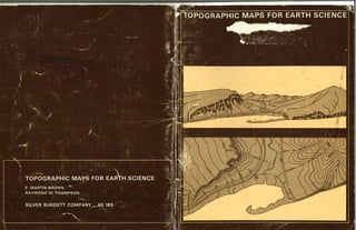
  • 2. TOPOGRAPHIC MAPS FOR EARTH SCIENCE F. Martin Brown Head, Science Department Fountain Valley School Colorado Springs, Colo. Lecturer in Earth Sciences Colorado College Ray W. Thompson Lakewood High School Long Beach, Calif. I I I I I I I 'lI I i SILVER BURDETT COMPANY A Divisìon of General Learning Corporation nMORRISTOWN, NEW JERSEY . Park Ridge, llt. . palo Alto . Dallas . Ailanta
  • 3. CElNTENTE¡ Map Exercise Page SILVER BURDETT EARTH SCIENCE PROGRAM Earth Science, and Teacher's Edition F. Martin Brown Grace H. Kemper John H. Lewis I 2 3 4 5 6 7 I 9 10 11 12 13 14 t5 16 17 18 t9 20 21 22 23 24 25 26 27 28 29 30 Reading a Map . Cumberland, Md.-Pa.-W. Va. Profiles and Gradients . Mendocino, CaliÍ. The Township Grid . EÍtingham, lll. Making an Overlay . Cayucos, Calif . Streams I . Voltaire, N. Dak. Streams ll . Neu¡ Bloomfield, Pa. Streams lll . Thousand Springs, ldaho Deltas . Breton Sound, La. Sand Hills . Ashby, Nebr. Water Table in Limestone Country . Lake Wales, Fla. lce Fields and Alpine Glaciers . Mount Fairweather, Alaska Alpine Glaciation , Mount Evans, Colo. Continental Glaciation , Ayer, Mass. Drumlins . Palmyra, N. Y. Plateaus 1 . Promontory Butte, Ariz. Canyons . Bright Angel, Ariz. Plateaus ll . Sf. Paul, Ark. Drainage Patterns . Monadnock, N. H. Folded Mountains . Strasburg, Va. Faults . Jellico, Calif. Fault Block Mountains . Santaquin, Utah Domes . Sundance, Wyo. Volcanics I , Menan Buttes, tdaho Volcanics ll . Mount Lassen, Calit. Shorelines I , Beaulorf, N. C. Shorelines ll . Bay City, Tex. Shorelines lll . Point Reyes, Calif. Shorelines lV . Kingston, R. I. Coastal Details . Greenport, N. Y. Submergent Coasts . Bangor, Maine Exercise Answers 1 3 5 7 o 11 13 15 17 19 2'l 23 25 27 29 31 33 35 37 39 41 43 45 47 49 51 53 55 57 59 60 Laboratory lnvestigations in Earth Science, and Teacher's Edition F. Martin Brown Grace H. Kemper John H. Lewis Topographic Maps for Eailh Science F. Martin Brown Ray W. Thompson Stereoscopic Aerial Photographs for Earth Science John K. Snobble Tests F. Martin Brown Grace H. Kemper OTHER SCIENCE OFFERINGS FROM SILVER BURDETT Silver Burdett Biology Program Silver Burdett Chemistry Program Silver Burdett Physics Program Silver Burdett Science Program (K-6) Silver Burdett Student Laboratory Program Terms, Tables, and Skills 21 st Century Monografics @ 1970 General Learning Corporation. All Rights Reserved. Printed in the United States of America . Philippines Gopyright 1970 by General Learning Corporation . Publisherj simultaneously in Canada This publication, or parts thereof, may not be reproduced in any form by photographic, electrostatic, mechanical, or any othèr ínethod, for any use, including information storage and retrieval, without written permission from the publisher.
  • 4. iI I 'l i INTFIcltrIUCTIclN ¡¡ map is a drawing on a flat surface of the features that are found l{ on the curved surface of the earth' For relatively small areas such representation is not difficult. For large areas, however, reducing the curvature of the earth to a flat piece of paper causes distortions. You have seen this on any map of a large area such as North America' The maps you will use in this book cover sufficiently small areas that the errors caused by the flatness of a piece of paper are very slight. There are many kinds of maps. Each of these is drawn for a specific purpose. Most of you are familiar with automobile road maps. Present- ing information about roads is the most important purpose of road maps. The maps in this book are made for another purpose, This purpose is to represent the shape of the land. Ä term that is used for the shape of the land is terrain. Maps that emphasize terrain are called topographöc maps. The word topography combines two Greek words: topos, meaning place and graphein, meaning to write. On a topo- graphic map the cartographer (map drawer) uses various symbols or signs to show the shape of the land, such as hills and valleys, and other features he wants to include. He uses conventional symbols just as we use the conventional symbol S in writing to indicate a sizzling sort of sound. On the opposite page you will see the more common conventional symbols that are used by the cartographers of the United States Geological Survey (U.S.G.S.), who made the maps we are using. When you use the maps, refer to this page, until you know all the symbols you need. The symbols printed in blue represent water features and those in brown, land features. Man-made features are in black, sometimes with red added. Vegetation, when it is included on a map, is printed in green. These are the conventional uses of color on the U.S.G.S. maps; green has not been included on your maps, The maps in this book are parts of topographic quadrangles: topographic because they show the features of the land, and quad- rangles because they have four corners. The full sheets from which your maps have been taken represent systematic parts of the grid of latitude and longitude that covers the United States. Many of your maps are parts of 7.5-minute quadrangles. These cover 7.5 minutes of latitude ( about 8.6 miles ) and 7.5 minutes of longitude (about 6.5 miles). Another frequently used size is 15 minutes of latitude and longitude. The distances between any two points on a map and between the same two points on the ground have a definite relationship, This re- lationship is expressed by the scale of the map. The map scale can be stated in several ways. On the sides of the opposite page are two of the scales for the maps you will use, The 7.5-minute quadrangles are drawn to a scale of t:24,000. This means that l inch on the map represents 24,000 inches on the ground. How many ground feet does a map inch equal? The 15-minute quadrangles are drawn to a scale of 1:62,500. Therefore l inch of the map represents 62,500 inches or about 1 mile on the ground. On the maps using a scale of I:250,000, I inch on the map represents 250,000 inches or about 4 miles on the ground. { i l < -i 'r- 'i i 'T t, r. a'' (' I + ilrlilll 0 2 3 4 -----,oOil -----..----oGas 5 MILES -n o o -{ U> o rm iÞ 5 ooo at¡.| : N MILE SCALE 1:62500 lctPCIG¡FIAFHIC MAP SYrvlBclLg Hârd surface, heavy duty road, lour or more lanes .--, Hard surface, heavy duty road, two or three lanes,.....-,-,,,,-,-, Unimproved dirt road-Trail-.,..,.-.,.-,,.,.,, Buildings (dwelling, place of employment, etc.)..-.....-.---.--.......,.. Wells other thán water (labeled as to type)- Located or landmark object-Windmi11..,,,,,,.,,,.... Horizontal and vertical control stâtion: tablel, sp¡rit level elevãtion. Township or range l¡ne, U.S. land survey,-,.,,,. Township or range line, approximate location...... Section line, U.S. land survey.--...-....... Section line, approximate locat¡on., ooo o Hard surface, medium duty road, four or more lanes-....-.-..-,-.,,, ,...----- BMÂ3899 oooo ooo trt lt t¡J J oU) IJJ J lndex contour., lntermediate contour..-..-.-.-..-...,,-,-:,,,.,. Supplementary contour............. .. . Depression contours.. Levee.... Sand area........ Perennial streams.......-..... Water well-Spring.... Large rapids.... ri'l_¡:¡¡a-;ljin l:11.i..:i.:_,, r "jj::r: :I '!l--.:r,-il'l¡J Grável beach -,, .......... Disappearing stream... Small falls-.-.-... Piling or dolphin..--,,-,, Sunken wreck.-.,. ffi f ì,rí.1.ì,.::r ra1-ir:¡.!:::7 r{*.uru oooo . -. - -.9î:. Small rapids.. :-----æl-- -,+ Marsh (swamp) -/'-a-/ + + Rock or coral reef.......... ¡o wooded ,.narsh-.,...,..--..,, I woods or brushwood....... E vineyard,,..,. liìã#,*T-ï*ffi=*il Mangrove.... n oooo -ït m m I Orchard--... Scrub,-..,--.. ffi.æK,q ffi ti......=...'ii,.l 00929:t 3lvcs tool Õ
  • 5. Ó O.T cuiT¿BERLAND aUÃDRANGLE MARYLÄ,ND-PENNSYLVANIA-WEST VIRGINIA 7.5 MTNUTE SERTES (TOpOcR.A.pHrc) NE/4 FROSTBURG 15' OUADRÀNGLE 4l'30" 78.45' Map: Cumberland, Md.-Pa.-W. Va. Contour inlerval: 20 feet. Scale: 1:24,000 (1 in. : 2000 ft.) Reference: 39"37'30"N, 78'5/30"W l¡lN THE opposrTE Pecr is the NE corner of a United V States Geological Survey topographic map. The upper right corner shows the location of the area included on the entire map. On a U.S,G,S. map, information about who did the mapping and how it was done appears in the lower left corner of each sheet. The scale information is centered at the bottom. You will also ffnd information about the relationship between magnetic ( compass ) north and true north at the bottom of the map, On U.S.G.S. maps, true north is always in the direction of the top of the sheet. A. At the corners and along the border lines of the map you will ffnd the geographic coordinates. The geographic coordinates in the SW corner of a map are the reference for the map. I. What are the latitude and longitude of the NE comer of the map? 2. This quadrangle is 7.5 minutes square. What desig- nation of longitude and latitude would you ffnd in the SW corner? 3. Notice that there is a large black cross (+)in the lower left portion of the map. This marks the intersection of what lines of longitude and latitude? B. The brown lines on the map are called contour lines. Each line connects all the points that are at the same elevation above sea level. Notice that each fffth line is heavier than the others. Also notice that on this map each of these heavier lines is labeled with a number that is an even multiple of 100. 4. What change in elevation does each of the ffner lines indicate? 'In the SE corner of the map, there is a narrow region where the contour lines are relatively far apart. On both sides of this region, and more or less parallel with it, the contour lines are closer together, Notice how the contour lines are numbered, This is the wav a mountain ridge is represented by contour lines. 5. What is the elevation of the high point of this . ridge? 6. What is the elevation of thevalleyaroundEllerslie? 7. How high above the valley is the high point of the ridge? 8. Examine the contour Iines on the west side of the ridge. Are they closer together above or below the 1200-foot contour line? MAP EXERCISE 1 READING A MAP 9. What does your answer to Item I suggest to you about the steepness of the slope? 10. Test your answer to ltem I this way: Measure the distance between the 1200- and 1400-foot contour lines. It is 0.25 inch. The scale of the map is 1:24,000. How many feet does 0.25 inch represent? 11. By dividing the change in elevation (200 feet) by the number of hundred (5) horizontal feet,.you arrive at the gradient per I00 feet. What is the gradient in the area measured in Item l0? 12. Now determine the gradient per 100feet between the 1000- and 1200-foot contour lines. What is it? 13. State a general ¡ule that you can use to relate contour lines to the gradient of a slope, C. In the NW part of the map, there is a house. It is high on the mountain and all alone. A road leads to this house. 14. How far in a direct line is this house from its nearest neighbor? 15. How high above its neighbor is this house? 16. What is the straightJine gradient between the two housesP 17. Most automobiles have difficulty climbing a rough, unpaved road with I2Vo grade of slope (12- foot climb per 100 feet). Would it be easy to drive to the house high on the mountainP D. Measures of the gradient of land slopes usually are given in feet per 100 feet. Major streams usually have such low gradients that it is usual to state the gradient of a stream in feet per mile. Wills Creek is the stream that flows by Ellerslíe. Close to the southern edge of the map you see a corìtgur line that crosses, Wills Creek. Follow the creek north until you ffnd the next place a contour line crosses.it. 18. How much has the stream changed in elevation between these contour linesP 19. What is the map distance along the creek between the linesP 20. What is the gradient per 100 feet? 21. What is an easy way to convert your answer for Item 20 to a per-mile gradient? 22. What is the per-mile gradient of the stream? 'i :ri ii 42i30" i { I f 1
  • 6. S : iIN É ¿ 30o JACKSSch =P t - 3 543 lt ll nt2 ^'tai ll il ll ll il lL íI I + I I I I I I I I I I I OLFR IV I I LITTL cù I end,oeino Ba 0* * D * *o .* * * ,pp &o , * åv t62 0 o 72 7A 78 o ¡9 lwell €r I I It ]I// ìl Map: Mendocino, Galif. Contour interval: 40 feet (Dotted lines are half intervals, or 20 feet.) Scale: 1:24,000 (1 in. = 2000 ft.) Reference: 39"15'N,'123' 48'W E xpERTENcED MAp READERS can visualize the slopes l- that are represented by a series of contour lines. Beginning map readers learl to do this by making profiles. Near the middle of the map you will see a horizontal red line, partly solid and partly broken, which is the boundry between T16N and T17N. You will develop a profile along this line from the left to the right edge of the map. You will draw your profile on a.piece of ten-line graph paper. On this paper the lines are spaced 0.10 inch apart in both directions. A. The ffrst step is to lay your graph paper along the line you have selected to proffle. This is the red vap rxrnctsE e PRt]FILES AN D GRADIENTS 200 vertical feet on the þround.'Locatb the inark you made to represent the coastline. Using the vertical lines as a guide, traùsfe¡ that mark to the 'O-eleva- tion line that you have designated. Now find thd mark that repre-pents the 200-fo9t contoûr line and transfer it to the ffrst light-blue line, ì¡/hiàh represents the 200-foot'elevation. Trj, to fft the four contoûrs betwedn 0 and 200 in their proper places between the 0 line and the 200-foot line of your profile. Now transfer the 400-foot-contour-line position to your proffle, and then the four lines that lie between the 200-foot and 400-foot contour lines. Continue in this way until you -have properly located the position of each contour line on your proffle. Starting at sea level, connect the points you have marked on your profile with a smoothiy curving line. Continue in this way until you have a line that extends across the distance that represents the width of the map. You now .have a natural-scale profile, which approximates the actual contours of the slopes. At this scale, small ups and downs practically dis- appear. To make them more evident, we usually draw profiles with vertical exaggeration. Make another pro- file directly below the one you just constructed. This, time, Iet each light horizontal line represent an increase in elevation of 40 feet. Each of the horizontal lines on the graph paper now represents a contour line, 4. What is the vertical scale now? 15. How much exaggeration does this represent? 6. Which of your proffles was the easier to draw? C. Make a north-south profile of aìother part of the map, Use the red line that separates section 32 from section 33 as a guideline. Make the profile from the north edge of the map to Schoolhouse Creek, Use a 5 X vertical exaggeration in your profile. 7. How does this north-south profile differ from your east-west profile? line described above. Next, use a sharply pencil to mark on the graph paper where the of the map, thd coastline, and eaóh of the pointed left edge lines intersect with the paþer. Norv number tour line according to. its elevation above sea Your.next job is to decide upon the scale, you want to use for the oertical distances in your proffle. (The horizontal scale has already been determined by the scale of the map.) 1. How many feet are represented by one inch on the map? 2. Using the scale from Item l, determine the distance represented by the side of one of the small squares on the graph paper. 3. If you use the vertical side of one of the small squares to represent a 200-foot change in eleva-, -tion, your proffle will be proportional to the actual slopes of the land. Using this vertical scale, deter- mine what fraction of the height of a square on the graph paper represents the elevation change between two 40-foot contour lines. B. Now try to use this vertical scale to draw a proffle. Here is how you do it, T,abel one of the heavy blug lines on the graph paper 0, and label the next heavy blue line above it 2000. By doing this, you havi¡ created a ve¡tical scale-that is the same as the horizontal one: 1 in.-: 2000 ft. This scale makes the spacing between the horizontal lines on the graph paper equivalent to 3
  • 7. L4 SHELBY CO C ( ïCA éJs I 357 358 R. s E. 3262 I s 7 39"15', R.4 E 350000m.E. 351 s52 353 354 355 40' 1345000m.N. Map: Effingham, lll. Conlour ¡nlerval: 10 fget Scale: 1:62,500 (1 in. : 5208 Ít.) Relerence: 39"06'N, 88'45'W MAP EXERCISE 3 THE TOWNSHIP GRID 4344 4343 T,9 I N 1?85, A sysrEM of surveying and mapping the r United States was adopted by Congress. It was known as the United States Land Office Survey. It mapped all the unsettled part of the country westward from western New York State. The plan was to divide the country into regular townships 6 miles on a side. Bach of these was further divided into 36 sectioús I mile square. A numbering system was used that allowed every section to have a distinctive number and each township withín a large area to have its own distinc- tive designation. The townships are numbered north and south from a base line and east and west from a principal meridian. t - A. Look at the western and northern margins of the map. There you will ffnd red numbers such as T9N and R4E (Township I North and Range 4 East). Part of the boundary line between Shelby and Bffingham counties crosses the township that is designated TgN, R4B. That boundary follows the line that separates sections 15 and 22 in township T9N,R4E. Notice that the sections of T9N across the northern part of the map are uniformly laid out. In the southern part of the map, T8N, this is not so. The surveying of the southern part was not so well done as that of the northern part. Notice that the sections are not square and the north-south lines do not meet those of the northern part of the map. Such errors are not uncom- mon in regions surveyed in the early part of the last century. Many of the surveyors were poorly trained, and they used instruments that were rather crude. B. Find the town of Shumway. Notice the short- dashed lines that deffne its limits. The major portion of Shumway occupies the NW% of section 33, TgN, R5B. The rest of the town is in the NEY¿ of the NE% of section 32, T9N,R5E. You can see by this example how the designation for a particular piece of land is composed. I. Draw a square that is 3 inches on a side and divide it into 36 squares each 1/z inch on a side. Examine the system used on the map to designate sections. Number the squares on your diagram according to the township system. 2. Draw a square that is 2 inches oú a side. Divide this into four l-inch squares. Each of these repre- sents a quarter seótion,^and the whole a full section. Label the southeast quarter section SE. Label the . southwestern quarter of the northeastern quarter section, SWr/¿. How should the t/E quarter section in the extreme southwestern part of the section be designated? 3. In the lower left portion of the map, find St. Pauls Ch. Write the full designation for the church property, including the township designation. 4, Near the western (left) margin of the map, ffnd the village of Holland. Write a full description of the location of the village. 5. Identify a landmark that has this location: NE7¿ of NE% of section 18, T9N,R5E. 6. What word is pri4ted in section 14, T9N,RSB? 7. Approximately how far to the west (left) of the border of your map is the western boundary of Range 4 East (R4E )? 8. A. normal section contains 640 acres (l square mile). How many acres are there in a quarter section? How many acres are there in the NWY¿ of the NW7¿ of a section? 9. Approximately how many acres are there in the town of Shumway? 10. Approximately how many acres are there in sec- tion 4, TBN,RSE? a N U) o z J ! ô I l E : ts o 4338 10' 4333 T8N, a 5
  • 8. t- -3e8Èj!ÊãËrà8t3Ë-EËãå,€EåëEÉÈÈZåå ËË¡Ëy:¡¡åïËEËËåå3å;E"i=É:;E;ëE å3Ê.!ËË5;ei.,!5;fi==ËTË;dõge¡ãs,> E€;s!F.ËE:sa,ÉÈltE!=t:i€åe]:äiti:sa;ïilj:åFür*çåËiË;peçnrrçÉ!:åÉE iåÈ¡EË3ËEiË!ËË+.9¡iäl+Ë?tËrå::çË+P^E=.giEËtES*E-^Ãeqà-dsp-qÃ.q!ré'=ãgúË Ê,ç¡aã:iEs1ïE:ÈË€õ;ÊEEE:;ËE-yi"r;-23å åËlååååqãååå¡åIEåå.å.ËåËtrË¡ti'i¡ë=åË¡,åË1g = ËE¿'zte'tÏÉ'FFËf:#:iÉe;E732Ì;:;Ê:¿ir F;:gJJiFËËËå:Ë:ËËËËEËJåiËiå€iEåEËËËÊEËã "Ë.È¡ËËls5¡Èd.ñoooÊ¡;€:;sÀ'€:EÈr ËHÀãËãÐáEiäEÐg€ïtçnå;ï€5åHã ãËsä:ilË::ËËEã***.Ë5gË:;Ëqä¡ äå3;EiÈÈã:g".iË+;E:i=:¡EP=E;!it gç;E.ËåååË;åEã==ÈË ïsË*FsËã+nã¡ ËË*åËå€åË åtEråËtËtråiËËsgãååËËåE,ã*isr:Ë; tãz';ii ' iåfiiEgE*ËãËätåËÊjËÉgEË?,=E ir|íåËåå:ËElEu;;:Ë=ñîi3¡¡:rEË'Ë¡iisF5åËããEËElËçÏ -= 'IrEtÉ ?:Ë+såï+ 7izr5i-â;È;¡É;iËËËÉËËËËËËËEr1äË;Ëíåå ö¡:EgEÈg¡EÏ+;=ôicâ{,¡ô ":E :eËãËå;iëÈ*Ë fär.lr -Jal-l-E HLULU X'- urO È c5 =v - > .-} ã=oôtc!u) tôo E"FÈo.ci ?roa- ò5co sËHs igs. 8:-s..daP s'E$Ë 'i'e/.- ':."... o ao ,ú .T f Loo..6a' BAY o -0 : --t7o" (ì íl .,i c. 9 .! oÕ Ots t) F o
  • 9. @ 0 ¿:) <-- <?o O- MFp: Voltaire, N. Dak. Contour inlerval: 5 feet Scale: 1:24,000 (1 in. : 2000 Ít.) Reference: 48"04'N, 100"52'W MAP EXERCISE 5 STREAM S I i 1 I i 1 a.HE MAp AccoMpANyrNc this exercise shows a small I portion of north-central North Dakota, It is a region that was under the continental glacier during the lce Ages. The surface here is largely covered ¡/ith ground moraine. In this exercise you will focus on the Souris River. The country here is so fat that a small contour interval (5-foot) has been used. If a 100-foot contour interval had been used, very few contour lines would appear on the map. Such a large interval would not show the terrain features that you will study. A. Examine the course of the Souris River. 1. How would you describe this stream? 2. Approximately how wide is the foodplain of the river? 3. What is the straightline distance from where the river enters the map to where it leaves the map? 4, What is the approximate length of the river's course between these same points? 5. What does the difference between these two dis- tances do to the river's gradient? 6. The river drops about 2 feet in elevation across the map. Mhat is its gradient per 100 feet? per mile? 7. What do you estimate to be the rate at which the river flows: very slowly, slowly, or rapidly? B. Examine the floodplain of the river. Notice the peculiar way the contour lines along the river run into one another. This indicates that natural levees occur, and that at some places they are at least 5 feet high. 8. What happened just east of Westgaard Cem. in section 3? 9. Has what you described in.Item 8 occurred any- where else on the map? 10. Notice that there are numerous elongated depres- sions in the floodplain. What are these? 11. How high is the floodplain blufi in section 33, adjacent to the long, narrow lake? 12. What do you suspect is the origin of the generally fat land between the present floodplain blufi and the steep bank in the northern third of section 33 and most of section 32? 13. There is a suggestion of a similar structure in sections 9 and 17. May this have been formed at the same time or not? C. Study the water features, other than Souris River, shown on the map. 14. What kind of water features are there? 15. What does your answer to Item 14 suggest to you about the drainage system in the region? 16. What may be responsible for the feature referred to in Item 15? s 0 0 9
  • 10. Map: New Bloomfield, Pa. Contour inlerval: 20 feet Scale: 1:62,500 (1 in. = 5208 Ít.) Relerence: 40'17'N, 77'15'W rrHE MOUNTAINS AND RTDGES ShOWn On this mAp are I composed of sedimentary rocks that are exposed at the end of an eroded syncline. Some of the rocks are more easily eroded than others. Sherman Creek is probably a superposed stream that flowed across the peneplain before stream erosion excavated valleys in the soft rock and left the harder strata standing as ridges. There are several examples of stream capture shown on the map. There are also good examples of trellis drainage pattern. These are difficult to see because there is so much other detail on the map. To make the streams and their patterns easier to see, you must prepare an overlay, (See Map Exercise 4, ) A. Register your overlay with the triangulation point 718 at Centre Sch. in the upper left part of the map, BM 690 near the edge of the map in the upper NB portion, and BM 932 at Sterretts Gap in Blue Moun- tain near the bottom of the map. On your overlay, trace all the streams that lie between Mahanoy Ridge and Sherman Creek, and SW of Sherman Creek west of Shermans Dale Sch. and north of Little Mountain. Remove the overlay from the map and place it on a piece of white paper so your drawing will be clearly visible. Look at the pattern of streams that you have traced in the vicinity of Pine Grove Sch., east of the center of the map. This is a fine example of trellis drainage. l. How would you describe trellis drainage? MAP EXERCISE E¡ STREAMS II B. Notice that the main tributaries of the upper part of the Pine Grove Sch. stream flow in the same valley as a stream that flows SW and into Sherman Creek. Once that stream was the only one in the valley. The headwaters of the Pine Grove Sch. stream cap- tured a large part of the water that flows in the valley. Now turn your attention to Pisgah Run, SE of Pisgah Ridge, Try to discover the stream capture that took place in that area. Make a sketch that shows how the itt"u-, flowed before capture. Look at the region between Mahanoy Ridge and Rattlesnake Ridge on your overlay. It looks as though Perry Furnace Run may have captured the headwaters of the stream at the SE foot of Mahanoy Ridge, a tributary of Little Juniata River. Study the map in that area. 2. Did stream capture occur there or not? 3. How did you form your opinion? C. Study the topography of the summit of Blue Mountain, the boundary between Perry Co. and Cumberland Co. There are many gaps present. 4. What kind of gaps do yo,t r"ãf - - D. Now study Little Mountain, just north of Blue Mountain. Replace your overlay, being careful to register it exactly as you had it originally. 5. Mark your overlay with a W for each of the water gaps that you ffnd and an X for each of the wind gaps. 11
  • 11. ,o , 3t82 l I .; Map: Thousand Springs, ldaho Conlour ihlerval: 20 feet (Dotted lines are half intervals, or 10 feet.) Scale: 1:24,000 (1 in. : 2000 ft.) Relerence: 42"40'N, 114e52'W M ",ffi ;ffi:ïtî 1ili î:t i::*:îi:J ii*T sheets. The map shows a portion of that country about halfway between Boise and Pocatello. The lava flow averages about 200 feet thick here. The lava flow followed down valleys and buried the stream beds. It spread over the adjacent land and has produced a lava plain. Along the Snake River this plain has some of the characteristics of a plateau. A. Examine the Snake River. The contour lines across the river are drawn at 5-foot intervals. l. In which direction is the river flowing? 2. At two places on the river, the cartographer has marked a series of blue dashes across the river. What do these representP 3. What causes the feature identiffed in Item 2? 4. Study the middle portion of the map. Notice the hill that is about 3220 feet high, west of the river. Bxamine the terrain that surrounds this hill. If the sur{ace of the Snake River were 60 feet higher than it now is, where would the river flow? 5. Examination of the ground shows that there are many river pebbles and water-worn boulders in the valley between Falls Creek and SE to the Snake River. Does this conffrm your answer to Item 4? 6. What would you call the valley from the Flume across the Snake River to the mouth of Falls Creek? 7. Where else on this map can the same feature you identiffed in Item 6 be located? 13 MAP EXER Cß87 STREAMS III B. Tum your attention to the land east of the Snake River. This is part of the lava plain. 8. Has there been much erosion of this plain since it was formed? 9. What is the evidence for your answet to Item 8? 10. What feature of this plain is plateaulike? 11. Study the center portion of section 33 along the river-cut margin of the plain. What do the blue circles with the twisted lines leading from them representP 12. The introductory paragraph of this Exercise con- tains a clue to the source of these springs. What is the clueP 13. What is the level of the spring line at Banbury Springs. 14. How thick do you estimate the lava to be at the south end of Banbury Springs? 15. Examine Briggs Creek Springs. How thick is the lava flow there? 16. Is the larger ancient stream bed at Banbury Springs or at Briggs Creek Springs? Why? C. Now look at the land on the west bank of the Snake River. 17. Is there a single escarpment for the lava plain or more than one? 18. Which of these escarpments is the most prominent? 19. Which escarpment is the least prominent? 20. What do your answers to Items 17, 18, and 19 suggest to you? 21. What is a good name for the flattish areas between the foot of one escarpment and the upper edge of the next lower one? 22, What features on this map may be related to the volcanism that produced the lava flows?
  • 12. + soll aa /-ittle Grcnd Co4tuilb tJaa ùtt¡uille ßay rcnd BagÉð . ,; Ealtfedore Ræf ;; Sand ( .¿ Hog lslands ú Erelon soft mud Eads NA !ând Poin|, Field oôit ' "no wells shells Ò hârd hard solt s¡nd + mud sand'l mud sâfld lsland hard solt Òmud Field C¿rencro lJau afl sird klana Toglor Pus snd mud solt Cocklet ELtu LAS'I' I},1' sônd h¿rd -î¿ Ç+ ', nud snd mud mud saod soft mud múd u/tY .-mud G¡ounü I Bau Mud Lumps mud snd ri 1 I lumps mud mud sand o o -i 6ÀRDEr- ISLAND B¡1) müd mud 0¡l tield lVhole llag sl¡cky :snd soll .s,n¿sano .!å.mId South mp: E snd shells :roil llay $ IVf:ST ßA' ad mud sand vrells *û _f, Yd" sofl mud 0it owells 0¡t I)i.vnt ¡ìd!l nud shells soft mud oil . o wells ,. .: snd 'Sand Light mud Sand mud South ,ri S¿nd Jetty soft 15 Map: Breton Sound, La. Conlour ihlerval: 50 feet Scale: 1:250,000 (1 in. = 3.95 mi,) Relerence: 28"53'N,89'30'W rlrHE DELTA of the Mississippi River is an example of I a bird's-foot delta, It gets this name from the pat- tem of its distributary channels. They resemble the spread toes of a bird's foot. The word distributary means just the opposite of tuibutat7. The tributaries of a river join with the main stream and bring water to it. The distributaries leave a main stream and carry water from it. A. Every yeaï the Mississippi River carries millions of tons of sediment to the Gulf of Mexico, l. What happens to the velocity of the river as its water enters the gulf? 2. What does this cause to happen? 3. What other difierence between the river's water and the gulf's water causes deposition? 4. On which side of the Mississippi River, east or west, does it appear that sedimentation is occur- ring now? 5. Explain your answer to Item 4. 6. Examine the depth lines shown on the map. De- scribe the slope of the bottom of the Gulf of Mex- ico shown on the map. B. Make a proffle of the ocean bottom from the NE tip of Breton Island southeast¡/ard to the eastern edge of the map. Pass the line of the proffle through the two words mud. Make a second proffle from Port Eads on South Pass along a line that follows the ietty (a straight black line) to the SE corner of the map. 7. Do these proffles agree with your description of the slope of the ocean bottom? 8. How do you explain the observed difierence? MAP EXERCISE EI DELTAS C. Examine the NW portion of the map. 9. How do you interpret the peculiar brown lines with cross-hatching? (Notice that there are similar marks just to the east of South Pass.) 10. What reason is there for the features you identified in Item 9? ll. The men working in the oil ffelds on the delta travel from place to place in the oil ffelds in a swamp buggI, an amphibious kind of truck. Why is this necessary? 12. Notice that there are areas on the map printed in gray (green on the original map). These represent trees and brush. Wliat efiect do these plants have upon the delta land? D. Part of the delta shown on your map is older than other parts. Study the area within the Delta National Wildlife Refuge. Notice that at least the eastern half of the aÌea is a mass of distributaries. They are out- lined by narrow mudbanks that rise just above sea level. Closer to the main channel of the Mississippi River, there is more swampy land than water. In this swampy land are numerous delta lakes. These lakes are all that are left of bodies of water that once were merely rimmed with mud. Younger lakes of this type, formed by mud deposited at the edges of distributaries, can be seen in the eastern part of the area, 13. Which delta land within the Wildlife Refuge is older, the eastern or the western portion? 14. Where, with respect to the main channel of the Mississippi River, is most of the older delta land? 15. Describe the characteristics of older delta land.
  • 13. Þ26å C øetLø LûþE a Floøi,ttþ Map: Ashby, Nebr. Contour interval: 20 feet Scale: 1:62,500 (1 in. = 5208 Ít.) Relerence: 42'02'N, 101'58'W MAP EXERCISE CIU SAND HILLS W" 1¡ HERE rs A LARGE AREA in southern Nebraska, western I Kansas, and eastern Colorado that is covered by stabilized sand hills. These sand hills date from the glacial ages, While the ice sheet covered much of the Midwest, the region of the sand hills was a cold and windy area. Much of the ffne material that melting water washed away from the front of the glacier wai blown into these hills. Later, prevailing westerly winds somewhat altered their shapes, but you can still see that the southern faces of the hills are steeper than the northern faces. Curiously, this sandy region is one where there is much water near the surface of the ground between the hills. A. Near the middle of the map is Castle Lake and just west of it is Castle Ranch. Bxamine the large sand hill just north of the lake and the ranch, in sections 32 and 33. l. About how high above Castle Ranch is the top of the hill? 2. Whai are the approximate dimensions of the'hill? 3. Describe the topography of the hill. 4. Is this a typical sand hill? 5. How do you explain the depressions? 6. What is the general trend of the long axis (dimen- sion) of the sand hills? 7. How would you describe the land between the hills? B. Sand allows water to sink through it rather rapidly. 8. How do you account for the numerous lakes and swales (swamps or marshes)? 9. Examine the level of the water in the lakes where the level is given. What do you suspect is the direc- tion of the dip of the impervious layer? 10. Notice that there are several Flowing Wells. What is another term applied to such a well? 11. Examine several of these wells and the water levels of the nearest lakes in two or more directions from the wells. Do you believe the water in these wells is from the same water table that the water in the lakes is from? If not, explain what you believe to be the situation, 12. Make a diagram of your solution to Item 11. 13. Another symbol associated with underground water sources is a little circle with ears. This is for a well with a windmill-driven pump. The ele- vation numbers associated with these symbols refer to ground level at the windmill. Which of the water tables, do you suppose, are tapped by these windmill pumps? 14. The townships across the lower part of the map are numbered T24N and across the upper part T25N. Examine the blue lines in sections I,2, 3, 4, and 5, T24N,R39W. What does blue represent on this map? 15. Do these particular blue lines represent streams, or ditches? Why? 16. What may be the reason for these? 17. Other than in size, how do the two ponds or lakes in section 30, T25N,R39W differ? 17
  • 14. //, è'o_ ¿-+- 'Q2. -+ (wrPc) 1,rþ' gii-' f1 r-!. l!' Lqies It6 Lake BeILe lir-''" .ú.: ¿ t! _ +*-' q - ri" -*- -+, . Map: Lake Wales, Fla. Contour'interval: Sfeet Scale: 1:24,000 (1 in. = 2000 Ít.) Reference: 27"53'N, 81'31'W MAP EXERCISE 1cI WATER TABLE IN LIMESTONE COUNTRY l', THE AREA SHOryN ON THE MAP iS iN CCNTTAI FIOTidA. I This part of the state is covered by a layer of lime- stone topped by thin soil. A. The uppermost part of the limestone is easily per- meable to water. Beneath this layer there is rock that is not so permeable. 1. How does limestone react to rain and other water that percolates through the soil? 2. What is the evidence on the map that solution caverns have undermined the region? 3. Where are the areas on the map that suggest that all the pervious limestone has been eroded, expos- ing the less pervious, or impervious, rock beneath it? B. There are many small lakes shown on the map. Notice that each lake is in a depression. 4. Are there any surface streams leading to or from these lakes? 5. Annual precipitation in this region is greater than annual evaporation. Why don t the lakes ffll their depressions and overflowP C. The elevation above sea level of a lake indicates the top of the water table in the immediate vicinity of the lake. Examine the water level in the lakes for which this measure is indicated by blue italic numbers. 6. What is the indication that the water levels are systematically arranged? 7. What direction does this suggest to you for the dip of the water table? 8. There are several dry sinkholes, or depressions, in the NB part of your map. How can you recognize these? D. Examine the sinkholes between Mountain Lake and Lake Wales and eastward to the margin of the map. 9. What is your estimate of the water-table elevation in this general area? 10. Is the bottom of any of the depressions you have examined below your estimate of the water-table elevation? ll. How does this explain why these are dry sinkholes? E. Examine Lake Edward, just north of the city of Lake Wales. 12. What is the level of the water in itP 13. What is the level of the water in Twin Lakes, just south of the city of Lake Wales? 14. Do these water leveìs fit with your hypothesis about the slope of the water table in the vicinity of the city? F. Overlay the map with a piece of tracing paper. Draw the outlines of all the lakes, using a soft pencil so you do not mar the map. 15. Draw a small x to indicate the center of each of the dry sinkholes. Remove the tracing from the map. Write the level of the water in each lake on your tracing. For those where the precise level is not given, state the approximate level, for instance, 115-120. 16. In the same way, write the elevation of the bot- tom of each dry sinkhole, but put the number in parentheses. 17. From the information that you have plotted, draw Iines that represent the contour lines at the surface of the water table for elevations of 120 feet and 115 feet above sea level. I I I ì ; l I ì ( I 19
  • 15. Heath C) å 1,n,tøt . MAP EXERCISE II ICE FIELDS AND ALPINE GLACIERS lbach Pt sland Map: Mount Fairweather, Alaska Contour.¡nterval: 20feet Scale: 1:250,000 (1 in. = 3.95 mi.) Reference: 58'18.6'N, 137'26.1'W s .a I ì ¡r HERE ARE NUMEROUS alpine glaciers along the coast I of Alaska. In many areas several glaciers have joined, forming ice fields. The large ice-covered region Str of the center of the map is an ice field. It is com- posed of the upper parts of many glaciels that extend down valleys to the ocean, In the NW portion of the map are several typical alpine glacier systems. Contour lines on the ice are printed in blue. The short blue lines are symbols for great cracks in the ice called crevasses. The clusters of brown dots in some places on the glaciers represent areas where morainal material is present on the surface of the ice. A. First turn your attention to the NW quarter of the map. At the head of Johns Hopkins Inlet you will ffnd the snout of Johns Hopkins Glacier. Study this glacier system by following each of its tributaries to its source. The ffrst major tributary enters from the south. l. What is the approximate elevation where the south tributary and the Johns Hopkins Gl. unite? 2. What is the general shape of the contour lines that cross the south tributary glacier near the junction? 3. How do you interpret this shape of the contour lines? 4. What is the highest point of the south tributary? 5. How does the slope of the ice along the dividing ridge between the Johns Hopkins and La Perouse glacier systems differ from the slope nearer sea level? 6. Which tributary glacier contains the steeper slopes in the vicinity of Mount Crillon? 7. Notice that in the vicinity of the crest of the glaciers there are patches of brown contour lines. What does this mean? (Such patches are called rwrwtaks, the Eskimo name for them. ) B. Now study the largest of the ice-covered areas on the map. This is the Brady Glacier system. Notice that it flows into the sea both to the north and south. It is really a small ice field rather than a simpie alpine gla- cier. Carefully study the alpine glaciers that surround and contribute to the ice field, Place a sheet of tracing paper over the map and key it to Reid Inlet at the north, Clillon Lake at the southwest, and Abyss Lake at the southeast. Draw an arrow from the highest point on the ice ffeld, indicating the direction of ice flow toward Taylor Bay in the SE corner of the mapi Now draw other arrows from the high point to the snouts of Lamplugh and Reid glaciers. Next draw arrows from the heads of the alpine glaciers that feed the Lamplugh-Brady ice ffeld from the'west. Mark with an N any nunataks that you find in the western part of the ice ffeld. C. Examine the southern portion of the map. 8. What evidence do you find that suggests the glaciers have retreated from their maximumextent? D. Examine the northern portion of the map. 9. What evidence is there that sea level has changed since glaciers formed in the region? 10. In what way may your ffndings in Part C be related to this? 11. What would be the effect of this melting if it took place only locally? f2, With your answe¡ to Item ll in mind, suggest when the development of Johns Hopkins Inlet took place. 1 ¿-Y. 4 21
  • 16. lt4Ð in il730 Map: Mount Evans, Colo. contour inierval: 40 feet Scale: 1:24,000 (1 in. : 2000 Ít.) Reference: 39"34'N, 105'41'W MAP EXERCISE 1E ALPINE GLACIATION ÞEFORE THE ALPTNE GLACTERS formed On the high lJ ¡¡su¡¡¿¡ns of Colorado, these mountains were often smoothly rounded at the top. After the ice melted, many rounded mountains were left with huge basins scooped from their sides. This scooping-out process altered the roundness of the mountains. Where two glaciers had been back to back on opposite sides of a rounded ridge, only a jagged edge of rock remains. Thus, the appearánce today of many high mountains is the result of glacial action. The map on the opposite page represents a region west of Denver, Colorado, where glaciers were active at various times during the last million years. A. Ml Spaulding ís near the middle of the map. Glacial action changed the shape of this mountain on three of it sides: east, south, and west. Notice how the contour lines on the NW part of the mountain are uniformly spaced and follow long, gentle curves. Notice also that these contour lines are relatively far apart. This indicates that this side of the mountain is smoothly rounded - it was least affected by glacial ice. l. Where on the map are there other extensive areas that were not affected by glacial ice? Directly east of Mt. Spalding is a basin containing Summit Lake. Notice that the contour lines of this basin are shaped like huge U's pointed toward the mountain ridge. Notice also that the lines lie closer together as they approach the ridge. A basin with these characteristics is called a cirque. 2. Describe how a cirque looks in nature. Summit Lake fflls a depression behind a low stadial moraine. Bear Creek has cut partly through the moraine and carries off the water from Summit Lake. Such a lake is called a moraine lake. High on the cirque between Summit Lake and Mt. Evans is a small pond without an putlet. Such a pond is called a tarn. A tarn is a small pond in a rock basin that was scooped out by ice action. The ridge WNW of Mt. Evans was shaped by the glaciers that fflled the basins containing Summit Lake and Abyss Lake. Such a ridge, with steep slopes and often pinnacles at the top, is called an arête. B. Using strips of graph paper and a scale of I inch : 2000 feet, make each of the following proffles. 3. A proffle from the summit of Mt. Spalding NW to the source of the creek between that mountain and Gray Wolf Mountain. Label this proffle an unglâ- cÍated slope. 4. A proffle from the summit of Mt. Spalding to where the unnamed stream enters the SW region of the more southerly of the Chicago Lakes. Label this profile a glaciated slope. 5. A proffle from where the stream flowing out of Abyss Lake crosses contour line 12600 to the point marked 12876 north of the east end of Summit Lake. Label this a glacial ridge, or arête. C. Place a piece of tracing paper over the map and key it to the outer left co¡nersl Use a soft pencil for your work on this overlay so that you do not mark the map itself¡ 6. On the overlay, draw lines that indicate the rims of all the cirques you can ffnd. Label these C from the NW corner of the map clockwise around the map from Cl to as many as you can ffnd. 7. On your overlay, locate what may be moraine lakes and the streams that drain them. Mark these lakes ML. Locate and mark on your overlay all of the tarns and label them T. Draw a line on your over- lay along each arête and mark each end with an A. ì A 23
  • 17. r.1 a) Map: Ayer, Mass. Conlour ihtervall 10 feet Scale: 1:24,000 (1 in, : 2000 ft.) Reference: 42'30'N, 71'34'W MAP EXERCISE 13 CONTINENTAL GLACIATION I i r¡ rFHrs MAp REPRESENTs a small area in NE Massachu- I setts that was overrun by the last continental ice sheet. On it you will ffnd many good representa- tions of landforms that are associated with continental glaciation. In this part of the country there is only a thin layer of soil above the bedrock. In some places the erosive action of the ice scraped away the soil, leaving a core of bedrock. Oak Hill is an example of such action. The long, almost straight, SE face of the hill is a feature that is determined by bedrock. The swamp-filled, more-or-less rectangular notch in the NE end of Oak Hill is an abandoned quarry. This part of the United States has been settled for more than 300 years. Towns had been established long before the Land Office began to operate. Therefore, there is no convenient grid of townships and sections that we can use to locate points of interest, Instead, we will use an imaginary grid for this map, dividing the area into nine rectangles. Consider these rectangles lettered A, B, and C from north to south and numbered 1, 2, and 3 from west to east. Thus, the SE corner of the map would be C-3, the very center B-2, and the NW portion A-1, A. Look over the entire map to familiarize yourself with the general features of the landscape. Notice that the countryside is composed of numerous rounded hills and swampy regions. There is a prominent ridge, Oak Hill, running more or less NE by SW in B-2 and C-1. In the NW corner of B-2 and extending into A-2 is an elongated hill a little more than 410 feet above sea level. Notice that the slope of one end of this hill is steeper than the other end. This is a drumlin, The steeper end is called the stoss, and the other the tail. Hills that are rounded and elongated and that have one end steeper than the other are very often drumlins. A good way to designate a hill is to use the quarter of the area in which you find the hill and the number of the highest contour line you ffnd on the hill, Thus, the drumlin mentioned above would be designated "Hill 410 in NW B-2." l. Find and designate two additional drumlins. B. Another feature of continental glaciation is a kame. These are hills of glacial debris that are often irregular in shape and rather steep-sided. Howevero sometimes they are symmetrical (almost circular ) and quite uni- formly sloped. Locate Pingry Hill in NE A-1. It is a kame, 2. Find and designate tu'o more, rather symmetrical kames in the A area. 3. Locate what may be an irregularly shaped kame in B-1. C. Look at the long hill in C-2 just east of Beaver Brook and west of Muddy Pond. Such an elongated hill is called an esker. These structures are often broken into segments, and the summits may vary in height. 4. How would you describe an esker? 5. What is the extent of this one? 6. How high above the level of Beaver Brook swamp are its summits? 7. At the southern end of Muddy Pond the high point on the esker is 290 feet above sea level. The level of Beaver Brook swamp 150 feet directly west of the summit is 230 feet, What is the gradient per 100 feet of the western slope of the ridge? 8. Examine A-3 very closely. Locate another esker that is strongly segmented and not nearly so well deffned as the one you have just studied. Describe its location, D. A ground moraine is recognized by swell-and- swale terrain. Such terrain is composed of irregular, small, low and broad hills among which are scattered depressions, sometimes dry and sometimes wet. 9. Locate three small but characteristic areas of ground moraine on your map. 2/5 I I I 25
  • 18. o Nol ,,,,, A () Map: Palmyra, N.Y. Contour ¡nlerval: 10 feet Scafe: 1:24,000 (1 in. : 2000 ft.) Reference: 43"00'N, 77"14'W MAP EXERCISE 14 DRUMLINS ^NE oF THE FTNEST examples of a swarm of drumlins V is found in the vicinity of the city of Paìmyra in central New York. These were formed under the last great ice sheet, which covered the region. Geologists have not yet solved the problem of how drumlins form. Some geologists believe their formation may have something to do with the peculiar way that clay behaves when it absorbs water. Clay absorbs consider- able amounts of water and at the same time remains rather firm. However, when a little more water is added, clay becomes a slippery fluid, which flows. Perhaps the characteristic shape of drumlins is caused when the outer layers of a clay mound become wet enough to flow, while the drier, inner layers remain ffrm. A. Examine the whole map. 1. Besides drumlins, what other features of a glacial drift plain are shown? 2. In the SE section of the map you will ffnd Short Road. It runs along the eastern edge of a pair of drumlins. Prepare a longitudinal proffle of the western twin. Be sure to mark the north and south direction on your profile. How do the two ends of the drumlin difier? 3. What special names are given to the opposite ends of a drumlin? 4. Is the difference in the slope at the ends of the drumlin you proffled common to all the drumlins, to most of the drumlins, or to only a feu of the drumlins shown on the map? 5. Which end of the drumlins is upstream of the glacier and which is downstream? B. Register a piece of tracing paper on the crossroad NE of Bear Hill, road intersection 543, and road inter- section 548. Using a ruler, draw the long axis of each of the drumlins on the overlay. 6. Make a statement about the 'gêneral direction of the.long axes of drumlins in the same swarm. 27
  • 19. 'l: Ø Map; Promontory Butte, Ariz. Conlour interval: 50 feet Scale: 1:62,500 (1 in. = 5208 lt.) Relerence: 34'17'N, 111'09'W MAP EXERCISE I5 PLATEAUS I I THE AREA suowN on the map is in central Arizona. I The edge of the Mogollon Plateau, or Mesa, crosses the map from east to west. You will need to know the township designations for this exercise, Sections 20, 29, and 32 at the western edge of the map are in T11%N,R11r/zE. ln the same column of sections north of section 20 the sections are in T12N,R11E. All the other townships are whole-numbered and are related to T12N and R1lE. Make a neat sketch of the arrangement of townships and properly label them. It will make the references in this exercise easier if you do this. (If you do not remember how townships are numbered and arranged, refer back to Map Exercise 3, ) A. Notice how abruptly the arrangement of contours changes along the boundary between Coconino and Gila counties. l. What does this indicate? 2. The name given to the feature you observe along the county line is escarpment. Deffne an escarp- ment. 3. On which side of the county line is the plateau? 4. In what general direction do the streams flow on the plateau? (These streams are called consequent streams. Such streams flow down the original slope of the strata. ) 5. In what general direction do the strata of the plateau dip? B. How steep is the slope of the plateau's surface? To discover this, you need a measure of distance and the change in altitude over that distance. 6. What is the elevation in township T12N,R12E where the corners of sections 27 and 33 touch? 7. Gentry Cabin is in section tl of the same township. What is its elevation? 8. What is the straight-line distance between the two points in Items 6 and 7? 9. What is this gradient per 100 feet? 10. Does the gradient in Item g indicate a steep slope, or a gentle slope? C. From the same corner of section 33 that you used in Item 6, meâsure the distance to contour 6750 above the first O in Mogollon. ll. How far is it on the map? 12. What distance does this represent on the ground? 13. What is the change in elevation between these two points? 14. What is the gradient of this slope in feet per 100 feet? 15. Is this a steep slope or a gentle slope? 16. Examine the spacing of the contour lines farther south from the upper portion of the escarpment. What happens to the land? D. If you examine the country just south of the rim, you will ffnd several named springs. 17. Locate these and prepare a table with the follow- ing headings: Spring Sectåon Towræhip Eleoa.tìon Study your table. 18. What do you deduce about a possible aquifer from your table? E. Turn your attention to the streams. 19. Which of the streams, those flowing on the plateau or those flowing down the escarpment, have the greater gradientP 20. Which of the two groups of streams have the most power with which to erode their beds? 21. Predict what will occur because of headward erosion? 29
  • 20. Ê Map: Bright Angel, Ariz. Contour'¡nlerual: 80 feet Scale¡ 1:62,500 (1 in. = 5208 Ít.) Reference: 36'03'N, 112"09'W THu cRAND cANyoN is one of the most spectacular r examples of the work of water. This map depicts a section across the Grand Canyon between the National Park headquarters on the South Rim and Bright Angel Point on the North Rim. The sculptured masses of rock that lie within the canyon are rernnants of the sedimentary strata that once extended across the region. A. Let's consider the width and depth of the Grand Canyon in the area shown on the map. The narrowest part lies between Yaki Point, on the South Rim near the middle of the bottom of the map, and Obi Point, on the North Rim near the east margin of the map. l. Use the Ìittle triangles (triangulation stations ) at these points and determine the map and air dis- tance between them. 2. The elevation is given for the two triangulation stations that you used to measure the distance across the canyon. To determine the depth of the canyon, use the average of these elevations and the elevation of the river along the line connecting them. 3. What is the evidence that the river may be actively cutting into its bedP B. The Colorado River, in forming the Grand Canyon, has cut through a thick column of sedimentary rocks and is now cutting into the crystalline rocks at the base of the sedimentaries. Examine the way the terrain is arranged in steps. around the rock formations called Isis Temple, Brahma Temple, and Zoroaster Temple, among others, Notice that erosion has produced an alternation of steep and gentle slopes. 4. How would you explain this in terms of harder and softer rocks? 5. Compare the approximate elevations of the gently sloping areas, called esplanades, just above 4000 feet on Bradley Point (near Zoroaster Temple) and across the river near Pattie Butte. 6. If we assume that both of these esplanades repre- sent erosion surfaces at the top of the same hard layer, in which direction does this layer dip? MAP EXERCISE 1E¡ CANYONS 7. Compare the elevations of the esplanades on Sumner Butte, Jones Point, and the unamed point NE of Hattan Butte. (These are along the eastem side of Bright Angel Canyon. )' 8. Does your answer to Item 7 verify, or contradict, your previous estimate of the dip? 9. Now compare the elevations of the esplanades on Jones Point and Johnson Point, which face each other across Bright Angel Canyon. 10. Compare the elevations of the esplanade on the unnamed point due east of Clement Powell Butte and the esplanade on a line that runs from Ribbon Falls to Brahma Temple. C. Bright Angel Canyon was formed by the stream in it. This stream has eroded deeply along a fault zone. Study the data you have gathered about the dip of the strata and the hard erosion surfaces (esplanades) on both sides of the canyon. ll. Was the movement along Bright Angel Fault mostly vertical or not? Why do you think so? 12. What feature suggests that the fault extends across the Colorado River and into the South Rim of the Grand Canyon? D. Examine the eroded slopes of the southern wall of the Grand Canyon for the presence of springs. 13. List these by their name or by the name of the creek into which they empty. Also note the approxi- mate elevation of each. Spríng Eletsation infeet 14. What does the presence of these springs indicate to you about the elevation of an aquifer? 15. Look at the head of Bright Angel Canyon. Name the spring you ffnd there. 16. Might the spring you found in Item 15 be from the same formation that the springs in the south wall of the Grand Canyon are from? Explain your answer. 31 lr
  • 21. Map: St. Paul, Ark. Contour inlerval: 20 feet Scale: 1:62,500 (1 in. = 5208 Ít.) Reference: 35'45'N,94"00'W MAP EXEH CßE17 PLATEAUS II rl¡HE REGToN sHowN on the map is in NW Arkansas. t This rugged country is called the Boston Mountains. These mountains are a part of the Ozark Plateau. The White River flows across the NE quarter of your map. A. By examining the contour lines that cross the river you can determine the direction in which it flows. Notice how the river wanders back and forth across its narrow foodplain. The 1300-foot contour crosses it in section 14, T14N,R28W. The 1360-foot contour crosses it in section 32, TI4N,R27W. This should allow you to number properly all the townships shown and also determine the gradient of the stream. 1. Does the river generally fow NW or SE? 2. What other information do you need to calculate the gradient of the stream? 3. Calculate the gradient. 4. Determine the gradients of Crosses Creek and Possum Creek, two of the tributaries from the south. 5. From these gradients, what is your hypothesis about the gradients of tributaries relative to the gradient of the main stream? B. All the streams on the map have been, and are still, actively eroding the original plateau. They have cut deeply into the ori$nally more-or-less level land, forming V-shaped valleys and flat-topped hills. 6. What is the approximate elevation of.the remnants of the plateau? 7, Are these remnants higher above sea level in the southern part of the map, or in the northern'part? 8. Is there much difference in elevation from east to west across the remnants near the southern edge of the map? 9. What was the probable direction of slope of the original plateau surface? 10. Notice where the main roads (parallel continuous lines in the mountains ) are located. Do the maiority follow the old plateau level, or do they cut across country? ll. Speculate on why this is so. C. Geologists call the type of country shown on this map maturely dissected plateau. 12. How would you describe such country? 13. What would you expect in a region of youthfully dissected plateau? 14. What would you expect of anolddissectedplateau? 15. Look at the map for Map Exercise 15. What stage of dissection would you say it is: youthful, mature, or old? 33
  • 22. -:1"*,* 4.i 4.:¡ Map: Monadnock, N.H. Contoul inlerval: 20 feet Scale: 1:62,500 (1 in. : 5208 ft.) Reference: 42"46'N, 72'11'W MAP EXEBCISE 1El DRAINAGE PATTERNS THE srATE or New Her,rpsHrne was completely over- I run by the last great ice sheet, In many regions this ice sheet scraped the crystalline bedrock bare and produced rounded rock hills, In other regions, the morainal debris fflled in the low areas. Here and there, old mountains were large enough to resist the erosion of the moving ice. Thus, they remain as isolated mountains in today's landscape. We use the term monadnock for these mountains and for any other eroded mountains that are isolated from peaks of the same size and elevation. This term comes from the name of the mountain that is shown in the middle of the map on the opposite page. A. Study the entire map. l. What is the name and elevation above sea level of the highest area on the map? 2. What are the next two highest places on the map? 3. How far from the summit of the highest mountain are these located? 4. What is the difference in elevation between Monadnock Mtn. and the second highest point on the map? 5. Examine the pattern of streams flowing off Monad- nock Mtn, Such a pattern is said to be a radial stream pattern. Deffne a radial stream pattern. B. Examine the eastern third of the map. The lower two-thirds of that area represents land that is covered deeply with glacial drift in the form of ground moraines. The rounded, somewhat elongated hills are drumlins. Other less regularly shaped hilJs are kames, and in some places these are clustered on a kame terrace. 6. Notice how the streams wander haphazardly in this area and notice the presence of many swamps and lakes. These are characteristic features of country covered with glacial drift. The drainage system of such an area is said to be poorly developed. Why? 7. Are there other areas shown on the map that are probably covered by glacial drift? 8. Glacial drift probably covers most of the land except Monadnock Mtn. and the other high areas, such as Gap Mtn. and the Beech Hill area. Look at Stone Pd, and Stone Pond Bk. Does Stone Pond Bk. flow into Stone Pd. or out of Stone Pd? 9. lVould you say this is an example of good drain- age, or poor drainage? Do you think that poor drainage is associated with glaciated country? 10. Examine Dublin Pond. Is it better drained than Stone Pd.? Why? Á 35
  • 23. Map: Strasburg, Va. Conlour interval: 40 feet Scale: 1:62,500 (1 in. = 5208 ft.) Reference: 38"49'N, 78"27'W MAP EXERCISE 19 FOLDED MOUNTAINS ,d TrHrs MAp REpREsENTs a part of the Appalachian I Mountains in northern Virginia. The two meander- ing rivers are the North Branch and South Branch of the famous and beautiful Shenandoah River. Diago- nally across the map from SW to NE runs an eroded synclinal fold. Southeast of South Branch, in the corner of the map, is a little of the eroded metamorphic rock of the Blue Ridge portion of the Appalachians. A. First examine Little Fort Valley, located with Three Top Mountain to the northwest and Green Mountain to the southeast. 1. What is the shape of this valley? 2. Study the NE end of the valley. Describe it, 3. Do you see why Little Fort Valley is called a canoe valley? There is another way to describe the valley, Does the long axis of the valley follow the dip (slope) of the strata, or the strike (at right angles to the dip ) of the strata? 4. Examine the ridge of Three Top Mountain. Do any streams cut across this ridge? 5. Examine the ridge of Green Mountain. Do any streams cut across this ridge? 6. What is your best guess about the relative hardness of the rock that composes these ridges? 7. Five gaps in the ridge of Green Mountain are named. What kind of a gap is Woodstock Gap? 8. List the other named gaps of this kind. 9. What kind of gap is Boyer GapP 10. Are there any other named gaps of this kind? ll. Examine Mine Run and Little Passage Creek in Little Fort Valley. What kind of streams are these? 12. Suppose at one time the streams that drained Little Fort Valley, one from the southwest and Little Passage Creek from the northeast, joined opposite Mine Gap and left the valley through Mine Gap. If that were true, explain the present stream system in the valley. B. Now examine Massanutten Mountain. 13. What is the shape of the ridge where Little Crease Mtn. joins it? 14. Field examination of the strike and dip of the ¡ocks shows that there is an anticline between the two mountains. Notice how abruptly the little valley ends at the northeast. This is the end of a plunging anticline. In what kind of valley does the upper part of Mill Run flow? 15. In what kind of valley does the lower part of Mill Run flow? 16. How does Mill Run cross Little Crease Mtn. C. Study the North Branch of the Shenandoah River, Notice that it has a narrow floodplain that is consider- ably lower than the surrounding country, North Branch (and South Branch) is an entrenched meandering stream. Bxamine the meanders. 17. On which side of each sharp turn is the bank steeper? 18. What is this kind of bank calledP 19. What is the bank on the inner side of a turn called? 20. In which direction is North Branch flowing, NE or SW? 21. In general, which bank, the NE or the SW, is being actively eroded by the long, straight parts of the meanders? 22. Defend your answer to Item 21. l l I i ll fl4 37
  • 24. lBøld Mtn lReserooir l Bidwell Ranch Map: Jellico, Calif. Conlour interval: 40 feet Scale: 1:62,500 (1 in. : 5208 Ít.) Reference: 40"45'N, 121"30'W MAP EXERCISE E! O FAULTS EAULTS ARE usuALLy difficult to locate on topographic F maps. One of the best map examples of faults with conside¡able vertical movement is shown on the oppo- site page. This map lepresents a small area in the volcanic region of northern California, in which the escarpments produced along the faults are clearly deffned. Locally they are called rims. The mottled symbol that occupies much space in the western portion of the map represents lava flows. Often faults accompany lava flows, but by no means do they always occur together. The township in the upper left corner of the map is T36N,R4E. Make a rough diagram of the townships shown on the map to guide you in doing this exercise. A. Examine the western portion of the map. l. What evidence, other than the lava flows, do you ffnd that indicates volcanic activity? 2. Notice that Lost Creek comes to an abrupt end in section 7, T34N,R4B. Why do you think the stream ends so abruptly? B. Look at the series of escarpments running more or less north to south through the central part of the map. These are along the fault lines. Examine the escarpments along the section line between sections I and 17 in T34N, R5B, and eastward. 3. How many escarpments cross that line? 4. Is the land higher on the eastern side, or on the western side of the escarpments? 5. Using a small piece of graph paper, draw a proffle from the SW corner of section B to the SB corner of section 10. If you use a vertical scale of 1 inch to represent 1000 feet, then the proffle will be verti- cally exaggerated about 5 times. Remember that the contour interval is 40 feet. 6. The more-or-less level areas between the escarp- ments are called benches. In which direction do they dip? 7. What is the approximate change in elevation from the foot of the escarpment at the west to the sum- mit of the escarpment at the east in the region you proffled? 8. What is the horizontal distance (in feet ) between {* the lower and the upper contour lines involved in u your estimate of the difference in elevation? 9. The area you proffled is called the fault zone. Is it uniformly, or almost uniformly, wide throughout its length on the map? 10. How does width of this fault zone vary? ll. How does the north end of the fault zone differ from the central portion on the map, other than in ¡/idthP 12. In the central portion of the fault zone, where there are three or four different escarpments, the short secondary faults are called splinter faults, VVhat is the evidence that at least some of the faulting took place after the lava flows had occurred? C. Key a piece of tracing paper to the triangulation stations on Cinder Butte, Bald Mtn., and Lookout Rim in section 15 of T34N,R5E. 13. Trace the general paüern of the faults. Try to decide which one you will consider the main fault and which the splinter faults. Label the main fault M and the splinter faults S. { 31 6 i : i ii lr ----- I 6 39
  • 25. Map: Santaquin, Utah Conlour inlerval: 40 feet (Dotted lines are half intervals, or 20 feet.) Scale: 1:62,500 (1 in, = 5208 Ít.) Reference: 39'45,0'N, 111 "54.6'W âoME MoUNTATN RANGES were formed when great Ð block, of the earth's crust were uplifted. The boundaries of these blocks are great faults along which large vertical displacements occurred. This uplift took place slowly. Thus, streams eroded deeply into the rocks as they rose. The approximate position of the fault can be found quite easily, Look for a line that has gently sloping land on one side and much more abrupt slopes on the other. Streams have often built large alluvial fans upon the more gently sloped land. These fans are located where the streams leave the uplifted block. A portion of the west side of the Wasatch Range in Utah is shown on the map, The individual mountains in this range have been carved by streams from a huge uplifted block of crust. The fault along the western edge of the block is not continuous, but is broken into segments that are offset one from the other. At each such offset there is a small area of confused topography that probably represents a group of splinter faults. Before you study the map in detail there is a feature that may puzzle you and should be explained. It is a zone in the mountains that starts about two miles east of the southern edge of the town of Mona. This zone strikes NE, and the contour lines are more widely spaced in it than in the adjacent mountain areas. This zone may be related to a fault that occurred earlier than the uplift of the block. A. Study the western edge of the Wasatch Range where it fronts upon Juab Valley. Notice that the main fault lines are rather straight and that where there are offsets, the contour lines suggest confused topography. Place a piece of tracing paper over the map and key it to the triangulation point on Mt. Nebo, the north end of Mount Nebo Reservoir, and West Cr. in the extreme SW corner of the map. Represent the position of each fault (its scarp ) by a straight line on the tracing paper. Label each segment consecutively from the south end of the map, l, 2, etc. Label each area of confused topography between the segments SF, for splinter faults. MAP EXEHCISE 2I FAULT BLOCK MOUNTAINS l. How many segments did you ffnd? 2. How many areas of splinter faults did you ffnd? Remove the tracing paper and locate Willow Creek in the south-central part o{ the map. Notice how the contour lines are drawn from the mouth of Willow Creek toward the middle of Juab Valley. They repre- sent an alluvial fan. Study the eastern portion of Juab Valley and locate othe¡ alluvial fans. 3. How many can you ffnd in the eastern part? 4. Replace the tracing paper and draw on it the posi- tion of each of the fans you found, To the left of each fan you mark, place the name of the stream you believe is most responsible for the debris that forms the fan. B. One of the featurês of fault block mountains are the triangular facets on the escarpment. These are not always present. They are usually more easily seen when looking at the mountains or a photograph than on a topographic map. There are several triangular facets on the western face of the Wasatch Range. None of them are conspicuous on the map. Let's ffnd one. Locate Long Canyon in the south-central part of the map. About t/+ inch east of the head of the stream you will see a small area where the contour lines are well spaced. This is the apex of the facet. The apex is not always flat-topped, but it is always a high point, as you would expect, Notice that there is a ridge running NW from the apex toward the mouth of Willow Creek and another running SW toward the mouth of Birch Creek. These ridges are the sides of the triangle of the facet. The base is along the fault line. @ Replace your tracing paper and draw in the outline of this triangular facet. East of Mount Nebo Reser- voir, locate North Creek and Pole Canyon. There is a facet between them. Loiate its apex and sides. Now locate the facet between Pole Canyon and Bear Canyon to the south of it, and still farther south, the facet between Dry Canyon and Couch Canyon. Replace the tracing paper and draw the three facets that you have located. 41
  • 26. ) , 20 --ì., -. 0 6 Map: Sundance,-Wyo. Contour inlerval: 40 feet (Dotted lines are half intervals, or 20 feet.) Scale: 1:62,500 (1 in. = 5208 ft.) Relerence: 44"18.9'N, 104"22.1'W MAP EXERCISE E! E! DOMES lìoMES ARE cAUSED by the injection of matter I þsfù/..r strata of sedimentary rock. The injected matter may be magma, salt, oil, gas, salt water, or a combination of these. In any case, the injected matter causes the sedimentary rock above the injection to rise as a blister upon the earth's surface. Small domes, such as those on the map, are often almost perfectly circular. Larger domes are more often elongated. Several landscape features are often associated with domes. Some of these are easily depicted on maps; others are not. Hogbacks can usually be recognized, especially on large domes. The radial drainage pattern and sometimes an annular pattern of streams around the dome are also usually seen on maps. But fatirons and race tracks are frequently unrecognizable. These are seen much more clearly on photographs than on maps. A. Green Mountain is almost in the center of your map. It is one of the best examples of a small dome. It is situated in a region where there is not enough precipitation to maintain permanent streams on so small a mountain. But there is one intermittent stream that flows off the north face of the mountain. 1. What evidence do you see on the map that there may be other channels on the mountain down which water may run during a heavy rainstorm? 2. Make a sketch showing the approximate positions of these drainage channels. 3. Explain how your sketch conffrms radial drainage on Green MountainP 4. What evidence do you ffnd of annular drainage associated with Green Mountain? B. The map evidence of hogbacks on Green Moun- tain is not striking, but can be found. Look in the SW comer of section 16. There you see a sharply recurved section of the 4800-foot contour line. This section and the 4760-foot contour line outline part of 'a hogback. In the western portion of section L7, yort will ffnd some small areas surrounded by contour line 4720. These are the high parts of the tops of a ring of hogbacks. The evidence for flatirons on Green Mountain is even slighter than that for hogbacks. Around the SW quarter of the mountain, between contour lines 5000 and 4800, you see a few small closed contours, Iittle flattened rings. These mark the upper tips of flatirons. C. Locate two low domes in the SW portion of the map. 5. What names are applied to these? 6. Which one is located in section 1, T50N,R63W? 7. Which of the following features of a dome can you ffnd on Lime Buttes: radial drainage pattern, annular drainage pattern, hogbacks, flatirons? 8. What features of a dome do you see associated with Gypsum Buttes? 9. Draw a sketch of this dome and show the features mentioned in Item 7. 10. What evidence do you find that suggests what the injected materials in this dome are? z4 43
  • 27. (i ä...r.'. E n ; Ilt ). Map: Menan Buttes, ldaho Contour ¡nlerval: 10 feet Scale¡ 1:24,O0O (1 in. = 2000 ft.) Reference: 43'45'N, 111'59'W lrHE Two voLCANoES suowN on the map are in central I eastern Idaho. You can make a reasonable decision about which of the three types of volcano these are by measuring the steepness of their sides, The sides of shield volcanoes seldom have slopes greater than 10o from the horizontal. This is a gradient of 18 feet per 100 feet. At the other extreme is a cinder cone, which has a slope near the summit between 30o and 40o from the horizontal. An eroded cinder cone may slope much less than this. Composite volcanoes have slopes that are gentle at the base and steep at the top. The average slope for this type is rarely greater than 20o. The following table shows the relationship between the degree of slope and the gradient, You will use this table in Part A. Slope ån Cradient in f eet degrees per 100 feet 00 5g l0 18 15 27 20 36 25 47 30 58 35^70 40 84 45 100 A. Look at the southern (lower) part of the Menan Buttes, Notice that the highest point on the crater rim is at the south. Its elevation above sea level is noted in black. l. What is that elevation? 2. What is the elevation of the contour where the foot of the volcano touches the Snake River? 3. How high above the river is the southern rim of the volcano? 4. What is the map length from the highest point on the southern rim of the crater to the nearest bank of the river. 5. What distance does this length represent on the ground? 6. What is the gradient (in feet per 100 feet) of this slope of the volcano? ?3MAP EXERCISE G VOLCANICS I 7. Consult the table and speculate on what kind of volcano South Menan Butte is. 8. Determine the most gentle slope you can find on the NE side of the volcano. 9. Does this gradient support your ffrst estimate? B. Examine the way the contour lines that represent the volcano are drawn. 10. How would you describe the NE face of the cone? ll. What is the evidence for your answer? C. Now examine the crater. Notice that the contour lines at the bottom have little tick marks on them. This is the map maker's method of indicating a depression. (All the contour lines within the crater should be so marked, but they are so close together that to "tick" them would obscure the lines. ) 12. How deep is the crater from the highest part of the rim? 13. Are the crater walls composed of cinders, which erode easily, or lava, which does not erode easily? 14. From which direction was the prevailing wind during the eruptions that formed the cone? What is the evidenceP D. Examine North Menan Butte. 15. What do you conclude about its structure? 16. Examine the area between the two volcanoes. 'What evidence do you see that would support the hypothesis that another volcano existed before Menan Buttes? 17. Examine the extreme NW corner of the map. Notice how irregular the contour lines are. Notice that there are some depressions, What do you think this might represent? .J tl tì l) : t ¡ . I c sr Mile :..: a' 45
  • 28. N ! -ì-lì-r, ¡ '22 a Map: Mount Lassen Volcanic National Park, Calif. Contour inlerval: 40 feet in norlhern fi; 80 feet in southern % Scale: 1:62,500 (1 in. = 5208 lt.) Reference: 40'26'N, 121"25'W MAP EXERCISE Ê! 4 VOLCANICS II 1¡HE AREA sHowN on the map lies in NE California I and is part of Mount Lassen Volcanic National Park. The area in the park usually visited is to the west ãnd southwest of the map on the opposite page. You have studied Map Exercise 23 based on Menan Buttes in Idaho. In this exercise, you can test your interpretation of volcanic features from a topographic map. There is one new symbol to learn. Just east and north of the center of the map, locate the Fantastic Lava Beds. The brown stippling in this area is the symbol used to show lava beds. A. Study Prospect Peak, in the north-central area of the map. l. How would you describe the general shape of this mountain? 2. What is the gradient of its south faceP 3. What type of volcano do you think this is? 4. ]ust SE of Prospect Peak is a much smaller volcano. It was formed by eruption in 1852. What type is it? B. Examine Hat Mountain, on the western edge of the map; Fairffeld Peak, in the center of the map; and Crater Butte, south of Fairffeld Peak. (Note: Contour interval for Crater Butte is B0 feet. ) 5. What is your best guess about what type of volcano they are? C. Examine the lakes that are adjacent to Fantastic Lava Beds. Notice Grassy Creek at thé south of Snag Lake. 6. Does this stream flow into, or out of, Snag Lake? 7. What is the evidence for your answer? 8. Examine Butte Lake and the stream to the north of it. Which way does the stream flow? 9. Where does the water flow from Snag Lake? I0. Notice the small unnamed pond west of the lava beds. Where does the water from this pond flowP ll. How can you tell that this pond lies in a depression. f2. Why doesn't the entire depression ffll with water? 13. Using your imagination, describe what may have been the situation along Grassy Creek to where the stream leaves Butte Lake, before the lava flows fflled the little valley with the Fantastic Lava Beds. I l :. i 0 0 t ( A r1 47
  • 29. J llll '7'1 hard " r1.1 Point soft ro Ca Lee ß Poínl hard te U"ro¡!.0 b Poìnt .; Sand d Sands()¿ ¡¡1] Hoop O( c "r'.,.'=)- t¡,,,, çL llall Pot Dor hard soft sanl lCoast Guard Station Poìnt ts ìr Hotto Sand ::j:,.SOft { r.it-.4* lslond Sand SandCltv sand mud mud sand Ouolslqnd llberg Sand lslond Stakes 60 Oøo ::. ". - ìl r¡Ì SandSând3A llequlò¡t Iùlct Sfiocklefo¡d l¡..1 ft¡t 60 ,].. sand .. :i.. Sând 'i:i.,:, tt , Sand Ø Sand sand IAPS -60 Y sand mud shell mud sand i sand gravel sand sand shell iii s¿nd gravsl shell Light o3o sand 6 CAPE shell gravel Breakers ,.!l: sând ê^ sand æsand shêll gravel shell A sJ sånd N ù *: soft sand ()øo sand shell ùouooco c;) sand shell sand shell sând shell gravel Map: Beaufort, N.C. Conlour interval: 50 feet (with some intermediate 2S-foot intervals) Scale: 1:250,000 (1 in. = 3.95 mi,) Reference: 34"22'N, 76"53'W rrHrs MAp rs A poRTroN oF one of the sheets in a series I that covers the entire United States. The scale for this map is 1:250,000, and because the scale is so small, 'the contour interval is large. The depth lines for the ocean are in feet, The map shows a small part of the coastal plain and the coast of North Carolina. A. First examine the land features that are shown on the map, l. Is the land hilly, ol does it appear to be rather flat? 2. Describe the streams. 3. What explanation can you give for this kind of stream pattern? 4. What is the offshore area like? B. Exarnine the banks more closely. 5. How does the outer shole of the banks difier from the shoreline of the mainland? 6. How do the shorelines of the banks on the sound side and ocean side differ? 7. How would you explain the differences you have just noted? 8. Speculate on what causes the formation of inlets between the banks. 9. Examine the shape of Cape Lookout. What is your /explanation of this? fr Make an overlay of the banks and on it draw your ¡/ bstimate of the directions of the longshore currents. MAP EXEBCISE A |5 SHOR ELINES I C. In the bight of Cape Lookout there are three symbols that denote wrecks. Blsewhere in the vicinity of Cape Lookout, you see a symbol that consists of a line with three crossbars and a dotted oval surrounding it, This indicates a sunken ship that may tje a hazard to navigation. ll. How do you account for so many accidents occur- ring in such a small area? 12, Notice that the 5-fathom line (marked 30 feet on the map ) extends far to the south of the cape, whereas along the banks it is about a mile offshore. How do you account for this? 13. What does the word Breakers tell you about the depth of water on this underwater extension of the cape? 14. Does the effect of the meeting of longshore currents extend into water deeper than the 5-fathom line? If so, explain your answer. 15. What do the notations mud, sand, grauel, and shell mean? 16. How do you suppose this information was gathered? 17. What is the general pattern of the bottom material? 49
  • 30. lþ A CO ) þ u{û<9at,n >) X Lv3 o ç $ (' vîitíi*s Lake lhsll ^ { sholl ÉÀ5' nud ïidalCUT mud múd sandmùd müd rda sand flats müd mud Líue BOGGy þrtv' DRESSING ¿i.¿ POTNIÊ È ' 14 :t:Pioes - ncogp¡ À I ¡lo¡¿a¡cr iand mnd rion€s (: 0¡l ta üod Winr oar e sholl3 .9 lawinot o4 1 çlaysand shslls mud!ônd clay 'ï Bând nud WN CFDAR shellssând mud sand mud shells mud rhell3 c¡ay sand mud mudmud sh6lls snd shells sod mud sand 3and mud mud sand mùd Beach !and nud sa¡d shells mud müd o7 müd mud mùd sand mùd mud múd mud mud 51 Map: Bay City, Tex, Contour interval: 25 feet Scale: 1:250,000 (1 in. = 3.95 mi.) Reference: 28"22.2'N, 95"58.7'W THE coAST oF TEXAS presents one of the most magnifi- I cent series af barrier beaches in North America. Behind these beaches the mainland slopes gently toward the interior, It is a broad coastal plain. The discovery of oil, natural gas, and sulfur deposits in the sedimentary rocks of the region has made it very important economically to the United States. A. Examine the portion of the map that represents the land. l. How would you describe it? 2. What kinds of stleams are present? 3. How do you recognize each of the types of streams on the map? 4. What map evidence suggests that there is not a great deal of rainfall in the region? 5. Select two triangulation points, one near the coast and one at least 3 map inches inland from the coast, for which speciffc elevations above sea level are given. Determine the gradient of the land in feet per mile. B. Now look at the depth lines in the Gulf of Mexico. 6. Determine the gradient of the bottom between the the S0-foot and the 60-foot depth lines. Be sure to make your distance measurement as close to perpendicular to these lines as possible. 7. Which has the greater gradient, the land or the bottom of the gulf? 8. If the coastal plain.is emergent sea bottom, why is there a difference in their gradients? MAP EXERCISE E Ei SHORELINES II C. Concentrate your attention on the coastline, 9. Would you describe it as an irregular coastline or not? 10. Is the coastline continuous'with the coastal plain throughout the map? If not, what prevents this? It. Study East Matagorda Bay and Cedar Lakes, How do these lagoons differ? 12. What would indicate that both these bodies of water were once larger? 13. Was Cedar Lakes ever like East Matagorda Bay in its main features? 14. What were the approximate dimensions ( in miles ) of Cedar Lakes when it was an open lagoon? 15. Examine and then describe the barrier beach of Bast Matagorda Bay. 16. What is one way to explain the position and shape of the little ponds on Matagorda Peninsula? 17. Examine the area at the western end of East Matagorda Bay. Notice that a small stream called the Colorado R. enters the bay. What occurs where this stream enters the bay? 18. What is the evidence that Matagorda Bay may in time be cut off from the gulf as is Cedar Lakes?
  • 31. 422r 4216 4213 4212 Schooner 157 a-) t. o. { I 1' t8 ------- o ij trt ¡t o Wreck 6O D n A K E aE I il l i I i + Rocl 4219 4218 53 Map: Point Reyes, Calif. Contour inlerval: 80 feet Scale: 'l:62,500 (1 in. = 5208 ft.) Relerence: 37"59'N, 123'02'W DorNr nEyES is a famous headland on the Marin f Peninsula north of San Francisco. It was here that Sir Francis Drake put in, to overhaul his ships in June, 1579. On the map you will see where he disembarked, and where he established a blacksmith shop to perform needed repairs. The great swells of the Paciffc Ocean beat against the headland. Longshore currents sweep both te ocean shore and the shore of Drakes Bay, In tlíe extreme NE corner of the map is a small portion of Tomales Bay, a long narrow inlet with parallel shores that fflls a lowered portion of the San Andreas Fault zone. A. Bxamine the shoreline. l. Is this a raised coast, or a submerged coast? 2. Explain your answer to Item l. 3. What evidence is there that the sea has worked upon the shoreline since the relative elevation of the land and sea last changedP 4. What is the probable cause of these conditionsP 5. At what place on the ocean side is there evidence to support your conclusionsP 6. Explain your answer to Item 5. 7. Is there any similar evidence on the Drakes Bay shoreline? If so, what is itP 8. What is now happening'at the heads of Estero de Limantour and several of the bays in Drakes EsteroP 9. What is the evidence that these bays once extended farther inland? 10. Locate places where bays have disappeared. MAP EXER Cß827 SHORELI NES III B. Now study Point Reyes. ll. How does the south shore of the point differ from the shores you studied in Part A? 12. The land facing the ocean is very steep, rising to 552 feet above sea level in about 700 feet. What do you suggest as a reason for such a different shoreline? 13. What does the presence of the Coast Guard Life Boat Station on the point suggest to you about the safety of sailing in these wâters? 14. Examine the pattern of dots that indicate sand on the ocean shoreline north from Point Reyes and the pattern of the B0-foot contour line. In what direction do the sand patches extend? 15. Where is the sand probably being producedP 16. What is your best guess as to the direction from which the strongest winds blow? 17. From what you have learned by your study of this map, suggest two important reasons for plac- ing the Life Boat Station where it is. f8. Why did Sir Francis Drake make a wise choice in using the bay now called Drakes Estero to give his men rest and to repair his vessels? 19. Carefully examine the shoreline from the mouth of Drakes Estero to Point Reyes. Pay particular attention to the contour lines of the land. Describe the land iust behind the shore. 20. What does this suggest to you about this piece of submerged coast?
  • 32. 99 iaqouqaloqszr,oueqÌppo^{araq^t,{1a¡eurrxorddV'lt ¿palmccolualou€qcnsJIdeurs¡qluoaulllsuoc eqtJouor¡rsodeqlq.rnccoplno.{e8uuqc1eq¡6 'laoJ96Ilnoq€osrrplno,tIo^o[Bes'f¡alalduroc pallouisdecec¡rqodaqlJIfuqfpaluurrlsosIlI'tI ¿IIIH ueaJCtuorJlseocaql8uo[Eqìrou.{q¡suas¡n[leq] ernlcnrlsoq+oì.{¡dduno.{plno^{aurtsuleq^A'õI ¿puodrrrolsn.Il urspu€lslll€rusaqlroJlunocceno.,(op¿AoH'II ¿BeseqltuorJ paleloq,,(1ala1duocuaaqlouo^Erlspuodpre3 pu€puodruolsnrl,,(qzu,uoseelelqrssod€e^r3'0I ¿sa8pFasaqltllnq.{lquqord¿wetl qpeuopuol'uuorlc€Josacrnoso^lor{lJorlclt{/l.'6 ¿eurleroqsaq¡¡oflrurcr,r at€rpatutureqtulpuu¡1seq8¡qeqlsIq8¡qø,o¡¡.g ¿uoqrpuoc¡uase.rdeql pacnpordezleq,{euuollc€JosecJnoso^llBrI^A'¿ ¿pu€leqlpop€^ullsrslraculseosaql ,{qpesnecselueqcJopugno.,(opacuapl^arsq^A'g 'eu{eroqseqlauFu€xg.t /IS]NII]UOHS aafstSulxldvl 'p€oulsod aqlJorünospu€lorllJo,,(qder8odolor{loql¡cseq'g ¿duuraqt¡o ¡ou.roc ^as âqlu¡'l[IHuoarc¡1ecno.{plno^l€riM'7 ¿qlnosol rllJoutuorJuor8a¡srqlqepl,tmoq,(¡aluurrxorddy'g ¿Iwellol .re.rsu€rno.(1ee^rrreolnofpe¡solnleoJì€q^,'6 ¿p€o.raqlJor{ìrouaqtoìsa¡¡'ure1d por{s€zrlnoJoour€.rourIBIpBls'esaqlJoqclr{^A'I 'ure¡dpaqsu^lnoJolErF woqeur€rotuIerp€ls¡ouo¡8ereqìsaluredespuorar¡J 'puoraqlJoqlnosuru.rJelaqlLUoJJluarâ#rpe¡rnbpue .rulnBarrrsrpeo.rslqlJor{lrouulurra}eql'}so,tiollsuo uror¡duruarllsessorcrlclq¡'pBoUlso¿eqÌelËcoT'V 'eurlaroqsÁep -luesardeqlpacnporclseqsluarrncpuusal€.r,(quorpu 'uoqlaculs'puqeqlpep€^q€eseql'a8e¡s¡ercu¡8eql JOpuãoqlleasorÌIuoq^a'zll,o1Ára,rs€,tsuBeco otllJolo^alralu^oql'uollelcts¡8urnur¡xuurJoatuq eqlSuFnC'eurloroqsluasardaqlpuo.{eqBasaq}o}ul pepualxaecrer{J'e8eecrluer8lsu¡aql8ul;np¡ per.rnq.,(¡a¡a¡duocsu./lr(rNvrsJscIoHU¡osrvrsaHI M,ge.l¿'N,t¿"lt:eoue¡o¡ðu ('UOOOZ:'!tut)000't¿:t:otecg lael0l:le^¡elu!¡no¡uoc '¡'g'uo¡s6u¡Y:dery o AL- g ,T-ot 6a >l ) T gl- o"Nv'Is ¿Z lulod IIHuaar 9/ I h tl 9¿ 6/ --gt ' puo¿ dtttoFn"LJ, èo lT'Ð 0 ) û tÊ T T -f jf ao qsll o 0oa o00 s2[) o 0T -F "'","""- 0 t¡'+ a ûLt o <2
  • 33. 0 o l) Ånryþ z /5 9 /a t9 AB ta I l i2t I ,ì ,. : 6-..'... /7 i6 ¡2 ¿ to /8 t3 t2l2 o' t2 7 .' s / (_- ,- .. 2 6 Cedar 6 7 3 9 + ,,8 _ ?,. Cø.d,afr Island,' C 7 3 a 2 ** 7 3 7 t t ¡ tì I ì ¡ Ì ; ,,/i ; ! ! l, i L I ) lt ,ì I ¡ .! ¡t I .u 't 9 3 ''-.'r. '' 'Head 6 .---¡1 /-.- 5 7 M o anSha 2 Bøa I )3 s to -! o 5 a to Nìc 2 ,/' { .5 .i i ,' I l, I fr t: 1t , l I t6 3 ..-- 20 ..7 4 a 5 ,.J¡ Map: Greenport, N. Y. Conlour ¡nterval: 10 feet (Dotted lines are half intervals, or 5 feet.) Scalea 1:24,000 (1 in. = 2000 ít.) Relerence: 41'02'N, 72.20'W I oNc Isr.¡Nt, New Yonr, is a large island shaped L something like a huge fish with a deeply cleft tail, swimming westward. Shelter Island is toward the eastern end of Long Island and lies in Gardiners Bay between the two easterly points of the island. The currents that fow in Gardiners Bay and the other bays east of Shelte¡ Island are largely tidal. A. Examine the terrain of the part of Shelter Island that is shown on the map. l. What are some of the peculiar features of this part of Shelter Island? 2. What sort of terrain does this remind you of? 3. Examine the pattern of depth lines (in feet) and the recorded soundings. Do these suggest that the bottom is smooth or just as irregular as the land? 4. What is one explanation of this situation? MAP EXERCISE e9 COASTAL DETAILS B. Study these features: Ram Island and Little Ram Island, Upper Beach and Lower Beach. 5. What kind of coastal structure connects Little Ram Island to the mainland and to Ram Island? 6. This part of the United States was .known and settled long before the Revolutionary War. What do the names Ram Island and Little Ram Island suggest to you? Are they islands now? 7. How high above sea level is the land that connects these islands and Shelter Island? C. Make an overlay of the map, showing the shore- line. 8. Draw a line that you believe represents the path of the longshore currents along the north and east shorelines. 9. Explain why you drew the current lines as you did, 10. D¡aw a line where you think the shoreline was before Little Ram Island became attached to the land. ll. Explain why you put the former shoreline where you did. 57
  • 34. (ry mud 1, I o lsland 20 Map: Bangor, Maine Conlour inlerval: 50 feet Scale: 1:250,000 (1 in. : 3.95 mi.) Relerence: 44"00'N, 68'50'W Ã suBI{ERGENT coAST need not be one where sea level l{ i, "rl.r"ntly rising in relation to the land. It is a region where such an event occurred in the recent past. The reÌationship between land and sea is complex. It is affected by two kinds of action. One of these is eustatic change in sea level. This occurs when water is withdrawn from or added to the oceans, as happened during the glacial epochs. The other is tectonic, or isostatic action, which results in lowering or raising the land. Such events affect primarily the level of the land and incidentally its relationship to the sea. The coast of Maine has been affected by the eustatic rise in sea level that occurred when the great contin- ental glaciers melted. The coast of Maine has also been affected by isostatic rebound after the release of the pressure placed upon it by the enormous weight of glacial Íce. It was not long ago that this ice covered the NE part of the United States and eastern Canada. The last great ice sheet that covered Maine moved over the land in a SSE direction. The ice margin 47as several hundred miles out into what is now the Atlantic Ocean. Ice movement removed most of the soil from the region, and it ground deep channels into the softer parts of the metamorphic rocks. As the ice retreated because of melting, the water of the oceans rose and flooded the newly exposed land. The fooding occurred in the lower parts of the land near the new coastline, but it left the summits of hills and ridges dry. Sea level rose as the ice melted. The land level rose slowly after being relieved of the weight of the ice, and it is still rising. MAP EXERCISE 3 fJ SUBMERGENT COASTS A. Examine the lower portion of the map. l. If the land continues to rise in relation to the sea, what will happen to the coastline? 2. Where would you expect the coastline to be located in the distant future when there no longer is isostatic rise of the land? 3. Why did you select this line? B. Bxamine Mount Desert Island. 4. There are several glacially gouged basins on the island. What are two prominent features of these basins? 5. Which of these flooded basins are occupied by fresh water and which by salt water? 6. If land level rose 60 feet in relation to sea level, what land that is now an island would form the SE corner of an enlarged Mount Desert Island? What island would form the SW corner? 7. If this rise of 60 feet took place, would Mount Desert Island still be an island? 8. Explain your answer to Item 7. 9. Examine Long Island, just west of Mount Desert Island. What would be the effect of a 60-foot land rise upon this island? C. Key a piece of tracing paper to the island in Silver Lake in the NW corner of the map, to Georges Pond in the NE corïer of the map, and to the light- house on Great Duck Island in the SE part of the map. Trace the 120-foot depth line on the paper. Be careful to use a soft pencil and to trace lightly, without marring the map. 10. How would the shoreline of this part of Maine change with a rise of 120 feet in land level relative to sea level? ll. In what two areas would the sea penetrate most deeply into the land? D. You studied a piece of emergent coastline in Map Exercise 26. 12. How do the coastline and the depths of the off- shore water on Map 26 differ from what you found on the map in this exercise? mud .|/iir ( /i 1l ì.-- a sand rocky ltl mud shells 1 I Ê-J--', r?0 Goft lsland ,s¿AND iJ a ú- '($)rn" Duck rocky lsland () - !) -'G oô ¡ocIy C o O tn a a cl¿y LiÑrouse * mud ,-1Ñ A rL b li î a o 09 59