SlideShare a Scribd company logo
1 of 72
TOTAL STATION
CONTENTS
• ELECTRONIC DISTANCE MEASUREMENT
• PARTS OF A TOTAL STATION
• ACCESSORIES
• ADVANTAGES AND APPLICATIONS
• INTRODUCTION TO ASTRONOMICAL TERMS
• FIELD PROCEDURE FOR TOTAL STATION SURVEY
ELECTRONIC DISTANCE
MEASUREMENT
• Method of measuring distance between points electronically by using
electro magnetic waves (Infra red, Micro waves etc…)
• Microwave requires transmitters/receivers at both ends
• Infra red use a transmitter at one end and a reflecting prism at the other
end (Most commonly used)
• EDM devices are typically mounted on top of a theodolite, but can
directly mounted on to a tribrach
For Eg. Total Station is a combination of theodolite with built in EDM
and Microprocessor
• WORKING PRINCIPLE
• EDM is very useful in measuring distances that are difficult to access
and are long distances.
• It measures the time required by a wave to be sent to a target and
reflect back
Measurement of distance
• Two Methods
1. Pulsed laser system
2. Phase shift Method (Most commonly used)
• Pulsed Laser System
• Make uses pulses derived from an infra red/ visible laser diode
• Distance is obtained by measuring transit time and velocity of pulsed electro
magnetic signal in travelling between TS & target and back
• Velocity V of pulses gets determined
• Transit time t is measured using electronic signal processing technique
• Distance, D = 0.5 * V * t
• Large no. of pulses gets analyzed during measurements
• PHASE SHIFT METHOD
• Uses continuous EM waves
• Measures length by indirectly determining the number of full and partial
cycles of transmitted E M between the two ends of a line
• EDMI (Electronic Distance Measuring Instrument) consisting of an electro
wave generator, an oscillator , a modulator, a transmitter, and a receiver etc..
• Modulated EM Wave is transmitted to the target , Placed at the other end of
the line. The target, acting as a reflector, reflects the light beam back to the
receiver , where the incoming light is converted to an electrical signal. A
phase comparison is made between the projected and reflected signals. Then
the amount by which the transmitted and received signals are out of phase
gets measured electronically and get registered in a meter by getting
converted to an equivalent distance.
PHASE SHIFT METHOD
• If the received signal is out of phase by a measure of Dq , Then the
equivalent distance, d is
• d = Dq * l/360
l : Wavelength of the E M wave
• The distance is calculated as
D =
1
2
*[ nl + (
Dq
360
) l]
n : integral no . of wave length, l in the double path ( see next figure)
TOTAL STATION
TOTAL STATION
• An electronic / Optical Instrument
• An electronic theodolite having optical telescope integrated with
EDM (Electronic Distance Meter) and Microprocessor with
memory unit and other accessories
• Accessories consists of Keyboard , Display , Power Supply ,
data collectors, field computers, memory card etc…
• Provides (By measuring or estimating)all parameters
(Distances&Angles) & derived values (corrections & cordinates)
of surveying simultaneously
• Values of parameters can get displayed in viewing panel
• Precision may vary from 0.1” to 20”
TOTAL STATION TYPES
• Based on minimum circle reading accuracy :
0.1” to 20” (For eg: 1” total station, 2” total station, 5”, 15” , 20”
etc..)
• Based on Control
• Manual
• Robotic : (Operator controls from distance via remote)
PARTS OF A TOTAL STATION
SCREEN AND KEYS
WORKING OF SALIENT PARTS
• Handle : To carry the Instrument physically
• Bluetooth antenna : To communicate via Bluetooth wireless
technology
• External interface hatch : To connect to external devices
• Instrument height mark : To measure height of Instrument
• Luminance sensor : Adjusts the brightness of screen automatically
• Guide light : To carry out setting out measurement effectively
• Objective lens :
• Laser pointer function : To sight a target in dark location
• Vertical clamp screw :
• Vertical fine motion screw
• Trigger key: To carry out operation indicated by the soft key in bold
type on the screen
• Horizontal clamp screw:
• Horizontal fine motion screw:
• Tribrach clamp: clamp the upper part of the instrument with lower part
• Telescope eyepiece screw:
• Telescope focusing ring:
• Sighting collimator : To aim in the direction of measurement point
• Instrument centre mark
• A Total Station primarily consist of an electronic theodolite, an EDM,
Microprocessor and many other accessories
• Body of a theodolite is divided into two broad parts, upper part -The
Alidade & lower part – The Tribrach
• Alidade includes standards, telescope,EDM, Circles (horizontal &
vertical) and other elements for measuring angles and distance
• Tribrach contains foot screws, circular level, clamping devise and
treads
• TELESCOPE
• Objective lens : focus on the object to form image at the plane of reticle
• Eyepiece lens : focus on the plane of reticle
• Axis or line of sight : Line joining the objective lens and the eyepiece
lens
• Parallax : If there is relative motion between Image formed & reticle,
parallax is present which should be avoided
• Lock & tangent screws for revolutions & rotations
• AUTOFOCUS
• It makes the telescope focus automatically to target. After aiming the
telescope to the target, autofocus button gets pressed
• ANGLE MEASUREMENT SYSTEM
• For horizontal angle measurement, two glass circles within the
alidade are mounted parallel one on the top of other , with a slight
spacing between them. In a levelled TS (Total Station) horizontal
angle circles should be in horizontal plane
• For vertical angle measurement, two more glass circles are
mounted in parallel with slight spacing between them but aligned in
a vertical plane automatically in a levelled TS
• MICROPROCESSOR
• Controls , measures , computes , Reduces observations/ data by
providing commands through keyboard.
• Some salient functions
• To make circles zeroed instantaneously
• To observe angles by method of reiteration in either direction
• To observe angles by method of repetition
• Averaging multiple distances and angle observations
• Reducing slope distances into horizontal & vertical distances
• Computation of elevation from vertical distance components
• Computation of coordinates from horizontal angle and
horizontal distance components
• AUTOMATIC COMPENSATOR
• To get TS precisely indexed with the direction of gravity
• Automatically align vertical circles having zero degree oriented
precisely upward towards the zenith.
• PLUMMET
• Build into either alidade or tribrach
• Provides a line of sight that is directed downwards , collinear with
the vertical axis after leveling
• For accurate centering
• Laser variety provides a beam of collimated light
• OPTICAL GUIDANCE SYSTEM
• One or two above or below the telescope tube at the end of the objective
lens. These are light emitting diodes and emit a visible light pattern which
enables a detail pole to be set directly on the line of sight and at the correct
distance without the need for hand signals from the total stations
• In some instruments , OGS is represented as Guide Light . It is composed of
lights that is divided into Green and Red sections. A poleman can ascertain
the present position by checking the Guide light color as follows
LIGHT STATUS MEANING
Increased flashing speed Move towards TS
Decreased flashing speed Move away from TS
Fast Flashing Target at the correct distance
Red Move target left
Green Move target right
Red & Green Target at correct horizontal position
ACCESSORIES
• INTRODUCTION
Apart from salient components, some accessories are required for working
with TS. Some of the Accessories are present as integral part of the TS –
Control Panel , Data Collector , Memory Etc…
Some others totally independent – Reflectors
These are the Major accessories
• CONTROL PANEL
• DATA COLLECTORS
• MEMORIES
• REFLECTORS
• SOFTWARE
ACCESSORIES - CONTROL PANEL
• Control panel of a total station consist of a keyboard & multiple line
LCD ( liquid Crystal Display)
• The keyboard enables the user to select & implement different
measurement modes, enable instrument parameters to be changed and
allow special software functions to be accessed. Multifunction keys in
the keyboard carry out specific tasks and some other keys activate&
display menu systems which enable the TS to be used as computer
• Keyboard is also used to code data generated by the instrument for
mapping. If a code is entered from the keyboard to define the feature
being observed, the data can be processed much more rapidly when it
is downloaded into and processed by an offline based computer
plotter.
• The keyboard and display can be detached from the instrument and
interchanged with other total stations and with GPS receiver. This
enables data to be shared between different instruments and systems
using single interface
• Thus combination of keyboard and display unit not only controls the
operations of total station but also stores measurements and data
• KEYBOARD
• Keyboard contains different types of keys to provide different commands to
its micro processor which subsequently gets works carried out by its
different parts. It contains different alpha numeric keys , option selection
keys, switching keys, Power key , lighting keys etc..
• Salient Keys
• Power Key : To switch between ON & OFF
• Illuminator Key : For lighting the reticle/keys and to select screen backlight
brightness . To turn laser- pointer/guide light ON /OFF
• Star Key : To jump from each mode screen to the screen of
checking/changing the various settings directly
• ESC Key : To cancel the input data/to return to previous screen
• TAB Key : To shift to next item
• B.S Key : Delete a character on the left
• S.P Key : Input a blank space
• FUNC Key : To toggle between observation mode screen pages
• ENT Key : Select/Accept input word/Value
• Numeric – Alpha Keys : To input numerals and alphabetic characters
• α key : Input Mode Key (To switch between numeric and alphabetic
characters)
• SHIFT Key : To switch between lower case and uppercase characters
• Target Keys : To switch between target types (Reflector & Non Reflector)
• PRG Key : To switch between program mode and basic mode
• Luminance sensor/ Microphone key
ACCESSORIES - DATA COLLECTOR
• Automatically receives and stores field notes in computer
compatible files
• Control of the measurement and storage operations is
maintained through data collector’s keyboard
• Point identifiers and other descriptive information with
measurements may be recorded
• Preliminary information required to be entered manually before
the collection of measurements
• For a given type of survey, data collector is programmed to
follow specific steps
• Stores information in either binary or ASCII format
• Data storage and entry are carried out through a series of step
by step instructions displayed by the data collector
• Enable operator to scroll through stored data, display for review
and editing in real time
• Data collectors are developed instrument specific, however
there are some which are flexible
• Data collectors are of two types , External and Internal
• EXTERNAL DATA COLLECTOR
• Can be interfaced with various instruments
• Has Windows CE OS , thus can run variety of windows software
programs
• Can do variety of calculations directly in the field
• Has Bluetooth technology to communicate with other instruments and
WiFi capabilities for connecting to internet
• INTERNAL DATA COLLECTOR
• Data collection system as internal components directly into the
equipment
• Incorporates all features of external data collectors
• Use Windows CE OS
• Pen & Pad arrangement /Key board is used to point on menus and
options to run software
ACCESSORIES –DATA COLLECTOR…
• ADVANTAGES
• Mistakes in reading and manually recording observations are precluded
• Time to process , display and archive the field notes in office reduced
significantly
• Execute program in field and in real time
• Most useful when large quantities of information is involved
• DISADVANTAGES
• Field data may be erased due to carelessness or malfunction of instruments
• All information can not be entered/stored in digital form
• Varied data structures from different manufacturers
• Need to be compatible to the computer/software in which data need to be
considered further.
ACCESSORIES - MEMORIES
• Total station makes use of internal memories or memory cards for
processing and storing information
• Internal memory on board storage capacity of about 5000 to 10000
coded survey points
• Data can also be stored on memory cards which are plugged into Total
Station
• All memory cards should satisfy PCMCIA standards
• Data may get exchanged to/from PC from/to through card reader
ACCESSORIES - REFLECTORS
• TS Use return or reflected signals for measurements. This is obtained
by using a specific reflector
• TS reflectors consist of special reflecting prism constructed from glass
cubes or blocks
• Return waves or pulses along a path exactly parallel to the incident
path but within a range of angles of incidence of about 20 degree
• A wide range of reflecting prisms are available to suit short as well as
long range measurements
• Single & Triple prism sets for fixing on tripod stand ,mini-prism for
pole mounting or 360 degree prism for robotic TS are being used
• Reflecting prisms are associated with a prism constant (distance
between effective centre of the prism and its plumbing point) of the
order of -30 to -40 mm
ACCESSORIES - SOFTWARE
• Operating System generally used is Windows CE
• Field Software or the measurement software . Field softwares are
manufacturer dependent
• Processing softwares : These are which is made use to arrive at the
final product of the data collected.
Eg : Carlson , AUTOCAD, etc…
ADVANTAGES OF TOTAL STATION
• Quick setting of the instrument on the tripod using laser plummet
• On-board area computation program to compute the area of the filed
• Local language support
• Full GIS creation
• Automation of old maps
• Greater accuracy in area computation
• Graphical view of plots and land for quick visualization
• Integration of data base
• The area computation at any user required scale
• Once the field jobs are finished , the map of the area with
dimensions is ready instantly after data transfer
• It reduces the time taken for the survey considerably and it also
able to measure up to 3 to 5 km distances.
• Comparatively easy to work with
• High precision
APPLICATIONS OF TOTAL STATION
• To measure horizontal and vertical angles
• To obtain the horizontal distance, inclined distance and vertical
distance between points.
• To get the three-dimensional co-ordinates i.e.[x,y,z] of a point in
space.
• To find the length of a missing the line
• To find the elevation of the remote object.
• To find the distance to a remote object
• To locate the points at a predetermined distance along gridlines.
• Calculation of Area of a closed figure.
• Total station is extensively used in Mine Survey, Cadastral
Survey, Engineering Survey, Large scale Survey, Road / rail/
canal Survey
• Some total stations also have a GNSS (Global Navigation
satellite System) interface which combines the advantages of
these two technologies (GNSS – line of sight not required
between measured points; Total Station – high precision
measurement especially in the vertical axis compared with
GNSS) and reduce the consequences of each technology’s
disadvantages (GNSS – poor accuracy in the vertical axis and
lower accuracy without long occupation periods; Total Station –
requires line of sight observations and must be set up over a
known point or with line of sight to 2 or more points with known
location).
DISADVANTAGES OF TOTAL STATION
• It may be difficult for the surveyor to look over and check the
work while surveying.
• The instrument is costly. And for conducting surveys using Total
station, Skilled personnel are required.
• For an over all check of the survey, It will be necessary to return
to the office and prepare the drawings using appropriate
software
• The instrument contains sensitive electronic assemblies which
have to be well protected against dust and moisture
PRECAUTION TO BE TAKEN WHILE
USING A TOTAL STATION
• Use both hands to hold the total station handle
• Set up the tripod as stable as possible
• Do not move or carry a tripod with the Total Station fixed on it ,
except for centering
• Store the battery pack with the battery discharged
• Do not over tighten any of the clamp screws
• Take maximum care when the tribrach is removed from the
Total Station
FIELD PROCEDURE FOR TOTAL
STATION SURVEY
• Leveling the Total Station
• Leveling the Total Station must be accomplished to sufficient accuracy
otherwise the instrument will not report results
• Leveling the instrument takes 30 to 45 minutes – make sure you can
see all targets from the instrument station before going through the
process
• STEP 1 : TRIPOD SETUP
• Tripod legs should be equally
spaced
• Tripod head should be
approximately level
• Head should be directly over
survey point
STEP 2: MOUNT INSTRUMENT ON TRIPOD
• Place Instrument on Tripod
• Secure with centering screw
while bracing the instrument
with the other hand
• Insert battery in instrument
before leveling
STEP 3: FOCUS ON SURVEY POINT
• Focus the optical plummet
on the survey point
STEP 4: LEVELING THE INSTRUMENT
• Adjust the leveling foot screws
to center the survey point in the
optical plummet reticle
• Center the bubble in the circular
level by adjusting the tripod legs
STEP 4: LEVELING...
• Loosen the horizontal clamp and turn instrument until plate level is
parallel to 2 of the leveling foot screws
• Center the bubble using the leveling screws- the bubble moves toward
the screw that is turned clockwise
• Rotate the instrument 90 degrees and level using the 3rd leveling screw
STEP 4: LEVELING…
• Observe the survey point in the optical plummet and center the
point by loosening the centering screw and sliding the entire
instrument
• After re-tightening the centering screw check to make sure the
plate level bubble is level in several directions
STEP 5 : ELECTRONICALLY VERIFY
LEVELING
• Turn on the instrument by pressing and holding the “on” button (you
should hear an audible beep)
• The opening screen will be the “MEAS” screen. Select the [Tilt]
function
• Adjust the foot level screws to exactly
center the electronic “bubble”
• Rotate the instrument 90 degrees and
repeat
STEP 6: ADJUST IMAGE & RETICLE FOCUS
Release the horizontal & vertical clamps and point telescope to a
featureless light background
• Adjust the reticle (i.e. cross-hair) focus adjustment until reticle image is
sharply focused
• Point telescope to target and adjust the focus ring
Until target is focused
• Move your head from side-to-side to test for image
shift (i.e. parallax). Repeat the reticle focus step if
parallax is significant
• NOTE: When the instrument operator changes the
reticle focus may need to be adjusted
MEASURING THE HEIGHT OF AN OBJECT
• Level the instrument at a site where the target can be viewed through the
telescope and the mirror target can be setup directly below the target
• After powering on the instrument select “REM” from “MEAS” > “Menu”
• Ht = h1 + h2
• h2 = S (sin θz1) (cot θz2 ) – S (cos θz1)
• NOTE: Instrument height does not affect this calculation
MEASUREMENT OF TARGET HEIGHT
• Set the Target Height from “MEAS” > “Menu” > “Coordinate” > “Station Orientation” >
“Station Coordinate”
• Set the target height to the measured height of the mirror target. Make sure you use
the metric side of the tape measure if working with metric units. You do not have to fill
out the other fields for a REM measurement, however, it is good practice to measure
and enter the instrument height. After entering the TH and IH make sure you press
“OK” (F4) to accept new values.
• Press “ESC” to return to the “MEAS” menu
• Select the “MEAS” > “Menu” > “REM”, sight the mirror target,
press [OBS] to measure “S”, then [STOP]
• Sight the object above the target for height measurement
• Select [REM] after sighting the top of the height target,
and then [STOP] to stop the calculations
REM SCREEN RESULTS
• To re-shoot the mirror target use the [OBS]
on the REM screen.
• Note that after selecting REM the instrument
continues to make calculations in case you
need to adjust the vertical angle on the height
target.
• Select “STOP” to terminate calculations on the
REM command.
Trouble-Shooting the REM Measurement
• The only numerical input is the target height so make sure that is entered
correctly. When TH is changed make sure you hit the “OK” function key.
• If the instrument is reset (zeroed) TH will be 0.0 so if you make a REM
measurement with TH=0 the answer will be underestimated by the actual
TH.
• A quick check can be made by using REM on the mirror target – the
answer should be the TH.
CALIBRATING THE INSTRUMENT
• Calibration must be completed before coordinates can be obtained
• 3 possible calibrations:
• Backsight by angle: must know instrument coordinates and have
a landmark/target at a known azimuth
• Backsight by coordinate: must know instrument coordinates and
have mirror target set on a position of known coordinates
• Resection (triangulation): must have 3 or more mirror targets
established at known 3D coordinates
3D COORDINATES
• Coordinates may be absolute or relative depending on survey
requirements
• Surveying the area of a mining site would require relative coordinates,
therefore, the initial instrument X,Y,Z coordinates may be 5000, 5000, 100
• Surveys that have to match a downloaded aerial photo from the USGS
would have to match UTM NAD83 coordinates so the starting point would
have to be determined by an accurate GPS receiver
Calibrate by Backsight by Angle
• Remember that when the instrument is powered on it has a random
X,Y coordinate system: you must align the instrument with your working
coordinate system.
• Level the instrument on the desired starting survey marker. Make sure
that on the last leveling step the optical plummet is centered on the
survey point
• Measure the target height and instrument height
• Select [COORD] from the MEAS menu
• Select “Stn. Orientation” and then “Stn. Coordinate”
• Edit the “N0”, “E0”, and “Z0” fields to appropriate values (i.e. northing,
easting, elevation of instrument)
Backsight by Angle continued..
• Enter the instrument and target height if necessary
• Select [OK] when done
Backsight by Angle continued…
• Select “Backsight” and then “Angle”
from the menu
• Sight the landmark/target of known azimuth
relative to instrument with telescope
• Select “Angle” from menu. Note that the menu
displays the zenith angle (ZA) and current horizontal
angle (HAR) and is waiting for you to enter the known
angle with [EDIT]
• Note: if you enter an azimuth angle as “85.4514” this
will be interpreted as 85 degrees, 45 minutes, 14 seconds
• IMPORTANT! You must select [OK] to accept the angle.
• Never use <Esc> to leave this screen
Backsight by Angle Continued…
• NOTE: because the backsight by angle simply sets the instrument
horizontal angle encoder to match your desired coordinate system the
mirror target is never “shot” by the beam. If you can accurately sight on an
object or landmark such as a building corner the mirror target is not
needed. Make sure the instrument is “locked” and accurately sighted with
telescope before entering the backsight angle.
• Because there is no internal statistical measure of how well the backsight
angle has been set it is imperative to check the backsight independently:
• Known point: shoot the target at a position of known X,Y,Z such as a
GPS point. The result should be within the resolution of the GPS.
• Known angle: shoot to a landmark at a known azimuth from the
instrument location- the angle should be within the resolution of the
instrument
Backsight by Coordinate
Use this method when you have 2 known survey points with the instrument established
on one and the mirror target on the other survey point
• From the “MEAS” menu select [COORD] and then “Stn. Orientation”. Set the
instrument coordinates with “Stn. Coordinate” and then select [OK] and return to
“Backsight”
• Select “Coord” and then enter the backsight target
coordinates (NBS, EBS, ZBS) and select [OK]
• Sight in the target and inspect the “Azmth” (it should
be reasonable for your coordinate system).
• Select [YES] to calibrate. If you don’t select [YES] the
coordinate system is still random
Backsight by coordinate …
• Always check the calibration of the instrument by shooting the target
used for the back sight.
• The resulting X,Y,Z should be within the several cm resolution typical for
a TS instrument.
• It is a very good idea to shoot other benchmarks within range to make
sure accuracy is within acceptable limits
RESECTION
• Resection uses 3 or more known target survey points to automatically
determine the X,Y,Z coordinates of the instrument
• This has the significant advantage of not requiring the instrument to be
leveled exactly on a survey point- any convenient location where you can
sight the targets is OK
• The ideal geometry is displayed
to the right
Resection continued…
Prior to resection enter survey markers as known points through the “MEM” menu
• From the “MEAS” menu select “[MENU]” > [RESEC]
• The resection procedure requires that the known
coordinates be defined first, and in the order that
they will be shot
• In the top right screen the 1st point has been defined
and the 2nd point is being entered. You can use
[READ] to read in previously entered or measured points
• Press the “>” or “<“ arrow to move to next or previous
point
• When all points are entered select [MEAS]
Resection continued…
• The [MEAS] screen (right) displays the
point being shot – in this example the
1st point
• Choose [DIST] if you are shooting to a
mirror target, [ANGLE] if not
• Select [YES] to accept measurement,
[NO] to re-shoot, [EDIT] to change target
height
• The [CALC] option will be displayed when
the standard deviation of northing and easting
can be displayed
Resection continued…
• Press [CALC] or [YES] on last point to display the calculated instrument
coordinates and the standard deviation of easting (σE) and northing (σN). Press
[OK] to finish Resection, and then [YES] to set the backsight azimuth to the
1st shot point
• Press [RESULT] to display the residuals of each shot
point- large deviations identify “bad” points
• If there are no problems press {Esc} to return to main
resection screen
• The standard deviations are a measure of the accuracy.
They should be in the range of several cm’s for most
surveys
Resection Notes
• Resection initializes the X,Y,Z coordinates of the instrument. Save this
as a point (ex. G1S02 for group 2, instrument station #2) since it
represents a surveyed coordinate
• Once the instrument is calibrated the mirror targets can be taken down
and used elsewhere
• The instrument height should be entered before resection is calculated
• You can only begin shooting resection point 1 from the resection point
#3 or higher coordinate entry screen
Resection Notes
• Certain Geometries
should be
avoided: Targets
and Instrument
should not be
arranged
on a circle
Coordinate Measurement
• Used to determine XYZ coordinates of
target point.
• Make sure the instrument height and
target height are already set.
• Make sure backsight/resection have
already “locked” the instrument into a
mapping coordinate system
• From MEAS select
Menu > Coord > Observation
Offset: Single Distance
• Single distance offset – used to measure points that cannot be
“occupied” by the target.
• Examples:
• center of a large tree,
• center of a fountain
• center of a building
Offset: Single Distance
• Offset point can be right or left of the target, but must be the same
distance from the instrument.
• Offset point can be in front or behind target, but must be on the
same azimuth line.
• In any case the person/team holding the target must have a tape to
measure the exact distance (to cm accuracy at least) of the offset.
• The instrument will request an observation to the target first, and
then request the offset distance and where the target point is relative
to the point of interest (left, right, front, back).
Offset: Single Distance
• Note the arrow that indicates that
the target is to the left of the survey
point by 2 meters.

More Related Content

What's hot (20)

Total station
Total stationTotal station
Total station
 
Theodolite traversing, purpose and principles of theodolite traversing
Theodolite traversing, purpose and principles of theodolite traversingTheodolite traversing, purpose and principles of theodolite traversing
Theodolite traversing, purpose and principles of theodolite traversing
 
Contouring
ContouringContouring
Contouring
 
Surveying
Surveying Surveying
Surveying
 
Compass Surveying
Compass Surveying Compass Surveying
Compass Surveying
 
Balancing of traverse
Balancing of traverseBalancing of traverse
Balancing of traverse
 
Welcome to the presentation on ‘total station
Welcome to the presentation on ‘total stationWelcome to the presentation on ‘total station
Welcome to the presentation on ‘total station
 
Control surveying
Control surveyingControl surveying
Control surveying
 
9. MORDAN SURVEYING INSTRUMENTS (SUR) 3140601 GTU
9. MORDAN SURVEYING INSTRUMENTS (SUR) 3140601 GTU9. MORDAN SURVEYING INSTRUMENTS (SUR) 3140601 GTU
9. MORDAN SURVEYING INSTRUMENTS (SUR) 3140601 GTU
 
Surveying,ADVANCE EQUIPMENT IN SURVEY
Surveying,ADVANCE EQUIPMENT  IN SURVEYSurveying,ADVANCE EQUIPMENT  IN SURVEY
Surveying,ADVANCE EQUIPMENT IN SURVEY
 
traversing of survey
traversing of surveytraversing of survey
traversing of survey
 
EDM ( Electronic distance meter)
EDM ( Electronic distance meter)EDM ( Electronic distance meter)
EDM ( Electronic distance meter)
 
Triangulation
Triangulation Triangulation
Triangulation
 
Surveying and levelling
Surveying and levellingSurveying and levelling
Surveying and levelling
 
GPS Surveying
GPS SurveyingGPS Surveying
GPS Surveying
 
Theodolite angle measurement
Theodolite angle measurementTheodolite angle measurement
Theodolite angle measurement
 
Total station
Total stationTotal station
Total station
 
Levelling
LevellingLevelling
Levelling
 
EDM and Total Stations
EDM and Total StationsEDM and Total Stations
EDM and Total Stations
 
Hydrographics surveying
Hydrographics surveyingHydrographics surveying
Hydrographics surveying
 

Similar to Total station Surveying

Total Station Advance Suryeying Civil Engineering
Total Station Advance Suryeying Civil EngineeringTotal Station Advance Suryeying Civil Engineering
Total Station Advance Suryeying Civil EngineeringKetan Mahajan
 
Modern surveying techniques
Modern surveying techniquesModern surveying techniques
Modern surveying techniquesSunny Jaiswal
 
Advance surveying equipments
Advance surveying equipmentsAdvance surveying equipments
Advance surveying equipmentsRanjan Kumar Lal
 
Advance surveying equipments
Advance surveying equipmentsAdvance surveying equipments
Advance surveying equipmentsSuryaom Tiwari
 
DISTANCE MEASUREMENTS.pptx
DISTANCE MEASUREMENTS.pptxDISTANCE MEASUREMENTS.pptx
DISTANCE MEASUREMENTS.pptxMagakaneRonald
 
Survey Total Station- IV
Survey Total Station- IVSurvey Total Station- IV
Survey Total Station- IVOpenmaps
 
Fundamentals of plc 1
Fundamentals of plc 1Fundamentals of plc 1
Fundamentals of plc 1Sachin Tupe
 
dynamic characterstics of transducer.pptx
dynamic characterstics of transducer.pptxdynamic characterstics of transducer.pptx
dynamic characterstics of transducer.pptxanushrajb
 
Total station surveying and its application
Total station surveying and its applicationTotal station surveying and its application
Total station surveying and its applicationChavanRavishankar
 
5535484946484884497358484048446605251.pdf
5535484946484884497358484048446605251.pdf5535484946484884497358484048446605251.pdf
5535484946484884497358484048446605251.pdfkrishnakondu
 
Input devices dani
Input devices daniInput devices dani
Input devices daniDinesh Kumar
 
Total_station_and_its_application_in_sur.pptx
Total_station_and_its_application_in_sur.pptxTotal_station_and_its_application_in_sur.pptx
Total_station_and_its_application_in_sur.pptxrahulsharma76abc
 
Modern Surveying & Mapping
Modern Surveying & MappingModern Surveying & Mapping
Modern Surveying & MappingEr.Karan Chauhan
 

Similar to Total station Surveying (20)

Total Station Advance Suryeying Civil Engineering
Total Station Advance Suryeying Civil EngineeringTotal Station Advance Suryeying Civil Engineering
Total Station Advance Suryeying Civil Engineering
 
Total station
Total stationTotal station
Total station
 
Modern surveying techniques
Modern surveying techniquesModern surveying techniques
Modern surveying techniques
 
Modern surveying instruments.pdf
Modern surveying instruments.pdfModern surveying instruments.pdf
Modern surveying instruments.pdf
 
Advance surveying equipments
Advance surveying equipmentsAdvance surveying equipments
Advance surveying equipments
 
Advance surveying equipments
Advance surveying equipmentsAdvance surveying equipments
Advance surveying equipments
 
Modern Surveying.pptx
Modern Surveying.pptxModern Surveying.pptx
Modern Surveying.pptx
 
DISTANCE MEASUREMENTS.pptx
DISTANCE MEASUREMENTS.pptxDISTANCE MEASUREMENTS.pptx
DISTANCE MEASUREMENTS.pptx
 
Survey Total Station- IV
Survey Total Station- IVSurvey Total Station- IV
Survey Total Station- IV
 
Total Station.pptx
Total Station.pptxTotal Station.pptx
Total Station.pptx
 
Surveying
Surveying Surveying
Surveying
 
Fundamentals of plc 1
Fundamentals of plc 1Fundamentals of plc 1
Fundamentals of plc 1
 
Total station .pptx
Total station .pptxTotal station .pptx
Total station .pptx
 
dynamic characterstics of transducer.pptx
dynamic characterstics of transducer.pptxdynamic characterstics of transducer.pptx
dynamic characterstics of transducer.pptx
 
Total station surveying and its application
Total station surveying and its applicationTotal station surveying and its application
Total station surveying and its application
 
Total station .pdf
Total station .pdfTotal station .pdf
Total station .pdf
 
5535484946484884497358484048446605251.pdf
5535484946484884497358484048446605251.pdf5535484946484884497358484048446605251.pdf
5535484946484884497358484048446605251.pdf
 
Input devices dani
Input devices daniInput devices dani
Input devices dani
 
Total_station_and_its_application_in_sur.pptx
Total_station_and_its_application_in_sur.pptxTotal_station_and_its_application_in_sur.pptx
Total_station_and_its_application_in_sur.pptx
 
Modern Surveying & Mapping
Modern Surveying & MappingModern Surveying & Mapping
Modern Surveying & Mapping
 

Recently uploaded

Sachpazis Costas: Geotechnical Engineering: A student's Perspective Introduction
Sachpazis Costas: Geotechnical Engineering: A student's Perspective IntroductionSachpazis Costas: Geotechnical Engineering: A student's Perspective Introduction
Sachpazis Costas: Geotechnical Engineering: A student's Perspective IntroductionDr.Costas Sachpazis
 
Past, Present and Future of Generative AI
Past, Present and Future of Generative AIPast, Present and Future of Generative AI
Past, Present and Future of Generative AIabhishek36461
 
Call Girls Narol 7397865700 Independent Call Girls
Call Girls Narol 7397865700 Independent Call GirlsCall Girls Narol 7397865700 Independent Call Girls
Call Girls Narol 7397865700 Independent Call Girlsssuser7cb4ff
 
TechTAC® CFD Report Summary: A Comparison of Two Types of Tubing Anchor Catchers
TechTAC® CFD Report Summary: A Comparison of Two Types of Tubing Anchor CatchersTechTAC® CFD Report Summary: A Comparison of Two Types of Tubing Anchor Catchers
TechTAC® CFD Report Summary: A Comparison of Two Types of Tubing Anchor Catcherssdickerson1
 
Why does (not) Kafka need fsync: Eliminating tail latency spikes caused by fsync
Why does (not) Kafka need fsync: Eliminating tail latency spikes caused by fsyncWhy does (not) Kafka need fsync: Eliminating tail latency spikes caused by fsync
Why does (not) Kafka need fsync: Eliminating tail latency spikes caused by fsyncssuser2ae721
 
complete construction, environmental and economics information of biomass com...
complete construction, environmental and economics information of biomass com...complete construction, environmental and economics information of biomass com...
complete construction, environmental and economics information of biomass com...asadnawaz62
 
Work Experience-Dalton Park.pptxfvvvvvvv
Work Experience-Dalton Park.pptxfvvvvvvvWork Experience-Dalton Park.pptxfvvvvvvv
Work Experience-Dalton Park.pptxfvvvvvvvLewisJB
 
main PPT.pptx of girls hostel security using rfid
main PPT.pptx of girls hostel security using rfidmain PPT.pptx of girls hostel security using rfid
main PPT.pptx of girls hostel security using rfidNikhilNagaraju
 
IVE Industry Focused Event - Defence Sector 2024
IVE Industry Focused Event - Defence Sector 2024IVE Industry Focused Event - Defence Sector 2024
IVE Industry Focused Event - Defence Sector 2024Mark Billinghurst
 
Arduino_CSE ece ppt for working and principal of arduino.ppt
Arduino_CSE ece ppt for working and principal of arduino.pptArduino_CSE ece ppt for working and principal of arduino.ppt
Arduino_CSE ece ppt for working and principal of arduino.pptSAURABHKUMAR892774
 
Introduction to Machine Learning Unit-3 for II MECH
Introduction to Machine Learning Unit-3 for II MECHIntroduction to Machine Learning Unit-3 for II MECH
Introduction to Machine Learning Unit-3 for II MECHC Sai Kiran
 
Study on Air-Water & Water-Water Heat Exchange in a Finned Tube Exchanger
Study on Air-Water & Water-Water Heat Exchange in a Finned Tube ExchangerStudy on Air-Water & Water-Water Heat Exchange in a Finned Tube Exchanger
Study on Air-Water & Water-Water Heat Exchange in a Finned Tube ExchangerAnamika Sarkar
 
UNIT III ANALOG ELECTRONICS (BASIC ELECTRONICS)
UNIT III ANALOG ELECTRONICS (BASIC ELECTRONICS)UNIT III ANALOG ELECTRONICS (BASIC ELECTRONICS)
UNIT III ANALOG ELECTRONICS (BASIC ELECTRONICS)Dr SOUNDIRARAJ N
 
Concrete Mix Design - IS 10262-2019 - .pptx
Concrete Mix Design - IS 10262-2019 - .pptxConcrete Mix Design - IS 10262-2019 - .pptx
Concrete Mix Design - IS 10262-2019 - .pptxKartikeyaDwivedi3
 
What are the advantages and disadvantages of membrane structures.pptx
What are the advantages and disadvantages of membrane structures.pptxWhat are the advantages and disadvantages of membrane structures.pptx
What are the advantages and disadvantages of membrane structures.pptxwendy cai
 
CCS355 Neural Networks & Deep Learning Unit 1 PDF notes with Question bank .pdf
CCS355 Neural Networks & Deep Learning Unit 1 PDF notes with Question bank .pdfCCS355 Neural Networks & Deep Learning Unit 1 PDF notes with Question bank .pdf
CCS355 Neural Networks & Deep Learning Unit 1 PDF notes with Question bank .pdfAsst.prof M.Gokilavani
 
Artificial-Intelligence-in-Electronics (K).pptx
Artificial-Intelligence-in-Electronics (K).pptxArtificial-Intelligence-in-Electronics (K).pptx
Artificial-Intelligence-in-Electronics (K).pptxbritheesh05
 
CCS355 Neural Network & Deep Learning UNIT III notes and Question bank .pdf
CCS355 Neural Network & Deep Learning UNIT III notes and Question bank .pdfCCS355 Neural Network & Deep Learning UNIT III notes and Question bank .pdf
CCS355 Neural Network & Deep Learning UNIT III notes and Question bank .pdfAsst.prof M.Gokilavani
 

Recently uploaded (20)

Sachpazis Costas: Geotechnical Engineering: A student's Perspective Introduction
Sachpazis Costas: Geotechnical Engineering: A student's Perspective IntroductionSachpazis Costas: Geotechnical Engineering: A student's Perspective Introduction
Sachpazis Costas: Geotechnical Engineering: A student's Perspective Introduction
 
Past, Present and Future of Generative AI
Past, Present and Future of Generative AIPast, Present and Future of Generative AI
Past, Present and Future of Generative AI
 
Call Girls Narol 7397865700 Independent Call Girls
Call Girls Narol 7397865700 Independent Call GirlsCall Girls Narol 7397865700 Independent Call Girls
Call Girls Narol 7397865700 Independent Call Girls
 
Design and analysis of solar grass cutter.pdf
Design and analysis of solar grass cutter.pdfDesign and analysis of solar grass cutter.pdf
Design and analysis of solar grass cutter.pdf
 
TechTAC® CFD Report Summary: A Comparison of Two Types of Tubing Anchor Catchers
TechTAC® CFD Report Summary: A Comparison of Two Types of Tubing Anchor CatchersTechTAC® CFD Report Summary: A Comparison of Two Types of Tubing Anchor Catchers
TechTAC® CFD Report Summary: A Comparison of Two Types of Tubing Anchor Catchers
 
Why does (not) Kafka need fsync: Eliminating tail latency spikes caused by fsync
Why does (not) Kafka need fsync: Eliminating tail latency spikes caused by fsyncWhy does (not) Kafka need fsync: Eliminating tail latency spikes caused by fsync
Why does (not) Kafka need fsync: Eliminating tail latency spikes caused by fsync
 
complete construction, environmental and economics information of biomass com...
complete construction, environmental and economics information of biomass com...complete construction, environmental and economics information of biomass com...
complete construction, environmental and economics information of biomass com...
 
Work Experience-Dalton Park.pptxfvvvvvvv
Work Experience-Dalton Park.pptxfvvvvvvvWork Experience-Dalton Park.pptxfvvvvvvv
Work Experience-Dalton Park.pptxfvvvvvvv
 
main PPT.pptx of girls hostel security using rfid
main PPT.pptx of girls hostel security using rfidmain PPT.pptx of girls hostel security using rfid
main PPT.pptx of girls hostel security using rfid
 
IVE Industry Focused Event - Defence Sector 2024
IVE Industry Focused Event - Defence Sector 2024IVE Industry Focused Event - Defence Sector 2024
IVE Industry Focused Event - Defence Sector 2024
 
Arduino_CSE ece ppt for working and principal of arduino.ppt
Arduino_CSE ece ppt for working and principal of arduino.pptArduino_CSE ece ppt for working and principal of arduino.ppt
Arduino_CSE ece ppt for working and principal of arduino.ppt
 
Introduction to Machine Learning Unit-3 for II MECH
Introduction to Machine Learning Unit-3 for II MECHIntroduction to Machine Learning Unit-3 for II MECH
Introduction to Machine Learning Unit-3 for II MECH
 
Study on Air-Water & Water-Water Heat Exchange in a Finned Tube Exchanger
Study on Air-Water & Water-Water Heat Exchange in a Finned Tube ExchangerStudy on Air-Water & Water-Water Heat Exchange in a Finned Tube Exchanger
Study on Air-Water & Water-Water Heat Exchange in a Finned Tube Exchanger
 
UNIT III ANALOG ELECTRONICS (BASIC ELECTRONICS)
UNIT III ANALOG ELECTRONICS (BASIC ELECTRONICS)UNIT III ANALOG ELECTRONICS (BASIC ELECTRONICS)
UNIT III ANALOG ELECTRONICS (BASIC ELECTRONICS)
 
Concrete Mix Design - IS 10262-2019 - .pptx
Concrete Mix Design - IS 10262-2019 - .pptxConcrete Mix Design - IS 10262-2019 - .pptx
Concrete Mix Design - IS 10262-2019 - .pptx
 
POWER SYSTEMS-1 Complete notes examples
POWER SYSTEMS-1 Complete notes  examplesPOWER SYSTEMS-1 Complete notes  examples
POWER SYSTEMS-1 Complete notes examples
 
What are the advantages and disadvantages of membrane structures.pptx
What are the advantages and disadvantages of membrane structures.pptxWhat are the advantages and disadvantages of membrane structures.pptx
What are the advantages and disadvantages of membrane structures.pptx
 
CCS355 Neural Networks & Deep Learning Unit 1 PDF notes with Question bank .pdf
CCS355 Neural Networks & Deep Learning Unit 1 PDF notes with Question bank .pdfCCS355 Neural Networks & Deep Learning Unit 1 PDF notes with Question bank .pdf
CCS355 Neural Networks & Deep Learning Unit 1 PDF notes with Question bank .pdf
 
Artificial-Intelligence-in-Electronics (K).pptx
Artificial-Intelligence-in-Electronics (K).pptxArtificial-Intelligence-in-Electronics (K).pptx
Artificial-Intelligence-in-Electronics (K).pptx
 
CCS355 Neural Network & Deep Learning UNIT III notes and Question bank .pdf
CCS355 Neural Network & Deep Learning UNIT III notes and Question bank .pdfCCS355 Neural Network & Deep Learning UNIT III notes and Question bank .pdf
CCS355 Neural Network & Deep Learning UNIT III notes and Question bank .pdf
 

Total station Surveying

  • 2. CONTENTS • ELECTRONIC DISTANCE MEASUREMENT • PARTS OF A TOTAL STATION • ACCESSORIES • ADVANTAGES AND APPLICATIONS • INTRODUCTION TO ASTRONOMICAL TERMS • FIELD PROCEDURE FOR TOTAL STATION SURVEY
  • 3. ELECTRONIC DISTANCE MEASUREMENT • Method of measuring distance between points electronically by using electro magnetic waves (Infra red, Micro waves etc…) • Microwave requires transmitters/receivers at both ends • Infra red use a transmitter at one end and a reflecting prism at the other end (Most commonly used) • EDM devices are typically mounted on top of a theodolite, but can directly mounted on to a tribrach For Eg. Total Station is a combination of theodolite with built in EDM and Microprocessor
  • 4. • WORKING PRINCIPLE • EDM is very useful in measuring distances that are difficult to access and are long distances. • It measures the time required by a wave to be sent to a target and reflect back
  • 5. Measurement of distance • Two Methods 1. Pulsed laser system 2. Phase shift Method (Most commonly used) • Pulsed Laser System • Make uses pulses derived from an infra red/ visible laser diode • Distance is obtained by measuring transit time and velocity of pulsed electro magnetic signal in travelling between TS & target and back • Velocity V of pulses gets determined • Transit time t is measured using electronic signal processing technique • Distance, D = 0.5 * V * t • Large no. of pulses gets analyzed during measurements
  • 6. • PHASE SHIFT METHOD • Uses continuous EM waves • Measures length by indirectly determining the number of full and partial cycles of transmitted E M between the two ends of a line • EDMI (Electronic Distance Measuring Instrument) consisting of an electro wave generator, an oscillator , a modulator, a transmitter, and a receiver etc.. • Modulated EM Wave is transmitted to the target , Placed at the other end of the line. The target, acting as a reflector, reflects the light beam back to the receiver , where the incoming light is converted to an electrical signal. A phase comparison is made between the projected and reflected signals. Then the amount by which the transmitted and received signals are out of phase gets measured electronically and get registered in a meter by getting converted to an equivalent distance.
  • 7. PHASE SHIFT METHOD • If the received signal is out of phase by a measure of Dq , Then the equivalent distance, d is • d = Dq * l/360 l : Wavelength of the E M wave • The distance is calculated as D = 1 2 *[ nl + ( Dq 360 ) l] n : integral no . of wave length, l in the double path ( see next figure)
  • 8.
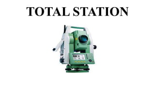
  • 10. TOTAL STATION • An electronic / Optical Instrument • An electronic theodolite having optical telescope integrated with EDM (Electronic Distance Meter) and Microprocessor with memory unit and other accessories • Accessories consists of Keyboard , Display , Power Supply , data collectors, field computers, memory card etc… • Provides (By measuring or estimating)all parameters (Distances&Angles) & derived values (corrections & cordinates) of surveying simultaneously • Values of parameters can get displayed in viewing panel • Precision may vary from 0.1” to 20”
  • 11. TOTAL STATION TYPES • Based on minimum circle reading accuracy : 0.1” to 20” (For eg: 1” total station, 2” total station, 5”, 15” , 20” etc..) • Based on Control • Manual • Robotic : (Operator controls from distance via remote)
  • 12. PARTS OF A TOTAL STATION
  • 13.
  • 15. WORKING OF SALIENT PARTS • Handle : To carry the Instrument physically • Bluetooth antenna : To communicate via Bluetooth wireless technology • External interface hatch : To connect to external devices • Instrument height mark : To measure height of Instrument • Luminance sensor : Adjusts the brightness of screen automatically • Guide light : To carry out setting out measurement effectively • Objective lens : • Laser pointer function : To sight a target in dark location • Vertical clamp screw : • Vertical fine motion screw
  • 16. • Trigger key: To carry out operation indicated by the soft key in bold type on the screen • Horizontal clamp screw: • Horizontal fine motion screw: • Tribrach clamp: clamp the upper part of the instrument with lower part • Telescope eyepiece screw: • Telescope focusing ring: • Sighting collimator : To aim in the direction of measurement point • Instrument centre mark
  • 17. • A Total Station primarily consist of an electronic theodolite, an EDM, Microprocessor and many other accessories • Body of a theodolite is divided into two broad parts, upper part -The Alidade & lower part – The Tribrach • Alidade includes standards, telescope,EDM, Circles (horizontal & vertical) and other elements for measuring angles and distance • Tribrach contains foot screws, circular level, clamping devise and treads
  • 18. • TELESCOPE • Objective lens : focus on the object to form image at the plane of reticle • Eyepiece lens : focus on the plane of reticle • Axis or line of sight : Line joining the objective lens and the eyepiece lens • Parallax : If there is relative motion between Image formed & reticle, parallax is present which should be avoided • Lock & tangent screws for revolutions & rotations • AUTOFOCUS • It makes the telescope focus automatically to target. After aiming the telescope to the target, autofocus button gets pressed
  • 19. • ANGLE MEASUREMENT SYSTEM • For horizontal angle measurement, two glass circles within the alidade are mounted parallel one on the top of other , with a slight spacing between them. In a levelled TS (Total Station) horizontal angle circles should be in horizontal plane • For vertical angle measurement, two more glass circles are mounted in parallel with slight spacing between them but aligned in a vertical plane automatically in a levelled TS
  • 20. • MICROPROCESSOR • Controls , measures , computes , Reduces observations/ data by providing commands through keyboard. • Some salient functions • To make circles zeroed instantaneously • To observe angles by method of reiteration in either direction • To observe angles by method of repetition • Averaging multiple distances and angle observations • Reducing slope distances into horizontal & vertical distances • Computation of elevation from vertical distance components • Computation of coordinates from horizontal angle and horizontal distance components
  • 21. • AUTOMATIC COMPENSATOR • To get TS precisely indexed with the direction of gravity • Automatically align vertical circles having zero degree oriented precisely upward towards the zenith. • PLUMMET • Build into either alidade or tribrach • Provides a line of sight that is directed downwards , collinear with the vertical axis after leveling • For accurate centering • Laser variety provides a beam of collimated light
  • 22. • OPTICAL GUIDANCE SYSTEM • One or two above or below the telescope tube at the end of the objective lens. These are light emitting diodes and emit a visible light pattern which enables a detail pole to be set directly on the line of sight and at the correct distance without the need for hand signals from the total stations • In some instruments , OGS is represented as Guide Light . It is composed of lights that is divided into Green and Red sections. A poleman can ascertain the present position by checking the Guide light color as follows LIGHT STATUS MEANING Increased flashing speed Move towards TS Decreased flashing speed Move away from TS Fast Flashing Target at the correct distance Red Move target left Green Move target right Red & Green Target at correct horizontal position
  • 23. ACCESSORIES • INTRODUCTION Apart from salient components, some accessories are required for working with TS. Some of the Accessories are present as integral part of the TS – Control Panel , Data Collector , Memory Etc… Some others totally independent – Reflectors These are the Major accessories • CONTROL PANEL • DATA COLLECTORS • MEMORIES • REFLECTORS • SOFTWARE
  • 24. ACCESSORIES - CONTROL PANEL • Control panel of a total station consist of a keyboard & multiple line LCD ( liquid Crystal Display) • The keyboard enables the user to select & implement different measurement modes, enable instrument parameters to be changed and allow special software functions to be accessed. Multifunction keys in the keyboard carry out specific tasks and some other keys activate& display menu systems which enable the TS to be used as computer • Keyboard is also used to code data generated by the instrument for mapping. If a code is entered from the keyboard to define the feature being observed, the data can be processed much more rapidly when it is downloaded into and processed by an offline based computer plotter.
  • 25. • The keyboard and display can be detached from the instrument and interchanged with other total stations and with GPS receiver. This enables data to be shared between different instruments and systems using single interface • Thus combination of keyboard and display unit not only controls the operations of total station but also stores measurements and data
  • 26. • KEYBOARD • Keyboard contains different types of keys to provide different commands to its micro processor which subsequently gets works carried out by its different parts. It contains different alpha numeric keys , option selection keys, switching keys, Power key , lighting keys etc.. • Salient Keys • Power Key : To switch between ON & OFF • Illuminator Key : For lighting the reticle/keys and to select screen backlight brightness . To turn laser- pointer/guide light ON /OFF • Star Key : To jump from each mode screen to the screen of checking/changing the various settings directly • ESC Key : To cancel the input data/to return to previous screen • TAB Key : To shift to next item
  • 27. • B.S Key : Delete a character on the left • S.P Key : Input a blank space • FUNC Key : To toggle between observation mode screen pages • ENT Key : Select/Accept input word/Value • Numeric – Alpha Keys : To input numerals and alphabetic characters • α key : Input Mode Key (To switch between numeric and alphabetic characters) • SHIFT Key : To switch between lower case and uppercase characters • Target Keys : To switch between target types (Reflector & Non Reflector) • PRG Key : To switch between program mode and basic mode • Luminance sensor/ Microphone key
  • 28. ACCESSORIES - DATA COLLECTOR • Automatically receives and stores field notes in computer compatible files • Control of the measurement and storage operations is maintained through data collector’s keyboard • Point identifiers and other descriptive information with measurements may be recorded • Preliminary information required to be entered manually before the collection of measurements • For a given type of survey, data collector is programmed to follow specific steps • Stores information in either binary or ASCII format
  • 29. • Data storage and entry are carried out through a series of step by step instructions displayed by the data collector • Enable operator to scroll through stored data, display for review and editing in real time • Data collectors are developed instrument specific, however there are some which are flexible • Data collectors are of two types , External and Internal
  • 30. • EXTERNAL DATA COLLECTOR • Can be interfaced with various instruments • Has Windows CE OS , thus can run variety of windows software programs • Can do variety of calculations directly in the field • Has Bluetooth technology to communicate with other instruments and WiFi capabilities for connecting to internet
  • 31. • INTERNAL DATA COLLECTOR • Data collection system as internal components directly into the equipment • Incorporates all features of external data collectors • Use Windows CE OS • Pen & Pad arrangement /Key board is used to point on menus and options to run software
  • 32. ACCESSORIES –DATA COLLECTOR… • ADVANTAGES • Mistakes in reading and manually recording observations are precluded • Time to process , display and archive the field notes in office reduced significantly • Execute program in field and in real time • Most useful when large quantities of information is involved • DISADVANTAGES • Field data may be erased due to carelessness or malfunction of instruments • All information can not be entered/stored in digital form • Varied data structures from different manufacturers • Need to be compatible to the computer/software in which data need to be considered further.
  • 33. ACCESSORIES - MEMORIES • Total station makes use of internal memories or memory cards for processing and storing information • Internal memory on board storage capacity of about 5000 to 10000 coded survey points • Data can also be stored on memory cards which are plugged into Total Station • All memory cards should satisfy PCMCIA standards • Data may get exchanged to/from PC from/to through card reader
  • 34. ACCESSORIES - REFLECTORS • TS Use return or reflected signals for measurements. This is obtained by using a specific reflector • TS reflectors consist of special reflecting prism constructed from glass cubes or blocks • Return waves or pulses along a path exactly parallel to the incident path but within a range of angles of incidence of about 20 degree • A wide range of reflecting prisms are available to suit short as well as long range measurements • Single & Triple prism sets for fixing on tripod stand ,mini-prism for pole mounting or 360 degree prism for robotic TS are being used • Reflecting prisms are associated with a prism constant (distance between effective centre of the prism and its plumbing point) of the order of -30 to -40 mm
  • 35. ACCESSORIES - SOFTWARE • Operating System generally used is Windows CE • Field Software or the measurement software . Field softwares are manufacturer dependent • Processing softwares : These are which is made use to arrive at the final product of the data collected. Eg : Carlson , AUTOCAD, etc…
  • 36. ADVANTAGES OF TOTAL STATION • Quick setting of the instrument on the tripod using laser plummet • On-board area computation program to compute the area of the filed • Local language support • Full GIS creation • Automation of old maps • Greater accuracy in area computation • Graphical view of plots and land for quick visualization • Integration of data base • The area computation at any user required scale
  • 37. • Once the field jobs are finished , the map of the area with dimensions is ready instantly after data transfer • It reduces the time taken for the survey considerably and it also able to measure up to 3 to 5 km distances. • Comparatively easy to work with • High precision
  • 38. APPLICATIONS OF TOTAL STATION • To measure horizontal and vertical angles • To obtain the horizontal distance, inclined distance and vertical distance between points. • To get the three-dimensional co-ordinates i.e.[x,y,z] of a point in space. • To find the length of a missing the line • To find the elevation of the remote object. • To find the distance to a remote object • To locate the points at a predetermined distance along gridlines. • Calculation of Area of a closed figure.
  • 39. • Total station is extensively used in Mine Survey, Cadastral Survey, Engineering Survey, Large scale Survey, Road / rail/ canal Survey • Some total stations also have a GNSS (Global Navigation satellite System) interface which combines the advantages of these two technologies (GNSS – line of sight not required between measured points; Total Station – high precision measurement especially in the vertical axis compared with GNSS) and reduce the consequences of each technology’s disadvantages (GNSS – poor accuracy in the vertical axis and lower accuracy without long occupation periods; Total Station – requires line of sight observations and must be set up over a known point or with line of sight to 2 or more points with known location).
  • 40. DISADVANTAGES OF TOTAL STATION • It may be difficult for the surveyor to look over and check the work while surveying. • The instrument is costly. And for conducting surveys using Total station, Skilled personnel are required. • For an over all check of the survey, It will be necessary to return to the office and prepare the drawings using appropriate software • The instrument contains sensitive electronic assemblies which have to be well protected against dust and moisture
  • 41. PRECAUTION TO BE TAKEN WHILE USING A TOTAL STATION • Use both hands to hold the total station handle • Set up the tripod as stable as possible • Do not move or carry a tripod with the Total Station fixed on it , except for centering • Store the battery pack with the battery discharged • Do not over tighten any of the clamp screws • Take maximum care when the tribrach is removed from the Total Station
  • 42. FIELD PROCEDURE FOR TOTAL STATION SURVEY • Leveling the Total Station • Leveling the Total Station must be accomplished to sufficient accuracy otherwise the instrument will not report results • Leveling the instrument takes 30 to 45 minutes – make sure you can see all targets from the instrument station before going through the process
  • 43. • STEP 1 : TRIPOD SETUP • Tripod legs should be equally spaced • Tripod head should be approximately level • Head should be directly over survey point
  • 44. STEP 2: MOUNT INSTRUMENT ON TRIPOD • Place Instrument on Tripod • Secure with centering screw while bracing the instrument with the other hand • Insert battery in instrument before leveling
  • 45. STEP 3: FOCUS ON SURVEY POINT • Focus the optical plummet on the survey point
  • 46. STEP 4: LEVELING THE INSTRUMENT • Adjust the leveling foot screws to center the survey point in the optical plummet reticle • Center the bubble in the circular level by adjusting the tripod legs
  • 47. STEP 4: LEVELING... • Loosen the horizontal clamp and turn instrument until plate level is parallel to 2 of the leveling foot screws • Center the bubble using the leveling screws- the bubble moves toward the screw that is turned clockwise • Rotate the instrument 90 degrees and level using the 3rd leveling screw
  • 48. STEP 4: LEVELING… • Observe the survey point in the optical plummet and center the point by loosening the centering screw and sliding the entire instrument • After re-tightening the centering screw check to make sure the plate level bubble is level in several directions
  • 49. STEP 5 : ELECTRONICALLY VERIFY LEVELING • Turn on the instrument by pressing and holding the “on” button (you should hear an audible beep) • The opening screen will be the “MEAS” screen. Select the [Tilt] function • Adjust the foot level screws to exactly center the electronic “bubble” • Rotate the instrument 90 degrees and repeat
  • 50. STEP 6: ADJUST IMAGE & RETICLE FOCUS Release the horizontal & vertical clamps and point telescope to a featureless light background • Adjust the reticle (i.e. cross-hair) focus adjustment until reticle image is sharply focused • Point telescope to target and adjust the focus ring Until target is focused • Move your head from side-to-side to test for image shift (i.e. parallax). Repeat the reticle focus step if parallax is significant • NOTE: When the instrument operator changes the reticle focus may need to be adjusted
  • 51. MEASURING THE HEIGHT OF AN OBJECT • Level the instrument at a site where the target can be viewed through the telescope and the mirror target can be setup directly below the target • After powering on the instrument select “REM” from “MEAS” > “Menu” • Ht = h1 + h2 • h2 = S (sin θz1) (cot θz2 ) – S (cos θz1) • NOTE: Instrument height does not affect this calculation
  • 52. MEASUREMENT OF TARGET HEIGHT • Set the Target Height from “MEAS” > “Menu” > “Coordinate” > “Station Orientation” > “Station Coordinate” • Set the target height to the measured height of the mirror target. Make sure you use the metric side of the tape measure if working with metric units. You do not have to fill out the other fields for a REM measurement, however, it is good practice to measure and enter the instrument height. After entering the TH and IH make sure you press “OK” (F4) to accept new values. • Press “ESC” to return to the “MEAS” menu • Select the “MEAS” > “Menu” > “REM”, sight the mirror target, press [OBS] to measure “S”, then [STOP] • Sight the object above the target for height measurement • Select [REM] after sighting the top of the height target, and then [STOP] to stop the calculations
  • 53. REM SCREEN RESULTS • To re-shoot the mirror target use the [OBS] on the REM screen. • Note that after selecting REM the instrument continues to make calculations in case you need to adjust the vertical angle on the height target. • Select “STOP” to terminate calculations on the REM command.
  • 54. Trouble-Shooting the REM Measurement • The only numerical input is the target height so make sure that is entered correctly. When TH is changed make sure you hit the “OK” function key. • If the instrument is reset (zeroed) TH will be 0.0 so if you make a REM measurement with TH=0 the answer will be underestimated by the actual TH. • A quick check can be made by using REM on the mirror target – the answer should be the TH.
  • 55. CALIBRATING THE INSTRUMENT • Calibration must be completed before coordinates can be obtained • 3 possible calibrations: • Backsight by angle: must know instrument coordinates and have a landmark/target at a known azimuth • Backsight by coordinate: must know instrument coordinates and have mirror target set on a position of known coordinates • Resection (triangulation): must have 3 or more mirror targets established at known 3D coordinates
  • 56. 3D COORDINATES • Coordinates may be absolute or relative depending on survey requirements • Surveying the area of a mining site would require relative coordinates, therefore, the initial instrument X,Y,Z coordinates may be 5000, 5000, 100 • Surveys that have to match a downloaded aerial photo from the USGS would have to match UTM NAD83 coordinates so the starting point would have to be determined by an accurate GPS receiver
  • 57. Calibrate by Backsight by Angle • Remember that when the instrument is powered on it has a random X,Y coordinate system: you must align the instrument with your working coordinate system. • Level the instrument on the desired starting survey marker. Make sure that on the last leveling step the optical plummet is centered on the survey point • Measure the target height and instrument height • Select [COORD] from the MEAS menu • Select “Stn. Orientation” and then “Stn. Coordinate” • Edit the “N0”, “E0”, and “Z0” fields to appropriate values (i.e. northing, easting, elevation of instrument)
  • 58. Backsight by Angle continued.. • Enter the instrument and target height if necessary • Select [OK] when done
  • 59. Backsight by Angle continued… • Select “Backsight” and then “Angle” from the menu • Sight the landmark/target of known azimuth relative to instrument with telescope • Select “Angle” from menu. Note that the menu displays the zenith angle (ZA) and current horizontal angle (HAR) and is waiting for you to enter the known angle with [EDIT] • Note: if you enter an azimuth angle as “85.4514” this will be interpreted as 85 degrees, 45 minutes, 14 seconds • IMPORTANT! You must select [OK] to accept the angle. • Never use <Esc> to leave this screen
  • 60. Backsight by Angle Continued… • NOTE: because the backsight by angle simply sets the instrument horizontal angle encoder to match your desired coordinate system the mirror target is never “shot” by the beam. If you can accurately sight on an object or landmark such as a building corner the mirror target is not needed. Make sure the instrument is “locked” and accurately sighted with telescope before entering the backsight angle. • Because there is no internal statistical measure of how well the backsight angle has been set it is imperative to check the backsight independently: • Known point: shoot the target at a position of known X,Y,Z such as a GPS point. The result should be within the resolution of the GPS. • Known angle: shoot to a landmark at a known azimuth from the instrument location- the angle should be within the resolution of the instrument
  • 61. Backsight by Coordinate Use this method when you have 2 known survey points with the instrument established on one and the mirror target on the other survey point • From the “MEAS” menu select [COORD] and then “Stn. Orientation”. Set the instrument coordinates with “Stn. Coordinate” and then select [OK] and return to “Backsight” • Select “Coord” and then enter the backsight target coordinates (NBS, EBS, ZBS) and select [OK] • Sight in the target and inspect the “Azmth” (it should be reasonable for your coordinate system). • Select [YES] to calibrate. If you don’t select [YES] the coordinate system is still random
  • 62. Backsight by coordinate … • Always check the calibration of the instrument by shooting the target used for the back sight. • The resulting X,Y,Z should be within the several cm resolution typical for a TS instrument. • It is a very good idea to shoot other benchmarks within range to make sure accuracy is within acceptable limits
  • 63. RESECTION • Resection uses 3 or more known target survey points to automatically determine the X,Y,Z coordinates of the instrument • This has the significant advantage of not requiring the instrument to be leveled exactly on a survey point- any convenient location where you can sight the targets is OK • The ideal geometry is displayed to the right
  • 64. Resection continued… Prior to resection enter survey markers as known points through the “MEM” menu • From the “MEAS” menu select “[MENU]” > [RESEC] • The resection procedure requires that the known coordinates be defined first, and in the order that they will be shot • In the top right screen the 1st point has been defined and the 2nd point is being entered. You can use [READ] to read in previously entered or measured points • Press the “>” or “<“ arrow to move to next or previous point • When all points are entered select [MEAS]
  • 65. Resection continued… • The [MEAS] screen (right) displays the point being shot – in this example the 1st point • Choose [DIST] if you are shooting to a mirror target, [ANGLE] if not • Select [YES] to accept measurement, [NO] to re-shoot, [EDIT] to change target height • The [CALC] option will be displayed when the standard deviation of northing and easting can be displayed
  • 66. Resection continued… • Press [CALC] or [YES] on last point to display the calculated instrument coordinates and the standard deviation of easting (σE) and northing (σN). Press [OK] to finish Resection, and then [YES] to set the backsight azimuth to the 1st shot point • Press [RESULT] to display the residuals of each shot point- large deviations identify “bad” points • If there are no problems press {Esc} to return to main resection screen • The standard deviations are a measure of the accuracy. They should be in the range of several cm’s for most surveys
  • 67. Resection Notes • Resection initializes the X,Y,Z coordinates of the instrument. Save this as a point (ex. G1S02 for group 2, instrument station #2) since it represents a surveyed coordinate • Once the instrument is calibrated the mirror targets can be taken down and used elsewhere • The instrument height should be entered before resection is calculated • You can only begin shooting resection point 1 from the resection point #3 or higher coordinate entry screen
  • 68. Resection Notes • Certain Geometries should be avoided: Targets and Instrument should not be arranged on a circle
  • 69. Coordinate Measurement • Used to determine XYZ coordinates of target point. • Make sure the instrument height and target height are already set. • Make sure backsight/resection have already “locked” the instrument into a mapping coordinate system • From MEAS select Menu > Coord > Observation
  • 70. Offset: Single Distance • Single distance offset – used to measure points that cannot be “occupied” by the target. • Examples: • center of a large tree, • center of a fountain • center of a building
  • 71. Offset: Single Distance • Offset point can be right or left of the target, but must be the same distance from the instrument. • Offset point can be in front or behind target, but must be on the same azimuth line. • In any case the person/team holding the target must have a tape to measure the exact distance (to cm accuracy at least) of the offset. • The instrument will request an observation to the target first, and then request the offset distance and where the target point is relative to the point of interest (left, right, front, back).
  • 72. Offset: Single Distance • Note the arrow that indicates that the target is to the left of the survey point by 2 meters.