SlideShare ist ein Scribd-Unternehmen logo
1 von 20
Downloaden Sie, um offline zu lesen
Blue Force Tracking
The Afghanistan and Iraq Experience
and Its Implications for the U.S. Army
About the Author
Richard J. Dunn, III
Richard Dunn is a senior
analyst at the Northrop
Grumman Analysis Center,
where he is responsible for
preparing in-depth assessments
of military, political, techno-
logical and economic develop-
ments worldwide. He is a
recognized, wide-ranging
authority whose opinions on
defense matters are sought by
the national and international
media. Before joining Northrop
Grumman Corporation, Dunn
spent over four years at SAIC,
where he developed new approaches for understanding the future of
warfare. Dunn joined SAIC after completing a highly successful 29-year
career in the U.S. Army that included brigade command and staff
positions of significant responsibility and culminated with service as
director of the Chief of Staff of the Army’s Staff Group. At the U.S.
Military Academy at West Point, Dunn taught Chinese language, interna-
tional relations, and Chinese politics and government. Dunn’s education
includes a bachelor’s degree in civil engineering from Bucknell Univer-
sity and a master of public affairs degree from Harvard University. He
also studied international relations in Taiwan as the first Olmsted
Scholar to study in Chinese. Dunn is a 1991 graduate of the National
War College.
T
he fortunes of war have always favored commanders who have
better and more timely information about what is happening on
the battlefield, even on the other side of the hill. This is certainly
true of recent conflicts in Afghanistan and Iraq, where the accomplish-
ments of American forces have been truly remarkable.
Many factors, such as high-quality personnel, technologically advanced
weapons, realistic and demanding training, and innovative leadership,
have powered the tremendous leap in U.S. military capabilities demon-
strated in these conflicts. One technological factor stands out from the
rest, because it truly differentiates U.S. capabilities from the capabilities
of others – information superiority. One of the key technologies that
gave U.S. land component commanders in Afghanistan and Iraq this
information superiority is Blue Force Tracking.
A Soldier’s Critical Questions –
A Historical Perspective
Through the centuries, three simple geographic location questions have
been all-important to soldiers and their leaders at all levels:
■ “Where am I?”
■ “Where are my forces and other friendly forces?”
■ “Where is the enemy and what is the best route to attack him?”
The outcomes of battles, the fates of armies, and even the survival of
states have often rested on the ability to answer those questions quickly
and correctly.
At Chancellorsville, Va., in May 1863, Confederate General Fitzhugh
Lee led General Thomas “Stonewall” Jackson to a hilltop overlooking
the exposed flank of General Hooker’s Union Army. There, Jackson
learned accurate and immediate answers to all three questions. Lee’s
reconnaissance allowed him to tell Jackson where the key overlooking
hilltop was located. Topping the hill, Jackson personally observed the
location and vulnerable position of the enemy. The couriers accompany-
ing Jackson knew where to find his subordinate commanders to carry
back orders. A local clergyman and a Confederate cavalryman told
Jackson the location of a concealed route that allowed him to move his
corps into position to attack. The picture complete, Jackson quickly took
1
advantage of this information and the enemy’s exposed flank. Maneuver-
ing his corps along the concealed route, he quickly deployed it for the
famous flanking attack that rolled up almost the entire Union line,
resulting in one of the most impressive victories against heavy odds of
the Civil War.1
The Evolution of Blue ForceTracking
Commanders and soldiers at all levels must have timely and accurate
information on their own location, the locations of their forces and other
friendly forces, and enemy locations. Until the advent of the Global
Positioning System (GPS) in the 1990s, most of this information was
determined with a map and compass, following map-reading procedures
that had changed little over several centuries. The accuracy of locations
so derived varied enormously according to factors such as the map-
reading and navigational skills of the soldier, visibility (determined by
light, vegetation and weather conditions), recognizable terrain features
and the age of the map. Picture a second lieutenant leading a patrol
through a dense swamp at midnight in a driving rain and trying to
determine his exact location on a 20-year-old map.
Global Positioning Systems
GPS made things much easier by providing soldiers with north-south/
east-west location, accurate to about 10 meters. Once soldiers found
their location on the grid printed on their maps (Figure 1), they knew
exactly where they were. This solved most location-accuracy problems.
Figure 1: The Military Grid System2
2
Footnotes: see pages 16-17.
Commanders, however, still needed to know the location of their forces
as well as other friendly forces in their vicinity. For tactical units this is
essential. In an attack, for example, commanders must ensure the
movements of all their elements are properly synchronized so their fires
and maneuvering have the desired effect upon the enemy at exactly the
right time. To use supporting artillery, attack helicopters and air support
effectively and safely, commanders must know exactly where their
forces and other friendly forces are to avoid hitting them with “friendly”
fire.
With GPS, commanders’ subordinate units knew exactly where they
were, but this information still needed to be provided to the commanders
and displayed to understand the tactical situation. Units, therefore,
radioed3
their location to the unit’s command post, where it was posted
on the map board.
Under the best of circumstances, this system was time and effort inten-
sive. Moreover, when a unit was moving, the scenario became more
complicated. Commanders were in moving vehicles, not command
posts, and had to receive and post their subordinate units’ locations on
their own maps. It also necessitated frequent reports. When a unit was
engaged in combat, these location reports sometimes received lower
priority as the commanders passed orders and discussed the tactical
situation with their subordinates. To compound these problems, moving
units often crossed from one map sheet to another.
Location reports also had to be communicated over unit tactical FM
radios that required direct line-of-sight to receive signals. Obstacles such
as mountains, hills and even buildings could block the line-of-sight,
breaking communications between a unit headquarters and its subordi-
nate units and preventing transmission of location reports. Furthermore,
FM radios have a limited range (10-20 kilometers on flat terrain and
without relay stations), so more distant units could not report their
locations.
Reporting and recording enemy information followed a similar process.
Subordinate units detecting the enemy determined their location manu-
ally and reported the information to the unit command post, where it was
plotted. The unit intelligence officer used this information, together with
intelligence summary reports from higher headquarters (sometimes
hours or more old), to track enemy forces the unit might encounter.
3
Force XXI Battle Command Brigade and Below
Recognizing the fundamental importance of location reporting and
recording, as well as other critical command and control tasks, the Army
focused its “digitization” efforts in the early 1990s on leveraging the
potential of new computer and communications technologies to auto-
mate them. These efforts led to the development of the digital battle
command system, Force XXI4
Battle Command Brigade and Below
(FBCB2). Begun in 1995, it is in use today.
FBCB2 normally uses GPS transponders located in ground vehicles
(typically the vehicles assigned to unit commanders at various levels) to
report the location of the host vehicle.5
The FBCB2 equipment then
retransmits its location to all units in the network via the Combat Net
Radios (EPLRS and the standard Single Channel Ground and Airborne
Radio System (SINCGARS) radio nets). Each vehicle location is dis-
played as a blue icon on digital maps on computer screens mounted in
the vehicles. Instead of a map covered with paper symbols, FBCB2-
equipped commanders have computers that show their location as a
screen icon on a digital map or overhead photograph, along with the
icons of all FBCB2-equipped subordinate units and any other friendly
units equipped with FBCB2 in the vicinity. This same information
(along with enemy information input by intelligence staffs, operational
control measures – such as unit operational boundaries – and danger
areas) is displayed in command posts and vehicles at all levels of com-
mand. FBCB2 also allows users to send formatted or free-text e-mail
messages – including orders and requests for support – to any other
FBCB2-equipped unit simply by clicking on the unit’s icon. This freed
tactical voice radio nets for higher priority messages.
The network of FBCB2 vehicles communicating over Combat Net
Radios for situational awareness6
and command and control is known as
the “tactical internet,” a self-forming network that adapts to terrain,
changes in unit organization, combat conditions and transmission
channel availability. As long as vehicles are within line-of-sight, the FM
radio-based tactical internet serves its users.
The first units to experiment with FBCB2 in 1995 found that location
reporting and command and control improved dramatically. Compared
to voice radios and plastic-covered maps, the new system was like going
from grainy, black-and-white photos to full Technicolor streaming video.
With FBCB2, soldiers at any level knew exactly where they were. In the
4
midst of a blinding sandstorm on a trackless desert, they could see their
own vehicles’ icons moving on the digital map or overhead photograph.
They also could see exactly where the rest of the unit and other friendly
forces were located – without inexperienced soldiers attempting to read
maps, lengthy voice radio messages, or exhausted sergeants posting
information on plastic map overlays. If the intelligence staff did a good
job of pulling enemy information from available sources and posting it
on the FBCB2 system, soldiers and commanders also had a pretty good
idea where the enemy was.
To investigate the full combat potential of FBCB2, the Army designated
the 4th
Infantry Division (Mechanized) as the “First Digitized Division”
to receive the new capability. Through controlled experiments and
testing against the “opposition force”7
at the National Training Center at
Fort Irwin, Calif., the 4th
Infantry Division quickly learned that the vastly
improved situational awareness FBCB2 provided allowed commanders
to operate much more quickly and accurately – and much more effec-
tively. Furthermore, the effort and resources (including time on radio
nets) previously required for determining and recording unit locations
and performing other command and control tasks could now be put to
better purposes, such as precisely orchestrating an attack.
Blue ForceTracking
FBCB2’s capabilities were evident in the flat terrain of the National
Training Center, where dense numbers of FBCB2-equipped vehicles
were able to maintain the tactical internet through line-of-sight FM
communications. When the Army deployed to the Balkans, however, it
discovered that the mountainous terrain and relatively thinly deployed
patrol vehicles in Bosnia and Kosovo imposed significant limitations on
a tactical internet using ground-based line-of-sight radios. To overcome
this, FBCB2 was adapted to communicate over commercial satellites
using transceivers bolted to the tops of vehicles. In this “hub and spoke”
configuration, each vehicle communicates with a satellite ground station
that aggregates the blue force picture and transmits it to each FBCB2-
equipped vehicle by satellite.
The flexibility and effectiveness of this additional communications
option was key to future deployments of the FBCB2 system, enabling
the Army to consider deployment options involving EPLRS-equipped
and satcom-equipped FBCB2 units. Although both communications
options employ the same FBCB2 applications software, the satcom
5
configuration came to be known as “FBCB2-Blue Force Tracking” or
“FBCB2-BFT” (commonly called “BFT” 8
) to distinguish it from the
original FBCB2.
When Army forces began operating in Afghanistan during Operation
Enduring Freedom and preparing for Operation Iraqi Freedom, the value
of FBCB2 to combat units was readily apparent. Army leaders decided
that as many of the units committed to combat operations as possible
should be equipped with an FBCB2-like capability.9
Of the units considered for deployment, however, only two brigades of
the 4th
Infantry Division were equipped with the ground digital radio
systems (EPLRS) required for the FBCB2 system. Moreover, as experi-
ences in the Balkans proved, ground-based digital FM radios could not
provide the range required to support Army units operating over the vast
distances of Afghanistan or anticipated in Iraq. Consequently, the Army
decided to launch a crash project to field a BFT variant based on satellite
communications (satcom).10
Because the 4th
Infantry Division was the only digitized force readily
available for deployment to the Iraqi theater, other non-digitized units
slated for Iraq – such as the 3rd
Infantry Division, the 101st
Airborne
Division (Air Assault) and the 82nd
Airborne Division – needed BFT
quickly. The U.S. Marine Corps and British combat units in the theater
also wanted the system so they could see the Army units and Army units
could see them.
Intensive planning for “thin” BFT fielding (down to company level) took
place at the Pentagon during the spring and summer of 2002. Actual
deployment of BFT to land forces in Southwest Asia started in late 2002
and continued until the Iraq campaign began. Over a three-month period
before the Iraq War, the Army and its contractor team installed the
available equipment on combat vehicles and helicopters and trained
commanders and soldiers to use the system.
6
Blue ForceTracking in Afghanistan and Iraq
Although only 210 BFT systems were deployed with U.S. forces in
Afghanistan and 1,242 were deployed in Iraq (with U.S Army, U.S.
Marine Corps and British forces), the impact on coalition command and
control capability was extraordinary. In Afghanistan and Iraq, BFT
provided revolutionary improvements in tactical command and control
that contributed significantly to coalition ground forces’ ability to
conduct decisive combat operations over daunting distances at previ-
ously impossible speeds.
In both conflicts, units equipped with BFT were able to answer the three
critical questions – “Where am I? Where are my forces? Where is the
enemy?” – with previously impossible speed and accuracy, even when
spread over vast distances. This quantum improvement in situational
awareness allowed commanders to make decisions and issue orders
much more rapidly and to employ their forces to the full limit of their
operational capabilities unrestrained by the limits of FM voice radio and
paper map command and control.
In Afghanistan and Iraq, BFT users often commented that the system
was sometimes the only accurate means of determining position location
and navigating, especially under extremely poor visibility conditions,
such as at night or during sandstorms. With BFT, subordinate units that
might otherwise have become lost or separated – requiring the parent
unit to cease operations and focus on recovery efforts – often were able
to return to their parent elements on their own.
A Task Force 82 Blackhawk helicopter was on a mission in
Afghanistan, close to dusk. A wind storm came up and visibility
became very minimal, causing the aircraft to lose visible contact
with the rest of the flight. The pilots were about to set the heli-
copter down in an unsecured area for the evening when the BFT
operator, able to zoom in on the map, found the other aircraft.
From his BFT screen, he was able to direct the pilot out of the
dust and effect linkup with the flight.
Operation Enduring Freedom, Afghanistan
7
Constantly knowing where they were on the battlefield allowed unit
commanders to focus on preparing for decisive action upon contact with
the enemy rather than on the task of maneuvering their units to gain
contact. Some commanders stated that without BFT they spent 80
percent of their time and effort moving their units to contact, leaving
only 20 percent to prepare for combat. BFT reversed those ratios.11
BFT simplified navigation immensely, even under circumstances where
it previously would have been almost impossible. In many cases, it
became the prime navigational capability of maneuver units.
...the infamous sandstorm of 23 March 2003. We were conducting
a reconnaissance in force to find and destroy Sadaam Fedayeen
forces. I was planning on using the sandstorm as cover for our
movement and we would use railroad tracks as a handrail to guide
us into our positions....We were all using BFT to track our move-
ment since the sandstorm created “zero visibility” conditions. We
were literally dead reckoning through the sandstorm using the
BFT system.
We ran into problems about halfway through the movement when
we tried to navigate around the As Samawa train station. Even the
1:50,000 maps did not show all the details of the train station.
Vehicles were getting stuck on the converging tracks and had to
maneuver around several buildings that weren’t identified on the
maps. The sandstorm made it impossible to see our surroundings
and we had several breaks in contact. One of the company com-
manders suggested we all switch from maps to imagery and would
then be able to see the details of the train station and help us get
around it. We were literally maneuvering by instruments like pilots
do in bad weather, but the imagery and GPS functions of the BFT
system allowed us to bypass the train station in the middle of a
sandstorm.
Lt. Col. John W. Charlton, USA
Commander, 1-15th Infantry Battalion
3rd
Infantry Division
8
In all likelihood, the operational distances covered and the speed of
ground operations in Iraq would have been difficult, if not impossible, to
achieve without BFT. Maj. Gen. Buford Blount, the commanding
general of the 3rd
Infantry Division, said that BFT gave him the ability to
see his division over a 200-230 kilometer front and to control the brigade
fights.12
By comparison, during the first Gulf War, the same division13
had a 30-kilometer front during its attack on Basrah.14
Confidence in the timeliness and accuracy of position reporting also
contributed significantly to the speed with which commanders reached
critical decisions during the war. For example, the 2nd
Brigade of the 3rd
Infantry Division was ordered to conduct only a reconnaissance in force
to test Iraqi defenses when it first entered Baghdad. However, Col. Dave
Perkins, the brigade commander, decided to stay and retain control of
key locations in the city, because he was certain his soldiers, positioned
as he could see they were on his BFT screen, could safely remain
downtown.15
One of the most critical decisions of the entire campaign, it
essentially eliminated any Iraqi opportunity to conduct a coordinated
defense of Baghdad.
Because commanders at all levels were looking at the same information
on their computer screens, the cohesion of the entire force was raised
considerably. Junior commanders could see they were part of a larger
whole. They knew higher headquarters was always watching and could
send support or reinforcements immediately if they got into trouble. This
raised confidence significantly.
Knowing where everyone was located also accelerated operations. For
example, previously, when a lead element made contact with the enemy,
it had to stop and determine its location and report to its company. The
company reported this location to battalion, which would report to
brigade for a decision. With BFT, commanders at all echelons knew the
exact location of the lead element, so the only information necessary to
report over the radio was the nature and location of the enemy that the
lead element encountered.16
If the lead element used BFT’s text trans-
mission capability, that report could go simultaneously to all echelons.
Commanders at all echelons sharing the same “big picture” also en-
hanced self-synchronization. For example, units ordered to move on line
abreast could see if they were falling behind or pulling in front of other
units and adjust their speed, without exchanging a word, even when they
9
were out of sight of each other. Additionally, subordinate units on the
flanks of larger units knew where the subordinate units of their adjacent
units were and could coordinate with them directly through BFT. Previ-
ously, that exchange of information would have gone to higher head-
quarters to be passed to the adjacent unit higher headquarters, then down
to the other flank unit. BFT allowed it to go directly, greatly simplifying
coordination (see Figure 2).
Figure 2: Cross Brigade Zone of Attack Coordination
A picture’s worth a thousand words. You can try to describe
where you’re at. Just the visual advantages of seeing where you
are in relation to the rest of your unit, I’m sure that’s a huge
advantage....You’re looking at BFT, “Hey company commander,
you’re a little off the route,” or he’s on route but is a few minutes
behind. It’s a pretty good thing when you see everybody’s in the
proper attack by fire position or at the proper phase line.
Capt. Sam Donnelly, USA
S-3 Air, 2-7th Infantry Battalion
3rd
Infantry Division
One of the greatest fears in any combat operation is killing your own
soldiers. One of the greatest advantages in shared situational awareness
– and one of BFT’s significant contributions – is fratricide avoidance.
Commanders can see when their units are coming close to adjacent units
and can warn their soldiers to look for friendly forces or order them not
to fire. The enhanced situational awareness BFT provides also helped to
avoid fratricide caused by the “lost lieutenant syndrome” – small units
wandering into areas where they are not expected and becoming at risk
of friendly fires.
10
Flank Unit Cross Zone Coordination without BFT Flank Unit Cross Zone Coordination with BFT
April 1st
east of Karbala. Company commander was going to do a
passage of lines between two units and intended that upon clearing
the units he would order “red free,” meaning, essentially, “fire at
will.” He didn’t know that a scout platoon was also making a
movement from the front left that would have placed the scouts in
front of the oncoming tank company. He saw the movement on
BFT and changed his order.
A Company, 2-69th Armor Battalion
3rd
Infantry Division
During the major combat operation phase of Operation Iraqi Freedom,
only one soldier was killed by friendly direct ground fire. This is attrib-
utable in part to the enhanced situational awareness provided by BFT.
Given the size and complexity of the operation, including the conditions
under which it was executed, this is truly impressive. By contrast, 35
soldiers were killed and 72 wounded by friendly direct ground fire
during Operation Desert Storm.17
In one dimension, however, BFT was not employed to its full potential.
Interviews with officers who fought in Iraq indicate that BFT’s capabil-
ity to provide detailed information on enemy locations was significantly
underused, probably because soldiers had insufficient time to train with
the systems. The officers reported that they and their fellows submitted
few enemy reports using BFT’s enemy contact reporting capability,
which puts enemy locations into the BFT database; therefore, they saw
very few red icons marking Iraqi units on BFT screens.18
As far as can
be determined from unclassified sources, there were no automated
interfaces between BFT and intelligence databases that might have
automatically added enemy location data from other sources to BFT’s
database.
However, because BFT provided precise information on a unit’s loca-
tion, it was much easier for commanders to use terrain association or
range/bearing techniques to obtain precise location information on
enemy units they spotted.19
This significantly reduced the time required
to call for artillery or other fire support.
11
“...like the night ambush, I knew the whole squadron was in column
on one highway. I knew where the enemy was firing from and
where I was because of my icon and because of my grid, so I
processed the initial fire mission [request for artillery support] by
doing the BFT screen.”
Capt. Clay Lyle, USA
Commander, A Troop, 3-7 Cavalry Squadron
3rd
Infantry Division
In contrast to the underuse of BFT’s enemy reporting capability, its
ability to support tactical communications was sometimes stretched to
the limit. Communications are so essential to tactical command and
control that command, control, and communications (or C3
) are usually
considered as parts of one whole. BFT’s satcom-based communications
allowed users to exchange text messages and graphics (such as routes,
phase lines, etc.) with any other BFT user or any number of BFT users
over essentially unlimited distances. This capability proved to be an
exceptional advantage in several ways.
First, the range allowed effective command and control over almost
unlimited distances. The 3rd
Infantry Division effectively controlled two
separate major battles over 200-230 kilometers – almost ten times the
previously possible distance.20
In Afghanistan, one brigade task force
operated in an area the size of Texas.21
In Iraq, battalions sometimes
controlled companies up to 70 kilometers away.22
Although the Army has used satcom voice communications for com-
mand and control over extended distances for years, the text and graphic
capability of BFT added an entirely new dimension. Satcom voice nets
suffer from the same limitation as FM voice nets,23
and the limited
number of available frequencies normally restricts use to tactical com-
manders at brigade level and above. BFT eliminates those problems with
net-based communications. Any user at any level can send a message to
any (or many) others at any time. The BFT network in Iraq sometimes
experienced message queuing delays because of the high volume of
traffic and the limited available satcom bandwidth, but it became a
relatively reliable means for communications for all echelons and all
functions. In Afghanistan, BFT was the only means for passing critical
logistical information for units deployed over vast distances.24
Moreover,
the ability to transmit the same message and graphics to multiple
12
addresses greatly accelerated the distribution of orders – a major pacing
event for tactical operations.25
BFT also helped ameliorate some of the challenges of communicating
with allies and forces from other services that often result from incom-
patible communications systems, lack of common doctrine, etc. Because
some Marine Corps and British Army forces were also equipped with
BFT, coalition forces could not only see where adjacent units from the
other service or country were located but also communicate with them.
This helped to resolve several dangerous situations that may well have
led to fratricide.
Implications of Combat Experience with
Blue ForceTracking
Combat experience in Afghanistan and Iraq shows that BFT-equipped
forces became “networked” forces that can add strength to the network
and also draw strength from it. Commanders of these forces have
immediate and accurate answers to the three critical location questions
that have always been – and always will be – essential to decisive
military operations.
To date, the Army has fielded satcom-based BFT capabilities only in
units that are about to deploy to combat or, as in Afghanistan, are
engaged in combat operations. Therefore, these units had insufficient
time to train with BFT, to understand its full potential, and to adapt their
tactics, techniques, and procedures to fully exploit BFT’s capabilities
before going into combat.
From the Afghanistan and Iraq experiences, it is clear that the high level
of situational awareness BFT provides makes units significantly more
effective and capable. But BFT can do more than that. It can also serve
as an important “intellectual catalyst” for Army transformation.
The critical terrain for transformation lies in the minds of our present
and future leaders. To convince them of the power of the information
revolution, they must experience this power not only in operations but
also in training to gain confidence in the capabilities of digital battle
command. If soldiers are not already familiar and confident with a
system, they will not use it in combat.
13
For example, one of the lead battalion task force commanders in the 3rd
Infantry Division reported that although he had BFT installed in his
command vehicle, he crossed the berm into Iraq with a bustle rack
[outside rack on the turret of a fighting vehicle] full of paper maps and
plastic overlays that he relied on for the first several days of the war. He
turned to BFT only when he received orders to fight in a built-up area
for which he had no paper maps or imagery. Convinced, he abandoned
his paper maps and came to rely entirely on BFT after using it to maneu-
ver his battalion through another urban area during a blinding sand-
storm.26
Leaders of the Army’s transformed Future Force will develop and
mature in the current force. To conduct operations with an information-
age force, leaders must understand the capabilities and the limitations of
digital battle command. They should not have to develop this under-
standing – and confidence – while leading soldiers decisively engaged
with an enemy. Nor can they develop it in the classroom. They must
develop an appreciation for an information-age, networked force through
training experience. Only then will soldiers have confidence in the
system and in their ability to employ it in war.
Combat experience in Afghanistan and Iraq has shown that BFT is more
than a force multiplier that allows soldiers to do better at what they did
before. Instead, it allows them to fight in new, more effective ways –
ways that previously were almost impossible. By providing decisive
information superiority, BFT becomes another weapon in the
commander’s arsenal.
This is not to say that BFT, as fielded in these two conflicts, is the “be all
and end all” of a digital battle command capability. The system has a
way to go yet. It needs to be made truly joint, to provide a common
ground picture to both ground and air forces. It also needs to include
additional capabilities:
■ A reliable, accurate and timely enemy-force picture
■ Tools for collaborative battle planning and monitoring progress
against that plan
■ Enhanced satellite communications to pass greater volumes of traffic
and improve reliability
14
■ A light-weight, man-portable unit to support dismounted operations
■ Fielding at least down to platoon level to support small-unit opera-
tions in a counterterrorism/counterinsurgency environment
Nonetheless, BFT moves the Army’s future digital battle command
effort pretty far down the right path.
The Army cannot afford to wait until BFT is perfected. Soldiers who
fought with it in Afghanistan and Iraq vow they would never, if at all
possible, fight without it again. “Thin” fielding is also not a good option.
As one British officer stated, “You cannot half digitize the army.”27
Units
equipped with BFT are networked forces able to strengthen and draw
strength from other elements in the network. Units without digital battle
command capability are non-networked forces in a networked world.
Attempting to operate without the situational awareness the network
provides makes units “invisible” to others in the network; they can
quickly become a danger to themselves and others – a liability rather
than a strength.
Today, the U.S. Army faces significant challenges. As worldwide opera-
tional commitments stretch the force, the Army must remain prepared
for combat in unexpected locations under unanticipated conditions. At
the same time, it must transform to be better prepared to fight and win
tomorrow’s battles. Blue Force Tracking is a capability that is here
today, ready to help soldiers meet present and future challenges. The
Army needs to move forward and seize the benefits Blue Force Tracking
offers. Its soldiers deserve nothing less.
15
Footnotes
1
Gen. Fitzhugh Lee, “Chancellorsville: An Address before the Virginia Division,
A.N.V. Association, October 29, 1879.” Southern Historical Society Papers, Vol. VII.
Richmond, Va., December 1879, No. 12.
2
U.S. Army Field Manual 3-25.26, Map Reading and Land Navigation (Washington:
Headquarters, Department of the Army, 20 July 2001,) Figure 4-21.
3
Each tactical unit, regardless of organizational level (platoon, company, battalion,
brigade, etc.), is usually assigned a single radio frequency (or set of frequencies for
frequency-hopping radios) to control its operations. The commanders and staffs of
the unit and its subordinate units all have to talk on that one frequency, called the
command or operations “net.” When someone is transmitting on that frequency,
everyone else can hear but no one else can talk. In combat, these nets become very
busy.
4
The 1990s term for the Army’s Future Force.
5
As a backup to GPS, FBCB2 also uses the Army’s new battlefield FM digital radio
link (the Enhanced Position Locating Reporting System or EPLRS) to obtain location
information.
6
Situational awareness is a military term that refers to an individual’s or organization’s
ability to sense and comprehend the environment in which it operates, including the
friendly and enemy tactical situations, terrain, weather, etc.
7
OpFor, the highly skilled and trained “enemy” force at the NTC.
8
Although the FBCB2-BFT system was most common in Afghanistan and Iraq, some
elements had other Blue Force Tracking systems. These were more limited in
functionality and did not provide true digital battle command capability. As used in
this paper, BFT refers to FBCB2-BFT.
9
Otto J. Guenther, Vice President and General Manager, Northrop Grumman Mission
Systems, Tactical Systems Division, “Industry Interview,” Military Information
Technology, August 9, 2003, p. 44.
10
Guenther, op cit.
11
Comment by Brig. Gen. Robert Durbin, Assistant Division Commander, 1st
Cavalry
Division.
12
Neil Baumgardner, “3rd
Infantry Division Commander Praises C2V, Communications
During OIF,” C4I News, May 29, 2003.
13
Then designated the 24th
Infantry Division (Mechanized).
16
14
Brig. Gen. Robert H. Scales, Jr., Certain Victory: The United States Army in the Gulf
War (Washington: Office of the Chief of Staff, United States Army, 1993), p. 307.
15
Statement by Col. Curtis L. McCoy, Program Manager, Combat Systems, U.S. Army
Tank and Automotive Command, at the National Press Club, Washington, D.C., July
17, 2003.
16
Based on debriefing of Capt. Stewart James, Commander, A Company, 2-69 Armor
Battalion, 3rd
Infantry Division
17
Frank Tiboni, “Force XXI Proves Mettle by Saving Lives in Iraq,” Defense News,
June 9, 2003, p. 42. During major combat operations in Iraq, a total of 13 American,
5 British, and 18 Kurdish soldiers were lost due to friendly fire from all sources.
[Dawn S. Onley, “Systems help avert friendly fire deaths,” Government Computer
News, July 28, 2003.]
18
Interviews with Capt. Stewart James, Commander, A Company, 2-69 Armor
Battalion, 3rd
Infantry Division; and Capt. Tim Terese, G-3 Current Operations, 3rd
Infantry Division
19
Terrain association is the use of terrain features to identify locations. For example, if
a commander knows he is just south of a known large hill and the enemy is firing at
him from the top of the hill, he can click the top of the hill on his BFT map to get the
enemy’s exact location. Using the range/bearing technique he can lase the enemy
with a laser rangefinder to determine the enemy’s distance from his location along a
compass bearing. He can then use BFT’s graphic software to plot this on the digital
map and determine the enemy’s exact location.
20
See note 9.
21
Interview with Lt. Col. Anderson, Commander, Logistics Task Force 307,
Afghanistan.
22
Lt. Col. John W. Charlton, “Digital Battle Command Baptism by Fire,” Battle
Command Training Center, Fort Hood, Texas (http://bctc.hood.army.mil/
download.asp?docid=396)
23
See note 4.
24
Interview with Lt. Col. Anderson.
25
Interview with Capt. Stewart James.
26
Charlton, pp 1-2.
27
Interview with Maj. John Cunningham, Aide-de-camp to Brigadier Binns,
7th
Armoured Brigade (UK).
17
Northrop Grumman Mission Systems
12011 Sunset Hills Road
Reston, Virginia 20190
www.northropgrumman.com
© 2003 Northrop Grumman Space & Mission Systems Corp.
All rights reserved.
FX2250903

Weitere ähnliche Inhalte

Was ist angesagt?

Death Of Synchronization
Death Of SynchronizationDeath Of Synchronization
Death Of Synchronizationguestaff4da
 
Military Space USA 2019
Military Space USA 2019Military Space USA 2019
Military Space USA 2019Dale Butler
 
The revolution after next
The revolution after nextThe revolution after next
The revolution after nextLex Pit
 
Carl Rhodes presentation to Williams Foundation Seminar March 22, 2018
Carl Rhodes presentation to Williams Foundation Seminar March 22, 2018Carl Rhodes presentation to Williams Foundation Seminar March 22, 2018
Carl Rhodes presentation to Williams Foundation Seminar March 22, 2018ICSA, LLC
 
Space policy top 40 rules for space war-unclassified
Space policy top 40 rules for space war-unclassifiedSpace policy top 40 rules for space war-unclassified
Space policy top 40 rules for space war-unclassifiedPaul Szymanski
 
AFD-160220-001
AFD-160220-001AFD-160220-001
AFD-160220-001Carl Clegg
 
Air war in Vietnman
Air war in VietnmanAir war in Vietnman
Air war in Vietnmanmrpachankis
 
Real-time threat evaluation in a ground based air defence environment
Real-time threat evaluation in a ground based air defence environmentReal-time threat evaluation in a ground based air defence environment
Real-time threat evaluation in a ground based air defence environmentAshwin Samales
 

Was ist angesagt? (13)

Death Of Synchronization
Death Of SynchronizationDeath Of Synchronization
Death Of Synchronization
 
Military Space USA 2019
Military Space USA 2019Military Space USA 2019
Military Space USA 2019
 
fm4-01.45(05)
fm4-01.45(05)fm4-01.45(05)
fm4-01.45(05)
 
The revolution after next
The revolution after nextThe revolution after next
The revolution after next
 
Carl Rhodes presentation to Williams Foundation Seminar March 22, 2018
Carl Rhodes presentation to Williams Foundation Seminar March 22, 2018Carl Rhodes presentation to Williams Foundation Seminar March 22, 2018
Carl Rhodes presentation to Williams Foundation Seminar March 22, 2018
 
Space policy top 40 rules for space war-unclassified
Space policy top 40 rules for space war-unclassifiedSpace policy top 40 rules for space war-unclassified
Space policy top 40 rules for space war-unclassified
 
AFD-160220-001
AFD-160220-001AFD-160220-001
AFD-160220-001
 
Esterly resume Oct2011
Esterly resume Oct2011Esterly resume Oct2011
Esterly resume Oct2011
 
Air war in Vietnman
Air war in VietnmanAir war in Vietnman
Air war in Vietnman
 
Real-time threat evaluation in a ground based air defence environment
Real-time threat evaluation in a ground based air defence environmentReal-time threat evaluation in a ground based air defence environment
Real-time threat evaluation in a ground based air defence environment
 
491
491491
491
 
UAS resume
UAS resumeUAS resume
UAS resume
 
sep-dec-2016
sep-dec-2016sep-dec-2016
sep-dec-2016
 

Andere mochten auch

перпендикулярность прямой и плоскости 10 класс
перпендикулярность прямой и плоскости 10 классперпендикулярность прямой и плоскости 10 класс
перпендикулярность прямой и плоскости 10 классolegkorobko
 
You n me debby puspita sari
You n me debby puspita sariYou n me debby puspita sari
You n me debby puspita saridebbypuspitasari
 
DM_CLUB_MEMBER
DM_CLUB_MEMBERDM_CLUB_MEMBER
DM_CLUB_MEMBERParag Shah
 
л. н. толстой
л. н. толстойл. н. толстой
л. н. толстойolegkorobko
 
педрада 29.12.2014
педрада 29.12.2014педрада 29.12.2014
педрада 29.12.2014Gymnasiya10
 
Security Guardian LinkedIn
Security Guardian LinkedInSecurity Guardian LinkedIn
Security Guardian LinkedInSimon Cuthbert
 
Research into Analytics Access for Comms and Content Designers
Research into Analytics Access for Comms and Content DesignersResearch into Analytics Access for Comms and Content Designers
Research into Analytics Access for Comms and Content DesignersWilliam Roissetter
 
иоганн вольфганг гёте
иоганн вольфганг гётеиоганн вольфганг гёте
иоганн вольфганг гётеolegkorobko
 
урок а 10 класс
урок а 10 классурок а 10 класс
урок а 10 классolegkorobko
 
Resume_Nitin Gupta
Resume_Nitin GuptaResume_Nitin Gupta
Resume_Nitin GuptaNitin Gupta
 
Medya planlama powerpoint
Medya planlama powerpointMedya planlama powerpoint
Medya planlama powerpointCuneyt Budak
 

Andere mochten auch (18)

Ma economics entrance dse 2013
Ma economics entrance dse 2013Ma economics entrance dse 2013
Ma economics entrance dse 2013
 
dushyanth CV 2015
dushyanth CV 2015dushyanth CV 2015
dushyanth CV 2015
 
перпендикулярность прямой и плоскости 10 класс
перпендикулярность прямой и плоскости 10 классперпендикулярность прямой и плоскости 10 класс
перпендикулярность прямой и плоскости 10 класс
 
Work Qualifications
Work QualificationsWork Qualifications
Work Qualifications
 
You n me debby puspita sari
You n me debby puspita sariYou n me debby puspita sari
You n me debby puspita sari
 
DM_CLUB_MEMBER
DM_CLUB_MEMBERDM_CLUB_MEMBER
DM_CLUB_MEMBER
 
л. н. толстой
л. н. толстойл. н. толстой
л. н. толстой
 
Question 1
Question 1Question 1
Question 1
 
педрада 29.12.2014
педрада 29.12.2014педрада 29.12.2014
педрада 29.12.2014
 
Weights and Measures Agency - Tanzania
Weights and Measures Agency - TanzaniaWeights and Measures Agency - Tanzania
Weights and Measures Agency - Tanzania
 
nedh
 nedh nedh
nedh
 
My portfolio light
My portfolio lightMy portfolio light
My portfolio light
 
Security Guardian LinkedIn
Security Guardian LinkedInSecurity Guardian LinkedIn
Security Guardian LinkedIn
 
Research into Analytics Access for Comms and Content Designers
Research into Analytics Access for Comms and Content DesignersResearch into Analytics Access for Comms and Content Designers
Research into Analytics Access for Comms and Content Designers
 
иоганн вольфганг гёте
иоганн вольфганг гётеиоганн вольфганг гёте
иоганн вольфганг гёте
 
урок а 10 класс
урок а 10 классурок а 10 класс
урок а 10 класс
 
Resume_Nitin Gupta
Resume_Nitin GuptaResume_Nitin Gupta
Resume_Nitin Gupta
 
Medya planlama powerpoint
Medya planlama powerpointMedya planlama powerpoint
Medya planlama powerpoint
 

Ähnlich wie bft-afghanistan-and-iraq-exper

Cuddington Journal Paper
Cuddington Journal PaperCuddington Journal Paper
Cuddington Journal PaperJeff Cuddington
 
Alexandros kolovos on_'esdp and space'_initiative_presented_on_eumc_on_24th s...
Alexandros kolovos on_'esdp and space'_initiative_presented_on_eumc_on_24th s...Alexandros kolovos on_'esdp and space'_initiative_presented_on_eumc_on_24th s...
Alexandros kolovos on_'esdp and space'_initiative_presented_on_eumc_on_24th s...alexanderkolovos
 
American History Retells World War II
American History Retells World War IIAmerican History Retells World War II
American History Retells World War IINicole Gomez
 
Army communicator Winter 2006 Mattison Black Network Article (page 13)
Army communicator Winter 2006  Mattison Black Network Article (page 13)Army communicator Winter 2006  Mattison Black Network Article (page 13)
Army communicator Winter 2006 Mattison Black Network Article (page 13)Edward Mattison
 
English 101 research paper
English 101 research paperEnglish 101 research paper
English 101 research paperbromoe2
 
Military application of gps (slapik)
Military application of gps (slapik)Military application of gps (slapik)
Military application of gps (slapik)Evgeny Slapik
 
GIS Applications in Military.pptx
GIS Applications in Military.pptxGIS Applications in Military.pptx
GIS Applications in Military.pptxAliya Fathima Ilyas
 
English 101 research paper
English 101 research paperEnglish 101 research paper
English 101 research paperbromoe2
 
SSA research_2_19_13_final
SSA research_2_19_13_finalSSA research_2_19_13_final
SSA research_2_19_13_finalMatthew Lupone
 
How Military sector change the GIS world
How Military sector change the GIS world How Military sector change the GIS world
How Military sector change the GIS world PRASANNA KUMAR
 
U.s. space command’s vision 2020
U.s. space command’s vision 2020U.s. space command’s vision 2020
U.s. space command’s vision 2020PublicLeaker
 
U.s. national space policy
U.s. national space policyU.s. national space policy
U.s. national space policyPublicLeaks
 
Thompson Greg Z Resume 29 February 16
Thompson Greg Z Resume 29 February 16Thompson Greg Z Resume 29 February 16
Thompson Greg Z Resume 29 February 16Thompson, Greg
 
Comprehensive Resume
Comprehensive ResumeComprehensive Resume
Comprehensive ResumeMegan Fowler
 
Operation Anaconda in Afghanistan A Case Study of Ada.docx
Operation Anaconda in Afghanistan  A Case Study of Ada.docxOperation Anaconda in Afghanistan  A Case Study of Ada.docx
Operation Anaconda in Afghanistan A Case Study of Ada.docxvannagoforth
 
Toward Strategic Landpower
Toward Strategic LandpowerToward Strategic Landpower
Toward Strategic LandpowerStuart Farris
 
A Survey Report On Uber
A Survey Report On UberA Survey Report On Uber
A Survey Report On UberJill Ailts
 

Ähnlich wie bft-afghanistan-and-iraq-exper (20)

Cuddington Journal Paper
Cuddington Journal PaperCuddington Journal Paper
Cuddington Journal Paper
 
Alexandros kolovos on_'esdp and space'_initiative_presented_on_eumc_on_24th s...
Alexandros kolovos on_'esdp and space'_initiative_presented_on_eumc_on_24th s...Alexandros kolovos on_'esdp and space'_initiative_presented_on_eumc_on_24th s...
Alexandros kolovos on_'esdp and space'_initiative_presented_on_eumc_on_24th s...
 
American History Retells World War II
American History Retells World War IIAmerican History Retells World War II
American History Retells World War II
 
Army communicator Winter 2006 Mattison Black Network Article (page 13)
Army communicator Winter 2006  Mattison Black Network Article (page 13)Army communicator Winter 2006  Mattison Black Network Article (page 13)
Army communicator Winter 2006 Mattison Black Network Article (page 13)
 
English 101 research paper
English 101 research paperEnglish 101 research paper
English 101 research paper
 
Military application of gps (slapik)
Military application of gps (slapik)Military application of gps (slapik)
Military application of gps (slapik)
 
GIS Applications in Military.pptx
GIS Applications in Military.pptxGIS Applications in Military.pptx
GIS Applications in Military.pptx
 
English 101 research paper
English 101 research paperEnglish 101 research paper
English 101 research paper
 
SSA research_2_19_13_final
SSA research_2_19_13_finalSSA research_2_19_13_final
SSA research_2_19_13_final
 
How Military sector change the GIS world
How Military sector change the GIS world How Military sector change the GIS world
How Military sector change the GIS world
 
U.s. space command’s vision 2020
U.s. space command’s vision 2020U.s. space command’s vision 2020
U.s. space command’s vision 2020
 
U.s. national space policy
U.s. national space policyU.s. national space policy
U.s. national space policy
 
Thompson Greg Z Resume 29 February 16
Thompson Greg Z Resume 29 February 16Thompson Greg Z Resume 29 February 16
Thompson Greg Z Resume 29 February 16
 
Comprehensive Resume
Comprehensive ResumeComprehensive Resume
Comprehensive Resume
 
Gov Vision for 2020
Gov Vision for 2020Gov Vision for 2020
Gov Vision for 2020
 
Operation Anaconda in Afghanistan A Case Study of Ada.docx
Operation Anaconda in Afghanistan  A Case Study of Ada.docxOperation Anaconda in Afghanistan  A Case Study of Ada.docx
Operation Anaconda in Afghanistan A Case Study of Ada.docx
 
Toward Strategic Landpower
Toward Strategic LandpowerToward Strategic Landpower
Toward Strategic Landpower
 
A Survey Report On Uber
A Survey Report On UberA Survey Report On Uber
A Survey Report On Uber
 
Vol4ch02
Vol4ch02Vol4ch02
Vol4ch02
 
SAGE
SAGESAGE
SAGE
 

Mehr von Kevin Parrish

Mehr von Kevin Parrish (20)

intel_interrrogation_sept-1992
intel_interrrogation_sept-1992intel_interrrogation_sept-1992
intel_interrrogation_sept-1992
 
jp2-01-3
jp2-01-3jp2-01-3
jp2-01-3
 
jp2_0
jp2_0jp2_0
jp2_0
 
MCRP 4-20.102J z
MCRP 4-20.102J zMCRP 4-20.102J z
MCRP 4-20.102J z
 
fm3-21-38_2006
fm3-21-38_2006fm3-21-38_2006
fm3-21-38_2006
 
fm4-20-197
fm4-20-197fm4-20-197
fm4-20-197
 
killblane
killblanekillblane
killblane
 
ANA 4-01.45 Convoy OPNS TTP
ANA 4-01.45 Convoy OPNS TTPANA 4-01.45 Convoy OPNS TTP
ANA 4-01.45 Convoy OPNS TTP
 
Tactical_Convoy_Handbook2002
Tactical_Convoy_Handbook2002Tactical_Convoy_Handbook2002
Tactical_Convoy_Handbook2002
 
convoy-leader-training-handbook_8aug03
convoy-leader-training-handbook_8aug03convoy-leader-training-handbook_8aug03
convoy-leader-training-handbook_8aug03
 
CONVOY EVALUATION OTHER THAN IED
CONVOY EVALUATION OTHER THAN IEDCONVOY EVALUATION OTHER THAN IED
CONVOY EVALUATION OTHER THAN IED
 
ADA524970
ADA524970ADA524970
ADA524970
 
MCWP 3-15.3
MCWP 3-15.3MCWP 3-15.3
MCWP 3-15.3
 
fmfm_1-3b_sniping_u.s._marine_corps
fmfm_1-3b_sniping_u.s._marine_corpsfmfm_1-3b_sniping_u.s._marine_corps
fmfm_1-3b_sniping_u.s._marine_corps
 
adp3_90
adp3_90adp3_90
adp3_90
 
FM 5-0 - Army Planning & Orders Production
FM 5-0 - Army Planning & Orders ProductionFM 5-0 - Army Planning & Orders Production
FM 5-0 - Army Planning & Orders Production
 
jopes
jopesjopes
jopes
 
DHS-HomemadeExplosivesGuide
DHS-HomemadeExplosivesGuideDHS-HomemadeExplosivesGuide
DHS-HomemadeExplosivesGuide
 
TM-9-1370-208-10
TM-9-1370-208-10TM-9-1370-208-10
TM-9-1370-208-10
 
MICLIC
MICLICMICLIC
MICLIC
 

bft-afghanistan-and-iraq-exper

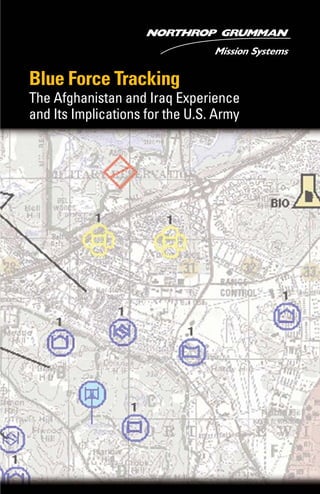
  • 1. Blue Force Tracking The Afghanistan and Iraq Experience and Its Implications for the U.S. Army
  • 2. About the Author Richard J. Dunn, III Richard Dunn is a senior analyst at the Northrop Grumman Analysis Center, where he is responsible for preparing in-depth assessments of military, political, techno- logical and economic develop- ments worldwide. He is a recognized, wide-ranging authority whose opinions on defense matters are sought by the national and international media. Before joining Northrop Grumman Corporation, Dunn spent over four years at SAIC, where he developed new approaches for understanding the future of warfare. Dunn joined SAIC after completing a highly successful 29-year career in the U.S. Army that included brigade command and staff positions of significant responsibility and culminated with service as director of the Chief of Staff of the Army’s Staff Group. At the U.S. Military Academy at West Point, Dunn taught Chinese language, interna- tional relations, and Chinese politics and government. Dunn’s education includes a bachelor’s degree in civil engineering from Bucknell Univer- sity and a master of public affairs degree from Harvard University. He also studied international relations in Taiwan as the first Olmsted Scholar to study in Chinese. Dunn is a 1991 graduate of the National War College.
  • 3. T he fortunes of war have always favored commanders who have better and more timely information about what is happening on the battlefield, even on the other side of the hill. This is certainly true of recent conflicts in Afghanistan and Iraq, where the accomplish- ments of American forces have been truly remarkable. Many factors, such as high-quality personnel, technologically advanced weapons, realistic and demanding training, and innovative leadership, have powered the tremendous leap in U.S. military capabilities demon- strated in these conflicts. One technological factor stands out from the rest, because it truly differentiates U.S. capabilities from the capabilities of others – information superiority. One of the key technologies that gave U.S. land component commanders in Afghanistan and Iraq this information superiority is Blue Force Tracking. A Soldier’s Critical Questions – A Historical Perspective Through the centuries, three simple geographic location questions have been all-important to soldiers and their leaders at all levels: ■ “Where am I?” ■ “Where are my forces and other friendly forces?” ■ “Where is the enemy and what is the best route to attack him?” The outcomes of battles, the fates of armies, and even the survival of states have often rested on the ability to answer those questions quickly and correctly. At Chancellorsville, Va., in May 1863, Confederate General Fitzhugh Lee led General Thomas “Stonewall” Jackson to a hilltop overlooking the exposed flank of General Hooker’s Union Army. There, Jackson learned accurate and immediate answers to all three questions. Lee’s reconnaissance allowed him to tell Jackson where the key overlooking hilltop was located. Topping the hill, Jackson personally observed the location and vulnerable position of the enemy. The couriers accompany- ing Jackson knew where to find his subordinate commanders to carry back orders. A local clergyman and a Confederate cavalryman told Jackson the location of a concealed route that allowed him to move his corps into position to attack. The picture complete, Jackson quickly took 1
  • 4. advantage of this information and the enemy’s exposed flank. Maneuver- ing his corps along the concealed route, he quickly deployed it for the famous flanking attack that rolled up almost the entire Union line, resulting in one of the most impressive victories against heavy odds of the Civil War.1 The Evolution of Blue ForceTracking Commanders and soldiers at all levels must have timely and accurate information on their own location, the locations of their forces and other friendly forces, and enemy locations. Until the advent of the Global Positioning System (GPS) in the 1990s, most of this information was determined with a map and compass, following map-reading procedures that had changed little over several centuries. The accuracy of locations so derived varied enormously according to factors such as the map- reading and navigational skills of the soldier, visibility (determined by light, vegetation and weather conditions), recognizable terrain features and the age of the map. Picture a second lieutenant leading a patrol through a dense swamp at midnight in a driving rain and trying to determine his exact location on a 20-year-old map. Global Positioning Systems GPS made things much easier by providing soldiers with north-south/ east-west location, accurate to about 10 meters. Once soldiers found their location on the grid printed on their maps (Figure 1), they knew exactly where they were. This solved most location-accuracy problems. Figure 1: The Military Grid System2 2 Footnotes: see pages 16-17.
  • 5. Commanders, however, still needed to know the location of their forces as well as other friendly forces in their vicinity. For tactical units this is essential. In an attack, for example, commanders must ensure the movements of all their elements are properly synchronized so their fires and maneuvering have the desired effect upon the enemy at exactly the right time. To use supporting artillery, attack helicopters and air support effectively and safely, commanders must know exactly where their forces and other friendly forces are to avoid hitting them with “friendly” fire. With GPS, commanders’ subordinate units knew exactly where they were, but this information still needed to be provided to the commanders and displayed to understand the tactical situation. Units, therefore, radioed3 their location to the unit’s command post, where it was posted on the map board. Under the best of circumstances, this system was time and effort inten- sive. Moreover, when a unit was moving, the scenario became more complicated. Commanders were in moving vehicles, not command posts, and had to receive and post their subordinate units’ locations on their own maps. It also necessitated frequent reports. When a unit was engaged in combat, these location reports sometimes received lower priority as the commanders passed orders and discussed the tactical situation with their subordinates. To compound these problems, moving units often crossed from one map sheet to another. Location reports also had to be communicated over unit tactical FM radios that required direct line-of-sight to receive signals. Obstacles such as mountains, hills and even buildings could block the line-of-sight, breaking communications between a unit headquarters and its subordi- nate units and preventing transmission of location reports. Furthermore, FM radios have a limited range (10-20 kilometers on flat terrain and without relay stations), so more distant units could not report their locations. Reporting and recording enemy information followed a similar process. Subordinate units detecting the enemy determined their location manu- ally and reported the information to the unit command post, where it was plotted. The unit intelligence officer used this information, together with intelligence summary reports from higher headquarters (sometimes hours or more old), to track enemy forces the unit might encounter. 3
  • 6. Force XXI Battle Command Brigade and Below Recognizing the fundamental importance of location reporting and recording, as well as other critical command and control tasks, the Army focused its “digitization” efforts in the early 1990s on leveraging the potential of new computer and communications technologies to auto- mate them. These efforts led to the development of the digital battle command system, Force XXI4 Battle Command Brigade and Below (FBCB2). Begun in 1995, it is in use today. FBCB2 normally uses GPS transponders located in ground vehicles (typically the vehicles assigned to unit commanders at various levels) to report the location of the host vehicle.5 The FBCB2 equipment then retransmits its location to all units in the network via the Combat Net Radios (EPLRS and the standard Single Channel Ground and Airborne Radio System (SINCGARS) radio nets). Each vehicle location is dis- played as a blue icon on digital maps on computer screens mounted in the vehicles. Instead of a map covered with paper symbols, FBCB2- equipped commanders have computers that show their location as a screen icon on a digital map or overhead photograph, along with the icons of all FBCB2-equipped subordinate units and any other friendly units equipped with FBCB2 in the vicinity. This same information (along with enemy information input by intelligence staffs, operational control measures – such as unit operational boundaries – and danger areas) is displayed in command posts and vehicles at all levels of com- mand. FBCB2 also allows users to send formatted or free-text e-mail messages – including orders and requests for support – to any other FBCB2-equipped unit simply by clicking on the unit’s icon. This freed tactical voice radio nets for higher priority messages. The network of FBCB2 vehicles communicating over Combat Net Radios for situational awareness6 and command and control is known as the “tactical internet,” a self-forming network that adapts to terrain, changes in unit organization, combat conditions and transmission channel availability. As long as vehicles are within line-of-sight, the FM radio-based tactical internet serves its users. The first units to experiment with FBCB2 in 1995 found that location reporting and command and control improved dramatically. Compared to voice radios and plastic-covered maps, the new system was like going from grainy, black-and-white photos to full Technicolor streaming video. With FBCB2, soldiers at any level knew exactly where they were. In the 4
  • 7. midst of a blinding sandstorm on a trackless desert, they could see their own vehicles’ icons moving on the digital map or overhead photograph. They also could see exactly where the rest of the unit and other friendly forces were located – without inexperienced soldiers attempting to read maps, lengthy voice radio messages, or exhausted sergeants posting information on plastic map overlays. If the intelligence staff did a good job of pulling enemy information from available sources and posting it on the FBCB2 system, soldiers and commanders also had a pretty good idea where the enemy was. To investigate the full combat potential of FBCB2, the Army designated the 4th Infantry Division (Mechanized) as the “First Digitized Division” to receive the new capability. Through controlled experiments and testing against the “opposition force”7 at the National Training Center at Fort Irwin, Calif., the 4th Infantry Division quickly learned that the vastly improved situational awareness FBCB2 provided allowed commanders to operate much more quickly and accurately – and much more effec- tively. Furthermore, the effort and resources (including time on radio nets) previously required for determining and recording unit locations and performing other command and control tasks could now be put to better purposes, such as precisely orchestrating an attack. Blue ForceTracking FBCB2’s capabilities were evident in the flat terrain of the National Training Center, where dense numbers of FBCB2-equipped vehicles were able to maintain the tactical internet through line-of-sight FM communications. When the Army deployed to the Balkans, however, it discovered that the mountainous terrain and relatively thinly deployed patrol vehicles in Bosnia and Kosovo imposed significant limitations on a tactical internet using ground-based line-of-sight radios. To overcome this, FBCB2 was adapted to communicate over commercial satellites using transceivers bolted to the tops of vehicles. In this “hub and spoke” configuration, each vehicle communicates with a satellite ground station that aggregates the blue force picture and transmits it to each FBCB2- equipped vehicle by satellite. The flexibility and effectiveness of this additional communications option was key to future deployments of the FBCB2 system, enabling the Army to consider deployment options involving EPLRS-equipped and satcom-equipped FBCB2 units. Although both communications options employ the same FBCB2 applications software, the satcom 5
  • 8. configuration came to be known as “FBCB2-Blue Force Tracking” or “FBCB2-BFT” (commonly called “BFT” 8 ) to distinguish it from the original FBCB2. When Army forces began operating in Afghanistan during Operation Enduring Freedom and preparing for Operation Iraqi Freedom, the value of FBCB2 to combat units was readily apparent. Army leaders decided that as many of the units committed to combat operations as possible should be equipped with an FBCB2-like capability.9 Of the units considered for deployment, however, only two brigades of the 4th Infantry Division were equipped with the ground digital radio systems (EPLRS) required for the FBCB2 system. Moreover, as experi- ences in the Balkans proved, ground-based digital FM radios could not provide the range required to support Army units operating over the vast distances of Afghanistan or anticipated in Iraq. Consequently, the Army decided to launch a crash project to field a BFT variant based on satellite communications (satcom).10 Because the 4th Infantry Division was the only digitized force readily available for deployment to the Iraqi theater, other non-digitized units slated for Iraq – such as the 3rd Infantry Division, the 101st Airborne Division (Air Assault) and the 82nd Airborne Division – needed BFT quickly. The U.S. Marine Corps and British combat units in the theater also wanted the system so they could see the Army units and Army units could see them. Intensive planning for “thin” BFT fielding (down to company level) took place at the Pentagon during the spring and summer of 2002. Actual deployment of BFT to land forces in Southwest Asia started in late 2002 and continued until the Iraq campaign began. Over a three-month period before the Iraq War, the Army and its contractor team installed the available equipment on combat vehicles and helicopters and trained commanders and soldiers to use the system. 6
  • 9. Blue ForceTracking in Afghanistan and Iraq Although only 210 BFT systems were deployed with U.S. forces in Afghanistan and 1,242 were deployed in Iraq (with U.S Army, U.S. Marine Corps and British forces), the impact on coalition command and control capability was extraordinary. In Afghanistan and Iraq, BFT provided revolutionary improvements in tactical command and control that contributed significantly to coalition ground forces’ ability to conduct decisive combat operations over daunting distances at previ- ously impossible speeds. In both conflicts, units equipped with BFT were able to answer the three critical questions – “Where am I? Where are my forces? Where is the enemy?” – with previously impossible speed and accuracy, even when spread over vast distances. This quantum improvement in situational awareness allowed commanders to make decisions and issue orders much more rapidly and to employ their forces to the full limit of their operational capabilities unrestrained by the limits of FM voice radio and paper map command and control. In Afghanistan and Iraq, BFT users often commented that the system was sometimes the only accurate means of determining position location and navigating, especially under extremely poor visibility conditions, such as at night or during sandstorms. With BFT, subordinate units that might otherwise have become lost or separated – requiring the parent unit to cease operations and focus on recovery efforts – often were able to return to their parent elements on their own. A Task Force 82 Blackhawk helicopter was on a mission in Afghanistan, close to dusk. A wind storm came up and visibility became very minimal, causing the aircraft to lose visible contact with the rest of the flight. The pilots were about to set the heli- copter down in an unsecured area for the evening when the BFT operator, able to zoom in on the map, found the other aircraft. From his BFT screen, he was able to direct the pilot out of the dust and effect linkup with the flight. Operation Enduring Freedom, Afghanistan 7
  • 10. Constantly knowing where they were on the battlefield allowed unit commanders to focus on preparing for decisive action upon contact with the enemy rather than on the task of maneuvering their units to gain contact. Some commanders stated that without BFT they spent 80 percent of their time and effort moving their units to contact, leaving only 20 percent to prepare for combat. BFT reversed those ratios.11 BFT simplified navigation immensely, even under circumstances where it previously would have been almost impossible. In many cases, it became the prime navigational capability of maneuver units. ...the infamous sandstorm of 23 March 2003. We were conducting a reconnaissance in force to find and destroy Sadaam Fedayeen forces. I was planning on using the sandstorm as cover for our movement and we would use railroad tracks as a handrail to guide us into our positions....We were all using BFT to track our move- ment since the sandstorm created “zero visibility” conditions. We were literally dead reckoning through the sandstorm using the BFT system. We ran into problems about halfway through the movement when we tried to navigate around the As Samawa train station. Even the 1:50,000 maps did not show all the details of the train station. Vehicles were getting stuck on the converging tracks and had to maneuver around several buildings that weren’t identified on the maps. The sandstorm made it impossible to see our surroundings and we had several breaks in contact. One of the company com- manders suggested we all switch from maps to imagery and would then be able to see the details of the train station and help us get around it. We were literally maneuvering by instruments like pilots do in bad weather, but the imagery and GPS functions of the BFT system allowed us to bypass the train station in the middle of a sandstorm. Lt. Col. John W. Charlton, USA Commander, 1-15th Infantry Battalion 3rd Infantry Division 8
  • 11. In all likelihood, the operational distances covered and the speed of ground operations in Iraq would have been difficult, if not impossible, to achieve without BFT. Maj. Gen. Buford Blount, the commanding general of the 3rd Infantry Division, said that BFT gave him the ability to see his division over a 200-230 kilometer front and to control the brigade fights.12 By comparison, during the first Gulf War, the same division13 had a 30-kilometer front during its attack on Basrah.14 Confidence in the timeliness and accuracy of position reporting also contributed significantly to the speed with which commanders reached critical decisions during the war. For example, the 2nd Brigade of the 3rd Infantry Division was ordered to conduct only a reconnaissance in force to test Iraqi defenses when it first entered Baghdad. However, Col. Dave Perkins, the brigade commander, decided to stay and retain control of key locations in the city, because he was certain his soldiers, positioned as he could see they were on his BFT screen, could safely remain downtown.15 One of the most critical decisions of the entire campaign, it essentially eliminated any Iraqi opportunity to conduct a coordinated defense of Baghdad. Because commanders at all levels were looking at the same information on their computer screens, the cohesion of the entire force was raised considerably. Junior commanders could see they were part of a larger whole. They knew higher headquarters was always watching and could send support or reinforcements immediately if they got into trouble. This raised confidence significantly. Knowing where everyone was located also accelerated operations. For example, previously, when a lead element made contact with the enemy, it had to stop and determine its location and report to its company. The company reported this location to battalion, which would report to brigade for a decision. With BFT, commanders at all echelons knew the exact location of the lead element, so the only information necessary to report over the radio was the nature and location of the enemy that the lead element encountered.16 If the lead element used BFT’s text trans- mission capability, that report could go simultaneously to all echelons. Commanders at all echelons sharing the same “big picture” also en- hanced self-synchronization. For example, units ordered to move on line abreast could see if they were falling behind or pulling in front of other units and adjust their speed, without exchanging a word, even when they 9
  • 12. were out of sight of each other. Additionally, subordinate units on the flanks of larger units knew where the subordinate units of their adjacent units were and could coordinate with them directly through BFT. Previ- ously, that exchange of information would have gone to higher head- quarters to be passed to the adjacent unit higher headquarters, then down to the other flank unit. BFT allowed it to go directly, greatly simplifying coordination (see Figure 2). Figure 2: Cross Brigade Zone of Attack Coordination A picture’s worth a thousand words. You can try to describe where you’re at. Just the visual advantages of seeing where you are in relation to the rest of your unit, I’m sure that’s a huge advantage....You’re looking at BFT, “Hey company commander, you’re a little off the route,” or he’s on route but is a few minutes behind. It’s a pretty good thing when you see everybody’s in the proper attack by fire position or at the proper phase line. Capt. Sam Donnelly, USA S-3 Air, 2-7th Infantry Battalion 3rd Infantry Division One of the greatest fears in any combat operation is killing your own soldiers. One of the greatest advantages in shared situational awareness – and one of BFT’s significant contributions – is fratricide avoidance. Commanders can see when their units are coming close to adjacent units and can warn their soldiers to look for friendly forces or order them not to fire. The enhanced situational awareness BFT provides also helped to avoid fratricide caused by the “lost lieutenant syndrome” – small units wandering into areas where they are not expected and becoming at risk of friendly fires. 10 Flank Unit Cross Zone Coordination without BFT Flank Unit Cross Zone Coordination with BFT
  • 13. April 1st east of Karbala. Company commander was going to do a passage of lines between two units and intended that upon clearing the units he would order “red free,” meaning, essentially, “fire at will.” He didn’t know that a scout platoon was also making a movement from the front left that would have placed the scouts in front of the oncoming tank company. He saw the movement on BFT and changed his order. A Company, 2-69th Armor Battalion 3rd Infantry Division During the major combat operation phase of Operation Iraqi Freedom, only one soldier was killed by friendly direct ground fire. This is attrib- utable in part to the enhanced situational awareness provided by BFT. Given the size and complexity of the operation, including the conditions under which it was executed, this is truly impressive. By contrast, 35 soldiers were killed and 72 wounded by friendly direct ground fire during Operation Desert Storm.17 In one dimension, however, BFT was not employed to its full potential. Interviews with officers who fought in Iraq indicate that BFT’s capabil- ity to provide detailed information on enemy locations was significantly underused, probably because soldiers had insufficient time to train with the systems. The officers reported that they and their fellows submitted few enemy reports using BFT’s enemy contact reporting capability, which puts enemy locations into the BFT database; therefore, they saw very few red icons marking Iraqi units on BFT screens.18 As far as can be determined from unclassified sources, there were no automated interfaces between BFT and intelligence databases that might have automatically added enemy location data from other sources to BFT’s database. However, because BFT provided precise information on a unit’s loca- tion, it was much easier for commanders to use terrain association or range/bearing techniques to obtain precise location information on enemy units they spotted.19 This significantly reduced the time required to call for artillery or other fire support. 11
  • 14. “...like the night ambush, I knew the whole squadron was in column on one highway. I knew where the enemy was firing from and where I was because of my icon and because of my grid, so I processed the initial fire mission [request for artillery support] by doing the BFT screen.” Capt. Clay Lyle, USA Commander, A Troop, 3-7 Cavalry Squadron 3rd Infantry Division In contrast to the underuse of BFT’s enemy reporting capability, its ability to support tactical communications was sometimes stretched to the limit. Communications are so essential to tactical command and control that command, control, and communications (or C3 ) are usually considered as parts of one whole. BFT’s satcom-based communications allowed users to exchange text messages and graphics (such as routes, phase lines, etc.) with any other BFT user or any number of BFT users over essentially unlimited distances. This capability proved to be an exceptional advantage in several ways. First, the range allowed effective command and control over almost unlimited distances. The 3rd Infantry Division effectively controlled two separate major battles over 200-230 kilometers – almost ten times the previously possible distance.20 In Afghanistan, one brigade task force operated in an area the size of Texas.21 In Iraq, battalions sometimes controlled companies up to 70 kilometers away.22 Although the Army has used satcom voice communications for com- mand and control over extended distances for years, the text and graphic capability of BFT added an entirely new dimension. Satcom voice nets suffer from the same limitation as FM voice nets,23 and the limited number of available frequencies normally restricts use to tactical com- manders at brigade level and above. BFT eliminates those problems with net-based communications. Any user at any level can send a message to any (or many) others at any time. The BFT network in Iraq sometimes experienced message queuing delays because of the high volume of traffic and the limited available satcom bandwidth, but it became a relatively reliable means for communications for all echelons and all functions. In Afghanistan, BFT was the only means for passing critical logistical information for units deployed over vast distances.24 Moreover, the ability to transmit the same message and graphics to multiple 12
  • 15. addresses greatly accelerated the distribution of orders – a major pacing event for tactical operations.25 BFT also helped ameliorate some of the challenges of communicating with allies and forces from other services that often result from incom- patible communications systems, lack of common doctrine, etc. Because some Marine Corps and British Army forces were also equipped with BFT, coalition forces could not only see where adjacent units from the other service or country were located but also communicate with them. This helped to resolve several dangerous situations that may well have led to fratricide. Implications of Combat Experience with Blue ForceTracking Combat experience in Afghanistan and Iraq shows that BFT-equipped forces became “networked” forces that can add strength to the network and also draw strength from it. Commanders of these forces have immediate and accurate answers to the three critical location questions that have always been – and always will be – essential to decisive military operations. To date, the Army has fielded satcom-based BFT capabilities only in units that are about to deploy to combat or, as in Afghanistan, are engaged in combat operations. Therefore, these units had insufficient time to train with BFT, to understand its full potential, and to adapt their tactics, techniques, and procedures to fully exploit BFT’s capabilities before going into combat. From the Afghanistan and Iraq experiences, it is clear that the high level of situational awareness BFT provides makes units significantly more effective and capable. But BFT can do more than that. It can also serve as an important “intellectual catalyst” for Army transformation. The critical terrain for transformation lies in the minds of our present and future leaders. To convince them of the power of the information revolution, they must experience this power not only in operations but also in training to gain confidence in the capabilities of digital battle command. If soldiers are not already familiar and confident with a system, they will not use it in combat. 13
  • 16. For example, one of the lead battalion task force commanders in the 3rd Infantry Division reported that although he had BFT installed in his command vehicle, he crossed the berm into Iraq with a bustle rack [outside rack on the turret of a fighting vehicle] full of paper maps and plastic overlays that he relied on for the first several days of the war. He turned to BFT only when he received orders to fight in a built-up area for which he had no paper maps or imagery. Convinced, he abandoned his paper maps and came to rely entirely on BFT after using it to maneu- ver his battalion through another urban area during a blinding sand- storm.26 Leaders of the Army’s transformed Future Force will develop and mature in the current force. To conduct operations with an information- age force, leaders must understand the capabilities and the limitations of digital battle command. They should not have to develop this under- standing – and confidence – while leading soldiers decisively engaged with an enemy. Nor can they develop it in the classroom. They must develop an appreciation for an information-age, networked force through training experience. Only then will soldiers have confidence in the system and in their ability to employ it in war. Combat experience in Afghanistan and Iraq has shown that BFT is more than a force multiplier that allows soldiers to do better at what they did before. Instead, it allows them to fight in new, more effective ways – ways that previously were almost impossible. By providing decisive information superiority, BFT becomes another weapon in the commander’s arsenal. This is not to say that BFT, as fielded in these two conflicts, is the “be all and end all” of a digital battle command capability. The system has a way to go yet. It needs to be made truly joint, to provide a common ground picture to both ground and air forces. It also needs to include additional capabilities: ■ A reliable, accurate and timely enemy-force picture ■ Tools for collaborative battle planning and monitoring progress against that plan ■ Enhanced satellite communications to pass greater volumes of traffic and improve reliability 14
  • 17. ■ A light-weight, man-portable unit to support dismounted operations ■ Fielding at least down to platoon level to support small-unit opera- tions in a counterterrorism/counterinsurgency environment Nonetheless, BFT moves the Army’s future digital battle command effort pretty far down the right path. The Army cannot afford to wait until BFT is perfected. Soldiers who fought with it in Afghanistan and Iraq vow they would never, if at all possible, fight without it again. “Thin” fielding is also not a good option. As one British officer stated, “You cannot half digitize the army.”27 Units equipped with BFT are networked forces able to strengthen and draw strength from other elements in the network. Units without digital battle command capability are non-networked forces in a networked world. Attempting to operate without the situational awareness the network provides makes units “invisible” to others in the network; they can quickly become a danger to themselves and others – a liability rather than a strength. Today, the U.S. Army faces significant challenges. As worldwide opera- tional commitments stretch the force, the Army must remain prepared for combat in unexpected locations under unanticipated conditions. At the same time, it must transform to be better prepared to fight and win tomorrow’s battles. Blue Force Tracking is a capability that is here today, ready to help soldiers meet present and future challenges. The Army needs to move forward and seize the benefits Blue Force Tracking offers. Its soldiers deserve nothing less. 15
  • 18. Footnotes 1 Gen. Fitzhugh Lee, “Chancellorsville: An Address before the Virginia Division, A.N.V. Association, October 29, 1879.” Southern Historical Society Papers, Vol. VII. Richmond, Va., December 1879, No. 12. 2 U.S. Army Field Manual 3-25.26, Map Reading and Land Navigation (Washington: Headquarters, Department of the Army, 20 July 2001,) Figure 4-21. 3 Each tactical unit, regardless of organizational level (platoon, company, battalion, brigade, etc.), is usually assigned a single radio frequency (or set of frequencies for frequency-hopping radios) to control its operations. The commanders and staffs of the unit and its subordinate units all have to talk on that one frequency, called the command or operations “net.” When someone is transmitting on that frequency, everyone else can hear but no one else can talk. In combat, these nets become very busy. 4 The 1990s term for the Army’s Future Force. 5 As a backup to GPS, FBCB2 also uses the Army’s new battlefield FM digital radio link (the Enhanced Position Locating Reporting System or EPLRS) to obtain location information. 6 Situational awareness is a military term that refers to an individual’s or organization’s ability to sense and comprehend the environment in which it operates, including the friendly and enemy tactical situations, terrain, weather, etc. 7 OpFor, the highly skilled and trained “enemy” force at the NTC. 8 Although the FBCB2-BFT system was most common in Afghanistan and Iraq, some elements had other Blue Force Tracking systems. These were more limited in functionality and did not provide true digital battle command capability. As used in this paper, BFT refers to FBCB2-BFT. 9 Otto J. Guenther, Vice President and General Manager, Northrop Grumman Mission Systems, Tactical Systems Division, “Industry Interview,” Military Information Technology, August 9, 2003, p. 44. 10 Guenther, op cit. 11 Comment by Brig. Gen. Robert Durbin, Assistant Division Commander, 1st Cavalry Division. 12 Neil Baumgardner, “3rd Infantry Division Commander Praises C2V, Communications During OIF,” C4I News, May 29, 2003. 13 Then designated the 24th Infantry Division (Mechanized). 16
  • 19. 14 Brig. Gen. Robert H. Scales, Jr., Certain Victory: The United States Army in the Gulf War (Washington: Office of the Chief of Staff, United States Army, 1993), p. 307. 15 Statement by Col. Curtis L. McCoy, Program Manager, Combat Systems, U.S. Army Tank and Automotive Command, at the National Press Club, Washington, D.C., July 17, 2003. 16 Based on debriefing of Capt. Stewart James, Commander, A Company, 2-69 Armor Battalion, 3rd Infantry Division 17 Frank Tiboni, “Force XXI Proves Mettle by Saving Lives in Iraq,” Defense News, June 9, 2003, p. 42. During major combat operations in Iraq, a total of 13 American, 5 British, and 18 Kurdish soldiers were lost due to friendly fire from all sources. [Dawn S. Onley, “Systems help avert friendly fire deaths,” Government Computer News, July 28, 2003.] 18 Interviews with Capt. Stewart James, Commander, A Company, 2-69 Armor Battalion, 3rd Infantry Division; and Capt. Tim Terese, G-3 Current Operations, 3rd Infantry Division 19 Terrain association is the use of terrain features to identify locations. For example, if a commander knows he is just south of a known large hill and the enemy is firing at him from the top of the hill, he can click the top of the hill on his BFT map to get the enemy’s exact location. Using the range/bearing technique he can lase the enemy with a laser rangefinder to determine the enemy’s distance from his location along a compass bearing. He can then use BFT’s graphic software to plot this on the digital map and determine the enemy’s exact location. 20 See note 9. 21 Interview with Lt. Col. Anderson, Commander, Logistics Task Force 307, Afghanistan. 22 Lt. Col. John W. Charlton, “Digital Battle Command Baptism by Fire,” Battle Command Training Center, Fort Hood, Texas (http://bctc.hood.army.mil/ download.asp?docid=396) 23 See note 4. 24 Interview with Lt. Col. Anderson. 25 Interview with Capt. Stewart James. 26 Charlton, pp 1-2. 27 Interview with Maj. John Cunningham, Aide-de-camp to Brigadier Binns, 7th Armoured Brigade (UK). 17
  • 20. Northrop Grumman Mission Systems 12011 Sunset Hills Road Reston, Virginia 20190 www.northropgrumman.com © 2003 Northrop Grumman Space & Mission Systems Corp. All rights reserved. FX2250903