

Empfohlen
Empfohlen
Weitere ähnliche Inhalte
Andere mochten auch
Andere mochten auch (20)
Ähnlich wie Maptek forge mar_14
Ähnlich wie Maptek forge mar_14 (20)
Kürzlich hochgeladen
Kürzlich hochgeladen (20)
Maptek forge mar_14
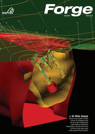
- 1. > In this issue Vulcan coal quality models Vulcan 9 modelling tools Tie up tools in BlastLogic I-Site defines Esperanza PerfectDig in the pit and online Land forming case study I-Site geotechnical solution March 2014Newsletter
- 2. Maptek Forge newsletter is published each quarter. You can receive it by mail or emailed link to the Maptek website. Email forge@maptek.com to subscribe or advise changes to contact details. Articles may be reproduced with acknowledgement. © 2014 Maptek MAPTEK FORGE / MARCH 2014 www.maptek.com/forge In this issue Maptek enters 2014 with renewed energy to help our customers work smarter by adding value to the technical data extracted from their mining processes. Making smart choices includes working cooperatively with other technology providers to deliver the best outcomes. Maptek has entered an agreement with Sandvik Mining to collaborate on developing integrated underground planning and automation solutions. Our customers will reap the benefits. Maptek has also invested in UAV photogrammetry developer DroneMetrex. This exciting new technology is evolving quickly and Maptek is committed to enabling the best possible results for our customers. Development effort in Vulcan is being applied to ensure that core architecture evolves alongside new tools for resource modelling, mine design and operations planning. I-Site Studio retains its commanding position as the premier software for modelling and analysis of 3D point cloud data. Two case studies highlight the benefits of our intuitive workflow and powerful tools for geotechnical studies. Enhanced measurement and reporting is being incorporated in the PerfectDig design conformance system. New tools in BlastLogic allow engineers to preview blast scenarios and animate detonation sequences. We continue to seek innovative solutions in response to customer needs. Feedback on Forge is welcome. Contact forge@maptek.com Contents Latest news 1 Vulcan coal quality models 2 Techniques for accurate modelling Vulcan modelling tools 4 Implicit modelling & support analysis Maptek Users Conference 6 Photo gallery and news BlastLogic product news 8 New tie up and modelling tools I-Site case study 9 Defining structures at Esperanza PerfectDig in the pit and online 10 Enhanced reporting, measurements I-Site case study 11 Efficient land forming I-Site case study 12 Geotechnical solutions for coal Calendar of events Want more? More information available online Video Detailed article Photo gallery
- 3. LATEST NEWS 1 Grad school sponsored Maptek sponsored the 23rd Edinburgh University Graduate School of Geosciences Conference in February, where students, staff and industry shared academic presentations, discussions and entertainment. ‘The event provides a fertile and enjoyable environment for networking and helps to raise the profile of current geosciences research,’ said Gary Buchanan, Sales Manager, Maptek Europe. Maptek in the air Maptek has invested in DroneMetrex, a startup company that has developed innovative new technology for aerial photogrammetric mapping from small drone aircraft. The DroneMetrex system collects high quality digital terrain data and imagery for rapid assessment and integration for mining, geospatial, agriculture and infrastructure applications. DroneMetrex will integrate seamlessly with Maptek Vulcan, Eureka and I-Site Studio products. I-Site 3D laser scanning systems complement DroneMetrex aerial data for quickly and accurately measuring and monitoring surface changes. ‘Maptek’s software capability will enhance our products and ensure customers gain maximum benefit from TopoDrone-100 data’, said Tom Tadrowski, Managing Director of DroneMetrex. The TopoDrone-100 is a small UAV (unmanned aerial vehicle), able to be operated with minimal training, that collects high precision aerial photographs for generating highly accurate terrain models with an elevation accuracy of 20 mm. AusIMM President’s Award Maptek founder Dr Bob Johnson has been awarded the Australasian Institute of Mining & Metallurgy (AusIMM) President’s Award for 2014. The award recognises Bob’s notable achievements in pioneering the use of computer software for modelling and analysis. The AusIMM Awards recognise the leadership of professionals in the minerals sector who have contributed to outstanding economic, environmental and social outcomes across the industry, the professions and the community. Bob will receive the award at a presentation dinner in May. Sandvik Mining cooperation Sandvik Mining, leading supplier of equipment, services and technical solutions is cooperating with Maptek to develop integrated planning and execution systems. ‘Enormous benefits can be gained by making Sandvik mining equipment more automated and spatially aware,’ said Sandvik Mining Global Head of Automation, Rowan Melrose. ‘We are pleased to be working with Maptek to create the most advanced mining systems in the world.’ ‘Our customers will be able to send detailed design and modelling data through the mine operations to monitor performance in real time,’ said Maptek General Manager, Australasia, Peter Johnson.
- 4. VULCAN2 01 02 03 Updating geological models for structurally complex or multi seam coal deposits can prove challenging. Using Vulcan techniques appropriately will create robust coal quality models that stand up to review and regulatory audits. Validation Database validation is an essential stage. Maptek™ Vulcan™ includes comprehensive tools for collar and downhole checks, and coal quality variables. Tools exist for checking individual fields, data ranges and outliers, as well as along-record checks on the sum of multiple values. Checks should be made for overlapping samples and for mismatches between lithology and quality tables. Compositing Intuitive Vulcan compositing tools streamline setup of structural and coal quality data. The first step is to define whether to look up intervals and match the quality by sample numbers or by depth. The sample numbers in the quality table may not always match those in the lithology record, for example if samples have been combined for analysis. Depth is then relied on, so the depths in the lithology sheet must be checked against the quality intervals. Tolerances can be set for missing and mismatched data. A coal seam fully covered by multiple samples is easily composited, but when estimating part of a seam, creating an allowance for samples to overlap slightly ensures valid composites are calculated without bias. When core loss results in missing data, rules can be set to ignore minor gaps. If new drilling data is available, but the depths do not match due to adjusted geophysics, it is tempting to just use data rules to allow tolerances. However, it is important to amend the data to ensure the core samples are reporting to the correct interval. A critical aspect of compositing is to weight the samples - by length for RD, by mass for raw qualities, and by mass and yield for washed product qualities. Seam splitting Seam splitting poses compositing problems where drillhole data is scarce. A database constructed from the Vulcan FixDHD structural mapfiles can capture all valid ply combinations and can be a better alternative than the original lithology database for compositing. Coal quality modelling Maptek™ Vulcan™ contains effective tools which enable geologists to create and update coal quality models. Trending can give better results when data is sparse.
- 5. MAPTEK FORGE / MARCH 2014 3 04 05 Vulcan will scan the parent seam as its child components, taking the true top and base of the seam while also estimating the location of the plies. Taking the FixDHD output as the reference for the quality model will bring in sampled drillhole data from all of the seams before and after splitting, resulting in better representation across the parent and child seams. Merging grids Vulcan tools are useful for merging the thousands of grids generated in quality modelling. The create multiple surfaces panel populates after the compositing run. Extents should equal the structural model and cell size should be a multiple of the model to avoid reserving problems. In some cases it is necessary to include data from outside the final model extents. Vulcan Grid Calc replay files can be used to create a modelling macro, only setting the grid extents after all the data has been loaded. Resulting models more accurately honour the available data and better reflect the observed quality trends. Trending Care must be taken when using trending tools. When there is not enough data to properly establish the trend of minor seams, the trend surface can be ‘borrowed’ from a major seam or seam group. Noise in the data should first be removed. The differences between the original data points and the trend surface, called residuals, are modelled to form a grid. The trend equation is then added to each node of the residuals grid to produce the final seam variable grid. Trending is ideal for quality variables that exhibit a regional, rank related trend, such as RoMax, Fluidity and Volatile Matter. Some quality variables are best estimated by their correlation to other variables; for example where there is little data, bore core results are inaccurate, or there is inconsistent handling of samples. Trends in any of the input variables will usually be better reflected if the calculations are made from the component grids in Grid Calc rather than the base data. Grid Calc allows the use of complicated equations for derived quality variables. Summary Due care at each step of the validation and modelling process results in better coal quality models. Vulcan has tools to quickly and easily generate the many grids involved in coal quality modelling. Grid Calc menus allow advanced manipulation of the data and calculations between grids. Scripts make complex and repetitive tasks easy, repeatable and auditable. Thanks to Adam Stewart Integral Resource Consulting Extract from paper presented at Maptek Users Conference, Brisbane, 2013 01 Without trending, cells beyond the data limits have unrealistic values 02 Cells beyond the data limits exhibit the regional trend when a trend surface is applied 03 The difference between trended and untrended models is only significant beyond the data limits 04 Minor seams may not have enough data to properly establish trend 05 Trend equation from a major seam is ‘borrowed’ to create a regionally consistent model
- 6. VULCAN4 Implicit modelling and support analysis Maptek™ resource geologist Anthony Bottrill combines new implicit modelling tools in Vulcan™ with existing change of support analysis to lift the lid on evaluating deposits. Consider a new exploration project. Initial vertical drillholes have been followed up with angled drilling. Now that new data is available, what is the potential of this project and did the drilling add value? How does it compare against other projects? Which project has the most potential to warrant spending your limited budget on? Combining Maptek™ Vulcan™ implicit modelling and change of support tools, geologists can answer these questions, and they can describe projects in a measurable way. This is critical when including mine planning and financial modelling concepts into discussions. An initial view of any project should start with analysis using Vulcan standard tools: >> database validation; >> advanced statistics; and >> load drillholes as discs for displaying grade and geology. Once a basic understanding of the project is obtained, the resource geologist must then be able to provide: >> a potential mineralised tonnage; and >> a potential tonnage and grade above an economic cutoff. Implicit Modelling Implicit modelling in Vulcan 9 allows solids to be created rapidly, straight from drillhole or composite data. Categorical variables such as lithologies can be modelled, as well as continuous variables such as grades. Implicit modelling can help to evaluate the potential range in the mineralised tonnage. Support Analysis Vulcan support analysis tools allow the geologist to map the change in the grade-tonnage curve between different drilling support to assess how much of the potential mineralisation could be economic. As infill drilling is added, the shape of the grade-tonnage curve changes. Change of support maps this and allows the resource geologist to identify the potential grade-tonnage curve at the time of mining (grade control drilling). This is important when comparing projects as it enables deposits to be measured on a like for like basis to show what could be expected at the time of mining. The realistic mining scenario lies somewhere between the theoretical grade-tonnage curves for the current exploration drilling and the actual samples. The challenge is to determine where that line really is, and how further drilling will affect the project. The grade-tonnage curve output by change of support represents change as a proportion, not actual tonnes. To report tonnage, the tonnes from implicit modelling can be combined with grade-tonnage curves from support analysis. This results in a potential range of size and grade for the deposit based on the current information. Two real world projects identified situations where: >> infill drilling would cost more than the potential incremental value of additional metal in the ground; and >> a large low grade project which contained significant high grade ore shoot potential had significant upside as a high grade target. Summary This modelling process can all be done easily in Vulcan. There is no need to import and export data or run different programs. Everything is saved in specification files so it is documented, repeatable and reliable. By combining the right tools in Vulcan, geologists can lift the lid on deposits to get a better view of what is there, before expensive drilling is undertaken. Extract from paper presented at Maptek Users Conference, Brisbane, 2013
- 7. MAPTEK FORGE / MARCH 2014 5 Support analysis outputs grade-tonnage curves, with the cutoff grade on the horizontal axis. The theoretical grade- tonnage curve based on exploration drilling can be graphed against a grade-tonnage curve based on samples; these are the two end-members for selectivity. Vulcan Implicit Modelling and Support Analysis 1. Value projects and assess their potential. 2. Compare projects on an equal basis. 3. Identify value-adding exploration requirements, such as chasing grade to improve project viability. 4. Measure the effectiveness and value of exploration drilling programs. 5. Audit estimates and run alternative scenarios based on different orientations of the orebody. 6. Generate theoretical grade- tonnage curves to test the smoothing applied in resource estimates. Adjusting the parameters in implicit modelling allows the resource geologist to determine end-member ranges for the size of the deposit based on the data available. This example reveals only a small range in grade, with the grade only slightly above cutoff. This indicates a marginal deposit where the only upside is expected to come from additional tonnes. To add value to this project, the geologist must identify opportunities for higher grade, not merely more tonnes.
- 8. MAPTEK FORGE / MARCH 20146 New developments in Maptek™ Vulcan™ , I-Site™ and BlastLogic™ were showcased at the conference. Great interest was shown in the new Vulcan implicit modelling tools. Implicit modelling integrates block and automatic solids aspects of 3D models in a single tool, offering users a powerful solution for modelling geological domains. Other presentations covered applications and enhancements in Chronos ultra sequencer and optimiser applied to underground and open pit mines, block caving and various operations where Vulcan proves itself to be the premier solution for geological modelling and mine planning. In the laser scanning arena, features and benefits of the I-Site 8810 were outlined. The new I-Site 8200 underground laser scanning system, along with its customised boom and workflows for open pit and underground applications, was well received. The latest enhancements in BlastLogic, Maptek’s strategic management system for drill and blast, were also shared. Feedback from customers allows Maptek to continue to innovate. ‘We welcomed all feedback and suggestions received throughout the conference,’ commented Marcelo Arancibia, Vice President, South America. ‘This allows Maptek to continue to improve and ensure our products, services and solutions remain world-class.’ The conference was followed by a 1-day workshop where participants could learn more about the new Vulcan implicit modelling tools. South America Users Conference The South America Users Conference provided the opportunity for more than 80 attendees to share over 25 technical sessions. Customers are invited to attend the 2014 conference. Put the date in your diary now! XVII CONFERENCIA DE USUARIOS MAPTEK 9-11 DECEMBER, 2014 Convention Centre Enjoy Hotel & Resort, Viña del Mar, Chile
- 9. 7
- 10. BLASTLOGIC8 BlastLogic ties up blast modelling Maptek™ BlastLogic™ is adding new tools to meet the demand from miners to more effectively manage their drill and blast operations. Blast modelling allows engineers to preview designs, timing and detonation sequences What keeps you awake at night? For the Maptek™ BlastLogic™ team, it was how to deliver immediate access to operational data in a simple, viewable way. This mandated a step-change in technology to provide seamless tools for engineers to optimise blast designs through simple analysis and effortless data management. The guiding principle behind enhancing the BlastLogic capability matrix is to help operations further optimise production performance. A significant new capability is the tie up and blast modelling function. This will further help industry to streamline design, drilling and loading of blast holes. Due for release later this year, BlastLogic 2.0 will also include consumables management, confirming its evolution into mining’s only holistic drill and blast system. Tie up design in BlastLogic allows fast creation of design scenarios. Multiple iterations can be compared side-by-side using the modelling and animation tools. Users can run a 3D animation of a detonation sequence, with sections of the holes highlighted and expanded to examine the detonation of explosive decks. Routine timing analysis tools which are relied on for determining the effectiveness of tie up design scenarios include timing envelope, timing contours, burden relief and first movement direction. Dynamic visual feedback with a streamlined interface for changing variables, provides instant onscreen decision making support. The timing envelope tool allows engineers to specify a point where infrastructure may be vulnerable to vibration, and enter a vibration propagation rate to quickly simulate the time it takes from detonation of each hole for effects to reach a specified location. Other blast models include wavefront reinforcement to simulate vibration and over pressure, and Kuz-ram for blast fragmentation. Engineers can be confident that BlastLogic will support better blast design and implementation. To see the tie up function in action visit www.maptek.com/video
- 11. MAPTEK FORGE / MARCH 2014 9 01 An area of 254,000 m2 (72% of the Esperanza pit) below the sulphide boundary was scanned to acquire 25,931 joints 02 High resolution scan data enabled clear definition of structures to create an accurate geotechnical database Esperanza is a porphyry copper- gold mine owned by AMSA (70%) and Marubeni (30%). Located 100 km south of Calama in the Antofagasta region at 2300 m above sea level, the Esperanza pit measures 1.5 km long, 1.3-1.4 km wide and 390-400 m deep. The geology comprises a sequence of Cretaceous volcaniclastic andesite and dacite dipping 20 to 30 degrees west, with a series of minor porphyry intrusions. The main structural model, generated by geologists for the Esperanza mine in August 2013, clearly defined the boundary between the primary and secondary mineralisation. The challenge The geotechnical department was tasked with updating structural domains for the area of primary mineralisation. The biggest challenge was to acquire information in a timely and safe manner from sectors that are inaccessible due to closure of inter-ramp slopes and benches. The first step was to take the structural model into the field to correlate structures for sectorisation and subsequent definition of the boundaries. Solution Different methods for acquiring data were assessed: >> Mapping benches by hand is inexact and presents safety issues >> ATV (Amateur Television) scanning is slow and expensive >> Maptek™ I-Site™ laser scanning was chosen because it is fast and provides detailed data for good quality results Data capture Moderate to high resolution scans were captured for the slopes between the top of the primary mineralisation and the pit floor. The point cloud data was processed and the spherical triangulation feature in I-Site Studio™ was used to select the area of interest from surface scans to identify joint systems. Discontinuities were saved within a tolerance range of 15 degrees strike-dip and minimum area of 20 cm2 . The extracted surfaces were then exported with dip and dip direction for analysis. Validation Geotechnical engineers reviewed the discontinuity reports for each sector, identified structural differences within these sectors and validated the segmentation of structural domains for the primary mineralisation of the Esperanza pit. I-Site technology made this validation possible and provided confidence in the data accuracy. Conclusion Using I-Site to capture fine structural data has generated a robust and reliable dataset that did not previously exist for the mine. I-Site geotechnical tools enabled detailed structural mapping to update and refine the structural domains for Esperanza. The accuracy of the data creates a high level of reliability for the structural characterisation generated for each domain. The ease of setup and operation with I-Site make it possible to capture information safely and quickly from sectors where operational factors prevent access. Thanks to Ramiro Herrera Santibanez Geotechnical Geologist, Minera Esperanza Extract from paper presented at Maptek Users Conference, South America, 2013 I-Site defines structures at Esperanza Geotechnical engineers found Maptek™ I-Site™ was the ideal solution to define structural domains for the primary mineralisation of the Esperanza mine in Antofagasta. 0201
- 12. PERFECTDIG10 PerfectDig in the pit and online Maptek™ PerfectDig allows users to compare laser scans with designs and provide rapid feedback into the mine planning cycle. PerfectDig makes it easier than ever for mining engineers, surveyors and managers to discover the degree to which their mine conforms to design. What once took hours now takes minutes. PerfectDig automatically generates high quality, visually rich output, ideal for reporting on the state of conformance of a scene. Output can be viewed and even queried online, enabling relevant information to be shared instantly between stakeholders. In the field PerfectDig supports reference-free registration of scan data and easily acquires data for conformance reporting. Simply drive up to the designed area and scan from 2 or more locations. PerfectDig automatically registers scans to each other and the data is immediately ready to use. Volumes by block Quantifying the degree of design conformance is an important consideration for compliance applications. PerfectDig now supports block lines so that volumes can be reported on a block-by-block basis. Volume regions are clearly outlined to differentiate particular areas and how much they exceed or under-reach design. Using material densities it is possible to calculate the number of truckloads required to correct a specific area. Measurements PerfectDig provides tools to query horizontal and vertical disparity from design, and cross-sections can be created with 1 or 2 clicks. Users can quickly gauge the degree of conformance at any specific point. In the office & online PerfectDig automates report generation once users have specified the as-built and design data to compare, and selected the region of interest. A professional design conformance report is created, with topographic and perspective views, auto- generated cross-sections and volumes split between block lines. Stakeholders can easily view and query compliance information with PerfectDig Online. Snapshot links allow online users to share their view of the data with others. Time and money are saved by quickly providing users with the information they need to take action to ensure compliance and optimise commodity excavation. Find out more by emailing perfectdig.sales@maptek.com.au
- 13. MAPTEK FORGE / MARCH 2014 11 Land forming benefits from laser system More than 400 million hectares, or approximately 53% of Australia’s total land area is used for agriculture. The industry is looking to laser scan technology to improve productivity. 01 Aerial photograph of trial paddock 02 Scan data provides detailed point coverage 03 Data is filtered & modelled to export final surface Land forming is the process of applying a man-made slope on land to be used for irrigation. Laser scanning provides accuracy and efficiency to ensure the correct grade for pre-determined watering and drainage systems. Comparing the design against actual at regular intervals throughout the farrowing activity ensures the paddocks adhere to specifications. The current method is to use survey GPS on a vehicle and pick up a point every 5 to 10 metres along tracks 15 to 25 metres apart. The survey points are imported into proprietary design software where a surface is created. That surface is used in a design package to create a simplified multi-plane surface that is then imported into the machine guidance system for the tractor, scraper or other equipment. The field trial proved that the Maptek™ method was faster, safer and more accurate for collecting and processing data for land forming. >> Survey the paddocks with the Maptek™ I-Site™ laser scanner to produce detailed surface models >> Export models as dxf for import into Civil 3D or similar system >> Create multi-plane data for export to machine guidance format >> Upload multi-plane data to machine guidance system The scanning was completed quickly using the I-Site 8810 vehicle mounted stop-go scanning system. Most areas required only 4 or 5 setups, averaging 3 minutes at each location. The onboard GPS and compass were used to seed scans which were locked in using I-Site Studio™ global registration tools. Filtering and modelling of the scans took less than a few minutes. The method is faster, safer and more accurate than the current process. Using the I-Site system promises to improve the integrity of the initial surface as well as the accuracy and efficiency of creating it. I-Site is able to complete 2 paddocks in the time conventional methods cover a single paddock. The ideal scenario is to import laser scan data directly into the machine guidance system to ensure accurate surfaces of the area are used. Email isite.sales@maptek.com.au Maptek demonstrated the potential of combining the I-Site 8810, I-Site Studio and PerfectDig technology to provide a more efficient solution. 02 01 03
- 14. I-SITE12 01 Geotechnical studies Geotechnical engineering teams at Anglo American coal sites in Australia use Maptek™ I-Site™ for highwall mapping, reconciliation and drill & blast planning. A major exporter of metallurgical coal in Australia, Anglo American has 6 operations in Queensland and New South Wales. The survey team at the Capcoal operation in Queensland’s Bowen Basin starting using the Maptek™ I-Site™ 8800 laser scanner in 2011. Geotechnical engineers recognised the potential benefits of the technology and quickly adopted the Maptek™ I-Site Studio™ geotechnical module. I-Site is now an intrinsic part of the geotechnical workflow, with scans taken every few days across the sites for use in: >> Highwall mapping - structural definition for kinematic analysis >> Reconciliation - plans to actual >> Drill & blast - optimise initiation direction and pattern spacing >> Material strength definition - analyse cause of failures Highwall mapping Surveyors can set up the scanner outside the highwall drop zone and safely capture high resolution photographs and detailed data for structure and joint delineation. Geotechnical engineers no longer need to use hand compasses and photogrammetry for structural data acquisition. I-Site Studio software is employed for mapping structures and kinematic analysis of proposed mine designs. I-Site Studio is ideal for completing sensitivity analysis, which can justify the need to lower batter angles to reduce risk. Reconciliation Geotechnical engineers routinely check excavated slopes against planned designs. I-Site tools add value to this process. For example, a 60 degree hardwall was planned for a particular block. Comparing design to actual with I-Site Studio cross-section tools demonstrated that historically, mining through weathered Tertiary in this block could achieve an angle of 35 degrees at best, and designs needed to be modified going forward. In another case, the plan was to dig to 65 metres. I-Site scans showed that failures were appearing when digging at 25 to 30 metres below the surface. Comparing design against actual, the geotechnical advice was to adjust the plans! Planning and operations departments now get feedback in real time on how the pit is performing to design and advice on how to reduce risk.
- 15. MAPTEK FORGE / MARCH 2014 13 Drill & blast planning Joints mapped from I-Site 8800 scans can be plotted onto rose diagrams. This data is used by drill & blast engineers to optimise the initiation direction for minimising in situ highwall damage and reducing energy loss. Structural data derived from scans can also be used to optimise pattern spacing and burden to achieve the desired fragmentation. The I-Site scanner is used to measure floor disruption where dragline pits with steeply dipping strata and/or weak floor require blasting. Accurate locations of floor disruption are required to maximise dump stability in subsequent pits. The scanner is set up on the low wall to capture a broad scan of the pit and the survey positions are used to create design files to reconcile shot effectiveness. Landform modelling A particularly useful feature of I-Site Studio is its ability to import dxf and dwg files. Geotechnical engineers are able to selectively trace design geometry off range diagrams for importing into slope stability modelling programs. I-Site has replaced more time consuming methods using a ruler and protractor to extract coordinates, significantly reducing modelling time. Using I-Site technology has sped up geotechnical data capture and reduced processing time compared to other highwall mapping techniques. Geotechnical engineers can spend more time in the field, where their expertise can add value. Material strengths I-Site Studio is used to back- analyse failures to better understand material properties. Before and after geometry can be modelled to determine failure plane location. Summary I-Site 8800 laser scanning has provided fast data capture and processing, improving productivity for highwall mapping and slope studies. I-Site Studio has dramatically streamlined reconciliation of designs, optimised the drill & blast process, and increased understanding of material strengths. The software is a core tool for all geotechnical engineers at Anglo American coal mines in Australia. Thanks to Alison McQuillan, Geotechnical Engineer, Anglo American’s Coal Business Extract from paper presented at Maptek Users Conference, Brisbane, 2013 03 04 05 02 01 Joint persistence and spacing data helps guide drill & blast 02 Modelled data from laser scan showing bench failure 03 Cross-section tools aid reconciliation to design 04 Capturing shot trench data for assessing shot effectiveness 05 Back-analysing failures improves understanding of material properties
- 16. www.maptek.com Maptek, Vulcan, I-Site, BlastLogic, Eureka and the stylised M are registered and unregistered trademarks of Maptek Pty Ltd; Maptek Computación Chile Ltda; Maptek Computación Chile Ltda, Sucursal Perú; Maptek S de RL de CV; Maptek Informática do Brasil Ltda and KRJA Systems, Inc. Registered marks are registered in one or more of the following countries: Australia, Brazil, Canada, Chile, China, Greece, India, Indonesia, Mexico, Peru, Russia, South Africa, Spain, United Kingdom and United States. April 2-4 X Conferencia Internacional de Mineria Chihuahua, México - Booth 198 April 9-11 Mining World Russia Moscow, Russia April 21-25 Expomin 2014 Santiago, Chile - Booth 809-2 May 11-14 CIM Convention & Exhibition Vancouver, BC, Canada May 26-28 Minerals Week Canberra, ACT, Australia June 4-7 Convención Minera de Zacatecas Zacatecas, México - Booth 95 June 5-6 Elko Mining Show Elko, Nevada, USA August 13-15 AIMS Annual Conference Sydney, NSW, Australia August 18-20 International Mining Geology Conference Adelaide, SA, Australia August 27-30 Congreso de Tendencias de la Actividad Minera en México Durango, México - Booth 37 November 5-6 AusRock 2014 Sydney, NSW, Australia November 24-25 Orebody Modelling & Strategic Planning Perth, WA, Australia Maptek Calendar Vulcan 9 was launched at an event hosted by distributor IT Experts LLC in Mongolia