
Recommended
More Related Content
What's hot
What's hot (20)
Viewers also liked
Viewers also liked (9)
Similar to Geomorphology Field Trip
Similar to Geomorphology Field Trip (20)
More from Jesse Jones
Geomorphology Field Trip
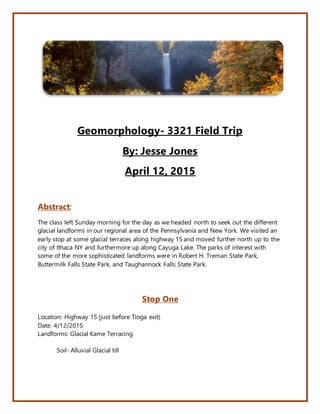
- 1. Geomorphology- 3321 Field Trip By: Jesse Jones April 12, 2015 Abstract: The class left Sunday morning for the day as we headed north to seek out the different glacial landforms in our regional area of the Pennsylvania and New York. We visited an early stop at some glacial terraces along highway 15 and moved further north up to the city of Ithaca NY and furthermore up along Cayuga Lake. The parks of interest with some of the more sophisticated landforms were in Robert H. Treman State Park, Buttermilk Falls State Park, and Taughannock Falls State Park. Stop One Location: Highway 15 (just before Tioga exit) Date: 4/12/2015 Landforms: Glacial Kame Terracing Soil- Alluvial Glacial till
- 2. Description- The soils that make up these terracing landforms are alluvial in nature from small meltwater tributaries depositing large amounts of sediment along the valley of the glacial. Stop 2 Location: Robert Treman State Park Date: 4/12/15 Landforms: Enfield Gorge and Lucifer Falls Enfield Gorge Description- This landform actually serves as a swimming hole in the late spring and summer months. Made up of mostly sedimentary rock with some granite that was moved down from what may have been locate on the Canadian Shield. Lucifer Falls Description - Made up of mostly shale’s, sandstones, and mudstones. Some granite was found along the reach below the falls which may have come all the way from the Canadian Shield. The one piece of granite we found in the stream and a quartz vein about ¾ of an inch thick all the way through the rock. Lucifer falls itself was about full flow with most of the snowmelt gone. We were only able to see about 80 foot of the 115 foot falls due to trails being closed from seasonal conditions. Stop 3 Location: Buttermilk Falls State Park Date: 4/12/2015 Landforms: Buttermilk Falls and gorge Buttermilk Falls Description- This very popular falls in the Ithaca area was formed about 12,000 years ago during the Little Ice Age. Was given this name due to the large amount of sediment load seen each year. Similar formation to the Lucifer Falls the gorge and fall is primarily made up of shale, sandstone, and limestone. Stop 4 Location: Taughannack State Park Date: 4/12/2015 Landforms: 90 degree faults, Taughannack Falls, Taughannack gorge Description- Starting at the falls itself, the fall is about 235 foot drop from the crest to the bedrock. All throughout the gorge before the fall and at the fall there are great exposures of 90 degree fault lines. That have been eroded over a long period of time.
- 3. The gorge and fall were formed from a connected tributary glacier that came down and met with the main glacier which form Cayuga Lake. Most of the rock formation around the area were limestone, shale, and sandstone. The gorge and hanging wall were specifically formed fluvial flow from a stream that flowed underneath the tributary glacier. Over time the water fall will retreat backward about 4-8 feet a year due to the intense erosion from the stream. The bedrock of the reach above the falls was primarily shale Pictures from Field Trip Location: Taughannack State Park Taughannack Falls Fluvial Ripple Marks
- 4. Fluvial Ripples Taughannack Upper Gorge Location: Robert Treman State Park (Lucifier Falls)